Snow Observations List
Widespread wind effect in the alpine of Hyalite yesterday. The windslabs were fairly stubborn however, and were only breaking in very small pockets, not propagating outwards. Where the recent snow was still protected from sun and wind, large dry loose slides were easy to trigger.
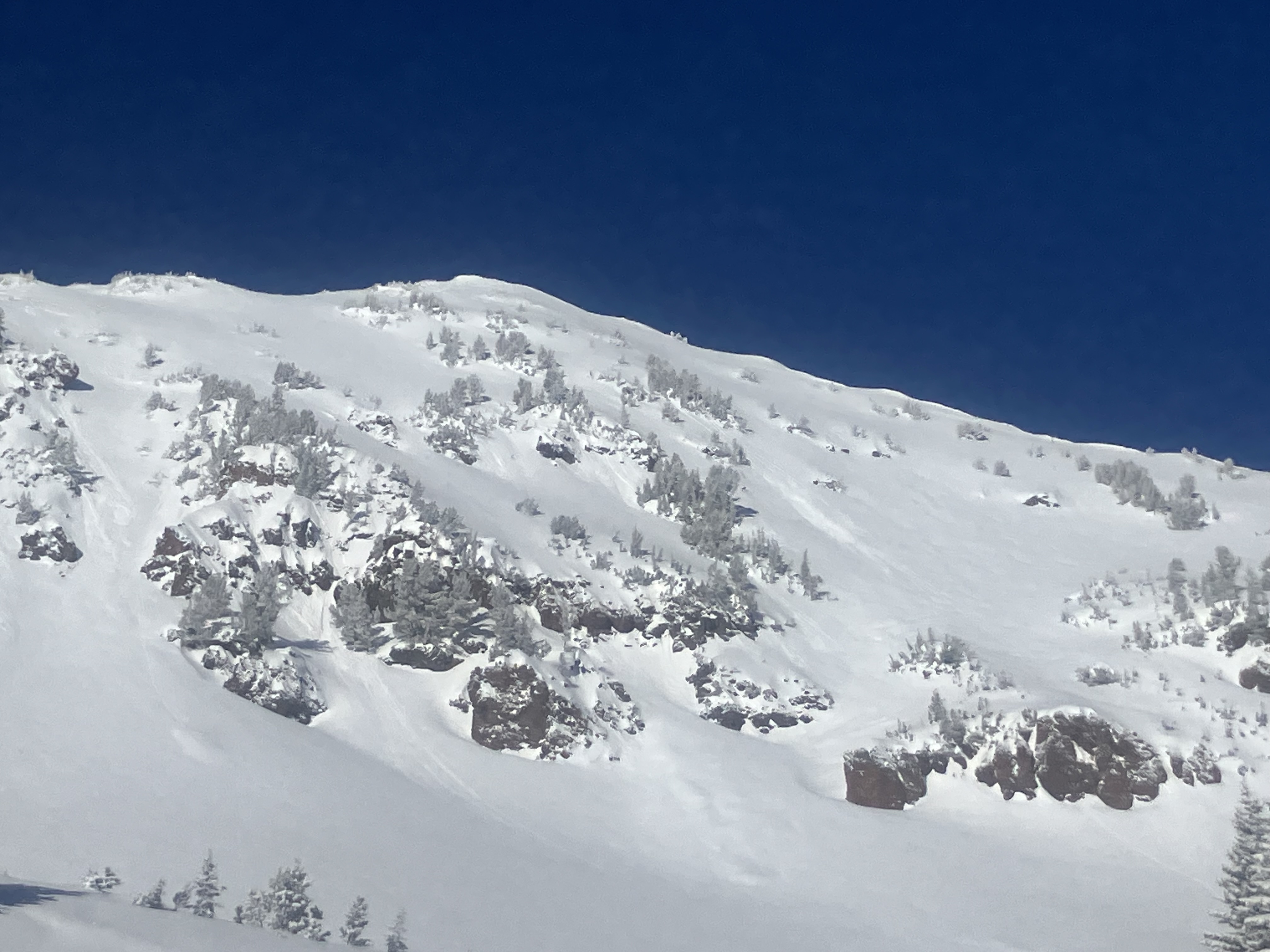
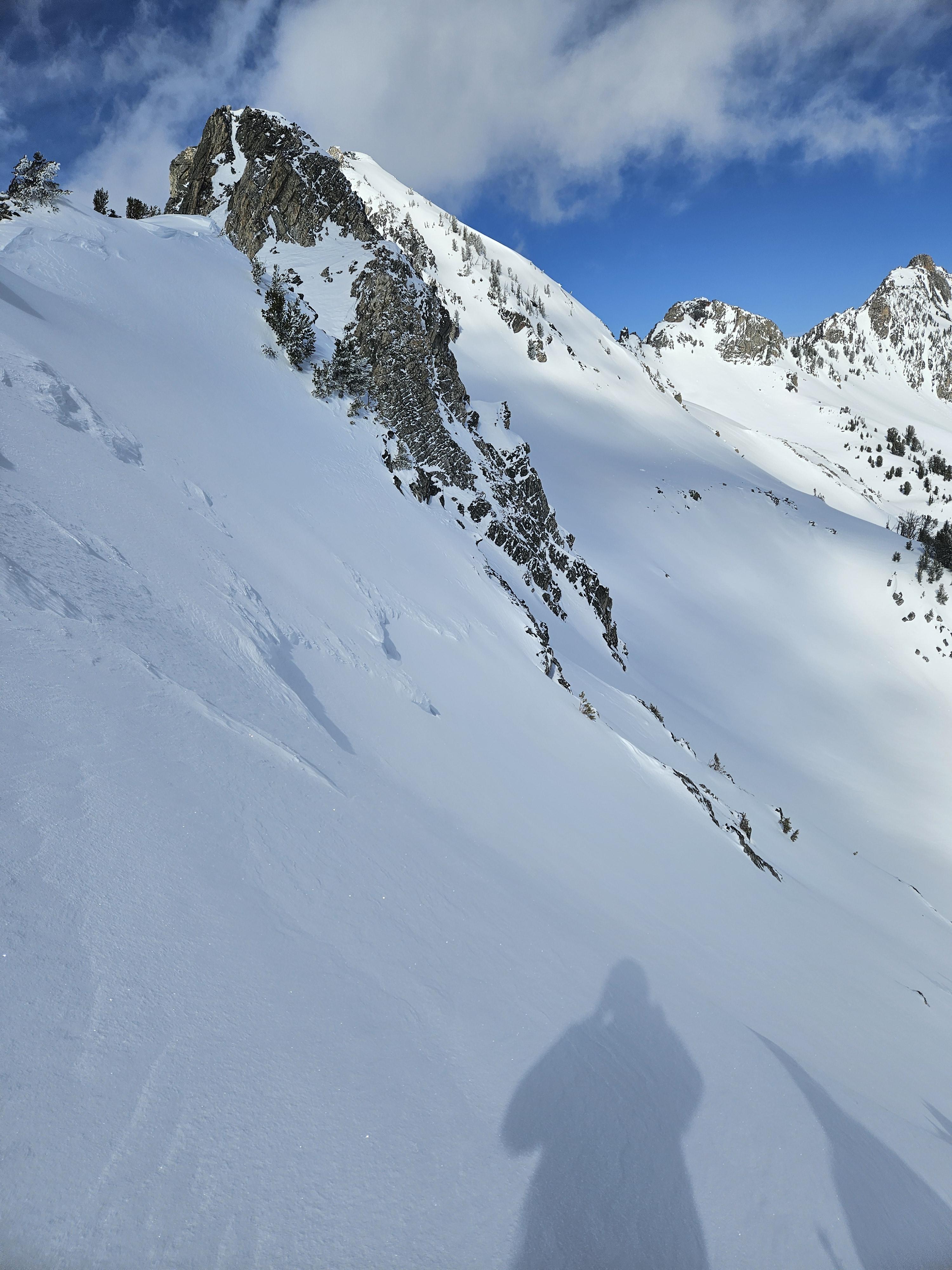
Full Snow Observation ReportWe rode from Battle Ridge and skied up the east face of The Throne to look at the stability of the recent new snow.
There was 6" of low density snow from yesterday. Winds were stronger than expected, from the north at the top of the Throne, and increased through the morning.
We found fresh drifts that were reactive, cracking easily and 5-10' wide out from our skis, on south and east facing slopes around 8000-8300'.
The new snow was low density and sluffed easily on steep shady northerlies. On steep slopes facing the sun (south and east, and probably west) the new snow sat on a crust and became moist as the sun warmed it up and started to slide under skis. We saw a couple very small natural loose snow slides below rock outcrops on south facing slopes. Air temperatures were well below freezing, especially with wind chill, but the sun quickly warmed the recent new snow.
It is spring, in addition to assessing for unstable drifts of snow, plan for wet snow avalanche hazards to increase in likelihood throughout the day when the sun is out and temperatures are near or above freezing.
Full Snow Observation Report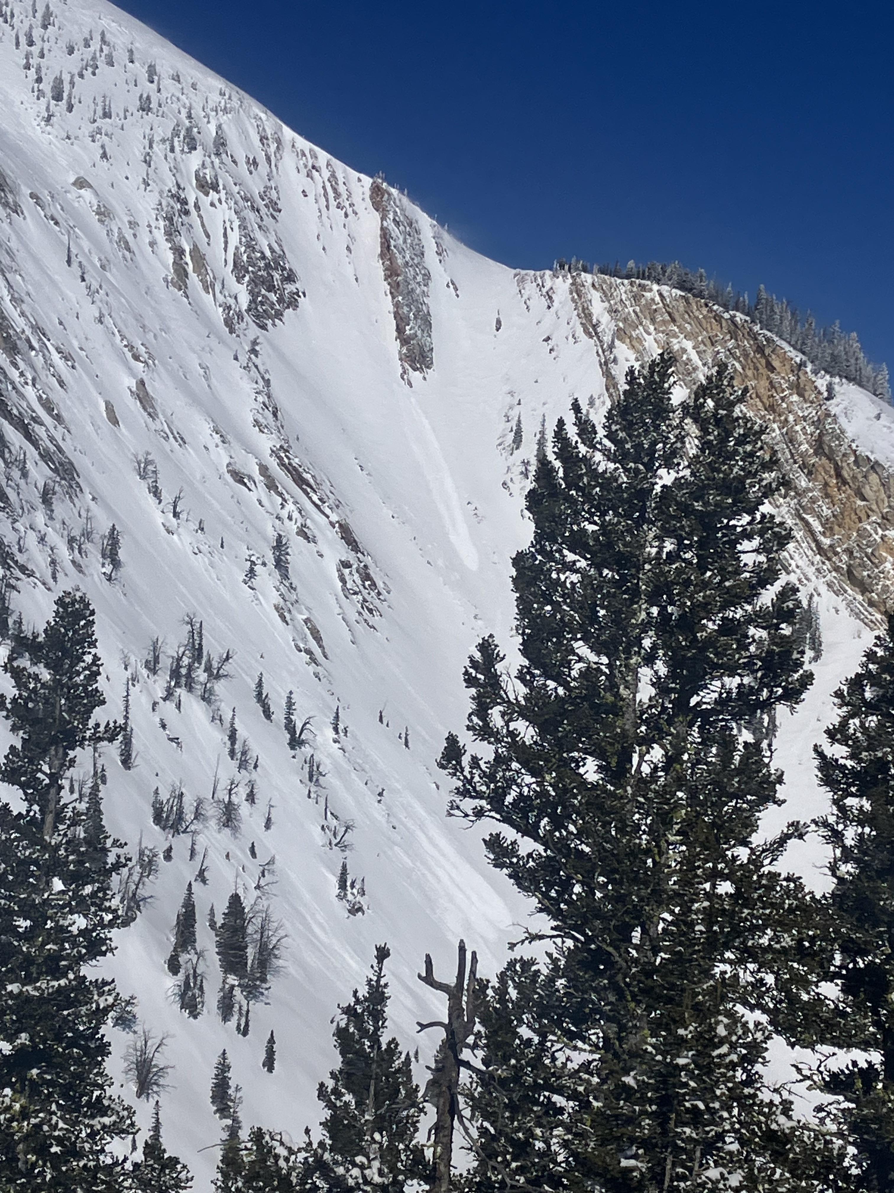

Rode to the wilderness boundary and skied a lap above Goose Lake. Dug in two places - all hard, dense, strong, deep snow
Rode above Goose Creek. Dug in two places along the very steep, north-facing slopes above the creek. Same. All hard, dense, strong, and deep snow. Facets from late January are buried about a meter deep and 1Finger+ hardness.
We were digging about 700 feet above the two persistent slab that were avalanches triggered on Feb 24th (about a week and a half ago). We didn't see any indication that that is a widespread problem. We didn't see any recent avalanches either.
Digging down to the late-January facets was a pain in the a$%. It seems like when it's becoming a pain to dig down to a weak layer, it's usually not much of problem anymore.
Full Snow Observation ReportDanger seems LOW
Looks like a recent naturally triggered slide towards the Idaho wilderness boundary on lionhead.
GNFAC note: This slide occurred on Feb 28th (previous observation)
Full Snow Observation Report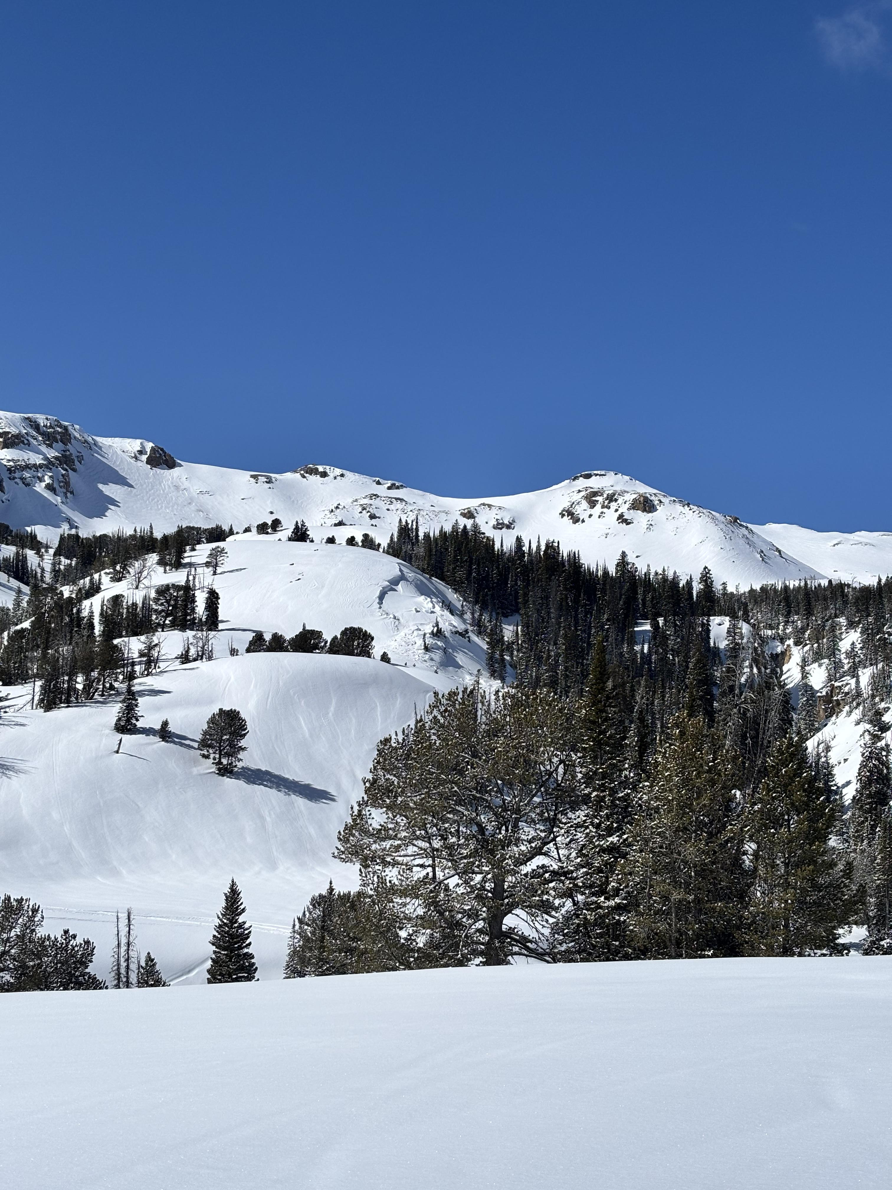
Multiple natural loose avalanches in the steep terrain of mt Blackmore. All originated at the base of cliffs or trees. Counted 4 prominent ones
Full Snow Observation Report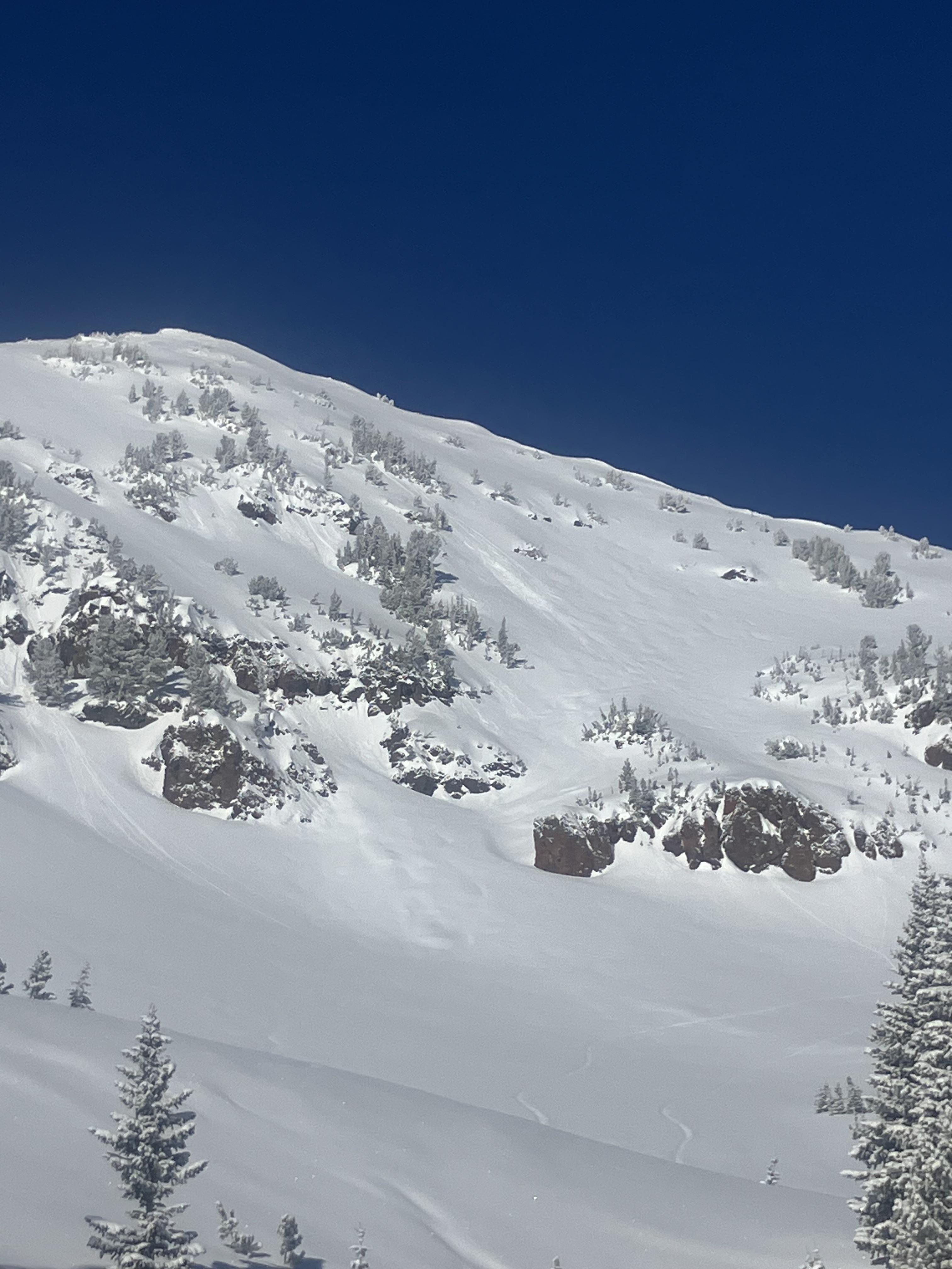
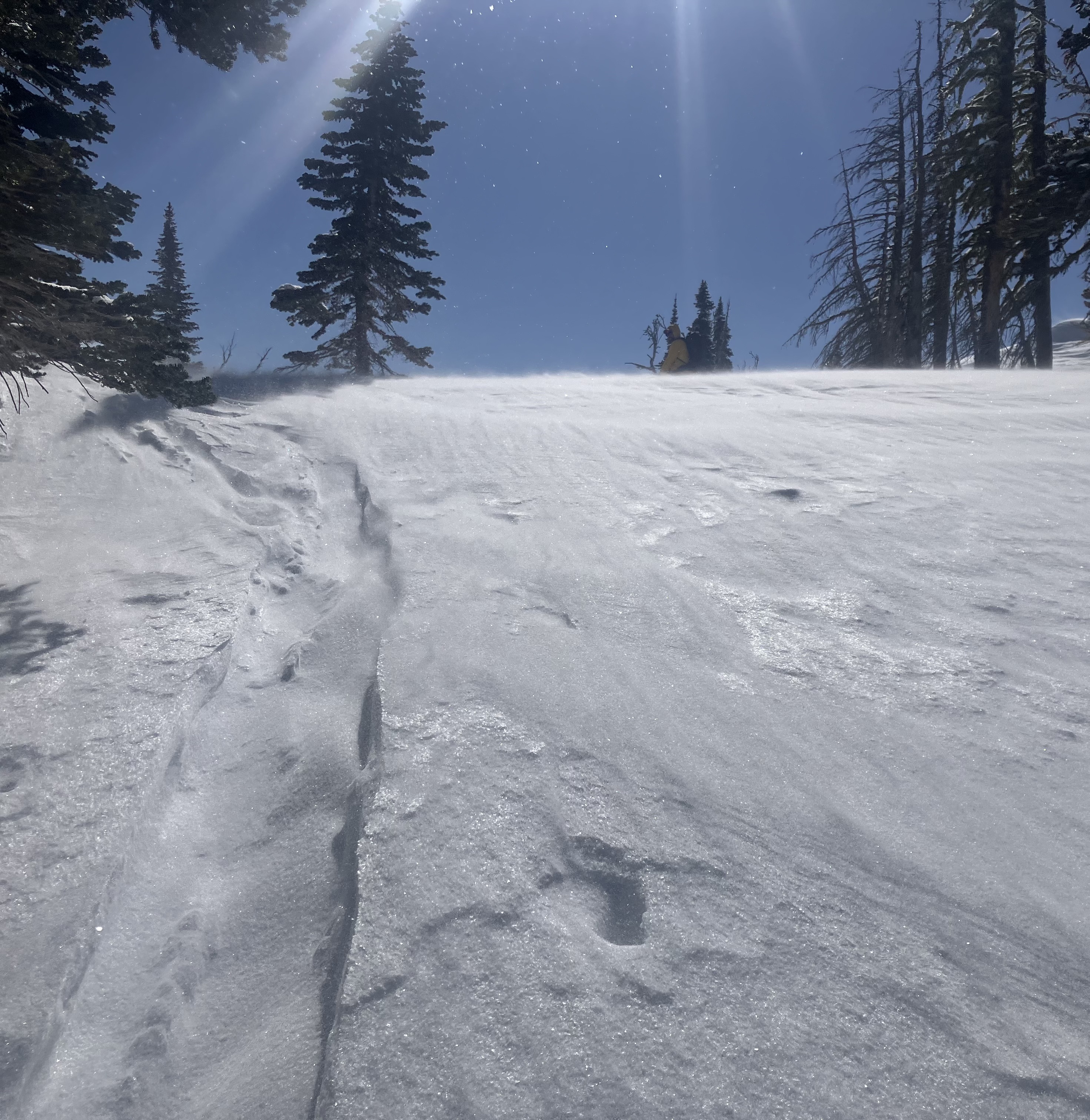
We toured from the dam up the north ridge to Trapper. Light snow fell throughout the day, adding up to about 6". As we descended the east-facing bowl, cracks shot out from our skis on slopes with a subtle wind effect. Avalanches within the new and wind-drifted snow were likely, but the volume would have been relatively small and mostly concerning in technical terrain or in the presence of terrain traps. There was a new facet layer below the melt-freeze crust. It is TBD if it will be a problem.
The other problem is continued concern about avalanches breaking 2-3 feet deep on weak layers formed during the January dry spell. The snowpack structure is weak in this area, similar to the slopes that most recently produced human-triggered avalanches in Cabin Creek, Tepee Basin, and Lionhead. Pole probing indicated this poor structure was widespread. Our pit at 9000' on a northeast-facing slope yielded an ECTP28 on the 4F- facet layer formed in January. Failures on these deep layers don't seem very likely, but, for now, step back from steep terrain to let the storm play out. Once the storm ends, we will reevaluate stability and proceed from there. While the actual likelihood is debatable, the consequences of getting caught in a slide breaking on these weak layers are not.
Full Snow Observation Report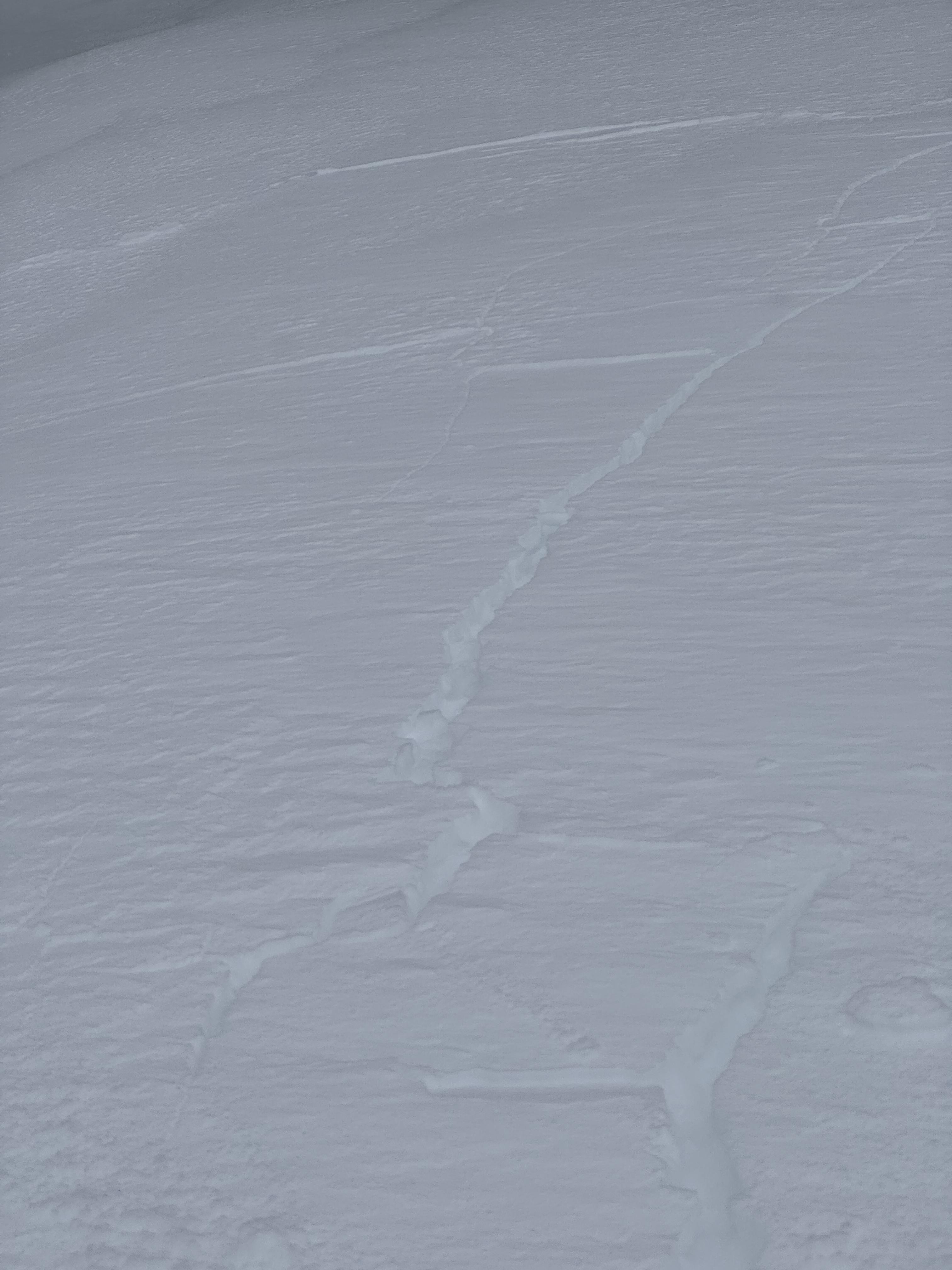

No Recent avalanche activity observed in Hayden Creek or Republic Creek today with the the exception of some small dry loose in steep terrain. No Collapsing or Cracking during our day out today. 2" new at 8700' at 9am with another inch throughout the day. East winds were light throughout the day.
Full Snow Observation Report
Toured into the emigrant gulch area today. At around 7600’, I found some touchy storm slabs. These only seemed to be reactive on solar aspects (crust). Near a ridge line, the winds were coming from the east, it was weird. Socked in all day with lots of snow flying around.
Full Snow Observation Report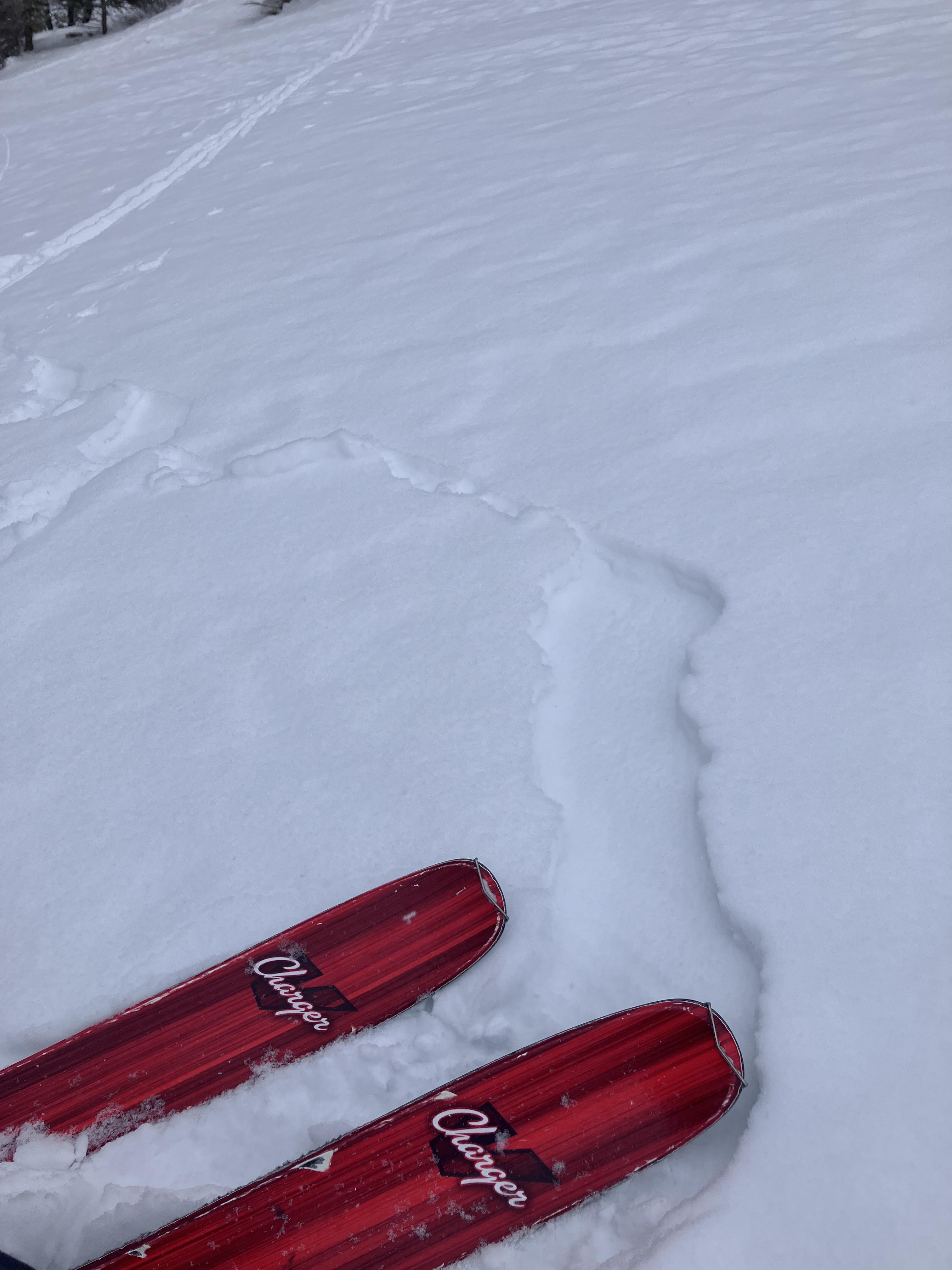
8-12 inches of new snow on the ground in the Centennials near Nemesis mtn. New snow that fell early this morning was very touchy on hard/icy surfaces from the melt/freeze activity we saw the prior days.
Full Snow Observation Report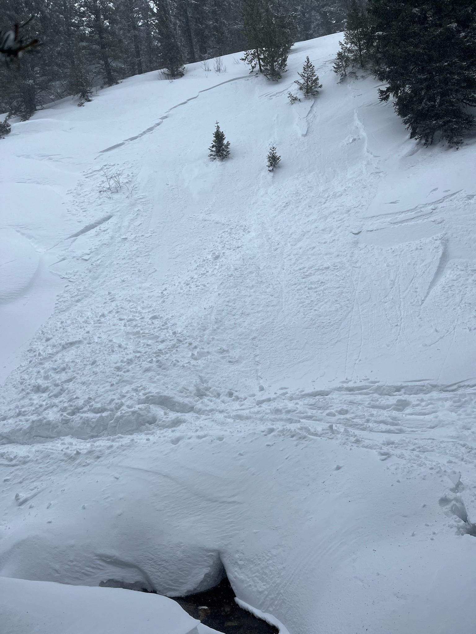
Observed some cracking in wind drifted snow above tree line NE facing slope. No avalanches observed
Full Snow Observation Report
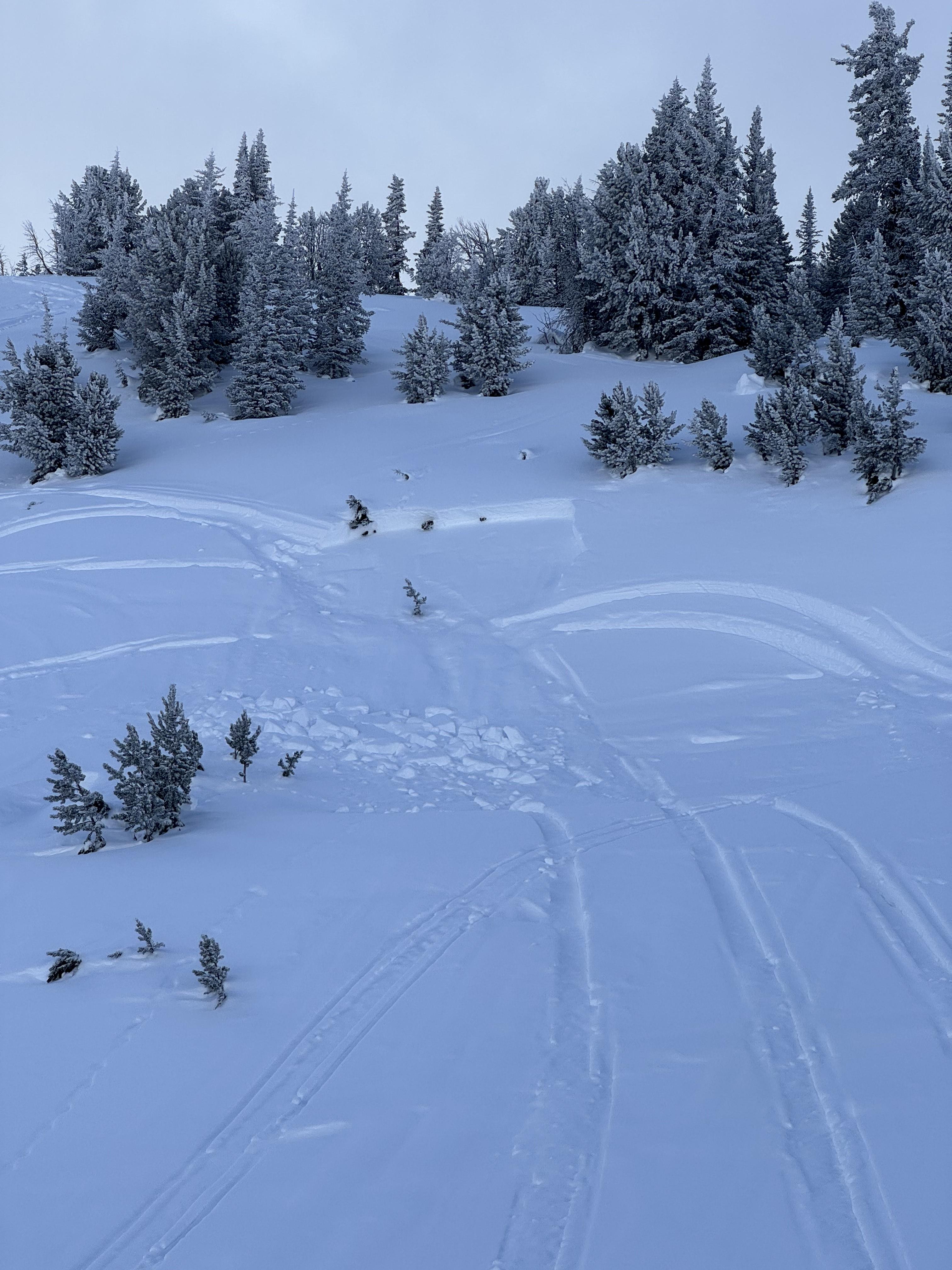
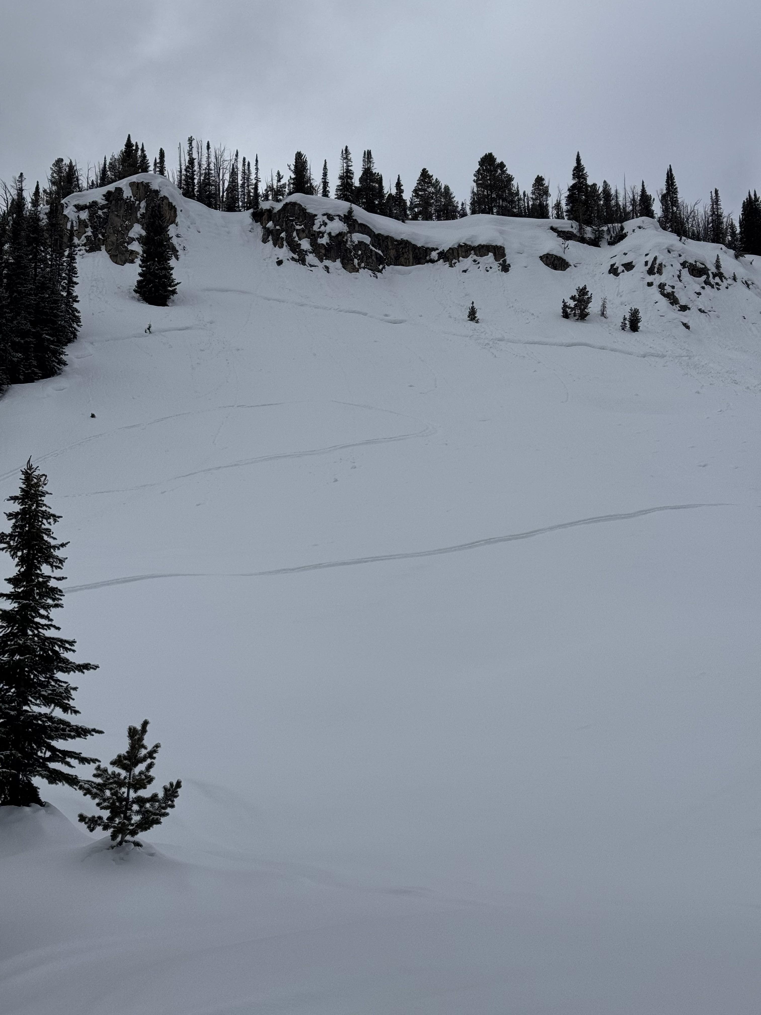
Came across a old slide in the hell roaring drainage heading towards Gallatin. East facing. Happened sometime before the recent snow but not long ago. Initial crown seemed to be 12-18 inches and stepped down further down the slope. Was a fairly large debris pile.
Full Snow Observation Report
Saw lots of small loose avalanches on Mt Blackmore and nearby slopes, some appeared to be natural and others skier triggered. We saw multiple dry loose on N and E aspects and a wet loose on a southeast aspect.
We also noticed recent wind loading on the southeast side of ridgetops and scouring on north slopes.
Full Snow Observation Report
Old Avalanche spotted from Wilson yesterday looking North. Possible cornice fall trigger during the warm up but difficult to tell as it was quite a ways away. Photo attached.
Full Snow Observation Report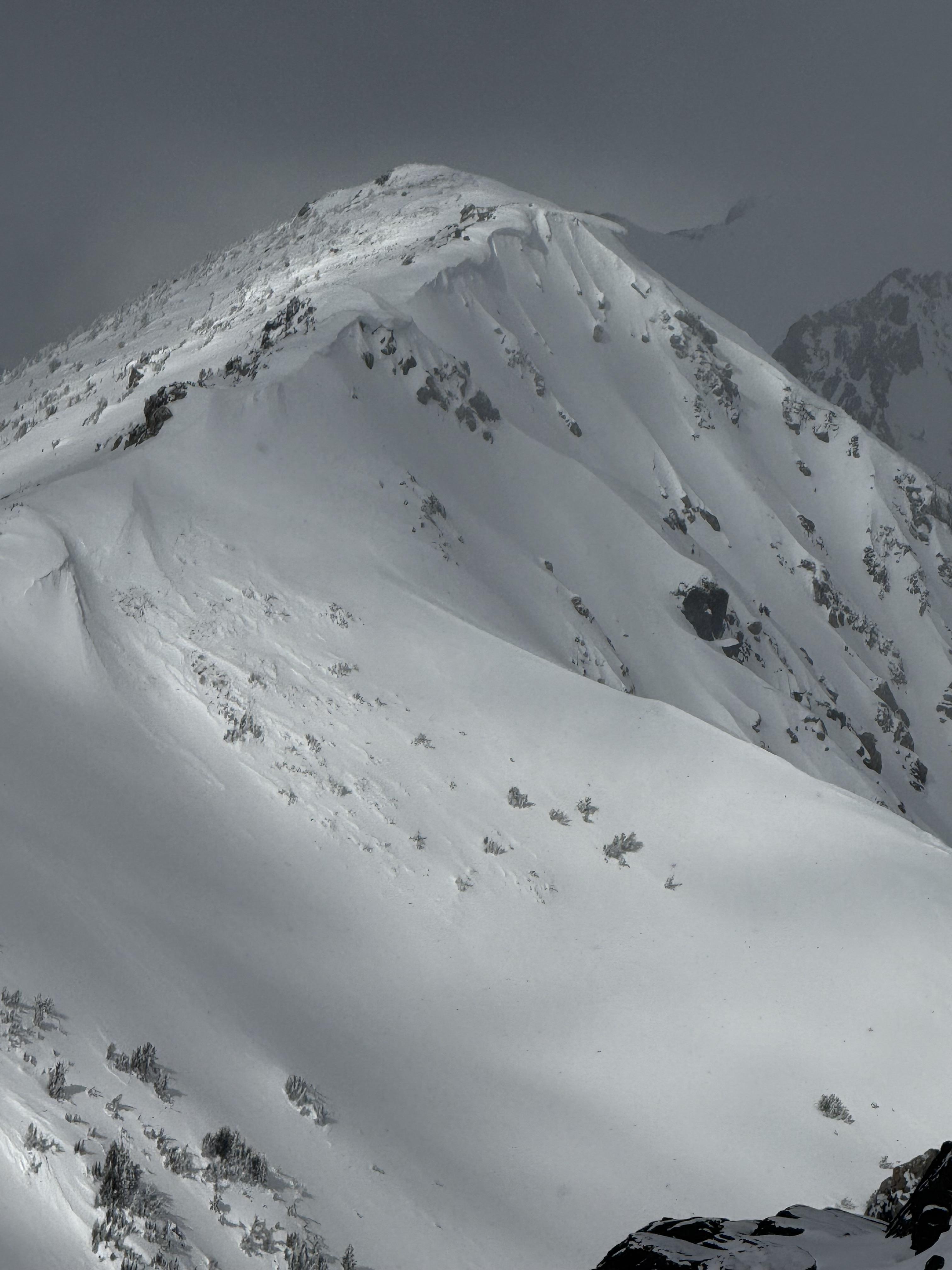
Got up early and cruised around on some different aspects on Mt Blackmore. Got some shooting cracks on the N side of the mountain mid slope, textured snow and snow drifts were widespread in the basin on N aspects. Found great skiing in N facing trees on that side of the mountain lower down below the apron and such.
East face had some top loading, nothing I was concerned about below ridge lines, save for some fast sluffs!
Found some isolated pockets of surface hoar, nothing widespread.
All in all, a fun morning, be curious to see how this next one affects the stability picture.
Full Snow Observation Report
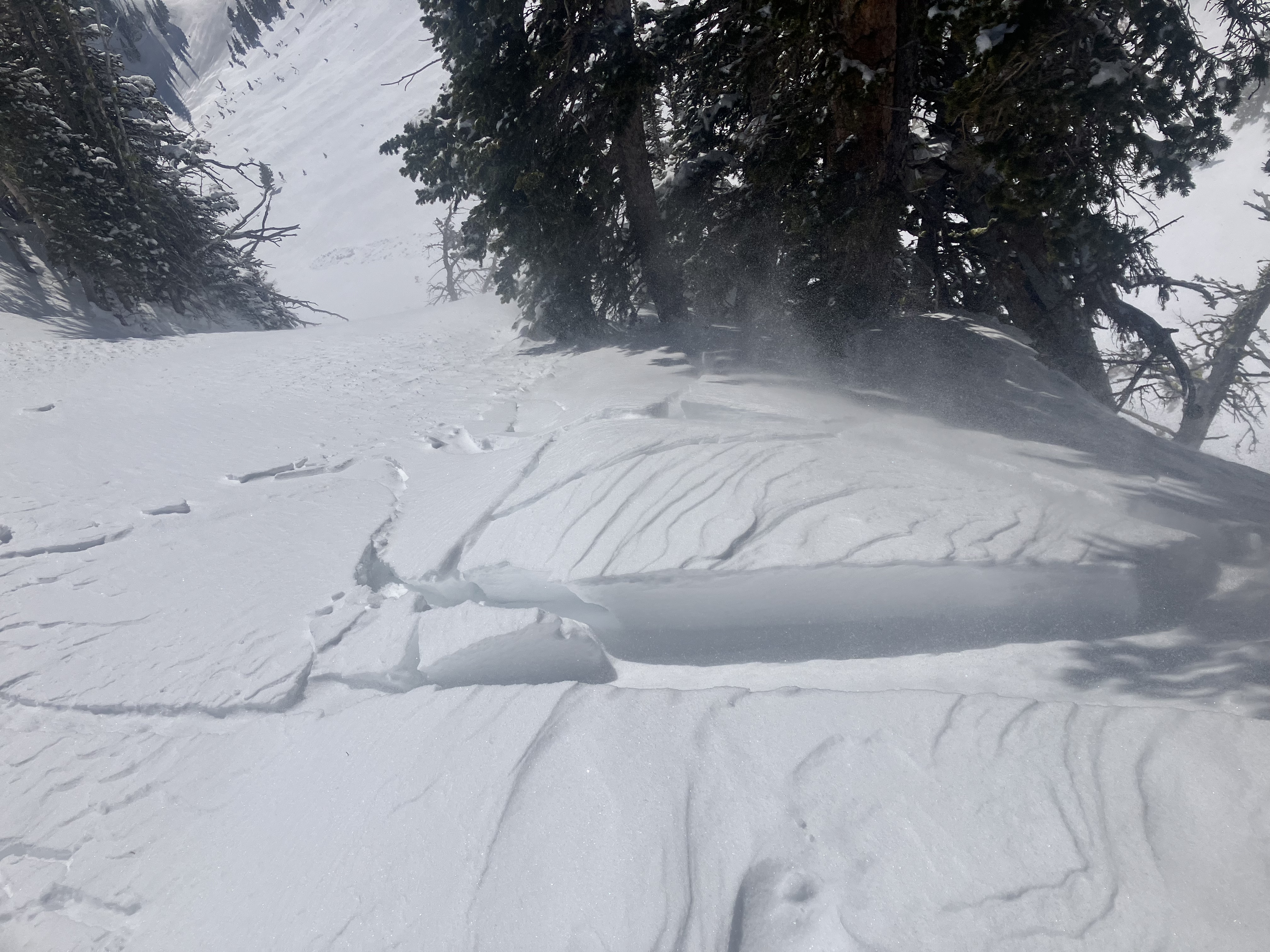
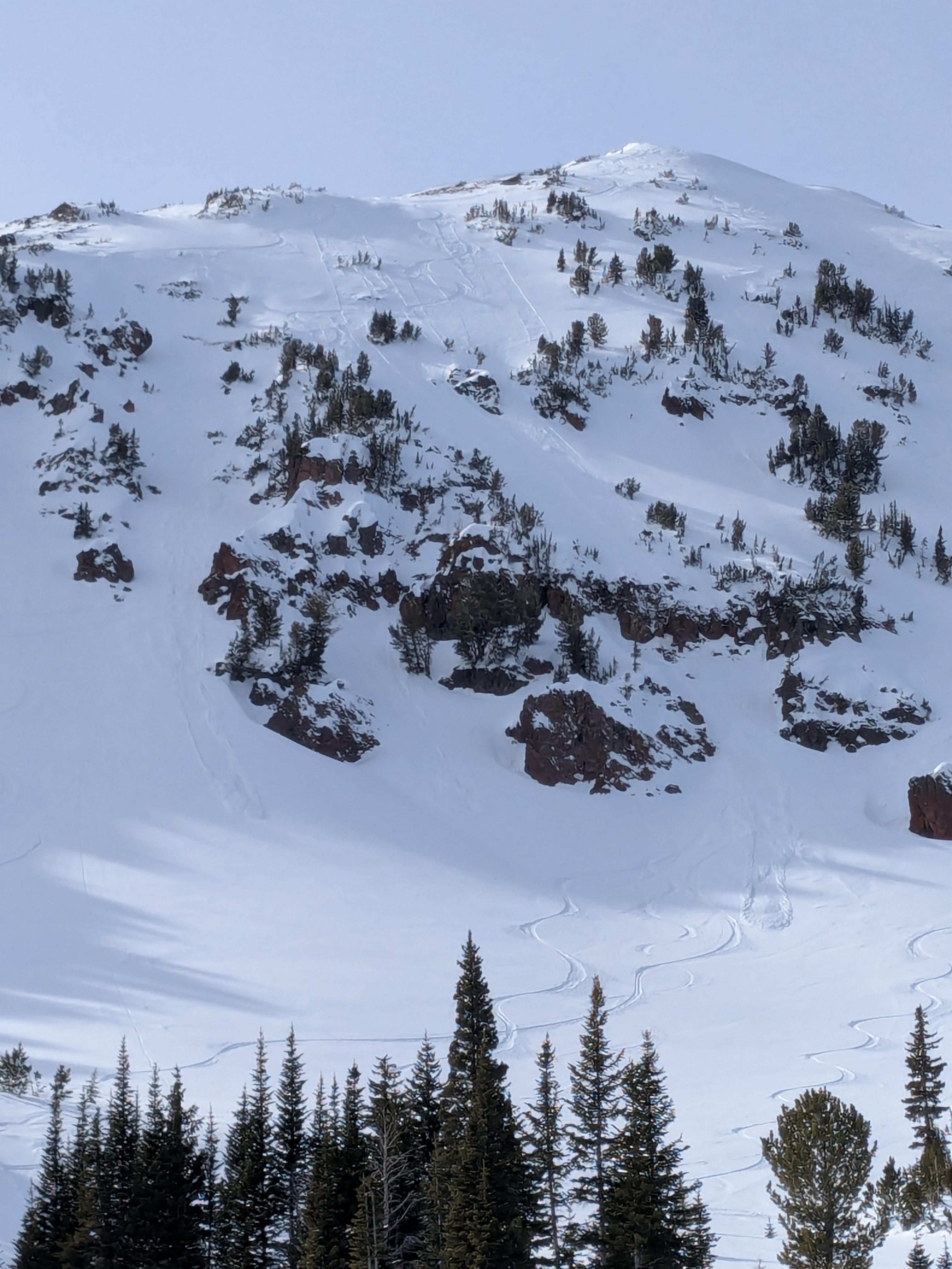
Took a quite tour up The Ramp to see how the new snow is bonding. Found 3-5" of new snow. Non-cohesive and seemed well bonded to the surfaces beneath. No signs of wind effect. No slab avalanches or signs of instability noted.
Saw a few sluffs in the new snow triggered by skiers in the very steep terrain just north of the Bridger Bowl ski area boundary (see photo). These sluffs were small, definitely not large enough to bury someone.
Full Snow Observation Report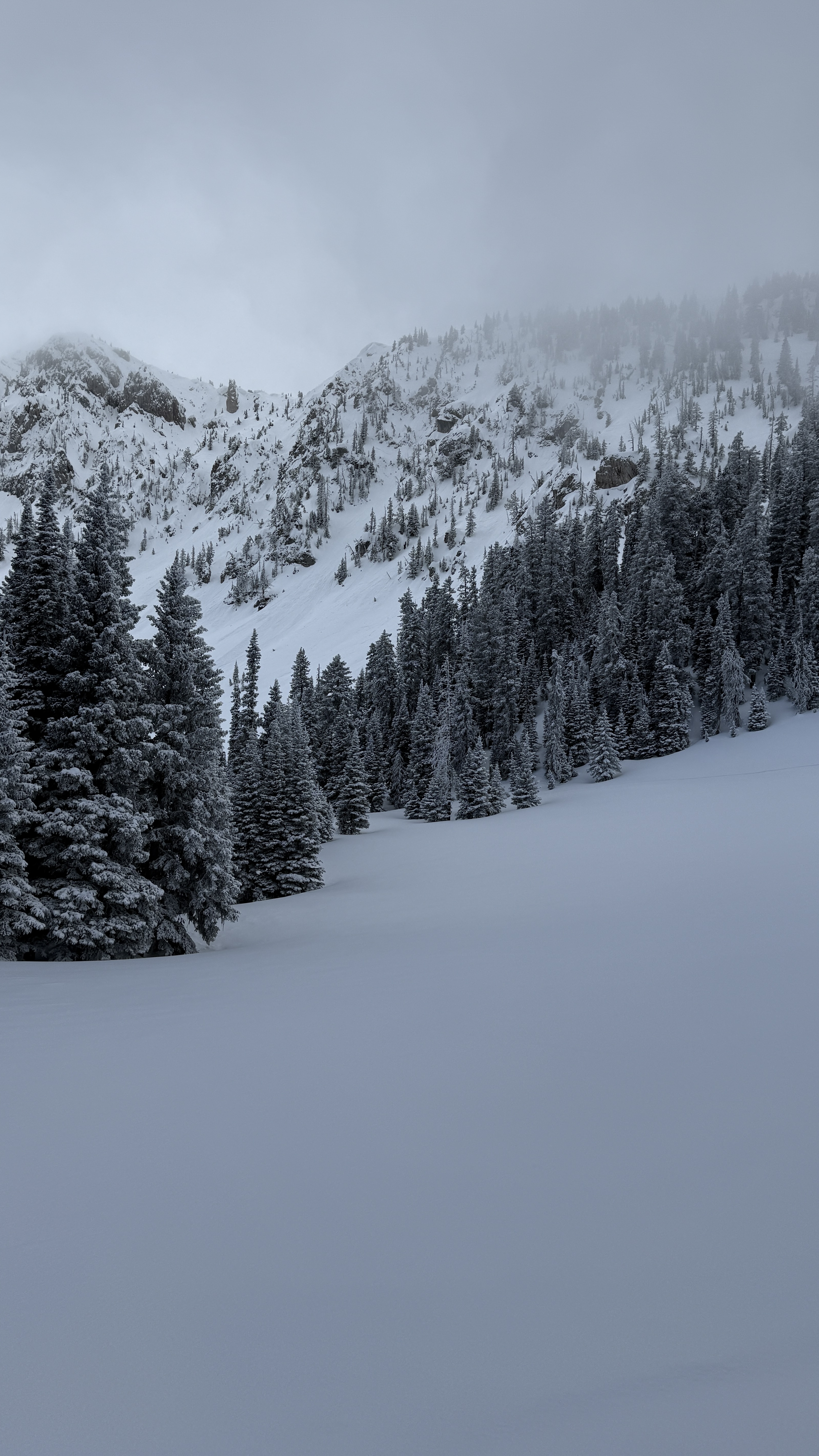
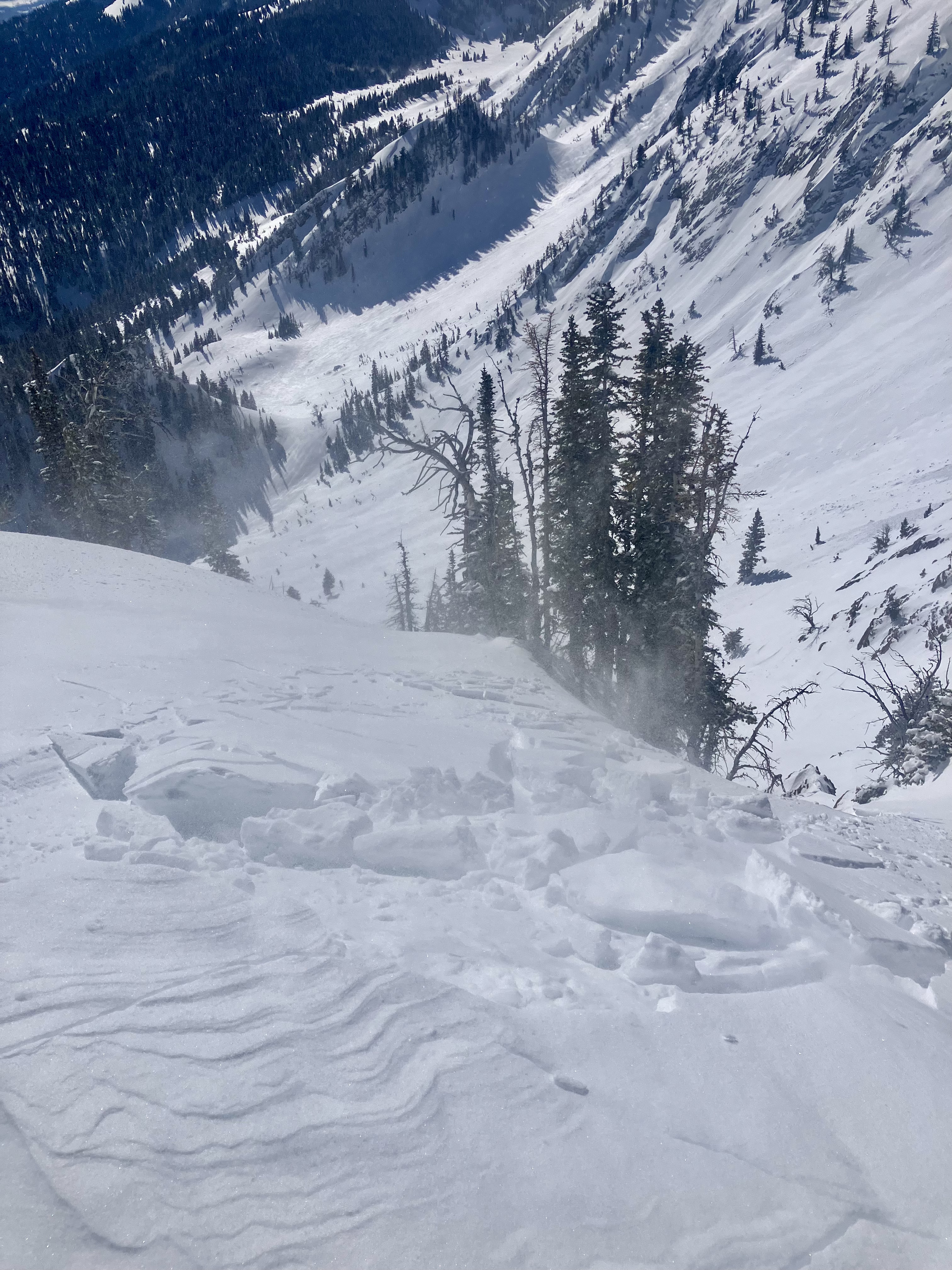
We rode along Buck Ridge, dropping into First, Second and Third Yellow Mules. We looked into Bear Creek and McAtee Basin drainages before riding through Muddy Creek to the Yellowstone Club boundary. Throughout our ride, we noted tracks nearly everywhere, including many steep slopes.
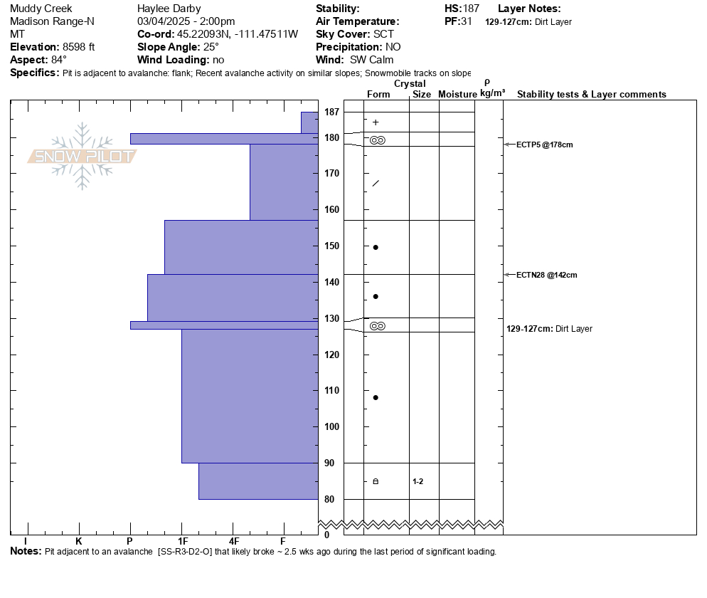
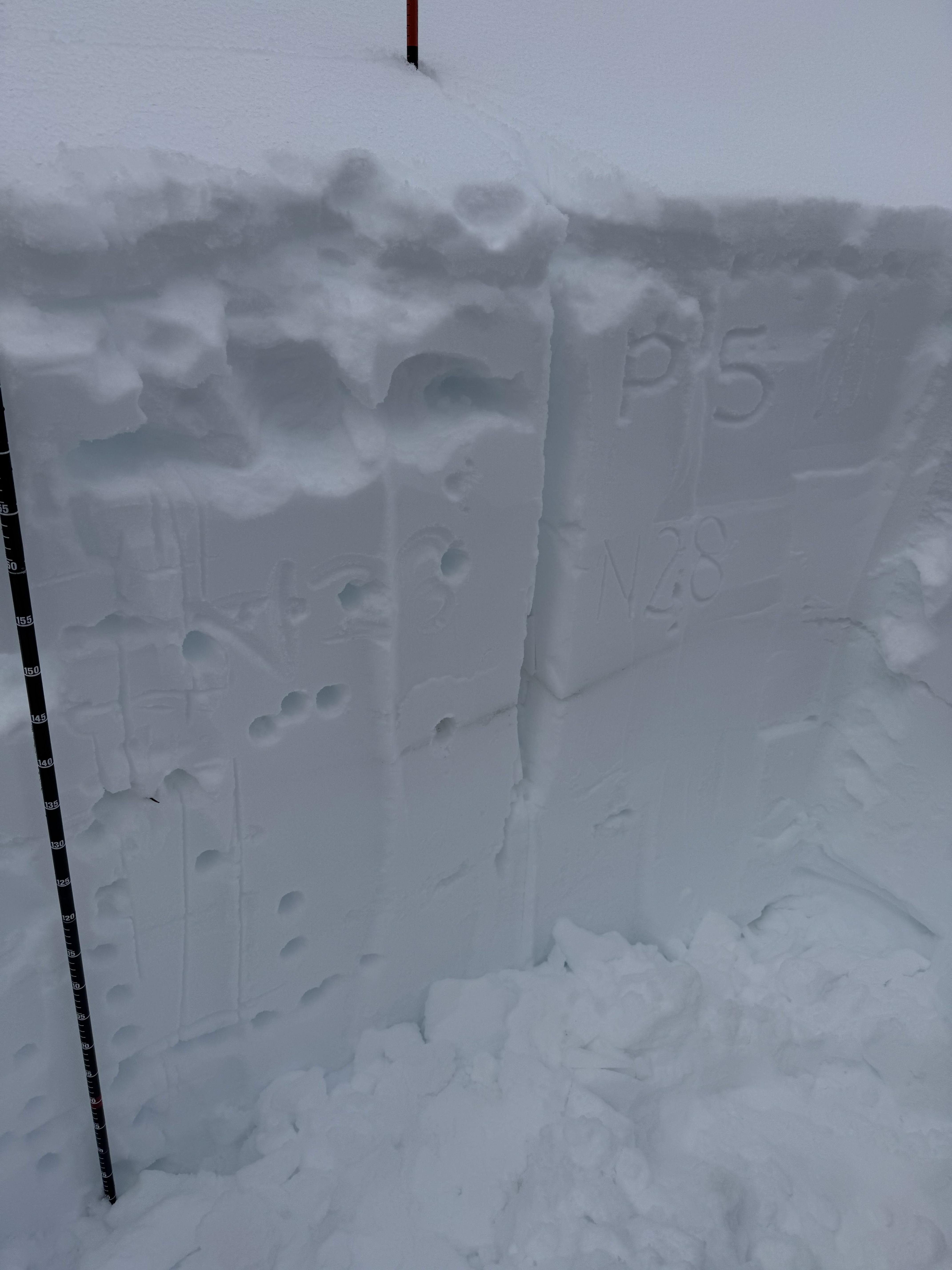
In nearly 45 miles of riding, we noted two avalanches. Both breaking on persistent weak layers a few feet down in the snowpack. The first was a small north-facing pocket in the First Yellow Mule (R1-D1) that was snowmobile triggered. It looked to be around a week old. The second was a larger avalanche (R3-D2), east-facing, deep in Muddy Creek. This was drifted in and likely broke around 2.5 weeks ago during the last significant storm cycle. We dug a snowpit near the lower flank of the path and noted that these weak layers had gained strength over time. We did get propagation on a stout melt-freeze crust near the surface (ECTP5) but did not get propagation lower down on faceted grains.
Currently, these two PWL avalanches are the only PWL avalanches we have seen/have been reported to us in this area this season. This zone seems to be the northernmost extent of the PWL problem that we are dealing with further south in Lionhead, S. Madisons and S. Gallatins.
Outside of these older two avalanches, we noted no other signs of instability and had a great day of riding.
Full Snow Observation ReportLOW danger is still fitting for the N Madisons.

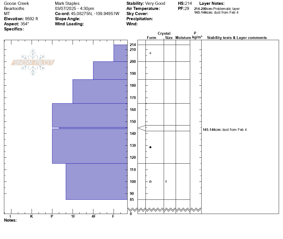
Dug a pit at 9650ft on a 20° NE facing slope near Zimmer Creek. HS 210-230. ECTN14 at about 40cm down.
Full Snow Observation ReportSkies were still blue with increasing clouds when we rode up into Fairy Lake zone this morning. We popped up onto the Frazier Basin ridgeline and could see many tracks from skiers over the weekend. As we descended back to Fairy Lake and transitioned to skis, the cloud deck increased and the ceiling lowered. We ascended up Nayu Nuki's east shoulder and at times visibility was limited to 25' in front of our ski tips. Temps were still quite warm and winds were minimal.
Snow surfaces were variable with a mix of sun crusts, wind board, and in shallower tree-sheltered zones, sugary faceted snow. It will be interesting to see how well a few inches of new snow this week bonds with these different snow surfaces.
While our original trip plan involved stepping out into steeper avalanche terrain, we decided to pull the plug due to extremely limited visibility. This was an example of how even though avalanche conditions may be generally stable, there are other factors to consider when choosing to ski steeper lines (visibility of your partners, visibility of surrounding avalanche terrain, etc.)
Full Snow Observation Report
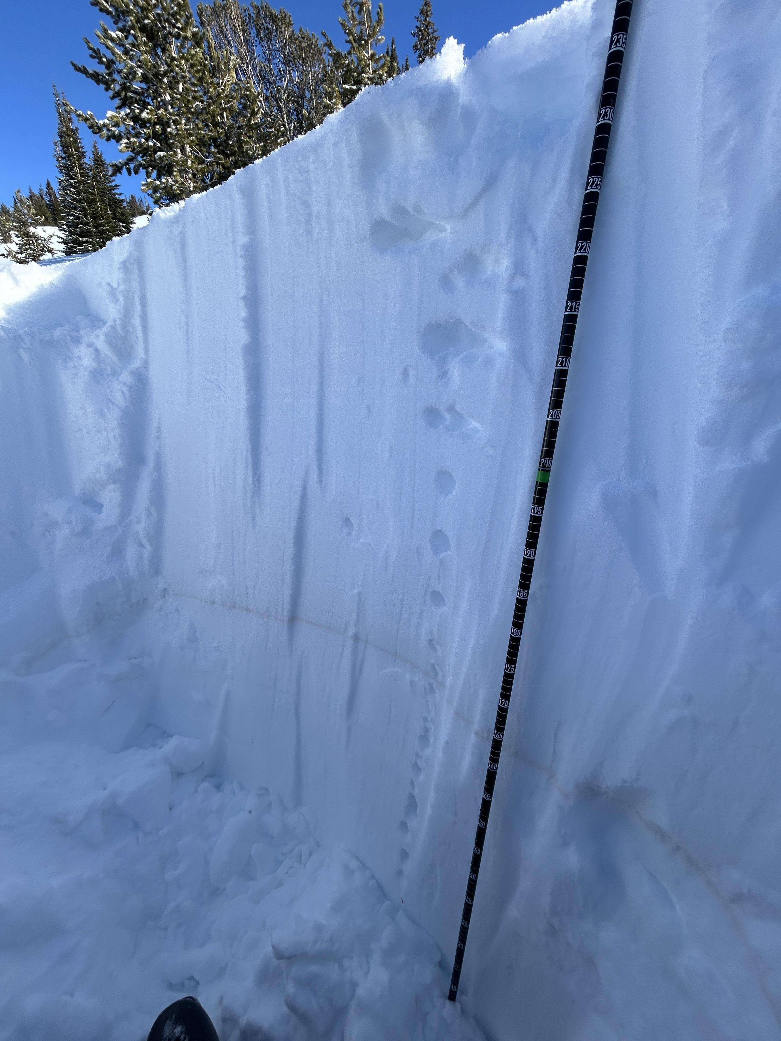
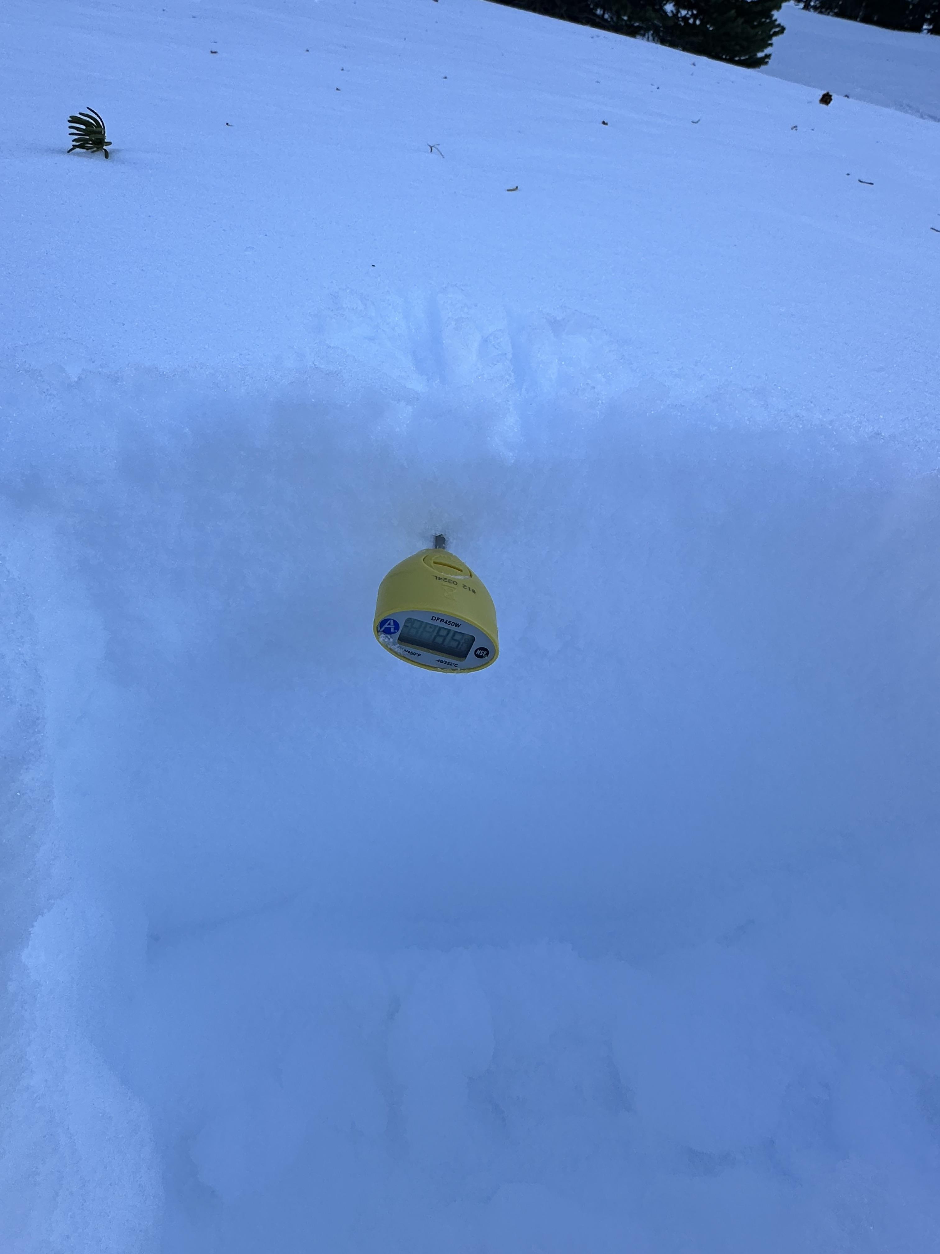
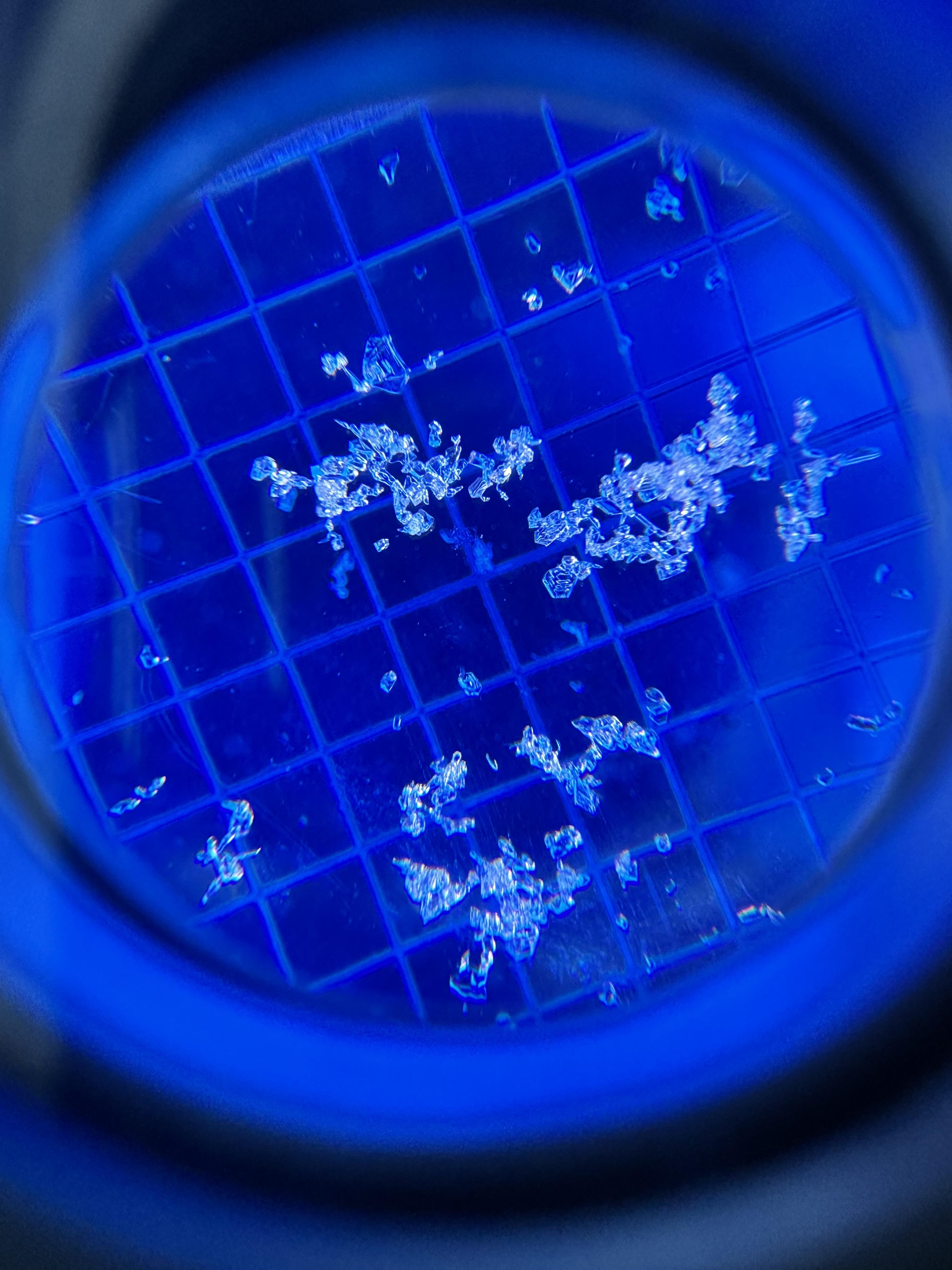
Toured up Flanders Creek to the main cirque. I was wondering what the snow surface was doing with the high pressure. I dug a pit on a NNW aspect at 8900'. HS 205cm, light SW wind, clear skies and air temp was 2.1 C at 4pm. Dust layer was down 60cm from the surface.
I didn't get any propagating results in my pit and the snowpack was right side up. I did notice a strong temperature gradient in the top few centimeters of snow. I only found this on sheltered, shaded slopes with dry powdery snow. I did not find a strong temp gradient or facets in dense wind affected snow. Something to keep in mind if we get a big dump of snow in the near future.
Full Snow Observation Report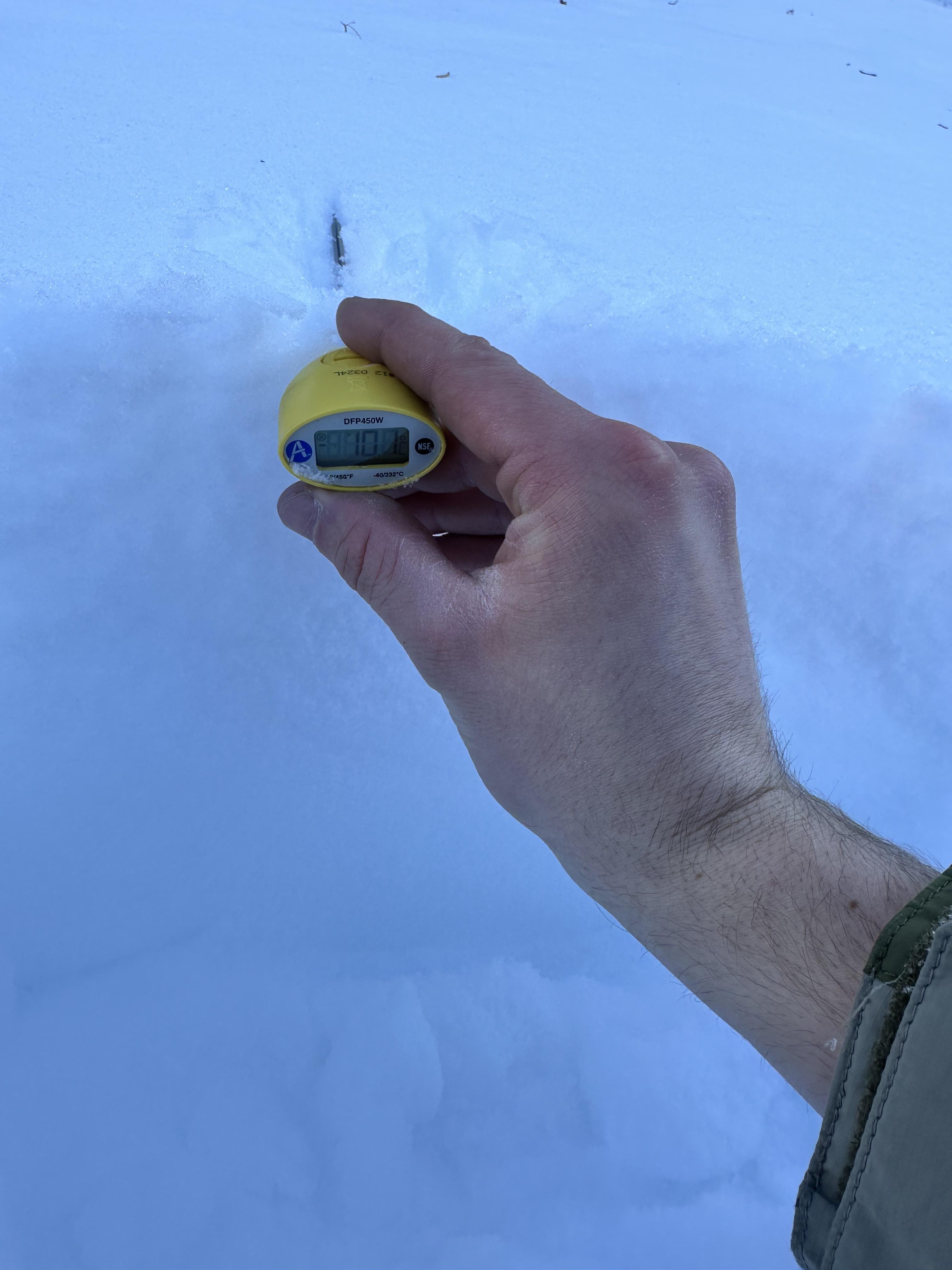
Today we observed wet loose avalanches in steep, rocky terrain on the west side of Miller ridge. SW facing, 9500 ft
Full Snow Observation Report