Snow Observations List
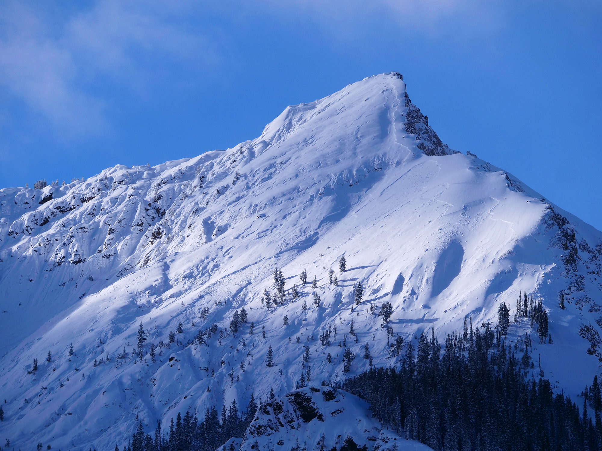
From email Jan 12: "Natural avalanche on the Fin of Mt. Republic observed this morning.
The timing of it looks to be about 36-48hrs ago.
Looks like it might have started at the new/old snow interface, and then stepped down into deeper layers mid face.
Quite an impressive avalanche!"
Full Snow Observation Report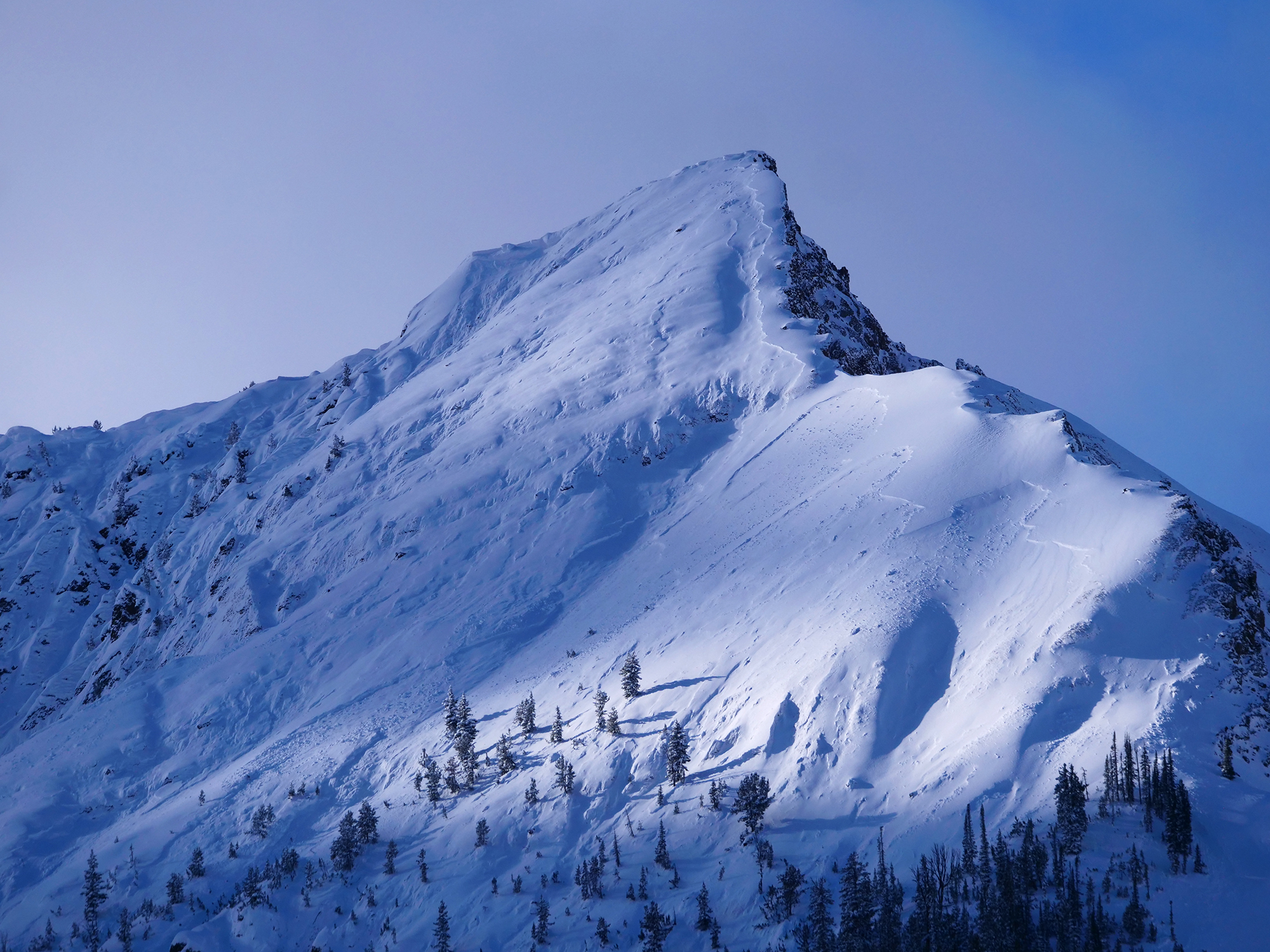
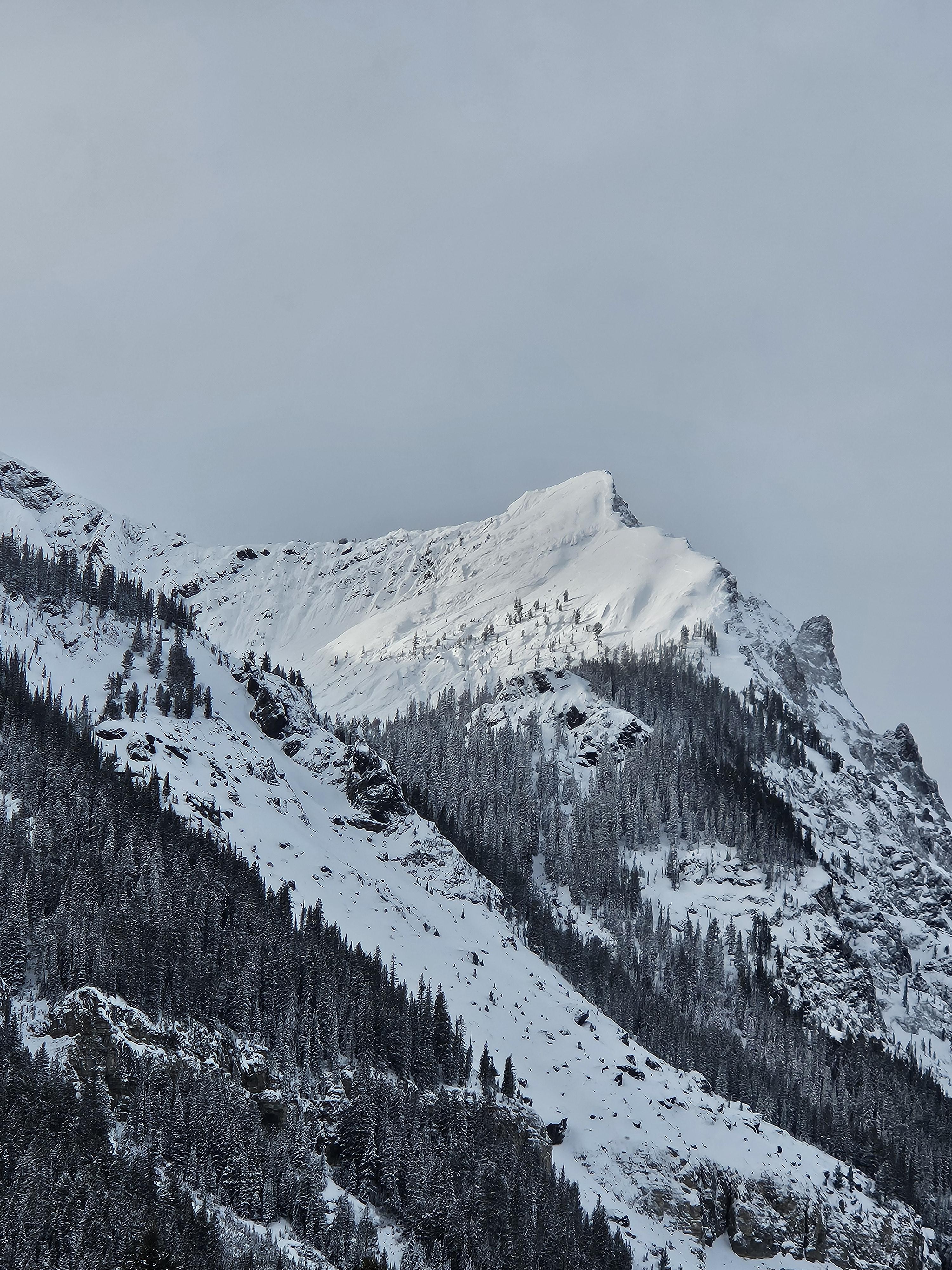
Collapsing, shooting cracks (30ft+), and whumpfing noted while breaking trail on the W aspect of Henderson. Frequency increased with elevation. Natural avalanches noted on E faces of Miller, Republic, and Henderson. Also natural avalanches on SW face of Scotch Bonnet.
Full Snow Observation ReportFrom email: "From this morning. Looks to be 1_1.5' deep. Maybe a few different ones based on what I can tell."
Full Snow Observation ReportReed texted me another photo this morning I will add later today. ZP
On 1/12/24, a skier triggered a 2 ft deep avalanche on a wind loaded south facing slope at 9700 ft near Big Sky and was caught and carried by it.
Full Snow Observation ReportFrom facebook message: "Strong winds and heavy wind loading. Cabin creek below skyline ridge. 1/12/24. Was seeing Shooting cracks all day."
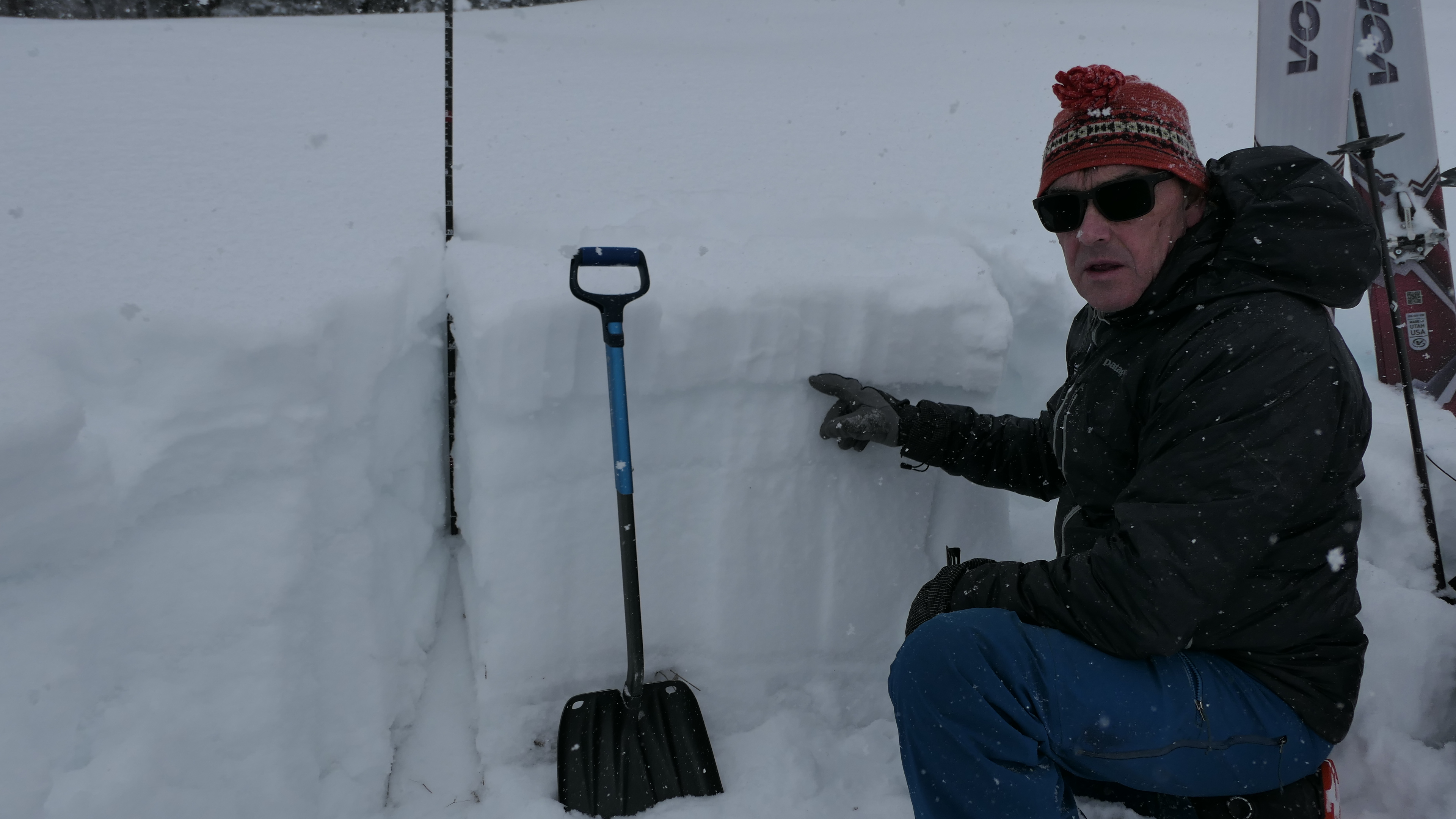
Full Snow Observation ReportYale creek opposite side of creek from maintenance shack at 7600 ft with 105 cm on a 27 deg slop 62 deg NE facing. First column test had an CTE - 1 failing at 75 cm and then CTE-4 failing at 63 cm
ECTN - 5 with no propagation across entire slab
Very deep facets with 4 melt freeze layers with one being 7 cm thick, surface hose layer very visible and one of the failure layers
Full Snow Observation ReportAspect- SW
HS-65”
17cm from top, we saw ECTN#16
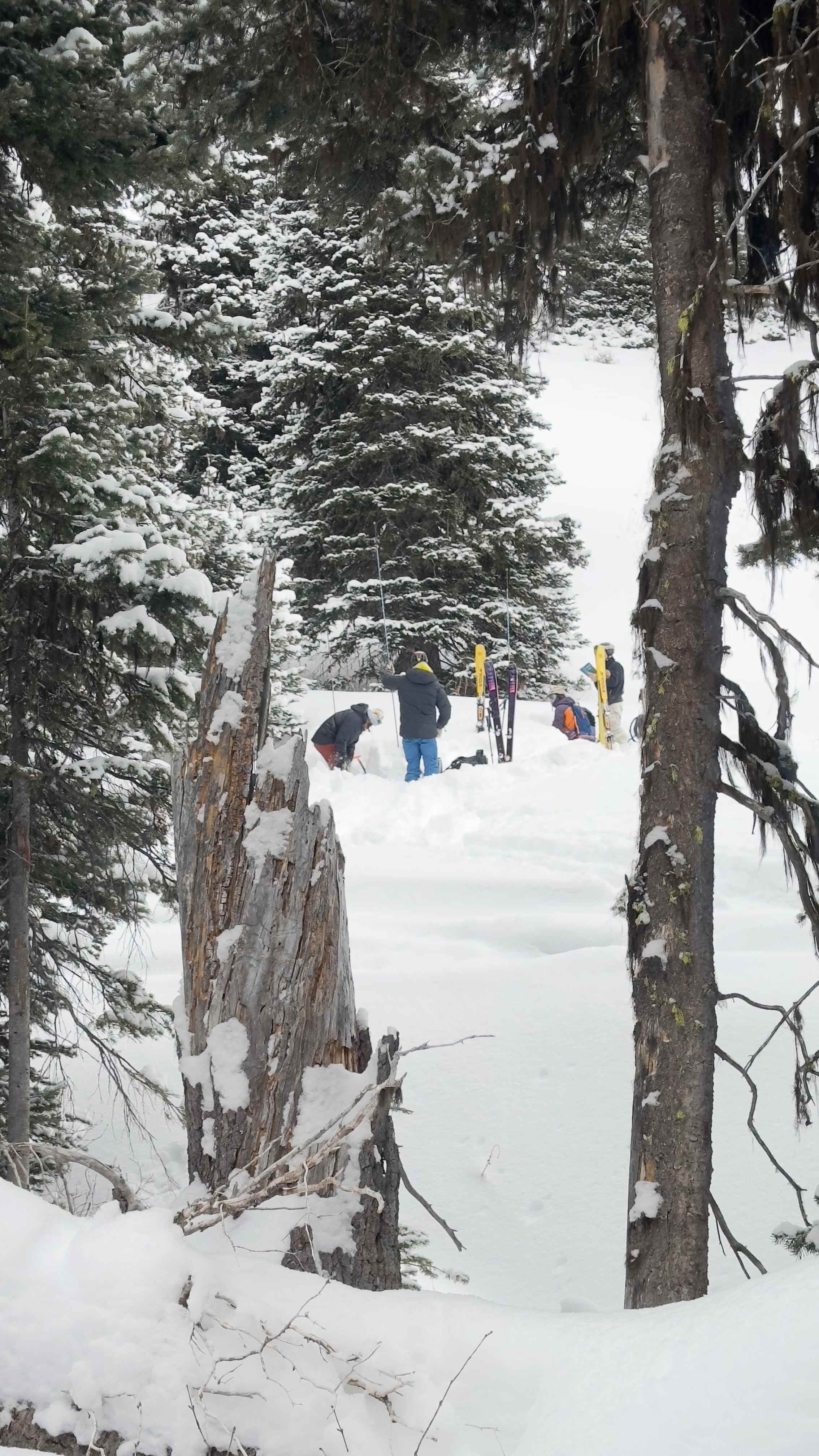
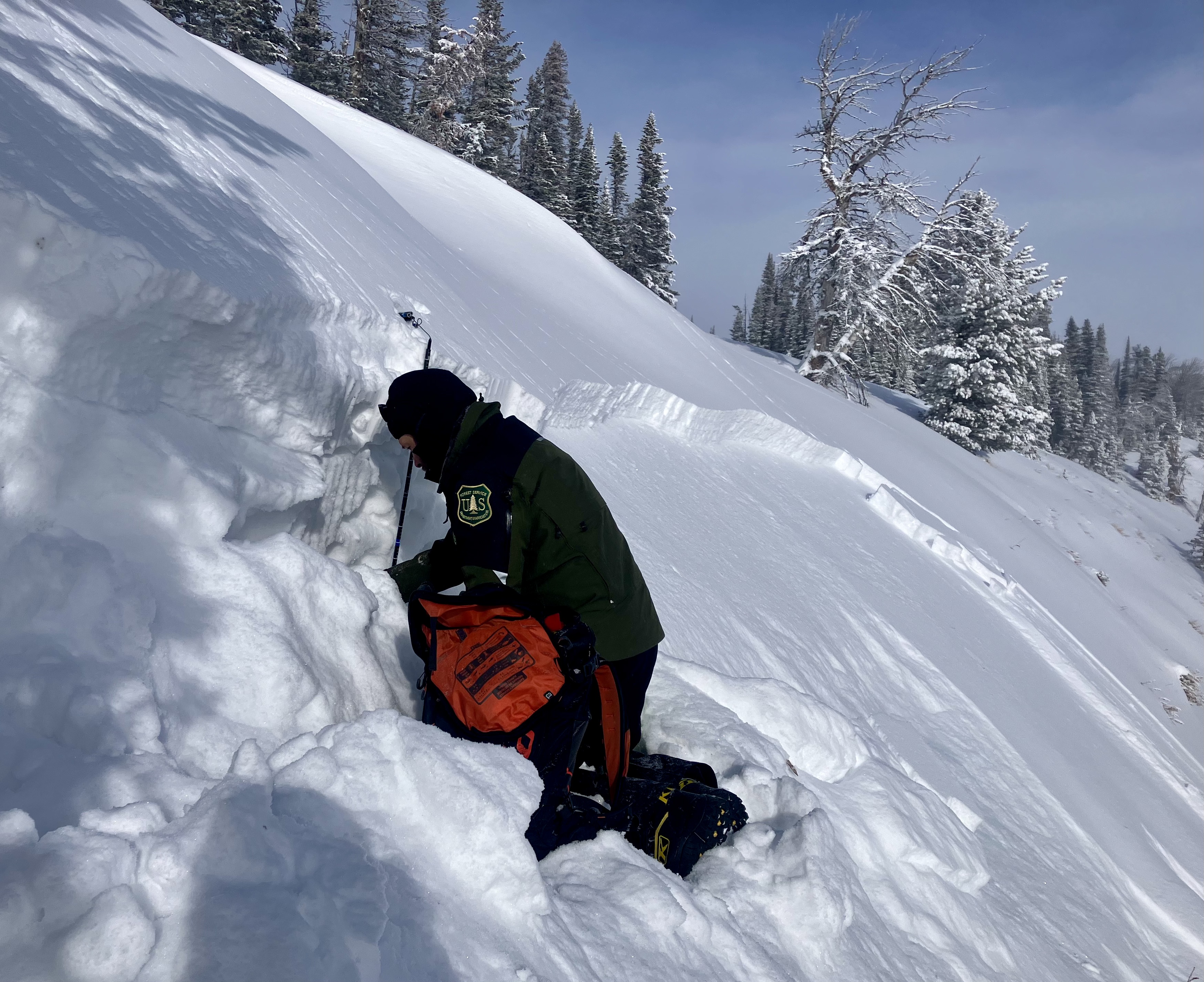
picture of pit location
Full Snow Observation Report
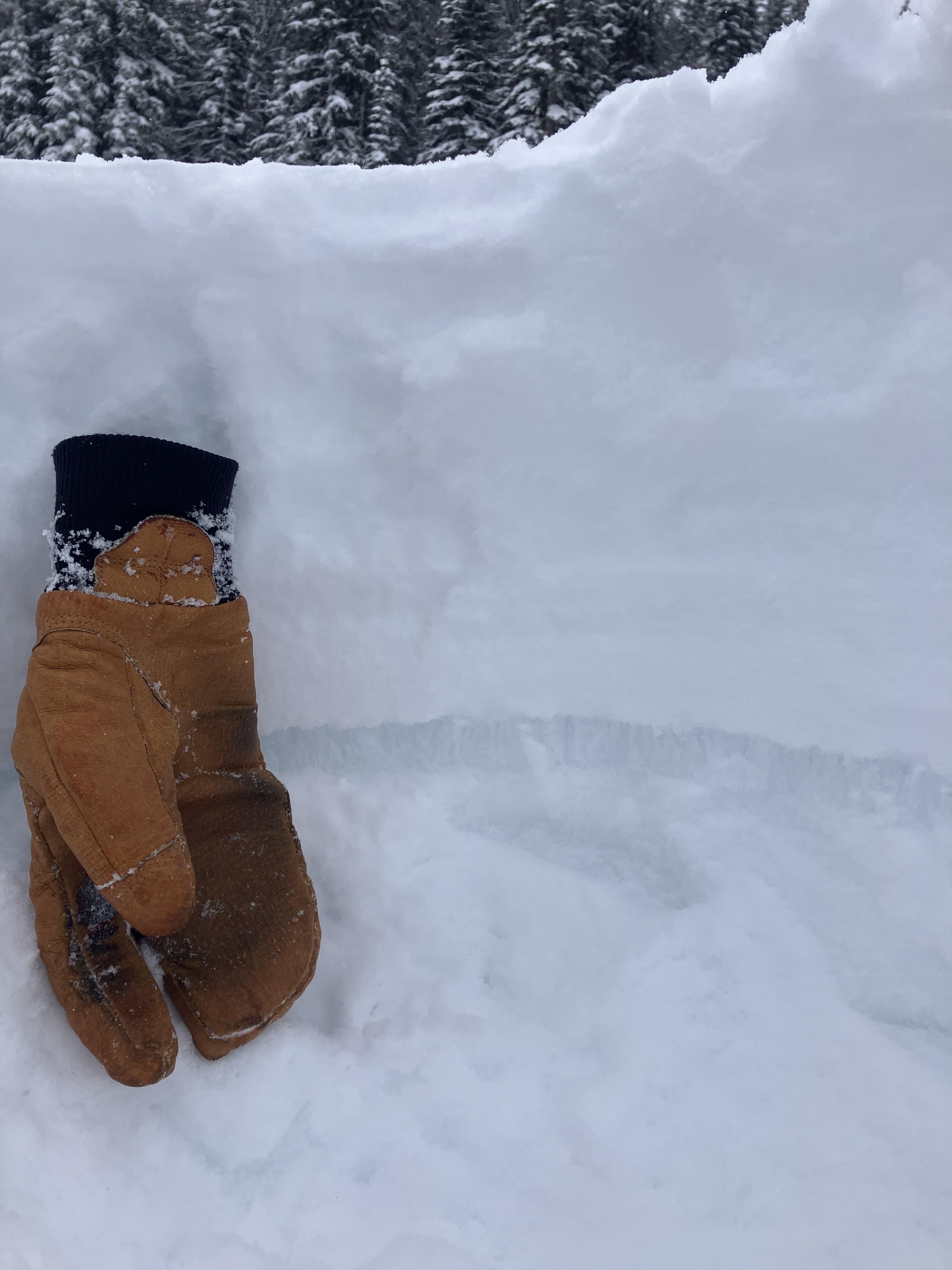
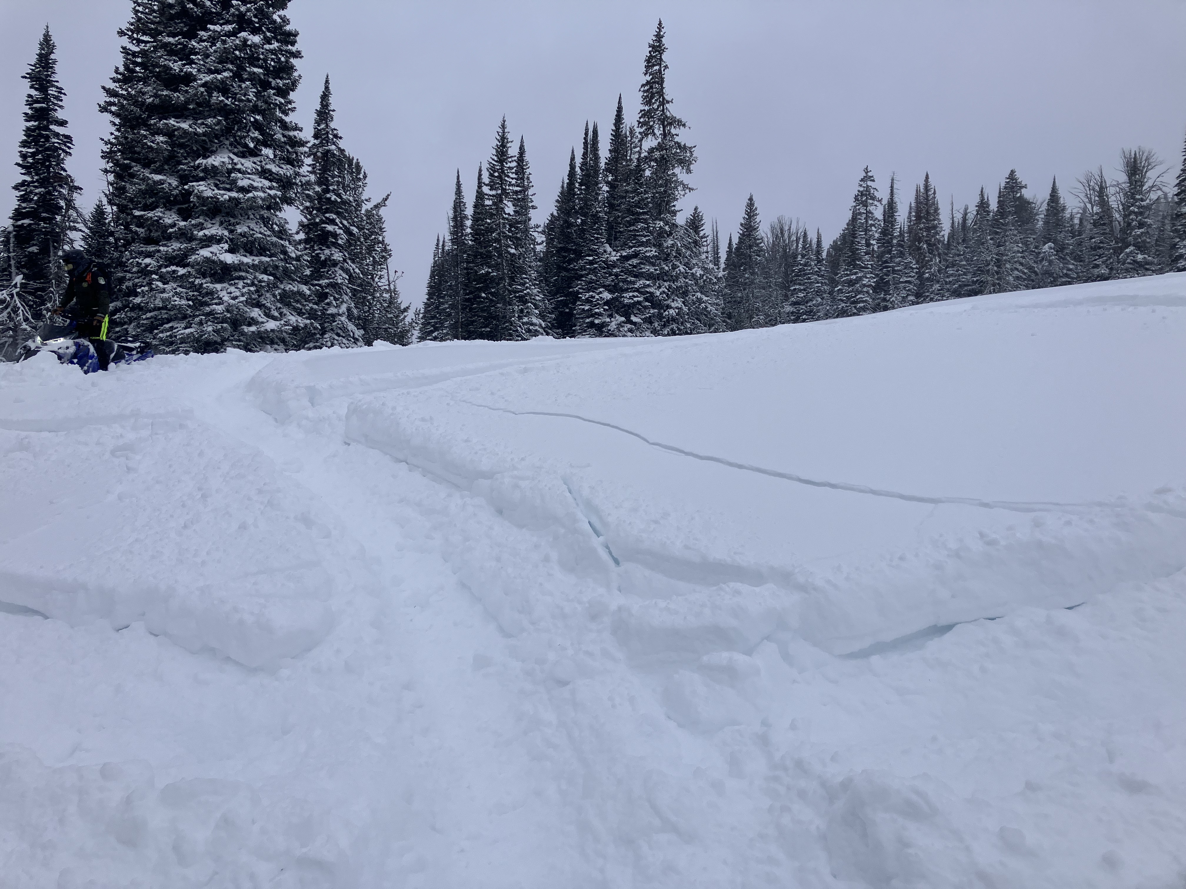
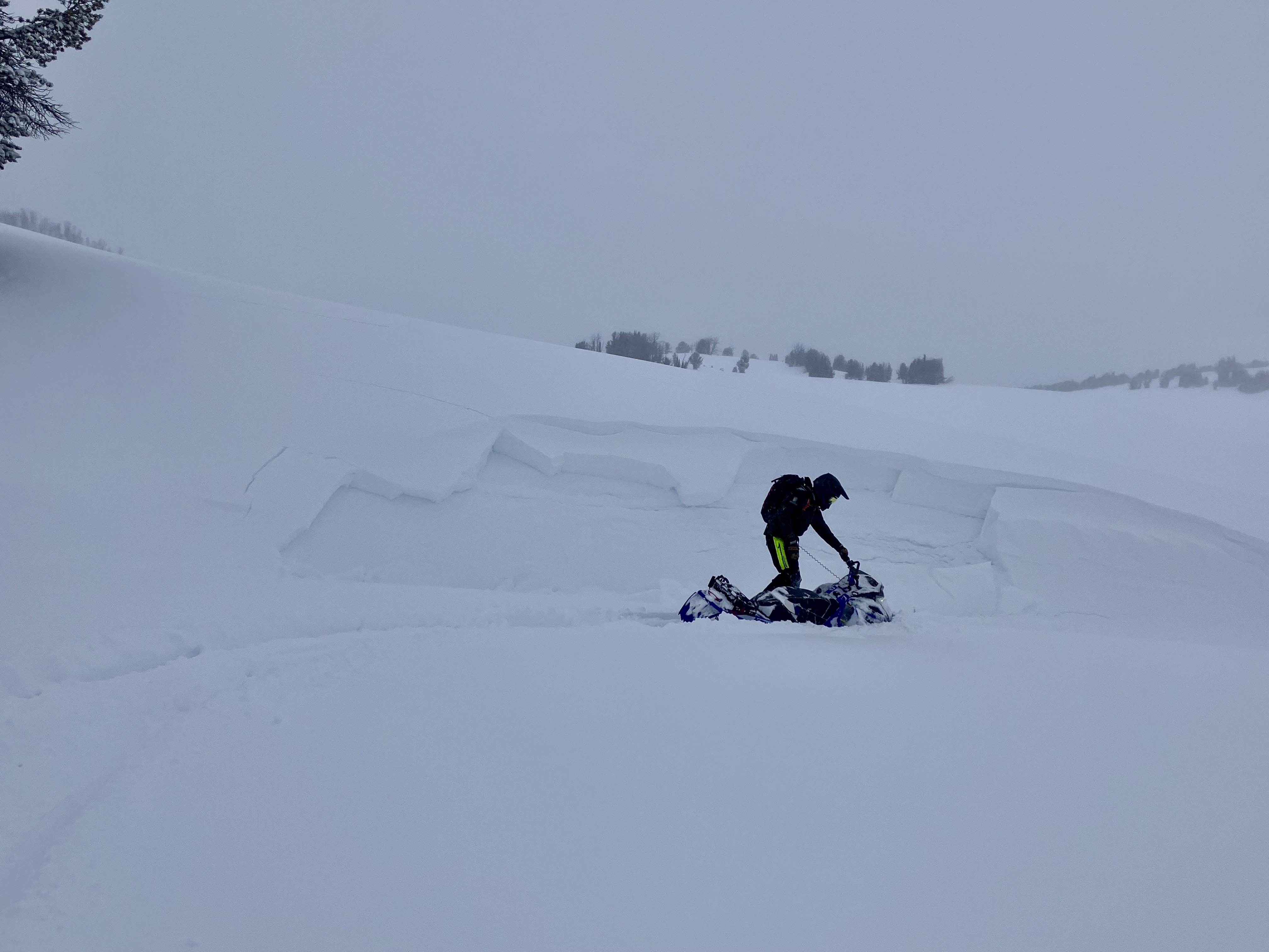
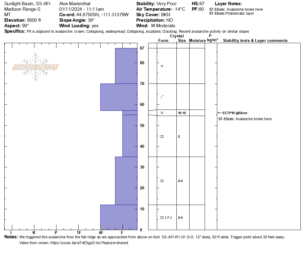
We saw a lot of action (unstable snowpack) in Taylor Fork today. At Sunlight Basin, we remotely triggered an avalanche while walking on the flat ridge above a wind-loaded slope. The avalanche broke below a 12" deep slab with 1.5" of snow water equivalent in the slab, and it failed on a layer of large (1-1.5cm) surface hoar. Video, pics, and crown profile attached. We also saw a small wind loaded slope that was triggered (remotely) by riders yesterday, and we triggered a similar slope today. These were short slopes, but the slabs broke over 1 foot deep and as wide as the terrain feature, and they were triggered from adjacent flat terrain 10-40 feet away (remotely triggered).
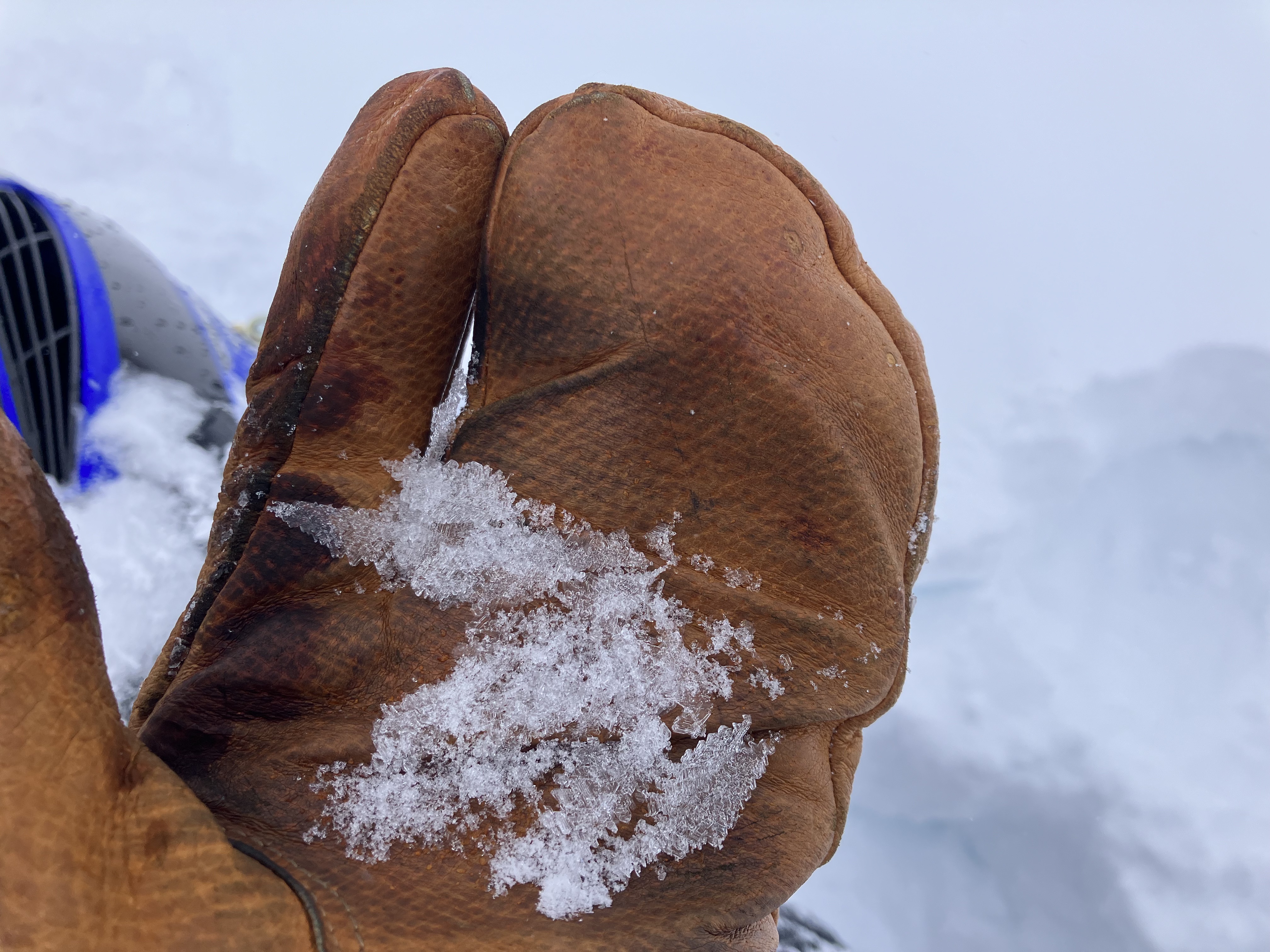
While riding around we frequently saw large shooting cracks on any slope with a slight wind-load/wind-effect. Near the wilderness boundary we saw these large cracks across the snow surface. In quick hand pits we easily found a weak layer of surface hoar below the recent snow that was 3-4cm long crystals, standing upright!!! (pics attached).
Wind was moderate out of the west, actively loading slopes and filling in tracks all day. Mostly cloudy/partly sunny morning. Started snowing in carrot basin around 1pm, shortly before we left.
Full Snow Observation Report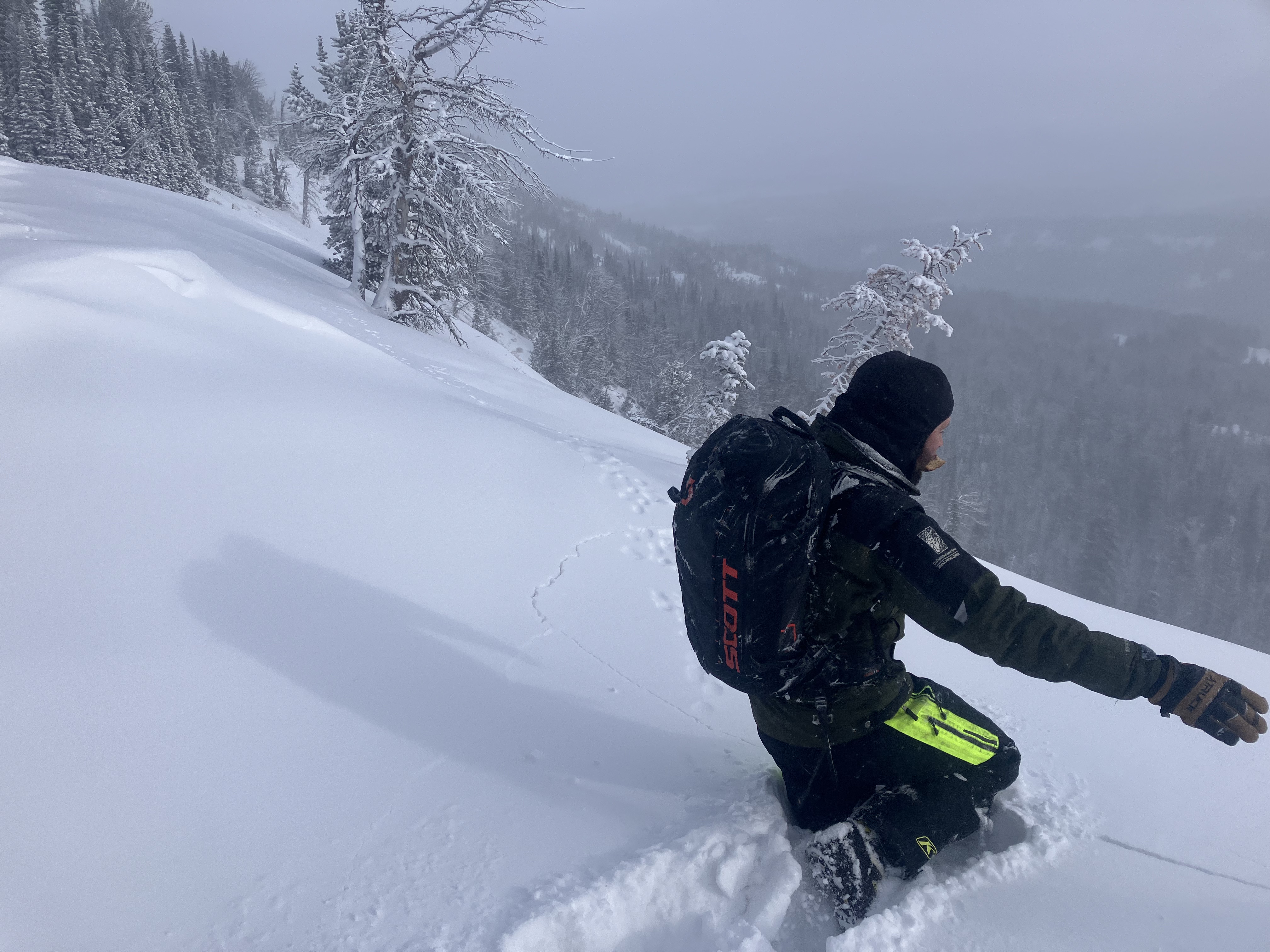

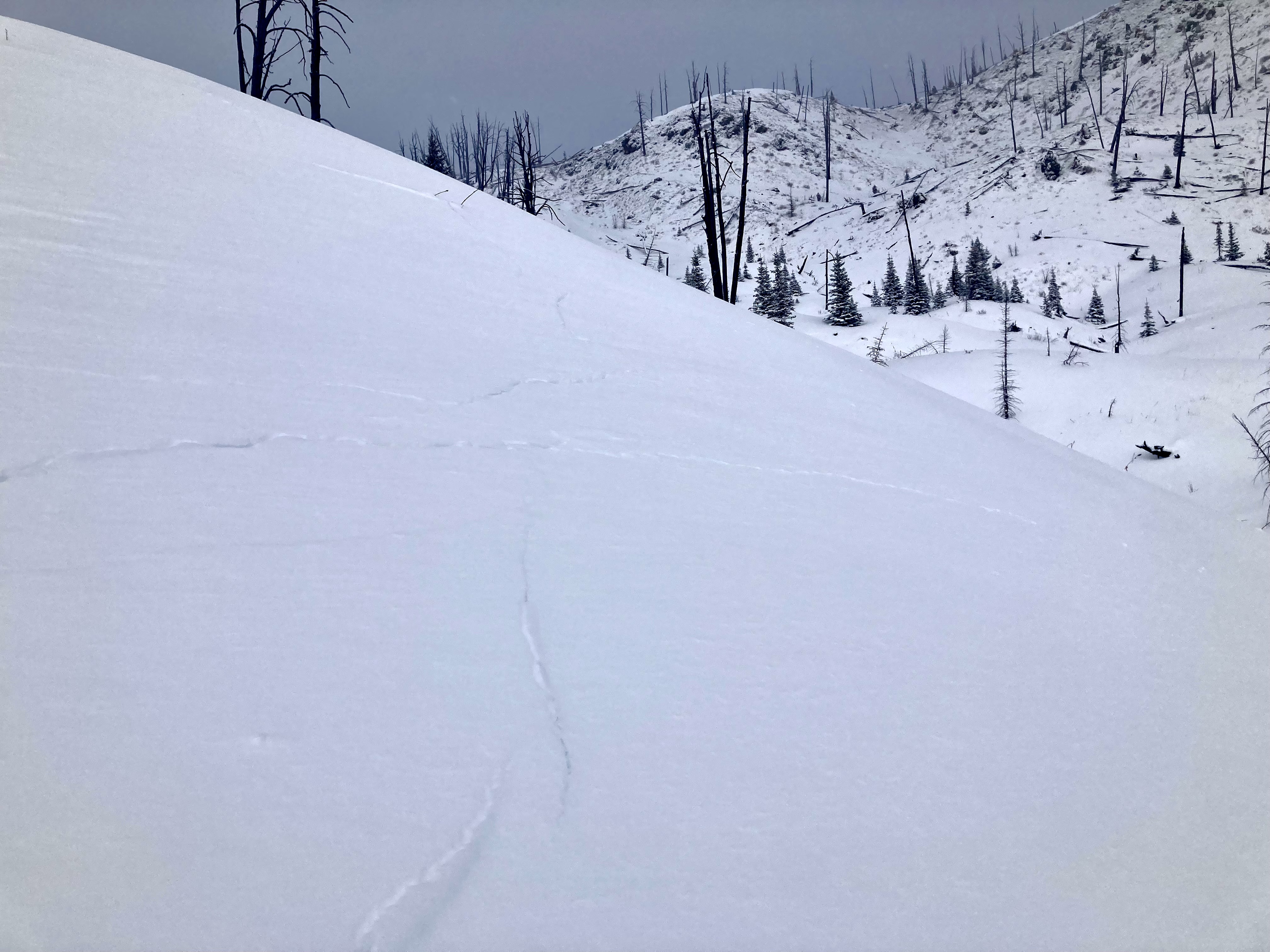
I skied up toward fawn pass today, and had a few notable observations. We had multiple collapses during our ski, and one 40’x40’ slope had a large collapse on the trip up and again on the way down. I noticed one meadow that had collapsed before we were out, and the new snow had sheared off of several downed logs. Most notably, my tracks from a month ago were easy to follow in a few places.
Full Snow Observation Report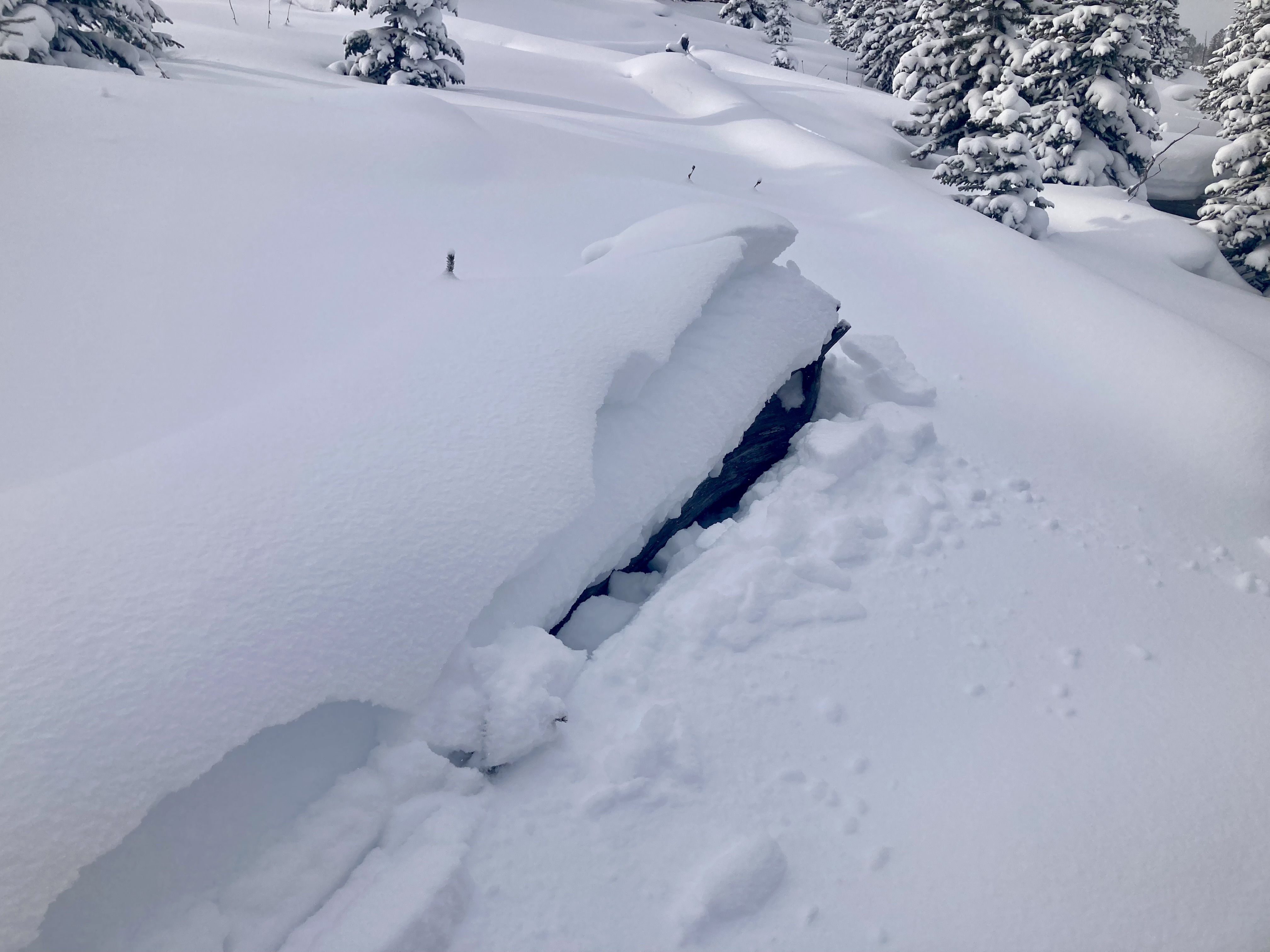
On Jan. 11, we toured north of Bridger Bowl after a foot of low-density snow fell, totaling 0.2" of snow-water equivalent. The snow was light and fell with minimal winds. Our concerns are loose snow avalanches (sluffs) and that our weak snowpack is getting incrementally tested by the weight of new snow and we don't know exactly when it will hit its breaking point. There were several small (D1) skier-triggered loose snow avalanches in Wolverine Bowl and the Hourglass. In the snowpits we dug, we didn't see this incremental loading pushing the weak layers to the edge. However, that is not the case everywhere in the Bridger Range where winds are active and this new low-density snow is being transported, further pushing the weak snowpack toward the edge. Looking north towards Naya Nuki we could see snow being transported at ridge tops while the wind remained calm near us. Employ conservative decision-making along with careful route finding and a thorough snowpack assessment if you are considering traveling on steeper slopes. When the wind ramps up expect the danger to increase and slopes to become more unstable.
Full Snow Observation ReportWatch the winds, if the winds pick up things will change.
ECT Test Pit
Elevation: 7420’
Aspect: NE
HS: 96 cm
ECTN 27
ECTX
Instructor performed PST END 45/100 @ 20cm from base.
Full Snow Observation Report
Skied the S/SE face of Blackmore this morning. Had several large collapses lower in the basin, as well as the ridge. As NOAA predicted, winds started cranking at 10:30am which was time to go, most of the tracks in the area were covered up within an hour.
Full Snow Observation ReportFrom email: "Approx 35 cm new snow. W aspect 9750’ HS 117 ECTP 4 and ECTP 1 35 cm down on surface hoar. Trace of new snow today and getting colder fast. Shooting cracks were common outside the skin track up to 20ft and collapsing was frequent. "
Full Snow Observation ReportFrom BPG Obs blog input by ZP after talking to Reed.
Traveled into the Blackmore area to find some soft snow and compiled a number of observations. We performed a quick ECT on a NE facing slope at roughly 9000’ in a slightly wind loaded terrain feature and got a result of ECTX. In our pit we did identify the potential for a 3-5” slab consisting of the recent snow to avalanche in certain situations. We felt this was a manageable hazard as long as it was not on a large slope with exposure. While touring we also noticed a small avalanche (presumably natural) on the E face of Blackmore. It is in the attached photo. Later we dropped a refrigerator size cornice onto a steep slope and got a small pocket of the new snow slab to release confirming our earlier suspicion. While skiing one of our intended slopes, one of my partners skied over a small rollover and as he arrived at the bottom of the small slope a pocket had released above him and stopped just above where he was standing. The culprit was again the recent snow on top of older faceted snow.
Overall was a successful outing and we scored some good snow while managing the hazard we had identified.
Full Snow Observation Report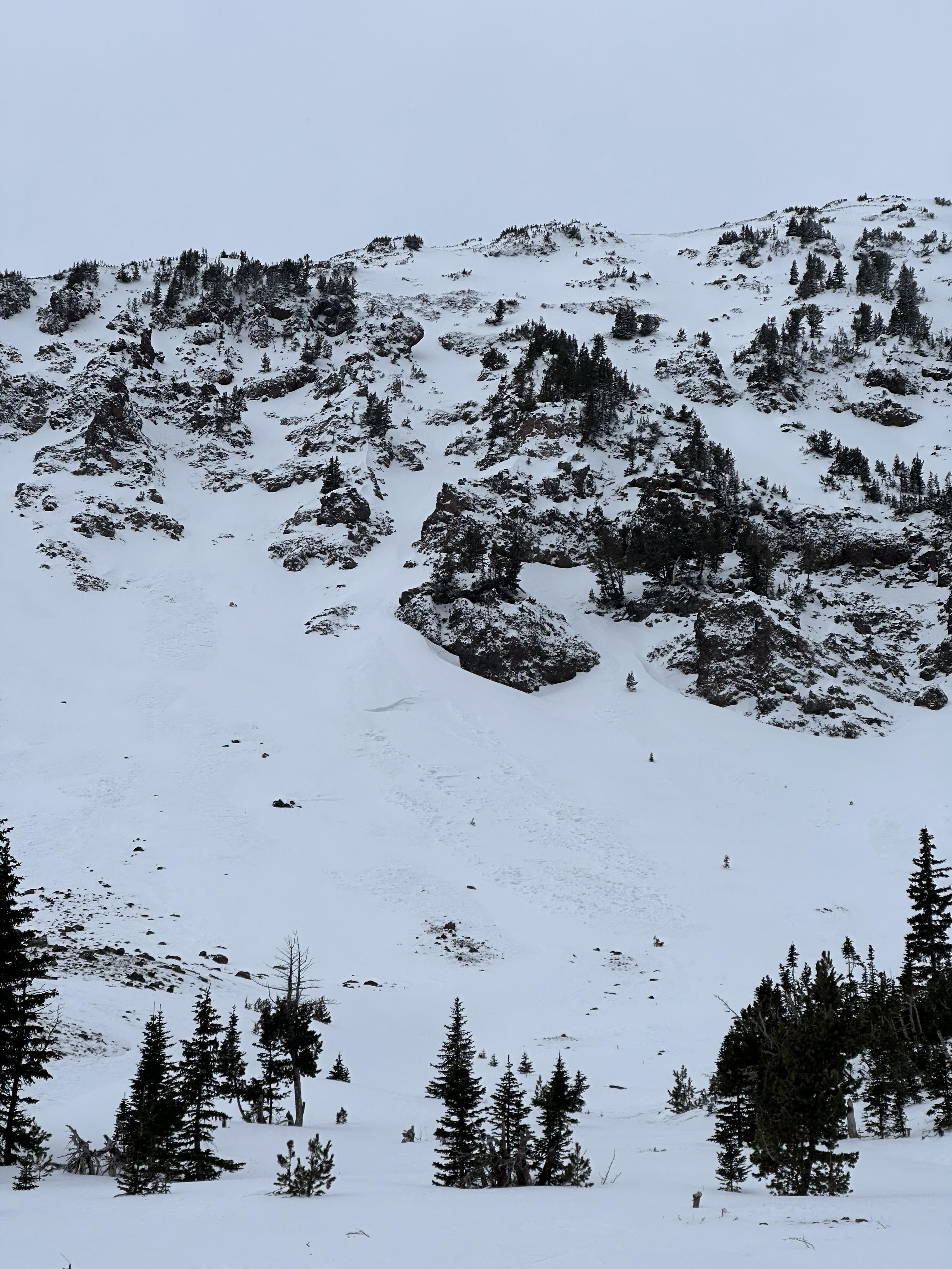
Pockets of wind loaded snow throughout the gully. Slab thickness varied. It was steep enough to slide but was anchored well by trees and willows. The hasty test seemed that the slab failed on facets just below the recent storm snow.
Full Snow Observation Report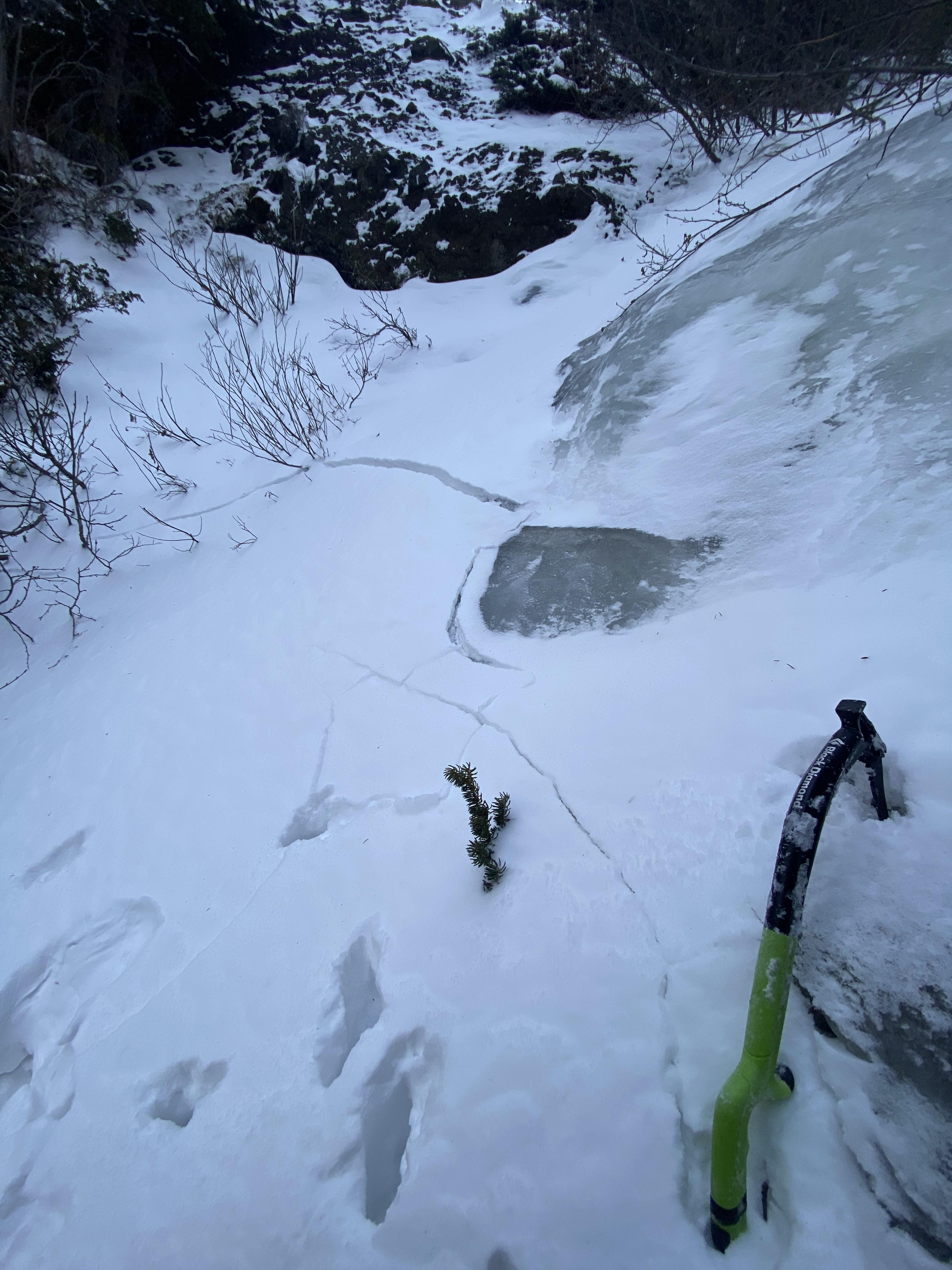
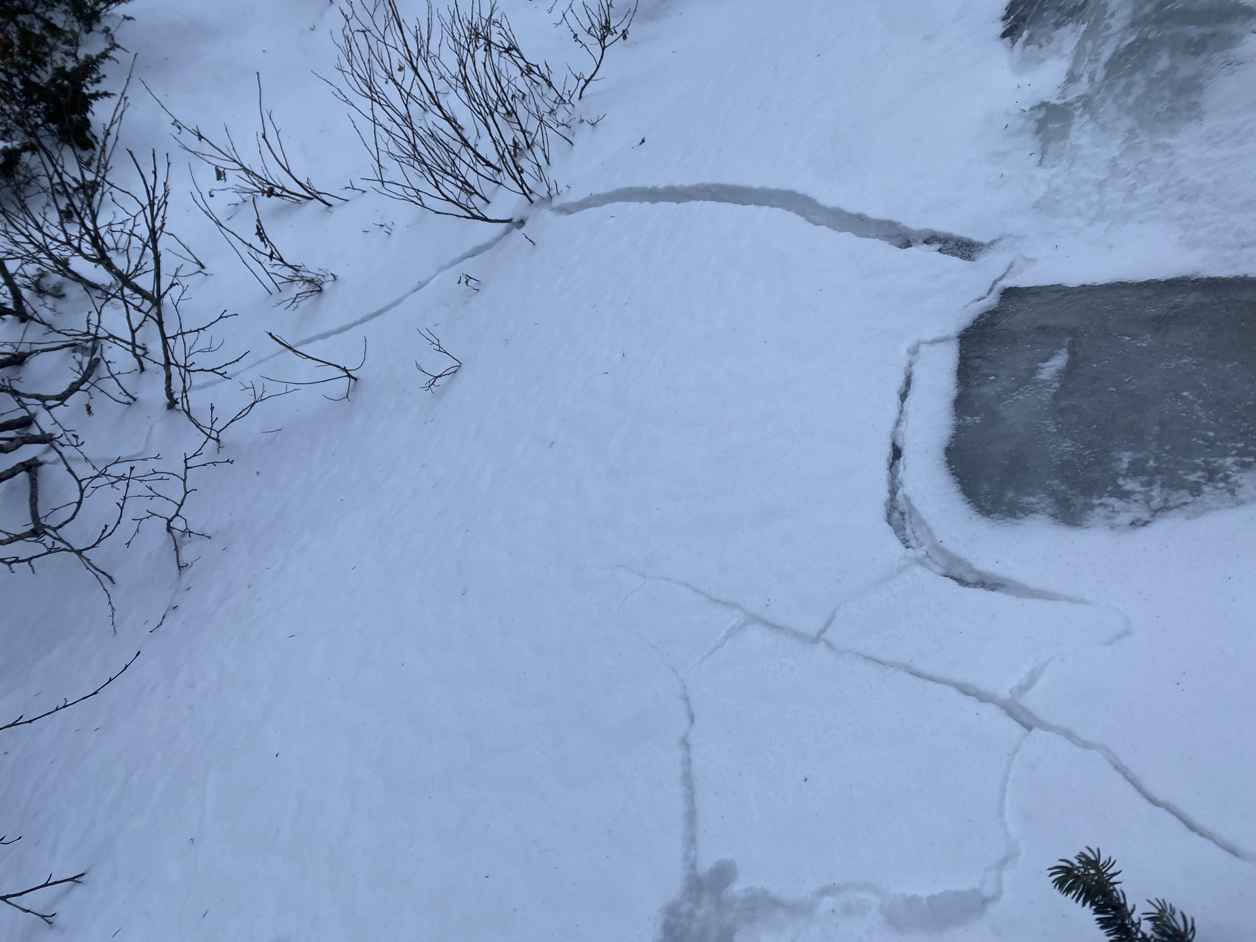
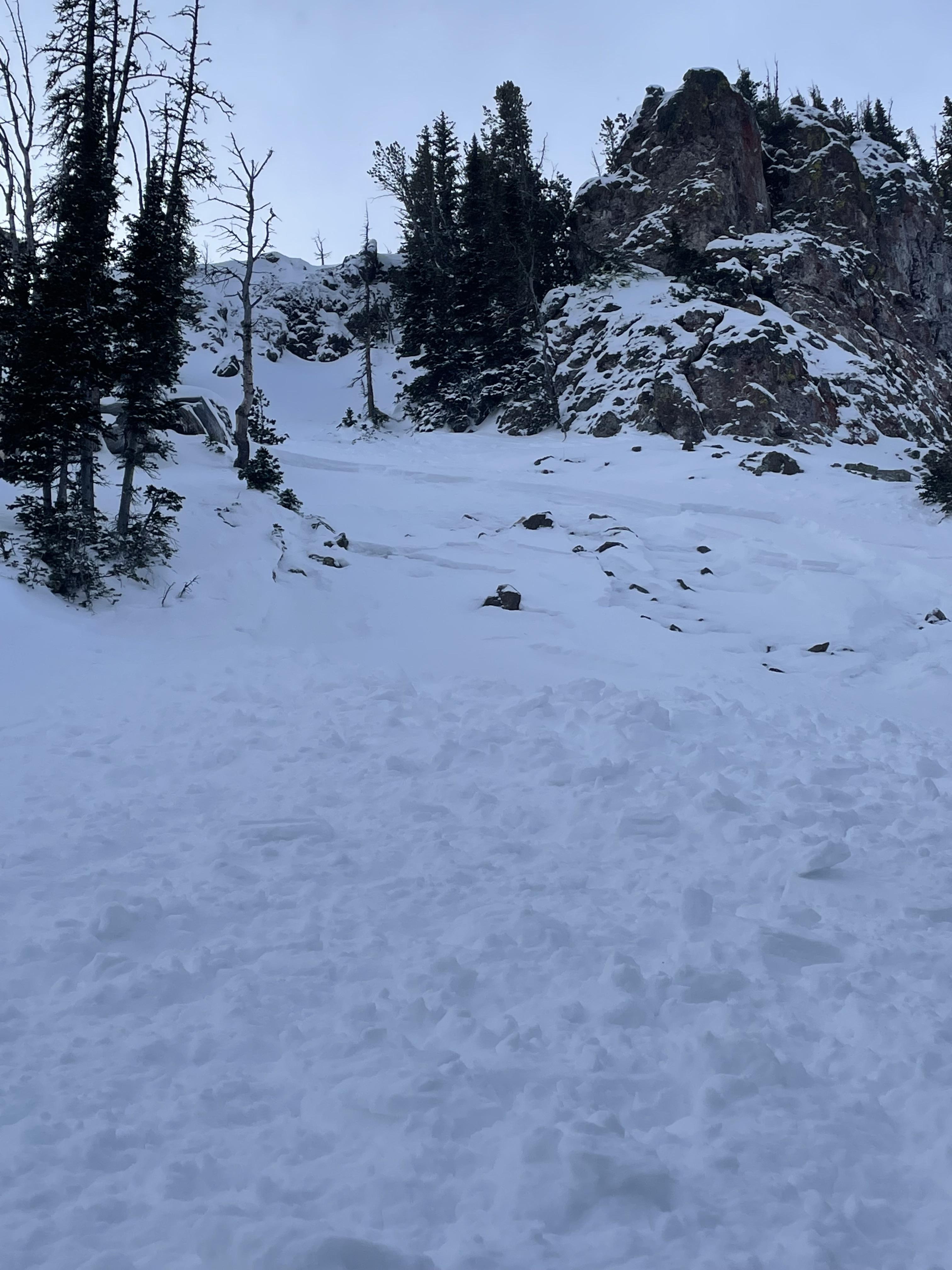
Toured into Bacon Rind today. Winds were calm and trace amounts of snow fell through the day. Near the top of the Skillet we found 5" of new snow (0.5" SWE) sitting over large feathery surface hoar and in stability tests, we had very poor scores on this layer, ECTP2. The entire snowpack however is very weak, with soft faceted snow to the ground. Even with skis on we would sink to the bottom of the snowpack in many areas. This area did not get very much snow or wind compared to the rest of the S. Madison region lacking enough of slab to cause widespread signs of instability. At higher elevations, there would likely be enough of a slab to increase concerns as winds were stronger and recent snow totals are greater.
Full Snow Observation Report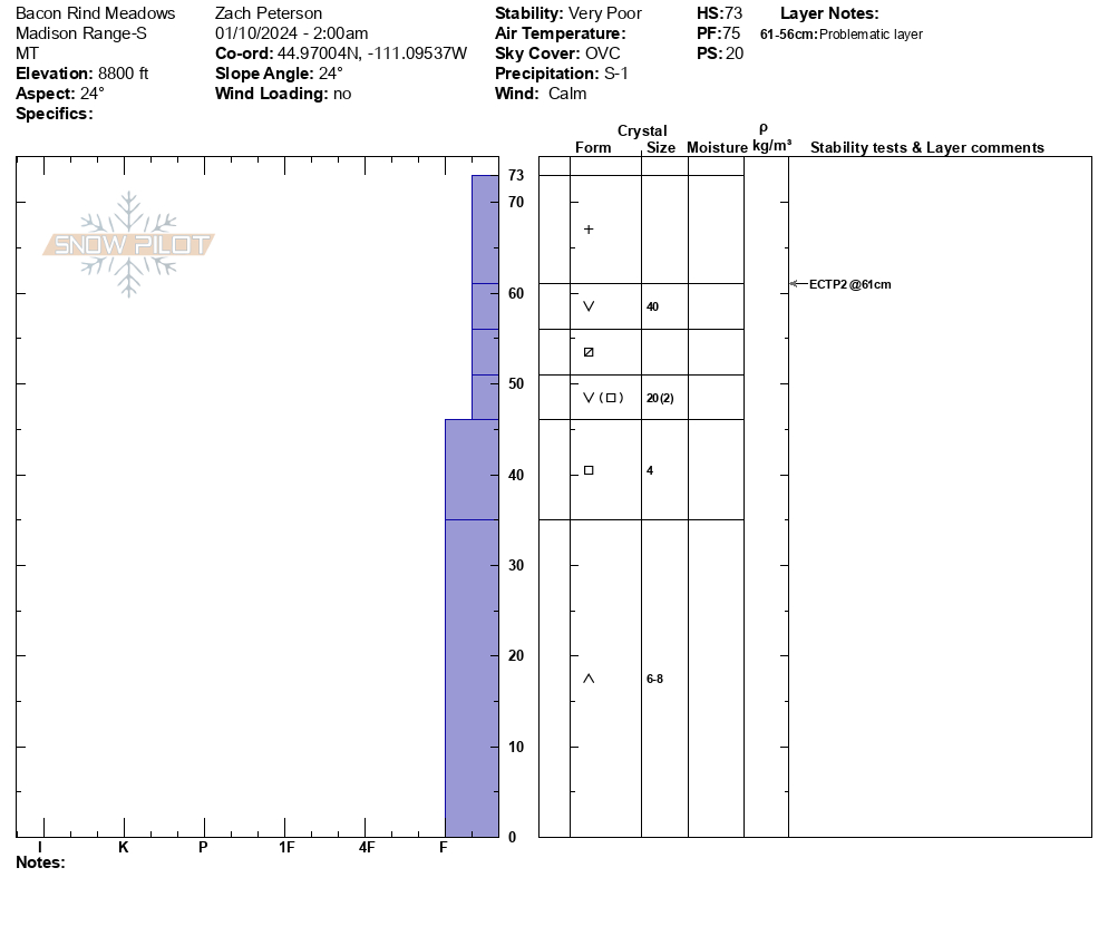
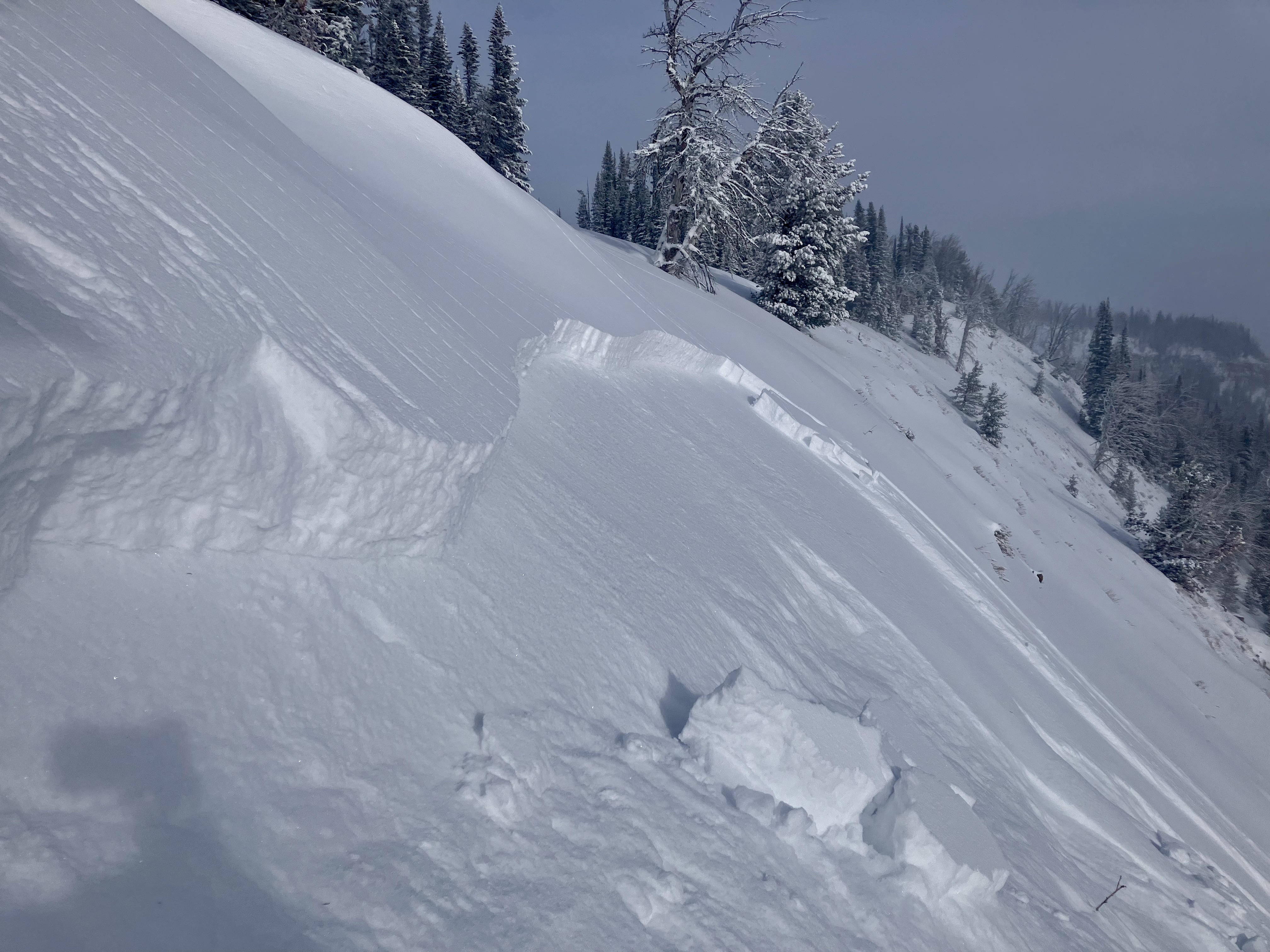
We toured up Tyler's Slope and dug at 9,200' on an west-facing slope. There was a 6" slab of snow sitting on fist hardness facets that propagated in our tests (ECTPV x2). Approaching the pit site we has some collapsing and shooting cracks. Continuing upslope we saw the cornices on the ridge had all broken and pulled out the wind-loaded pockets with one slope sliding 100' distance. These likely occurred last night.
We then dug on a east-facing slope to the north of the cornices and found 105 cm of snow and a 1 foot deep slab that broke in our test as an ECTP3. Low test scores, recent avalanche activity and cracking and collapsing was evidence of the snowpack's instability.
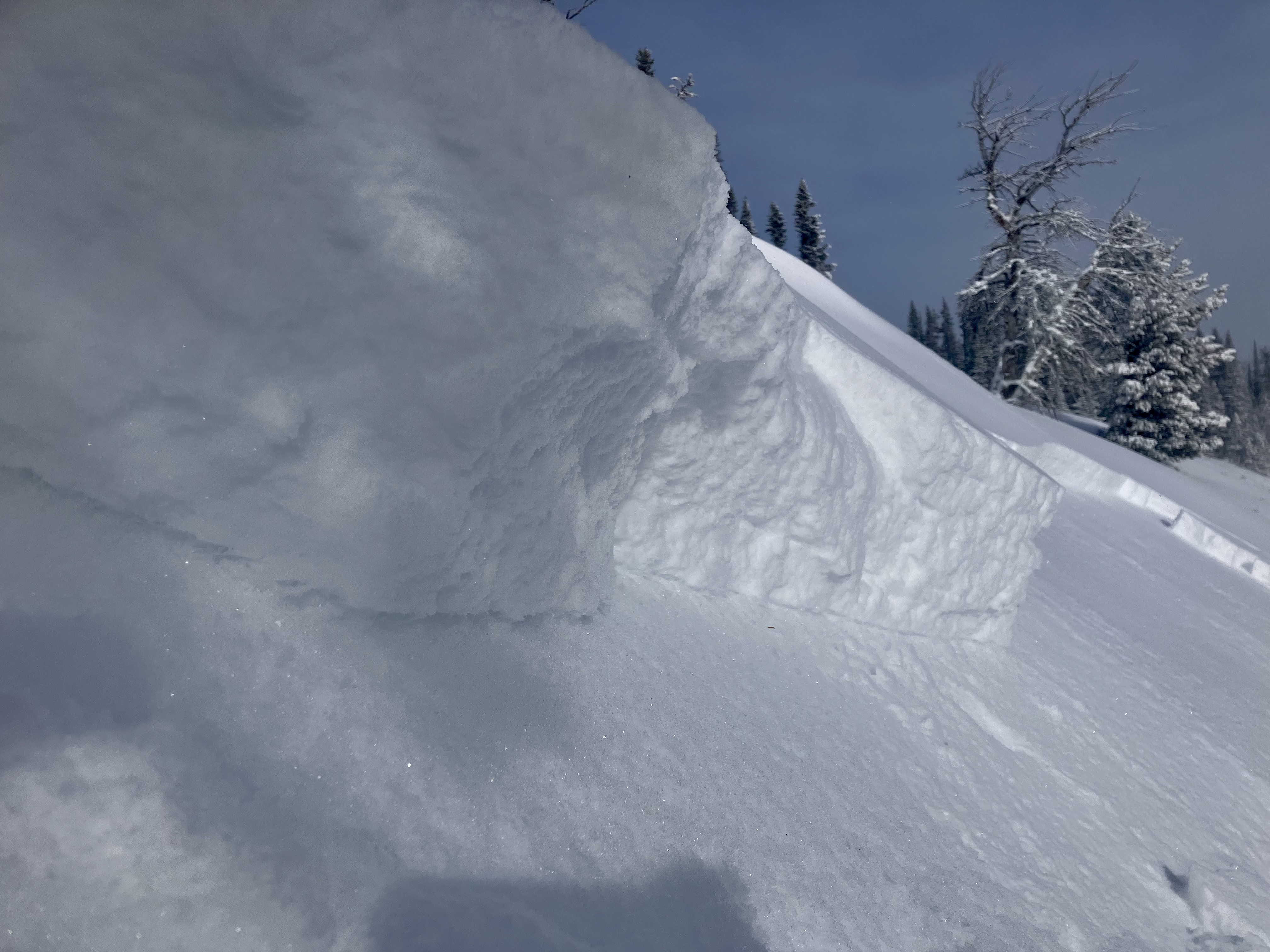
Full Snow Observation Report
The snowpack is still shallow on the Beehive side. Buried stumps and rocks were hidden.
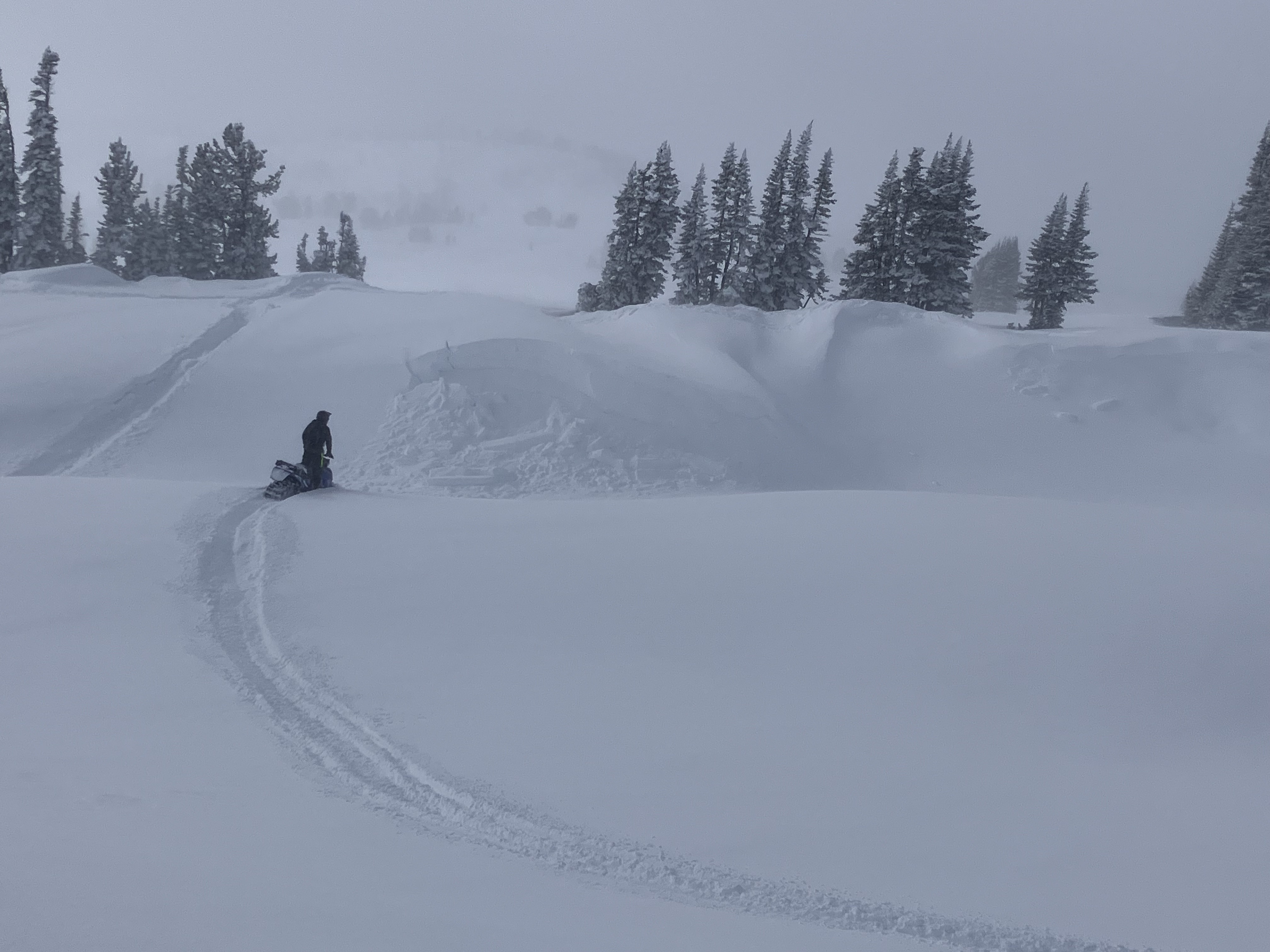
Danger was the low end of Considerable and I was not psyched to get into steep terrain. We skied the going home gully (by the prayer flag location).
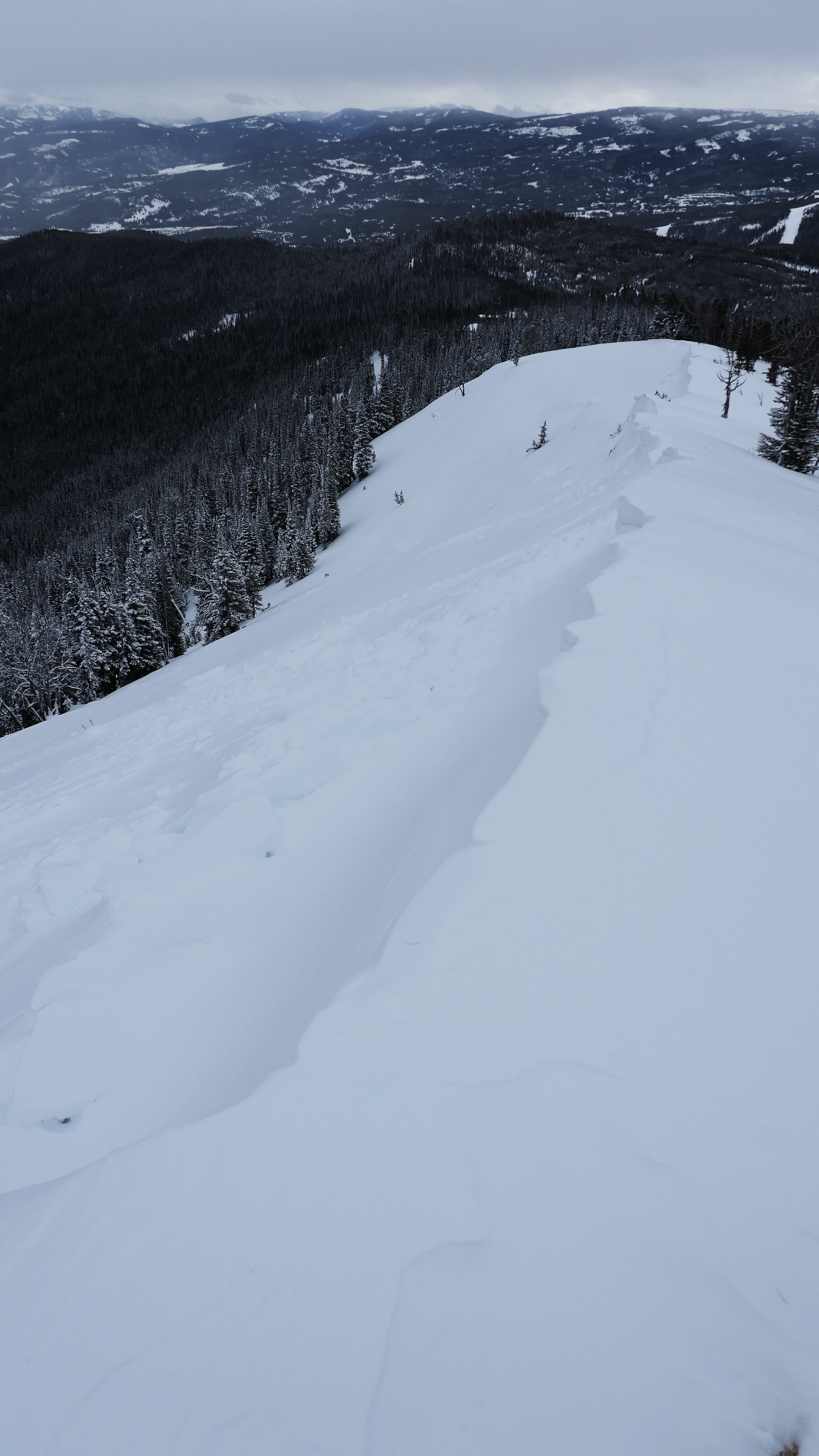
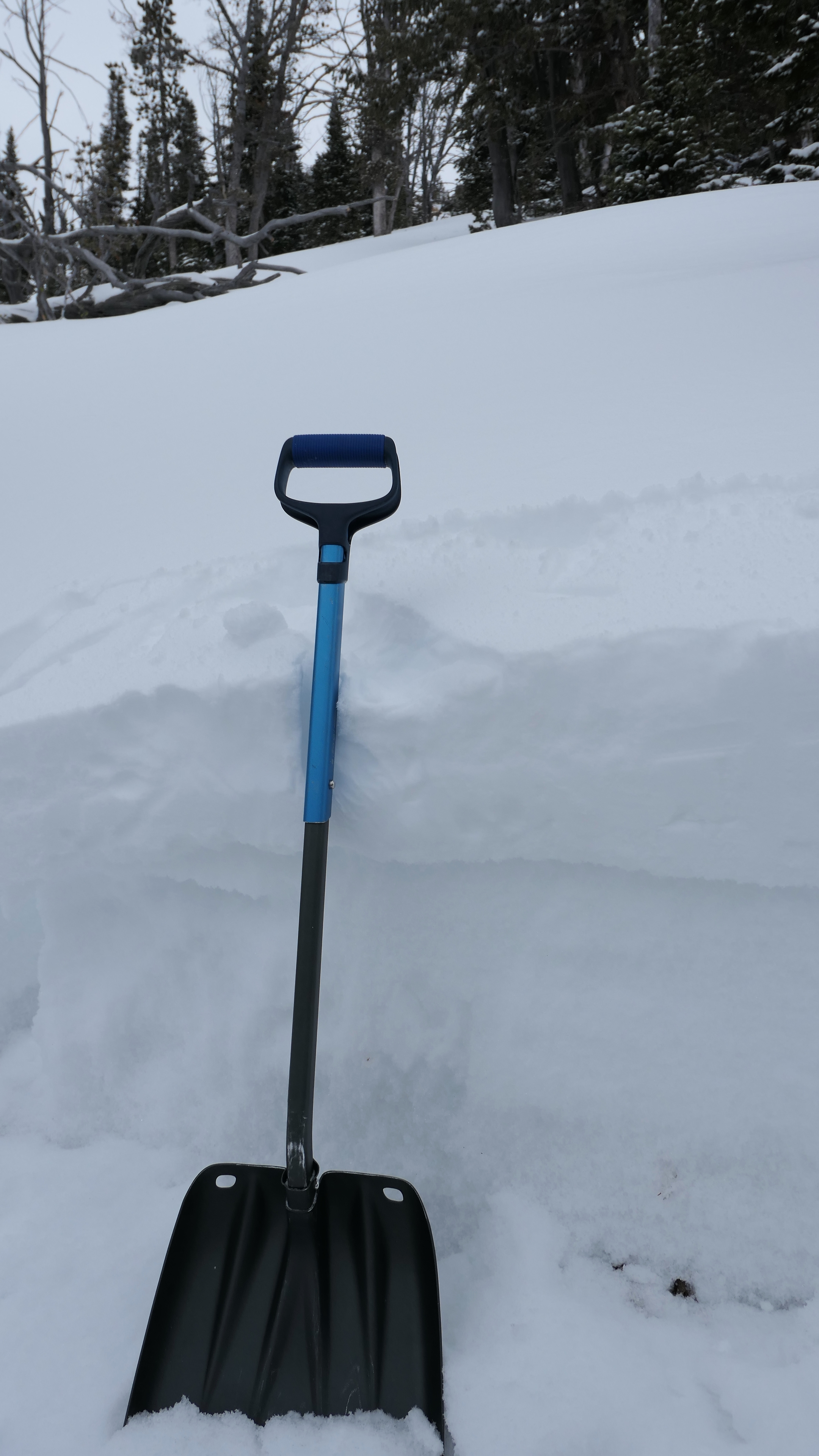
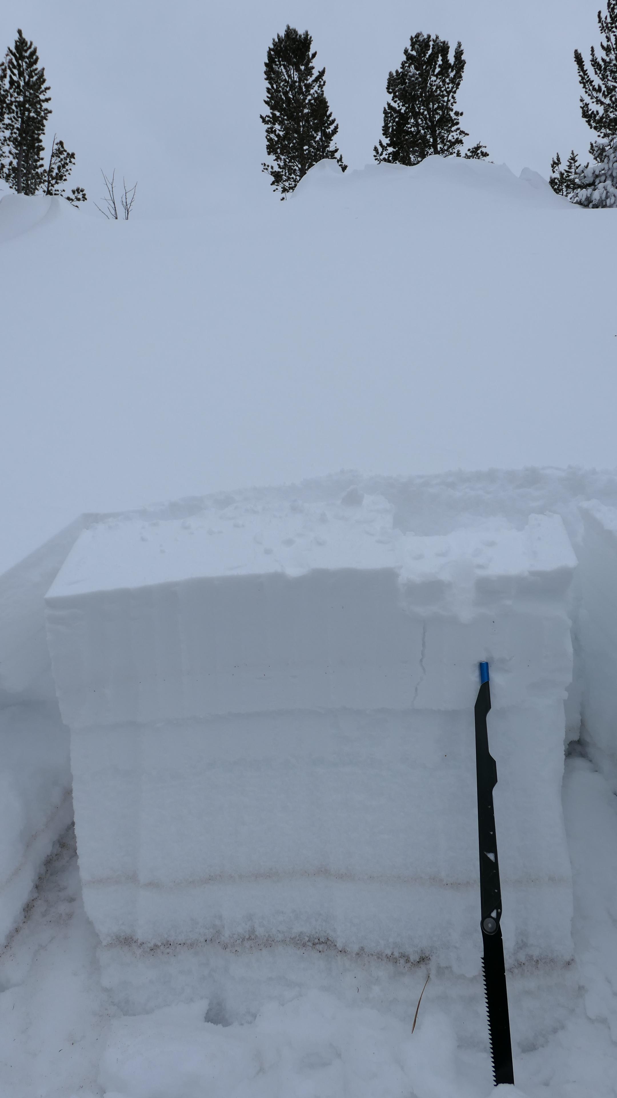
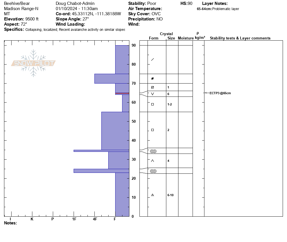

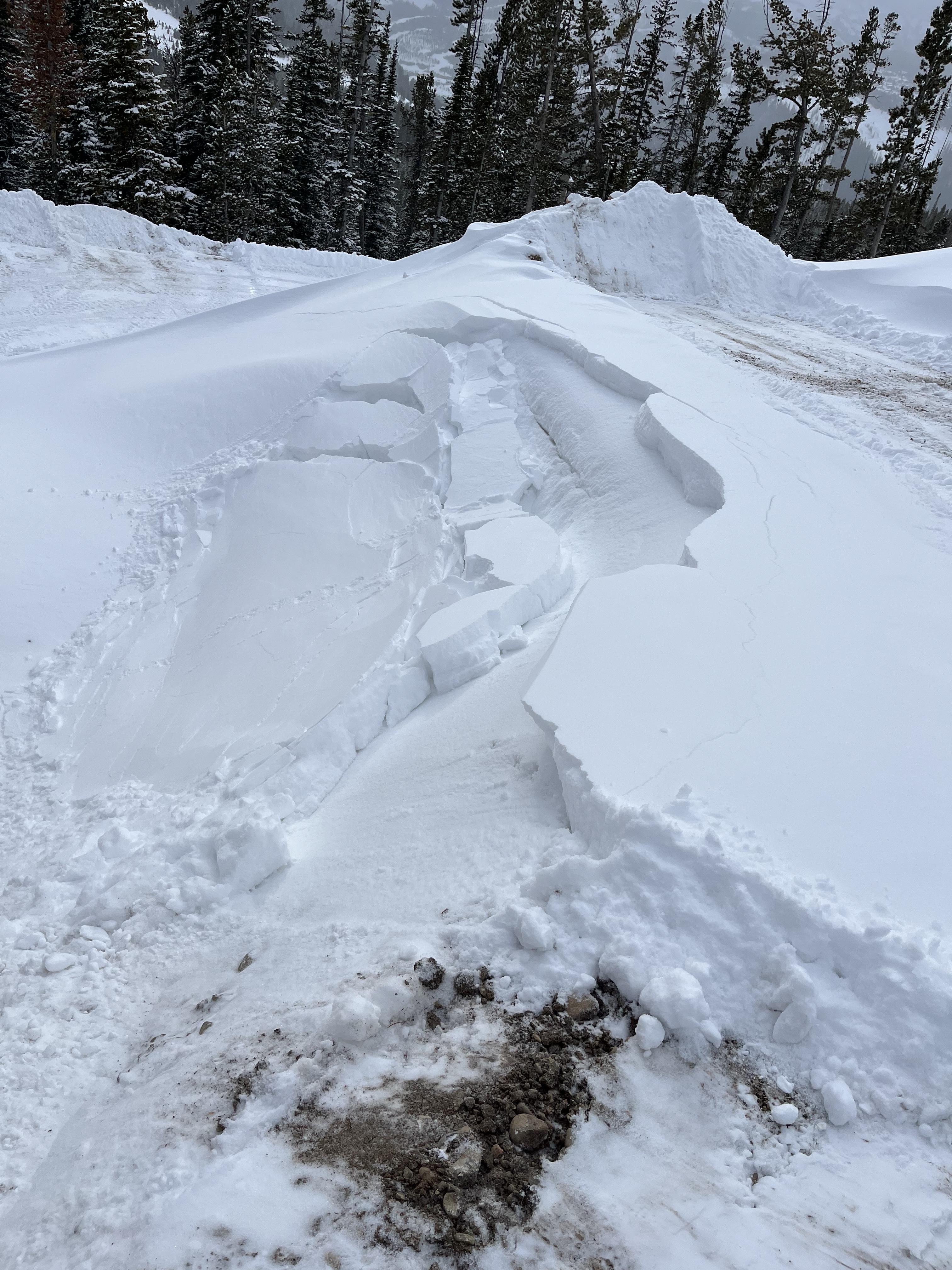
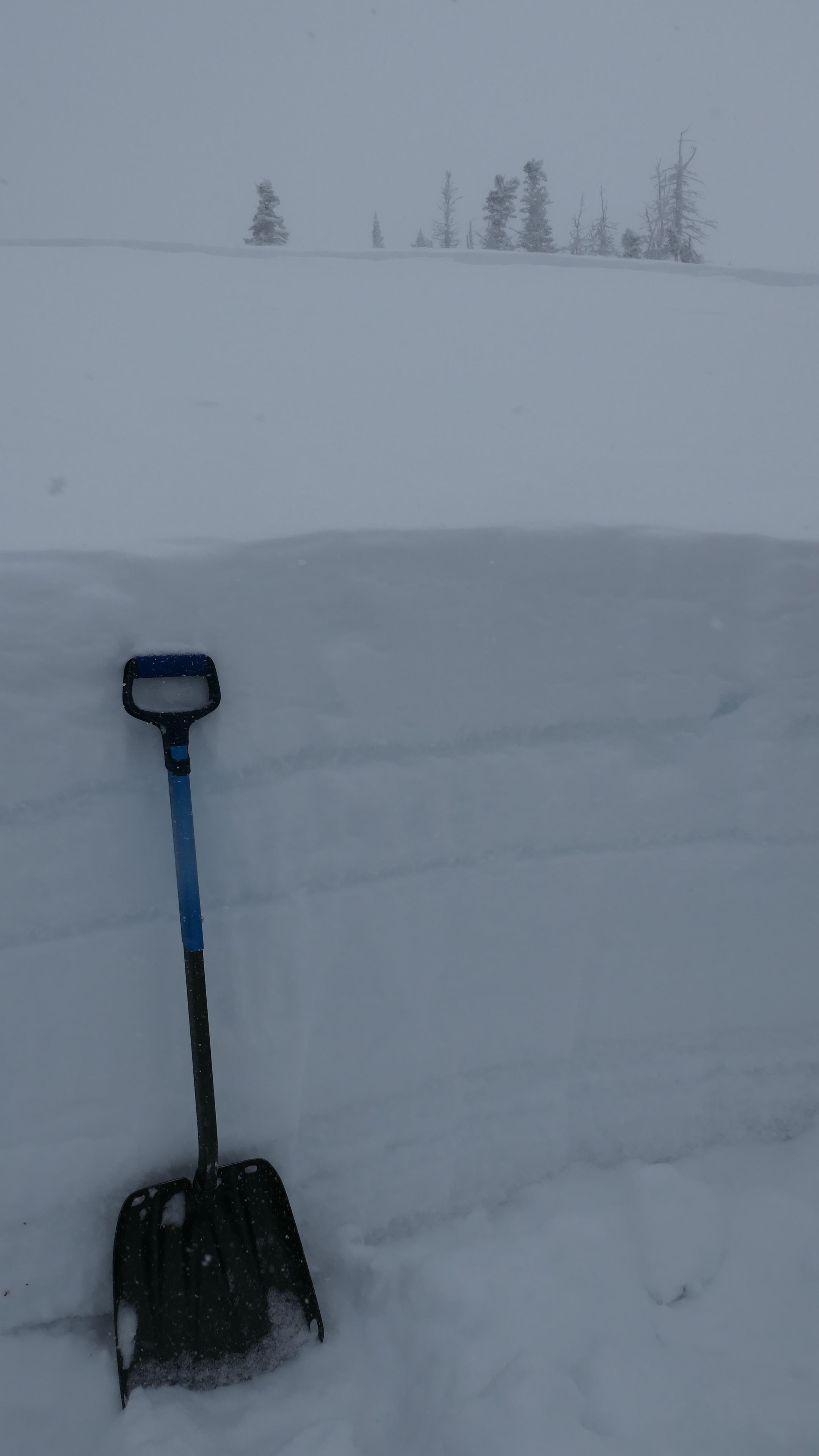
Our lower ridge has not been controlled or touched yet this year so very indicative the backcountry snowpack. It released sometime before the morning of Jan 10.
See picture.
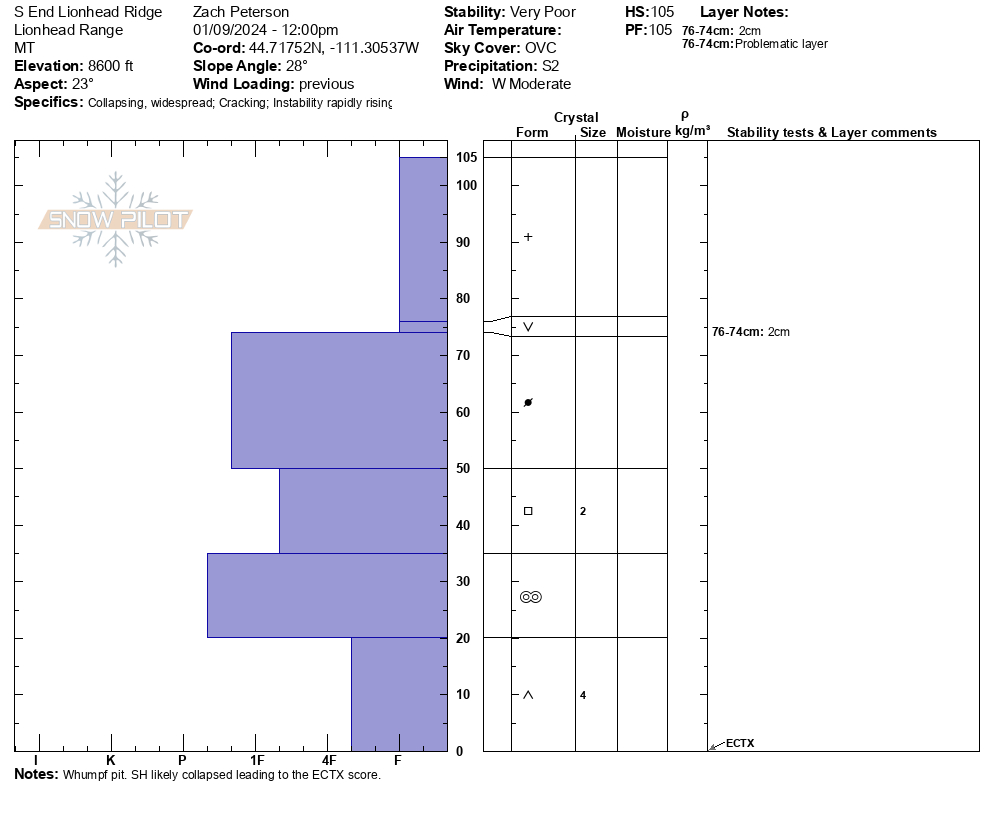
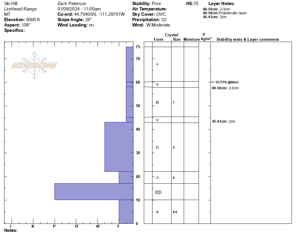
Full Snow Observation Report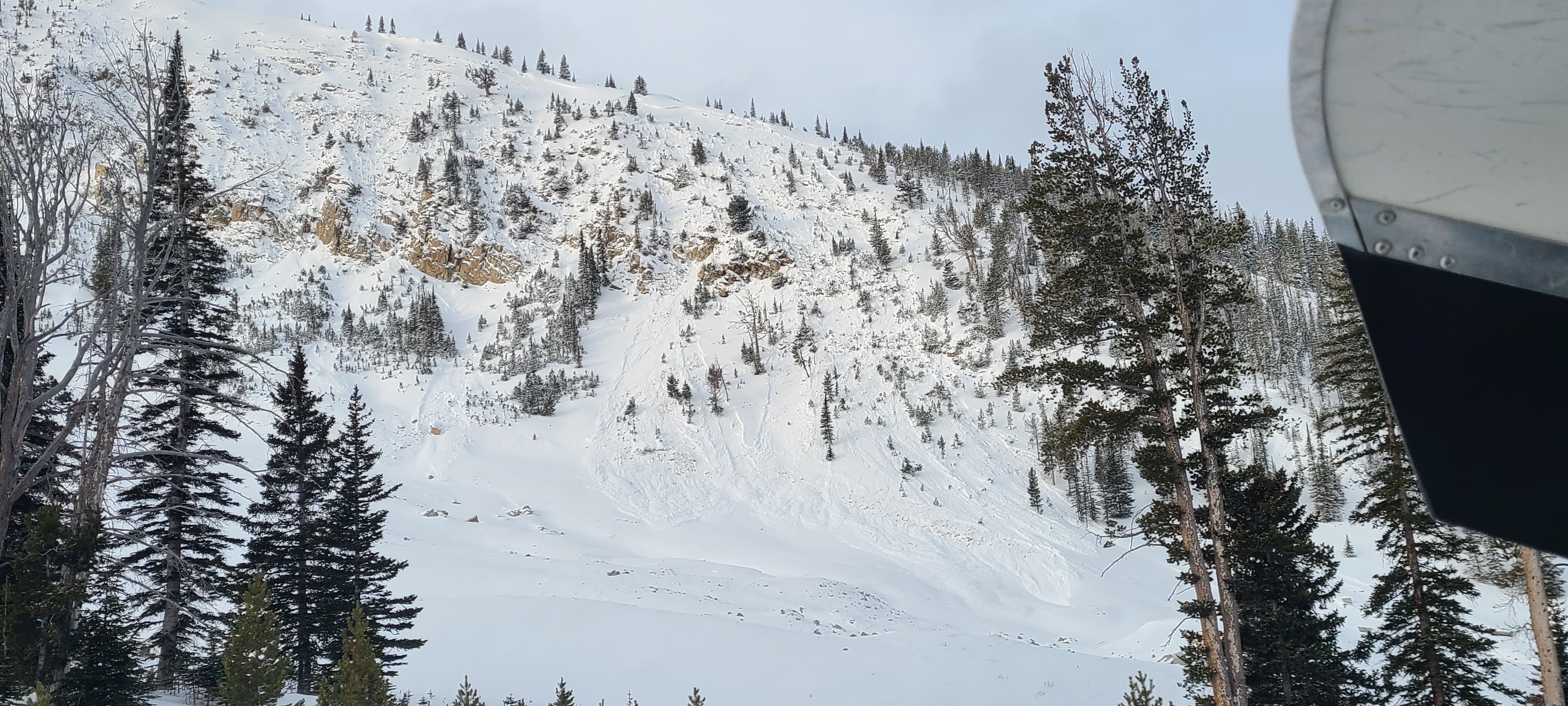
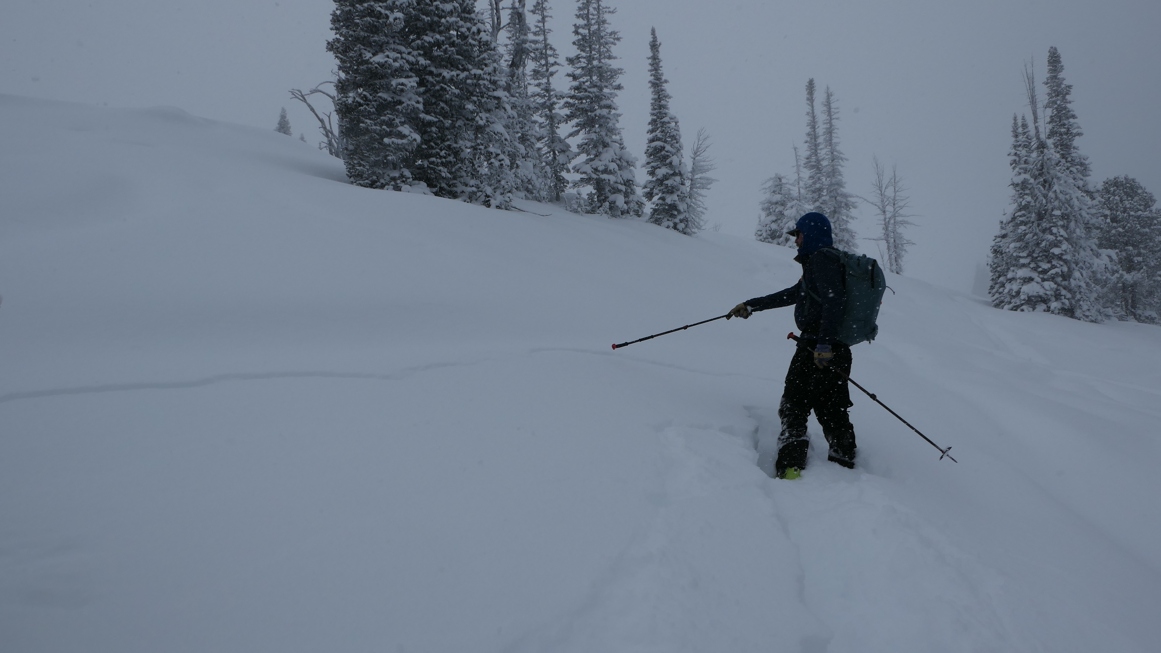
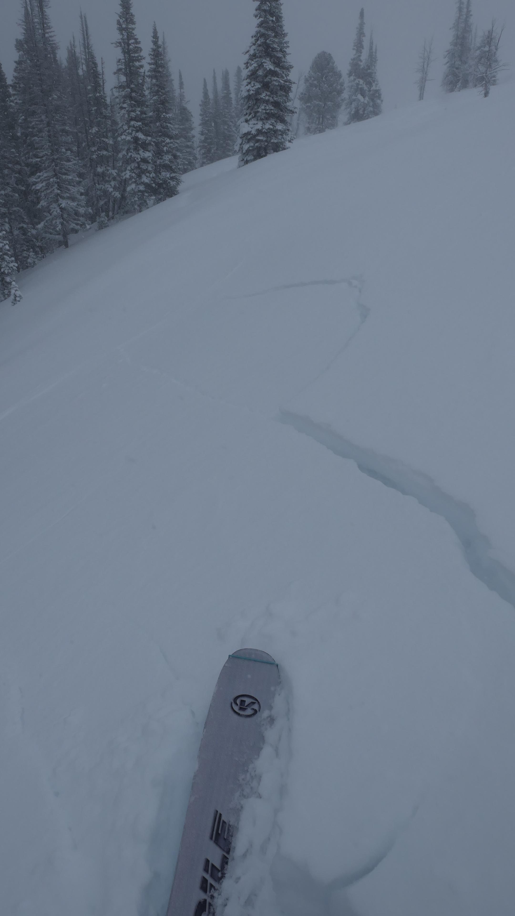
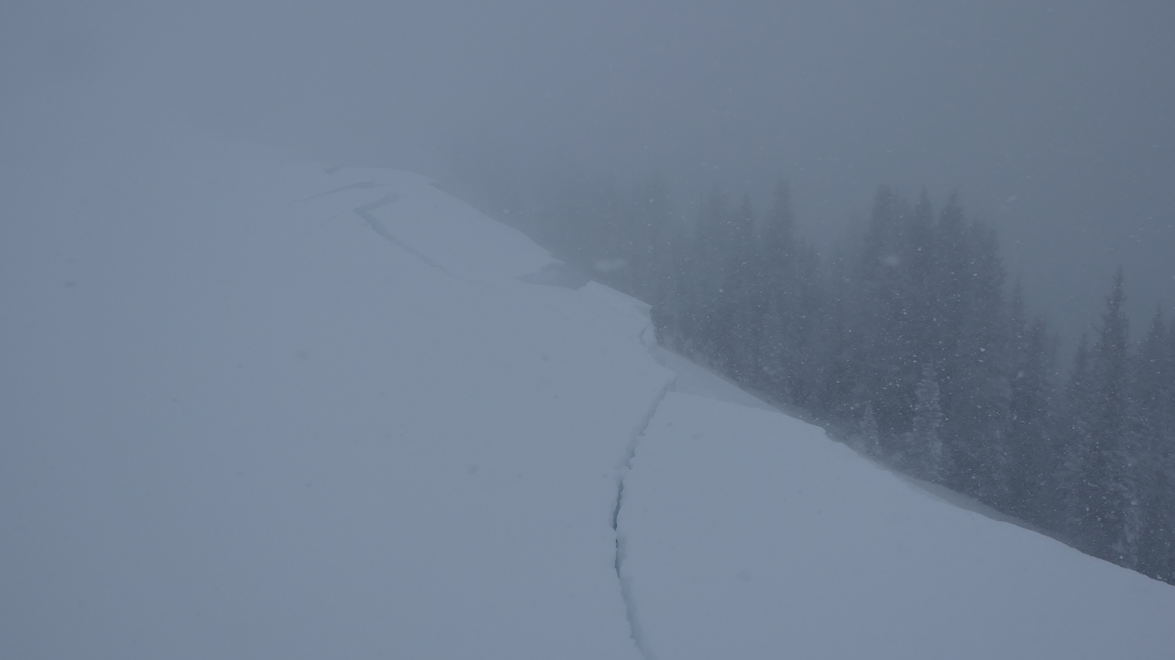
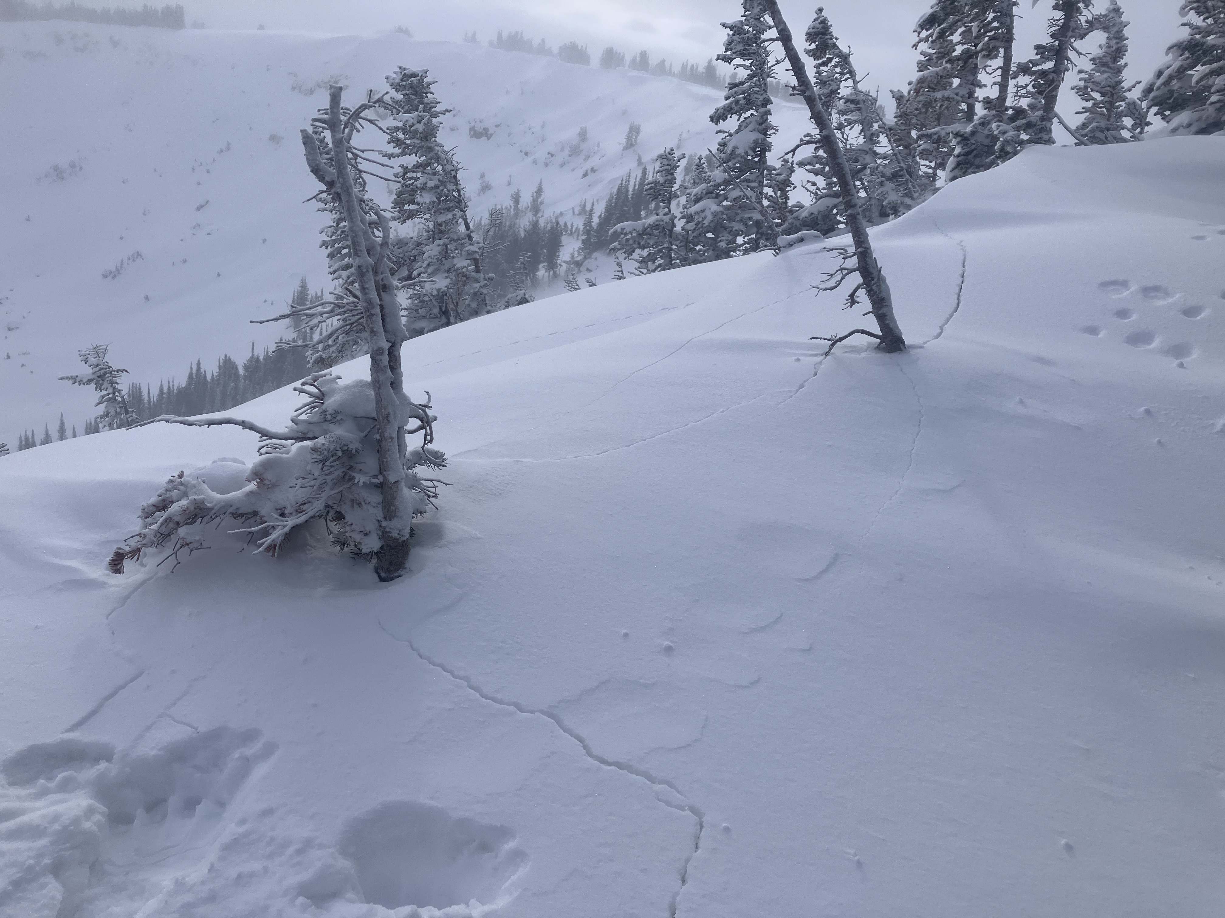
We rode into Lionhead today towards Lionhead Ridge. Cloudy with consistent snowfall through the afternoon. The wind was out of the west and was blowing snow around at all elevations. We stopped at Ski Hill and dug on an east-facing slope at 8000'. While isolating our ECT we had a failure 15cm below recent snow on a well-preserved layer of surface hoar (ECTPV). From here we transitioned to skis and continued up to the ridge. As we approached the ridge we experienced frequent collapses and shooting cracks that extended 20 feet in front of our skis. At a rollover, while breaking trail there was a collapse, and 3" wide cracks shot in all directions and the slab moved a few inches downhill. If this terrain had been any steeper it certainly would have been an avalanche.
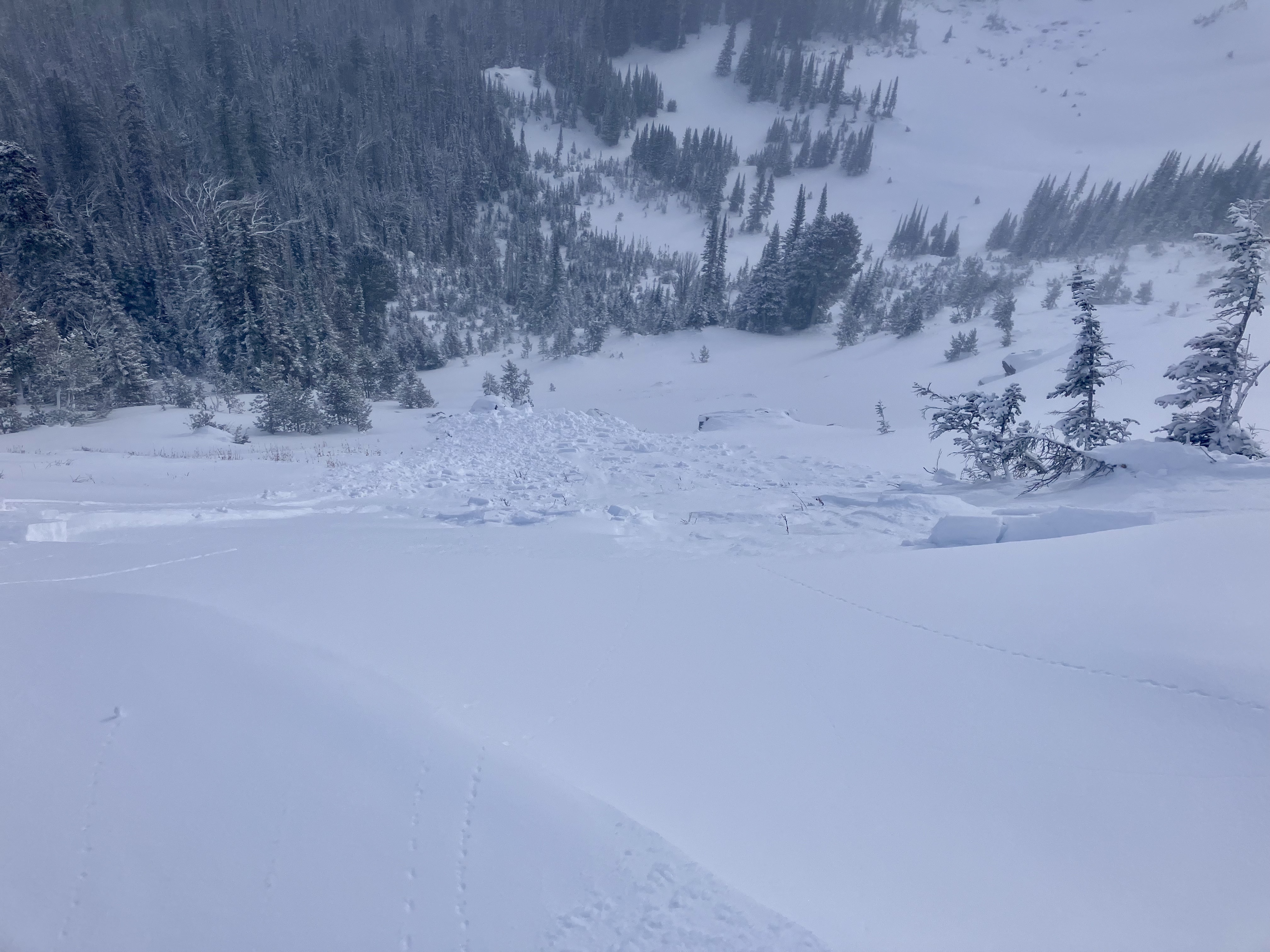
We continued towards the ridge and intentionally remotely triggered an avalanche on the steep terrain below the south end of the ridge. This avalanche broke 1000' wide, 18" deep, and ran 100 vertical feet to the trees. This avalanche likely happened on a layer of buried surface hoar similar to what we found in our pit on ski hill. Strong west winds at the ridgeline continued to blow snow and made for poor visibility but as we continued more cracking was seen and cornices were remotely triggered when walking near them.
Snowfall and strong winds continued making for poor visibility at ridgetop. We skied back to the snowmachine and portions of our skin track had been filled in by the steady wind and snowfall.
Full Snow Observation Report
We will go to an Avalanche Warning tomorrow for IP and Lionhead.