Good Morning. This is Eric Knoff with the Gallatin National Forest Avalanche Advisory issued on Friday, February 2nd at 7:00 a.m. Today’s advisory is sponsored by Grizzly Outfitters in partnership with the Friends of the Avalanche Center. This advisory does not apply to operating ski areas.
Overnight the mountains around Cooke City received 3” of new snow while all other areas picked up 1-2”. At 5 a.m. temps range from the teens to low 20’s F and winds are blowing 15-30 mph out of the W-SW. Today, light snow showers will impact the mountains with 1-3” possible by this evening. Snow intensifies tonight and the mountains will pick up an additional 2-4” by tomorrow morning. Highs today will warm into 20’s F and winds will continue to blow 15-30 mph out of the west.

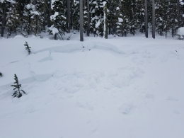
The primary avalanche problem in the mountains around Cooke City is wind loaded slopes. New snow combined with moderate winds from the west is the perfect recipe for wind slab formation. Yesterday, Alex rode north of town and observed evidence of a large recent avalanche that occurred in wind loaded terrain (video). This is consistent with another large avalanche that occurred off Woody Ridge earlier in the week (photo). Today, staying off wind loaded slopes will be the best way to avoid avalanches (photo).
A secondary concern is a layer of surface hoar buried 1-2’ deep (photo). Yesterday, Alex got unstable results on this layer in his stability tests. Buried surface hoar is notorious for having sporadic distribution so keep a watchful eye out for this layer before jumping into steeper terrain.
Today, human triggered avalanches are likely on wind loaded slopes which have a CONSIDERABLE avalanche danger. Non-wind loaded slopes have MODERATE avalanche danger.
Read a recent blog post on the complexities of the snowpack around Cooke City: https://www.mtavalanche.com/blog/additional-thoughts-regarding-my-uncertainty-surrounding-cooke-city-snowpack

Yesterday, snowmobilers triggered a small slide in the Lionhead area near West Yellowstone (photo). Although this side was small and relatively harmless, it’s a key indicator that larger slides are possible. Today, wind loaded slopes are the main concern. Watch for and avoid slopes that appear to be heavily wind load and steer clear of large cornices along the ridgelines. Cornices can break farther back than expected and also trigger larger avalanches on the slopes below.
Additionally, surface hoar buried 1-2’ deep and facets near the ground both hold the potential to produce slides. Buried surface hoar continues to produce unstable test results and is the main layer of concern. Fortunately, this layer is not buried very deep and is easy to look for and assess (video, photo). Facets near the ground are getting stronger, but could still produce large slides in isolated areas.
Today, human triggered avalanches are possible and the avalanche danger is rated MODERATE.
Overnight, winds blew 15-30 mph out of the west. Wind slabs 1-2’ deep likely formed in upper elevation, leeward terrain (video). These slabs could fail under the weight of a skier or rider. In most cases wind slabs are easy to recognize and avoid, but occasionally catch skiers and riders off guard. It’s poor practice to ski or ride onto a slope to try and intentionally trigger wind slabs. These can break deeper and wider than you might expect and can also break above you. Earlier this winter, a skier in the Bridgers took a nasty ride when he attempted to trigger a wind slab that broke above him and carried him 800’ downslope. Fortunately, he was not injured. Outside of wind loaded slopes, the snowpack is mostly stable.
For today, the avalanche danger is rated MODERATE on all wind-loaded slopes and LOW elsewhere. The avalanche danger could rise if the storm intensifies throughout the day.
King and Queen of the Ridge
King and Queen of the Ridge, Saturday, February 3rd. A Hike and Ski/Ride-a-Thon fundraising event to support the Friends of the Gallatin National Forest Avalanche Center. Sign up and start collecting pledges HERE.
Upcoming Avalanche Education and Events
BOZEMAN
Feb. 6th, Sidecountry specific avalanche awareness for family and friends. 6-8 p.m. @ Beall Park
Feb. 7th, Woman’s specific avalanche awareness, 6-7:30 p.m. @ REI in Bozeman
Feb. 7th, Avalanche awareness, 6-7:00 p.m. @ Roskie Hall MSU
Feb. 9 and 10, Companion Rescue Clinic, Info and Register
Feb. 28th, Know Before You Go avalanche awareness, 7:00 p.m. @ Procrastinator Theater, MSU
March 2nd, Avalanche Awareness, 6-7:00 p.m. Bozeman Split Fest
March 7th, Avalanche Awareness, 6-7:30 p.m. @ REI
PHILLIPSBURG
Feb. 8th, Avalanche Awareness, 6:30-8:30 p.m. @ the new Fire Hall
DILLON
Feb. 24th and 25th, Snowmobile intro to avalanches w/ field course. More info: https://msuextension.org/conference/.
WEST YELLOWSTONE
Feb. 3rd, Avalanche Awareness, 7-8 p.m. at West Yellowstone Holiday Inn Conference Center
Feb. 10th, Avalanche Awareness, 7-8 p.m. at West Yellowstone Holiday Inn Conference Center
COOKE CITY
Every Friday and Saturday, Current Conditions Update and Avalanche Rescue, Friday 6:30-7:30 p.m. at The Soda Butte Lodge in February. Saturday anytime between 10-2 @ Round Lake.
Check out this blog post by Evelyn Lees at the Utah Avalanche Center on “Avalanche Fatalities During Uphill Travel.” One third of tourers die on the ascent, a surprisingly high statistic.