Good Morning. This is Alex Marienthal with the Gallatin National Forest Avalanche Forecast issued on Monday, December 3rd at 7:00 a.m. This Forecast is sponsored by Yellowstone Arctic Yamaha and The Friends of the Avalanche Center. This forecast does not apply to operating ski areas.
This morning the mountains do not have any new snow and temperatures are single digits F. Wind was 0-5 mph out of the southeast-east yesterday and will be west-southwest at 0-10 mph today. Temperatures will be teens F today, and a trace to 1” of snow is possible near West Yellowstone and Cooke City. The rest of the week is forecast to be cold and dry.

The Lionhead area near West Yellowstone has a weak snowpack with sugary facets in the bottom half (photo, video). Recent light snow and wind created an unstable snowpack where a thicker slab of snow rests over the weak base. Avalanches breaking on this sugary, weak snow could be large and wide. Be extra cautious of steep slopes (>30 degrees), and avoid riding on and below them if you see cracking and collapsing of the snowpack or recent natural avalanches. Today, large avalanches are possible to trigger and avalanche danger is MODERATE.

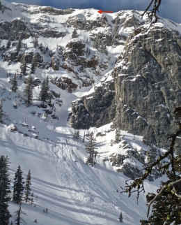
Yesterday we toured in the northern Bridger Range and saw small wind slabs and loose snow avalanches from the snow that fell Saturday morning (photo, photo). Below the recent snow, the snowpack is 3-4’ deep and generally stable without widespread weak layers (video). The snowpack is similar throughout the mountains near Bozeman, Big Sky and Cooke City. Yesterday, skiers in Hyalite and Beehive saw widespread natural dry loose avalanches (photo, photo), and triggered a loose snow avalanche on a steep, sun exposed slope (photo, photo).
A mostly stable snowpack and light wind today will limit avalanche activity to slides in the recent snow, similar to those observed yesterday. Although small, these avalanches can be deadly in the wrong terrain. Carefully assess the snowpack and terrain before riding steep slopes. Be cautious of wind-drifted snow near ridgelines, gullies, and rock outcrops, and expect loose snow avalanches on steeper avalanche terrain. A generally stable snowpack, light wind, and no new snow makes avalanche danger today LOW.
If you get out and have any avalanche or snowpack observations to share, contact us via our website, email (mtavalanche@gmail.com), phone (406-587-6984), or Instagram (#gnfacobs).
New this season, we added hyperlinks to the Weather and Avalanche Log and a new Menu item <Avalanches and SnowPits> with information on avalanche activity and incidents.
Upcoming Avalanche Education and Events
Our education calendar is full of awareness lectures and field courses. Check it out: Events and Education Calendar.
BOZEMAN
December 5, 1-hr Avalanche Awareness, 6-7 p.m. at REI, Bozeman
December 6, 1-hr Avalanche Awareness and Beacon Practice, 6:30-8 p.m. at Story Mill Park
December 11 and 12, Snowmobile Intro to Avalanches w/Field, Holiday Inn, West Yellowstone; more info here
December 12, 1-hr Avalanche Awareness for Snowmobilers, 6-7 p.m. at Yellowstone Motorsports, Bozeman
December 13, 1-hr Avalanche Awareness, 6-7 p.m. at Play It Again Sports, Bozeman
HELENA
December 12, 1-hr Avalanche Awareness, 6-7 p.m. at The Basecamp, Helena
COOKE CITY
Every Friday and Saturday, Rescue Training and Snowpack Update. Friday 6:30-7:30 p.m at the Soda Butte Lodge. Saturday anytime between 10-2 @ Round Lake.
Check out our new “Avalanches and Snowpits” menu item where we list all the reported avalanche activity.