Good morning. This is Alex Marienthal with the Gallatin National Forest Avalanche Forecast issued on Sunday, February 3rd at 7:00 a.m. Today’s forecast is sponsored by Bridger Bowl and the participants of King and Queen of the Ridge (Results). They raised over $10,200 for the Friends of the Avalanche Center. Ruby Zitzer is Queen with 26 hikes, and Sam Hennessey is King with 29 hikes with Mike Wolfe a close second also with 29 hikes. This forecast does not apply to operating ski areas.
At 4 a.m. the mountains have received 5” of snow near West Yellowstone and Cooke City, 2-3” near Big Sky, and 0” in Hyalite and the Bridger Range. This morning temperatures are high teens to 20s F. Wind is southwest at 20-45 mph near Big Sky and Hyalite and southeast at 10-20 mph elsewhere. Today, snow showers will continue with temperatures in the low 20s to teens F and wind out of the south-southwest at 20-35 mph. By morning, 10-15” of snow is possible near West Yellowstone and Big Sky with 6-12” elsewhere. Snow will continue through Tuesday with the greatest accumulation near West Yellowstone.

Snowfall since yesterday afternoon favored the mountains from Big Sky to West Yellowstone with 3-6” of snow equal to 0.3-0.6” snow water equivalent (SWE). Steady snow showers are expected today and southwest wind will create thick, fresh drifts of snow that can easily be triggered by a snowmobiler or skier. Sugary weak snow buried in the lower half of the snowpack will be pushed to break by the weight of new and wind-drifted snow through today (video). Large human triggered avalanches are likely and natural avalanches possible. Large slides during the last storm in the Centennials and Lionhead area are similar to what is likely today (photo, photo). Avoid travel on and below steep slopes, and plan for stability to decrease through the day. Avalanche danger is CONSIDERABLE.
Since yesterday the mountains near Cooke City received 5” of snow equal to 0.5” of SWE. The snowpack is shallow and weak on some slopes and deep and strong on other slopes (video). This variability makes widespread large avalanches less likely. However, new snow today will test weak snow and make dangerous avalanches possible in specific areas where the snowpack is less than 4' deep. I was there a couple days ago and observed only one small avalanche from the last storm, but experienced one large, rumbling collapse on a slope with less than 3 feet of snow (video). Fresh drifts of snow 1-2’ thick will be easy to trigger, and they will grow in size with more snowfall and wind loading today. Avalanches could break deeper where the snowpack is shallow and weak. Avalanche danger is CONSIDERABLE on wind loaded slopes and MODERATE on non-wind loaded slopes.

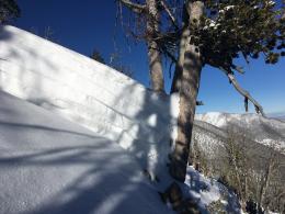
The Bridger Range and Hyalite do not have any new snow this morning. It is possible to trigger avalanches 2-3’ deep on weak layers buried in the middle of the snowpack, similar to what we saw on Mt. Ellis last week (video, avalanche incident). New snow and wind through today will form fresh drifts that can avalanche under the weight of a person, and could break on deeper weak layers. Plan for stability to decrease through the day. Buried weak layers with expected new and drifted snow through today make avalanches possible to trigger. Avalanche danger is MODERATE.
If you get out and have any avalanche or snowpack observations to share, contact us via our website, email (mtavalanche@gmail.com), phone (406-587-6984), or Instagram (#gnfacobs).
Avalanche Warning
King and Queen of the Ridge
A huge thank you to all who hiked and raised funds for the Friends of the Avalanche Center. We greatly appreciate this amazing support from our community. The top fund raising teams and individuals were:
#1 Fundraising Team (also top Family Team) -- Flamingo Flyers, $1814
#2 Fundraising Team -- Rocky Hoarer Powder Snow, $1564
#3 Fundraising Team -- Bridger Brigade, $1300
#4 Fundraising Team -- Strange Cattle of MAP Brewing, $1252
#1 Fundraising Individual -- Nick English (of Flamingo Flyers), $1323
#2 Fundraising Individual -- Grant Petersen (of Rocky Hoarer), $1185
#3 Fundraising Individual -- Axel Peterson (of Bridger Brigade), $650
#4 Fundraising Individual -- Niles Fetter, $611
Upcoming Avalanche Education and Events
Our education calendar is full of awareness lectures and field courses. Check it out: Events and Education Calendar.
BOZEMAN
February 6, 1-hr Women’s Avalanche Awareness, 6-7p.m. at REI Bozeman.
February 8 and 9, Companion Rescue Clinic, 6-8 p.m. Friday at REI, 10-4 Saturday in the field. More Info and Register.
February 22 and 23, Women’s Companion Rescue Clinic, 6-8 p.m. Friday at REI, 10-4 Saturday in the field. More Info and Register.
WEST YELLOWSTONE
February 9, 16 and 23, 1-hr Avalanche Awareness for Snowmobilers, 7-8 p.m. Holiday Inn West Yellowstone.
HELENA
February 13, 1-hr Avalanche Awareness, 6-7 p.m. at Carroll College.
COOKE CITY
Every Friday and Saturday, Rescue Training and Snowpack Update. Friday 6:30-7:30 p.m. at the Soda Butte Lodge. Saturday anytime between 10-2 @ Round Lake.