Good morning. This is Eric Knoff with the Gallatin National Forest Avalanche Forecast issued on Wednesday, February 6th at 7:00 a.m. Today’s forecast is sponsored by Yellowstone Ski Tours and Map Brewing. This forecast does not apply to operating ski areas.
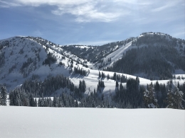
The mountains near West Yellowstone received 4-5” of snow in the past 24 hours while the rest of the forecast area received 2-3”. This morning snow has tapered off and skies are partly to mostly cloudy. The temperature inversion has broken down and cold air has moved over the region. At 5 a.m. temps are well below zero F in the mountains near Bozeman and Big Sky and single digits above zero F in the southern mountains. Winds are blowing 5-25 mph out of the west-northwest. Cold and dry conditions settle in for the next few days.

There are two primary questions you need to ask when riding in the backcountry: Am I in avalanche terrain and can the snow slide? Today, avoiding steep slopes will be the best way to stay out of trouble. This includes staying off low angle terrain connected to steeper slopes above.
Why is it important to avoid avalanche terrain today? Because weak layers and wind loaded slopes will be easy to trigger. On Sunday, Ian found an unstable layer of surface hoar 1-1.5’ deep at Bacon Rind (video) and snow rangers in the Lionhead area near West Yellowstone found similar conditions on Monday (photo). Yesterday, Doug and I didn’t find surface hoar to be reactive in Taylor Fork, but we did get a large collapse and unstable test results on facets near the ground where the snowpack was thin and weak (video). Large natural avalanches last weekend in Centennial Range are a good example of what’s possible (photo, photo).
Today, dangerous avalanche conditions exist and the avalanche danger is rated CONSIDERABLE.

The primary avalanche concern in the mountains around Bozeman, Big Sky and Cooke City is wind loaded slopes. Wind drifts 1-2’ thick have the potential to fail under the weight of a skier or rider (video). This problem is most prevalent on upper elevation slopes loaded by westerly winds. Be especially aware of this problem when traveling in or around high consequence terrain.
A less likely but more dangerous problem will be avalanches breaking 2-3’ deep on facets near the ground (video). This problem mainly exists on slopes with a thinner-weaker snowpack. Sings of instability such as cracking/collapsing are becoming less likely so digging to assess the snowpack structure is recommended before committing to steep terrain.
Today, human triggered avalanches are possible and the avalanche danger is rated MODERATE.
If you get out and have any avalanche or snowpack observations to share, contact us via our website, email (mtavalanche@gmail.com), phone (406-587-6984), or Instagram (#gnfacobs).
Upcoming Avalanche Education and Events
Our education calendar is full of awareness lectures and field courses. Check it out: Events and Education Calendar.
BOZEMAN
Tonight! 1-hr Women’s Avalanche Awareness, 6-7p.m. at REI Bozeman.
February 8 and 9, Companion Rescue Clinic, 6-8 p.m. Friday at REI, 10-4 Saturday in the field. More Info and Register.
February 22 and 23, Women’s Companion Rescue Clinic, 6-8 p.m. Friday at REI, 10-4 Saturday in the field. More Info and Register.
WEST YELLOWSTONE
February 9, 16 and 23, 1-hr Avalanche Awareness for Snowmobilers, 7-8 p.m. Holiday Inn West Yellowstone.
HELENA
February 13, 1-hr Avalanche Awareness, 6-7 p.m. at Carroll College.
COOKE CITY
Every Friday and Saturday, Rescue Training and Snowpack Update. Friday 6:30-7:30 p.m. at the Soda Butte Lodge. Saturday anytime between 10-2 @ Round Lake.