Good morning. This is Alex Marienthal with the Gallatin National Forest Avalanche Forecast issued on Monday, March 11th at 7:00 a.m. Today's forecast is sponsored by Gallatin Valley Snowmobile Association and Lawson Dental. This advisory does not apply to operating ski areas.
Over the last 24 hours the mountains did not receive any new snow. This morning temperatures are single digits to low teens F. Wind is out of the west at 10-20 mph with gusts to 30 mph. Today temperatures will reach the high 20s to low 30s F under mostly sunny skies. Wind will be west-southwest at 15-25 mph. The next chance for snow is Tuesday night.

All Regions
Recent avalanche activity is a clear sign that some slopes are unstable and avalanches are possible to trigger. Buried weak layers have had time to adjust to previous snowfall, and they do not exist on all slopes (video, photo). The likelihood of triggering an avalanche is relatively low, but you can hedge your bets against triggering an avalanche by using careful terrain selection and snowpack assessment.
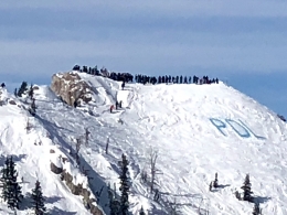
Be aware of two persistent weak layers in the snowpack. The first is weak facets buried 8-16” deep. Prior to the weekend skiers and riders triggered avalanches on this layer on Mt. Blackmore (photo) and near Cooke City (details), and on Saturday riders experienced collapses on Buck Ridge near Big Sky (details). Eric did not find this layer in the Bridger Range or the southern Madison Range (video). I did not find this weak layer in Hyalite (video), but another group of skiers did (details). Yesterday Ian toured near Hebgen Lake and found weak facets below a crust, but they were not unstable as he explains in his video. Before riding steep slopes dig to test the new snow/old snow interface. If it breaks across an extended column test, stick to lower angle terrain.
A second layer is weak, sugary facets near the bottom of the snowpack. Avalanches on this layer are difficult to trigger, but have large consequences. Yesterday skiers near Big Sky reported a deep avalanche that appeared it was triggered on Saturday (details and photos). The most widespread evidence of this problem has been near Big Sky (photos). I also expect these slides are more likely on the west side of the Bridger Range (photo) and places with a similarly shallow or variable snowpack. Yesterday skiers outside the advisory area in the Absarokas remotely triggered a large avalanche (details, photo). Avoid heavily wind loaded terrain, and complex rocky terrain with variable or shallow snow depth (<3-5 feet) (video).
Additionally, sunshine and wind contribute to smaller instabilities which are confined to the surface of the snowpack. Wet loose avalanches are possible on steep sunny slopes, and small fresh drifts pose a threat near ridgelines. These both can be deadly if they catch you above cliffs, rocks or other terrain traps, and they can trigger a larger slab avalanche (photo). Be cautious of wind loaded slopes, and avoid steep slopes that receive direct sun if the snow surface becomes wet.
Today avalanches are possible and avalanche danger is rated MODERATE.
If you get out and have any avalanche or snowpack observations to share, contact us via our website, email (mtavalanche@gmail.com), phone (406-587-6984), or Instagram (#gnfacobs).
Regional Pages
Use the Regional Pages under the Forecast tab to get a more detailed look at activity, snowpack and weather in the area you plan to visit.
Upcoming Avalanche Education and Events
Our education calendar is full of awareness lectures and field courses. Check it out: Events and Education Calendar
The accident report for the avalanche fatality in the Bridger Range on February 26th is complete. You can view the report here.