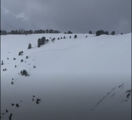
Good morning. This is Dave Zinn with the Gallatin National Forest Avalanche Forecast on Monday, March 14th at 7:15 a.m. This information is sponsored by pi, Mystery Ranch and the Yellowstone Club Community Foundation. This forecast does not apply to operating ski areas.
This morning, temperatures are in the teens with 10-20 mph winds from the southwest to northwest. The mountains around Cooke City received 8” of new snow with 3-6” in the mountains near Bozeman, Big Sky and West Yellowstone. Today, high temperatures will in the 30s to low 40s F with 10-20 mph winds from the southwest. The next chance for snow will come tomorrow afternoon.
Dangerous avalanche conditions exist in the mountains near Cooke City where 13” of snow equal to 1.1” of snow water equivalent (SWE) fell in the last three days. Moderate winds during the storm drifted this snow into slabs sensitive to human triggers. Riding in the area on Saturday, Alex saw at least seven recent natural and human triggered avalanches (details and photos, details and photos) and made a video discussing the danger of wind slabs and larger avalanches breaking deeper in the snowpack. Slides breaking 6-12” deep in the layers of new snow are likely and avalanches fracturing on a weak layer of facets around two feet deep are possible, both are dangerous for skiers and riders. Ian investigated a rider-triggered avalanche on Scotch Bonnet and discussed the persistent weak layer problem that caused the avalanche in his video (photo and details)
Do not succumb to the call of sun and fresh snow today. Avoid steep slopes. Safe travel requires careful snowpack evaluation, cautious route-finding and conservative decision-making. Human-triggered avalanches are likely, and the danger is CONSIDERABLE.
Heightened avalanche danger exists in the mountains around Bozeman, Big Sky and West Yellowstone where 6-9” of snow equal to 0.5-0.7” of SWE fell the last three days with moderate to strong winds. Avalanches are most likely on slopes with recent drifts of wind-loaded snow and weak layers of sugary facets or a slick melt-freeze crust lurking in the upper foot and a half of the snowpack. Yesterday, an avalanche broke approximately 1000’ wide on a heavily wind loaded slope in the backcountry near Big Sky Resort, catching a skier and launching him over a rock band. Thankfully, he walked away with bruises (photos and details). A smaller, hard slab avalanche broke 4-8” deep and 100’ wide on Saturday carrying a snowboarder in the northern Bridger Range (photos and details). Similar avalanches are possible today.
Warm temperatures and sunshine today may result in wet avalanche activity entraining recent snow this afternoon.
Evaluate the stability in the upper couple of feet of the snowpack and maintain a cautious skepticism around recently wind-load terrain. I followed my own advice yesterday in Beehive Basin where we found weak layers in the starting zone of an avalanche path, got unstable test results and choose a conservative exit from the area (video).
Today, the avalanche danger is MODERATE.
If you get out, please send us your observations no matter how brief. You can submit them via our website, email (mtavalanche@gmail.com), phone (406-587-6984), or Instagram (#gnfacobs).
Upcoming Education Opportunities
See our education calendar for an up-to-date list of all local classes. Here are a few select upcoming events.
Sadly, a snowmobiler was caught, buried and killed in an avalanche near Willow Park, Wyoming on Saturday. Our deep condolences go out to the family and friends of the rider. Preliminary information is available here.


