Good morning. This is Ian Hoyer with the Gallatin National Forest Avalanche Forecast on Saturday, December 3rd at 7:00 a.m. This information is sponsored by Montana State Parks and Gallatin County Sheriff Search and Rescue. This forecast does not apply to operating ski areas.
Please consider donating to the Friends of GNFAC GoFundMe campaign.
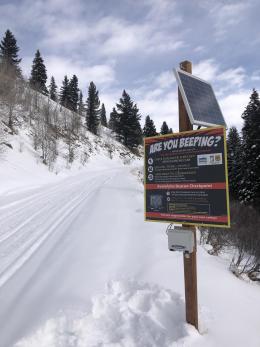
*Note: Bridger Bowl Ski Area is closed and there are no avalanche control or ski patrol services. Backcountry conditions exist. Please don’t ski over hoses and power cords, stay off chairlifts, and give snowcats and snowmobiles plenty of room
There is no new snow to report. Temperatures are in single digits and teens F. Winds are 15-25 mph out of the southwest and west with gusts of 40-50 mph. Temperatures will rise into the teens and 20s F with mostly sunny skies. Moderate west and south winds will continue. Another round of snowfall is expected to begin tomorrow.

The snowpack is still recovering from a big storm and huge loading event. Two feet of snow fell Wednesday through early Friday morning accompanied by very strong winds. Yesterday, riders saw a number of large natural avalanches along Lionhead Ridge (photos). The snowpack has now had 24 hours to begin to accommodate the big load load, so we don’t expect natural slides today and have allowed the avalanche warning to expire. However, because there are persistent weak layers buried beneath the new snow, triggering large avalanches remains likely today and it’ll take a bit more time before we can start to actually trust the snowpack (video). The avalanche danger is CONSIDERABLE.
As skies cleared yesterday, a number of natural avalanches were seen around Cooke City that broke during the storm (details and photos). The largest of these slides broke 3-4 ft deep, likely on a weak layer that formed last week prior to the storm (Alex’s video from yesterday). With the combination of two feet of storm snow, strong winds to build even thicker slabs, and buried weak layers - human triggered avalanches remain likely today. The avalanche danger is CONSIDERABLE.

Six inches to a foot of snow fell over the past few days, accompanied by strong winds to drift it into thicker slabs. These wind drifts are our biggest concern today (Taylor Fork video). There also are some areas where weak layers were buried beneath the new snow (Bacon Rind observation). It doesn’t appear that these weak layers are widespread, but we still have limited information to confirm this so our confidence is low. Conveniently, the snowpack is still shallow enough that it’ll only take a few minutes to dig down and check for these weak layers before committing to steep slopes. Human triggered avalanches are possible today and the avalanche danger is rated MODERATE.
If you get out, please share avalanche, snowpack or weather observations via our website, email (mtavalanche@gmail.com), phone (406-587-6984), or Instagram (#gnfacobs).
Upcoming Avalanche Education and Events
Our education calendar is full of awareness lectures and field courses. Check it out: Events and Education Calendar.
Monday, December 5, 6:30-7:30 p.m. @MAP Brewing in Bozeman, Know Before You Go avalanche awareness presentation.
Tuesday, December 6, 9 a.m. - 3:00 p.m. West Yellowstone Avalanche Fundamentals w/ Snowmobile Field Session. Pre-register HERE.
Thursday, December 8, 6 - 7:30 p.m., Free Snow & Avalanche Safety Workshop: Belgrade Community. This workshop will cover the basics of snow and avalanche equipment. Belgrade Community Library. A raffle and pizza will be included!
Monday, December 12, 5-8 p.m. @MAP Brewing, Movie Night.
Tuesday, December 13, 6 p.m., Avalanche Awareness + Beacons at Story Mill Park. Free.