Good morning. This is Ian Hoyer with the Gallatin National Forest Avalanche Forecast on Thursday, January 26th at 7:00 a.m. Today’s forecast is sponsored by Blitz Motorsports and Yamaha and Avalanche Alliance. This forecast does not apply to operating ski areas.
This morning, there are 3-5” of new snow around Bozeman, Big Sky, and Cooke City, with 1-2” near West Yellowstone. Winds are 15-20 mph out of the north and west with gusts of 25-35 mph. Temperatures are in the teens and 20s F. High temperatures today will be in high teens to low 30s F. Moderate winds with strong gusts will continue and may even pick up a bit this afternoon, shifting to the west and southwest. Snowfall will begin this morning in northern areas with 4-6” expected by nightfall. Snowfall will begin later this afternoon near West Yellowstone. By tomorrow morning, expect 6-10” of new snow near West Yellowstone and 10-20” near Bozeman, Big Sky, and Cooke City. Heavy snowfall will continue tomorrow.

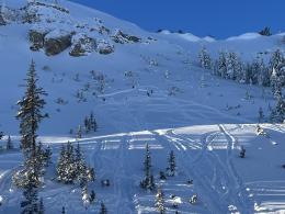
Another 3-5” of low density new snow this morning on top of yesterday’s 5-8” and strong winds means there are substantial wind drifts that are ready to avalanche. On many slopes these drifts are sitting above weak layers in the upper snowpack. Around Big Sky and Cooke City the weak layer may surface hoar (Cooke City video, Beehive video), while near Bozeman it is more likely to be facets (Saddle Peak video, Mt Ellis video). Don’t get sucked into the weeds - today, the specific grain type of the weak layer doesn’t matter - the important thing is that there are weak layers that are being loaded, especially where wind is building thicker drifts. Don’t mess with wind slabs today - assume that there are weak layers on every slope and that avalanches will break more easily, deeper and wider than they would in just new/wind drifted snow. A natural avalanche ran over a popular west-facing ice climb (Silken Falls) in Hyalite on Tuesday (details) and I expect more of these slides today.
More snowfall today and continued strong winds potentially increasing and shifting directions this afternoon will make new slopes unstable throughout the day, so constantly reevaluate your terrain choices. The avalanche danger is CONSIDERABLE on wind loaded slopes and MODERATE on all other slopes.

Large avalanches are a very serious possibility today. There hasn’t been much new snow, but there has been a little and there are very weak and reactive layers of surface hoar in the upper snowpack. Yesterday, Dave saw several recent natural avalanches along Lionhead Ridge that broke 1-2 ft deep on surface hoar (details and photos) and got an ECTP2 (a very unstable result) on another layer of surface hoar ~5” below the surface. These slides broke after only a couple inches of new snow fell. With a dusting of new snow overnight and a bit more on the way today, it wouldn’t be surprising to trigger similar slides today. Dig and test these weak layers before riding any steep slope and be ready to back off if necessary (Bacon Rind video). The avalanche danger is MODERATE today.
If more than a couple inches of new snow fall during the day, large avalanches will quickly become likely and the avalanche danger will rise to CONSIDERABLE.
Please share avalanche, snowpack or weather observations via our website, email (mtavalanche@gmail.com), phone (406-587-6984), or Instagram (#gnfacobs).

In Island Park, large avalanches are a very serious possibility today. There hasn’t been much new snow, but there has been a little and there are very weak and reactive layers of surface hoar in the upper snowpack that have recently avalanched nearby. Be wary of any steep slope, but even more so of any slope with more than a few inches of wind loading. Dig and test these weak layers before riding any steep slope and be ready to back off if necessary
KING AND QUEEN OF THE RIDGE, FEBRUARY 4TH
Do you like to hike? Do you like to ski? Then the King & Queen of the Ridge is for you. Hike, ski and raise money for the Friends of the Avalanche Center in their 2nd biggest fundraiser of the year. Join the effort to promote and support avalanche safety and awareness! Fundraising prizes for the top 5 individuals who raise over $500. No racing is necessary to compete for the fundraising prizes. Info is HERE. Race participants for the February 4th event must register separately with Bridger Bowl HERE.
Upcoming Avalanche Education and Events
Our education calendar is full of awareness lectures and field courses. Check it out: Events and Education Calendar.
TONIGHT! January 26, 6-7 p.m., FREE Avalanche Awareness in Cody, WY. Information HERE.
TOMORROW! January 27, 6:30 p.m., DILLON Avalanche Fundamentals. Information and course registration are HERE.
February 3, 9 a.m.-3 p.m., LIVINGSTON Avalanche Fundamentals. Information and course registration are HERE.
February 9, FREE Avalanche Awareness at REI Bozeman. More details to come.
Every Saturday, 10 a.m. - 2:00 p.m. Avalanche Rescue Training, drop in for any amount of time. Round Lake Warming Hut, Cooke City. Free.
Loss in the Outdoors, is a support group for those who have been affected by grief and loss related to outdoor pursuits. Check out the link for more information.
Bruce Jamieson and Karl Birkeland made a very informative video, An inside look at how people trigger slab avalanches. It is 12 minutes long and explains a complicated topic in simple terms.