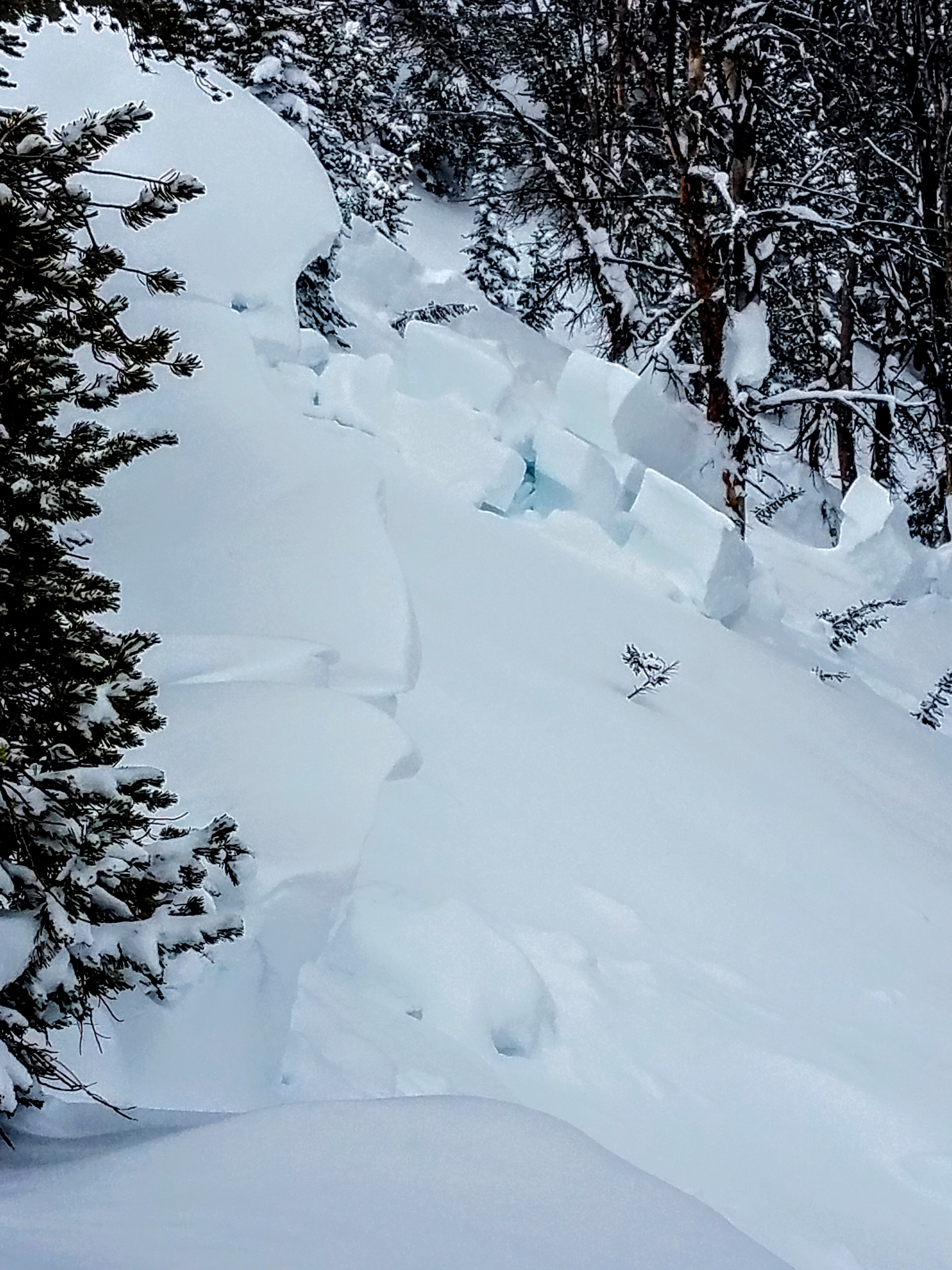
We encountered a natural avalanche that appears to have been triggered by a cornice drop. There seemed to be very little fresh snow on the slide surface so we suspect it occurred recently (Feb 14?). The slide occurred on the west side (east facing side) of Bear Basin (pinpoint on the map below). The avalanche was probably 200 feet wide at the top so it clearly propagate across the slope. Crown was 2 to 5 feet tall. We did not hike in there to investigate more carefully. There is a fair amount of trees on this part of the ridge. The picture shows how some large chunks got hung up on trees but we could see that the slide ran across the creek below (almost 1000 vertical feet). We had planned on skiing this slope and/or the open meadow (talus field) a hundred yards north but in light of this observation we turned around, skied back down in Middle Basin in the trees. Side note: we dug a pit earlier on an almost identical aspect (on the Beehive/Middle basin ridge) and obtained ECTN 16 @ 12" below the surface, ECTN 23 @4" below that, ECTN 28 @ 6" below that... Basically some definition between the latest storm layers but no propagation, and a right-side up snow pack. We only dug about 3 feet deep so this pit did not assess the ground level facets, which we figure are wide spread. The natural slide we encountered one ridge over seemed to be a case where a thin area was triggered by a cornice drop. Photo: Alex Lussier
Forecast link: GNFAC Avalanche Forecast for Sun Feb 16, 2020