Photos
|
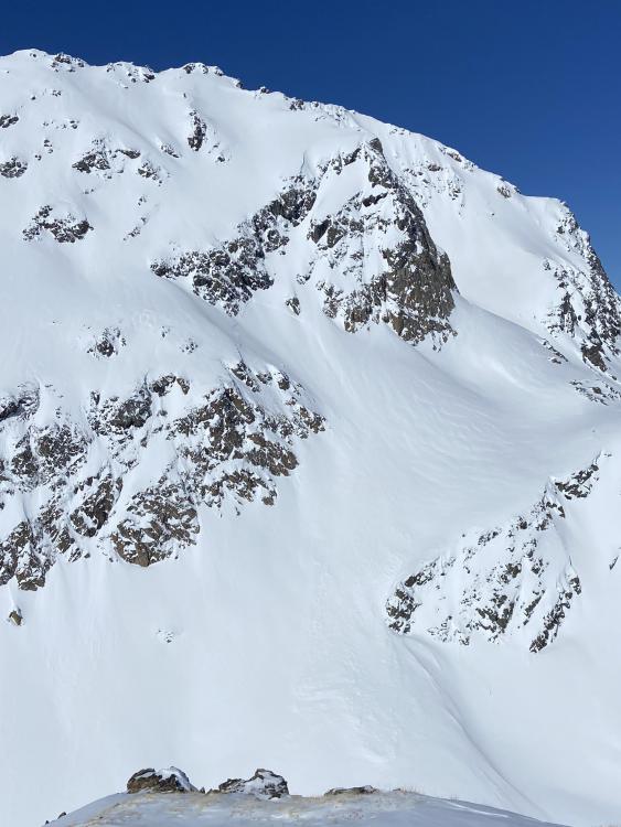
Out of Advisory Area, 2023-03-19 D3 slab avalanche on SE corner of Giant Castle Mountain north of Pahaska, WY appears to have been triggered by a skier between 3/16/2023 and 3/18/2023. Outside Advisory Area. Photo: A. Billin |
|
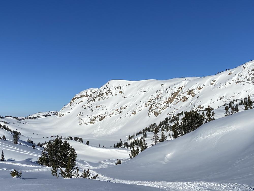
Out of Advisory Area, 2023-03-19 Side by side D2 natural slab avalanches at on SE edge of Giant Castle Mountain north of Pahaska, WY (occurred on 3/16/2023). Outside forecast area. Photo: A. Billin |
|
Out of Advisory Area, 2023-03-19 Side by side D2 natural slab avalanches at on SE edge of Giant Castle Mountain north of Pahaska, WY (occurred on 3/16/2023). Outside forecast area. Photo: A. Billin |
|
Out of Advisory Area, 2023-03-19 Side by side D2 natural slab avalanches at on SE edge of Giant Castle Mountain north of Pahaska, WY (occurred on 3/16/2023). Outside forecast area. Photo: A. Billin |
|
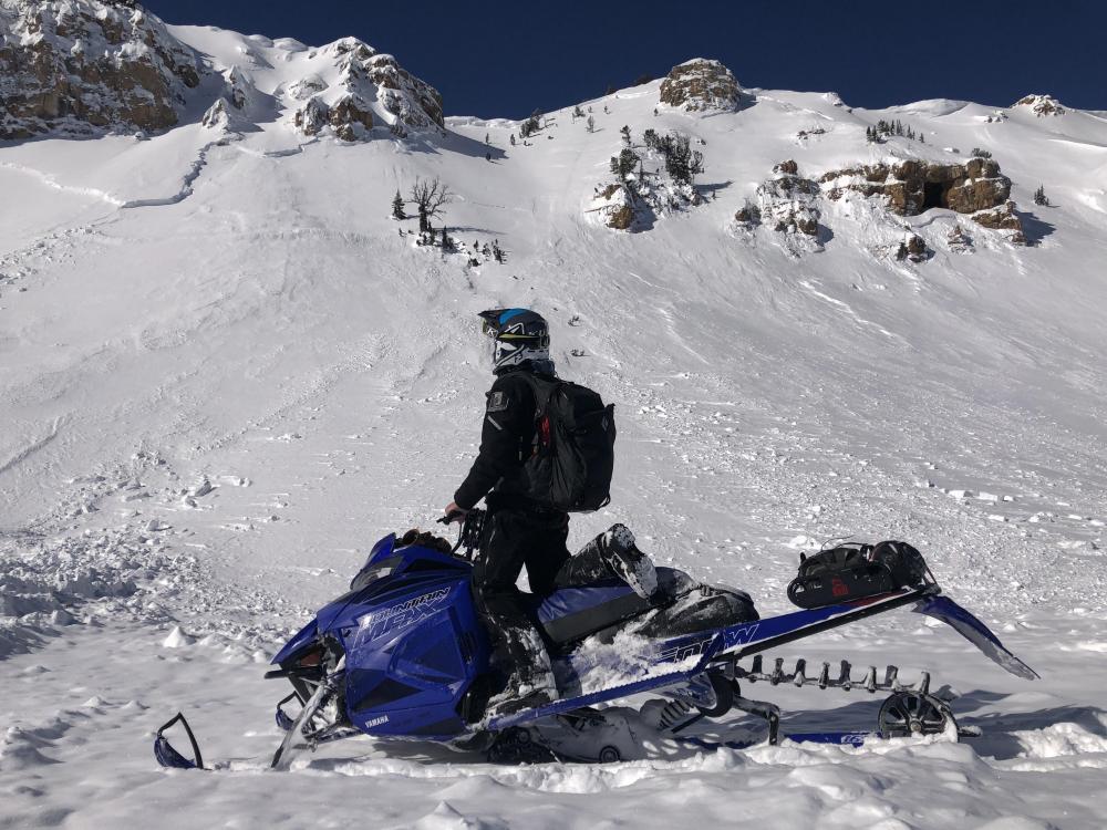
Southern Gallatin, 2023-03-19 Slab avalanche on NE facing slope at 7,500 feet - slid to the ground. Photo: K. Gordon Link to Avalanche Details |
|
Southern Gallatin, 2023-03-19 Slab avalanche on NE facing slope at 7,500 feet - slid to the ground. Photo: K. Gordon Link to Avalanche Details |
|
Cooke City, 2023-03-18 From 3/18/23: "Watched two riders on the north side of Henderson / Daisy pass high marking. One triggered a large avalanche and got stuck at the crown. Crown was taller than him. Guessing 8-10’ deep and 200+ yards wide.... We were across around the sheep mtn/ Scotch Bonnet area and watched the whole thing happen. We boogied over there as fast as possible to help." Photo: C. Diffley Link to Avalanche Details |

|
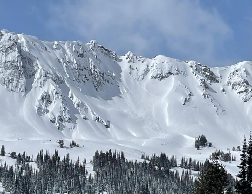
Northern Gallatin, 2023-03-18 Large avalanche on Mt. Bole seen by skiers on 3/17/23. Link to Avalanche Details |
|
Cooke City, 2023-03-18 A few recent slides were visible today on south, east and west aspect around goose lake zone. Looked like mostly wind slabs in the new snow. Photo: P. Hinmon Link to Avalanche Details |
|
Cooke City, 2023-03-18 A few recent slides were visible today on south, east and west aspect around goose lake zone. Looked like mostly wind slabs in the new snow. Photo: P. Hinmon Link to Avalanche Details |
|
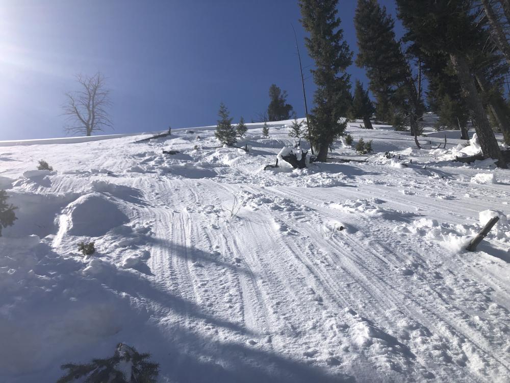
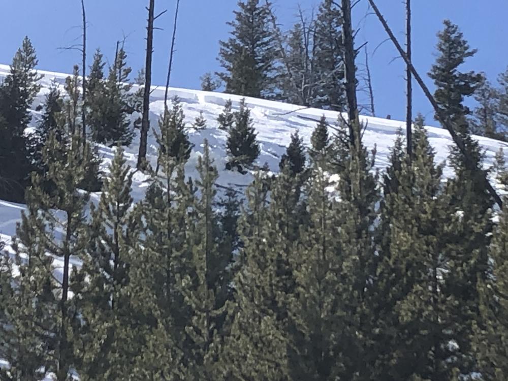
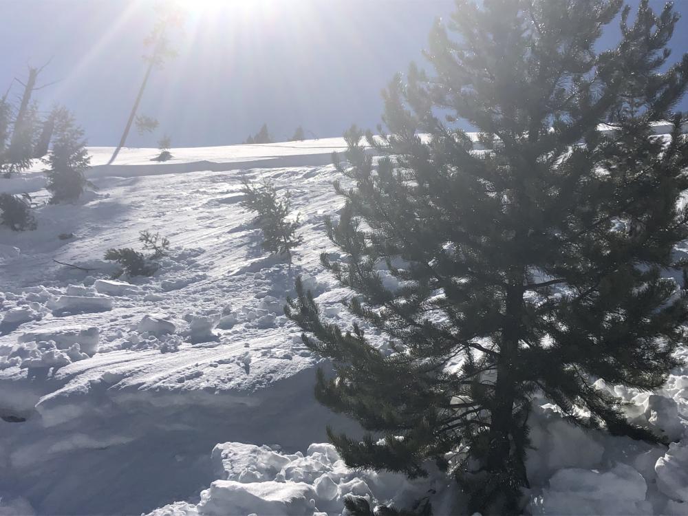
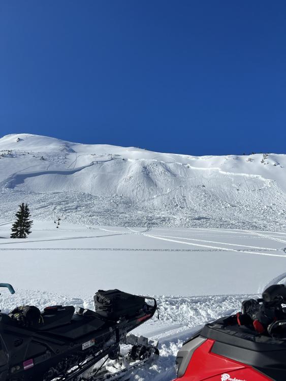
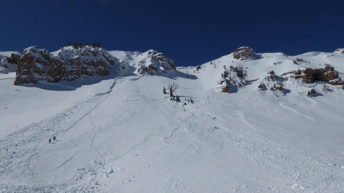
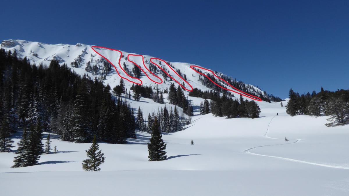
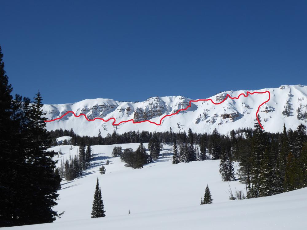
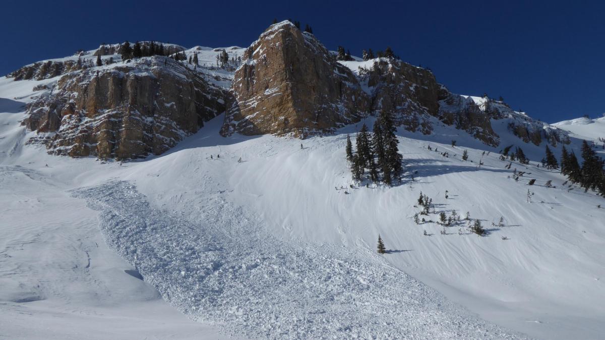
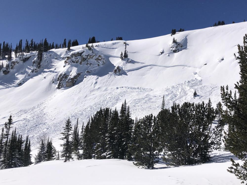
Lionhead Range, 2023-03-17 |
|
Lionhead Range, 2023-03-17 |
|
Lionhead Range, 2023-03-17 |
|
Lionhead Range, 2023-03-17 |
|
Lionhead Range, 2023-03-17 |
|
Lionhead Range, 2023-03-17 |
|
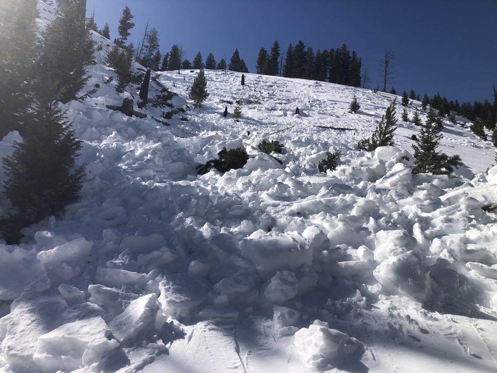
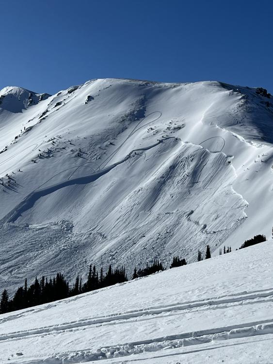
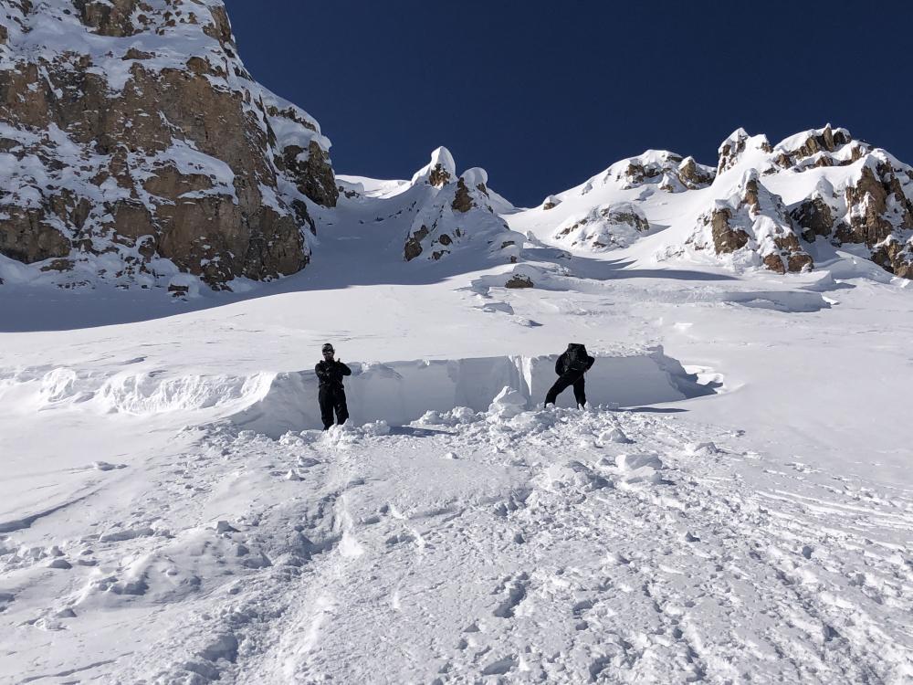
Lionhead Range, 2023-03-17 We dug in 1 crown and measured 11" of SWE above the weak layer (1mm facets) that avalanched. Every weak layer has a breaking point, and this layer needed about 11 feet of snowfall to get it to avalanche.
Link to Avalanche Details |
|
Cooke City, 2023-03-17 Saw this natural D2 soft slab off the east aspect of Miller Ridge. The crown looks shallow, so I’m guessing it ran at the storm interface. 3/16/23. Photo: N. Hance Link to Avalanche Details |
|
Island Park, 2023-03-16 From the FAA road up Sawtelle Peak outside Island Park we were able to see many crown lines and debris piles from the last 2 days of Avalanche Warnings. Most avalanches involved new snow, but there was 1 deep avalanche on Mt. Jefferson's east face that was large (D3). The FAA did avalanche control and an avalauncher round triggered a small, but deep slide (2-5' deep) and a larger explosive on another slope yielded no results. We saw 8 separate avalanches from the road. These were east and north facing, the only aspects available for viewing. The snowfall totaled 3' and it will take a few days for the snowpack to become more stable. In the meantime, be patient and stay off of steep slopes. Link to Avalanche Details |