Photos

|
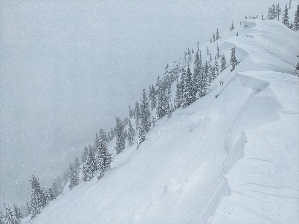
Cooke City, 2024-06-04 "At approximately 15:40 a D3 avalanche on the Gardiner headwall broke. It was triggered by a snowboarder and his dog. The run had already been tracked by skis and snow machines but the trigger point was slightly farther skier right and appeared to trigger a convex wind slab. Several skiers, boarders, and riders were in the area but there were no burials or injuries." Photo: C. Cavill Link to Avalanche Details |

|
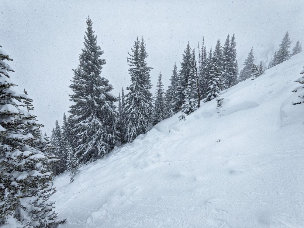
Out of Advisory Area, 2024-06-02 From IG messages on June 1 2024: "there were two riders and a dog on the slope. One rider was partially caught and rode out when everything stopped moving.... Happened about 3pm today within the first 20 riders. Started with a small slide and propagated much larger when it got closer to the rocks." Photo: L. Durkin Link to Avalanche Details |

|
Out of Advisory Area, 2024-06-02 From IG messages on June 1 2024: "there were two riders and a dog on the slope. One rider was partially caught and rode out when everything stopped moving.... Happened about 3pm today within the first 20 riders. Started with a small slide and propagated much larger when it got closer to the rocks." Photo: J. Hodge Link to Avalanche Details |

|
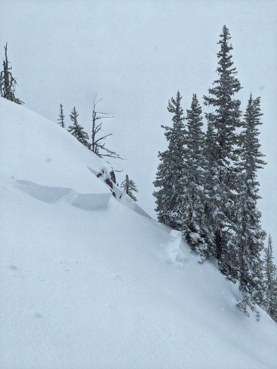
Northern Madison, 2024-05-23 From obs 5/23/24: "shooting cracks in the top 4 to 5 inches of new snow in middle basin" Photo: N. Greiner Link to Avalanche Details |

|
Bridger Range, 2024-05-23 From obs 5/23/24: "Toured to the top of PK during today’s storm. Snow was very wet and heavy. We saw no other slides or signs of instability on the way up. Coming down skiers right of flippers, all 3 of us caused small slides and cracking within the new snow. I triggered the largest slide, which was 6-8” deep and 12’ wide." Photo: T. Jordan Link to Avalanche Details |

|
Northern Gallatin, 2024-05-23 From obs 5/18/24: "Wet snow avalanche at around 9300’ on a northwest aspect in Hyalite basin. Group opinions on crown height ranged from 1-5 feet - hard to tell from a distance." Photo: A. Kautzer |

|
Northern Gallatin, 2024-05-23 From obs 5/18/24: "Wet snow avalanche at around 9300’ on a northwest aspect in Hyalite basin. Group opinions on crown height ranged from 1-5 feet - hard to tell from a distance." Photo: A. Kautzer |

|
Cooke City, 2024-05-17 From email 5/16/24: "I saw the photo of the fisher peak avalanche on the website. Figured I could fill in the blanks. Not a natural slide, snowmobile triggered. At approximately 12:15pm last Saturday I was climbing above fisher bench and unintentionally set off a slab avalanche on fisher peak. I was jumping the cornice at the ridge and had a massive slope collapse, followed by shooting cracks and propagation downslope. I was able to wheelie through the crown and sidehill above the slide away from the debris area. 5 minutes before my climb, another snowmobiler put a high mark 60 ft away from where I climbed with no results. There were numerous tracks on the slope prior to this avalanche, I found the weak spot. My riding partner was watching me from a safe zone further south, as we knew there was new snow instabilities to watch out for, at a minimum. We rode all day Friday without any obvious instabilities on similar slopes. We didn’t see the sheep mountain slide Friday morning. I took some pictures of the slide right after it happened. See attached…" Link to Avalanche Details |

|
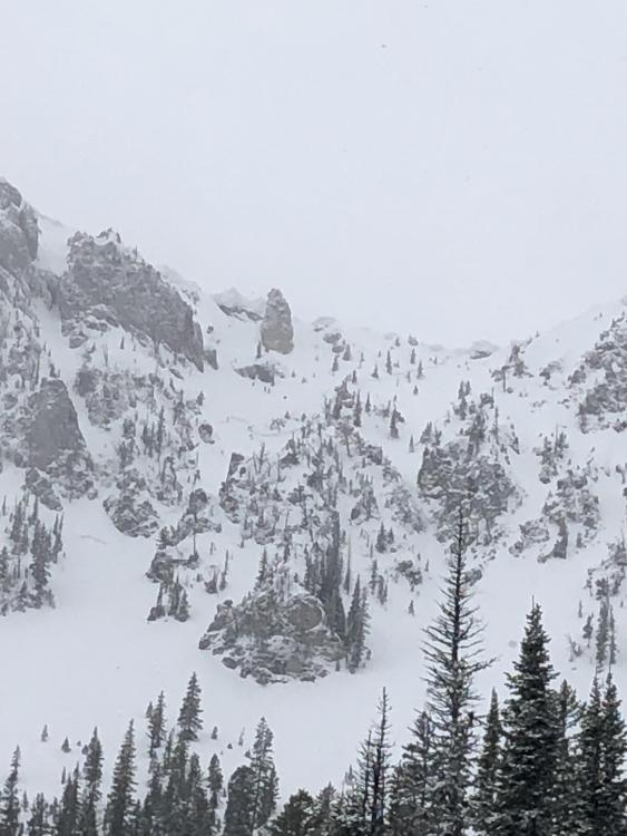
Cooke City, 2024-05-13 From obs 5/12/24: "Saw a few slides that look like they propagated across the layer of new snow from the last storm (as opposed to the characteristic spring wet snow point releases). The largest was the previously reported one from Sheep... We also saw a similar slide on a N/NW aspect of Mt Zimmer (pictured). Hard to say from a distance when these broke, but the one on Mt Zimmer looked the most recent." Photo: A. Kautzer |

|
Cooke City, 2024-05-13 From obs 5/12/24: "Saw a few slides that look like they propagated across the layer of new snow from the last storm (as opposed to the characteristic spring wet snow point releases). The largest was the previously reported one from Sheep. On the way out we saw a smaller slide farther south along the same ridge that looked like it broke on the new snow interface, both NE aspects (pictured)." Photo: A. Kautzer
|

|
Cooke City, 2024-05-12 From email 5/11/24: “Hey Guys, here are a few photos from the weekend. The sheep Mountain Avalanche was Snowmobile triggered on Friday…” Link to Avalanche Details |

|
Cooke City, 2024-05-12 From email 5/11/24: “Hey Guys, here are a few photos from the weekend. … the fisher peak avalanche happened today. Maybe cornice drop?” Link to Avalanche Details |

|
Cooke City, 2024-05-10 From IG story 5/8/24: "@mtavalanche remote triggers today in Cooke City. 2-4' of fresh north of round lake." Link to Avalanche Details |
|
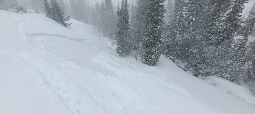
Bridger Range, 2024-05-08 From email 5/8/24: "A few snaps from today. Observed several D2 slides between sluice box and the nose. I didn't see the toe of these slides, but it looked like there were running with some speed into mid elevation terrain. Slabs were most common in winded terrain, but slides flanked out on new/old interface and 4/26 crust (these layers are not very far apart) even in sheltered middle elevation terrain. Visibility was poor, but I'd expect to see similar large slides in steep, winded terrain" Photo: B. VandenBos Link to Avalanche Details |
|
Bridger Range, 2024-05-08 A skier near the top of the Alpine Lift at Bridger Bowl ski area took a photo of three avalanche crowns near Peter’s Point. Photo: P Hinz Link to Avalanche Details |
|
Northern Madison, 2024-05-08 A skier triggered an avalanche on a test slope in Beehive Basin, breaking 12-16" deep and 75' across. The slide failed within the new snow. Link to Avalanche Details |