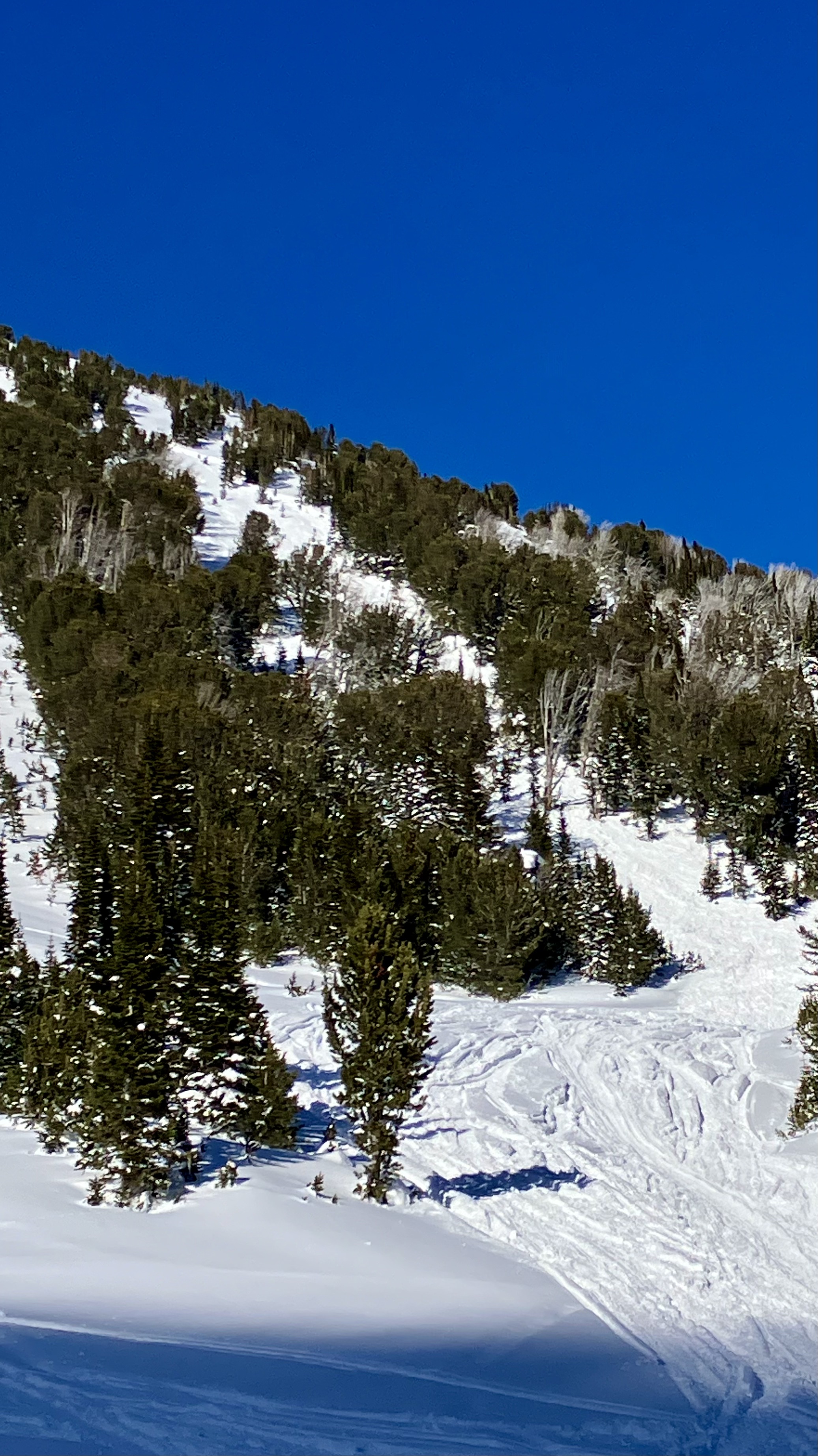
Snow Observations List
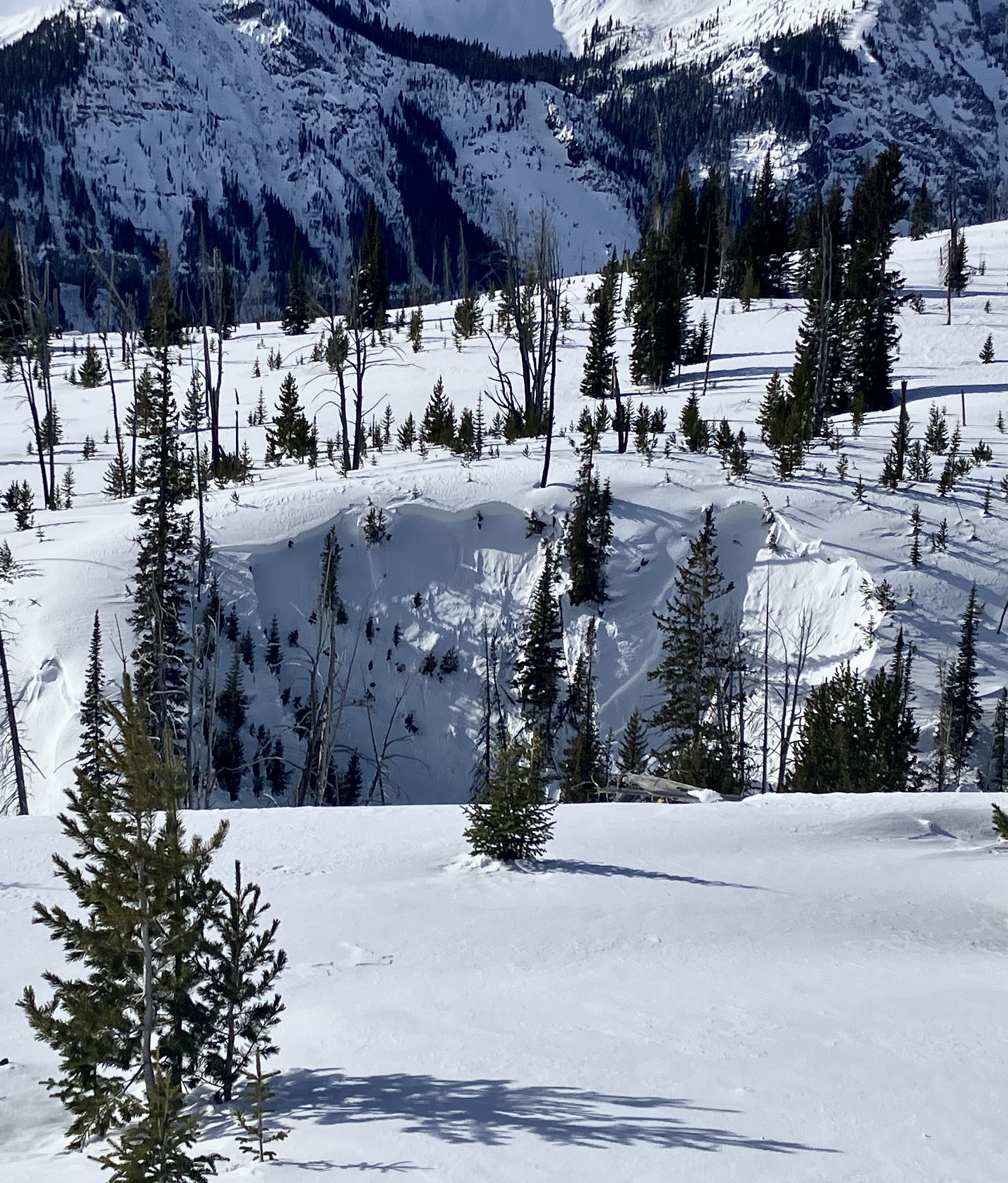
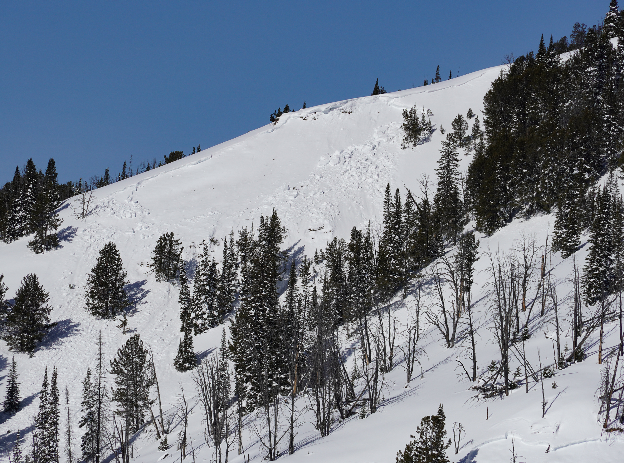
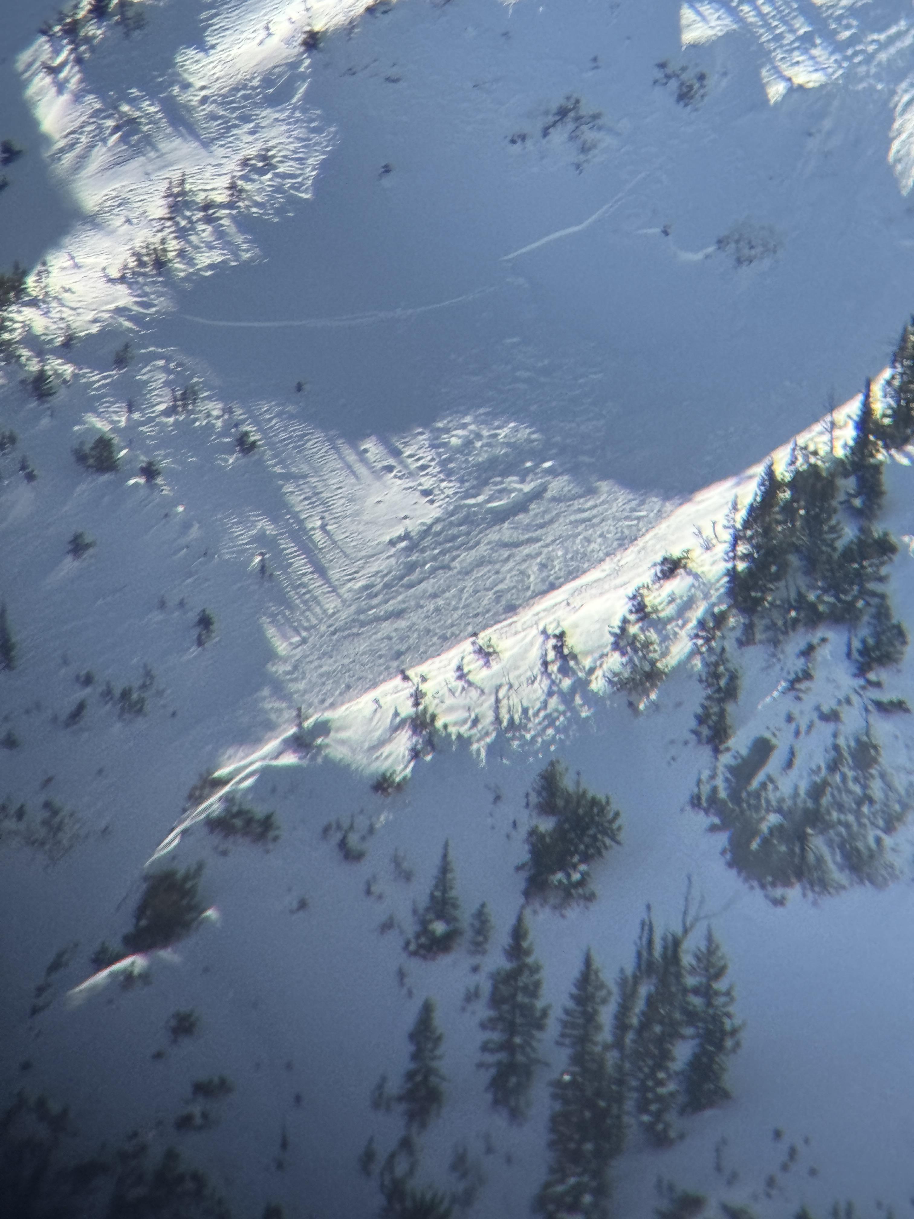
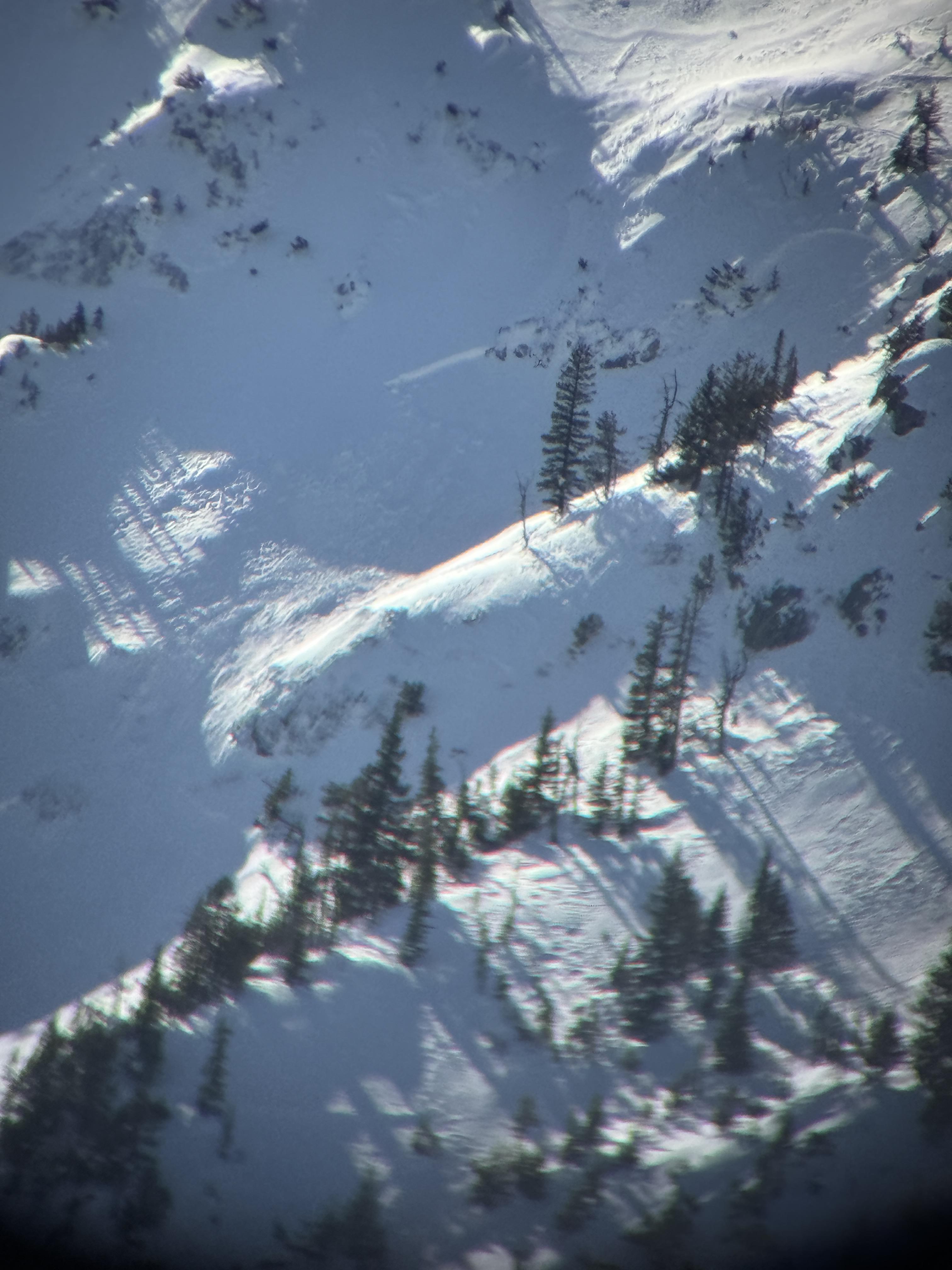
Cornice fall triggered a big one. Looks to be real fresh. last night or this morning Broke across the whole bowl and up to 8 feet deep maybe more right in the middle Broken trees in the debris, And ran out of sight.
Full Snow Observation Report
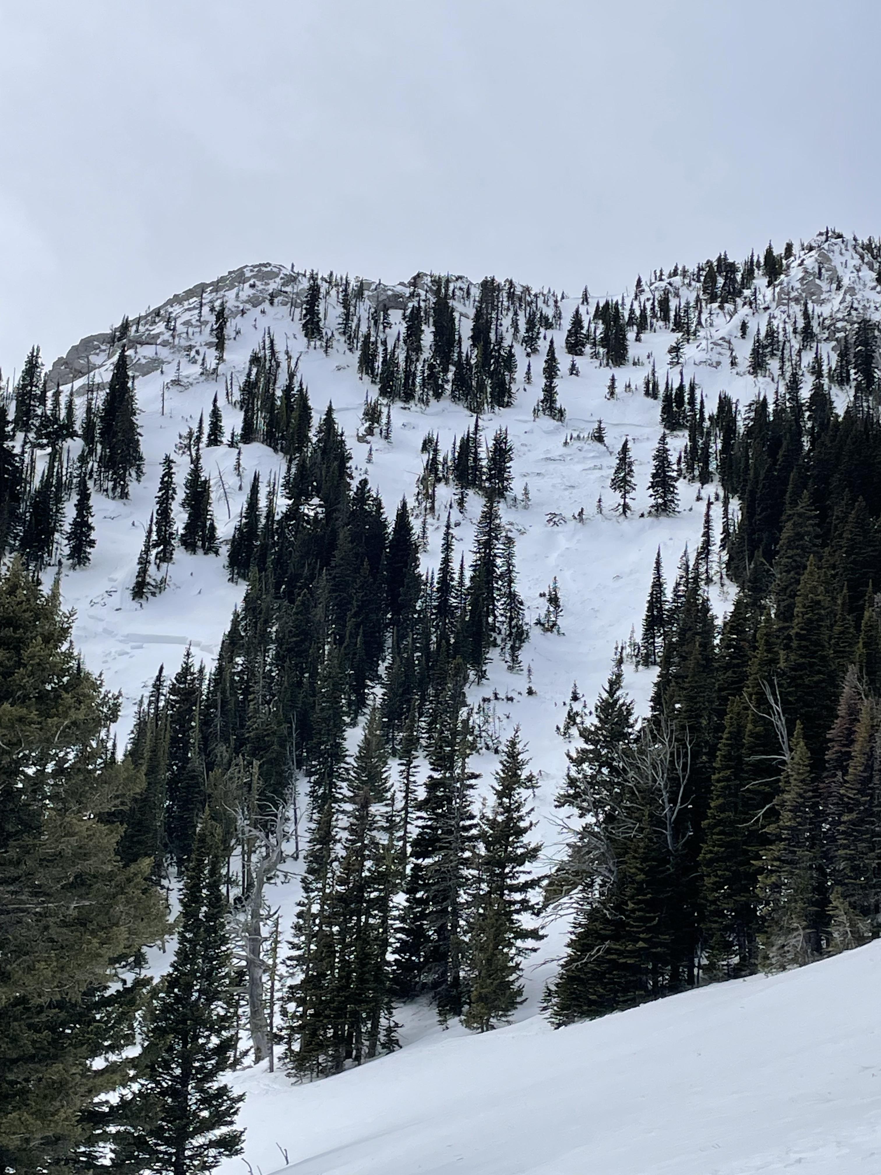
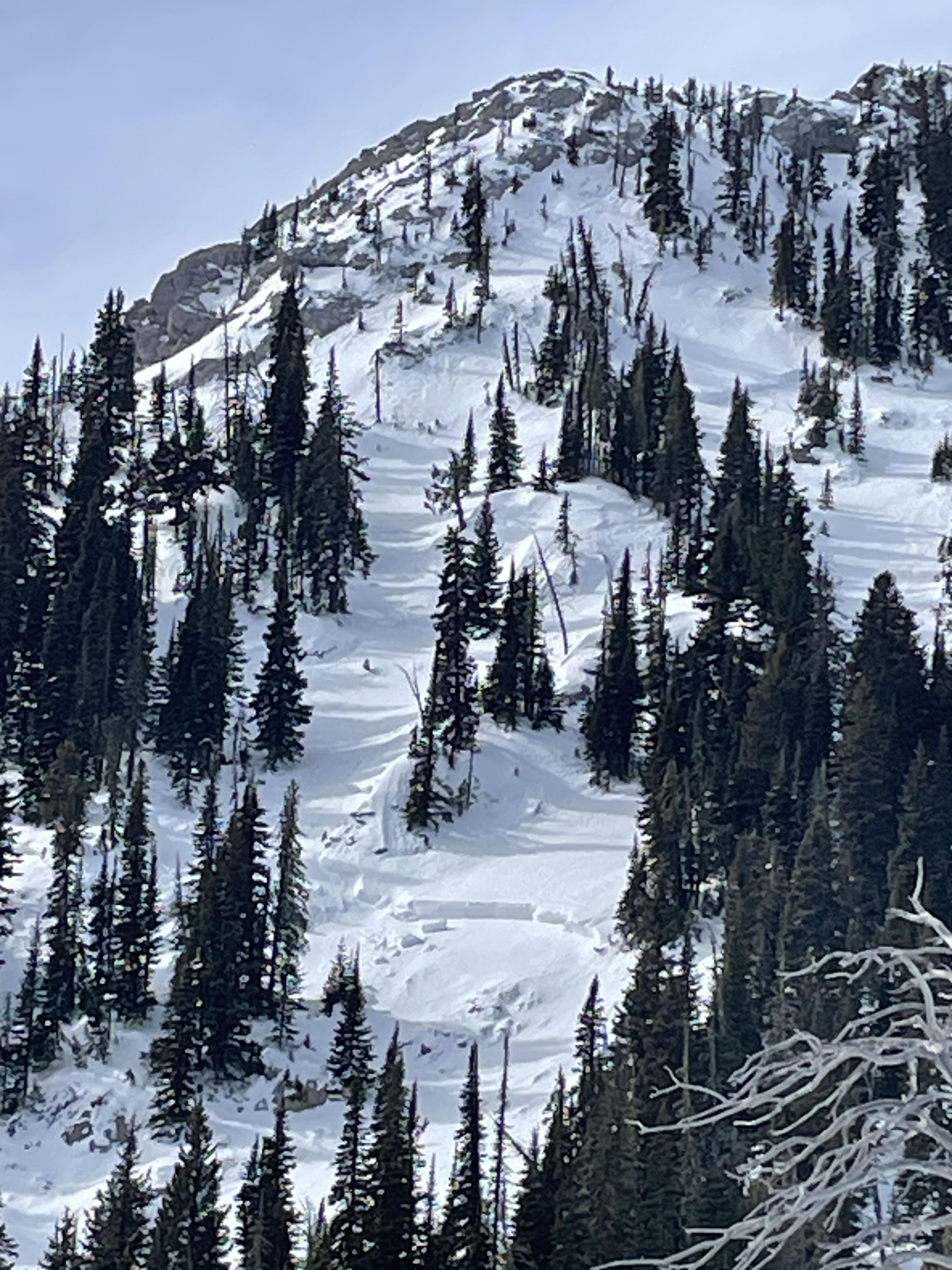
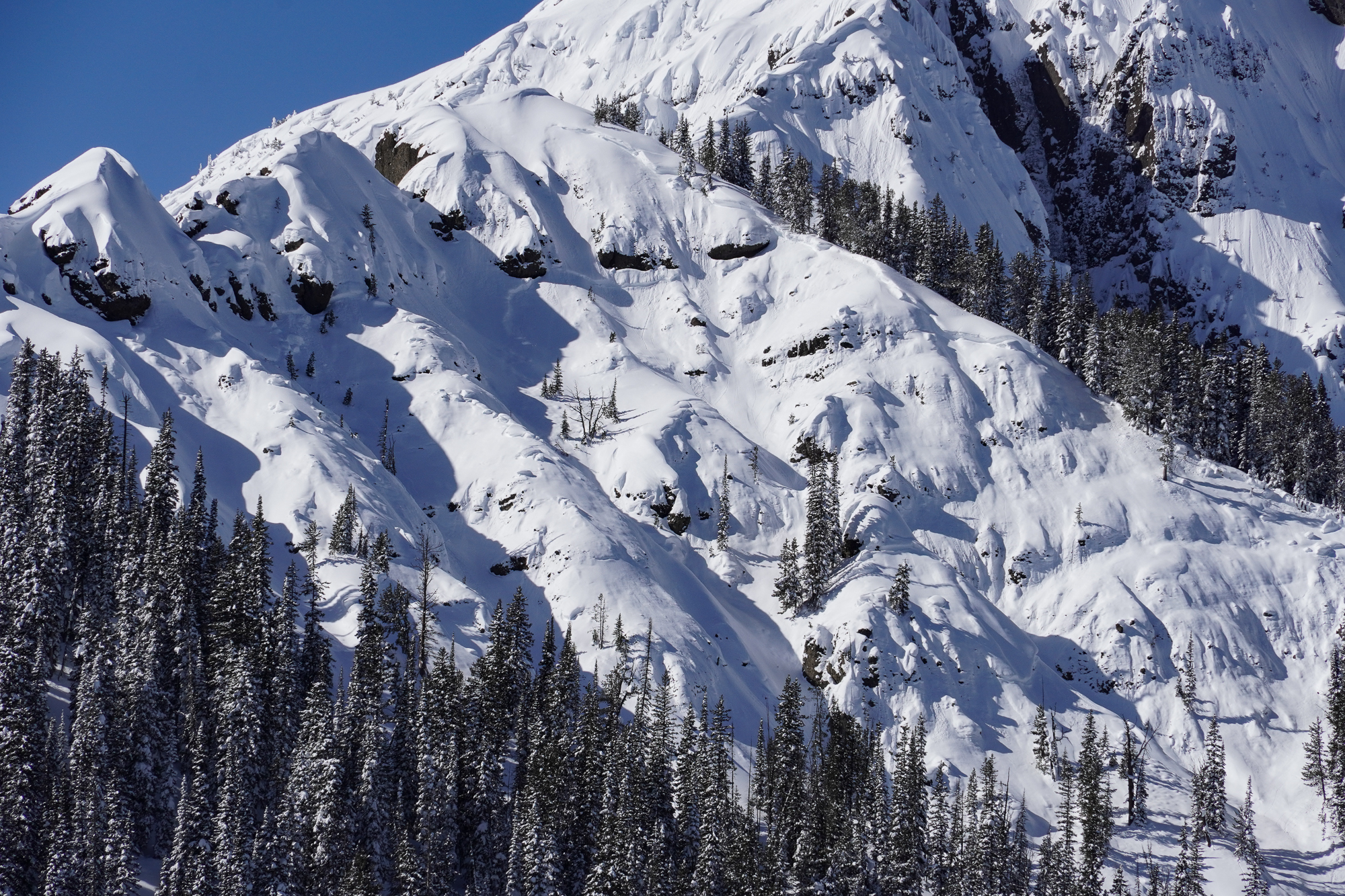
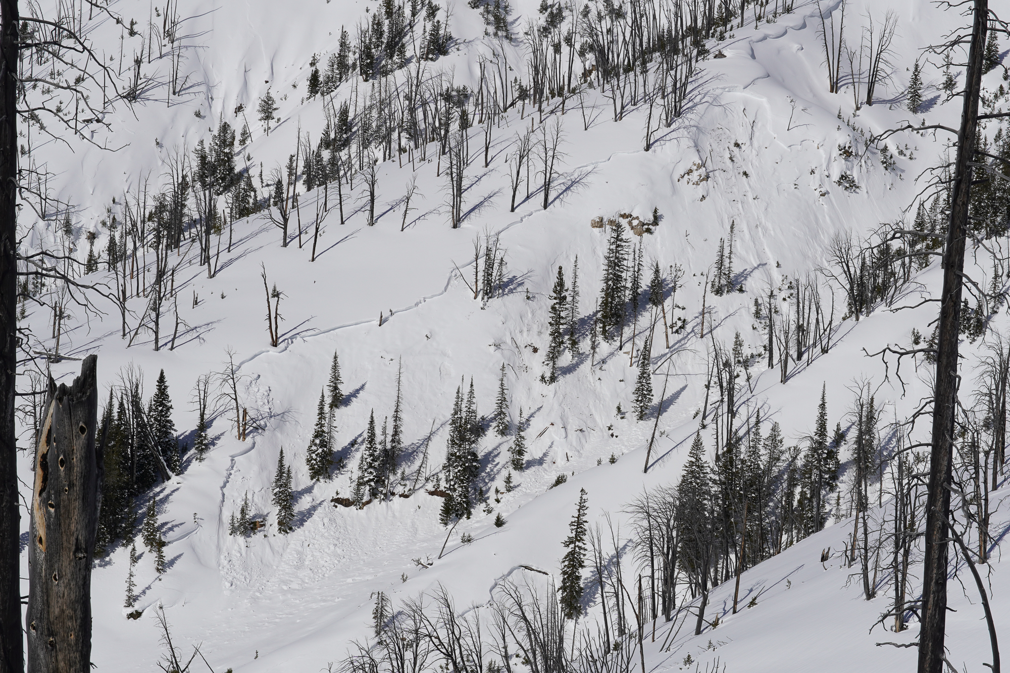
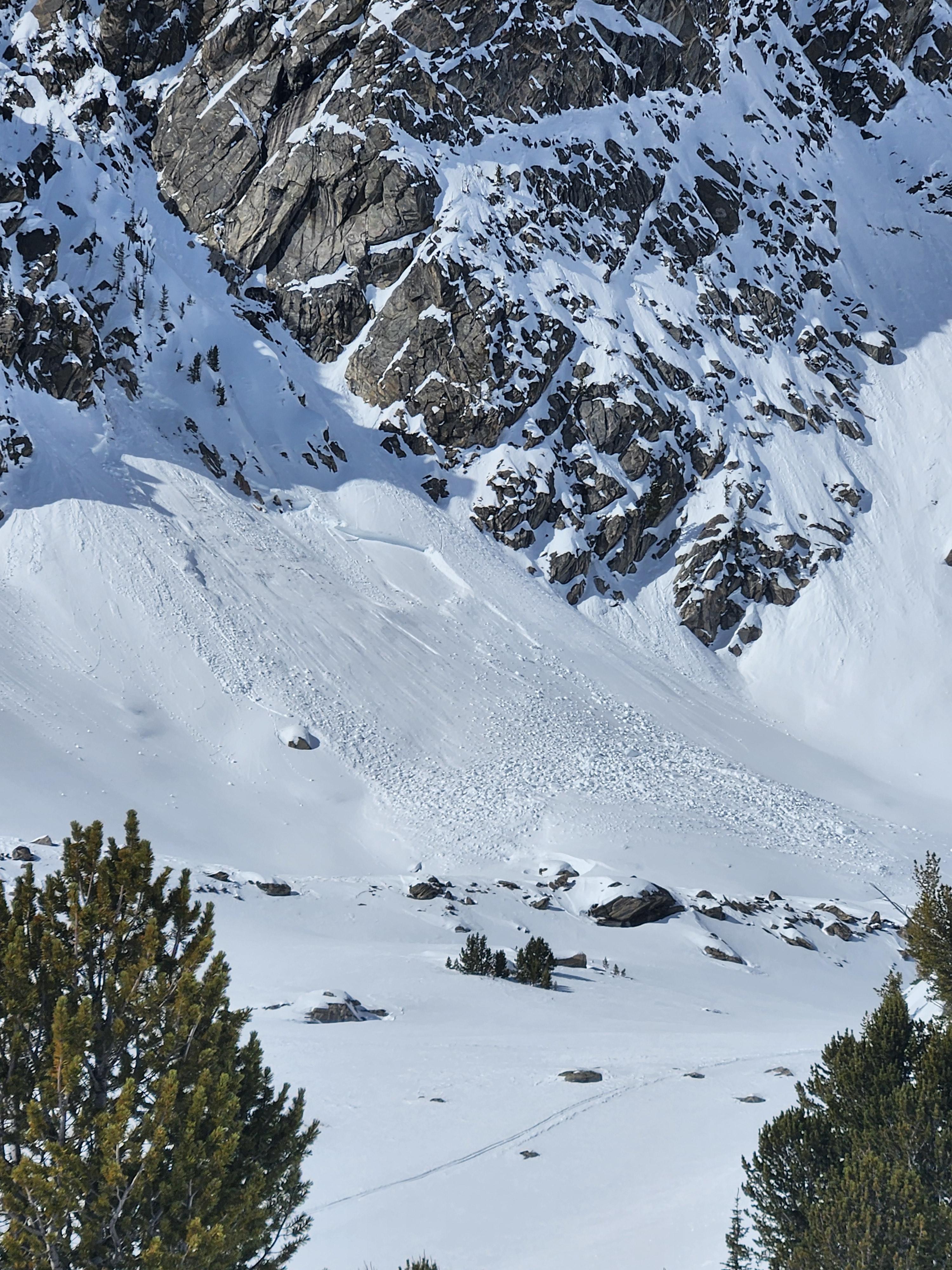
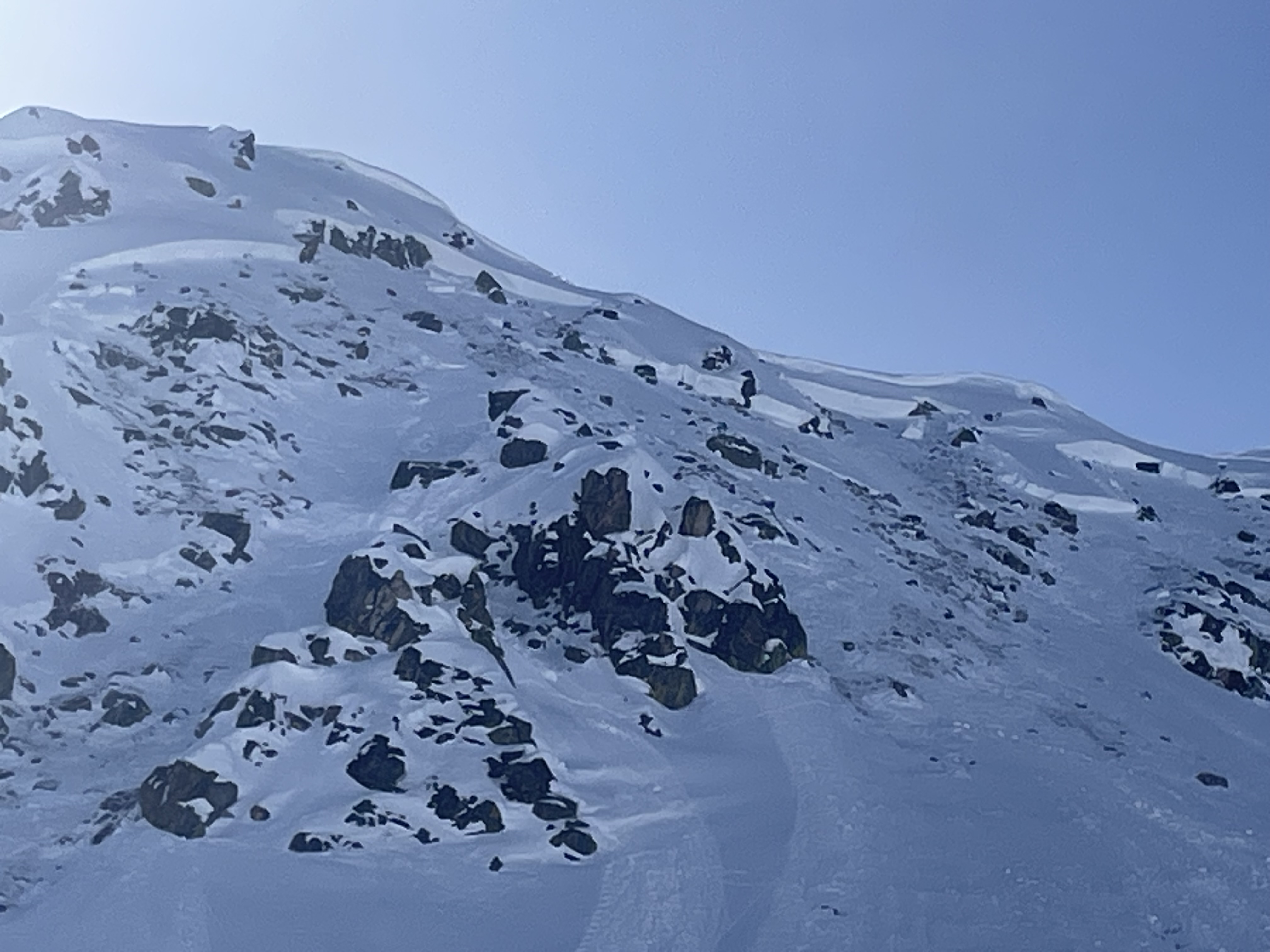
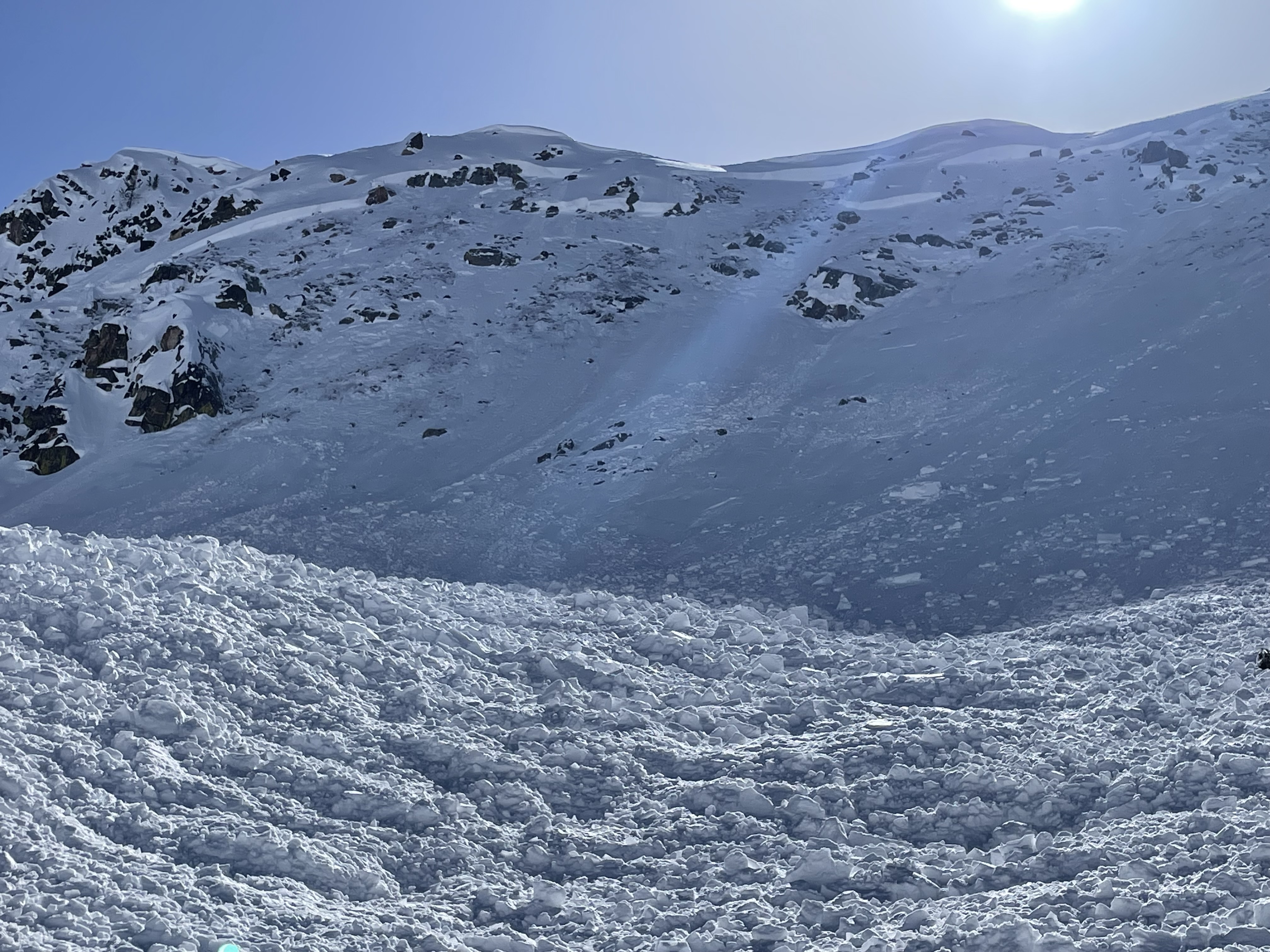
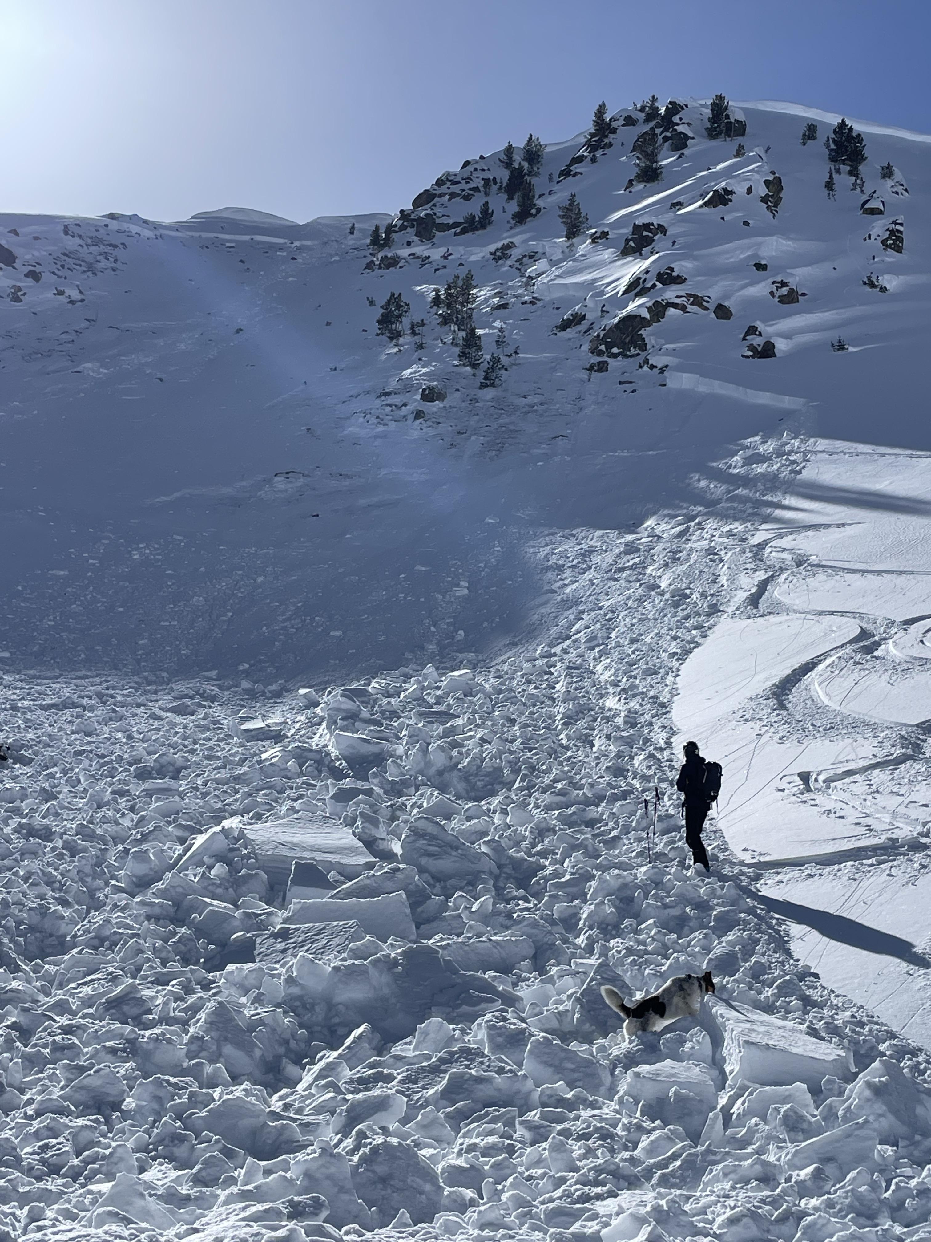
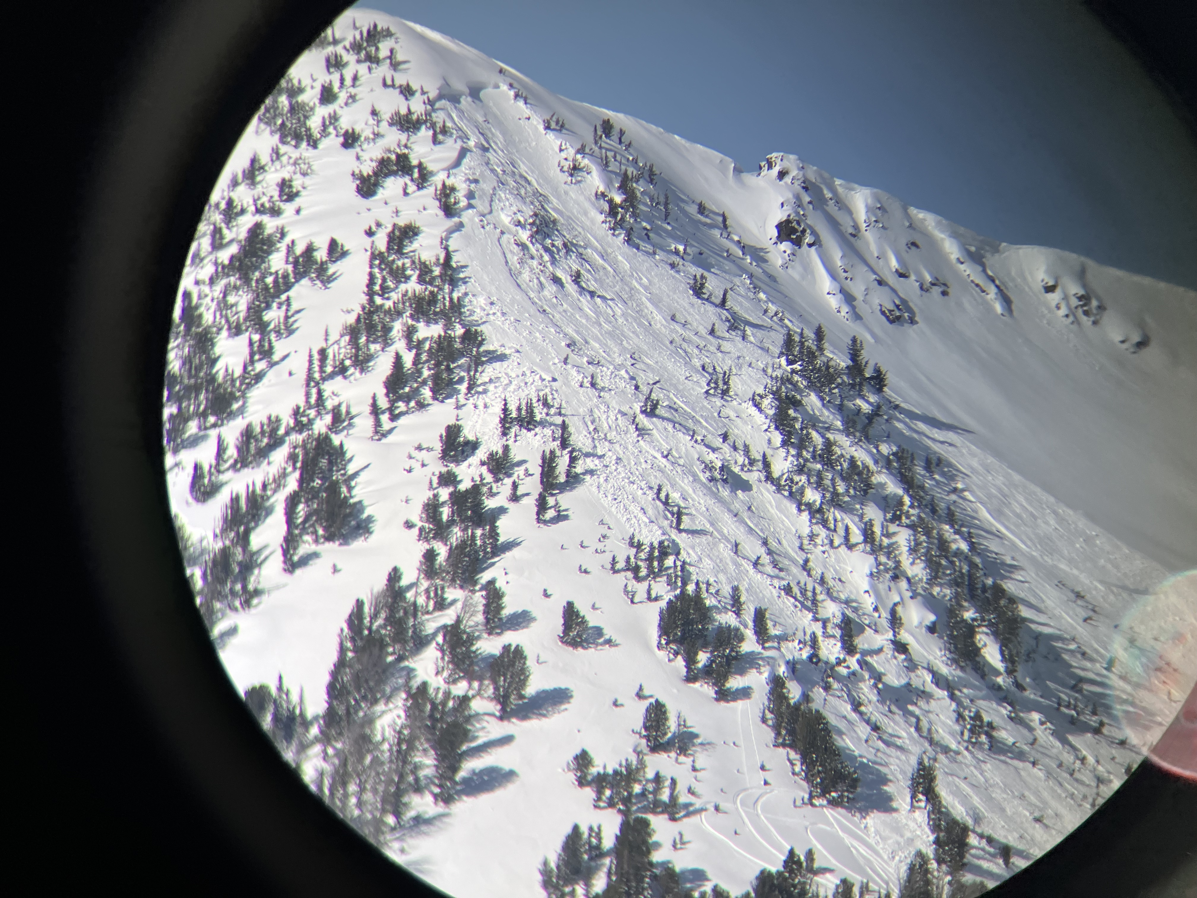
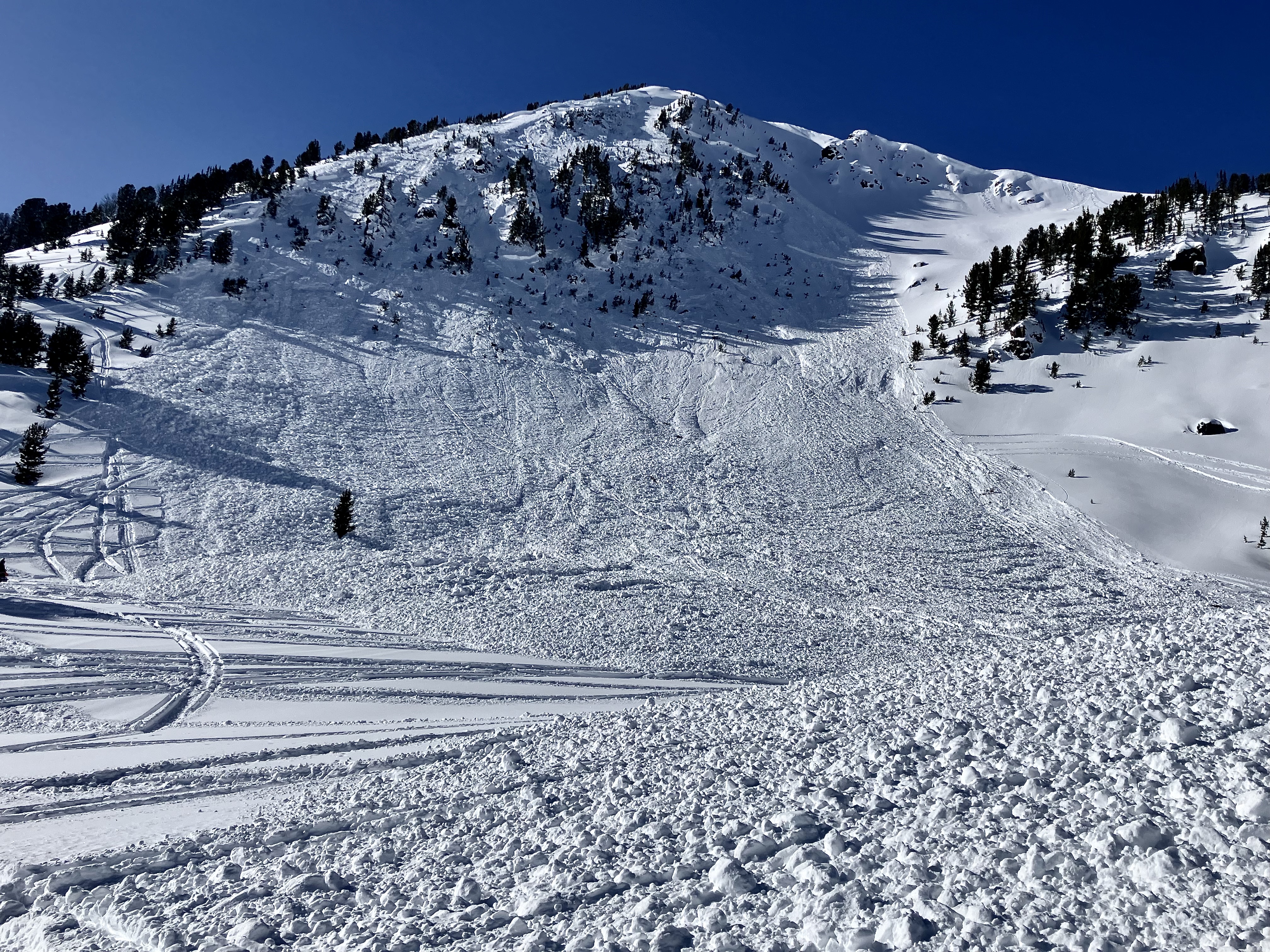
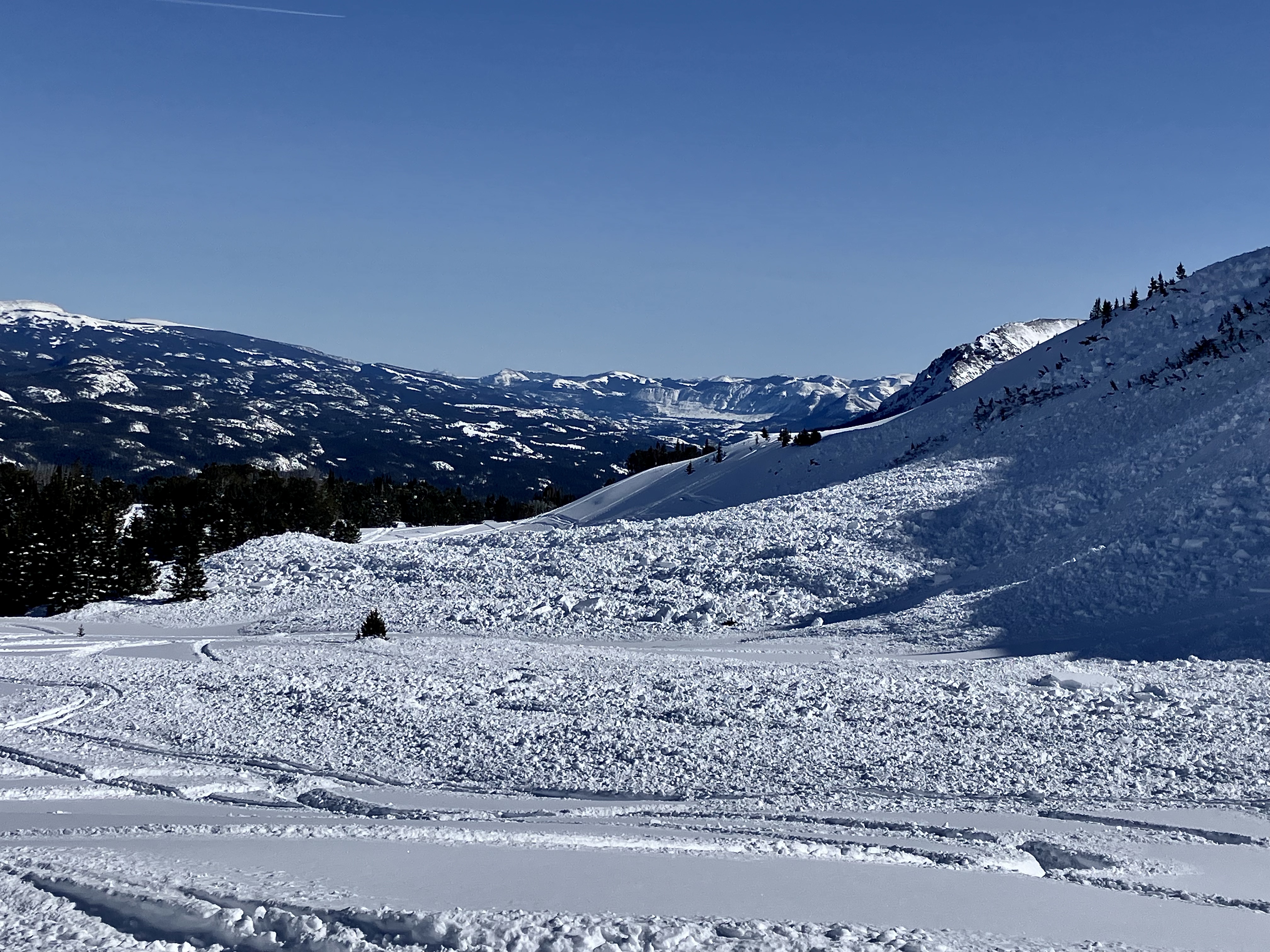
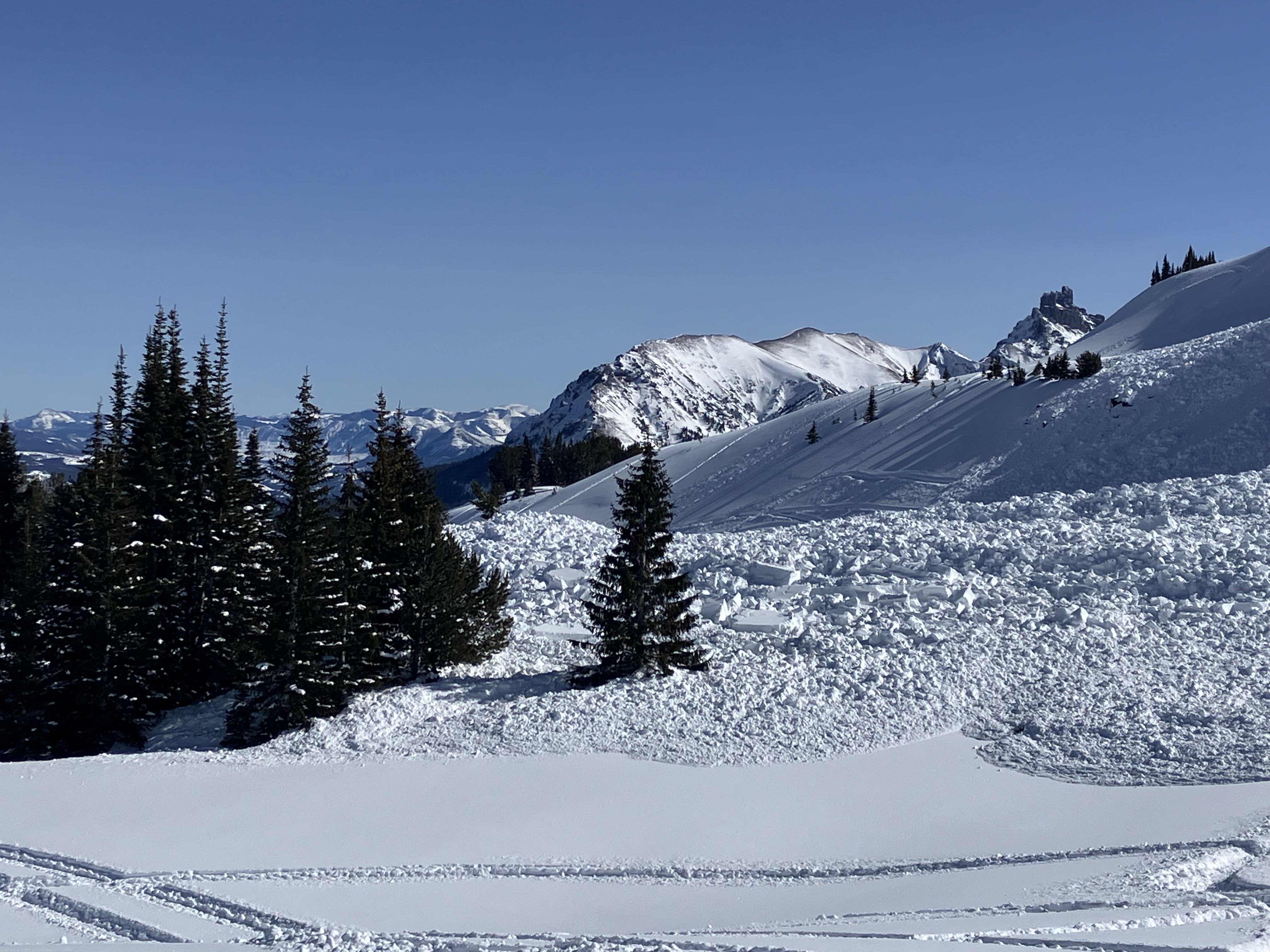
Large(D2.5) natural avalanche on Naya Nuki Sacagawea headwall.
looks to be a couple days old. Broke near the ridge and propagated far. Ran to near the end of the potential slide path
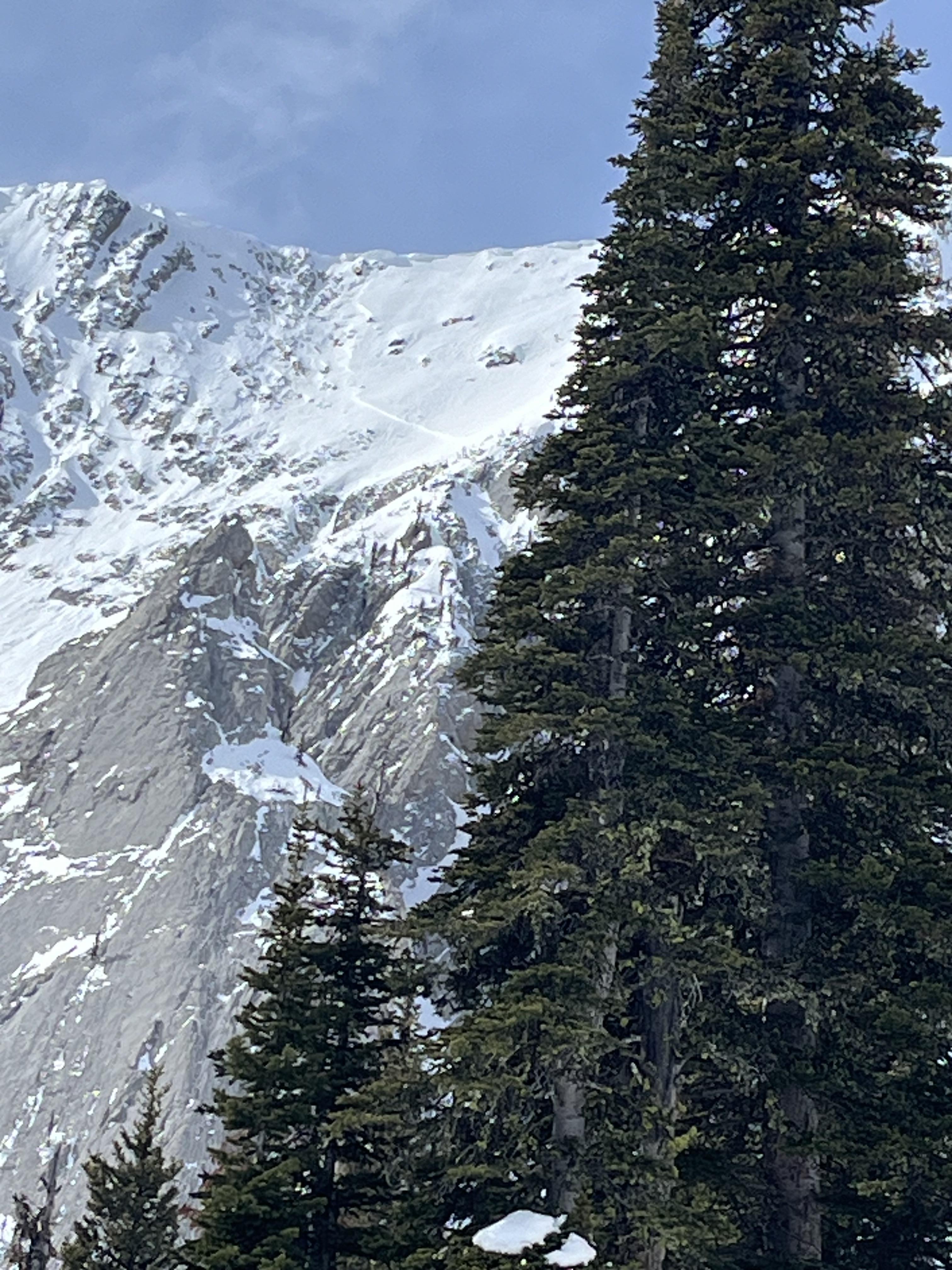
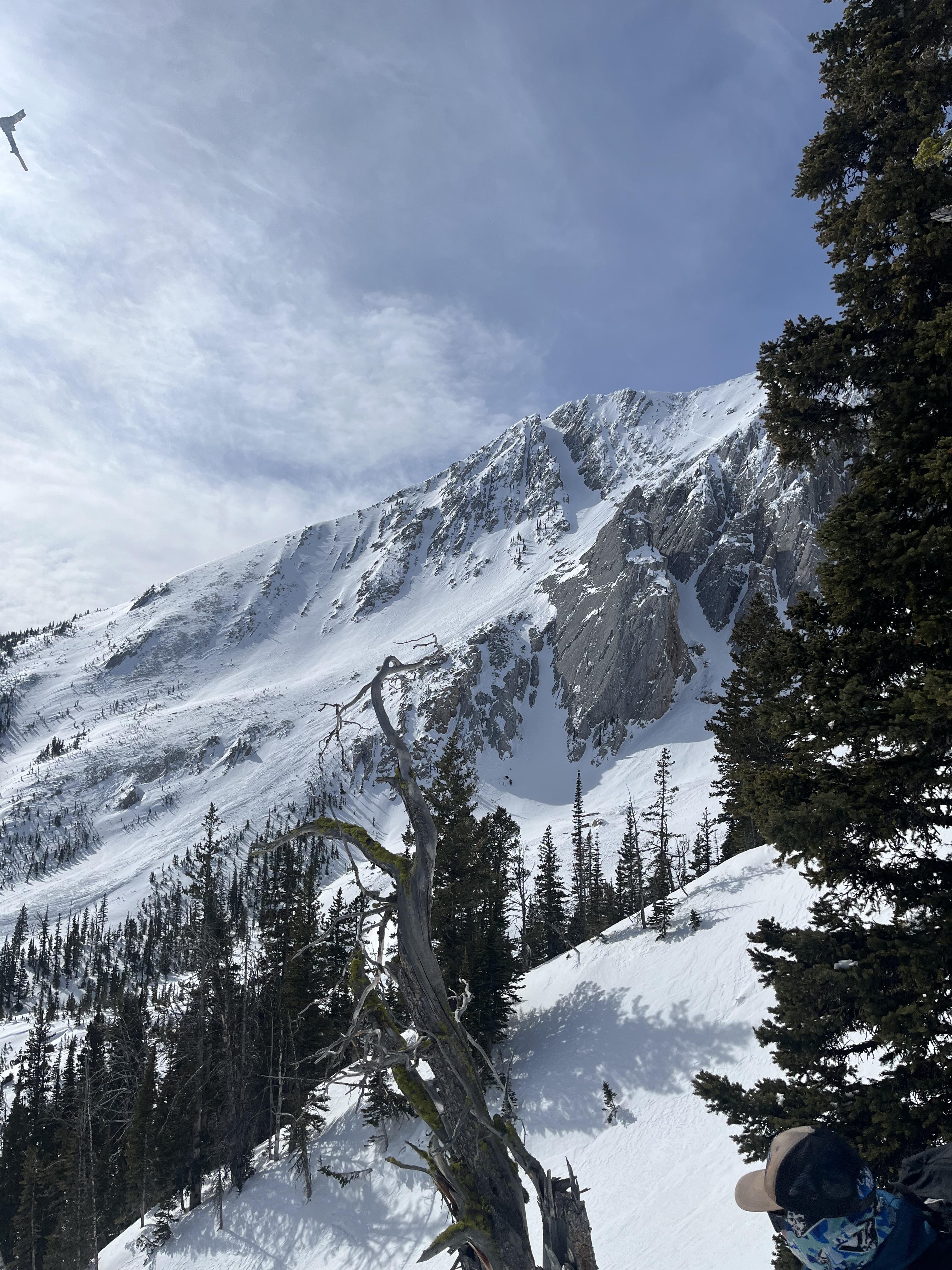
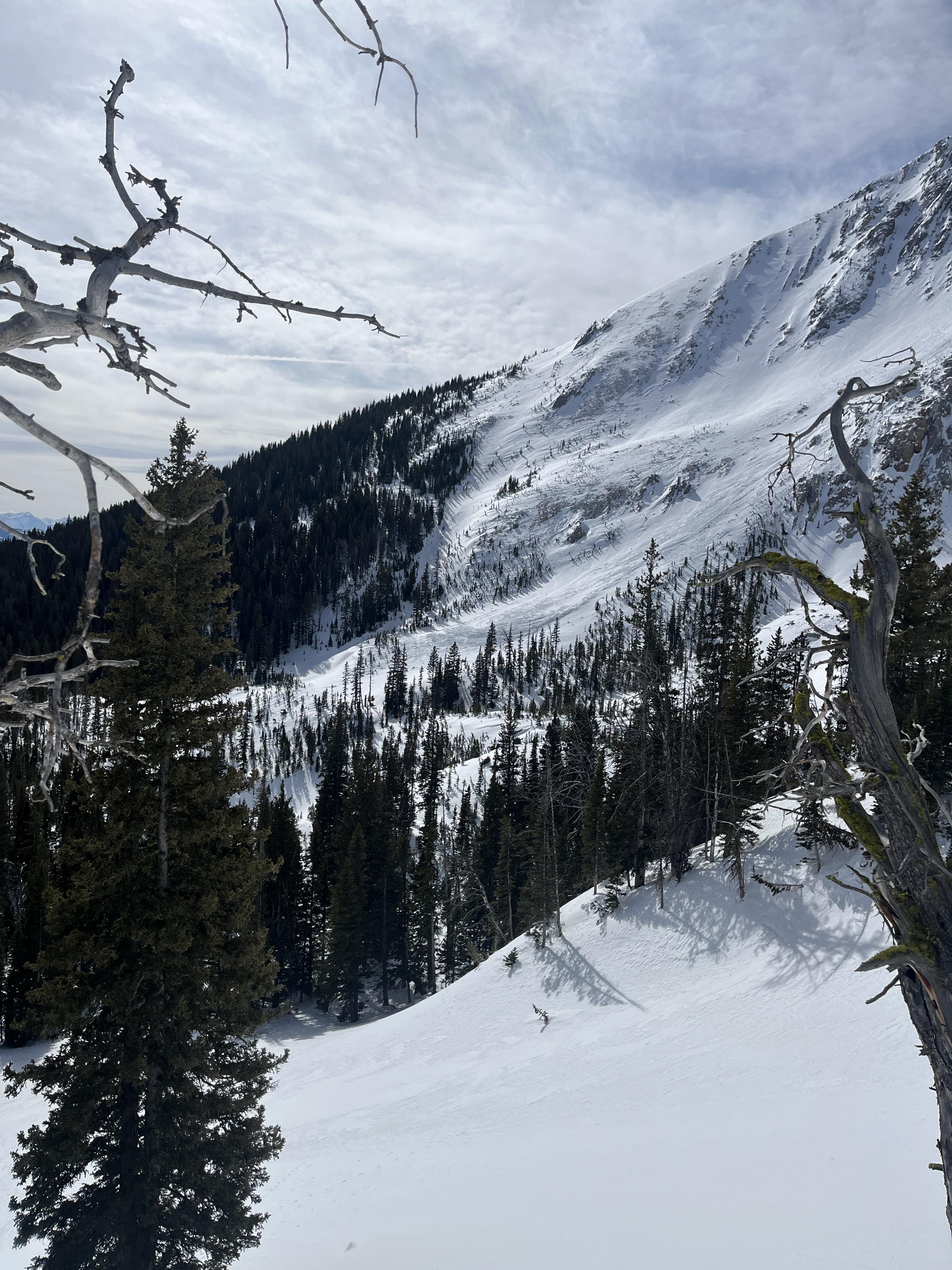
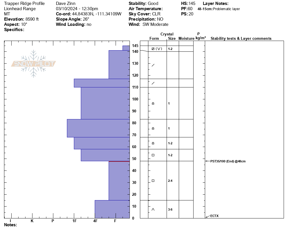
We ascended the north ramp of Trapper Ridge to the summit ridgeline. There were no signs of instability, and we did not see any recent avalanche activity in the nearby mountains of the Southern Madison Range or the Lionhead Ridge area. We dug a pit on a north-facing slope at 8600 feet elevation (ECTX and PST35/100end). The facets deep in the snowpack show no hardening trend, and they maintain their ability to propagate failure easily. Currently, it is simply a matter of the persistent weak layer having adjusted to the load they are supporting and being buried more deeply; thus, initiation of failure is more difficult. Large avalanches remain possible. The sun and warm temperatures affected the snow surface in the eastern and southern aspects (and I assume the western). A cool breeze kept any wet snow hazard from developing before we left at 2 PM. I suspect it did not develop today.
Of note, surface snow was weakening on northern aspects with a 3-4 cm layer of near surface facets and surface hoar. We will have to see how this behaves when it gets buried by new snow starting tomorrow.
Full Snow Observation Report
MODERATE seems appropriate for now. We did cross through some avalanche terrain but the area we skied was generally low-angle.

We rode over Daisy Pass and out to the pass between Wolverine and Abundance. Low on Daisy Road along the steep creek walls we saw three recent 2'+ deep avalanches. each 70-100' wide. HS-R4-D2-O. One looked within the last day or two and the other two were maybe 3-4 days old. Triggers unknown, there were various ages of sled/snowbike tracks nearby. We saw older crowns (4-7 days old) on east and north Miller Mtn.
Between Miller and Wolverine there was a recent large avalanche that I would guess was triggered yesterday. 3-6' deep, 250-300' wide. HS-R4-D2.5-O. Video and photos attached. Given the recent human triggered and natural avalanches, we expect dangerous conditions will continue to start the week.
Partly sunny skies, light to moderate winds with some stronger gusts and snow transport at ridgelines. Snow surface had a thick crust on any slopes that were not fully shaded yesterday. Rode back to town at noon and snow surface was still mostly frozen. Cloud cover increased through the day.
Full Snow Observation Report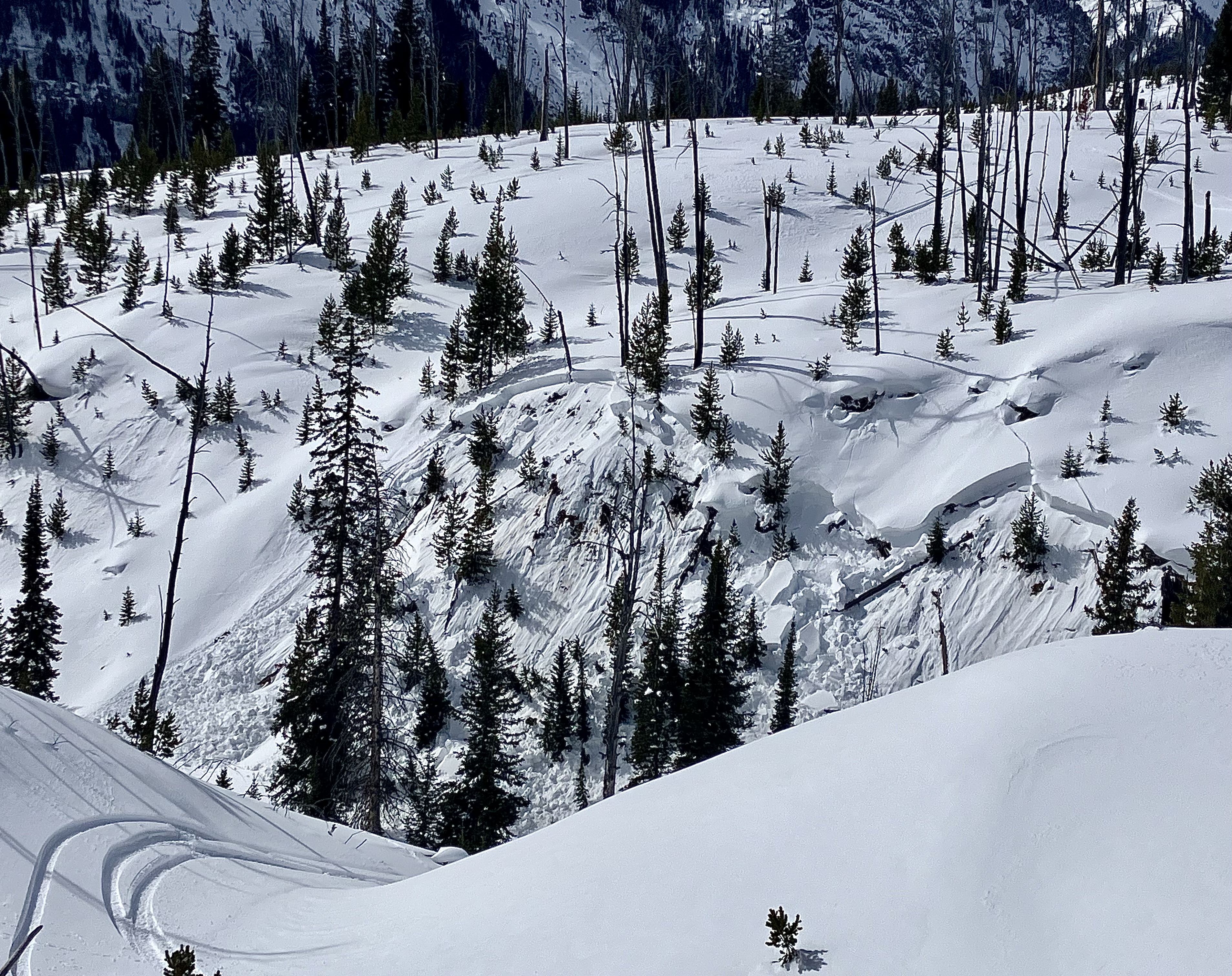

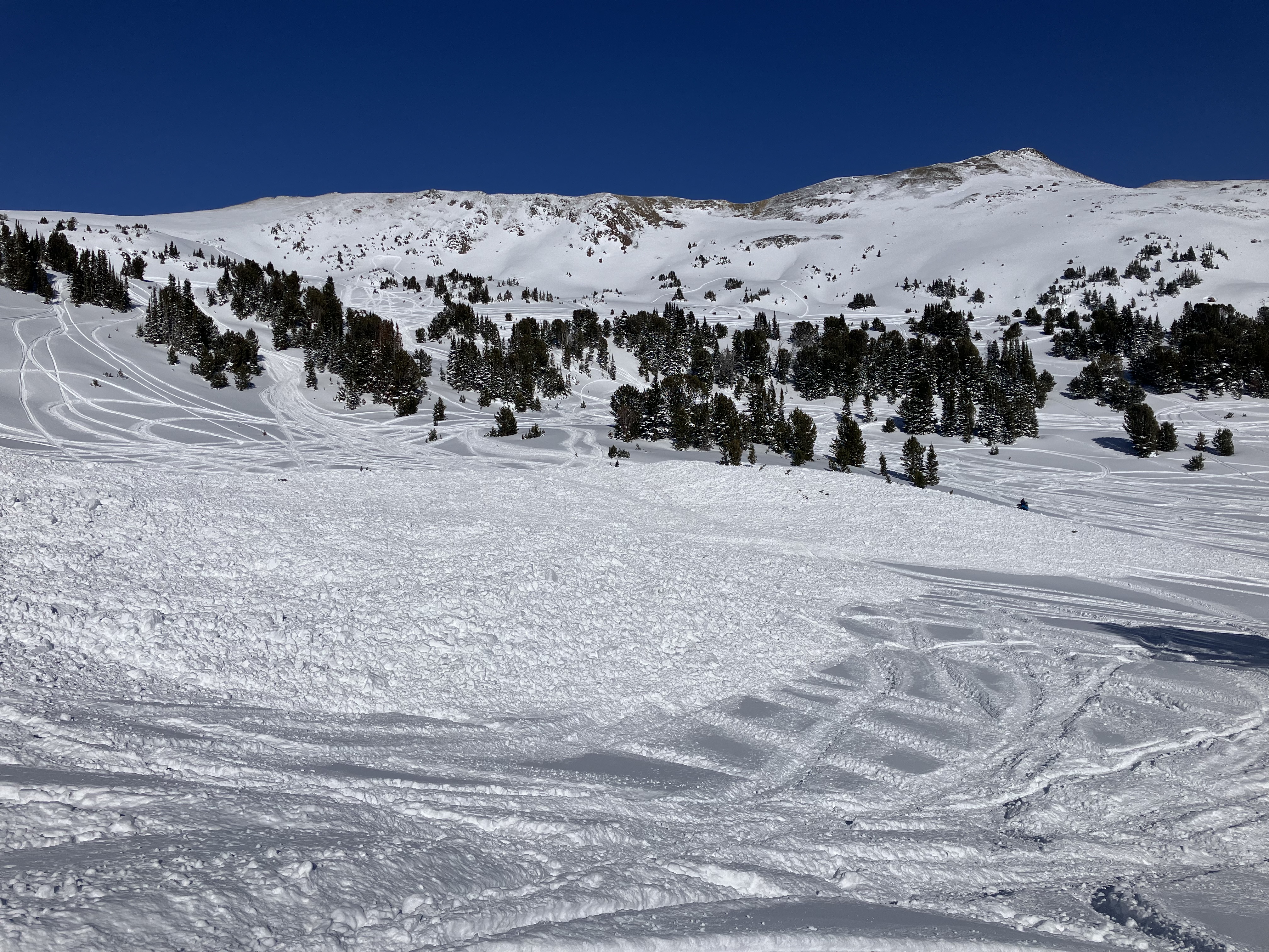
Deep Avalanches all over the mountain in multiple spots. One was spread across the Ross Peak approach gully and debris ran all the way to the bottom of the gully.
Full Snow Observation Report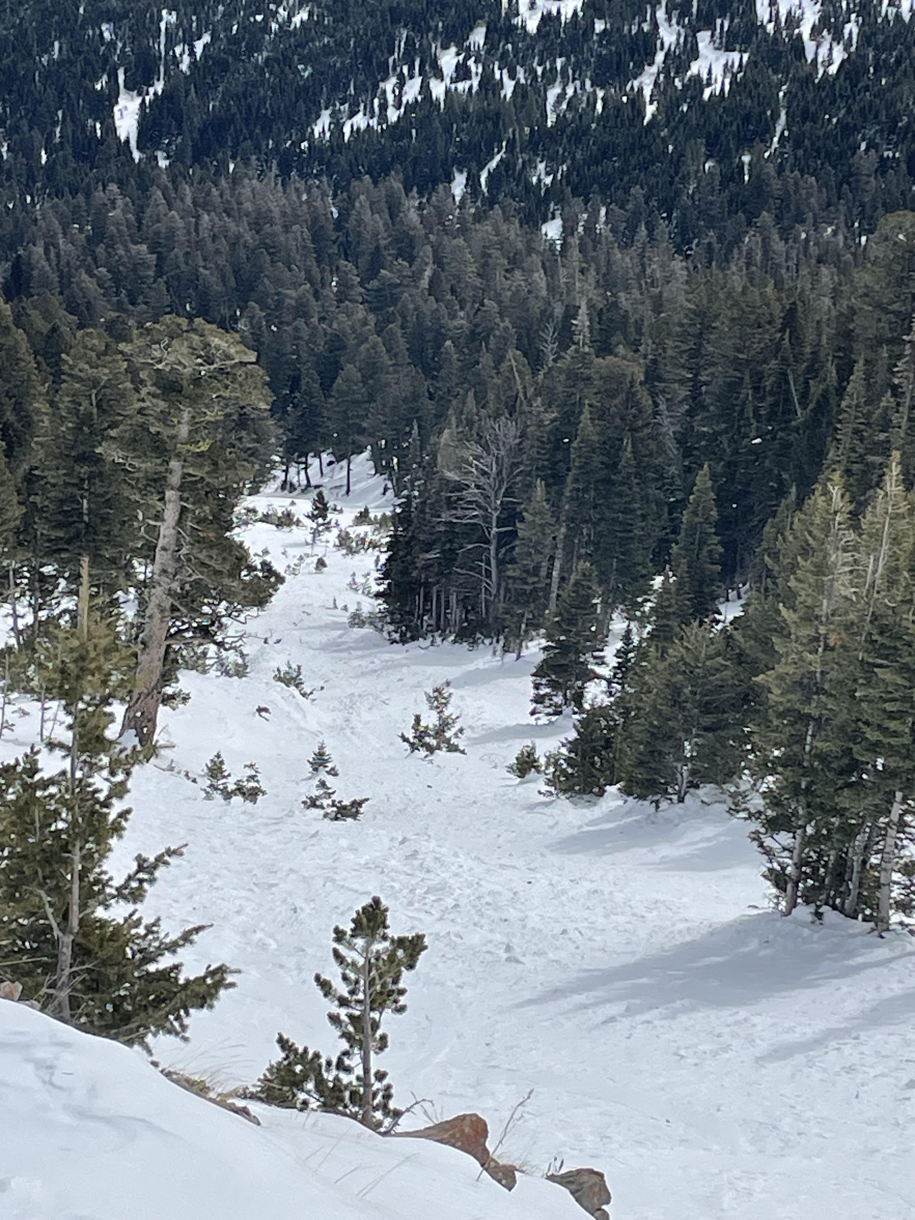
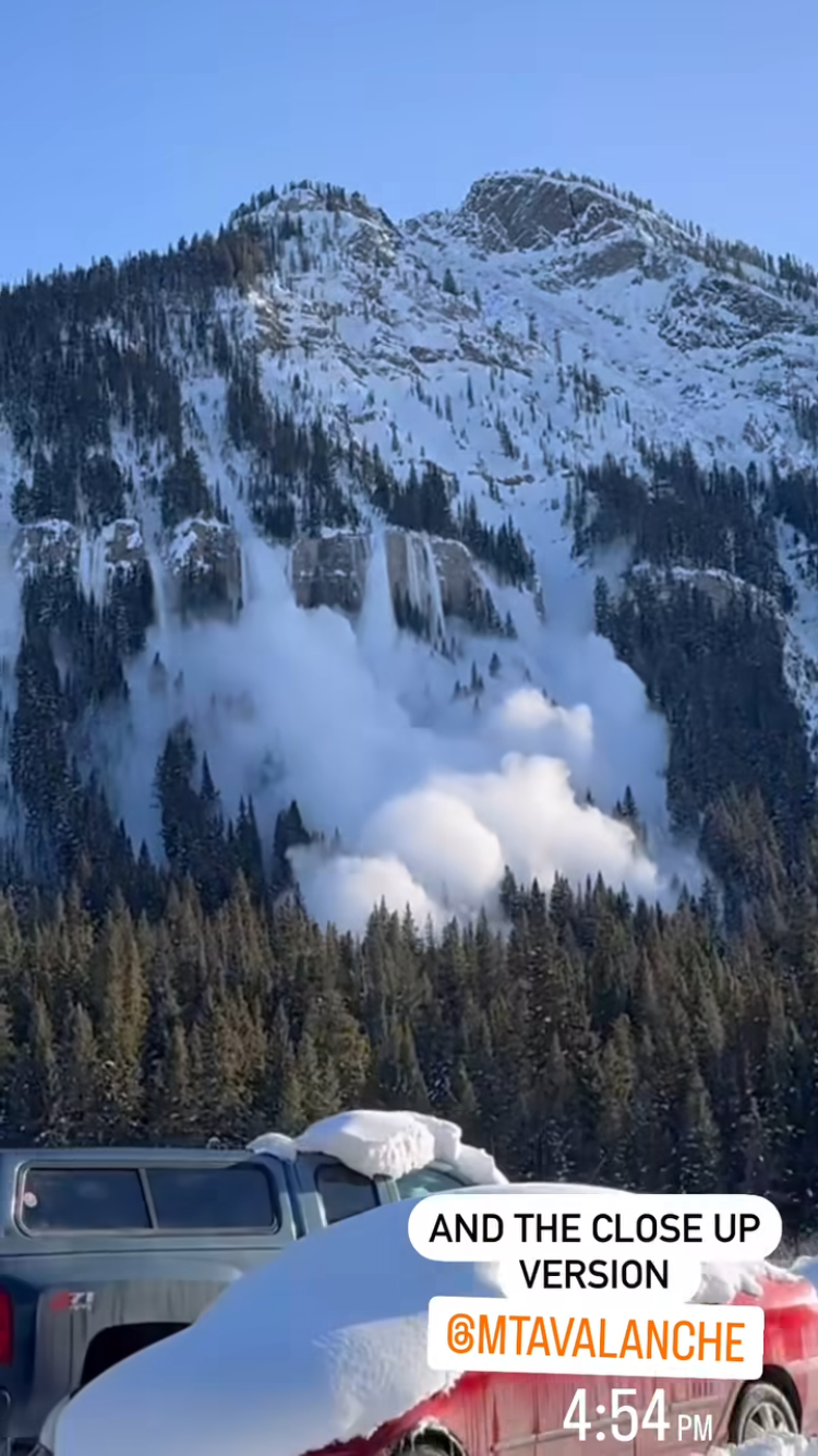
A natural avalanche was witnessed on the north side of Republic Mtn. on 3/9 at 4:54pm. It appeared to break around 3 feet deep.
Full Snow Observation Report
Saw a couple avalanches today in the Woody Creek Cabin area
First was in Woody Creek, right by the waterfall. D2, crown was up to 5 feet deep. NE facing
The other was on the backside of High Hayden, in Pilot Creek. This one ran probably 1000 feet. SE facing
Full Snow Observation Report
Natural avalanche in Beehive Basin. On eastern aspect. (the same aspect as yesterday's "intentional cornice drop avalanche", 3/10th of a mile north) guessing the elevation is around 9,900-9,650ft.
Full Snow Observation Report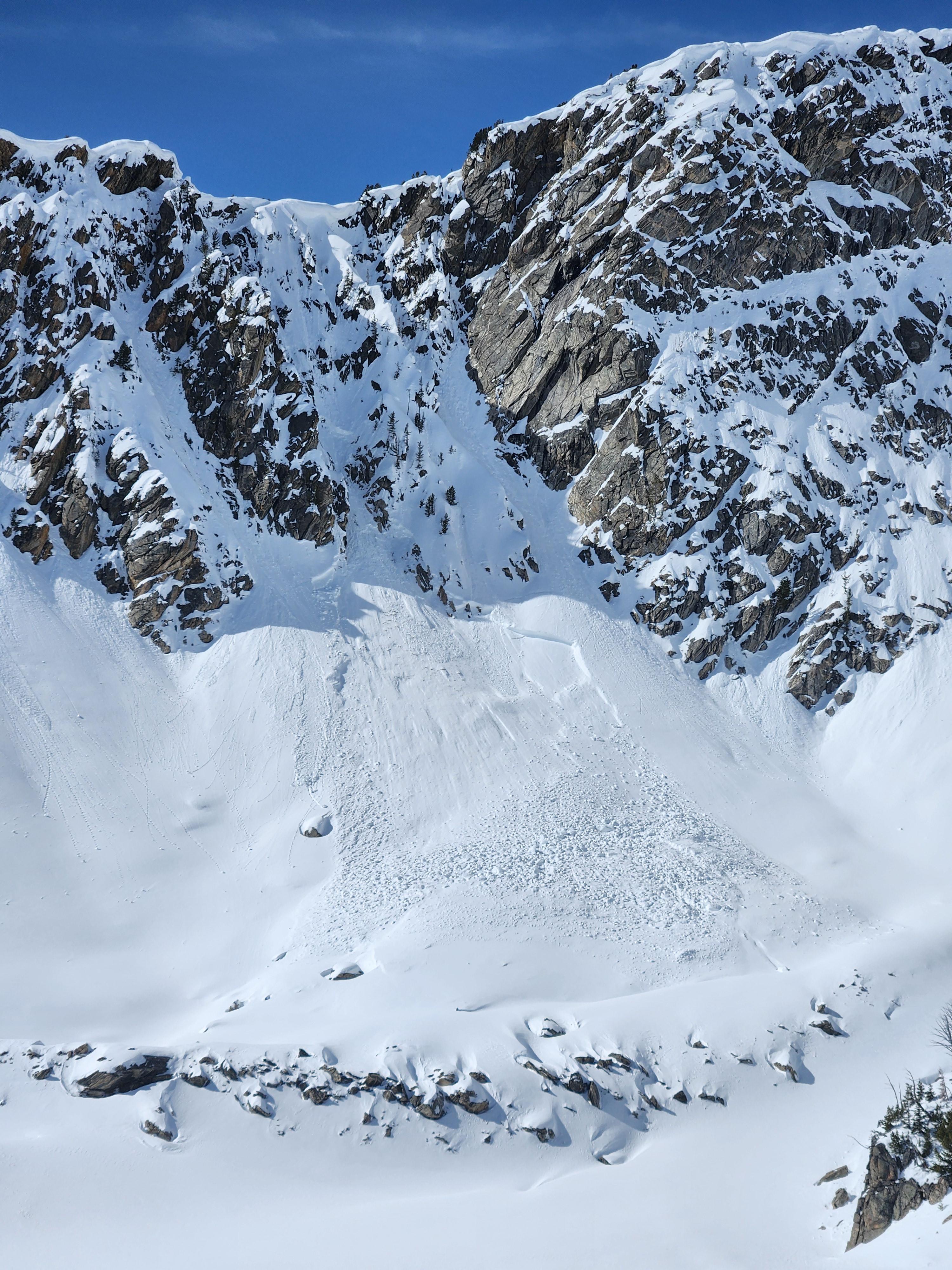
From IG 3/9/24: "Currently on the throne. Things warmed up quickly this morning. Wet loose, east aspect, 8500’, 10:30"
Full Snow Observation Report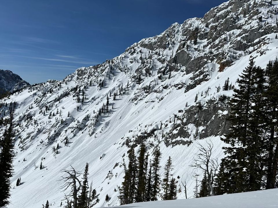
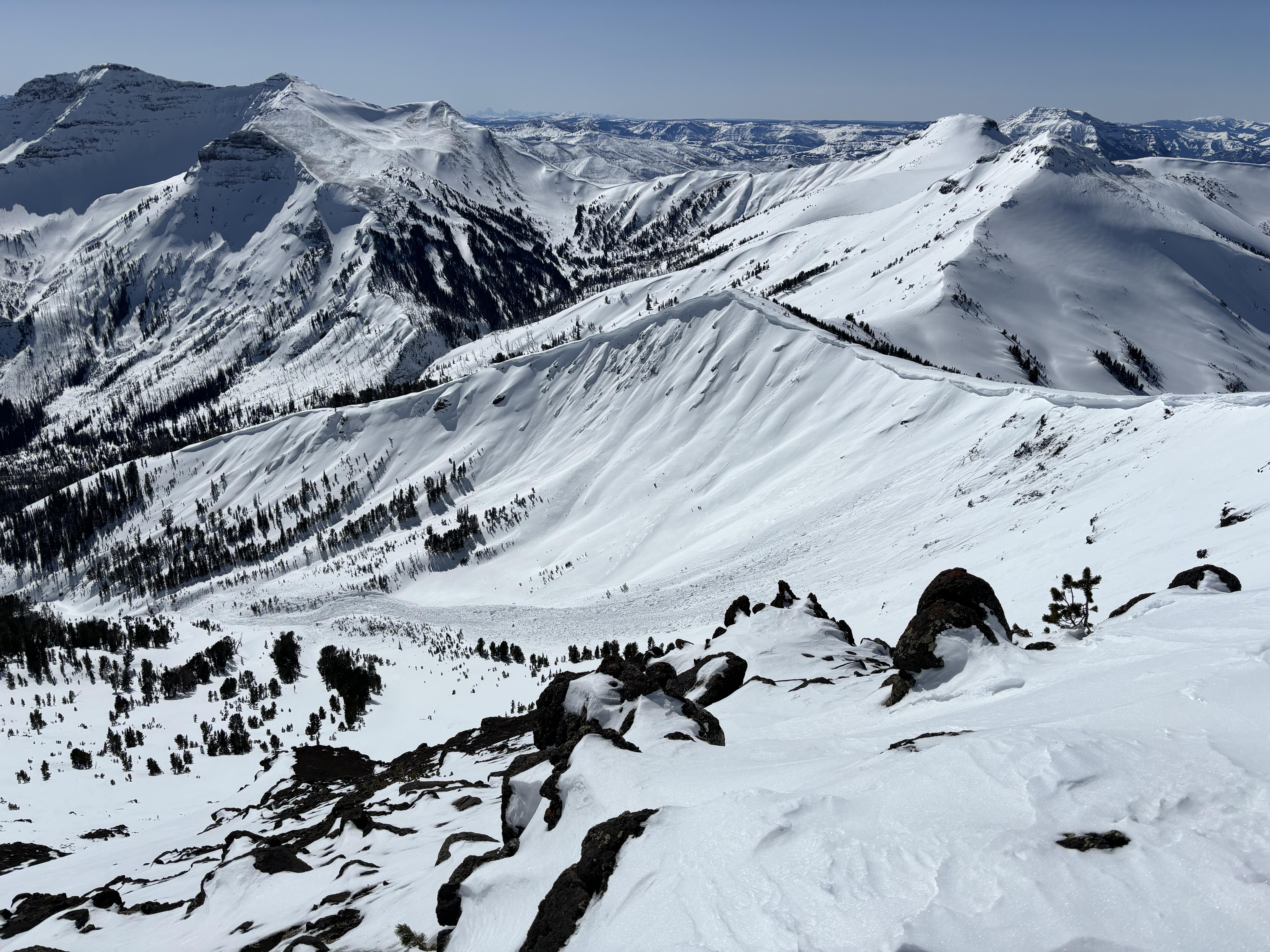
From the ridge between Blackmore and Elephant we saw multiple natural large slab avalanches in the upper South Cotttonwood drainage. More natural avalanches not shown, mostly on northerly aspects. Appeared fairly recent and deep. Decided against skiing Alex Lowe and opted for good turns on Blackmore. Warm with moderate/strong southwest winds, minor transport.
Full Snow Observation Report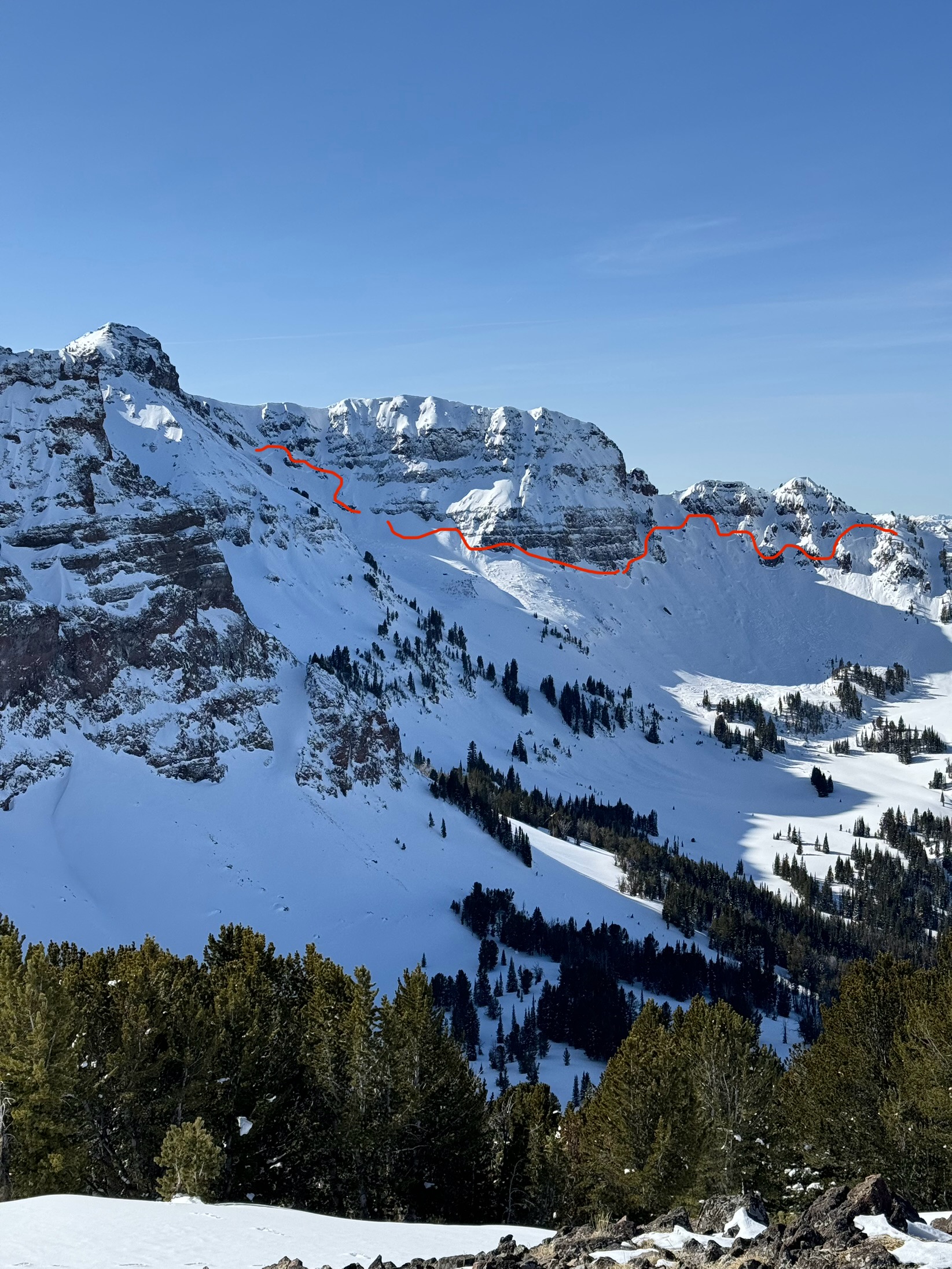
Skied into Frazier basin today. Saw multiple wet loose slides on the SE face across the basin. Winds were stripping many ridge lines and loading N aspects. No avalanches related to wind loading were observed. Pit at the bottom of the basin on a SE aspect around 8200 feet had HS 185 and showed Ectx.
Full Snow Observation Report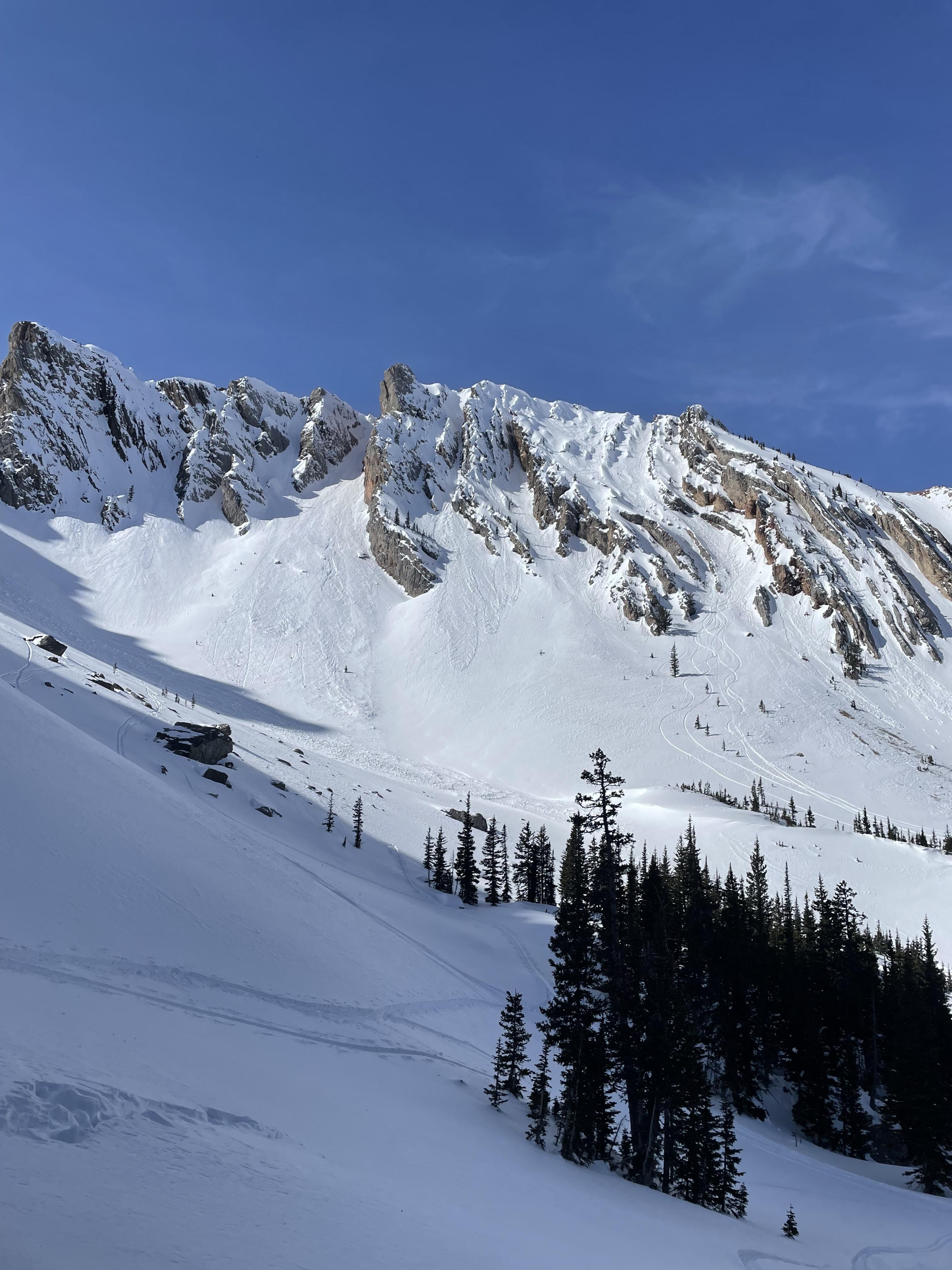
We saw the slide happen. Maybe 200 yards wide 4 to 10 ft deep crown. Triggered by a guy riding along in the run out zone, he was partially buried and got himself out. One of the kids has some photos in this phone, we will try to send them shortly.
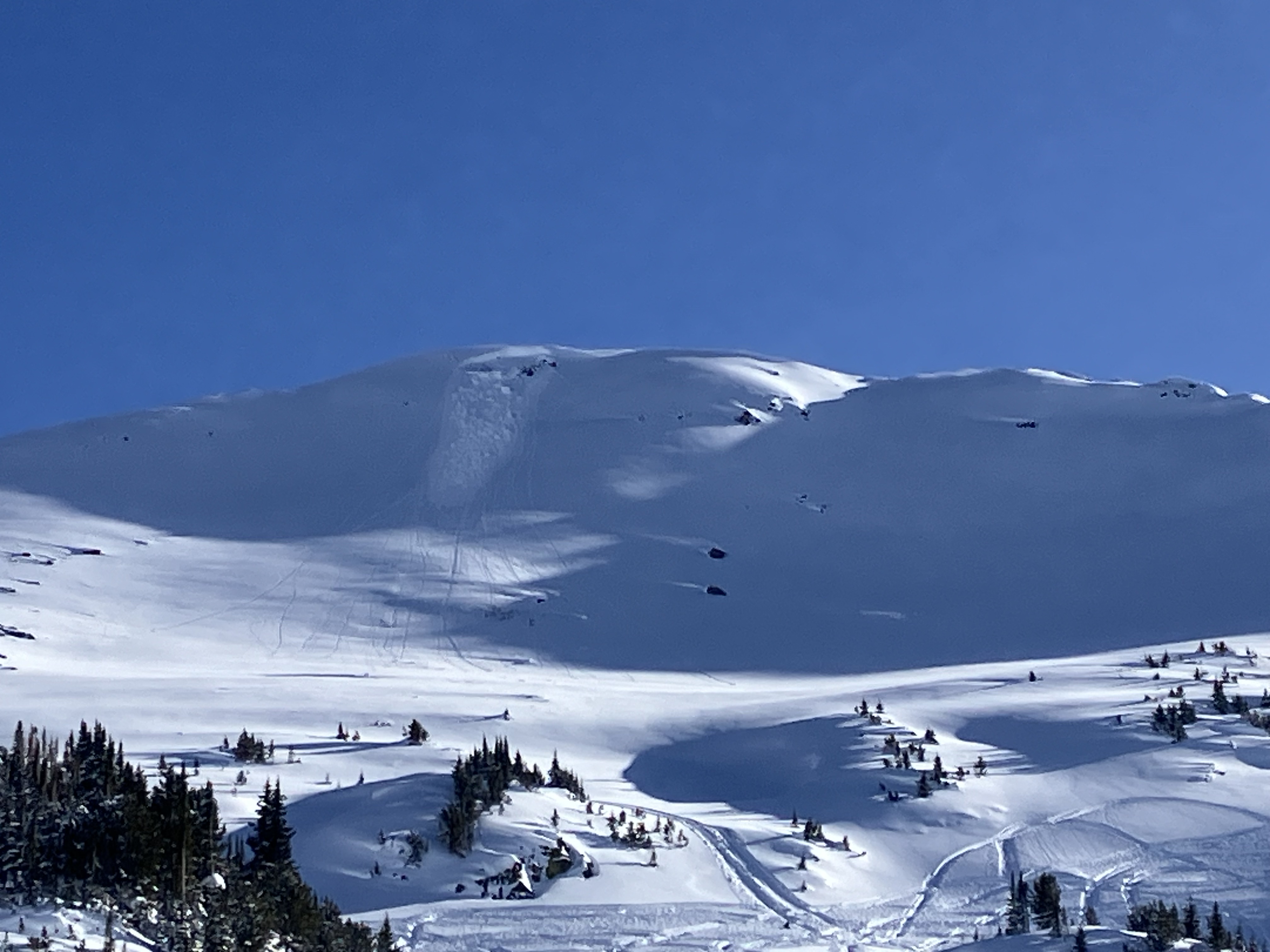
Full Snow Observation ReportWe rode to Round Lake and around the north and west side of Sheep, and back out through Round Lake. There was a big avalanche on the northeast side of Sheep that was previously not reported. It was there this morning so maybe happened yesterday. 6-8'+ deep, 500' wide R4-D3-O.
This morning we saw previous avalanches on Henderson Mtn. in better light and got a photo of one on the lower Henderson Bench. Showing wide propagation through thick trees.
Temps were warm under clear skies with calm wind. Snow surface was getting moist in the afternoon on sunny slopes.
Full Snow Observation Report
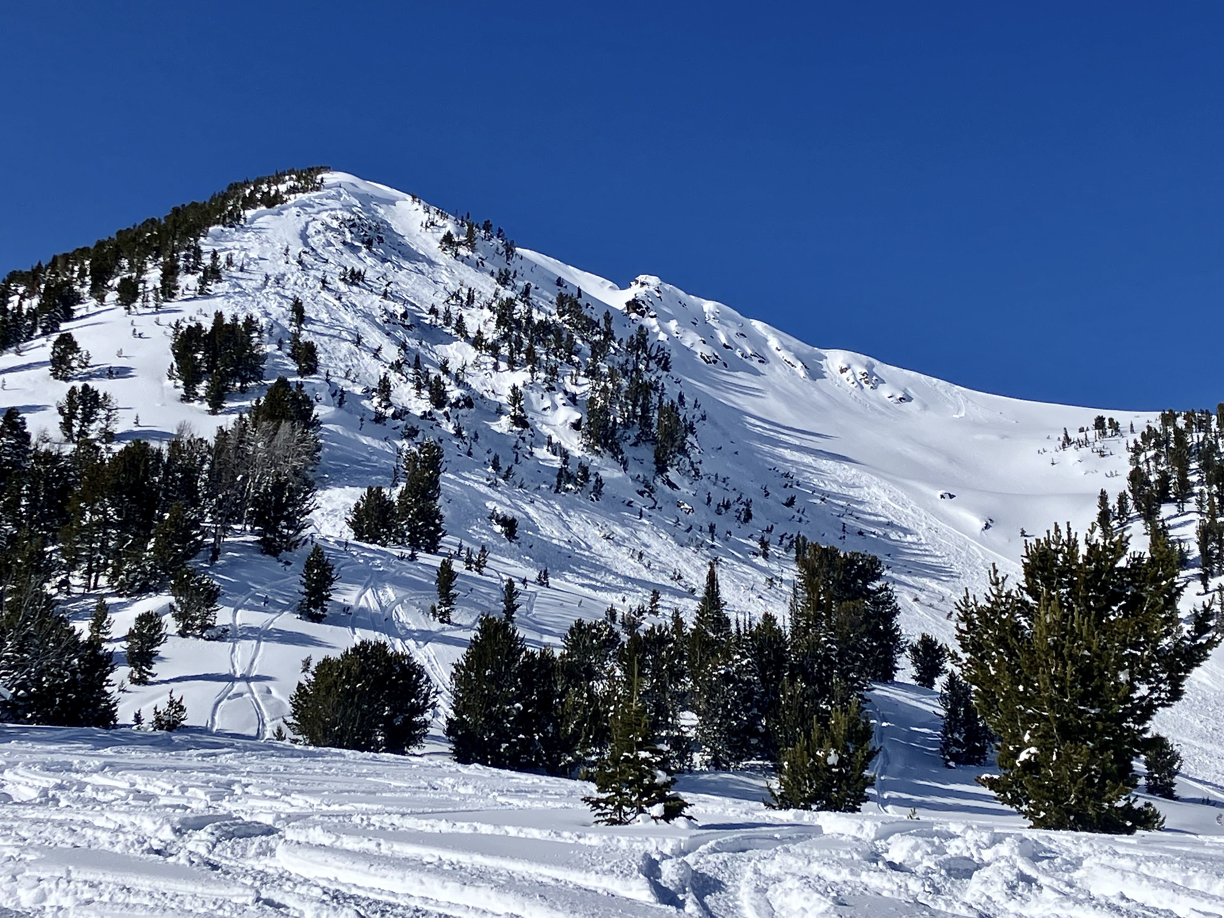
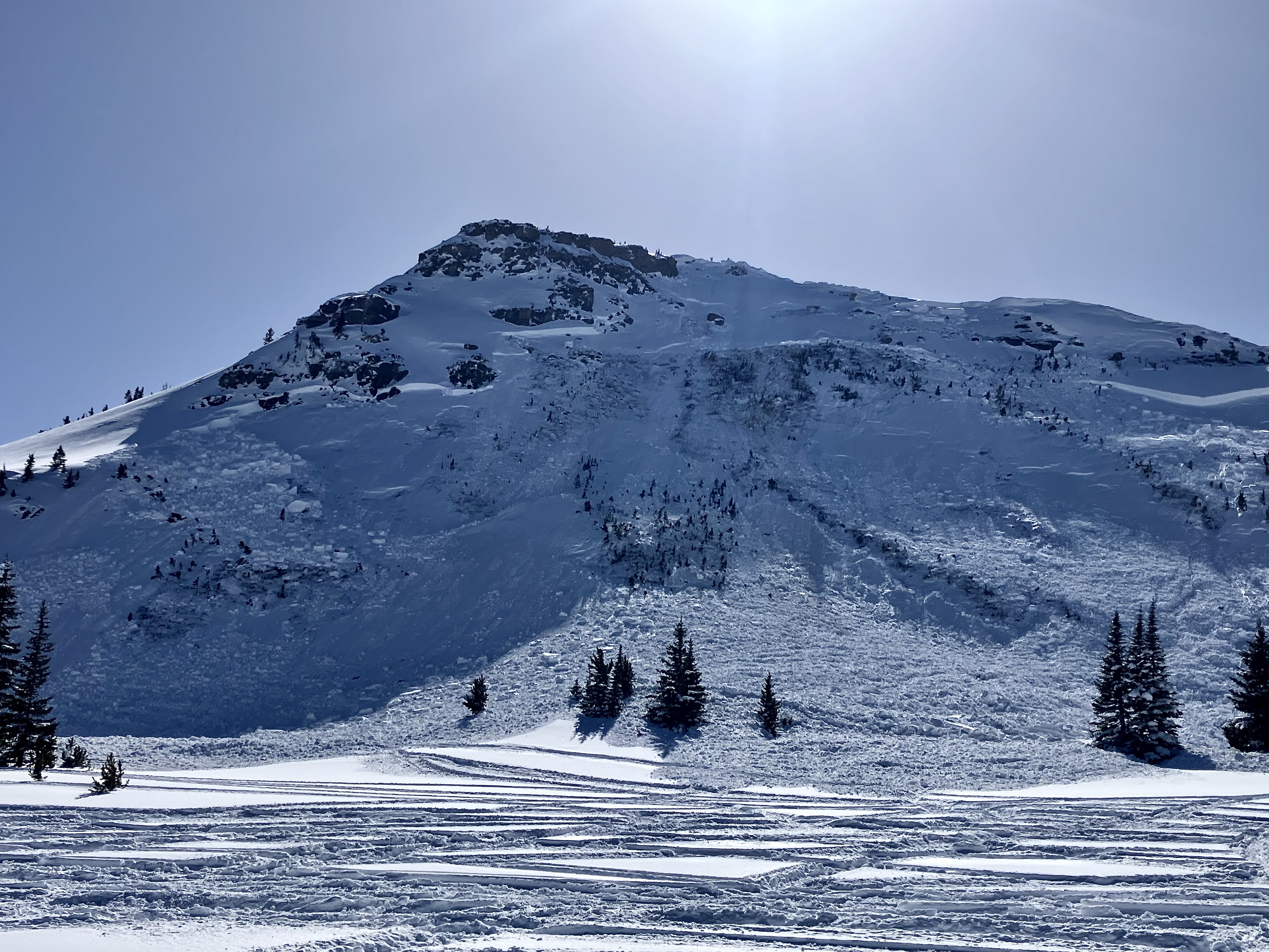
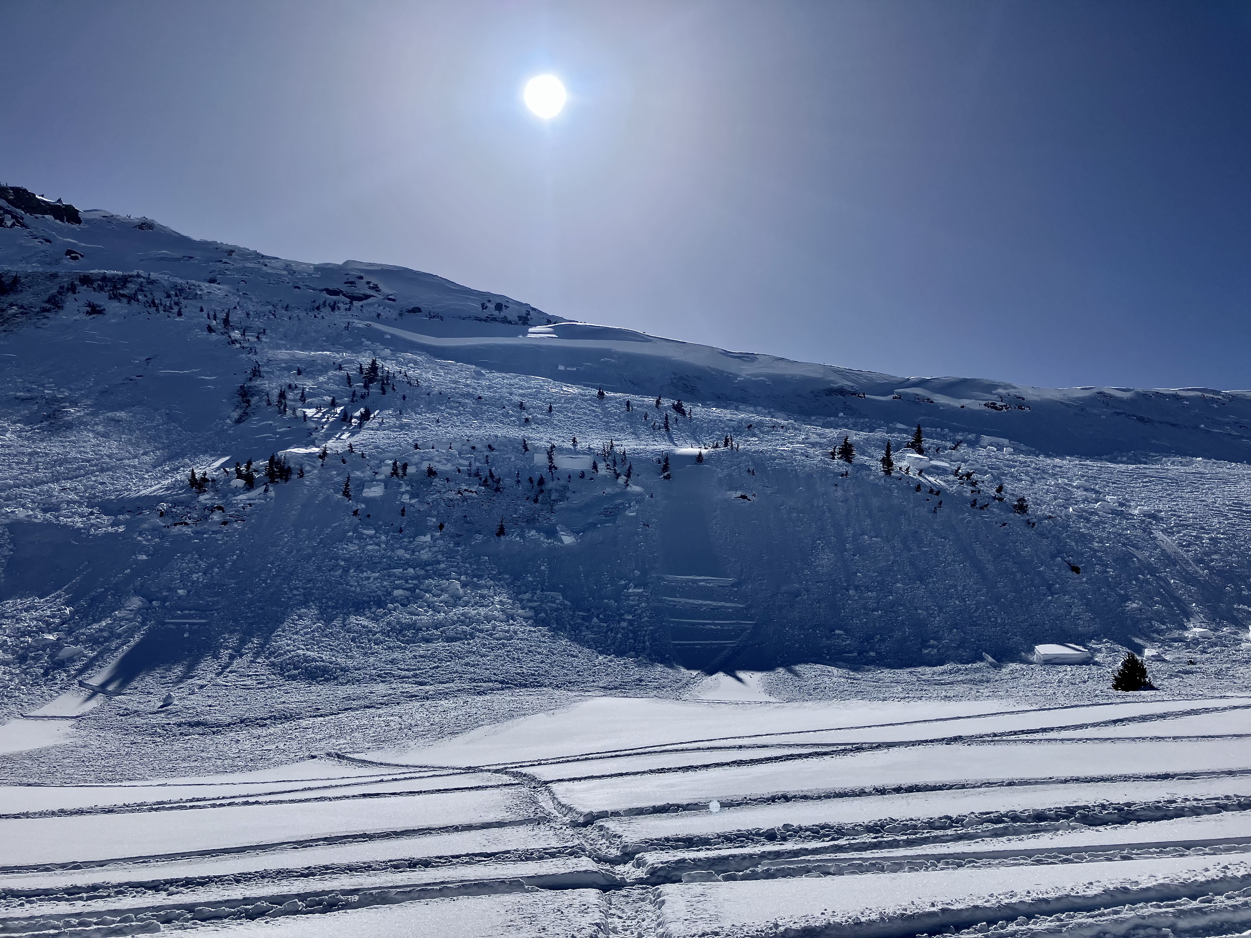
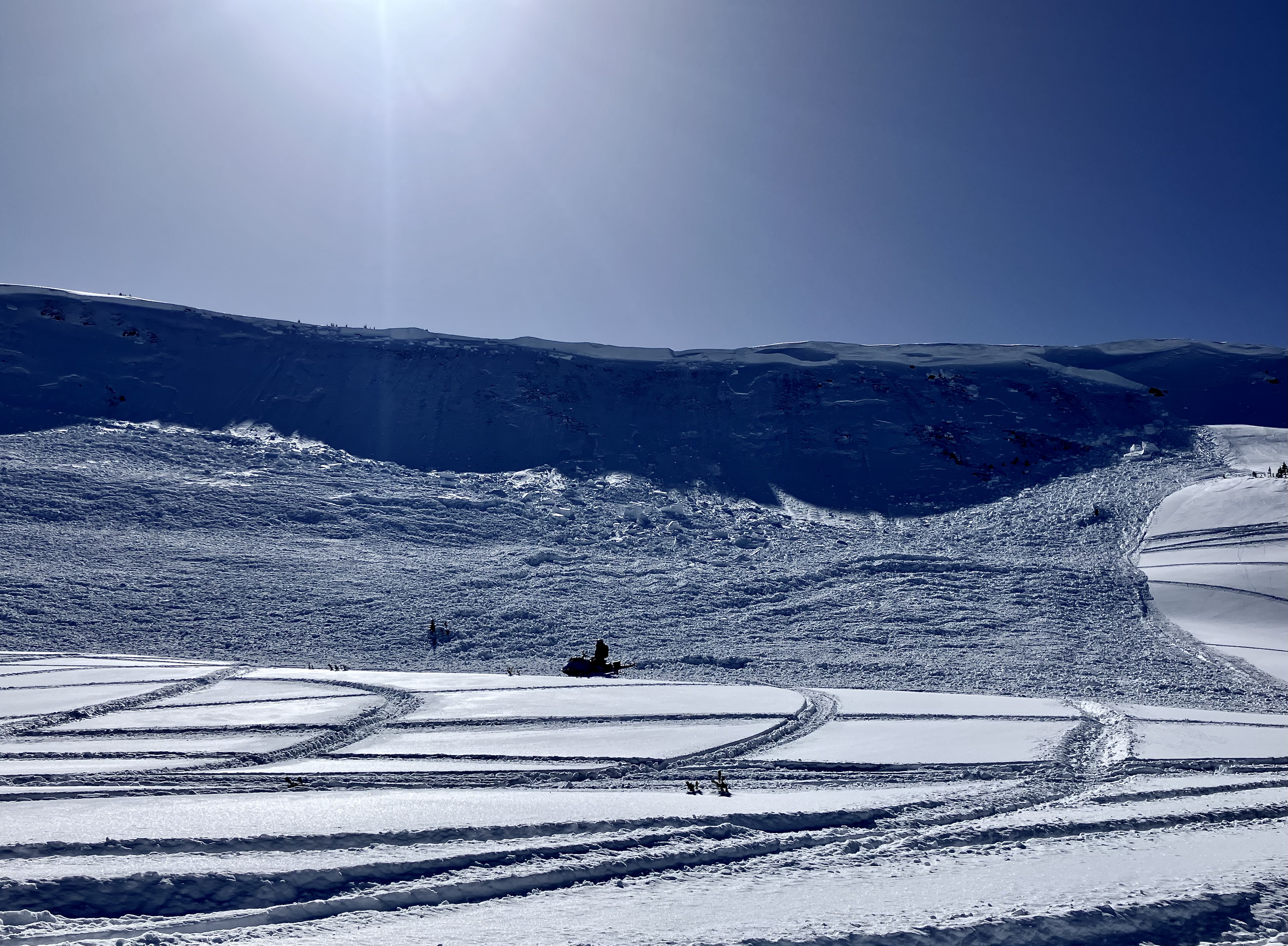
Saw a large slide (D2.5, R3 or 4) on Ross East shoulder that likely occurred in the March 3/4 timeframe. 3 to 4 feet deep crown in places. Looked around at the bed surface which was nearly to the rock slabs underneath.
Full Snow Observation Report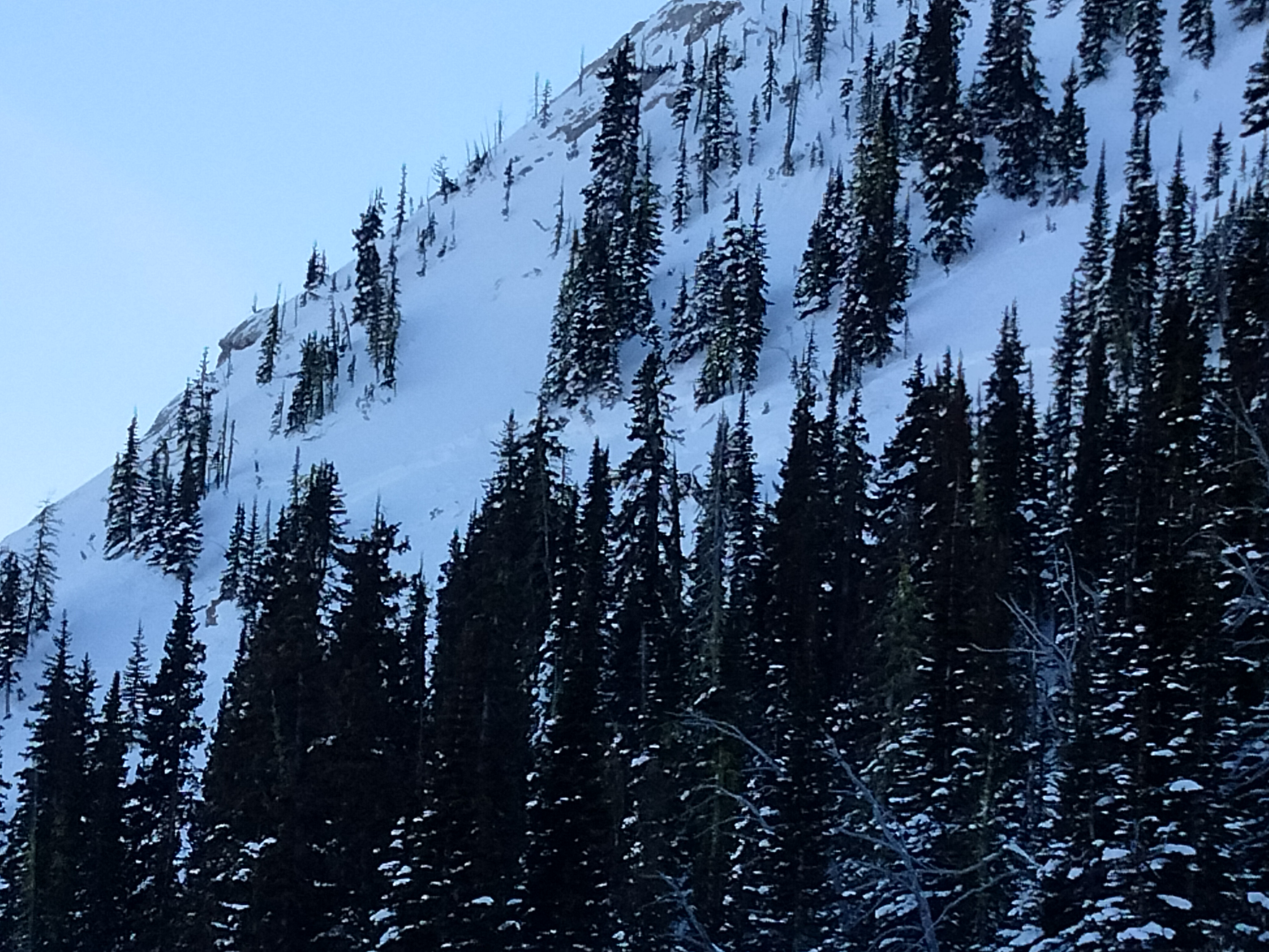
There were two skier-triggered avalanches on Saddle Peak today. The first was relatively small, estimated depth of less than a foot. The second occurred later in the day and was much more significant.
Downhill winds transported snow all day, loading wind-drifted snow onto slopes at upper and mid-elevations. At 1 PM, a solo skier descended Quarter Saddle toward Spencer's and Going Home Chute. The skier released a wind-slab avalanche that broke about a foot deep approximately 300 feet above the large cliff band on Saddle. The first release triggered a secondary slab that broke more widely (estimated 200' wide) and deeper (1-3 feet deep). The avalanche ran over the large cliffs into Going Home Chute. Bridger Bowl Ski Patrol interviewed the skier who triggered the avalanche along with a representative from GCSAR and the GNFAC. Based on the interview, the group believed it was unlikely that additional skiers were involved. Because of the interview, concerns about scene safety, and the timing of the avalanche, no search was performed on the ground. The team used binoculars from within the boundary of the ski area to look for obvious indications of a burial.
Full Snow Observation Report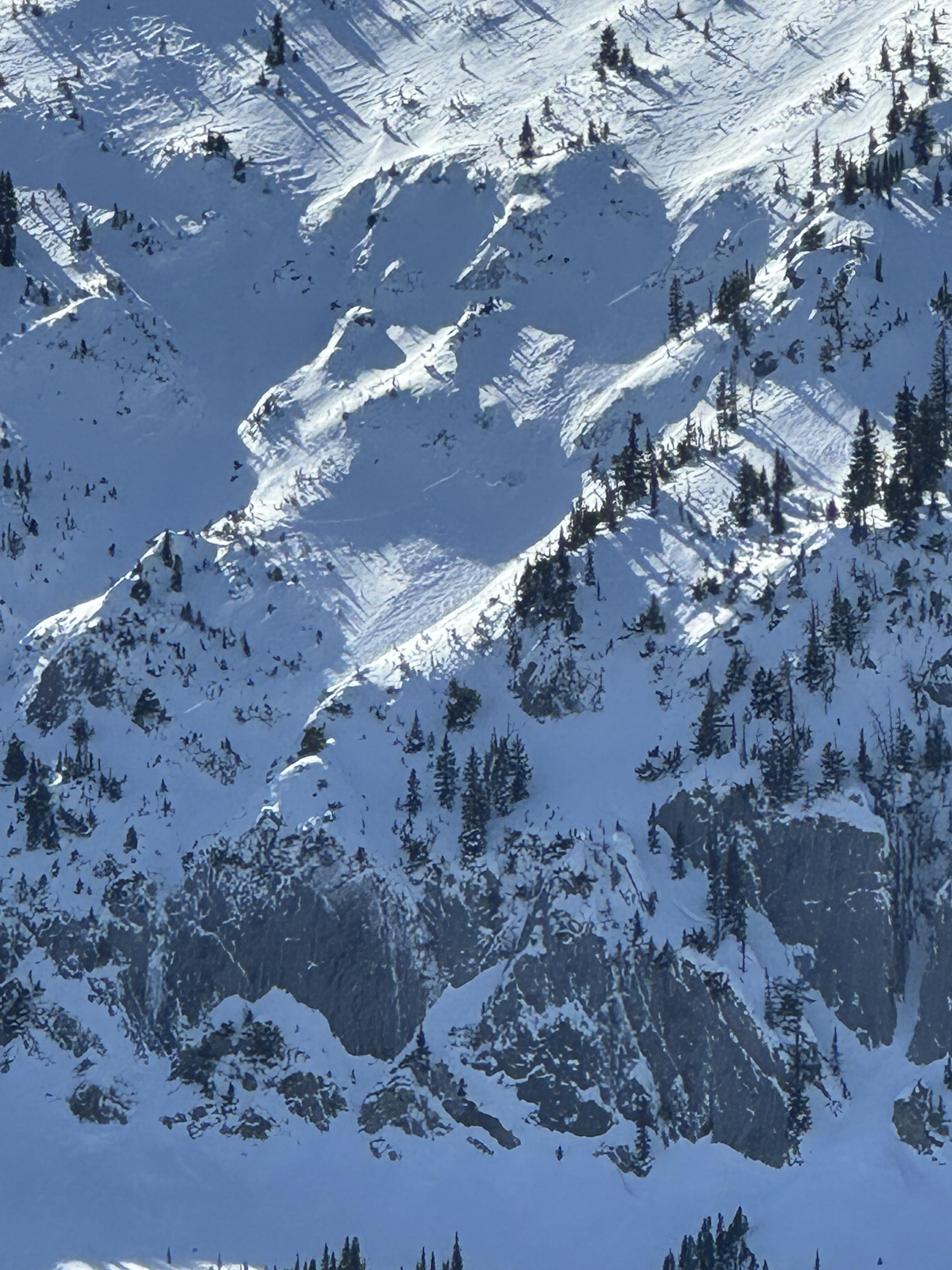
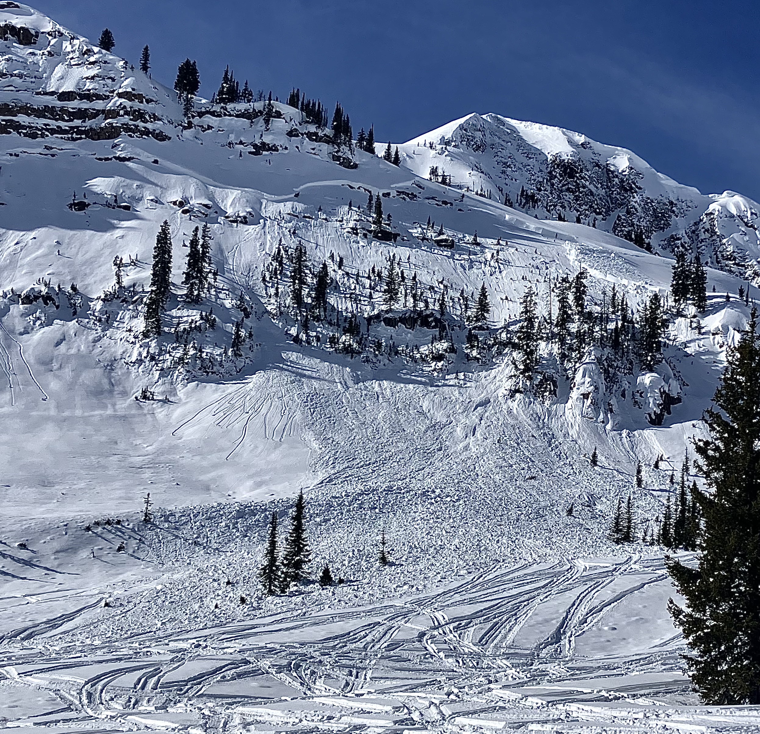
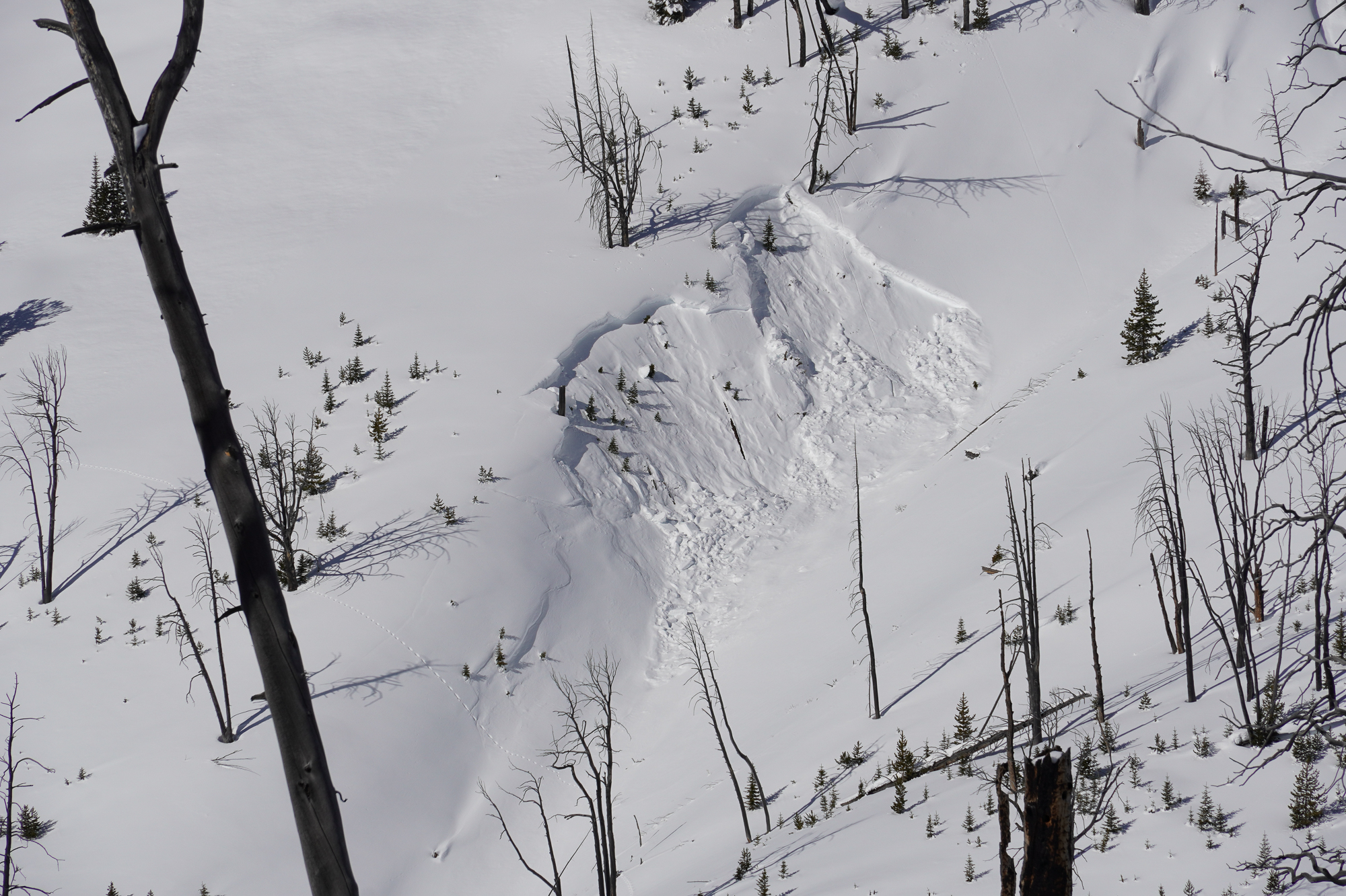
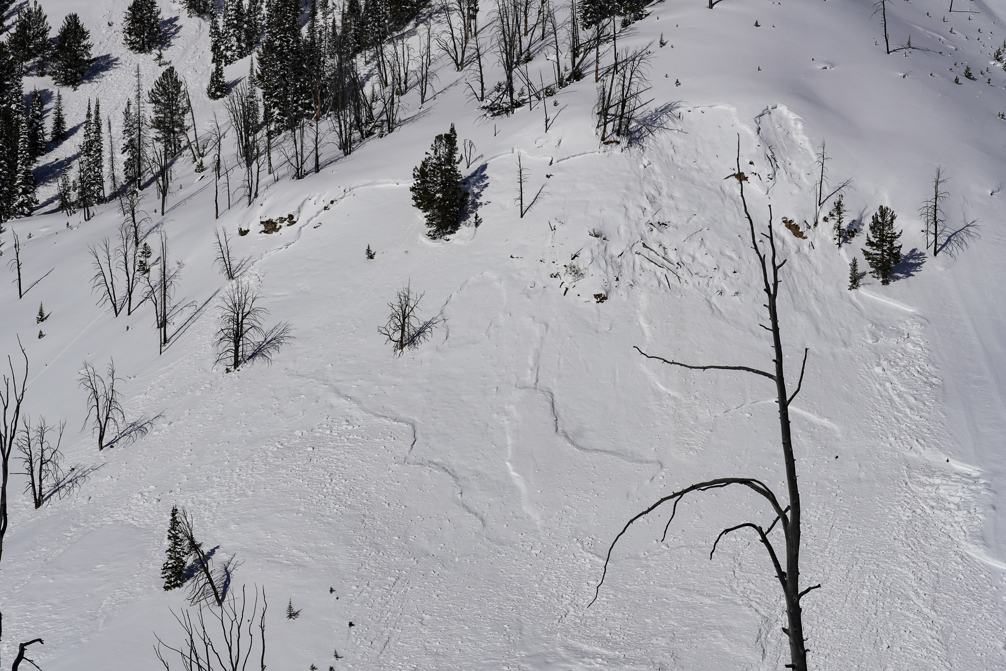
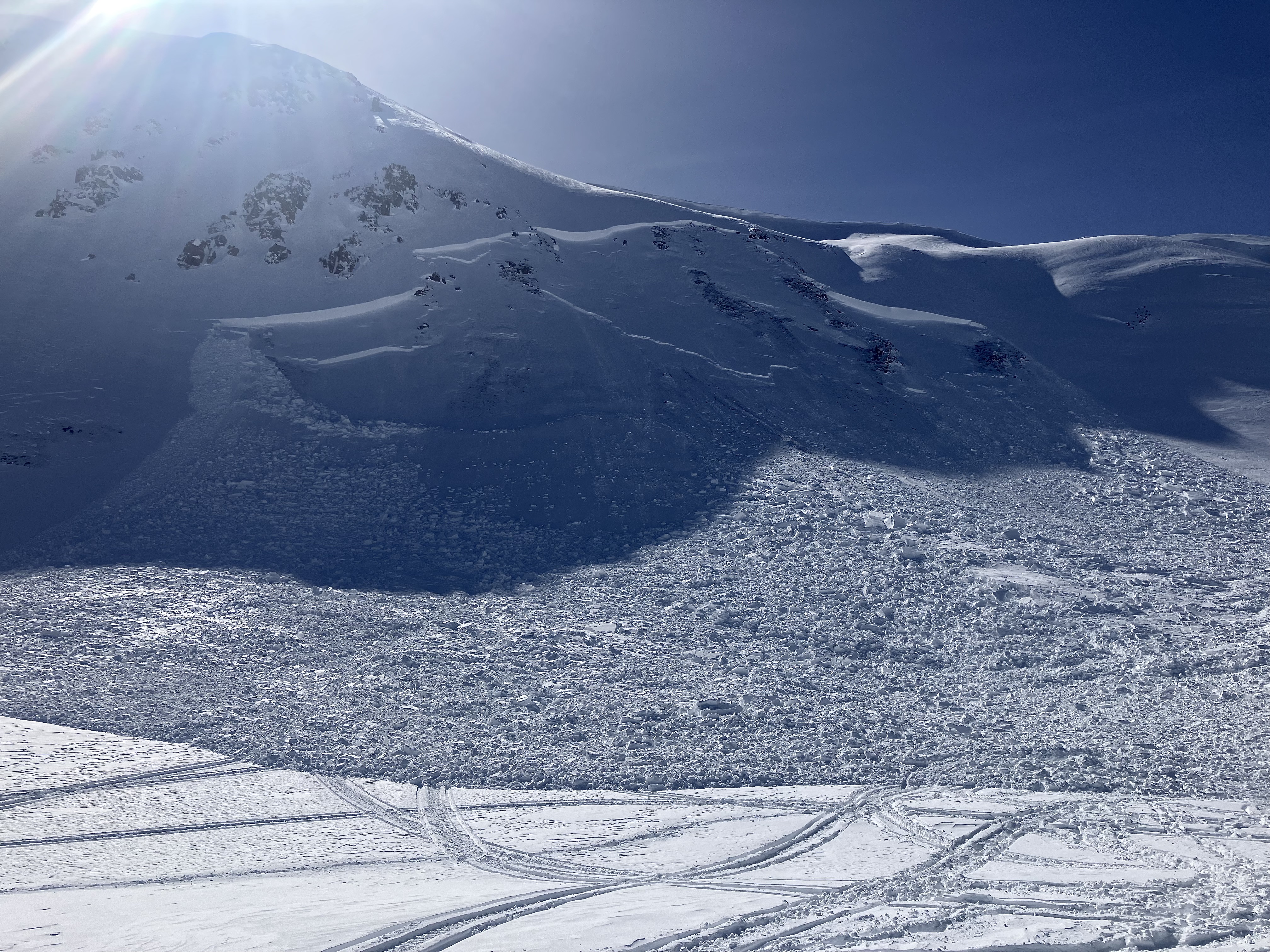
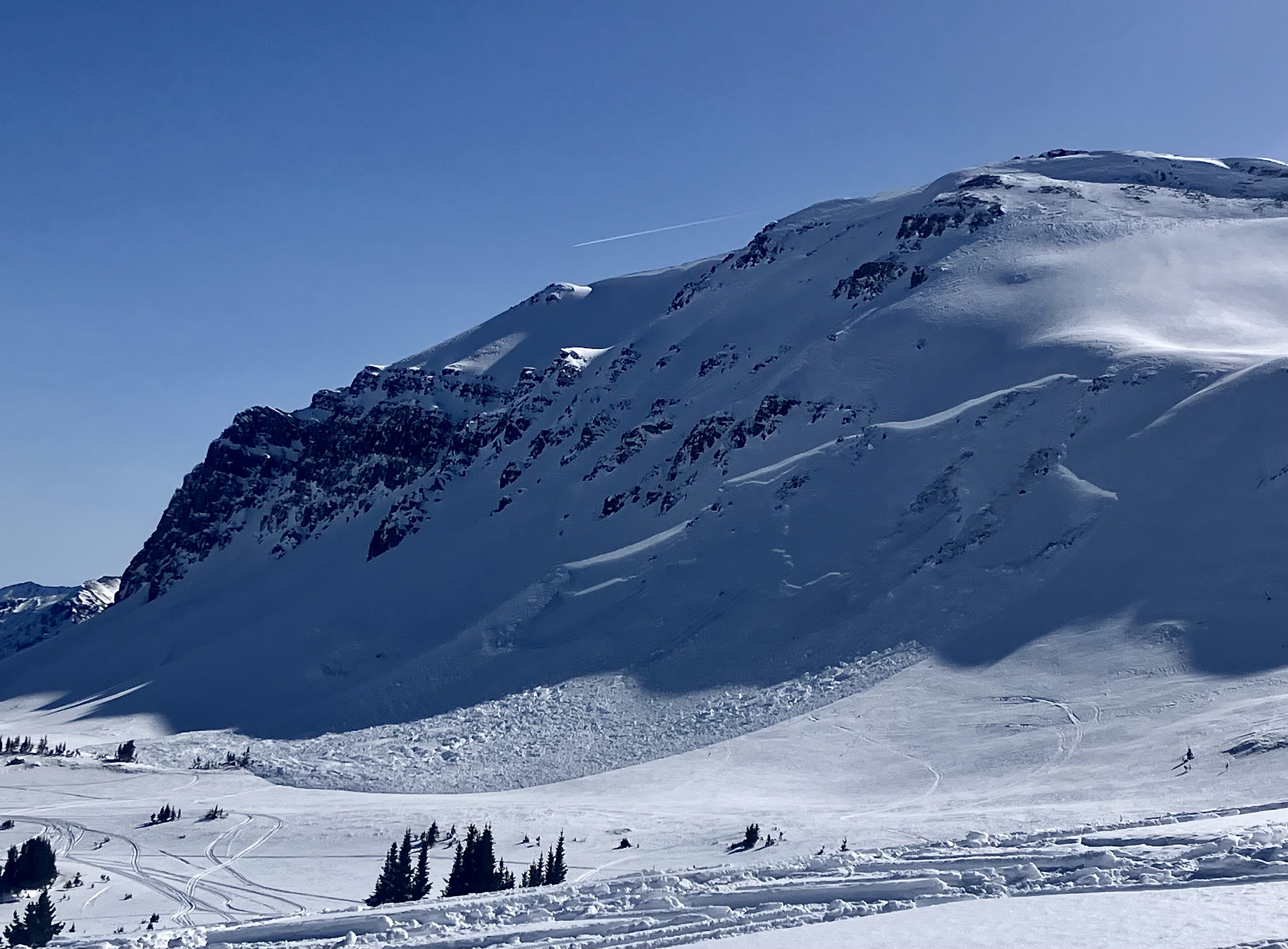
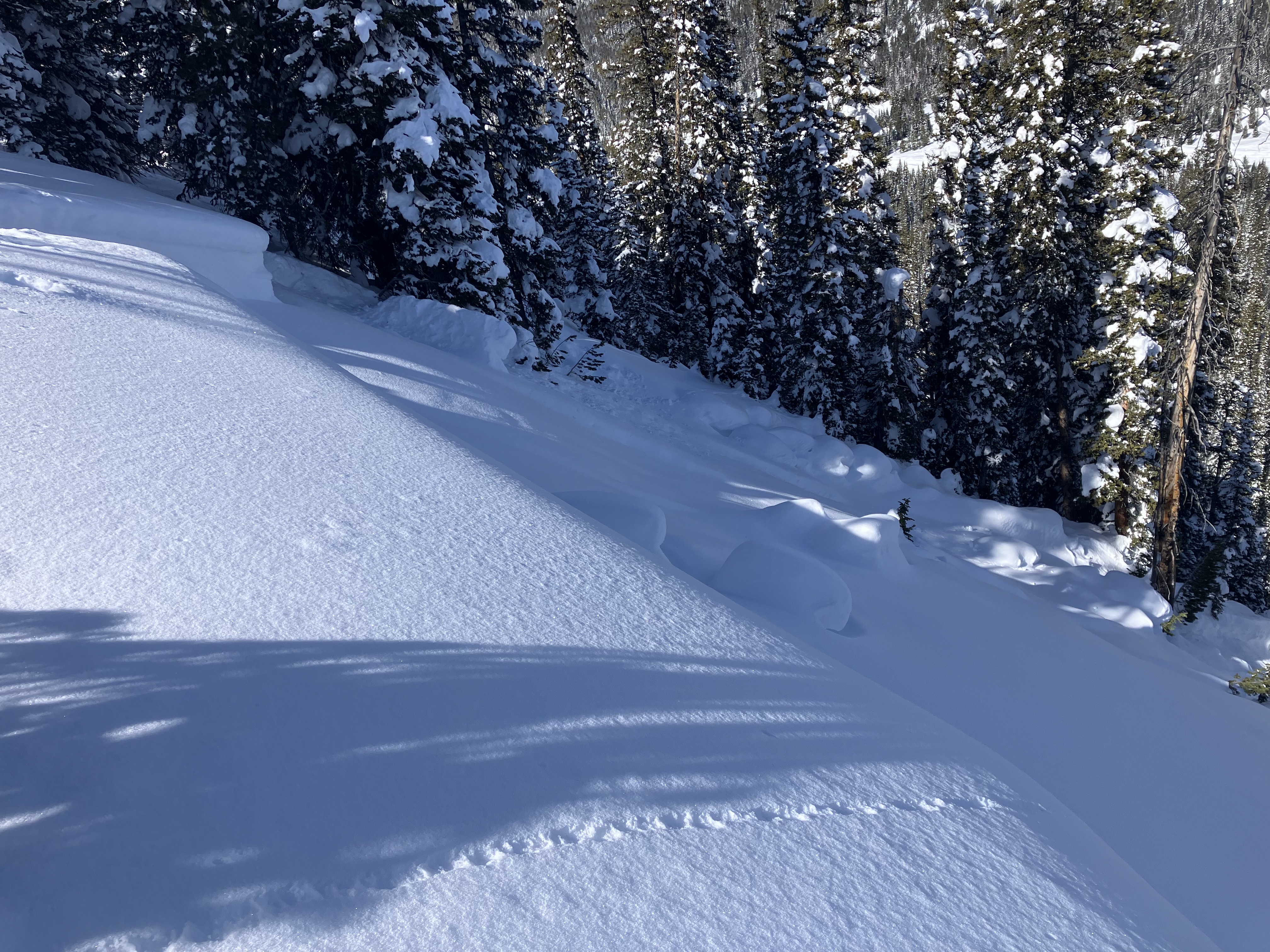
9500 ft E facing slope in Beehive basin. Dug to investigate the basal facet layer on the apron, found HS 120-140 cm with rounding facets on the ground, ECT 23 on pencil firm density layer above the facets, ECTx on basal layer. Chose ascent route in a slope concavity to avoid potential shallow trigger points. Cut a cornice prior to descent and struck a shallow (18 inches ) trigger point on top of some rocks which propagated about 500 ft wide across multiple ribs and 400 vert D3 R4. Did not recognize the razor thin margin for error on this slope, scouring in the start zone which created the shallow trigger point, or the propagation potential in this zone.
I meant to add the crown depth 18 inches to 6 feet
Full Snow Observation Report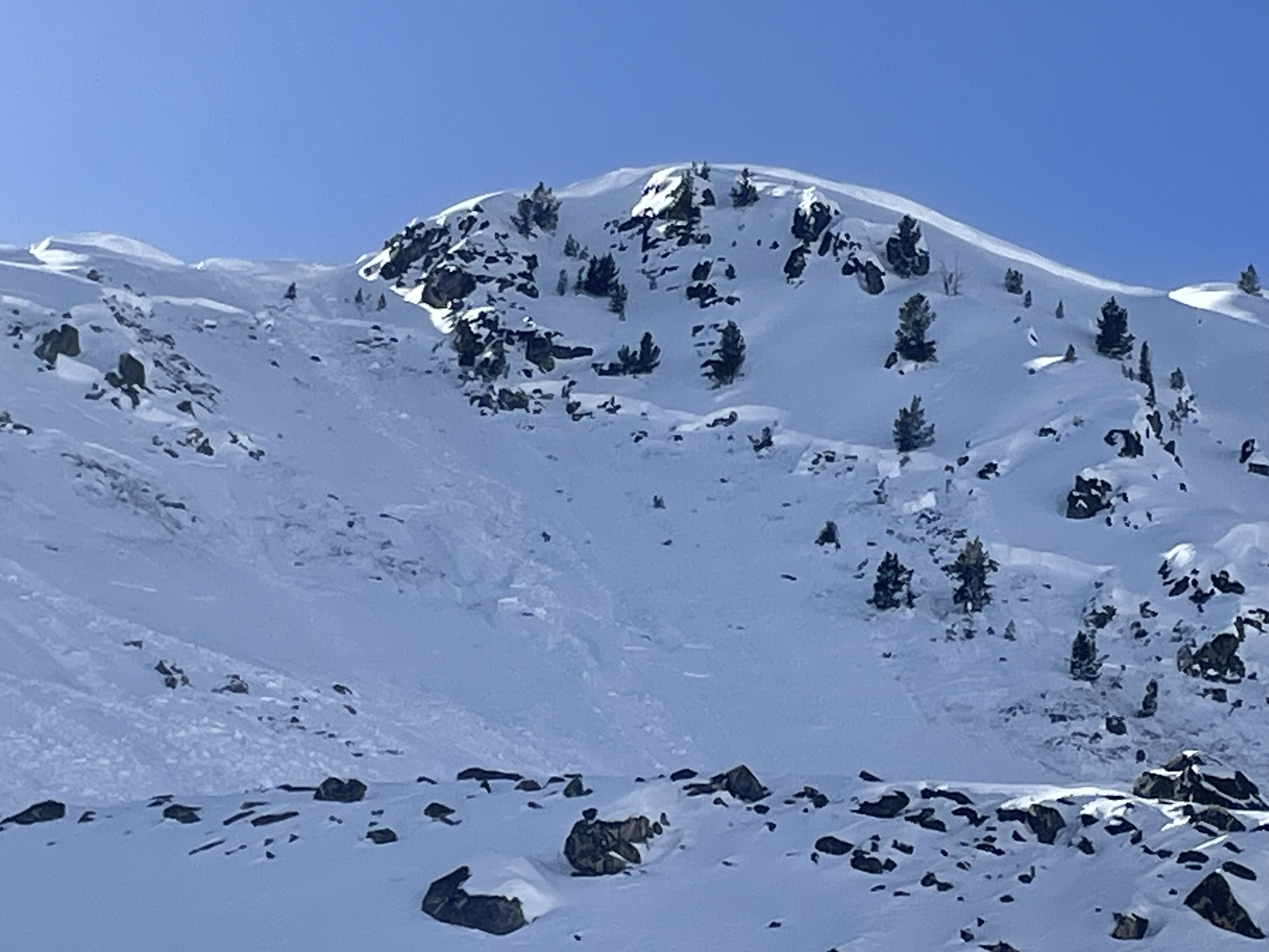
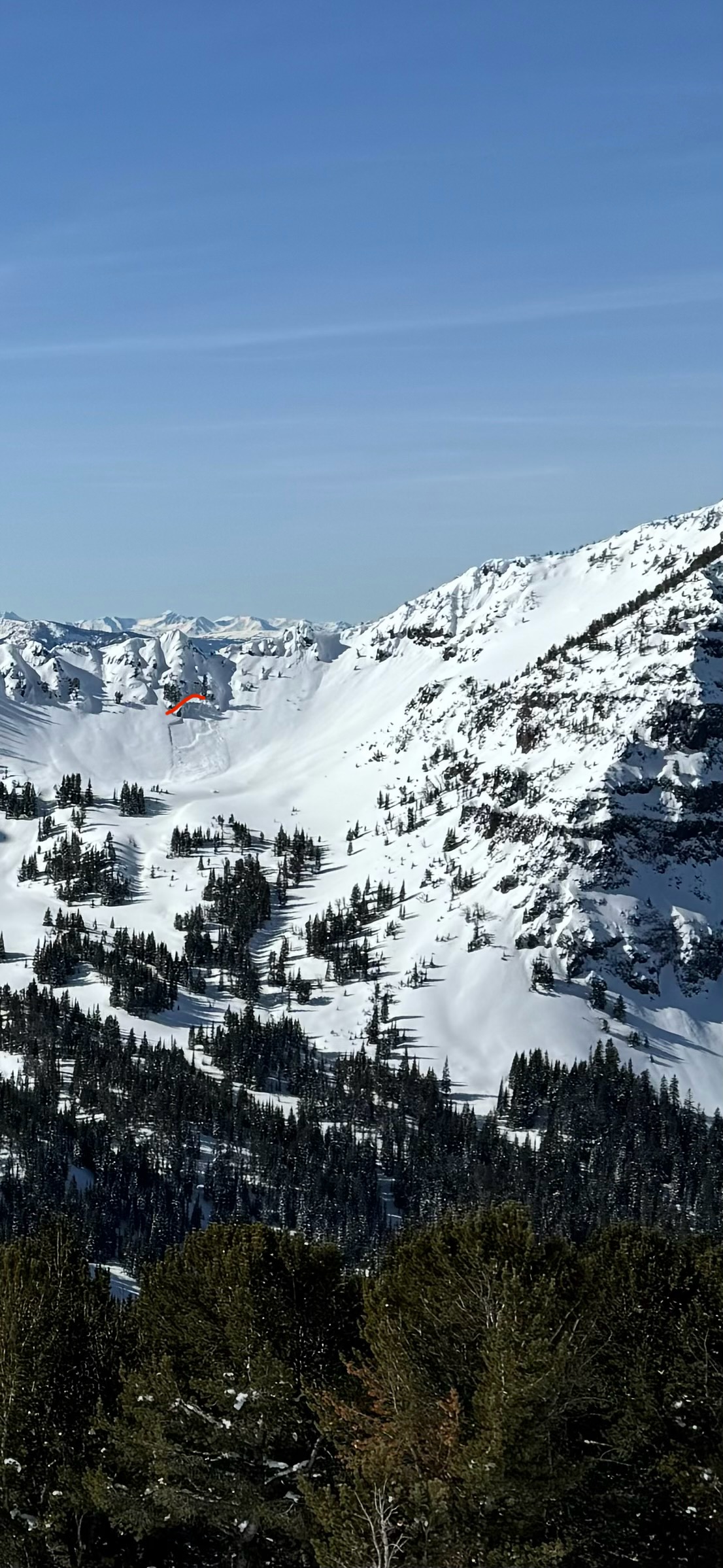
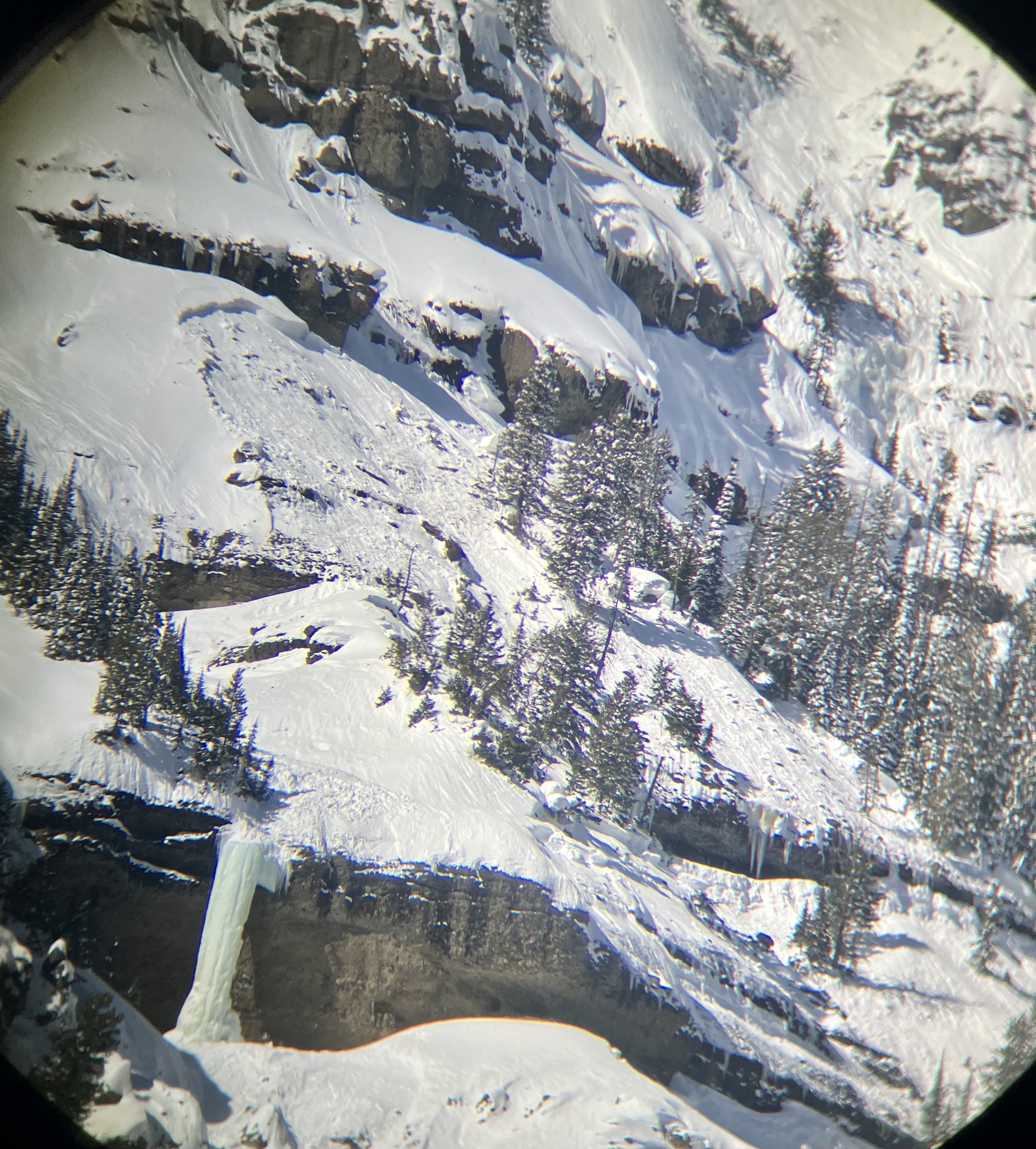
Saw this avalanche in the Rasta Chutes today, not sure if it was already sent in. Here is a picture from across the valley. The avalanche ran almost to the bottom of the chute, covering sled tracks heading into tradgenic.
Full Snow Observation Report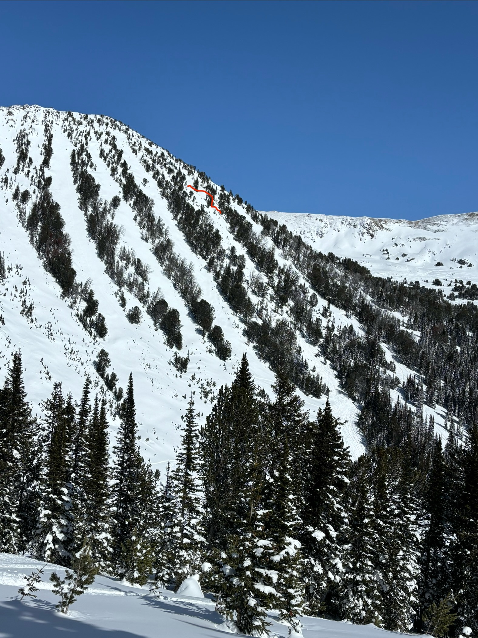
We rode out to the avalanche that was triggered yesterday on Henderson Mtn. It broke over 2000' wide (measured on GPS) and all the way up to the ridgeline, 6-10' deep and maybe 12-15' deep at the deepest section. There were a couple hundred feet of slope that had not slide between this one and the similarly large slide to the north last weekend. The deepest debris was probably 15-20'.
We also saw a fresh huge avalanche on the south side of Scotch Bonnet that happened today or late yesterday. 4-6' deep and 300' wide. Both slides were R4-D3-O. There was another fresh slide in the Rastas (one that didn't slide last weekend) that looked fresh yesterday or today, 4' deep hard slab, R3-D2-O, and one small but deep slab on the north side of Scotch Bonnet, 6' deep x 30' wide, R1-D1.5.
We could see evidence of previous large avalanches in the cirque on Republic Mtn. and in east Woody Creek south of town. There were widespread avalanches along Henderson Bench as well, below the steep break over in the trees, 3'+ deep breaking across multiple terrain features through thick trees, most of the bench slid, and appeared to have happened last weekend.
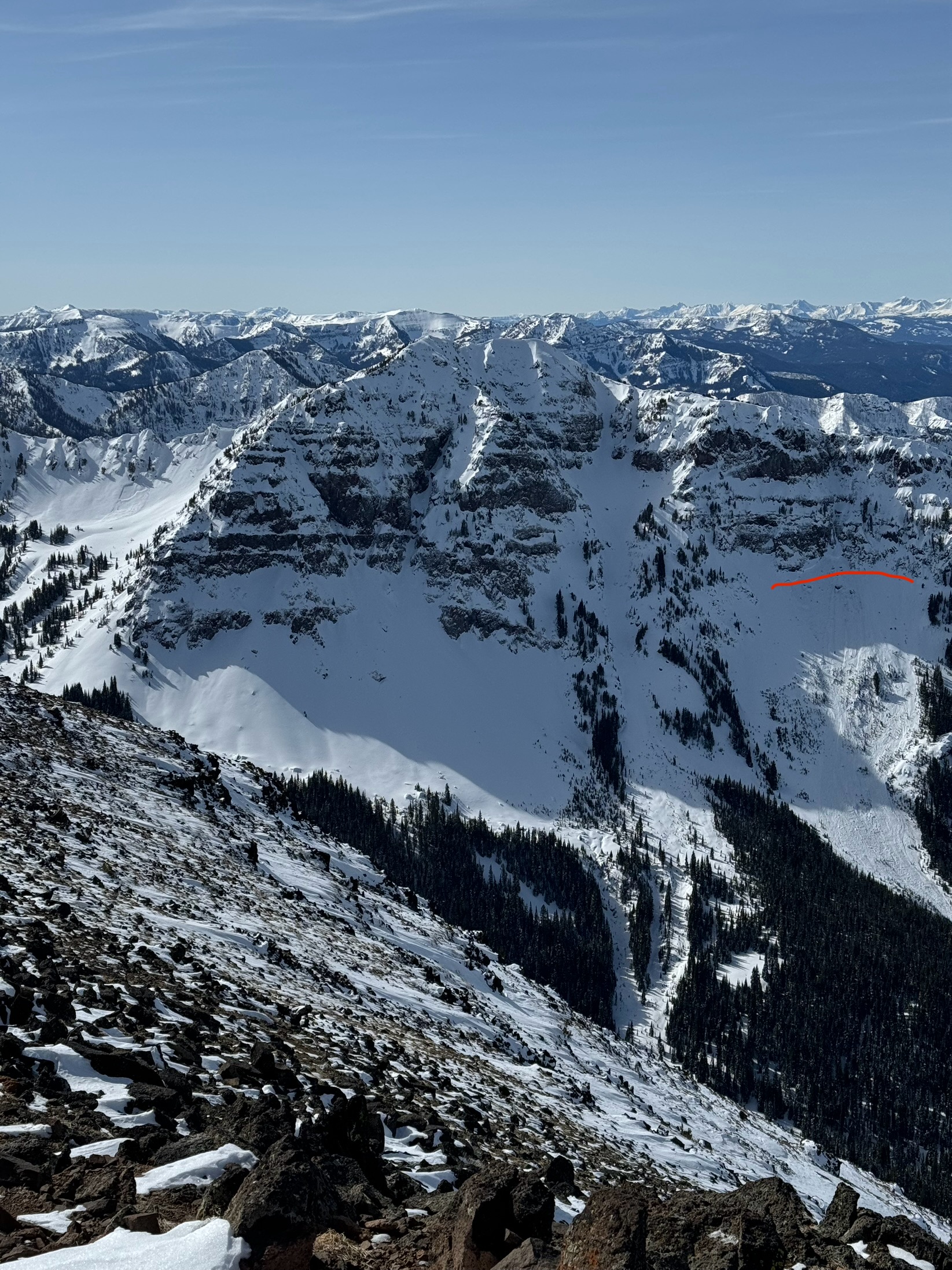
On my drive to Cooke City I saw old slab avalanches in YNP near Mammoth and on Abiathar and Ampitheater among other places. These appeared to have happened earlier in the week. I also saw a more fresh looking persistent slab avalanche on Barronette, 2-3' deep and as wide as its terrain feature, 100-200' (photo).
Pretty scary. Stay safe out there.
Full Snow Observation ReportWow. Maybe the most widespread large activity I have ever seen. The deep crowns across Henderson Bench from last weekend really round it out, through the "almost died" terrain and Chris Peterson's slope went big, probably R4-D2/2.5/3, connected through seemingly broken up terrain. Peterson's slope broke 20' below where my pit was last time I was here (my pit was on 15 degree slope and it rolls over quickly lower down).
Given all that has slide, there are still some slopes that are intact and await a trigger. South face of Abundance is one that comes to mind...
