Snow Observations List
From IG:
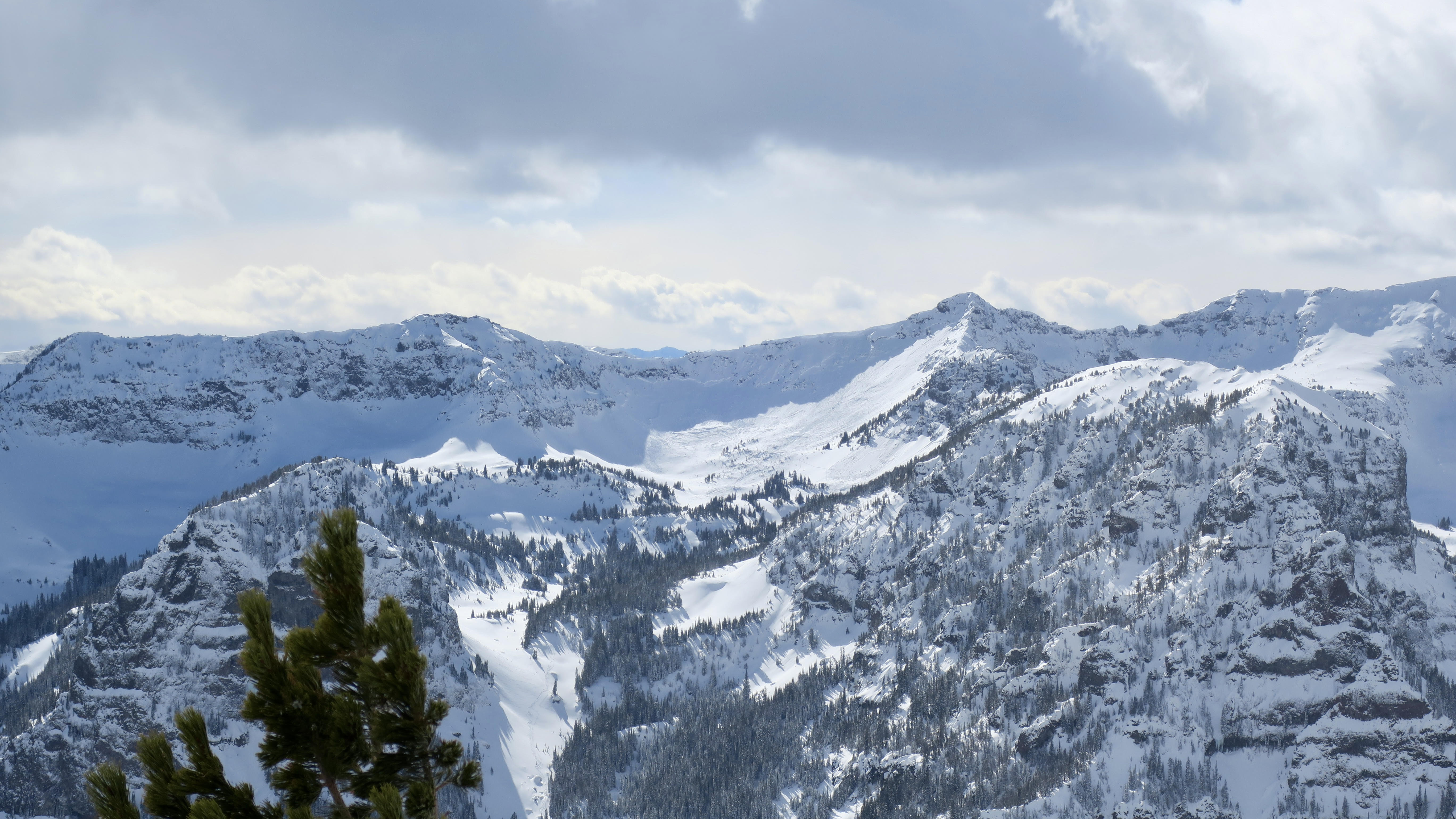
Very large natural avalanche in the Lionhead Area. Multiple other smaller naturals as well.
Pics taken 03/05/24
Full Snow Observation Report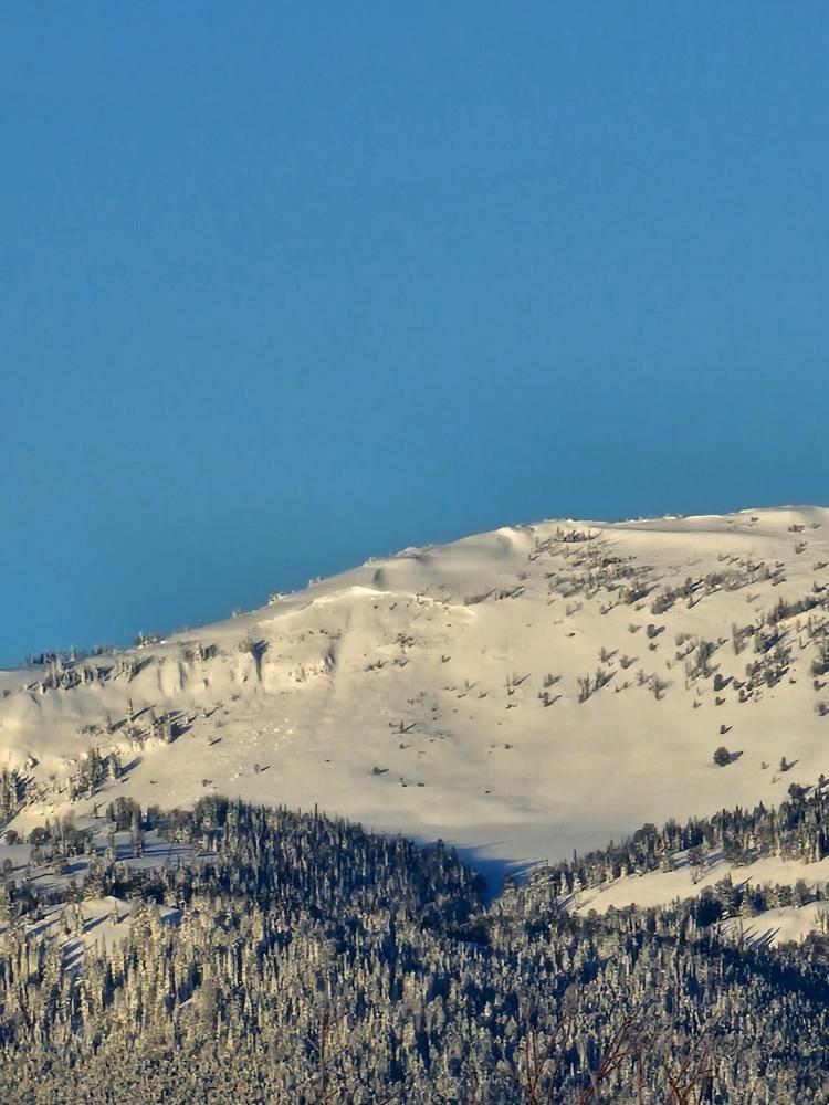
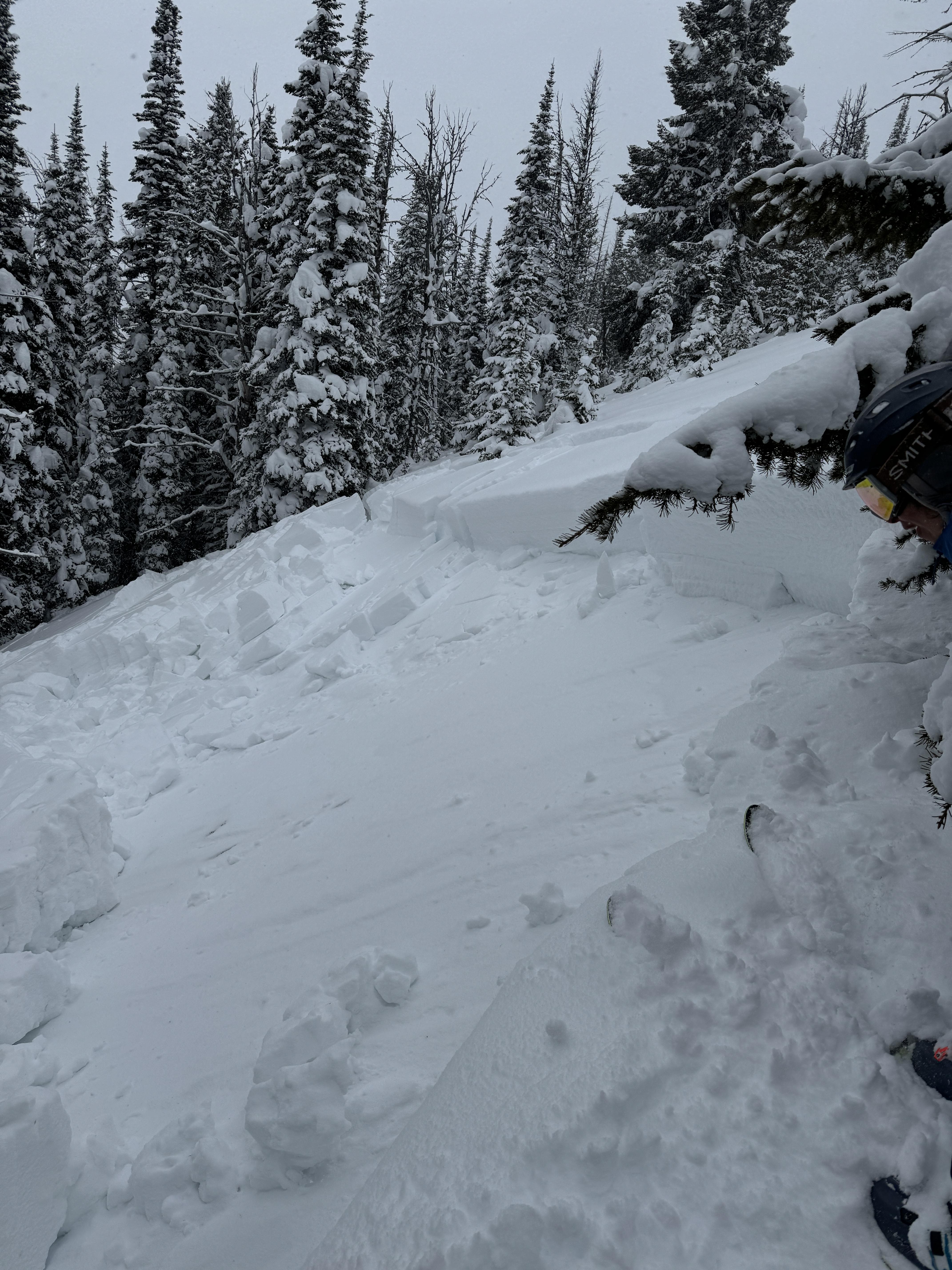
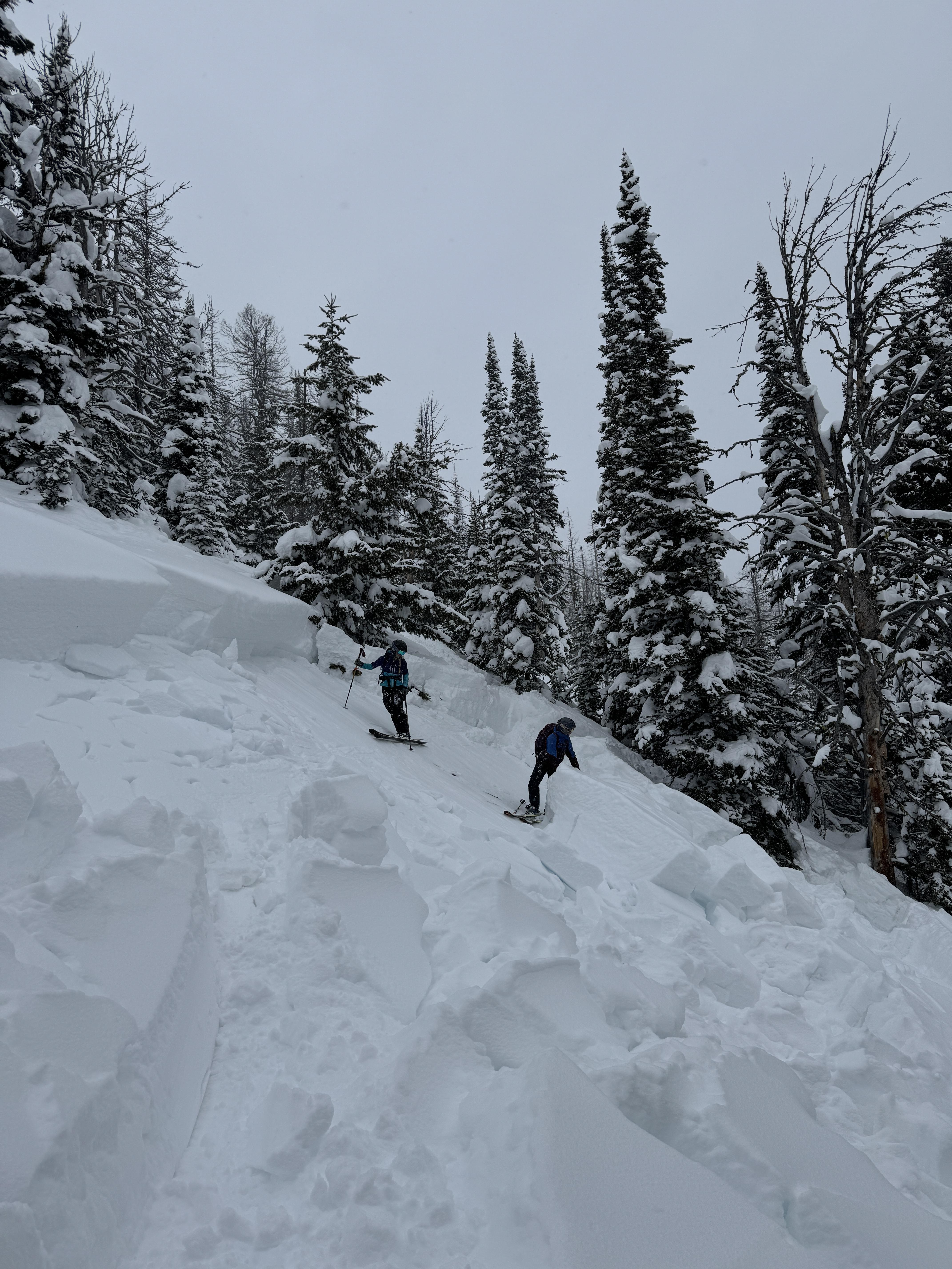
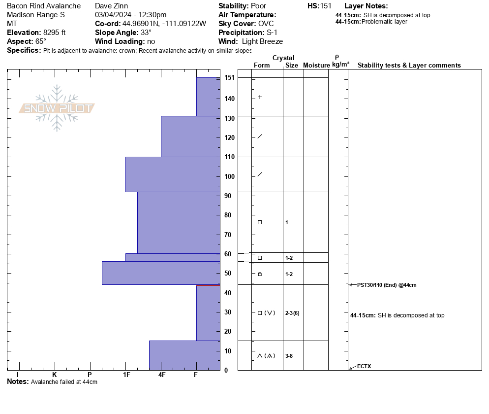
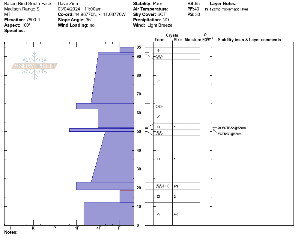
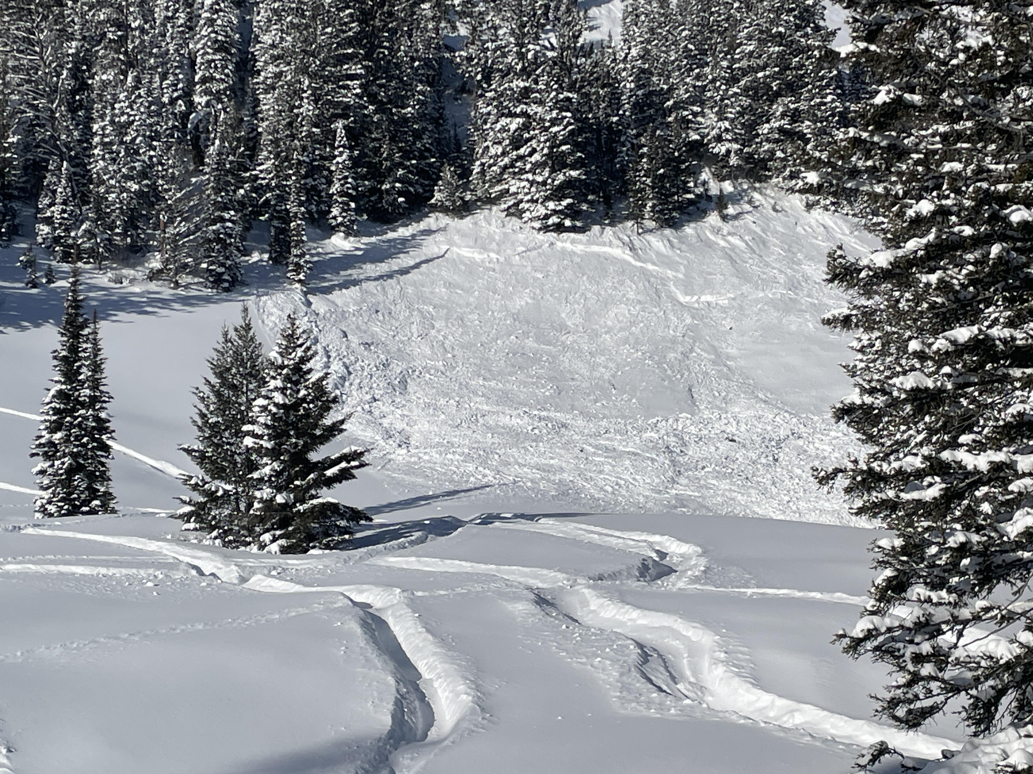
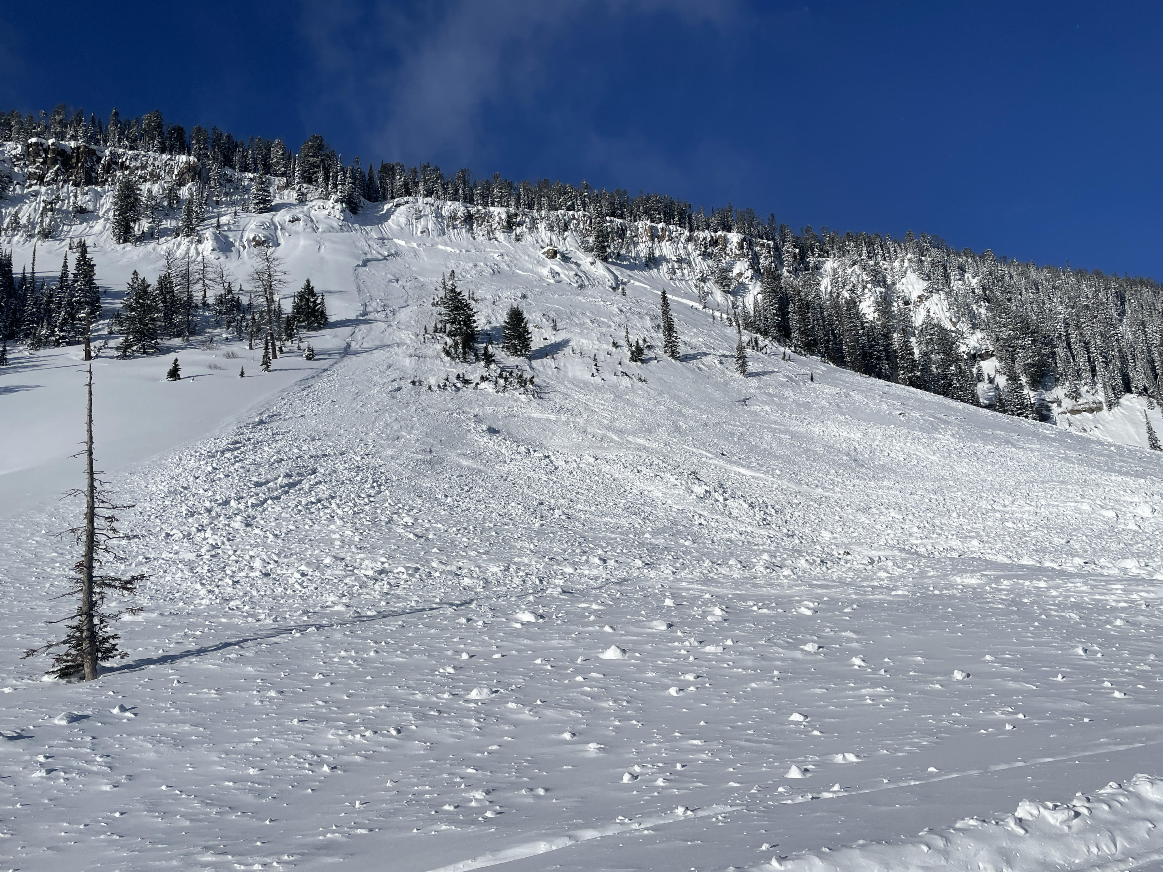
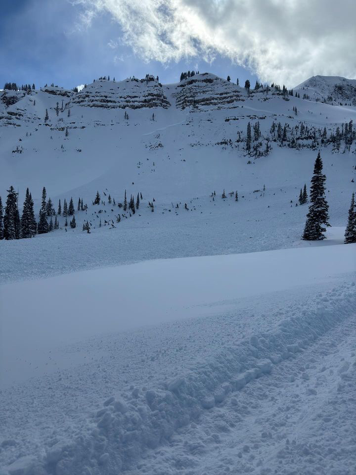
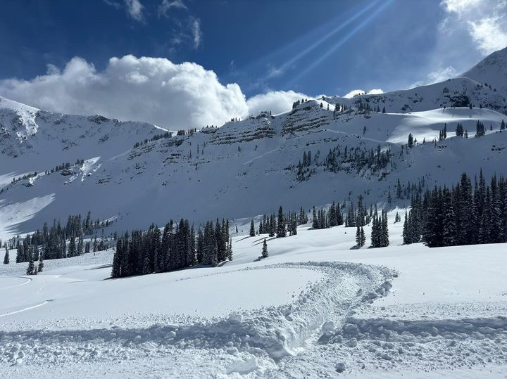
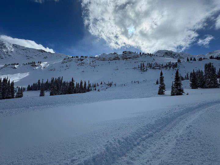
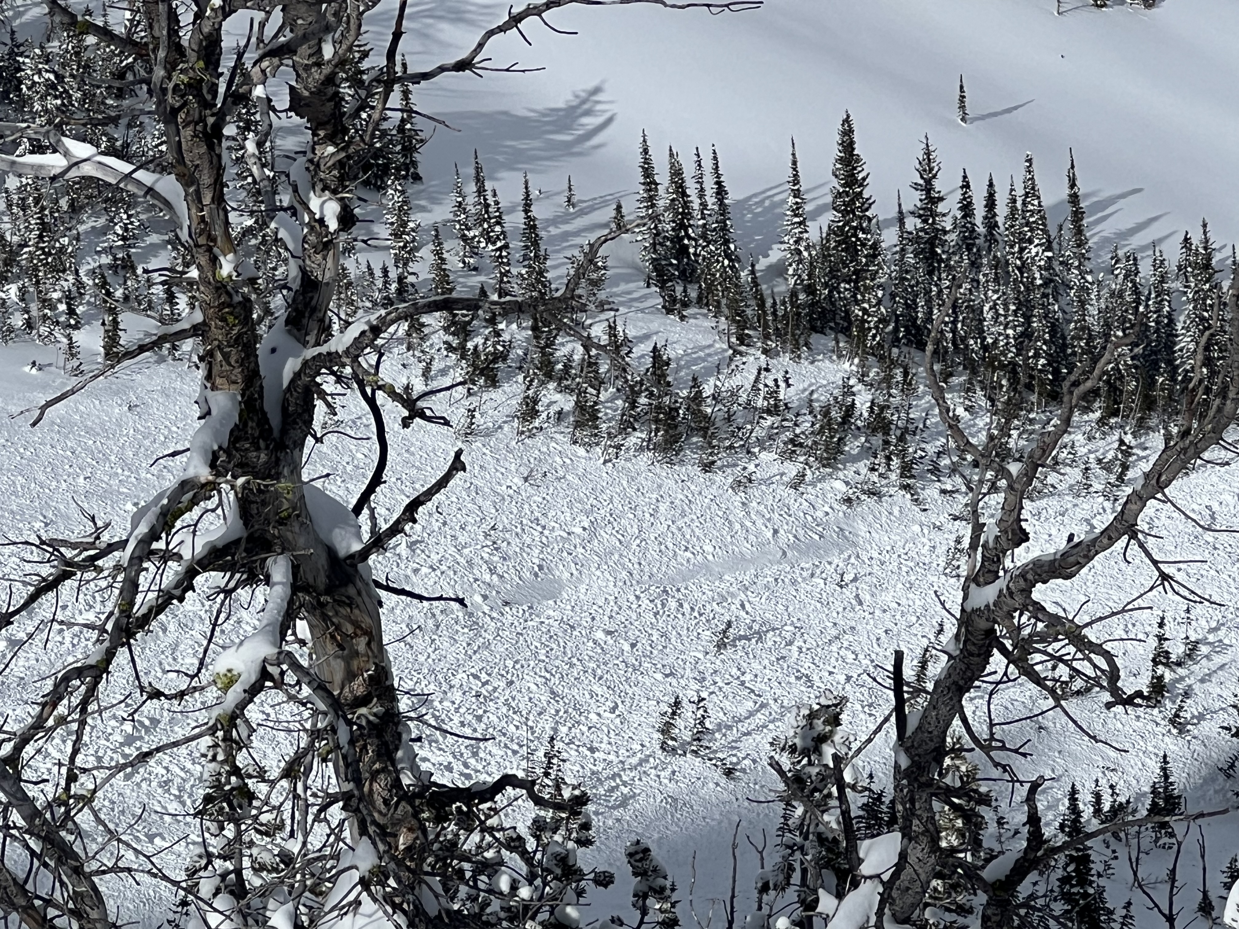
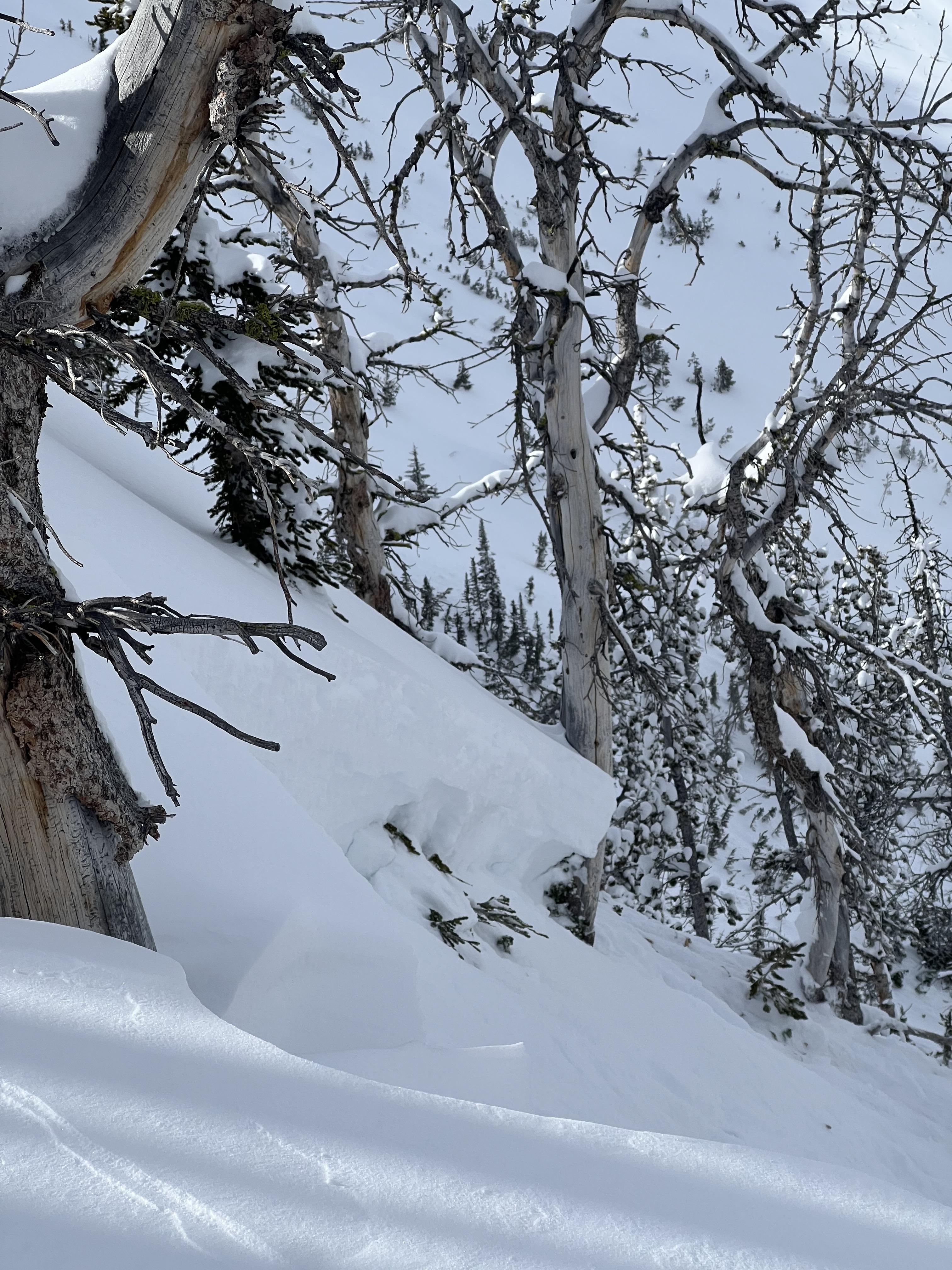
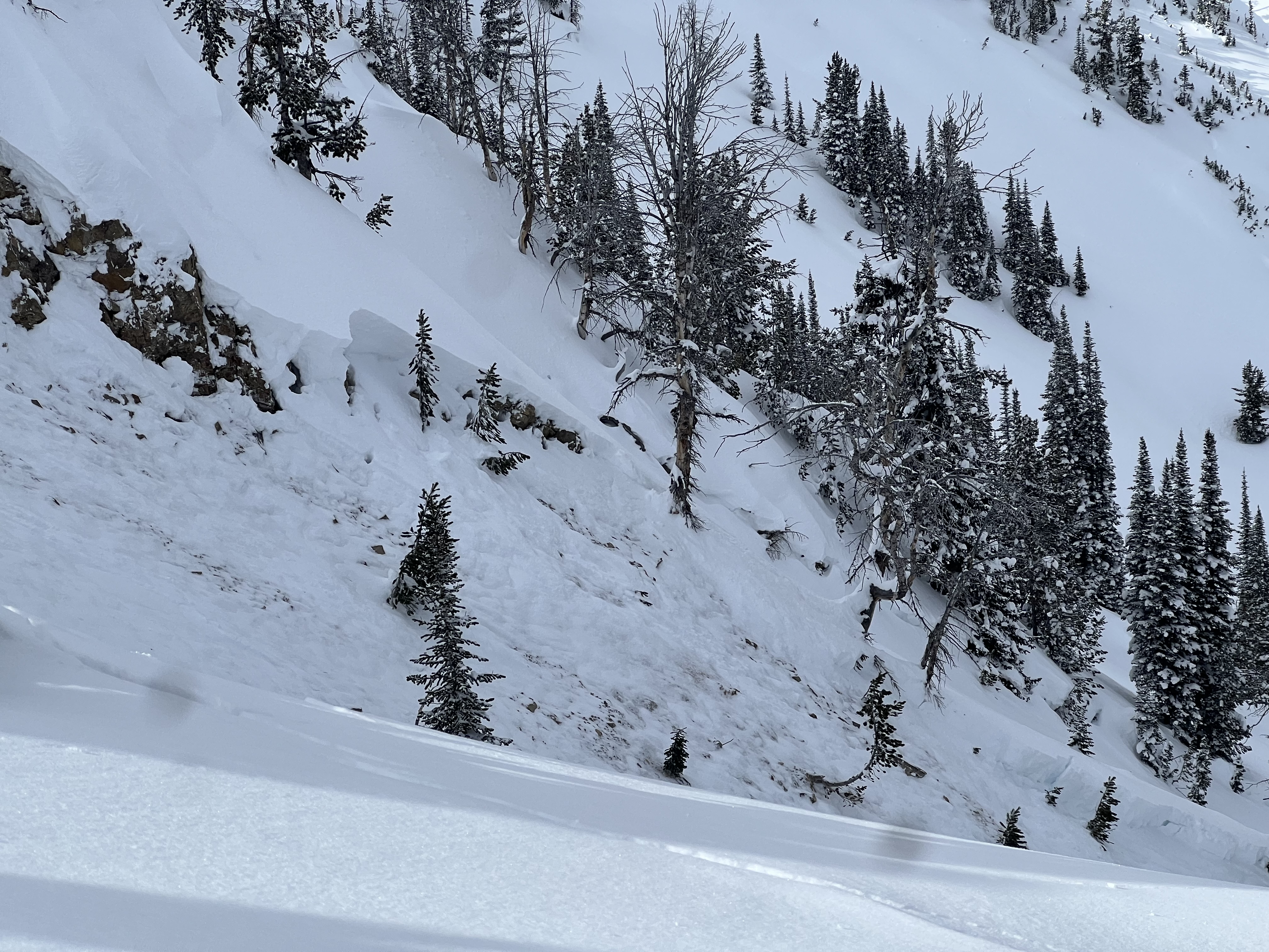
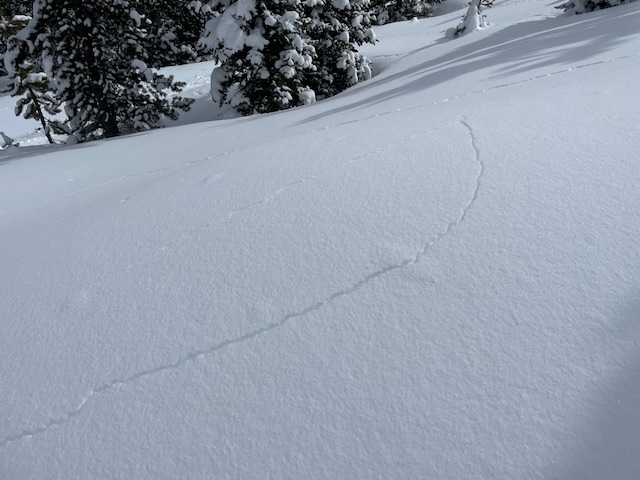
We toured up toward the Skillet along the standard uptrack route at Bacon Rind. We deviated to the south to look for a natural avalanche that broke on March 2nd in the south-facing meadows a third of the way up. We did not find it but dug a pit. 95 cm HS with a newly buried weak layer of facets above a crust at 52 cm (ECTP22x2 plus an ECTN17 on this layer). The depth hoar near the ground was moist.
Somewhat dejected after failing to locate the avalanche, we proceeded back to the typical route. We came across a deep avalanche on a small rollover. 100 feet wide, 3-4 feet deep, and 50-75 feet vertical. Slope angles ranged from 29-33 degrees steep. It was an R5, D1.5 avalanche that certainly would have been very dangerous on a larger slope. ECT in the crown was unremarkable (this is not uncommon in the crown of an avalanche), PST 30/110 End.
Continuing up, the next open meadow had collapsed and was splintered with shooting cracks. The failure propagated through the trees with more cracks and buckle marks as the slab tried to release... which it did a bit further downslope. Again, the crown was 3-4 feet deep, and the terrain constrained the length.
No additional signs of instability.
These two avalanches were different than the two we were initially looking for. I suspect skiers triggered them remotely on March 2 given the amount of new snow on the debris, but they may have failed naturally. Regardless, avalanches in these locations are very unusual and are indicative of dangerous conditions. With more snow coming the next two days, travel in or near avalanche terrain requires a great deal of caution. Conservative terrain selection will be essential.
Full Snow Observation Report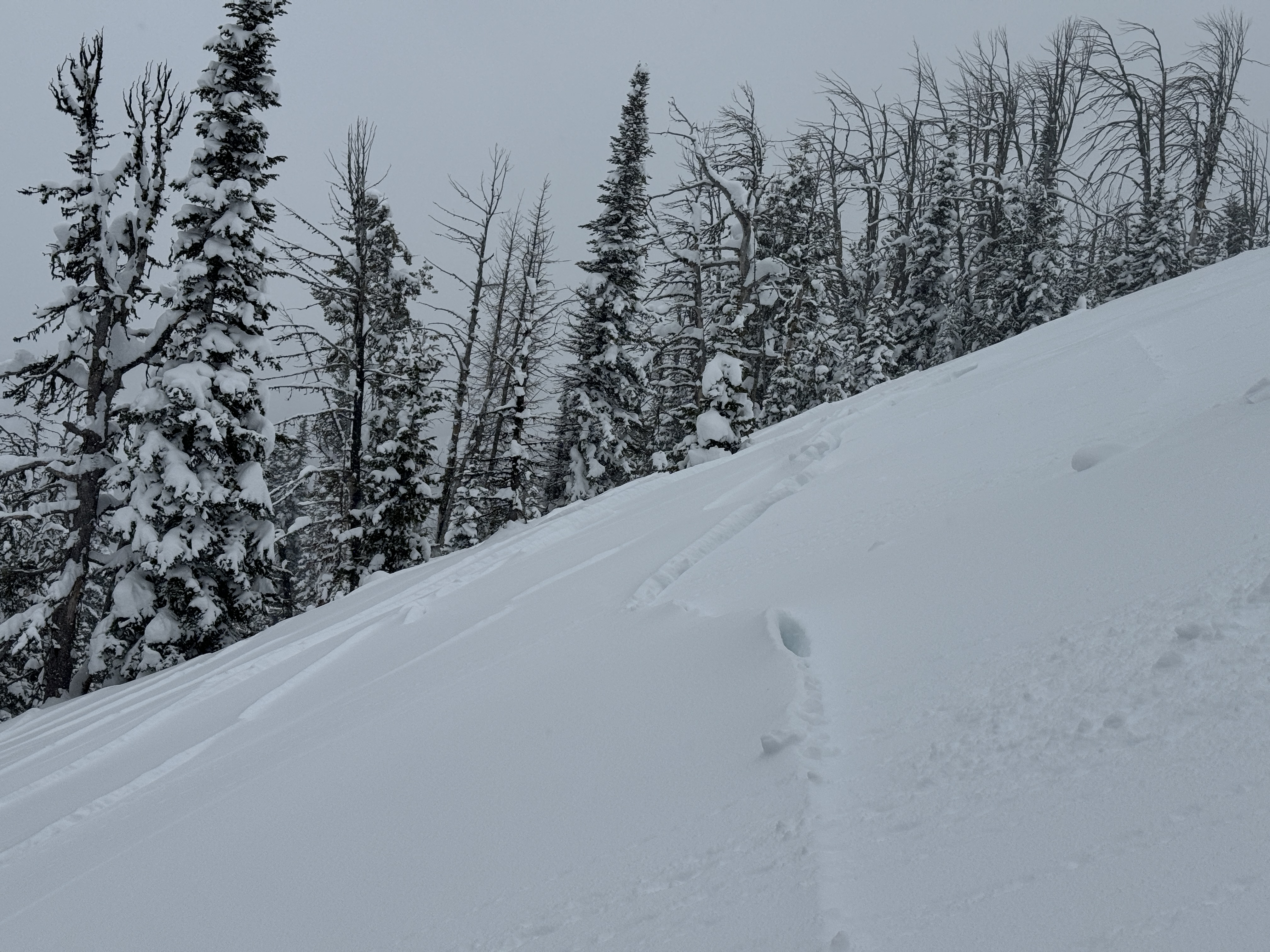

Observed a debris pile on the east face of Fischer Peak. Unable to determine when and what triggered it. Numerous debris piles on the Rasta Chutes on Scotch Bonnet.
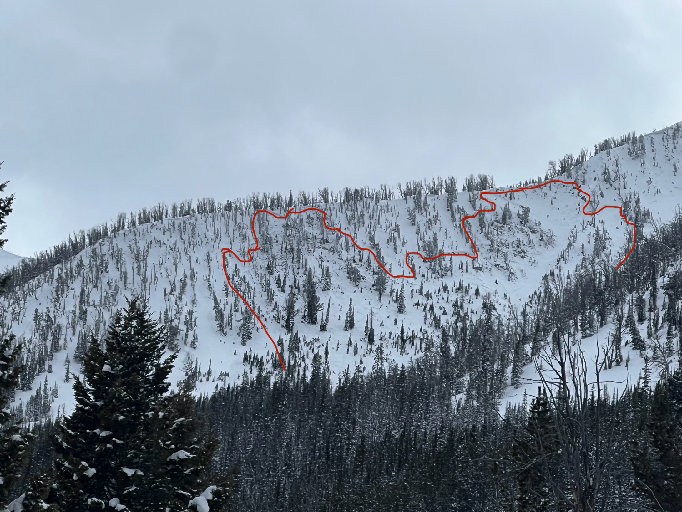
Full Snow Observation ReportThe Snow Ranger crew was out on Buck Ridge today. We did not see any new slides around Beaver Creek, 1st Yellowmule, or Slatts Hill/ upper Buck Creek. It began snowing before we made it to the McAtee/ 3rd Yellowmule area but from what we could see, it looked like the N/NE faces in McAtee that slid just over a week ago had avalanched again, nearly to the ground. There were slightly dirty looking debris piles mid slope and several prominant crowns just below the ridge top but it was hard to make out details through the light snow, even with binoculars.
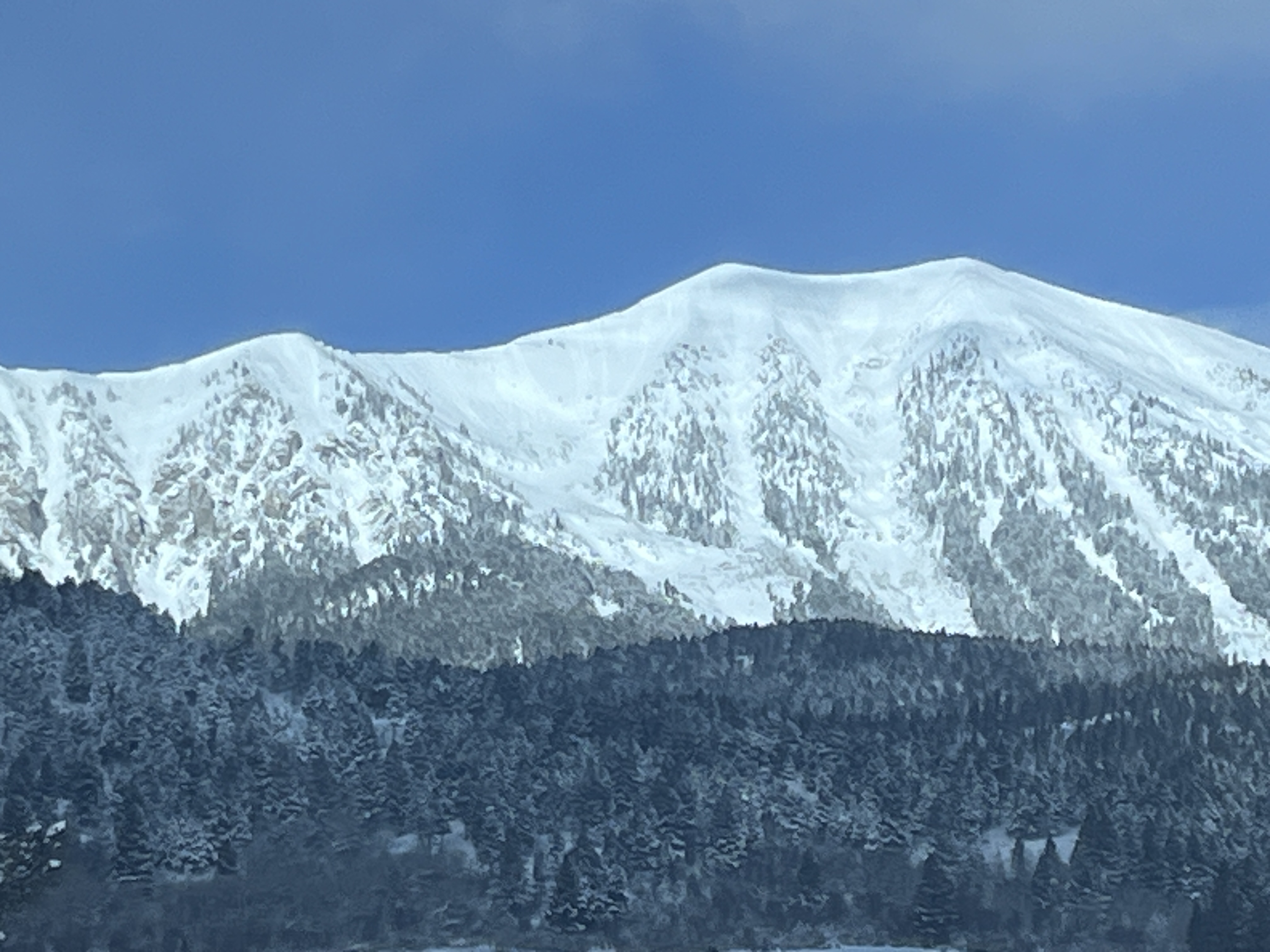
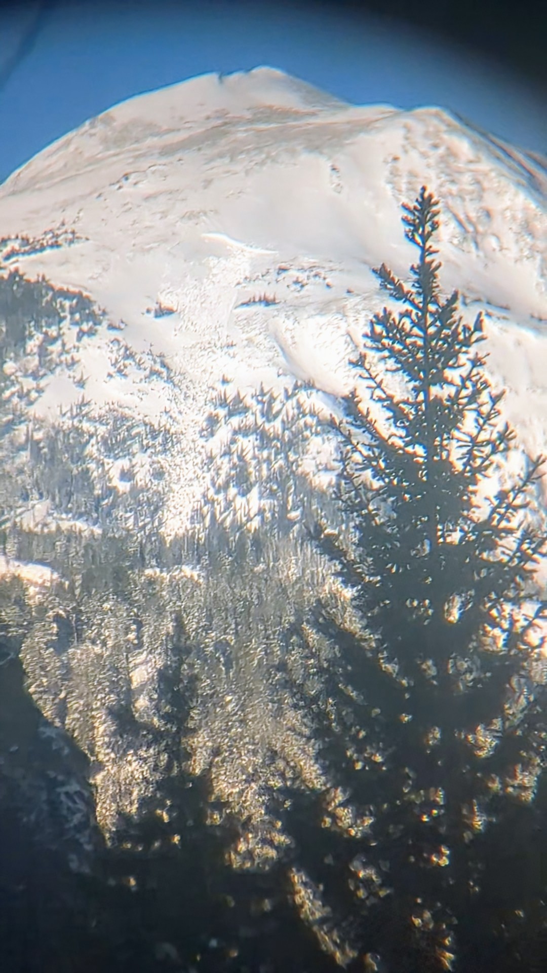
Full Snow Observation ReportWhile traveling to Big Sky from Ennis, I noticed a large avalanche on the east face of Fan Mt.
Crown appears to start at approx. the 9500' elevation with a vertical drop of at least 2000'. Crown appears to be 200-300 yards wide
Full Snow Observation ReportWhite touring in the History Rock area, I spotted a couple of recent slides on the NW shoulder of Mt. Blackmore. From a distance, these look like dry-loose slides on the recent snow interface around 8,500ft. on a N-NE aspect.
Otherwise, 12-20cm of new snow was present in the area (~ HS 80-115cm), with evidence of wind loading on east aspects, and scouring on west aspects. No other signs of instability were observed.
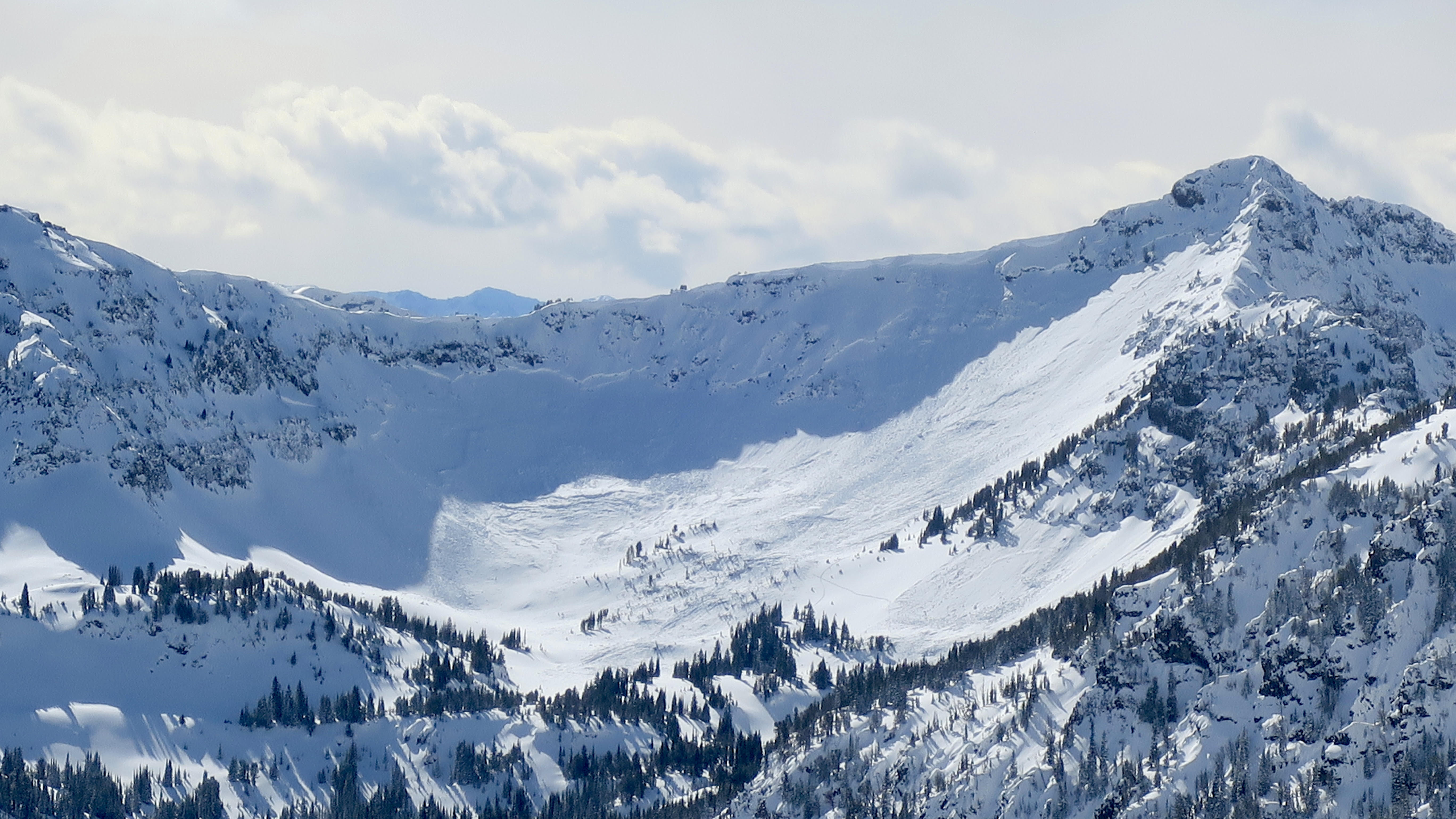
Full Snow Observation Report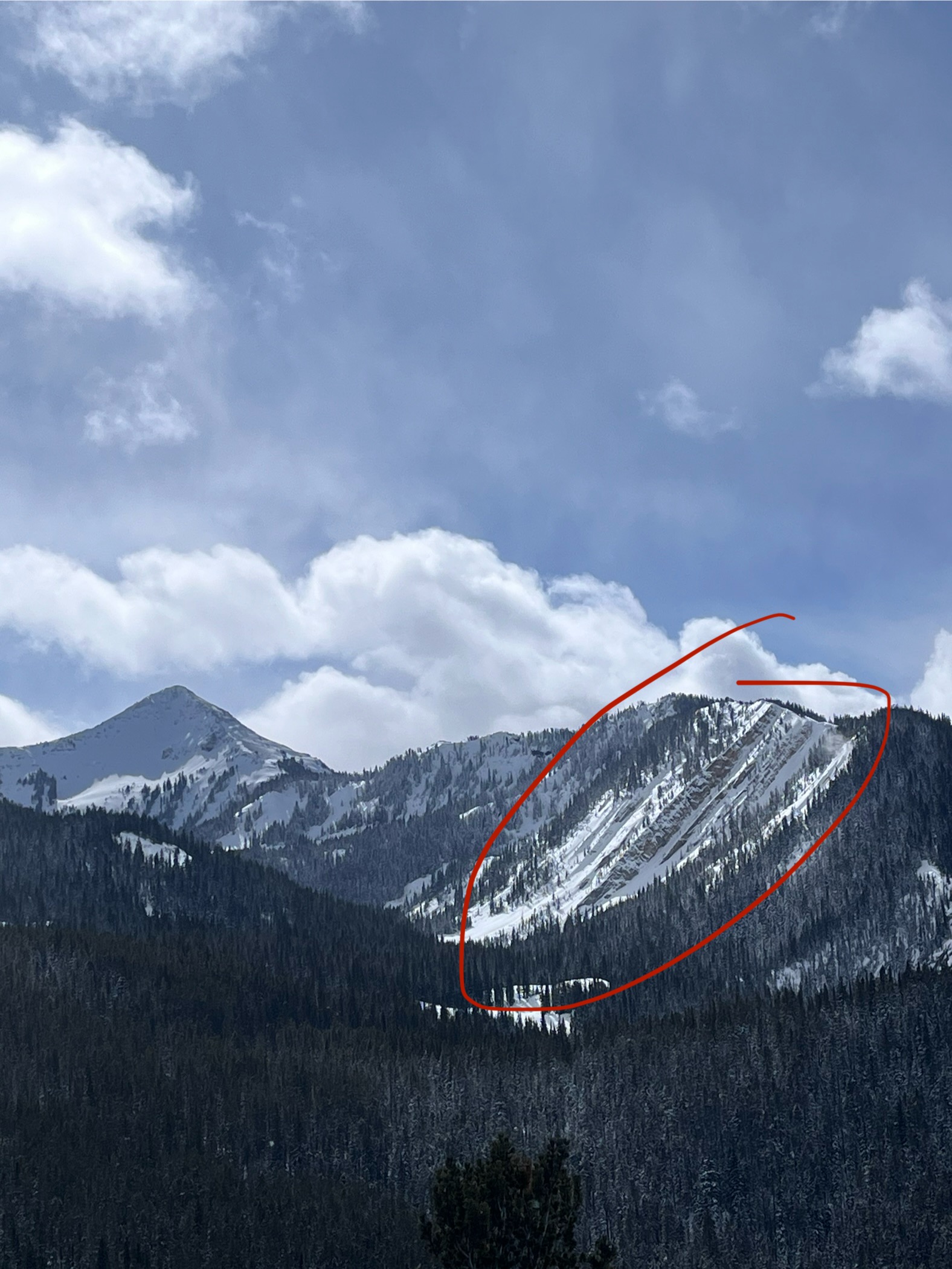
Shot from the top of Flanders, ~1400 this afternoon, 3/3/2024. Big slide(s) on Arden and in Maid of the Mist.
Looks like the skin track and ski track between the two slides got taken out. At first glance from across the way it looked like the skin track was crossing over the debris, but when zoomed in it looks like the debris overran the skin track and the ski track.
Full Snow Observation Report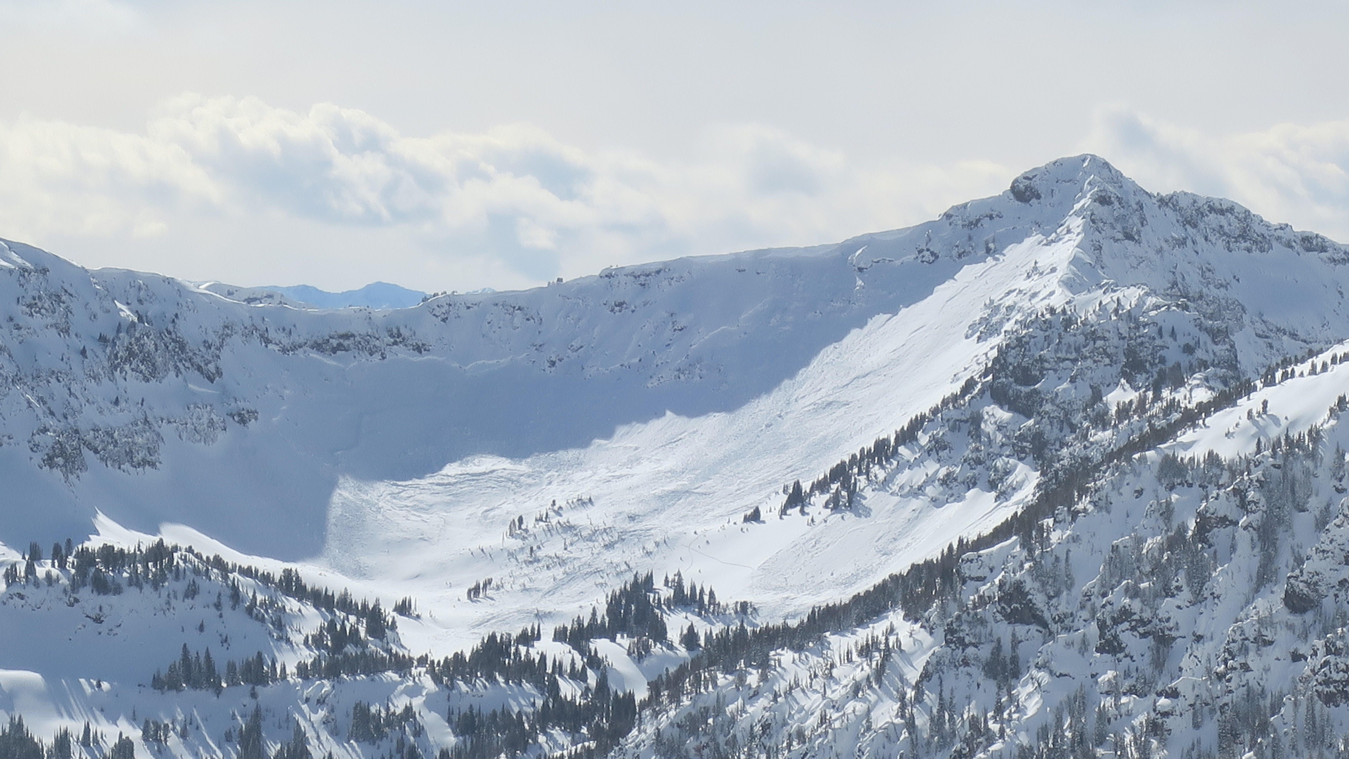
From email: "Two big avalanches observed above the “plug” east of Cooke city. on my ride over this AM. One ran to the road, unclear if it went over it and maybe the groomer ran over the debris. Appear natural or possibly snowmo triggered? "
Full Snow Observation Report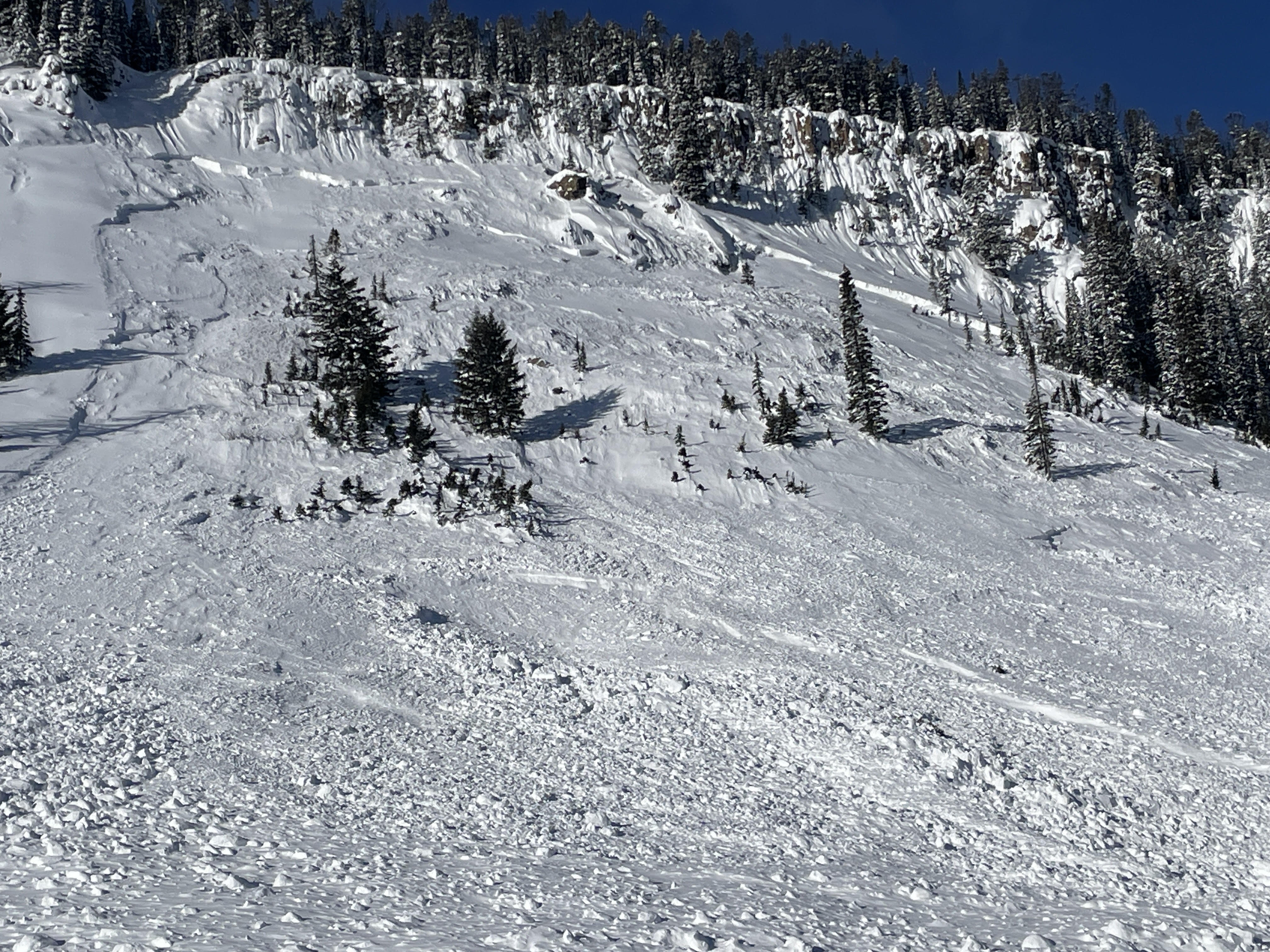
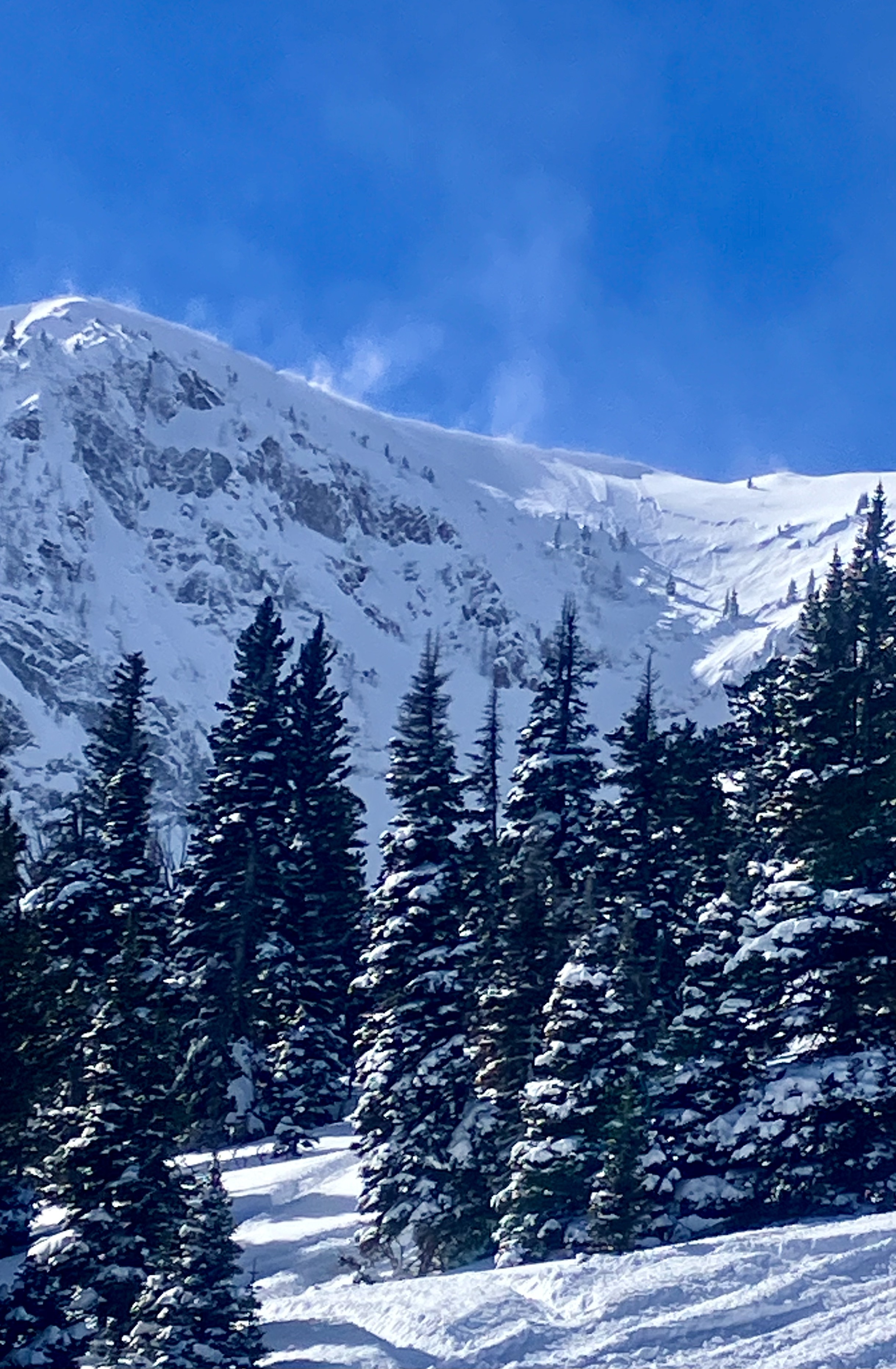
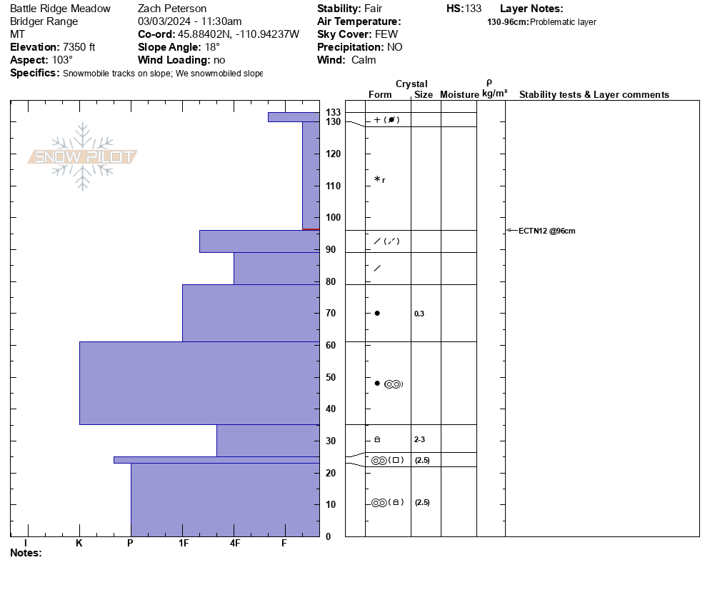
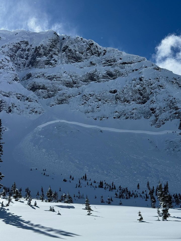
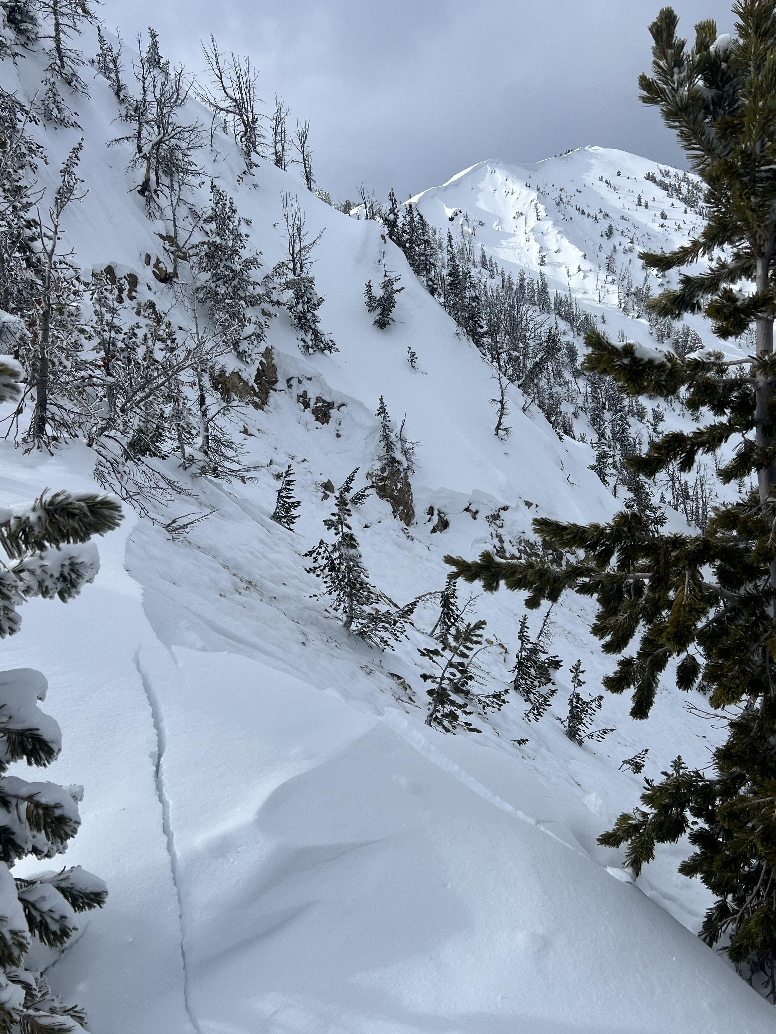
We rode near the Throne today 03/03/2024. From the truck driving up and down canyon, we saw several natural loose snow avalanches that broke beneath ridgelines and one slab avalanche near Bridger Peak. While riding into the Throne we saw a large natural avalanche south of Ross Peak that likely happened early this morning. Many slopes steeper than 30 degrees had numerous natural and a few human-triggered slough avalanches that entrained storm snow from the last 24 hours, some also entraining snow that fell on Friday as well. These avalanches were large enough to bury a rider or skier.
Near the throne on an east-facing slope at 7300', we dug a snow pit and found 23" of new snow that had fallen since Friday equaling 2.1" of snow water equivalent. 14" inches of this fell late last night (0.75" of SWE). Our stability tests yielded ECTN12 results below the new snow. Recent snow made up a little less than half of our snow pit height (HS 133 with 54 cms of new snow since Friday).
Wind remained calm today where we rode, but all day we saw snow being transported at the ridgeline above. Storm totals were well distributed and at all aspects and elevations we rode we found roughly 20" of recent snow.
Full Snow Observation Report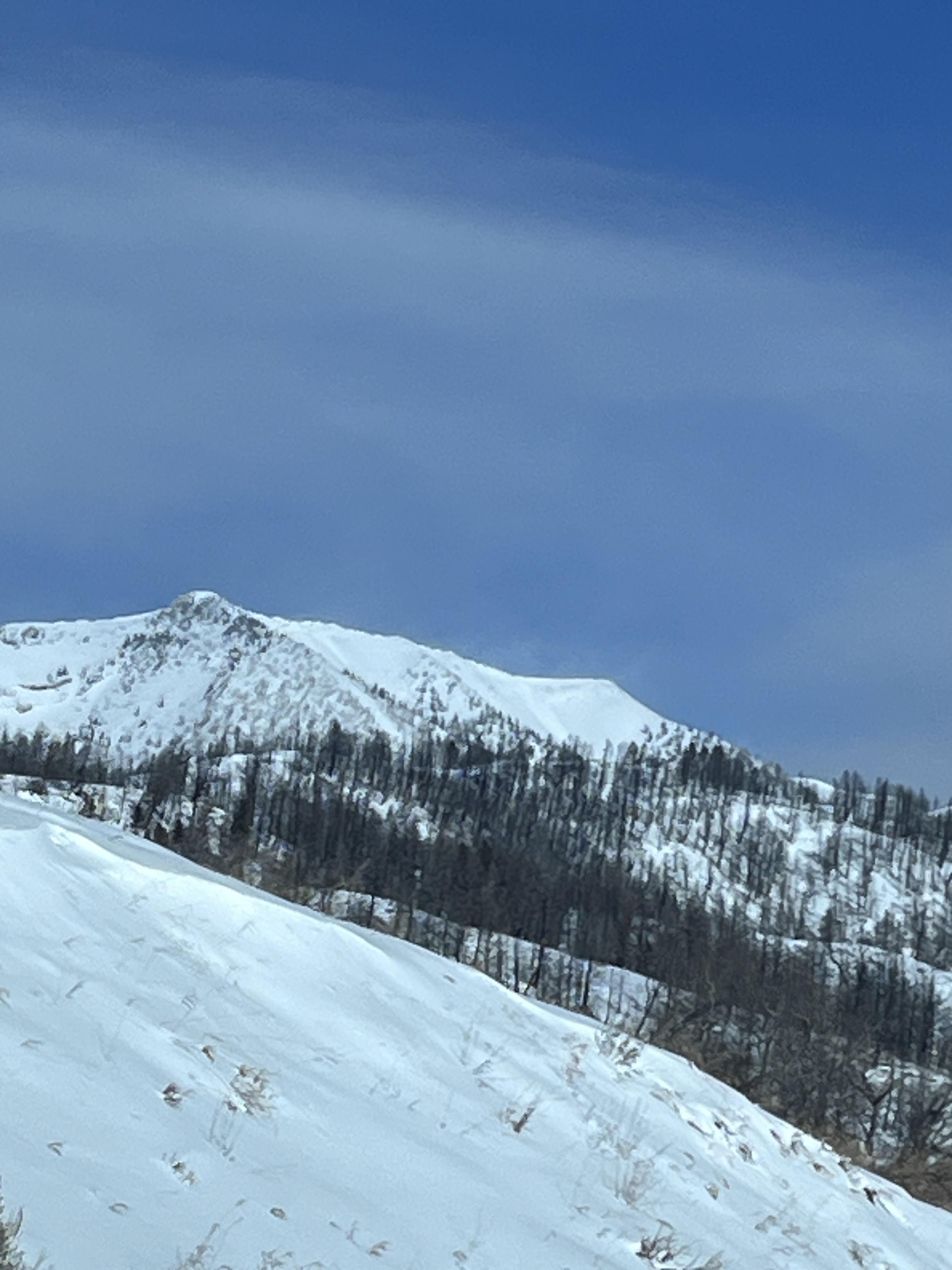

From IG on 3/3/24. Natural on Wolverine and natural between Miller and Sunset. Looked like they went today or yesterday.
Full Snow Observation Report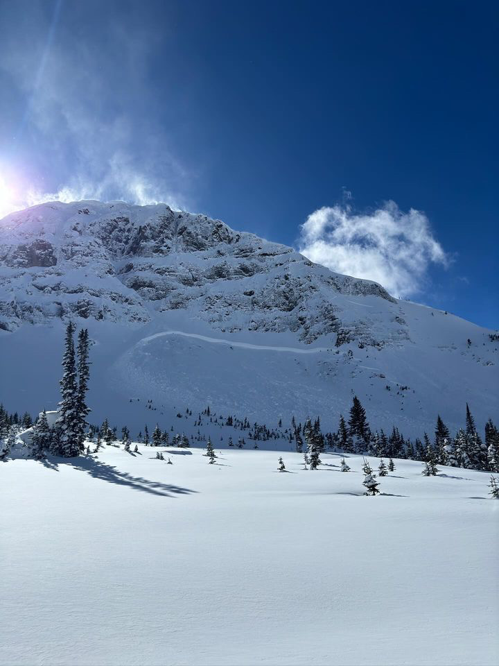
We saw one avalanche on a southeast facing slope. At about 7,400’ on a North facing slope we experienced a valley shaking whumpf while traveling up a heavily used ski track.
Full Snow Observation Report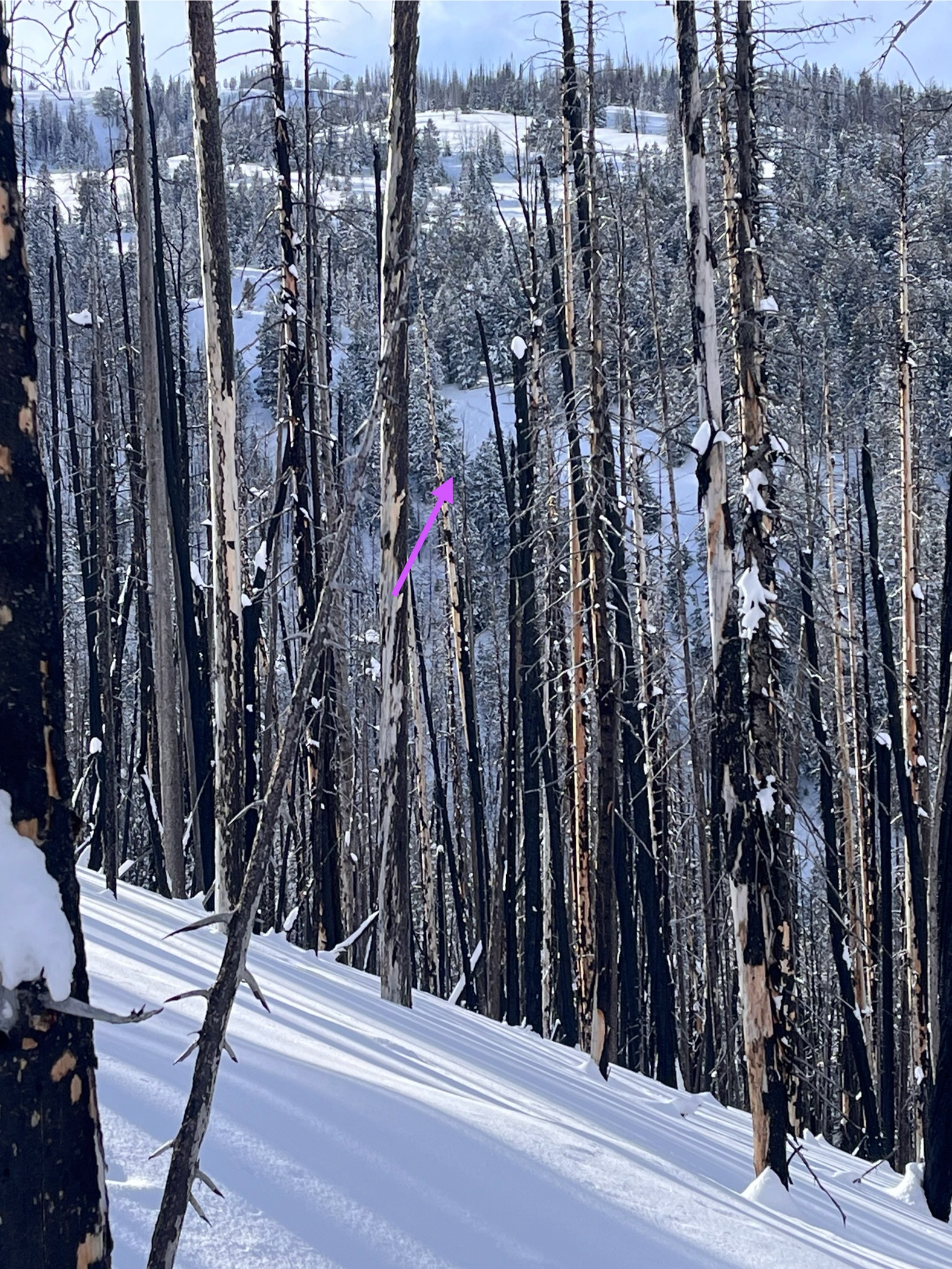
Remotely triggered a large avalanche on a N aspect at 9500 ft while ascending a ridge line [in Mill Creek, Absaroka]. We estimated the slide to be D3 R3. The crown spanned roughly 1400ft +/- and ranged between roughly 1-5ft deep. They appeared to be 2 distinct layers in the crown profile, one of recent ‘storm’ snow and a lower one above old facets. This was observed from a distance. Witnessed large trees being shaken by the slide and smaller ones completely breaking. The bottom of the run out became much more planar indicating the sheer volume of debris that filled in. Extremely powerful to witness such energy and destruction. All persons in the party were in safe terrain with no intention to ski this slope at all.
Full Snow Observation Report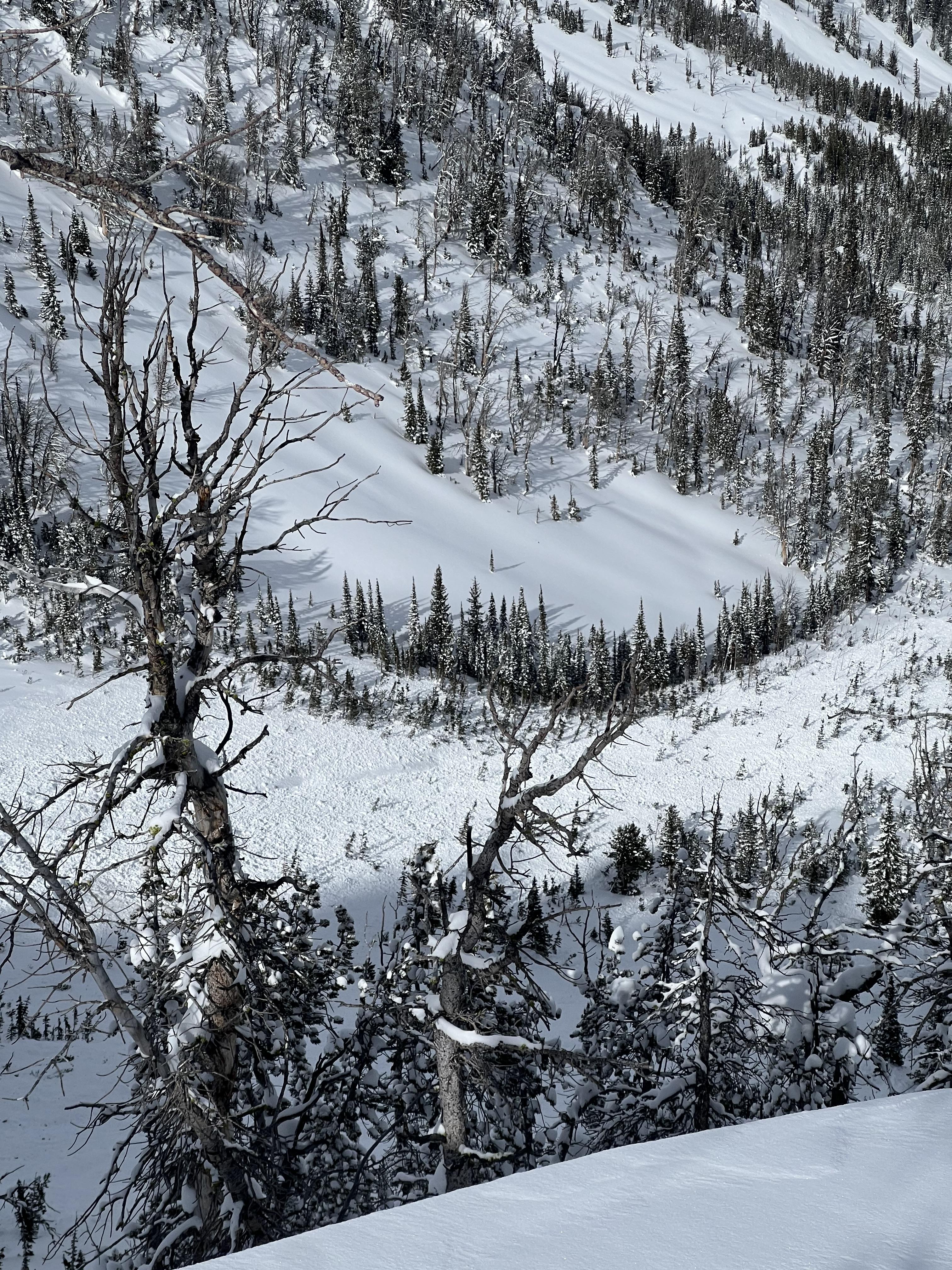

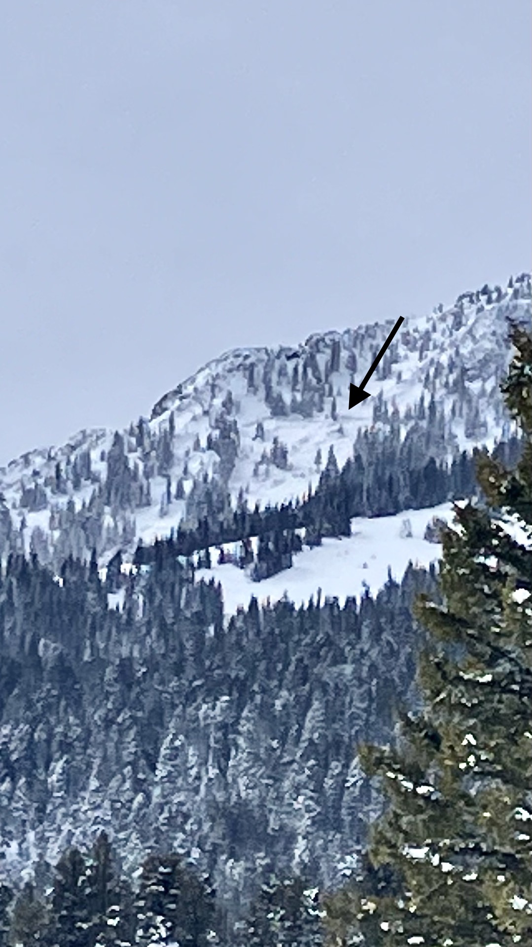
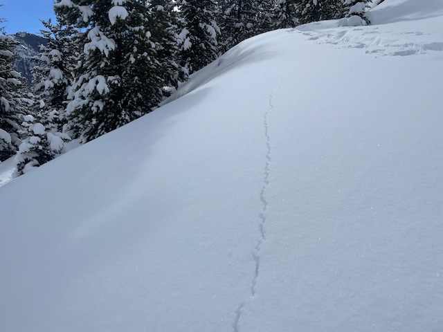
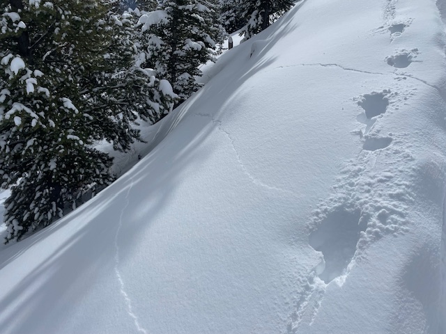
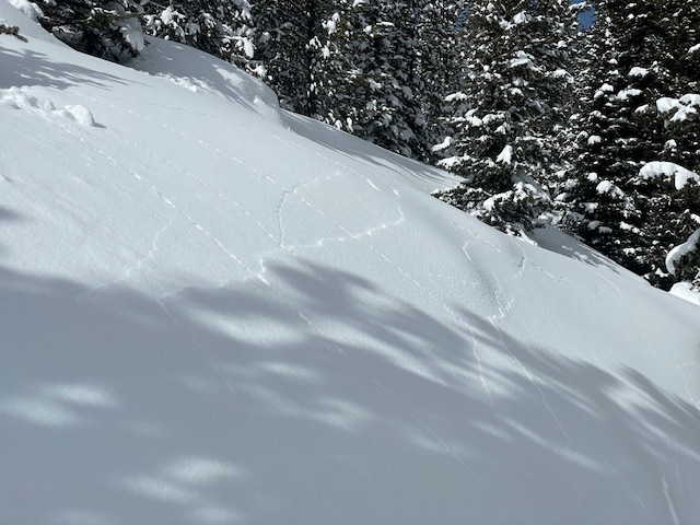
Noticed the pictured recent avalanche on an east facing aspect in the alpine of Beehive Basin. I would estimate it at a D2 size slide. It seems to have been naturally triggered by cornice fall and likely stepped down to older faceted snow deeper in the snowpack.
Full Snow Observation Report
Toured from the buffalo horn pass trail head to the pass itself. I didn’t go super high only a little over 8600’. I was shocked by the stability the snowpack showed however. I only had 1 collapse all day and that was at the trailhead. I wasn’t getting cracking at my feet. I definitely don’t trust the snowpack but it is the least reactive place I’ve seen yet to a fresh dump. Definitely some recent wind loading up high. I’d say a foot of new snow at the pass itself and 8” at the trailhead.
Full Snow Observation ReportMellow ski/split tour up to ridge from the pass day after the storm. Fresh snow in trees was 4-6”, in meadows fresh snow had moved around & was trace to a foot. Tops of trees had snow blown off, ridge itself was windswept & trees were coated in rime/hoar.
We stuck to terrain <30 degree slope and observed no avvy sign. Fun ski down, especially upper glades, & we were there only tracks out there once we got out of the lower meadows.
Full Snow Observation Report
We were skiing out of the Cabin Creek cabin over the weekend, mostly in the low angle terrain around Skyline Ridge. Throughout the storm on Saturday and after the clouds cleared on Sunday we experienced consistent whumpfing while breaking trail. Some were larger and some were smaller, usually triggered by the person breaking trail but some of the larger ones were triggered by the second or third skier in the track.
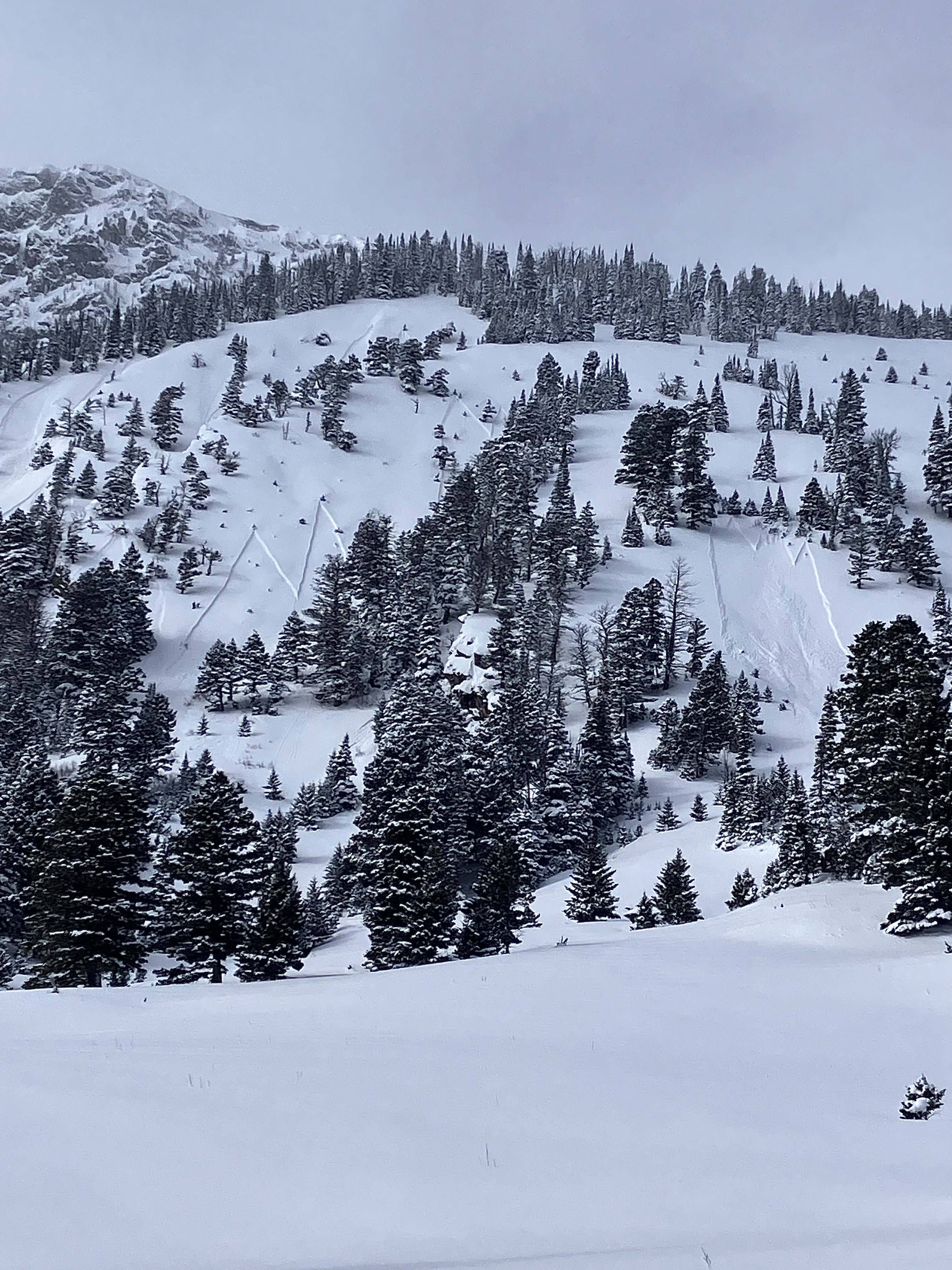
Full Snow Observation ReportPictures of an avalanche on Henderson Mountain just south of Lulu Pass taken on 3.3.24 (avalanche ocurred on 3.2.24).
Just wanted to pass along some high-resolution images in case they are helpful for future education.
Thanks for all you do!
-Alyssa Barrett
Full Snow Observation Report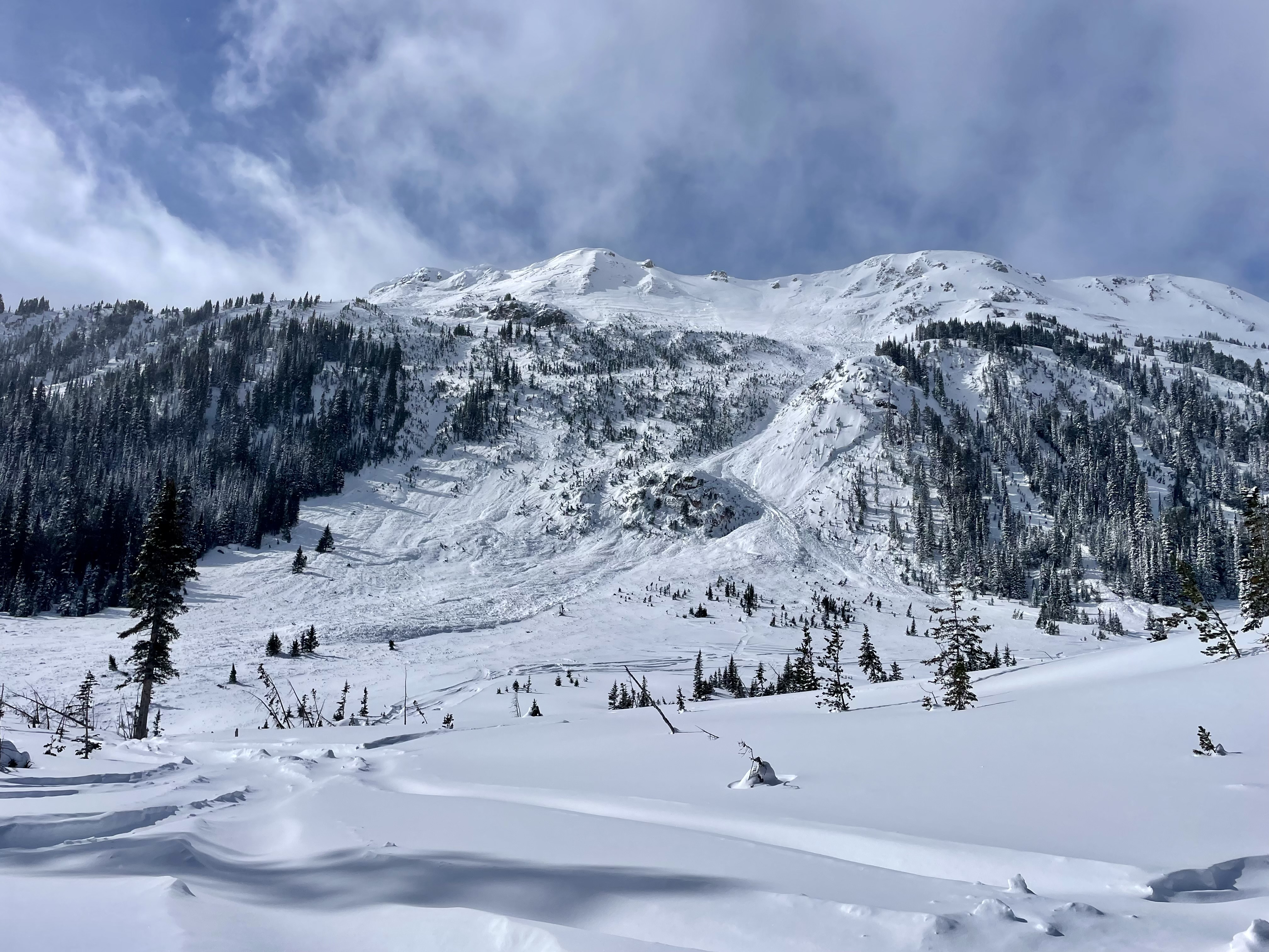
Toured to the zipper for some 25° meadows and while the skiing was excellent, the stability was not. We triggered numerous thundering whumphs and got shooting cracks, the largest of which propagated at least 100' wide! See snow profile attached with test results.
Full Snow Observation Report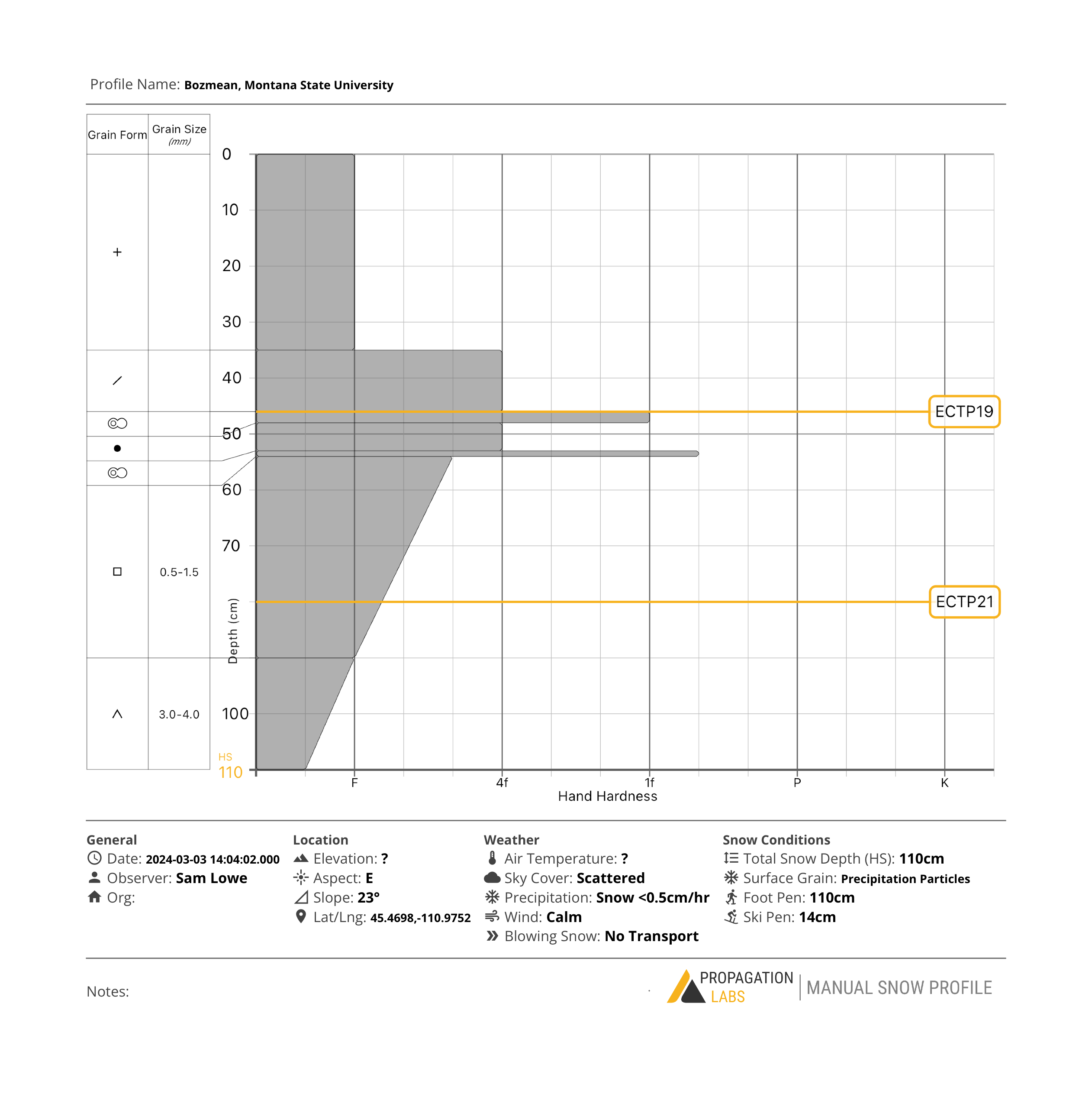
6" snow since Friday at 6000' in Mill Creek, very strong winds last night. Observed this large avalanche on an east face at treeline, appears to have failed on the weak snow at the base of the snowpack. Additional crowns observed in the bowls and chutes above it (these have been repeat offenders this season).
Full Snow Observation Report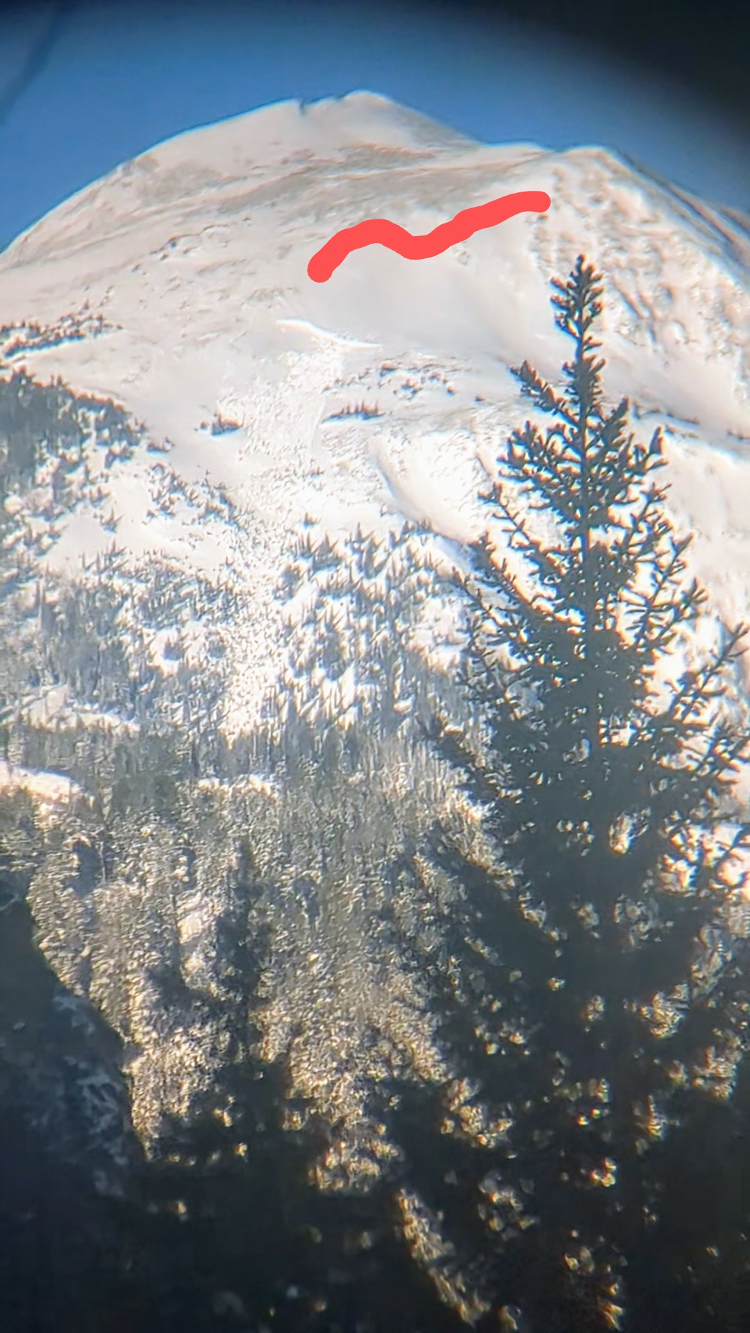
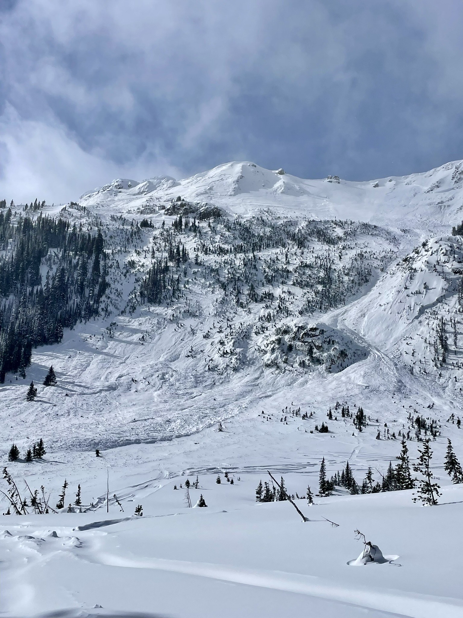
Continued signs of instability on a tour in Maid of the Mist Basin. A couple large collapses down low in the trees, wind slabs above tree line on variable aspects due to swirling wind up high. Large avalanche crown (10’ - 12’ in places) at the back of the basin which looked to have been trigger from cornice fall 3-4 days ago. ECTP 28 55cm off of ground on a 5cm thick layer of facets. Pit was dug on an east facing slope at 9,100 feet.
Full Snow Observation Report