Snow Observations List
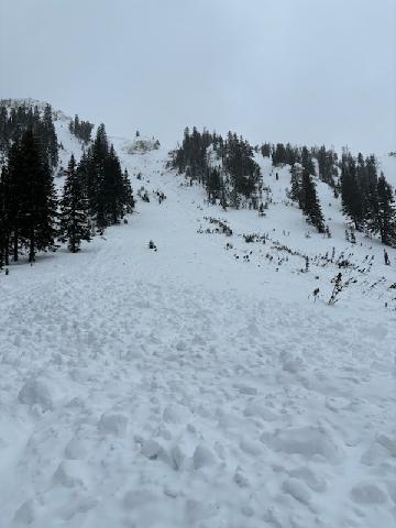
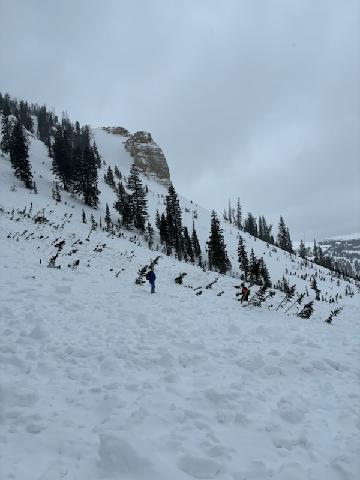
Secondhand photo and story regarding two snowmobilers sidehilling the northwest aspect of Twin Peaks and triggering the slide in the photos. They were both able to ride out of it. This avalanche is located about 150 yards north of the Twin Peaks avalanche accident site from January 2024.
Full Snow Observation Report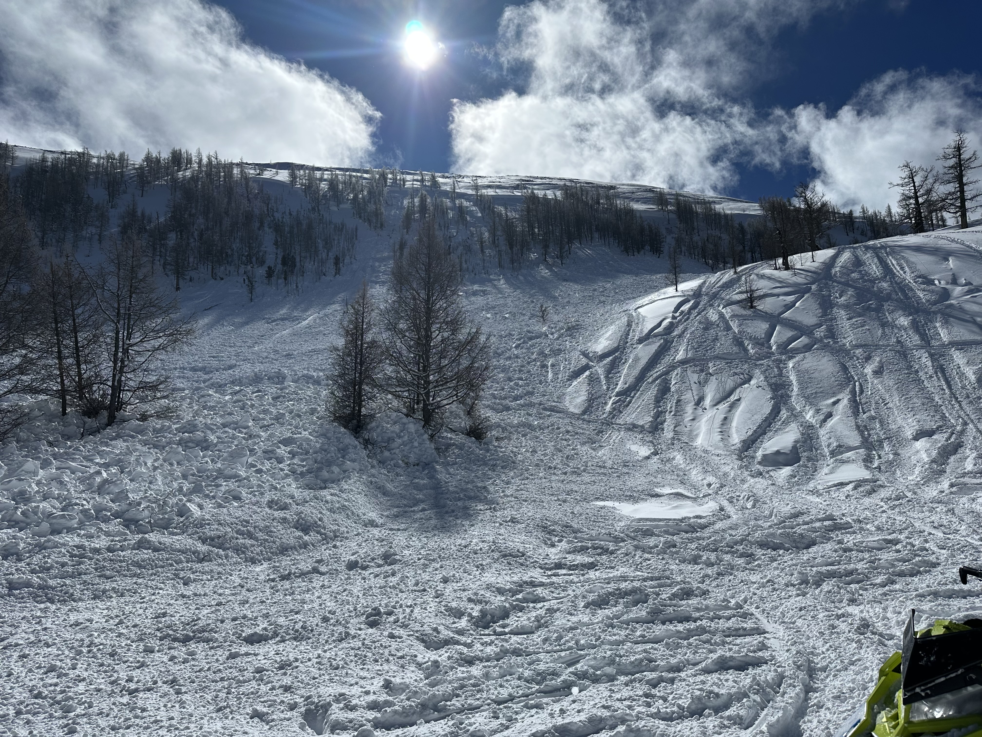
Guides at Beartooth Powder Guides saw numerous natural avalanches near Cooke City. They noted new snow avalanches on most slopes steeper than 30 degrees. Additionally, they saw several avalanches that broke several feet deep on east, southeast, and southwest-facing terrain.
Full Snow Observation ReportFrom IG 3/2: A skier triggered this slide in the Bridgers.
Full Snow Observation ReportI think this was skier triggered, but waiting for a response.
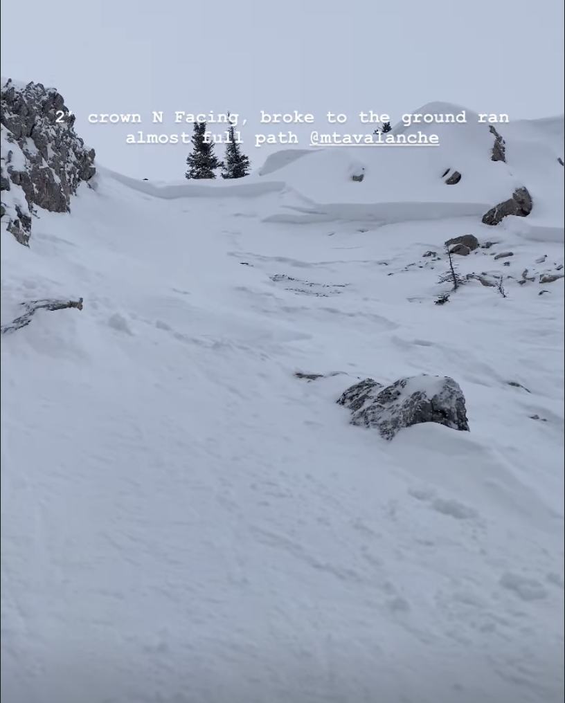
Photo from IG, slide occurred night of 3/1.
Full Snow Observation Report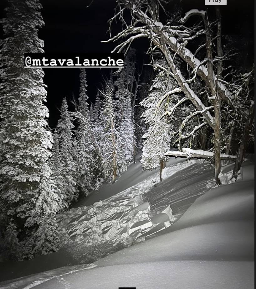
From email: "We were 3/4 the way up lulu today on the west side of the creek under the Henderson Bench. It broke1/2 way down off the top ridge and ran all the way to the creek. Debris pile 20+ feet. Location matches super slide of 5-6 years ago, we were accros the drainage sitting on the "match sticks" layed out on the trail thru lulu. Ran into the Av center team about an hour before the incident, and as always thanked them for being the best and keeping us all informed! Nobody caught, remote trigged, but we were luckily across the drainage when it went!"
Full Snow Observation Report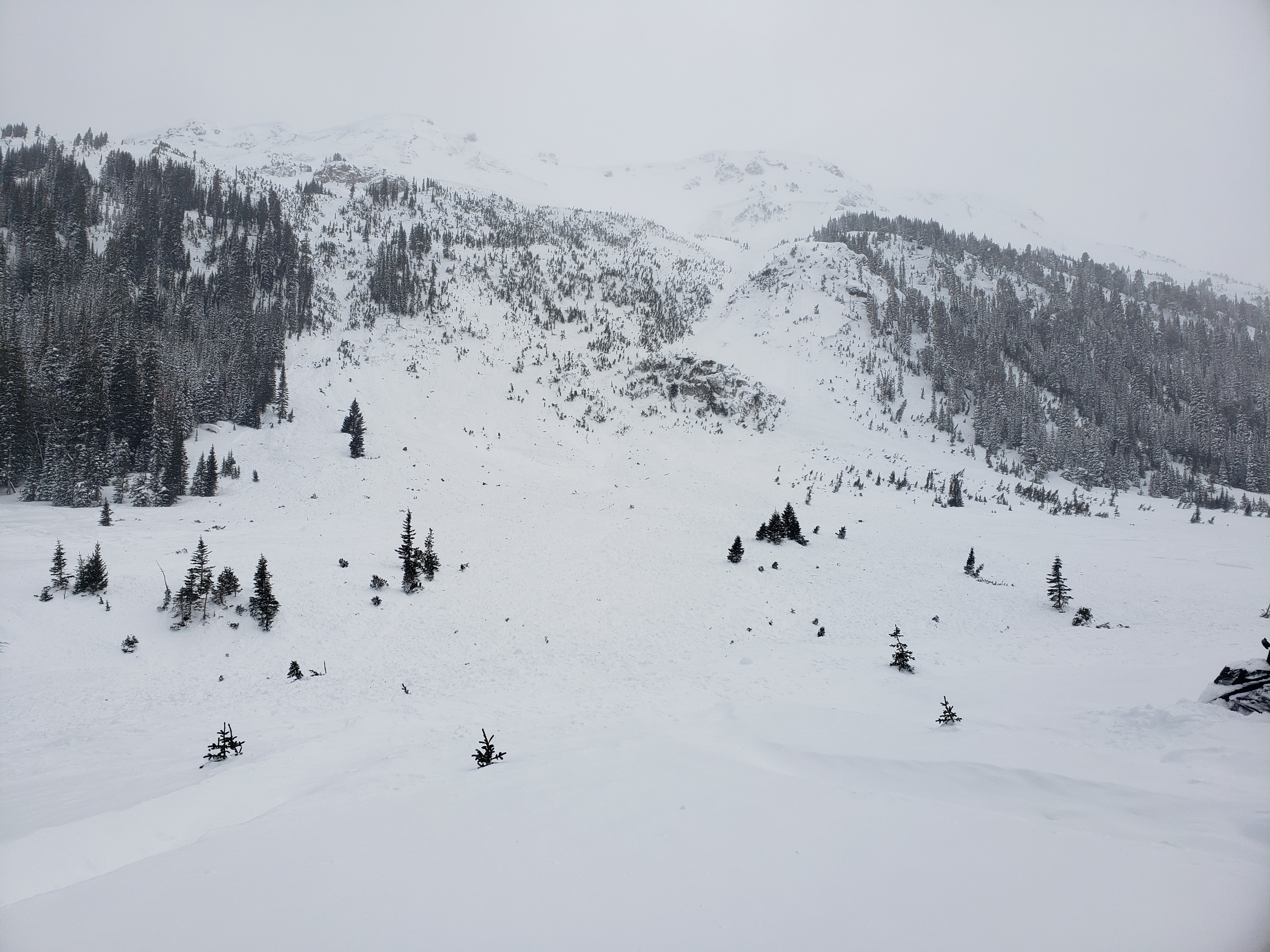
From email: "New Obs from Bridger side country. Toured Texas Meadows over to the playground. Saw some small point releases in new snow on south and southwest facing aspects. At the top of the playground I dug a small hand pit. I suspect it was in a shallow snow pack area, as I was able to dig to rock before running out of arm to dig. The snow was getting wet the whole way through (could make a snowball even out of the snow at the ground level where I was looking for buried persistent weak layers). On the southern aspect of the playground we saw some roller balls that had been covered by the new snow yesterday and today. The only places we saw evidence of wind on our tour was just past the bridger boundary. "
Full Snow Observation ReportWe rode into Tepee Basin and saw two recent avalanches. One looked like it happened this morning on a treed ridgeline, 1-1.5' deep 150-200' wide. The other looked like it maybe happened yesterday, on a heavily wind-loaded slope below some cornices, 2-2.5' deep and 250-300' wide. We had brief good visibility of the major avalanche terrain in the upper basin and didn't see any other slides. We measured 12" of snow = 1.5" of SWE that fell since Thursday. Snow was drifted near ridgelines and in the highest meadows. There was some cracking in the new snow around sled skis, but it was minimal.
Full Snow Observation ReportWe had a few time-consuming stucks along the trail in and out... more on that later.

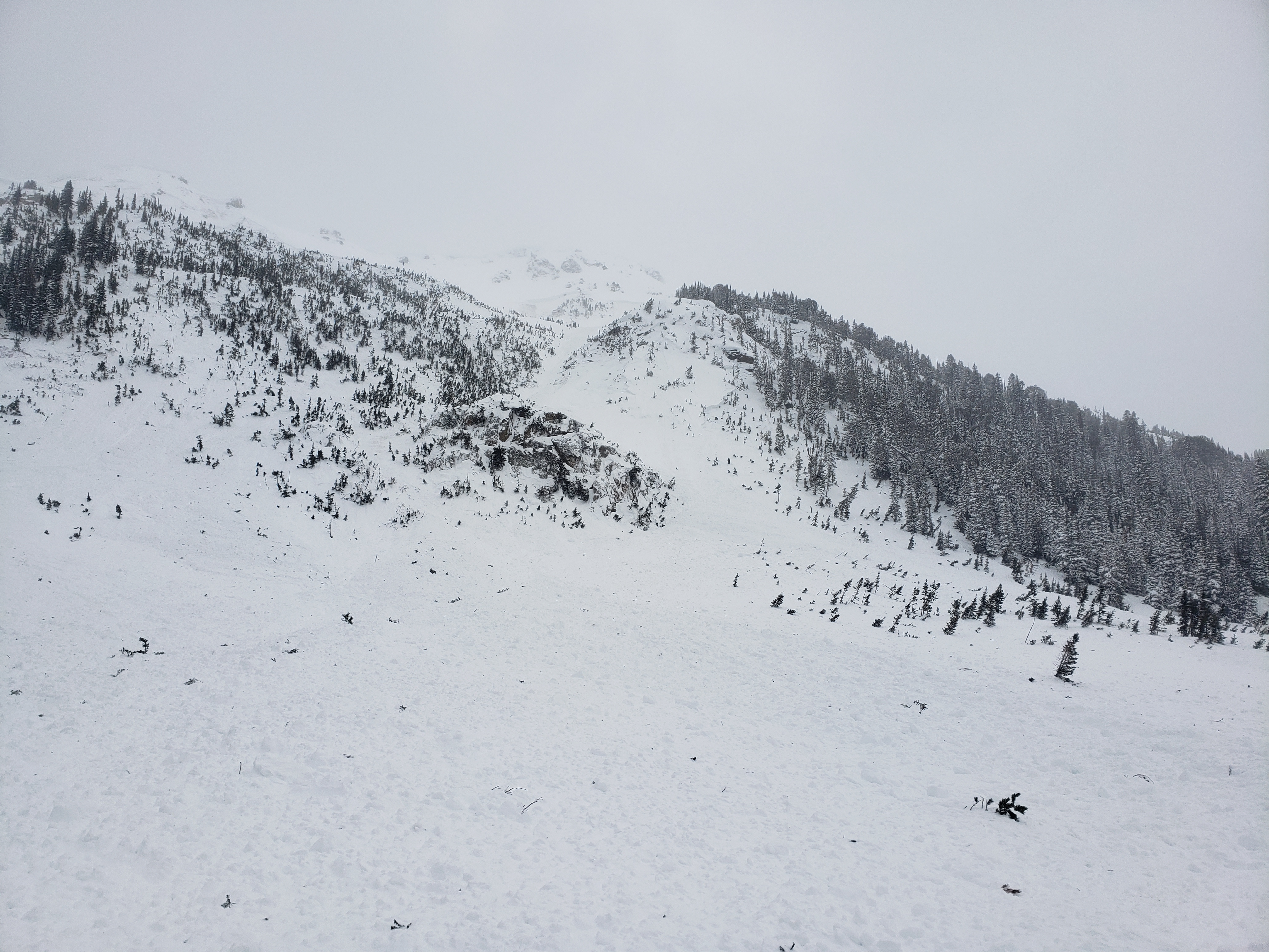
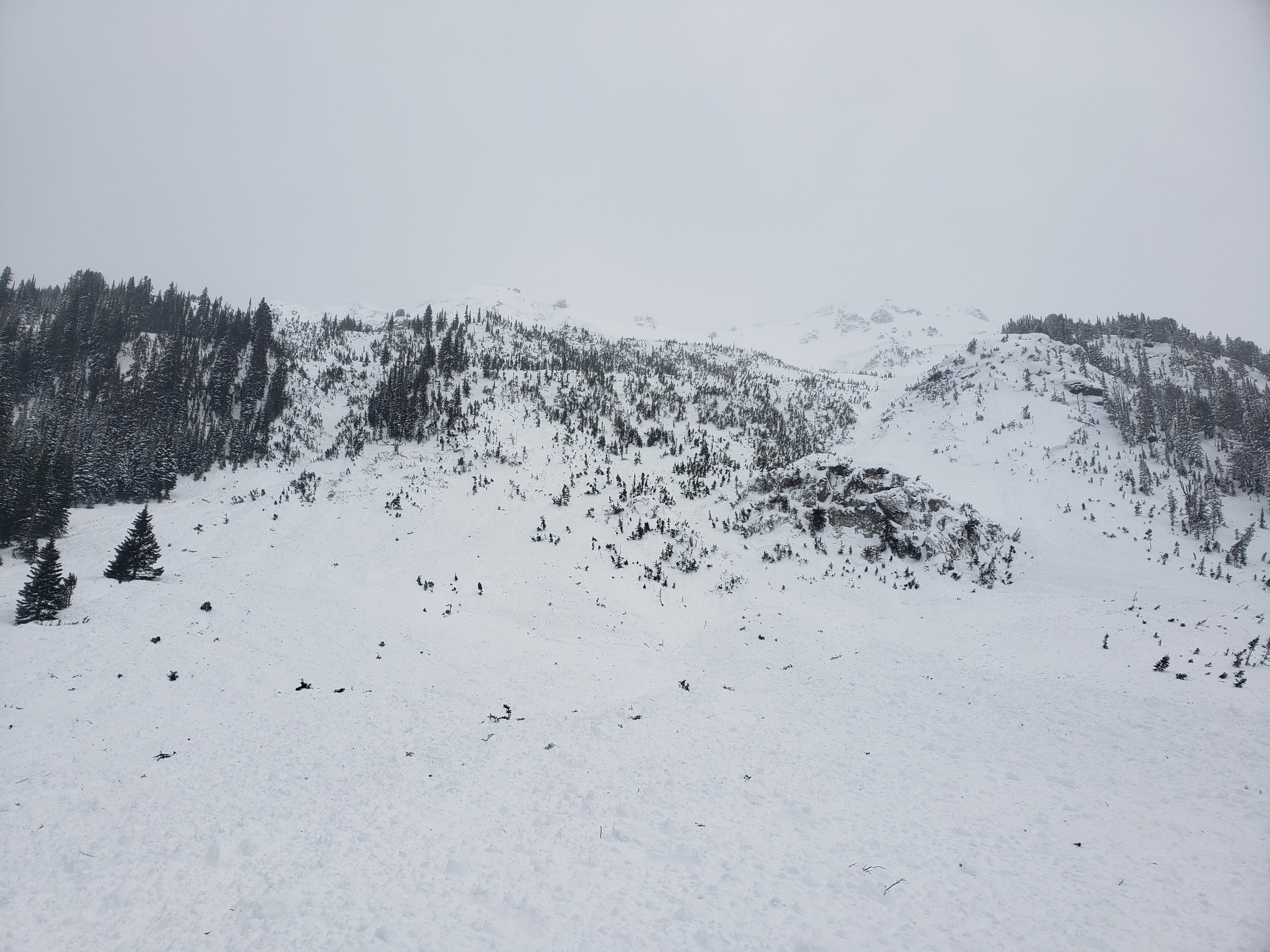
Watched a large avalanche come down the big Avi path on the east side of Henderson. The avalanche covered many snowmobile tracks from that afternoon. The crown varied and extended for 1,000 feet below the summit ridge. It was a huge volume of snow that reached Fisher Creek. The snowmobilers were lucky, as it was large enough to be buried deep.
Full Snow Observation ReportFrom a phone call with a friend: "Pretty sure we remote triggered this slide while skiing down a low angle ridge next to it. We saw it while we were ascending the uptrack and it wasnt there on our first lap."
2 Pics are from highway and are from the next day.
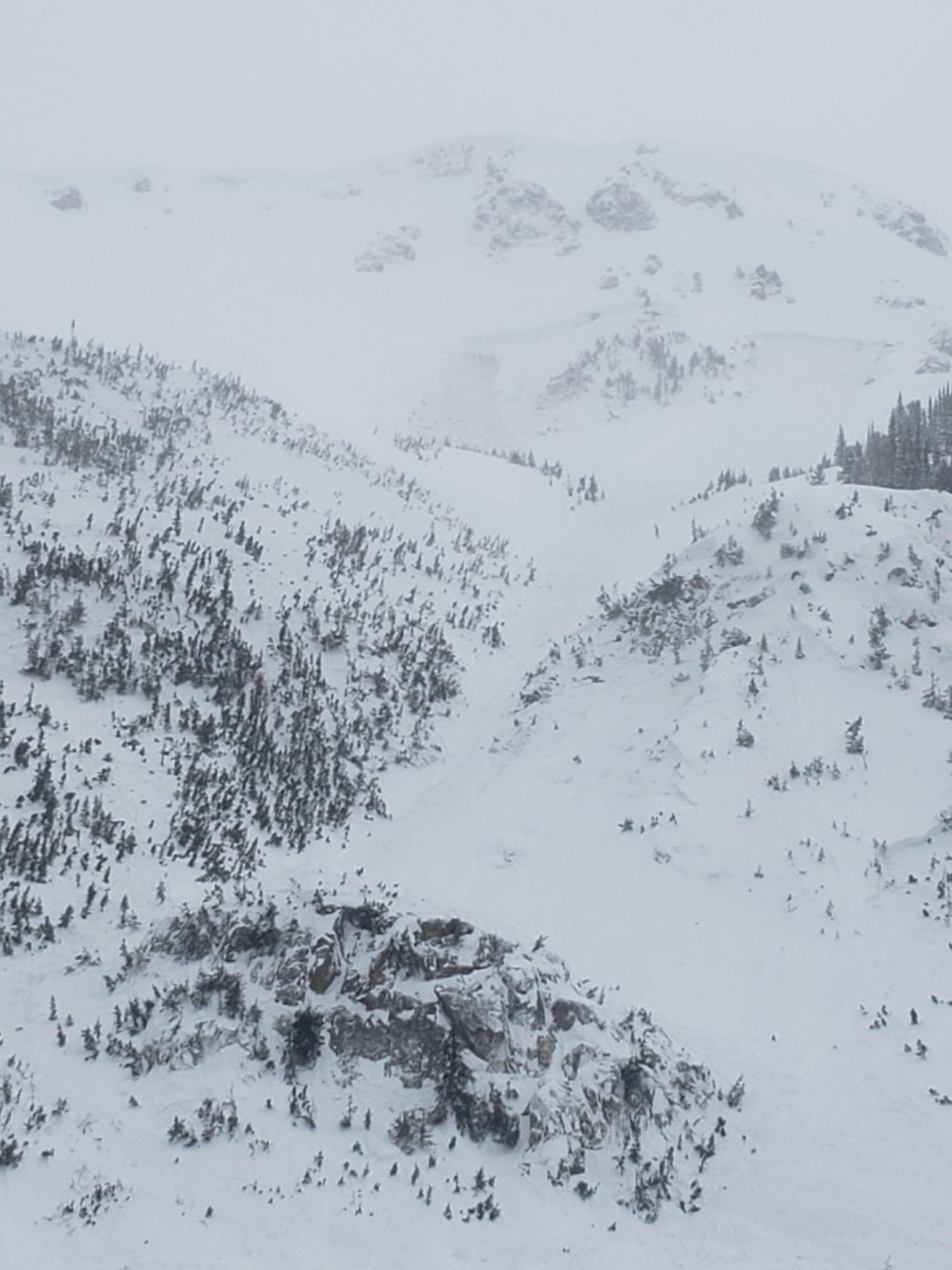
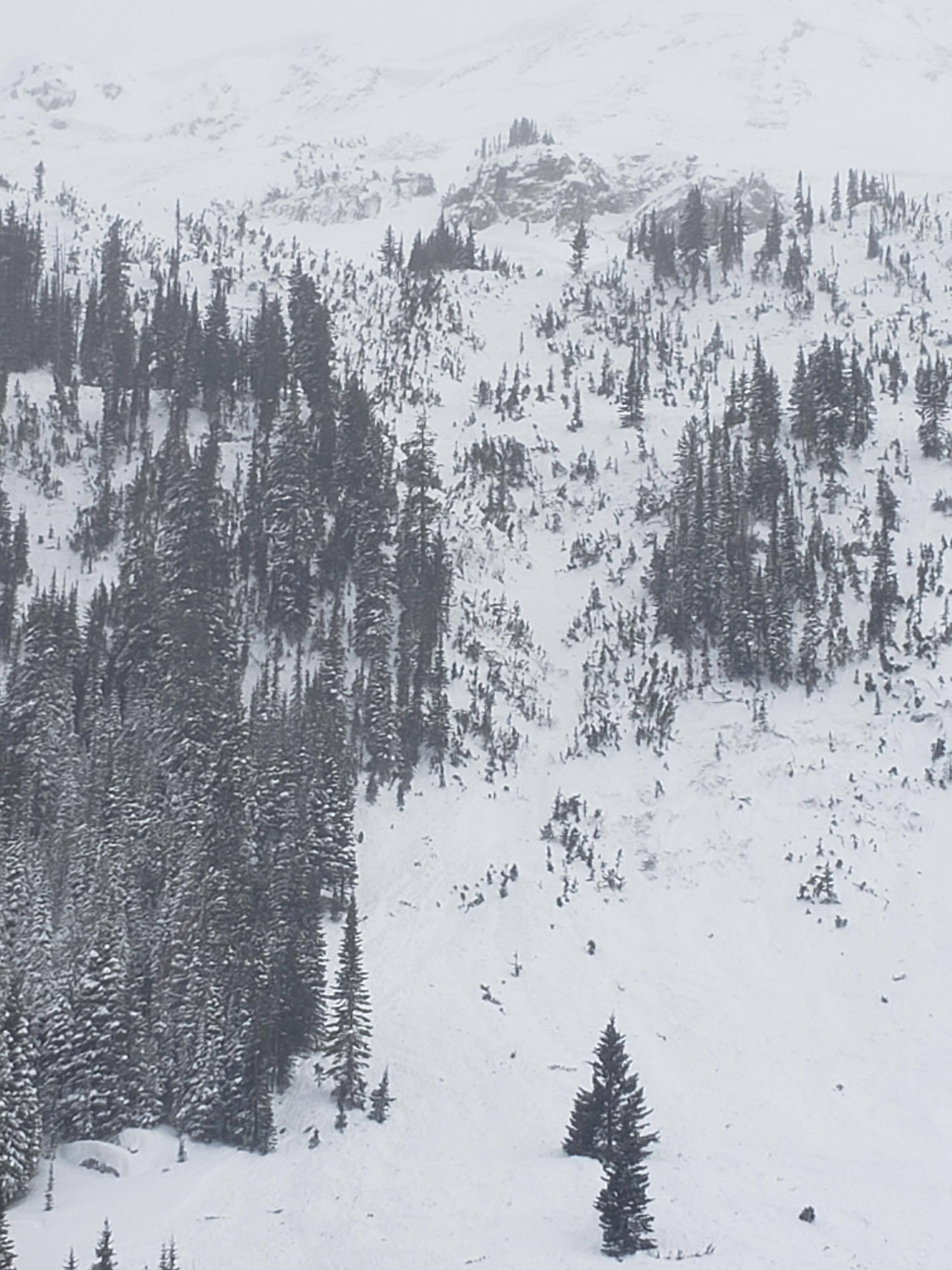
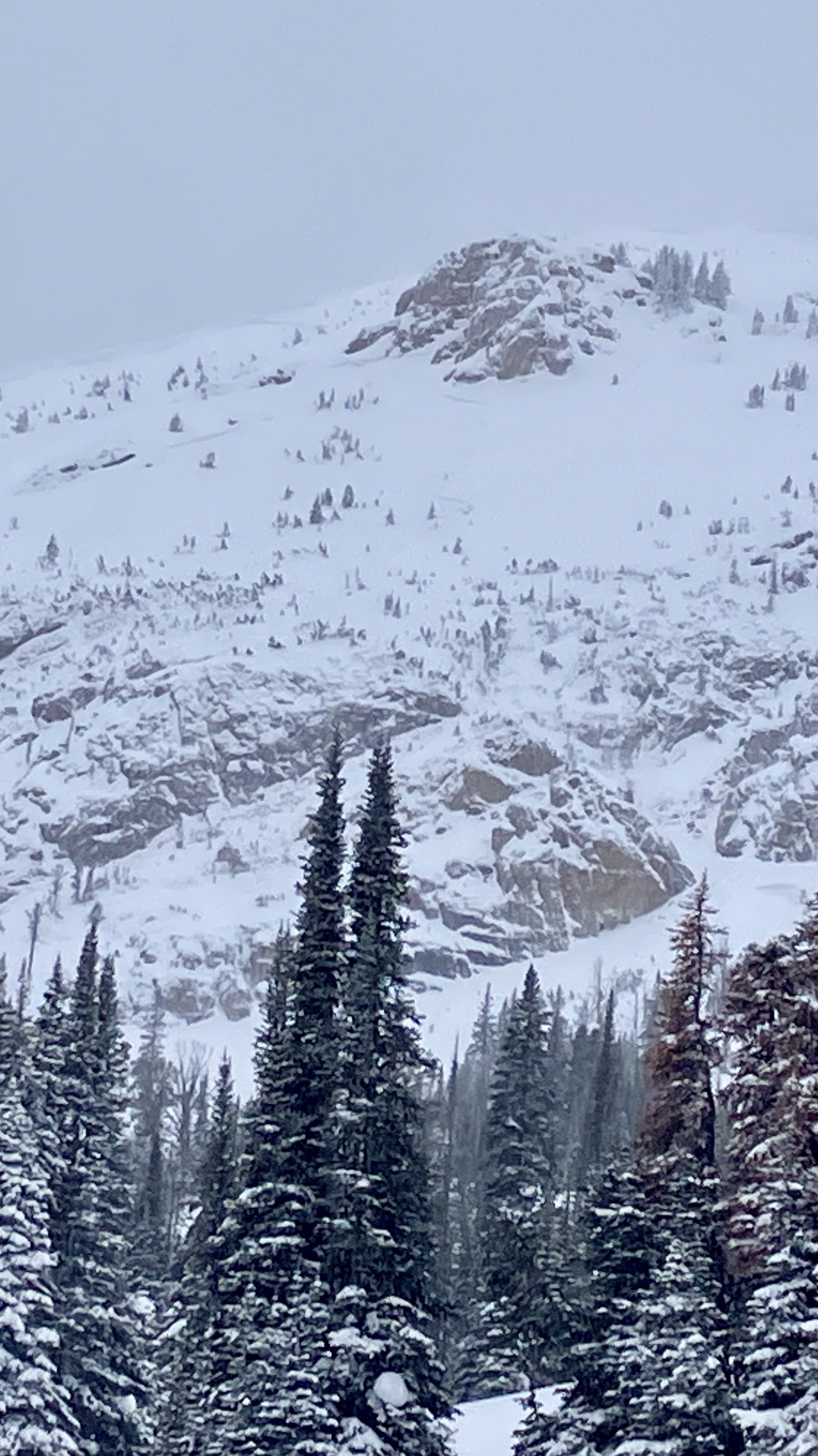
N-NW Facing slope at 7600ft. approx 100 cm deep. some stepped down to ground. approx 250 feet across and ran 3-400ft vertical. Large dangerous avalanche.
Full Snow Observation Report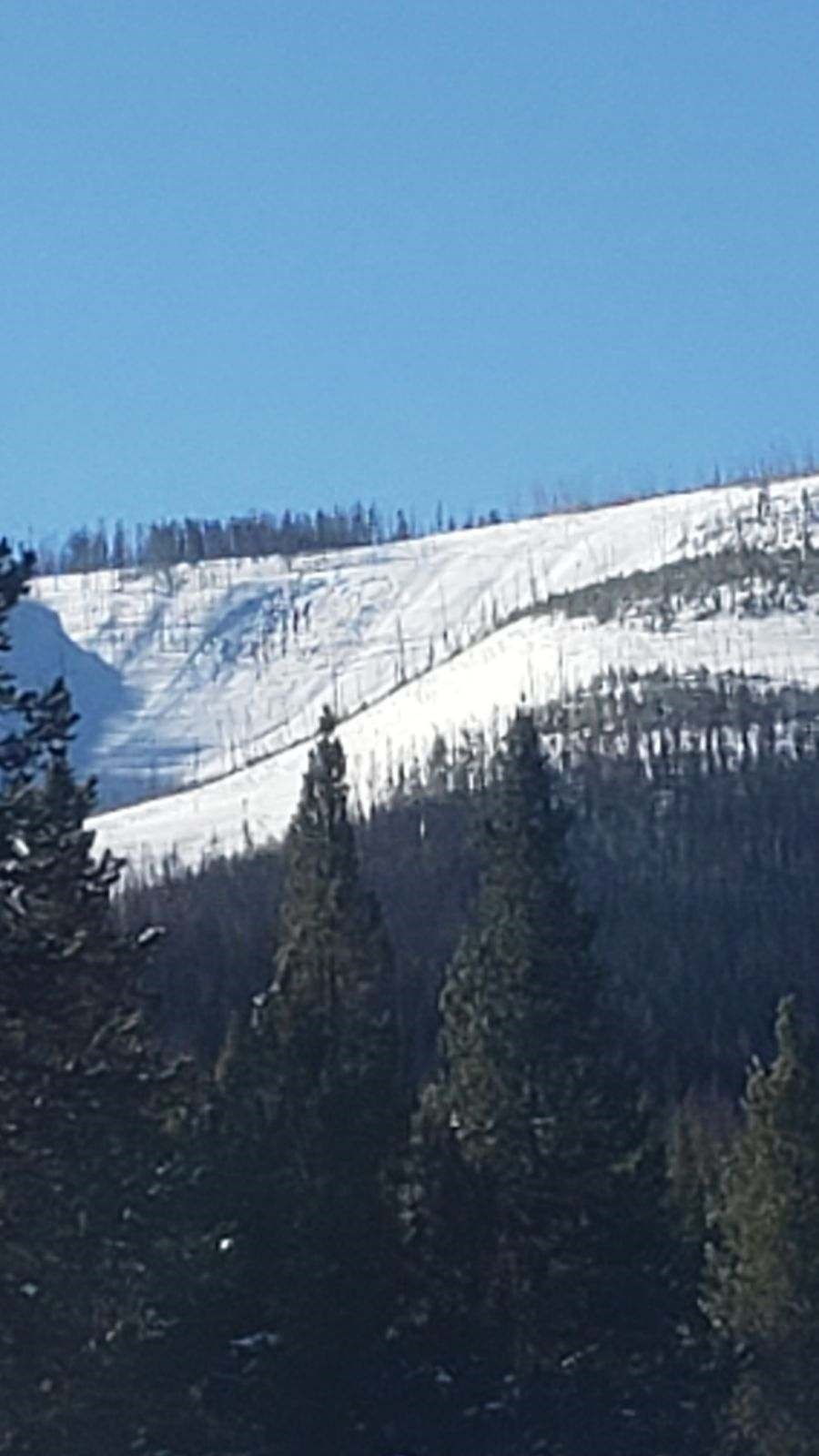
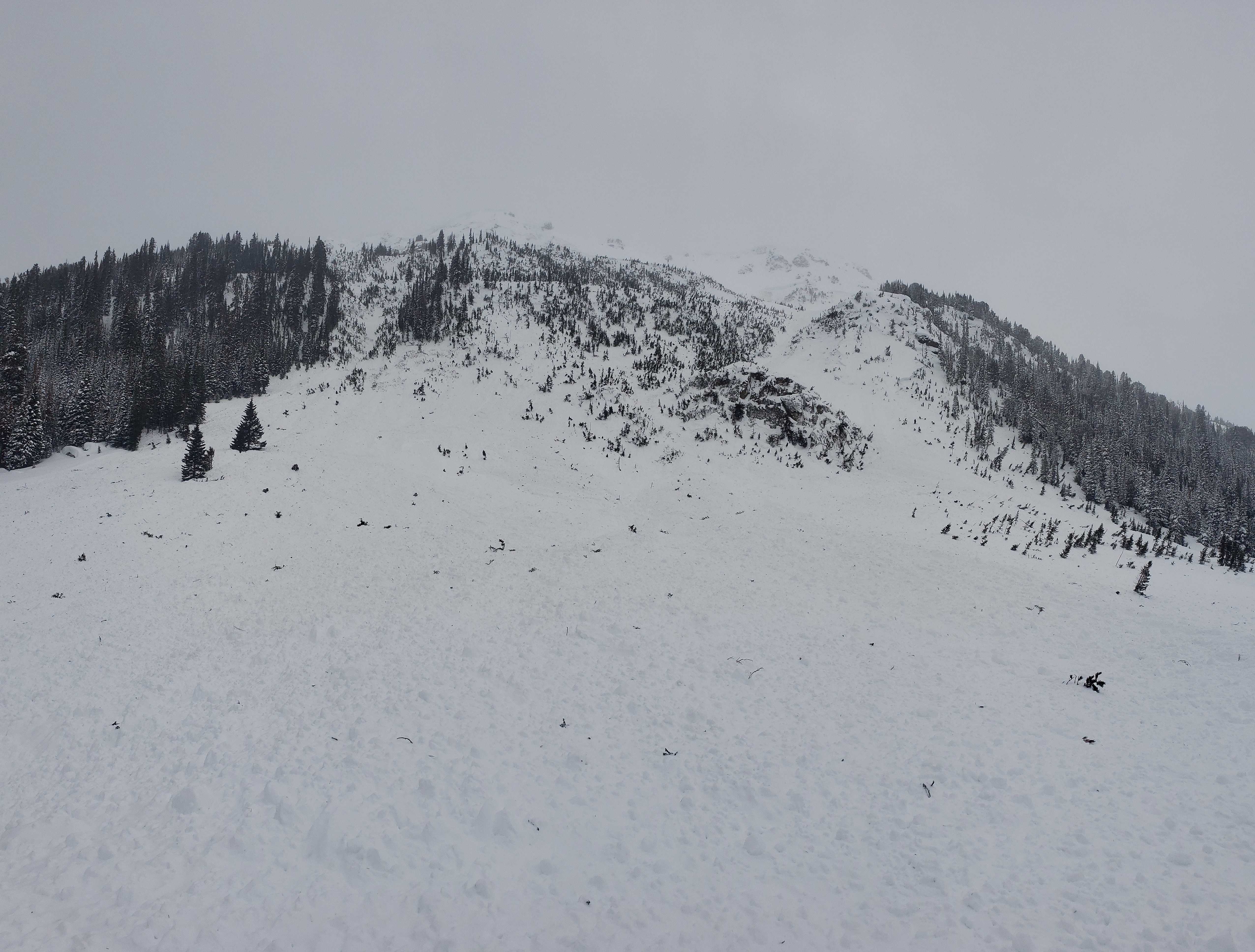
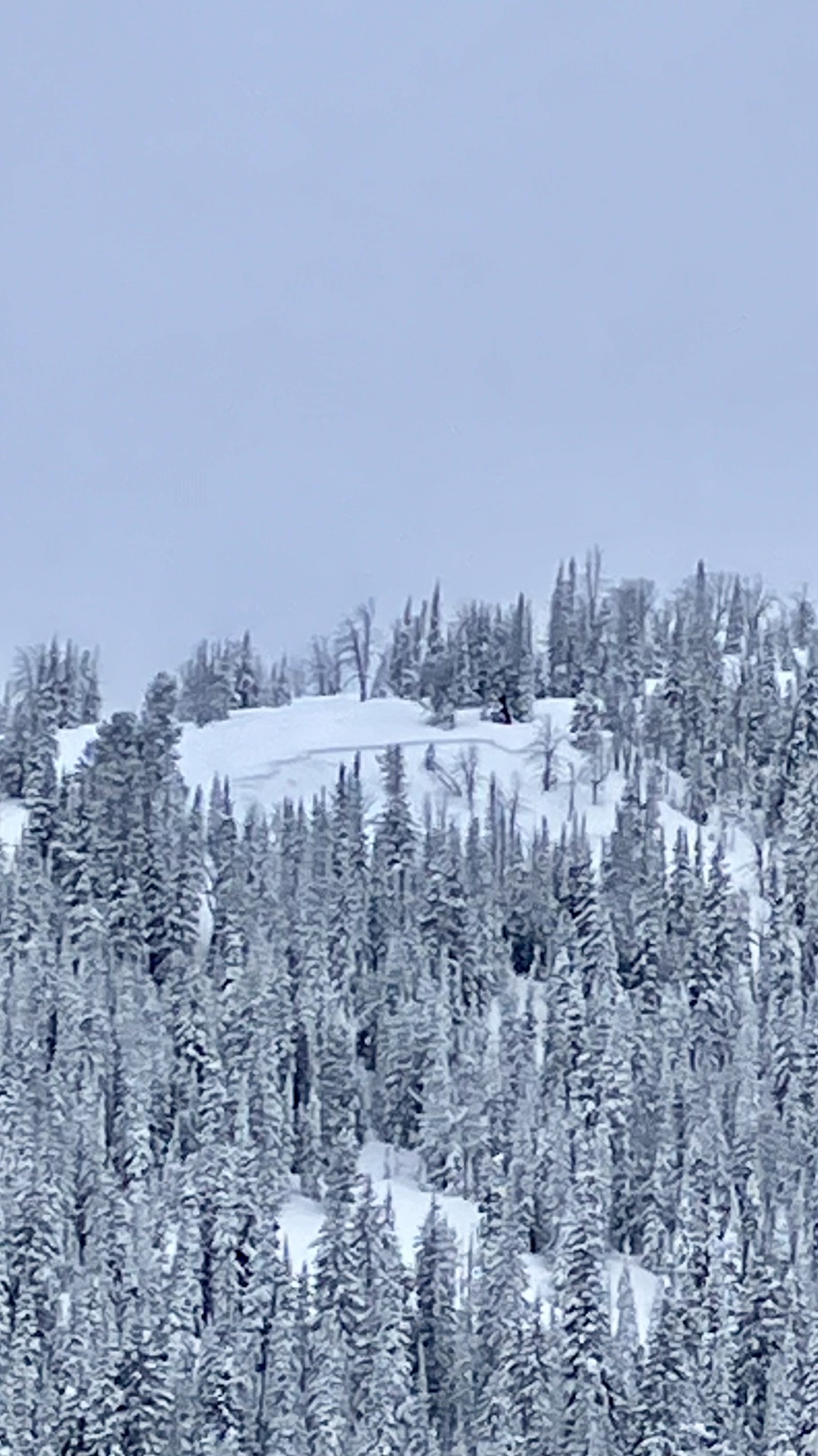
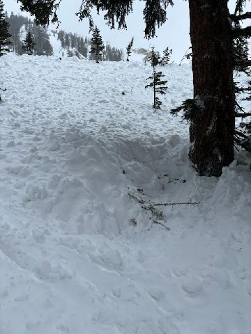
Observed Deep Slab avalanche on the Shoulder of Republic Mountain today. Went to ground runout/could see dirt throughout runout.
Full Snow Observation Report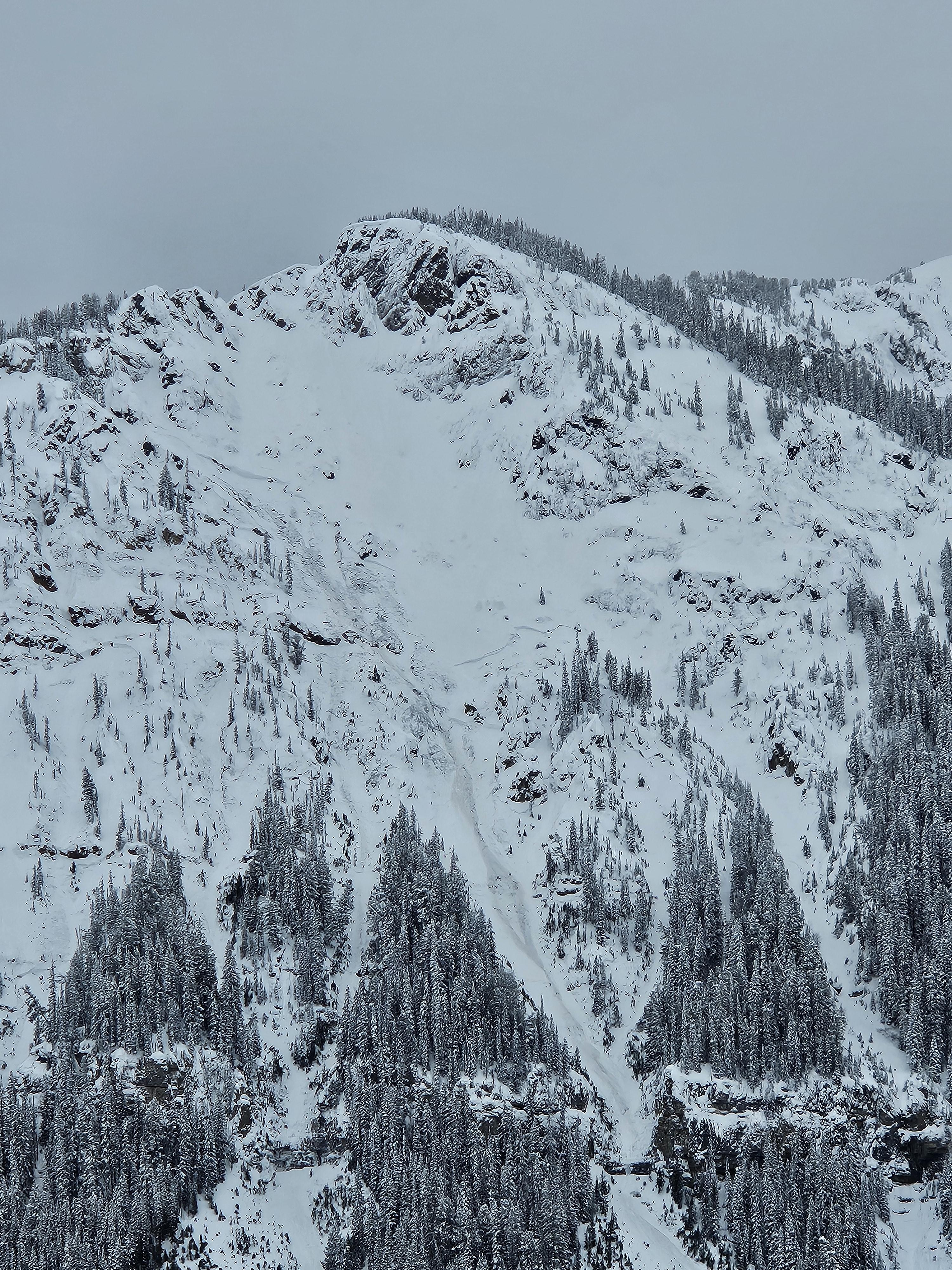
Unstable result on the S shoulder of lower Texas Meadows. ECTP 12 - 40 CM down on a crust facet combo from the last warm up. E facing 23 degree slope, 7639 ft.
Full Snow Observation Report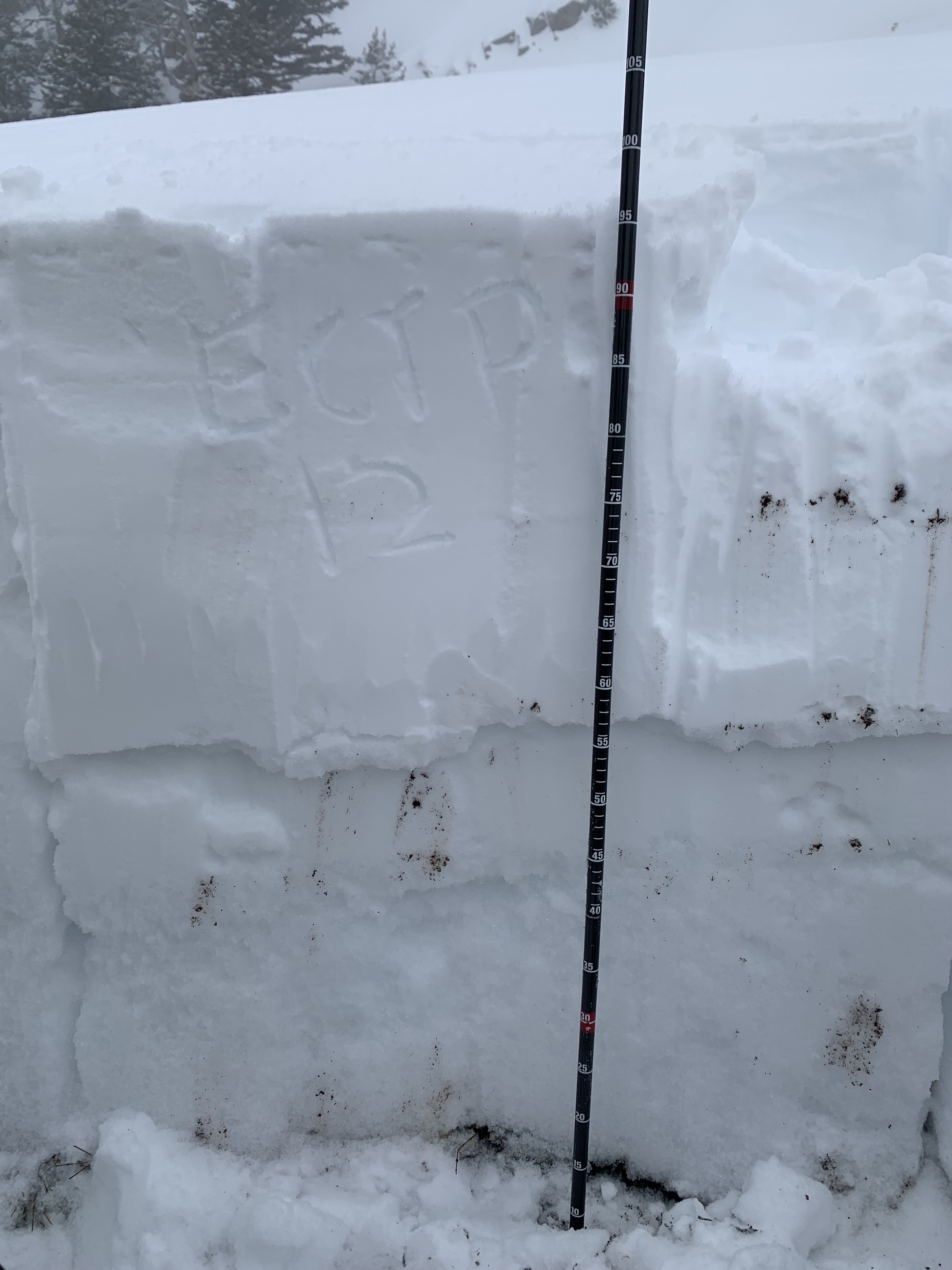
We were descending through the the trees off bacon rind when we skied upon a natural avalanche that appeared to be from today. The slide began at the top of a small clearing in the woods and went down through the trees below. However, we could not see how far down it went. The crown was roughly 3-4 feet deep and propagated about a hundred feet or so. This was on the eastern facing aspect of bacon rind just south of the normal ascent trail.
Full Snow Observation Report
Two remote triggers from about 250ft away on a slope up lulu pass. A lot new snow and everything was sliding above 30 degrees.
Full Snow Observation ReportMultiple avalanches on Rasta Chutes on Scotch Bonnet. Did not run full path but probably 3/4 at least. Crowns were 2-4’. Debris pile by the up track to tregencic was probably 6-8’ deep.
East Henderson had also slid near Fisher peak. Vis did not allow for photos.
Riders were getting collapsing and cracking in low angle trees on East Henderson.
New snow was 2-3’ deep
Full Snow Observation Report


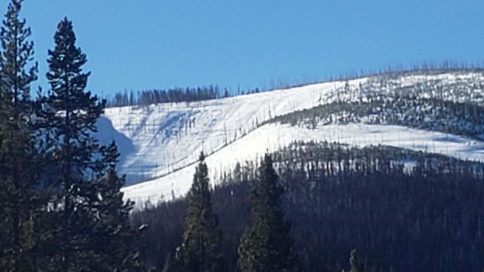
The sky’s broke for about three minutes today and I was able to get a look at the back north facing wall in the divide basin up the main fork of hyalite and it finally shed some of its layers.
the slide propagated the length between the two peaks in the photo
Full Snow Observation Report
submitted a snow pit on snow-pilot for yesterday 01032024. image attached.
Full Snow Observation Report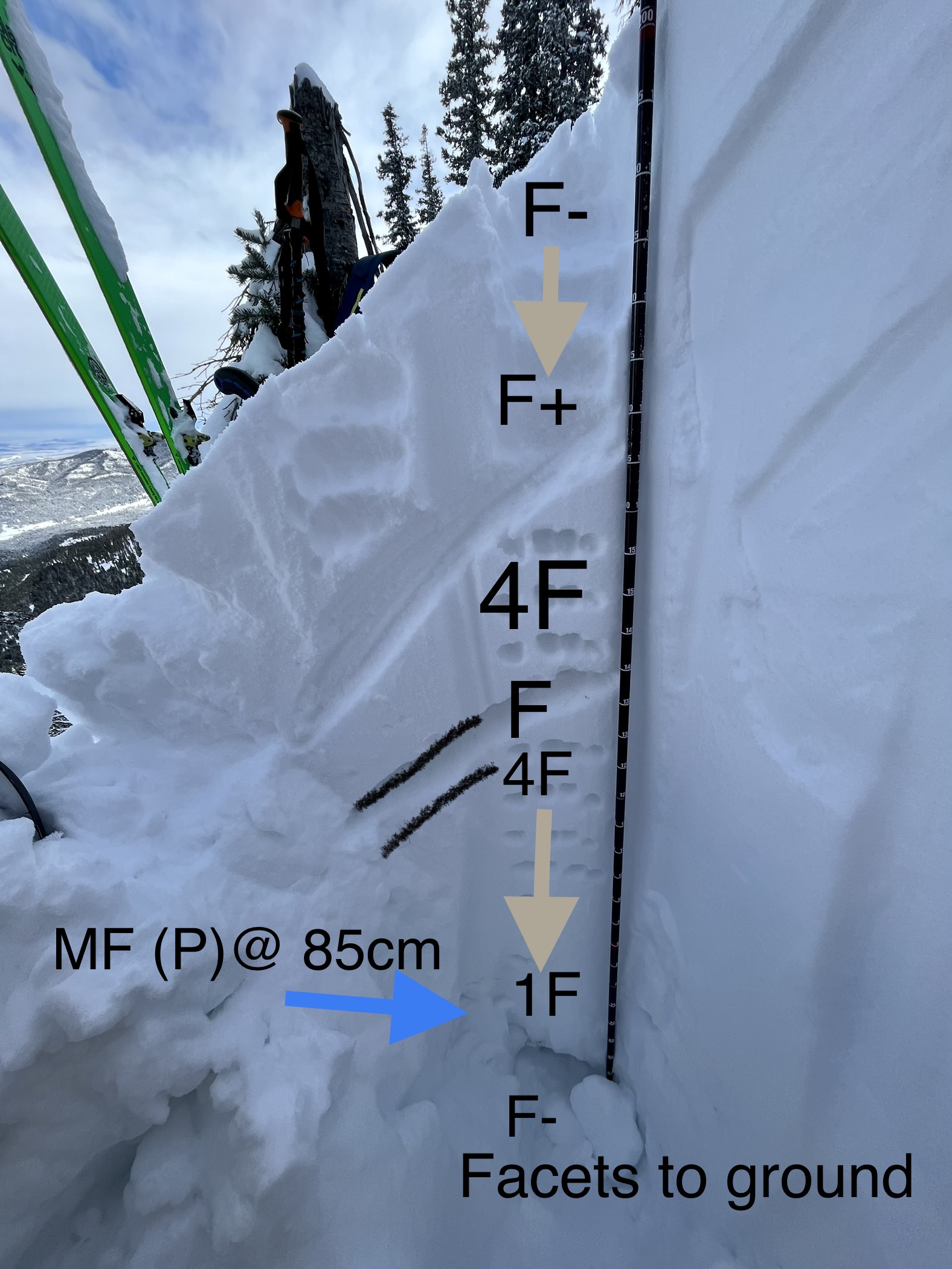
From a phone call:
A rider saw a large avalanche in one of the bowls around the corner of Lionhead avalanched. It likely occurred on Friday, March 1. There were holes dug in the snow indicating a buried person or sled. This is the same slope that killed a 19 year old from MN on December 28, 2006. They conducted a beacon search on the debris to make sure no one was buried.
Full Snow Observation ReportRyan Linhart reported this. He did a beacon search of the debris. A ghost signal with a 2-year old ortovox threw them a curve ball, but no other beacons picked it up.

Out with the Ride Rasmussen trip and found some test slopes to Sled cut.
Was able to produce some cracking and small slabs. S/SW aspect 7800.
Moderate to heavy snow throughout the day. New snow varies from 5”-10” in the deeper drifted locations.
From a phone call:
A rider was traversing a slope when he triggered and was caught in a slide. He was partially buried under his sled and was uninjured. He estimated the slide to be 150 yards wide and a few feet deep and breaking to the ground.
Full Snow Observation ReportThis was West Yellowstone LEO, Ryan Linhart.
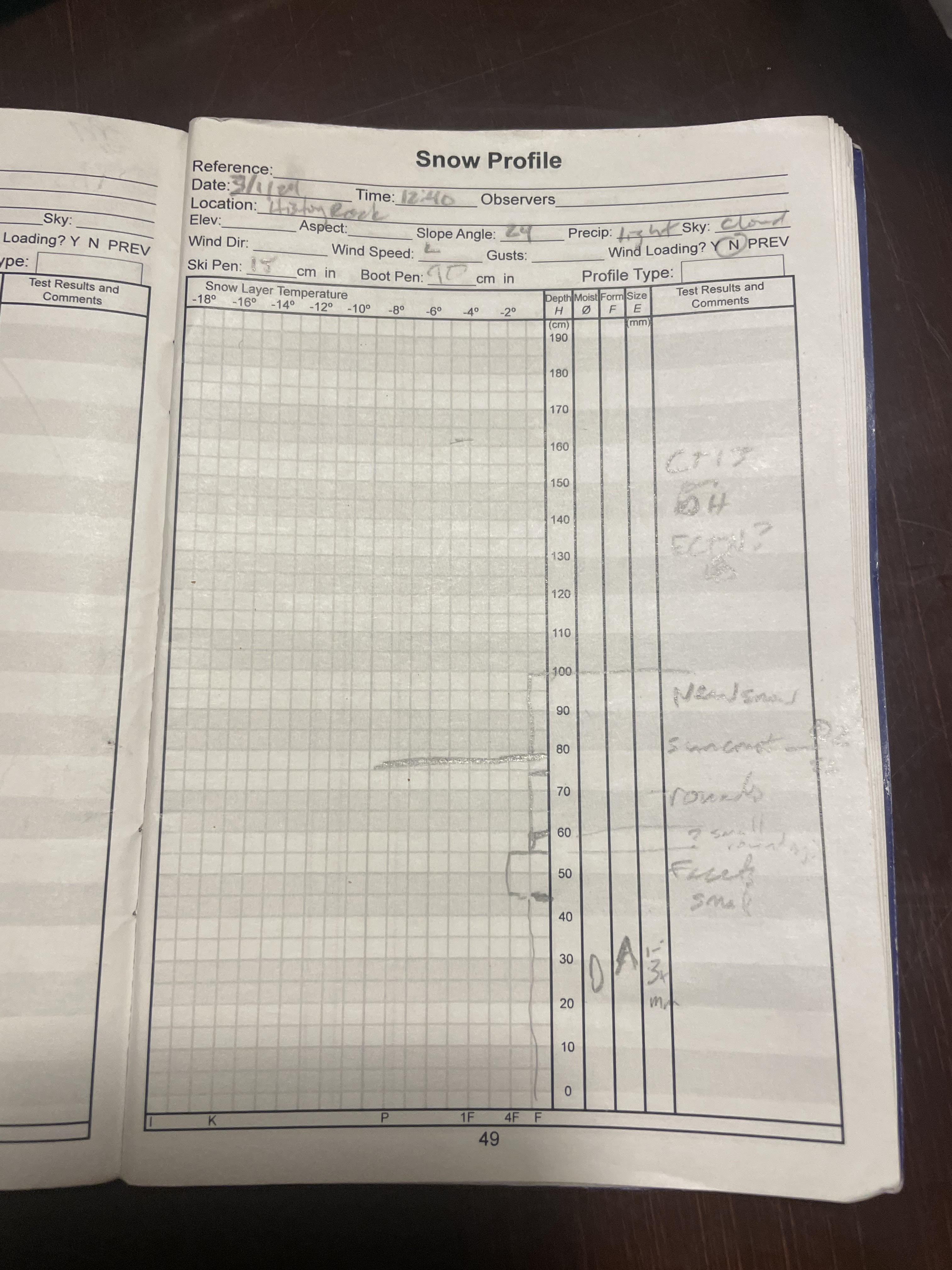
From email: "CT13 broke on depth hoar.
ECT15 broke as pictured below. "
Full Snow Observation Report