Snow Observations List
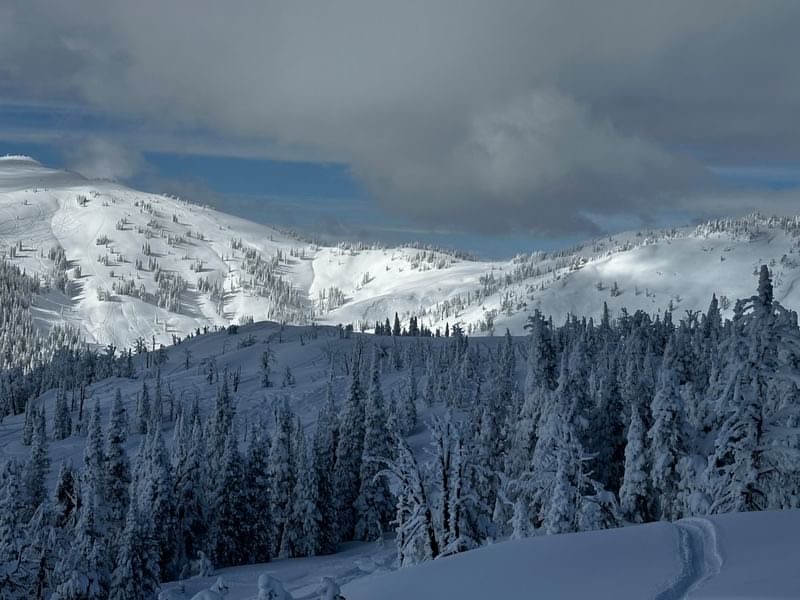
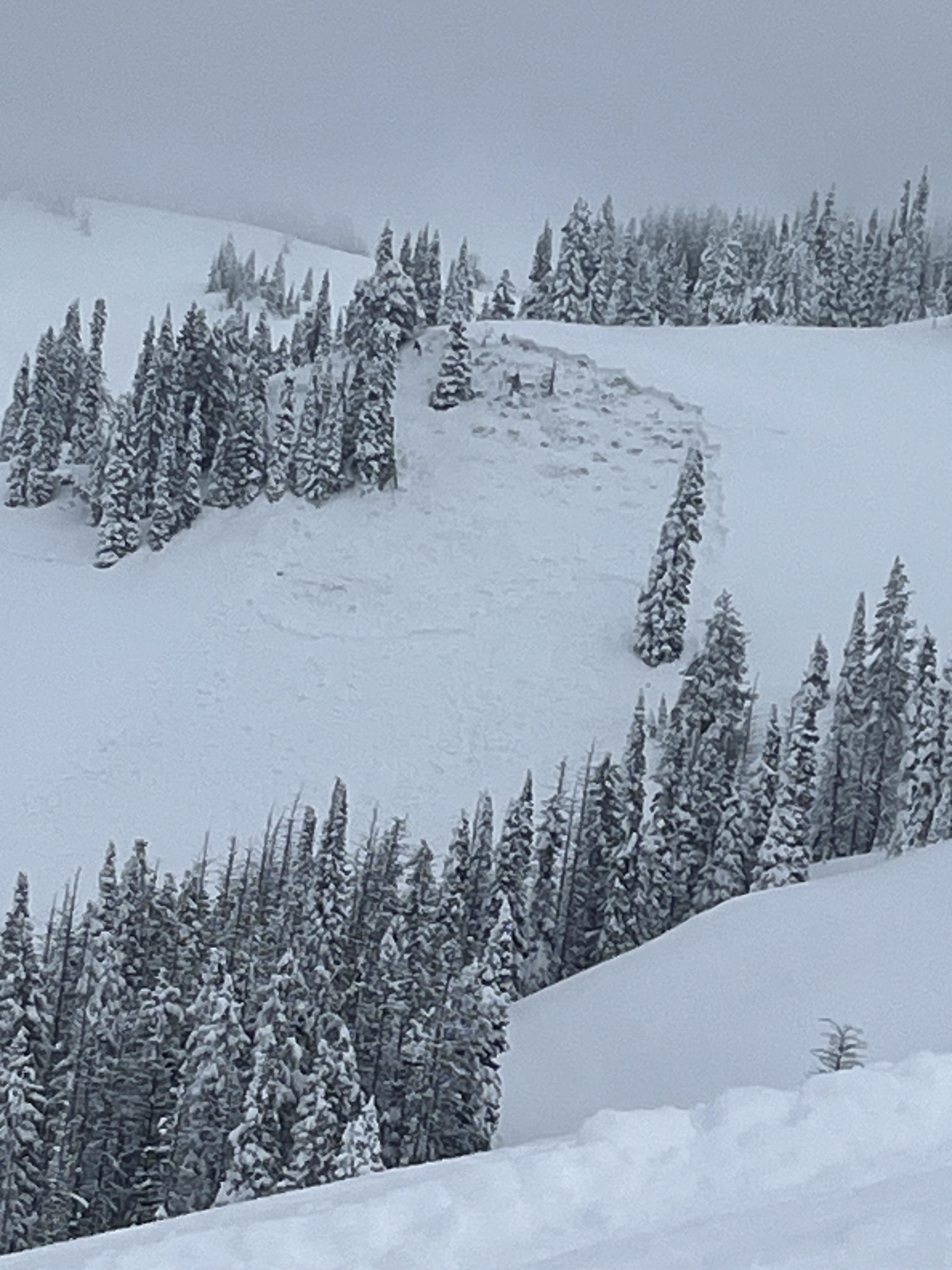
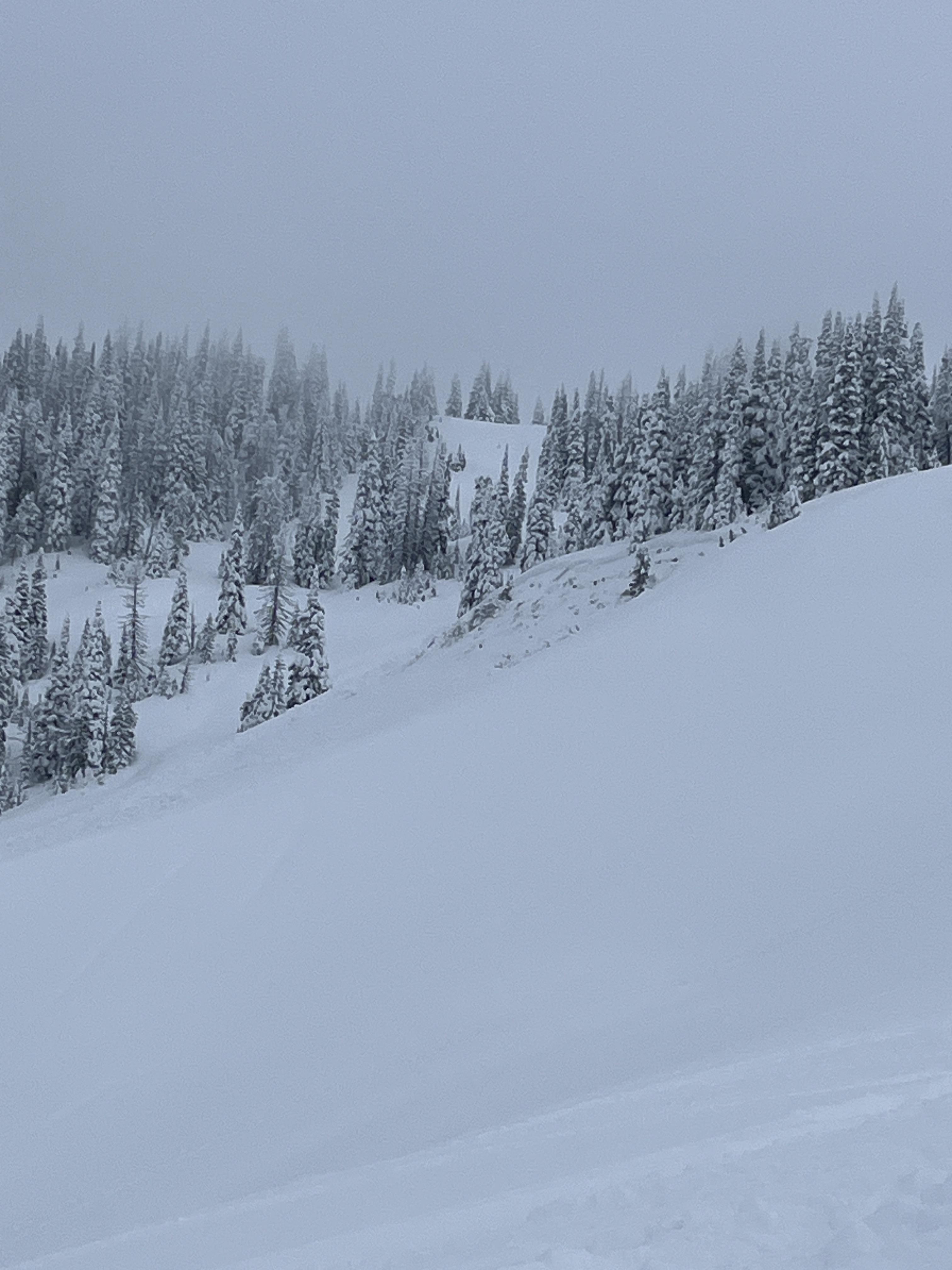
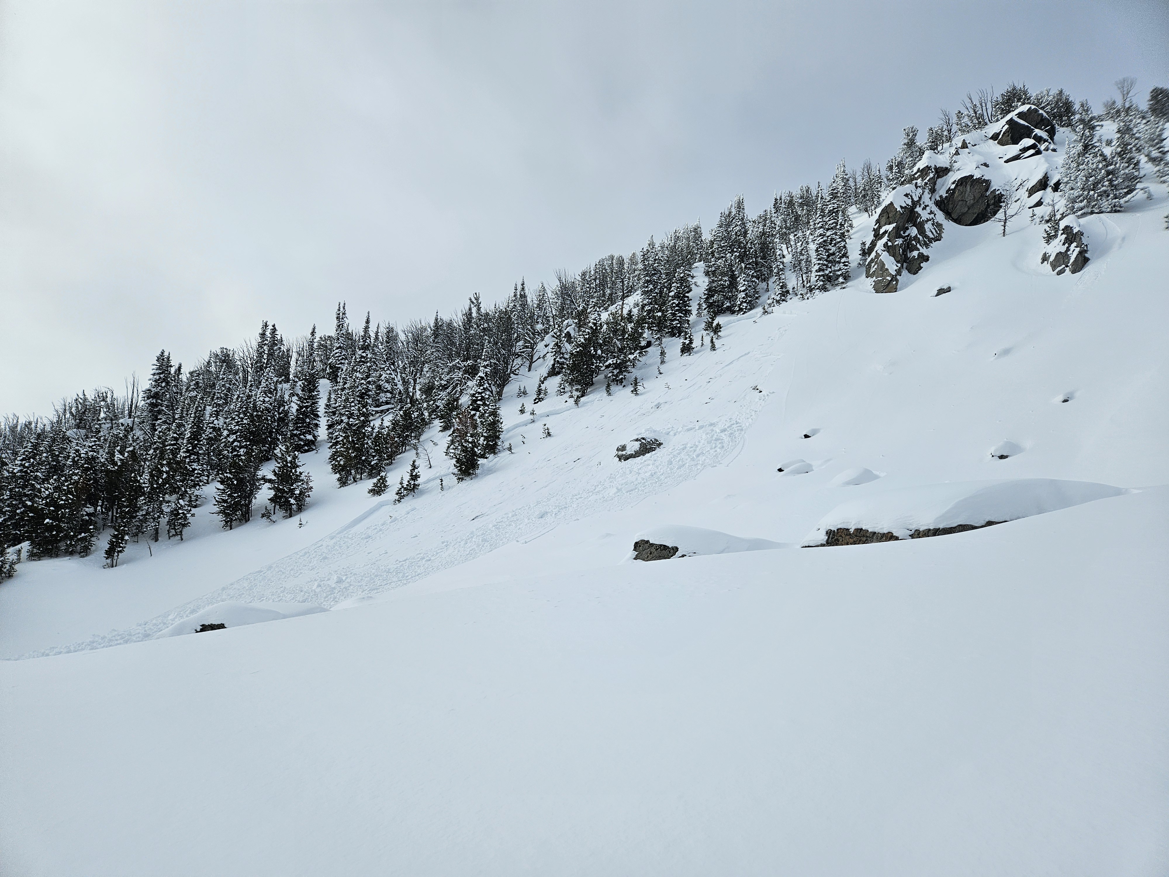
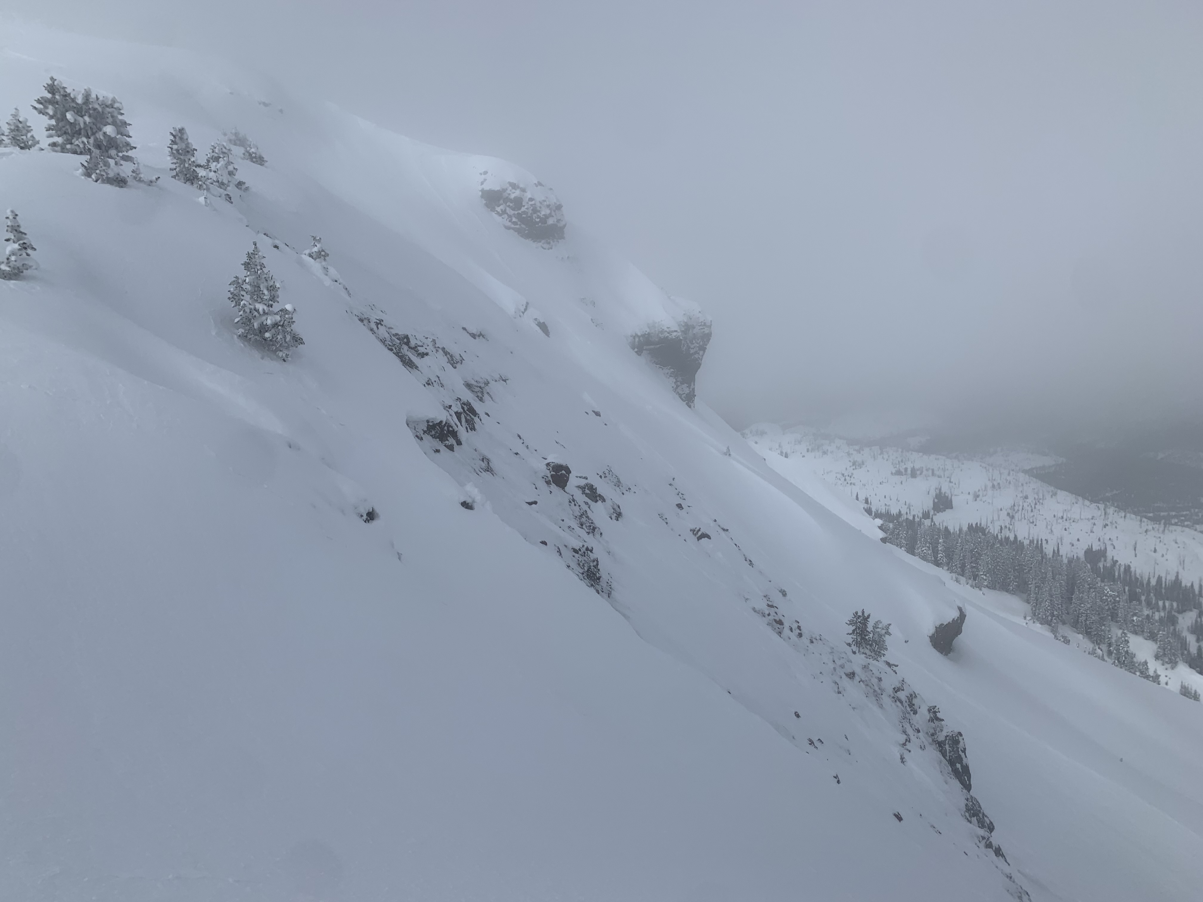
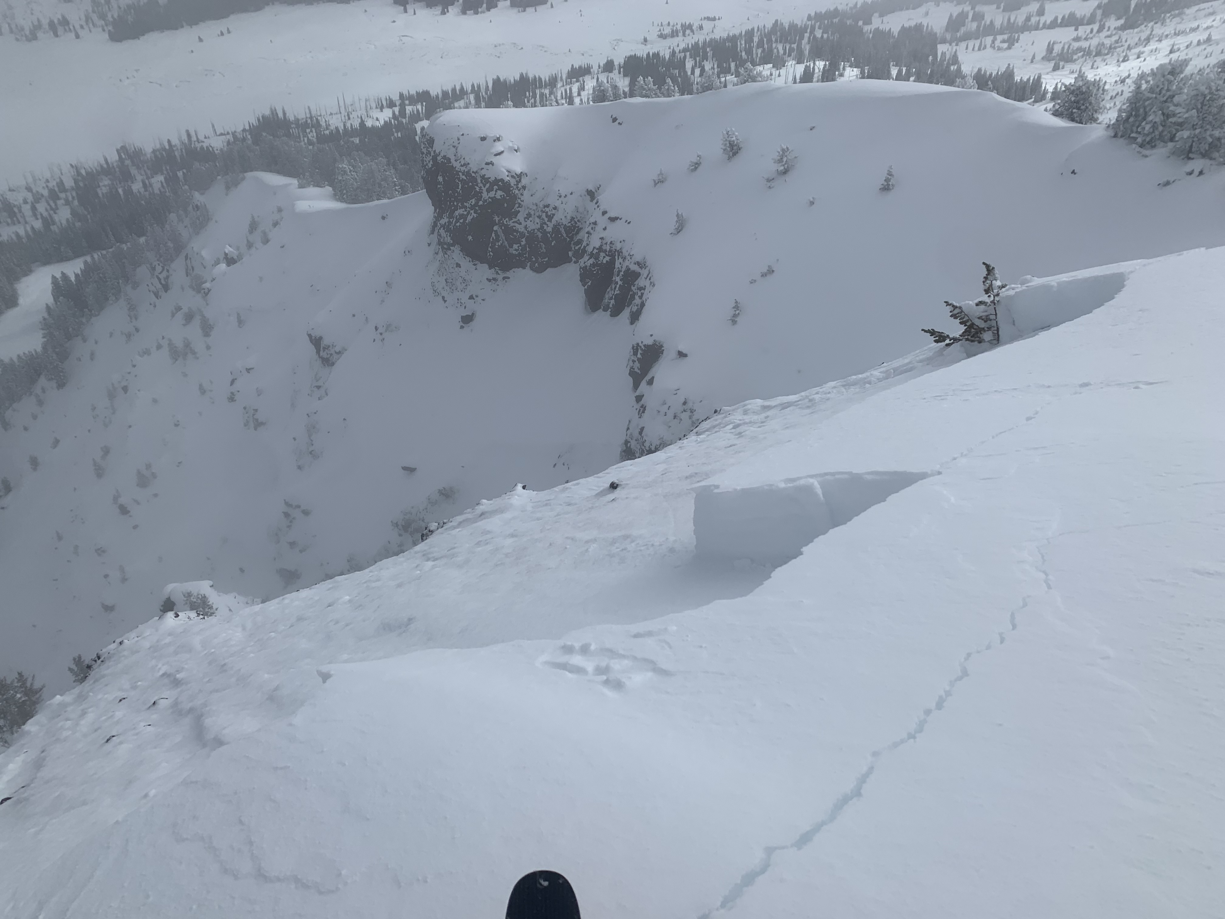
We rode into the Throne today in the Northern Bridgers. Our objective was to get to the top of the throne this time and to see what the warm-up in early February did. We felt that without signs of instability and good travel practices, this was an appropriate goal with wind-loaded terrain being off the table. At the bottom of the Throne, we discussed that if we saw signs of instability such as cracking and collapsing it was time to turn around. About halfway up on an east-facing slope at 8000' we dug a snowpit to test for instabilities. What we found is that the warm-up didn't change much, and found dry faceted snow below a stout crust that did form. Stability tests were reasonable with a score of ECTN 21 and we felt comfortable continuing to the ridgeline above. On the backside of the ridge, we were able to easily trigger small avalanches (1-2" deep) in the new snow. While walking on the ridge we felt a large collapse and saw shooting cracks behind, below, and above us. This made us both jump a bit and was an obvious sign that it was time to turn around. We pulled the plug once again and began skiing down, but not before kicking off a few more loose snow avalanches on the north side of the ridge.
Here's what we took away from this. First, the snowpack is still very weak and it will take more than just a short warm-up to improve stability. Second, areas where new snow has drifted into thicker slabs are concerning, and triggering an avalanche is likely. Third, new snow is bonding poorly to the old snow surface and as snow continues this new snow will be sensitive to human triggers.
Full Snow Observation Report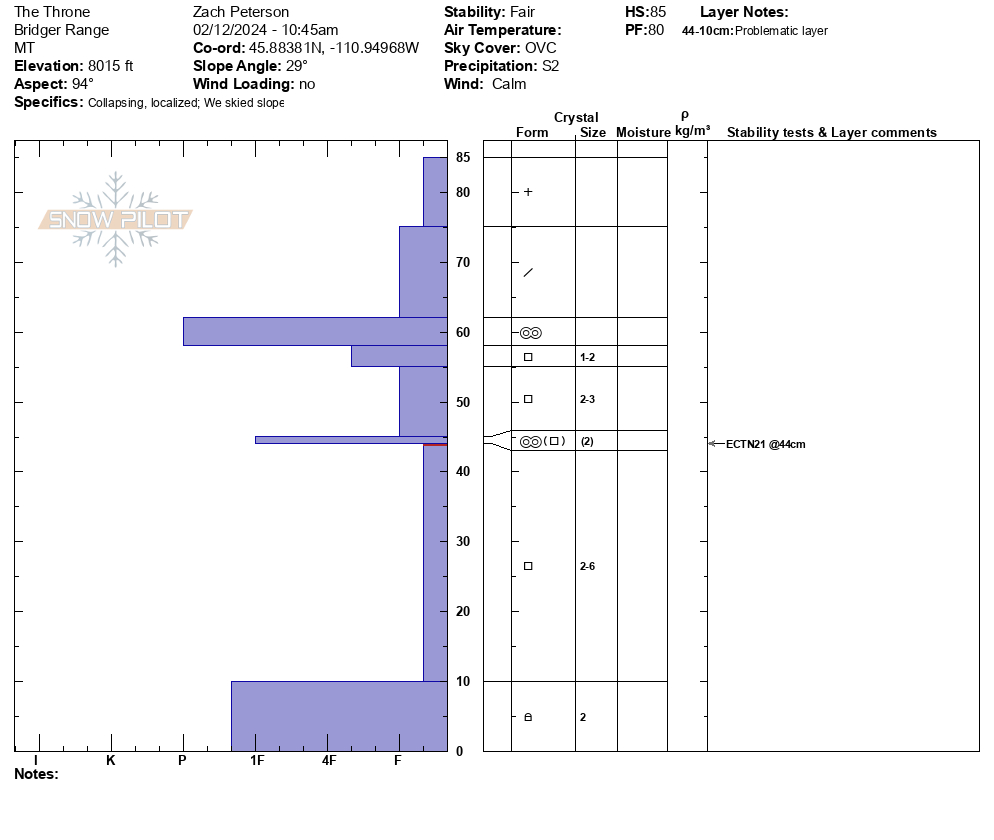

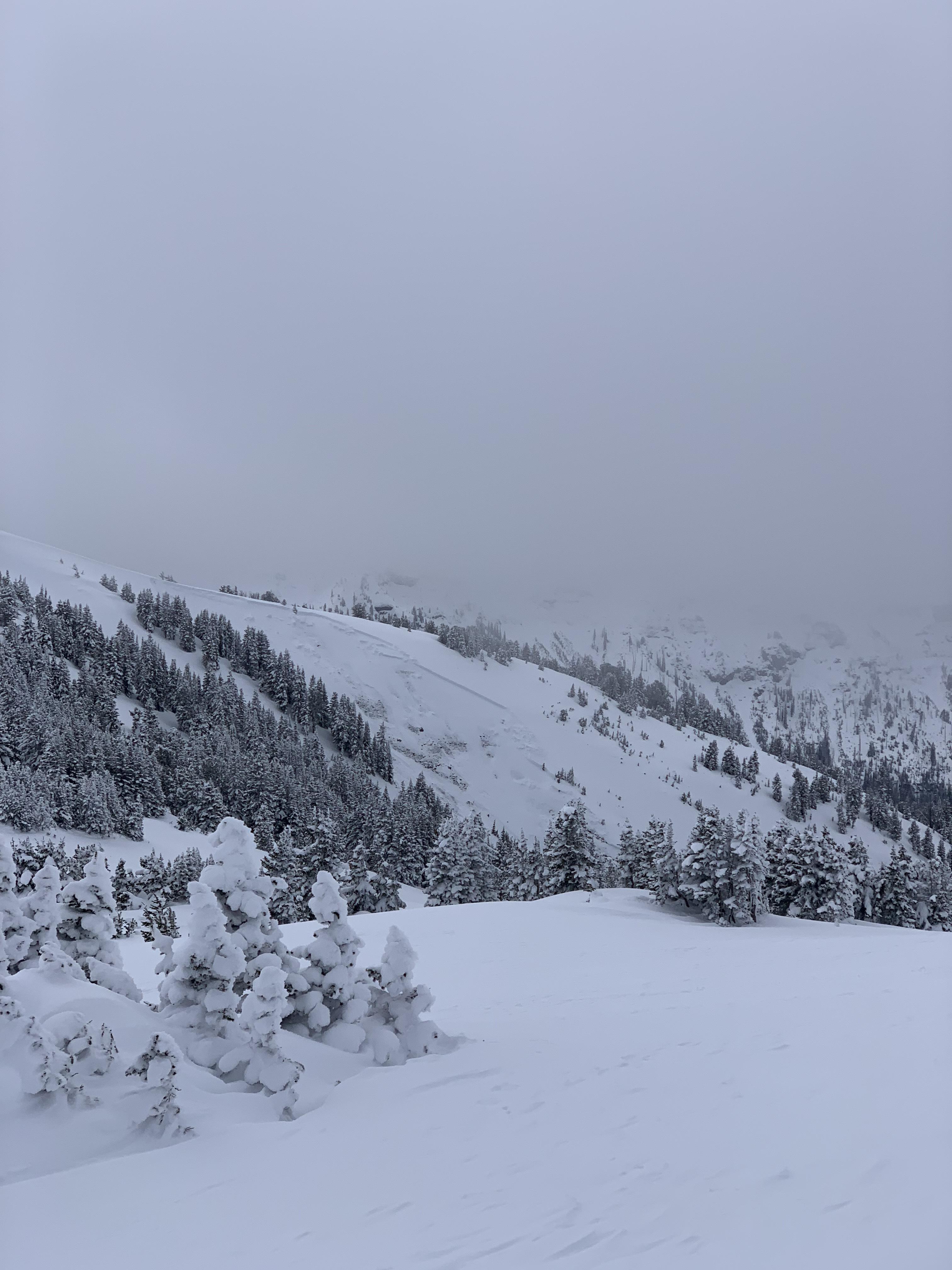
Skied the whitebark glade on Flanders and got several whumpfs at the mid and upper elevations. Light overnight and continued wind loading. There was a recent avalanche that appeared to be a wind slab with decent propogation on a north facing rocky slope. Visibility was too poor to get a good look or photo.
Full Snow Observation ReportNo details, came upon them while riding and making observations of the terrain. One was North-Northeast, the other was North-Northwest facing. Across the drainage from each other.
Also, notice three other small avalanches on a west facing slope, about two miles east of the first two. All five were on slopes well over 30. In the centennial mountains, close to the continental on the Idaho/Montana border.
No details, came upon them while riding and making observations of the terrain. One was North-Northeast, the other was North-Northwest facing. Across the drainage from each other.
Also, notice three other small avalanches on a west facing slope, about two miles east of the first two. All five were on slopes well over 30. In the centennial mountains, close to the continental on the Idaho/Montana border.


From email: "Natural avalanche from yesterday evening or last night.
North facing aspect, with an interesting 3 tiered crown beginning around 8900'."
Full Snow Observation Report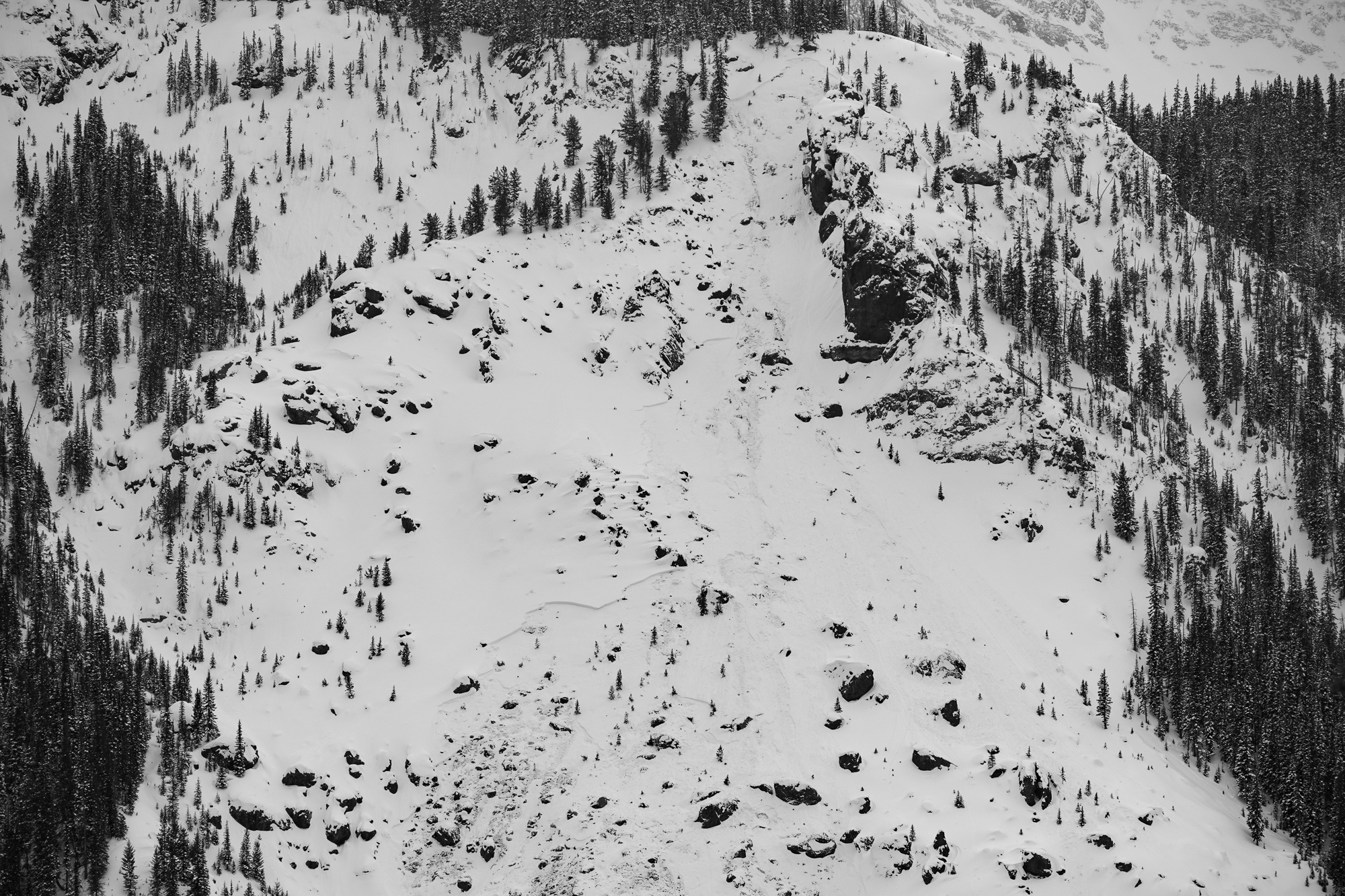
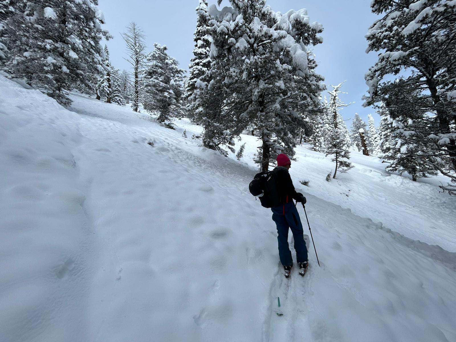
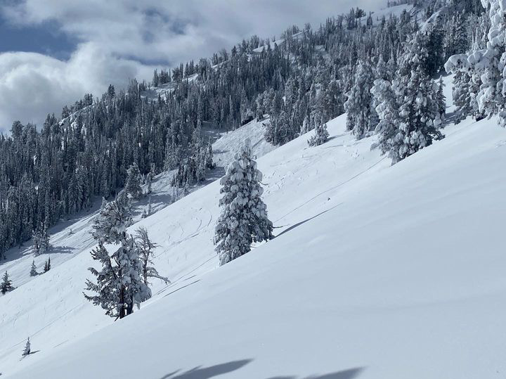
We took our level 1 course up to the ridge between Beehive and Bear Basin. Skies oscillated between overcast and broken as light snow fell throughout the day with little to no accumulation. Winds were generally light, and no snow was being actively transported.
We descended a low angle east aspect down to about 8500' and found quality surface conditions and fun turns. This week's snow comprised the upper 35 cm of the snowpack, was right side up, and generally well-bonded to the new/old interface below. Hand shears, up-track tests, and small test slopes were non-reactive. We avoided any sustained slopes over 30 degrees and we saw no obvious signs of instability during our tour.
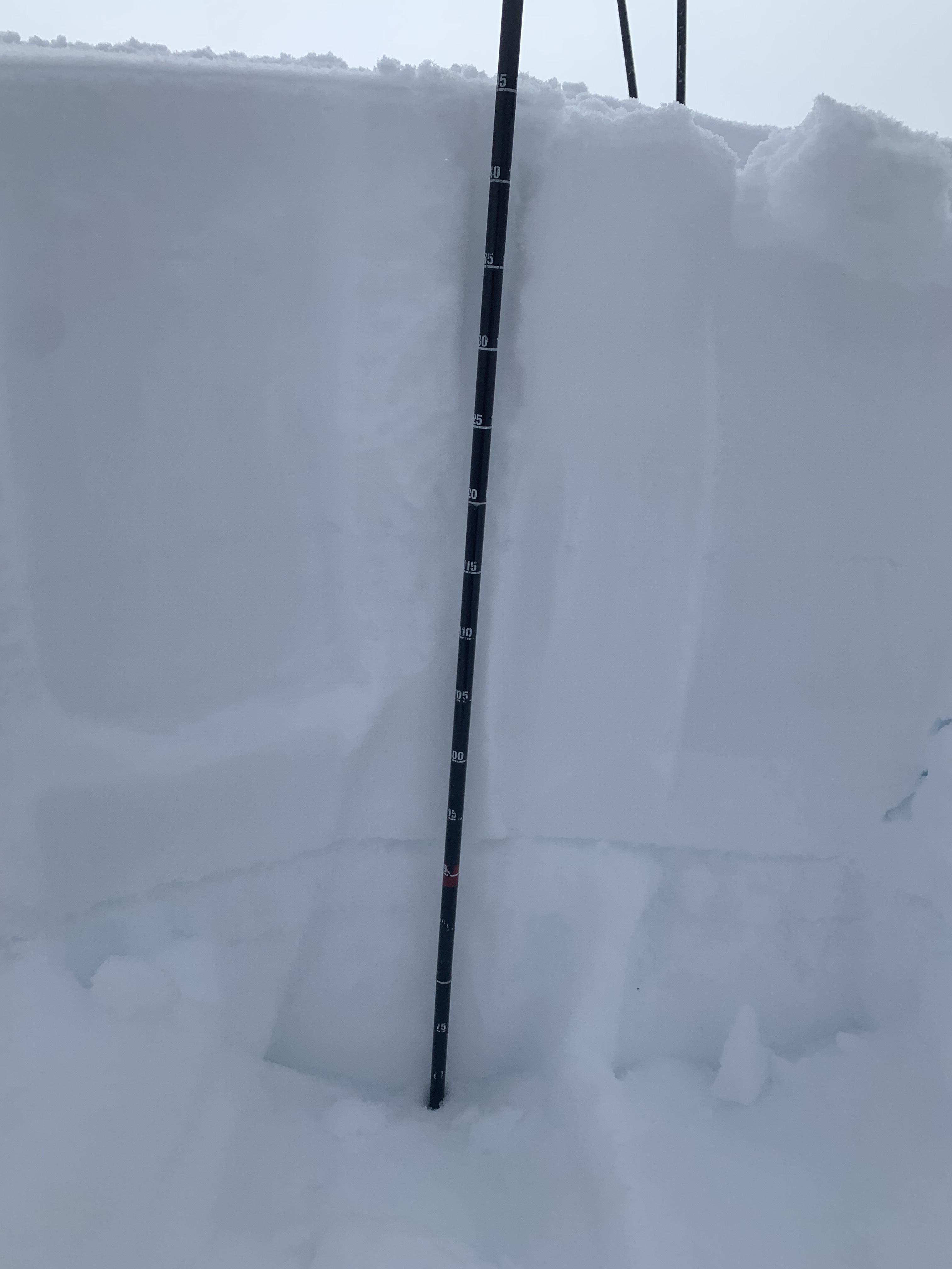
We dug two quick pits and performed an ECT in each. We found very similar poor structure in both pits and both ECT's propagated across the column within a layer of soft facets about 18" below the surface.
East aspect @ 8500', 28 degree slope
HS 90 - ECTP24 @ 44 cm
90-55 F>4F>1F - This week's snow
55-50 - P - Rounded Grains - January snow
50-35 - F - Facets
35-33 - 4F - Decomposing Crust/Facets
33-20 - F - Facets
20-Gnd - 1F - DH/Facets
East aspect @ 9100', 12 degree slope
HS 88 - ECTP11 @ 43 cm within a layer of fist-hard facets
Very similar structure to above, except for a 2 cm pencil hard MFcr at the interface below this week's snow capping a few cm of pencil hard rounds from January.
Fist-hard facet layer began at 47 cm and transitioned to 4F DH at 20 cm, with large and striated crystals visible to the naked eye.
Full Snow Observation Report
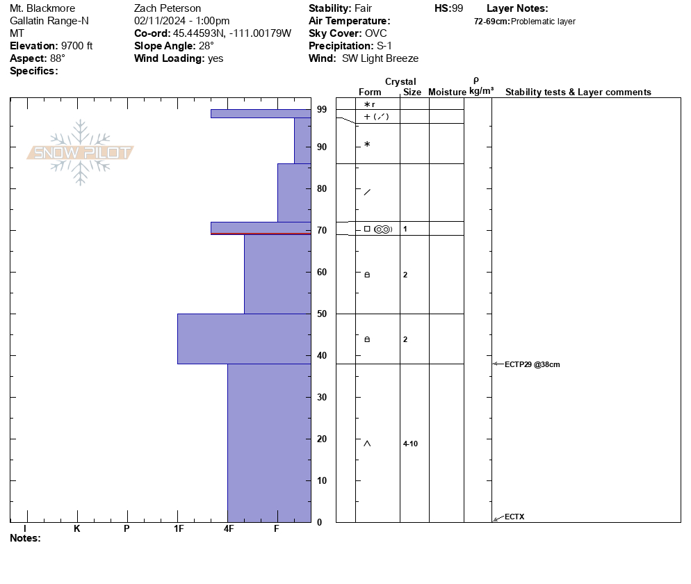
On Mt. Blackmore we dug a pit on the east face near the ridgeline. We measured 10-12" of new snow that fell over the last week, equalling 0.7" of snow water equivalent. In the trees and less wind affected areas there were 14-16" recent snow, but we did not measure SWE there. In our snowpit on an east-facing slope at 9700' we found this new snow sitting on 2' of faceted snow, showing us that the structure is there to create avalanches. While stability tests were not remarkable with scores of ECTX and ECTP29, we did not feel like stepping into avalanche terrain was an appropriate decision for two reasons. First, we know the snowpack setup is capable of creating large avalanches and new snow will increase the likelihood of this. Second, recent wind has drifted the new snow into thicker denser slabs that will add additional weight to already unstable slopes. We saw clear signs of wind loading with fresh cornices forming at ridgelines and pillows of wind-drifted snow forming at the top of rollovers. While skiing out my partner and I both noted that the snow felt unsupportable with our skis breaking through to the facets below. We also discussed that as more snow and wind come this week dangerous avalanche conditions will continue to exist.
Full Snow Observation ReportThe ski out had decent coverage and the core shot count is: Alex: 0 Zach: 1

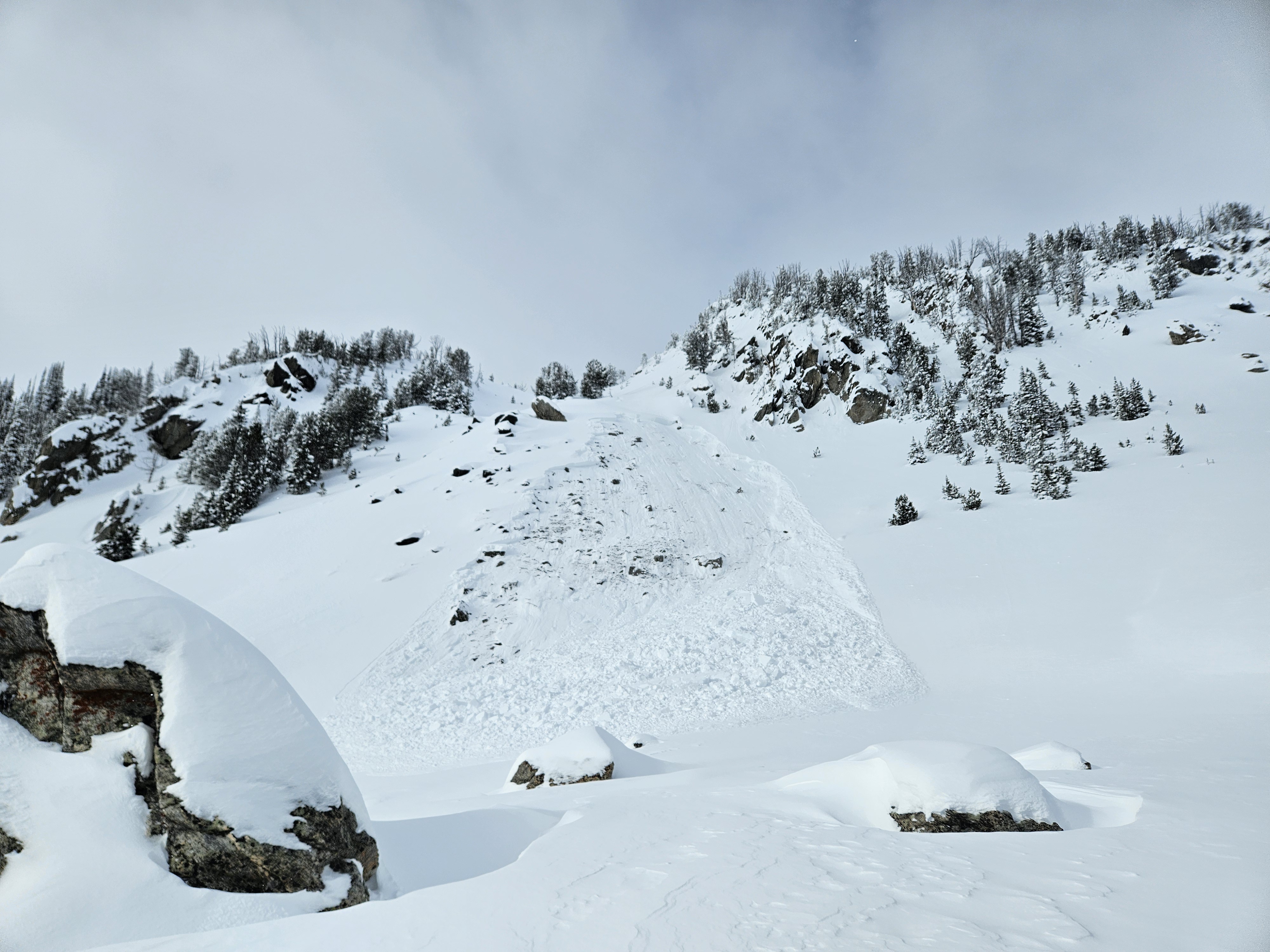
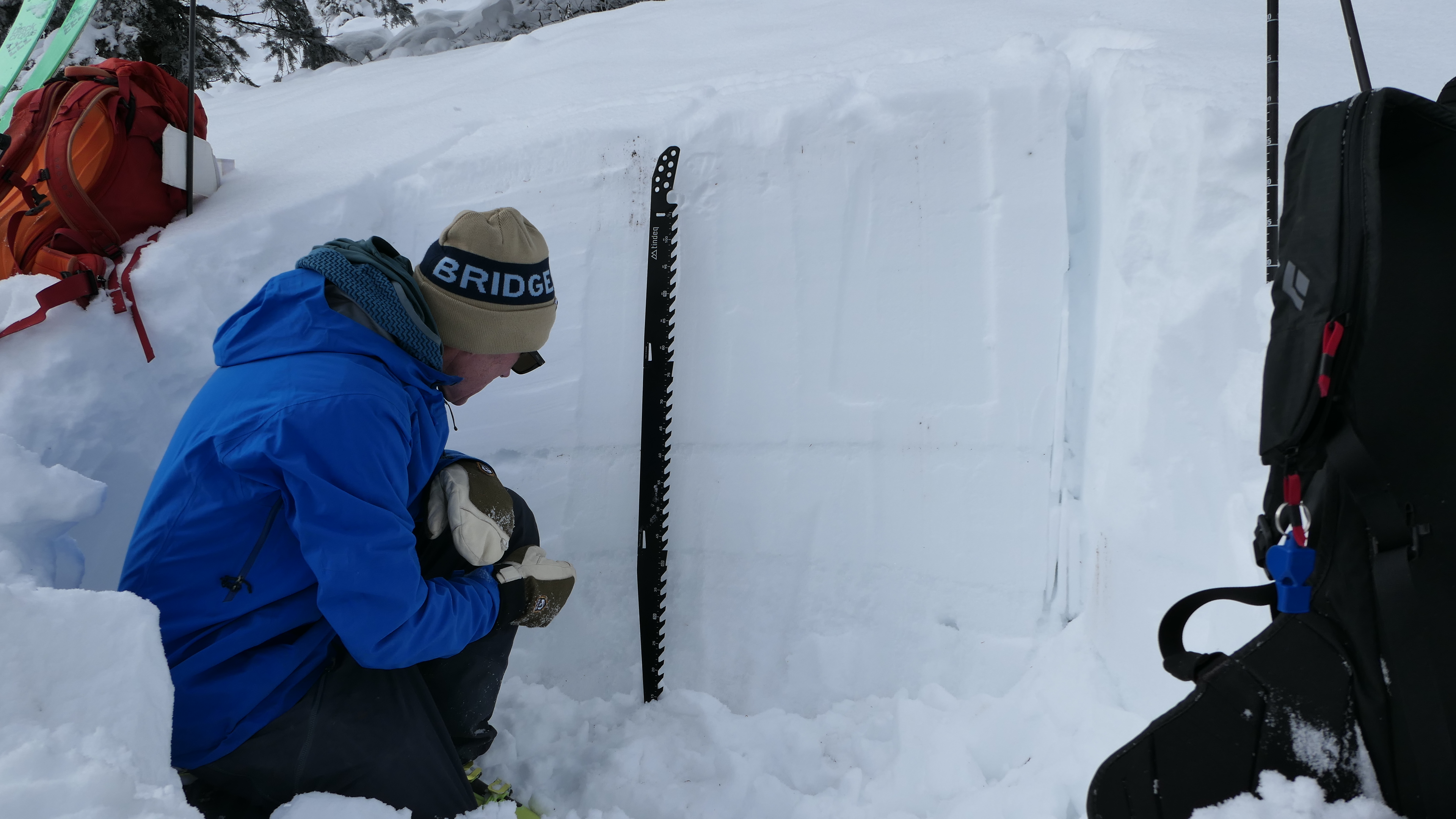
Wind was calm and there was no new snow overnight. A small whumpf in the skin track was followed by a massive one a few minutes later. I can count on one hand the number of times I got whumpfs in a skin track...rare indeed. The second one was so big it had us both deeply concerned. We peeled off the skin track after deciding to not cross a gully and soon found debris from a sizeable avalanche that released a couple days ago about 500' above us. We dug in the flank and had 100 cm of snow, 60 cm new from last week. The snowfall during the Avalanche Warning, doubled the depth and more than doubled the snow water equivalent of the snowpack. It was a large load and avalanches are breaking underneath the new snow.
Karl was using his 100 cm long Norwegian Battle Saw (pic)...a bit overkill.
Full Snow Observation ReportKarl and I were pretty spooked about the collapse in the skin track. The conditions there were the worst I've ever seen, so crossing the gully in the trees was not something we wanted to do. We cut back and within a 100' elevation gain we found an avalanche. It ran hundreds of feet below us. We also did a RB because Karl had his extra long Norwegian Battle Saw. RB4, not planar.

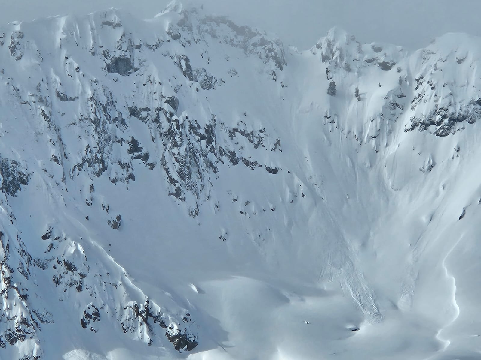
We observed three similar avalanches on Mt Abundance today (2/11). All were at about 9,900' and on NE-NW aspects. We were able to safely look at the crown of the first one, which was ~150' wide, 55cm deep, and with an HS of 145. It failed on 1-2 cm buried surface hoar. The other avalanches were on shallow unsupported rocky terrain. All were remote triggered from low angle terrain above, 20-50' away. One of the avalanches sympathetically released a gully and ran 800'.
Full Snow Observation Report
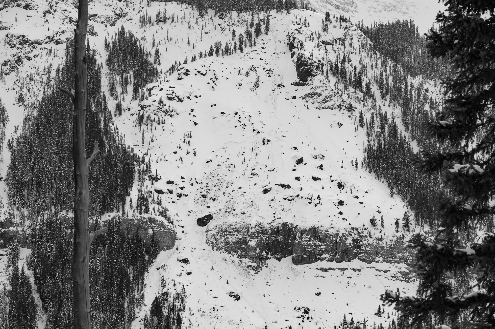
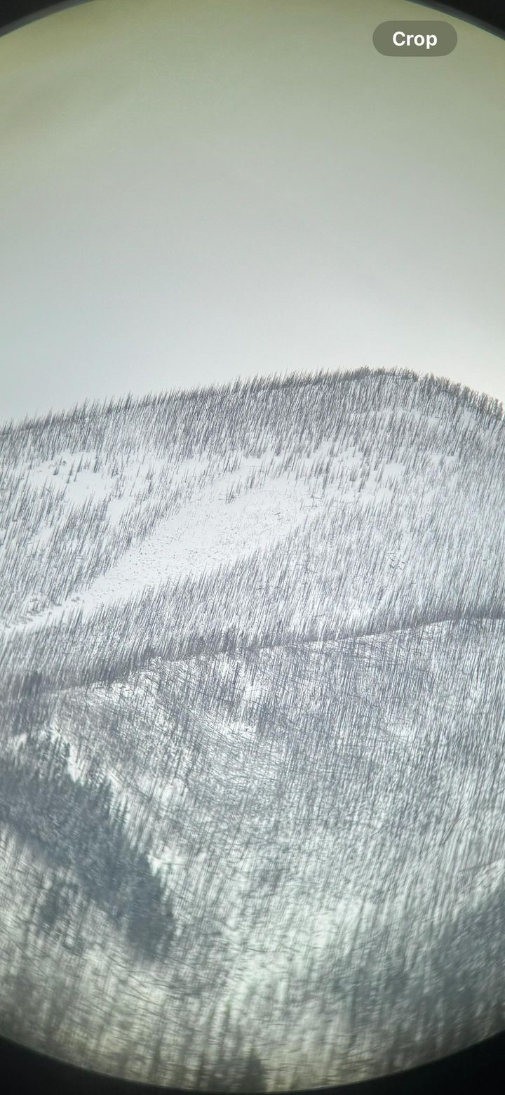
Natural avalanches observed on east facing aspect of Miller Ridge on 2/11. Larger avalanche propagated widely on the north end of the ridge around 10,000 ft. Smaller avalanche further south on the ridge as well.
Full Snow Observation Report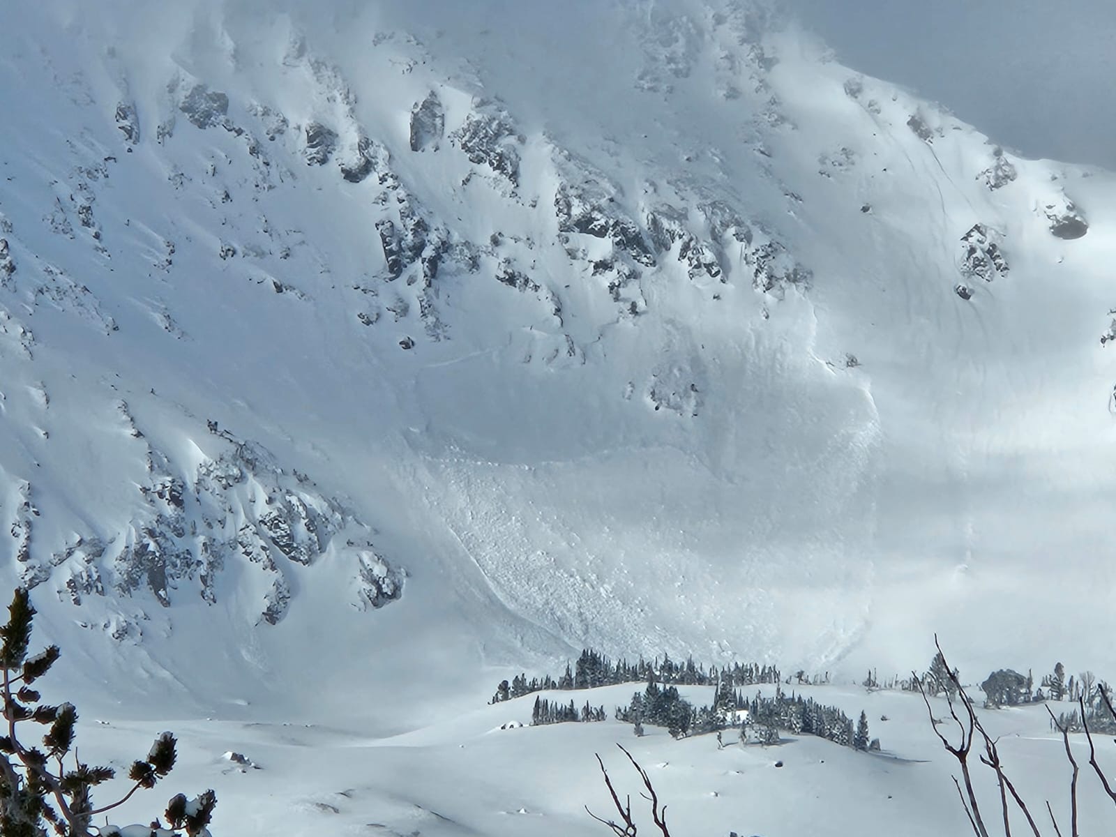
We got the same feedback that Dave and Doug did on 2/5/24 - collapsing every time we stepped out of the skin track or turned with any force, as well as a few sizable collapses triggered from inside the skin track. Very touchy, skied very well. Stayed well away from avy terrain.
Full Snow Observation ReportWe got the same feedback that Dave and Doug did on 2/5/24 - collapsing every time we stepped out of the skin track or turned with any force, as well as a few sizable collapses triggered from inside the skin track. Very touchy, skied very well. Stayed well away from avy terrain.
Full Snow Observation ReportFrom IG message: “It looks like the lawn mower up north deep creek slide full path. Looking through Bino’s from the valley it looked fairly fresh. Multiple fracture lines up at the starting point. I assume it went naturally”
Full Snow Observation Report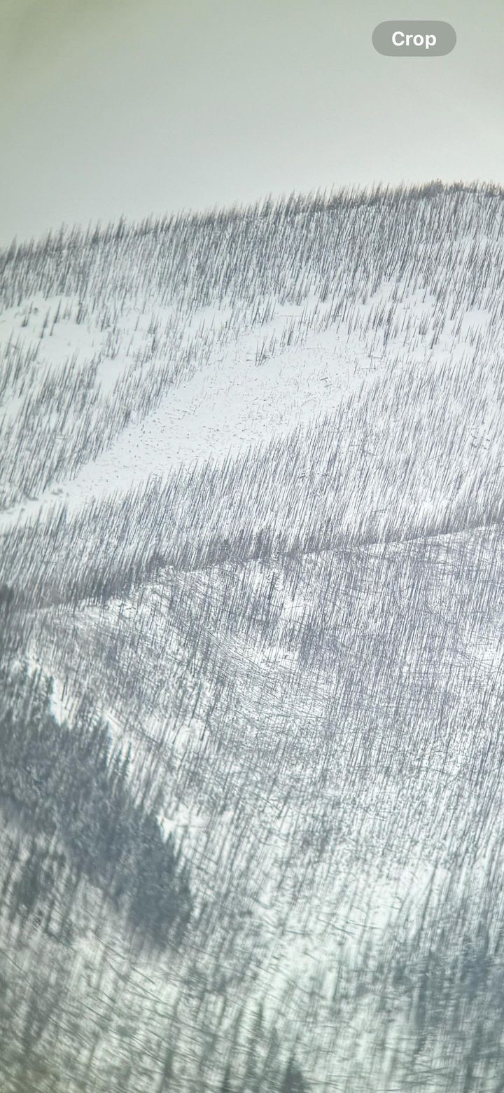

From IG: “Here is a big avalanche remotely triggered yesterday up lionshead area”
Full Snow Observation Report

Driving up the canyon this morning, 3-4 fresh slides can be spotted on Baldy and Saddle Peak
Full Snow Observation ReportFrom FB 2/10/24: "Another view of White peak south along ridge in UPR TeePee basin slide from wailer this week. Looked like was from a rider earlier this week. This view was from the slopes south of Lee Metcalf Wilderness boundary looking toward SW."
Full Snow Observation Report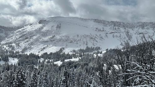

From IG 2/10/24: “Multiple avalanches in the northern lions head on the eastern half of the compass. All were at around 8,500 feet.”
Full Snow Observation Report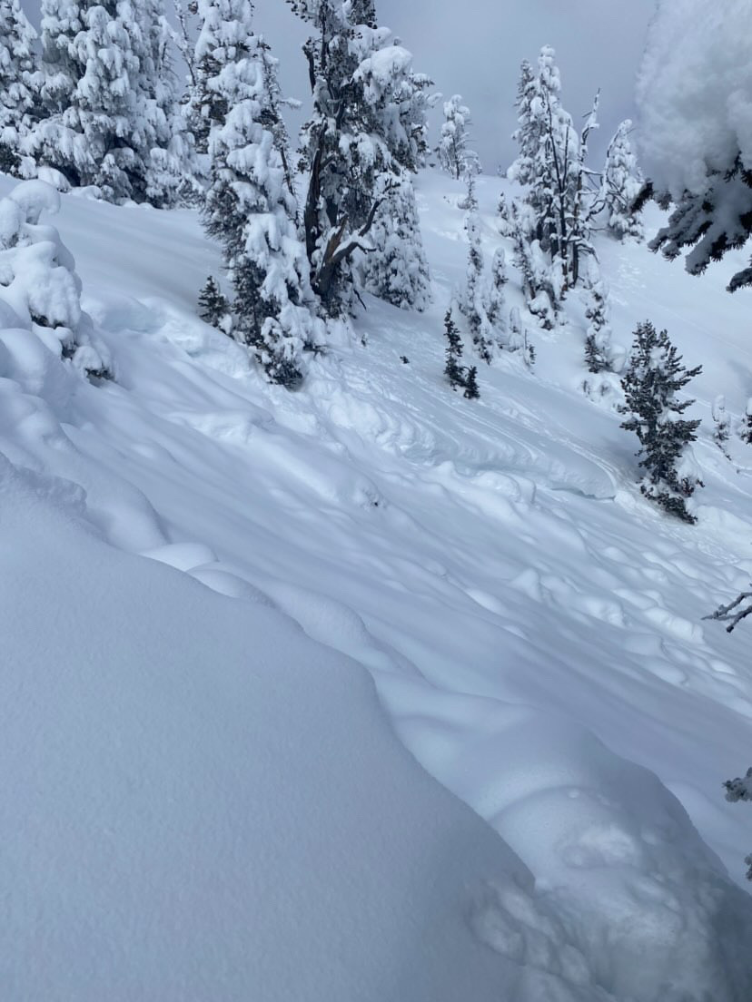
From IG 2/10/24: “East aspect, southwest of island park from the blue creek trailhead.”
Full Snow Observation Report