Snow Observations List
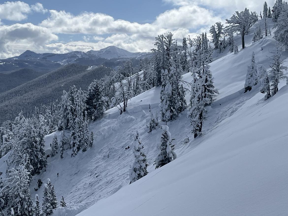
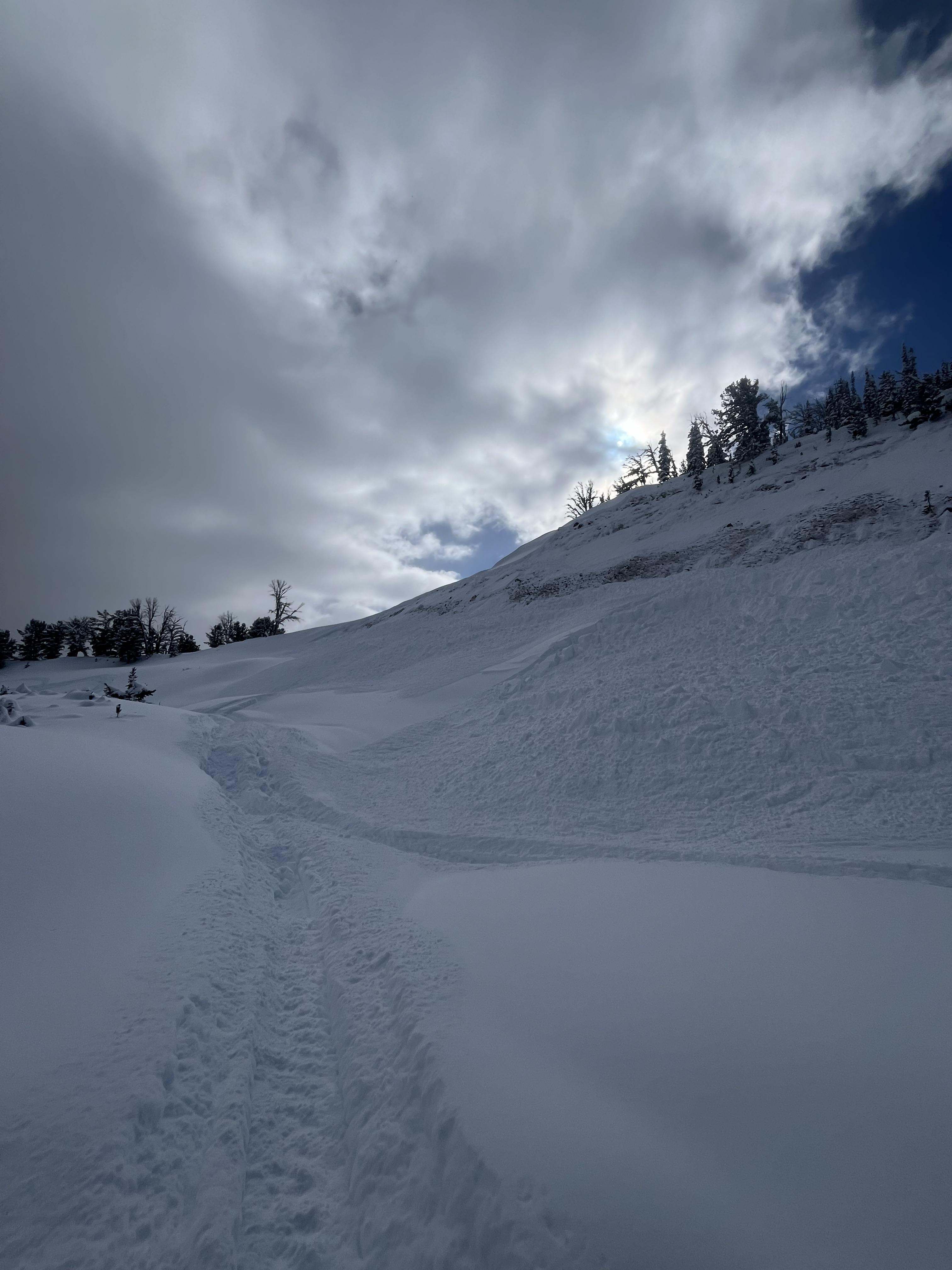
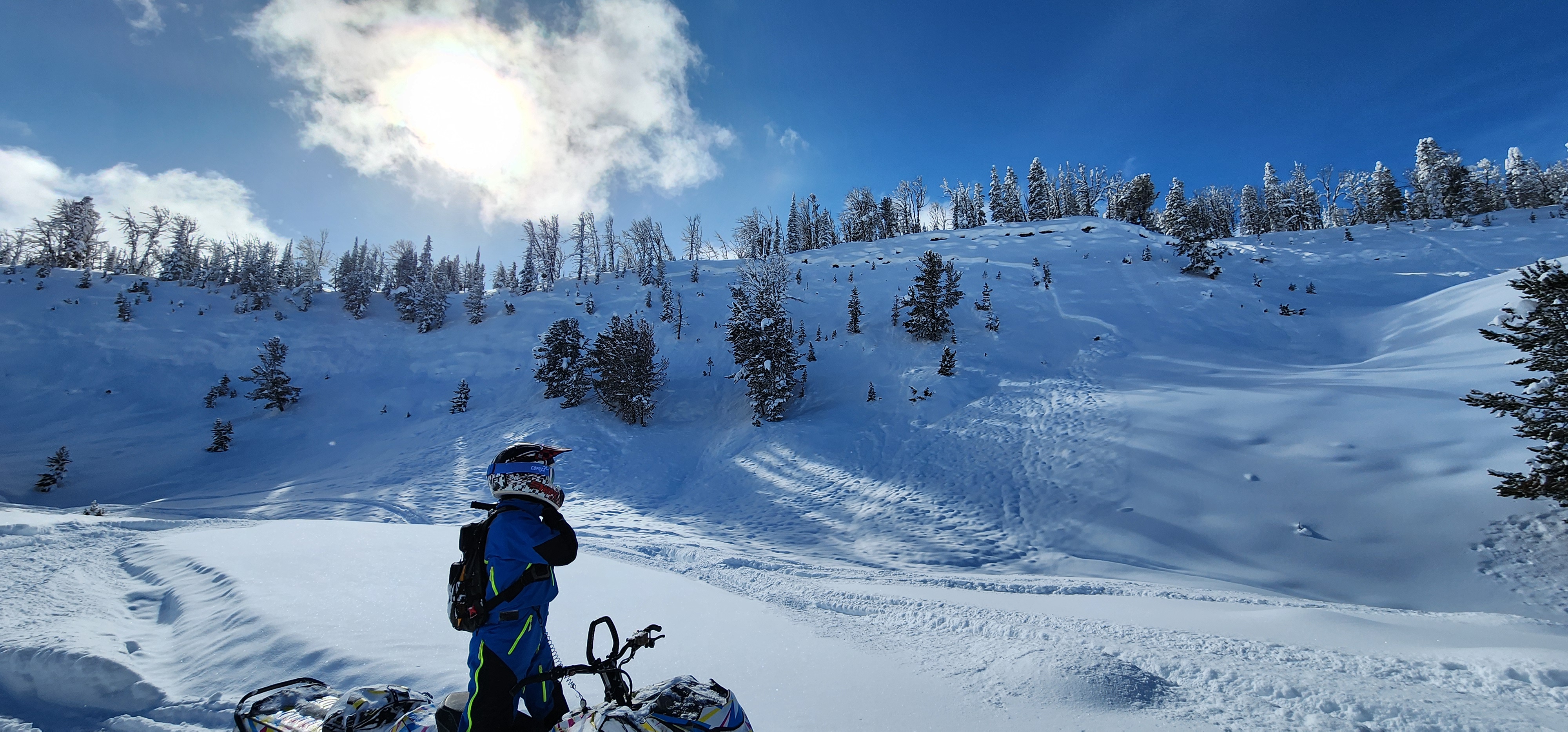
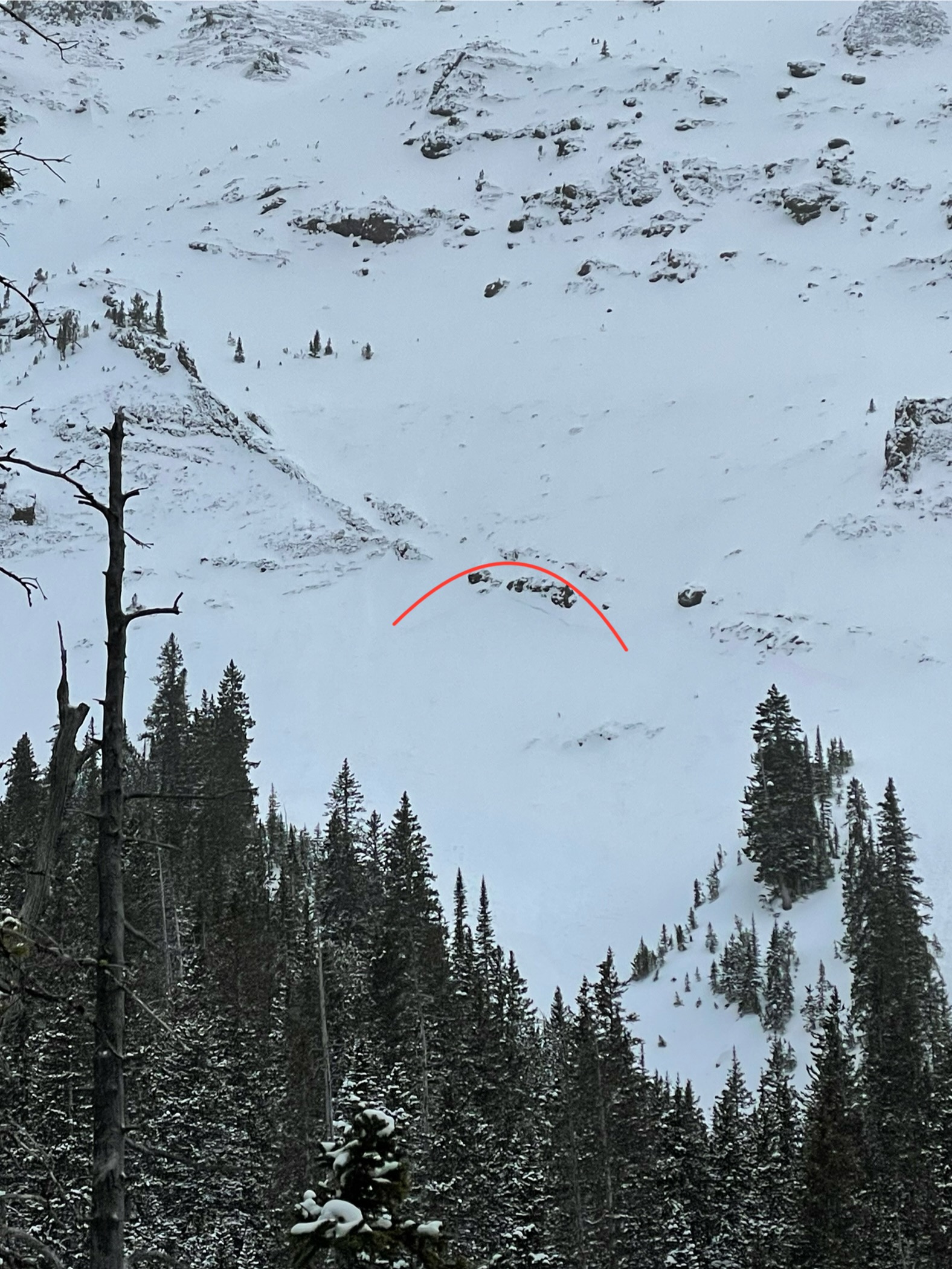
From email on 02/10/2024: "Yesterday, I skied a few Submarine and a few Woody Ridge laps. Collapsing/shooting cracks were widespread and thunderous. Snowfall totals seemed closer to 12” unsettled, with minimal wind. Biggest collapses were near the ridgecrest (1st pic was an impressive shooting crack).
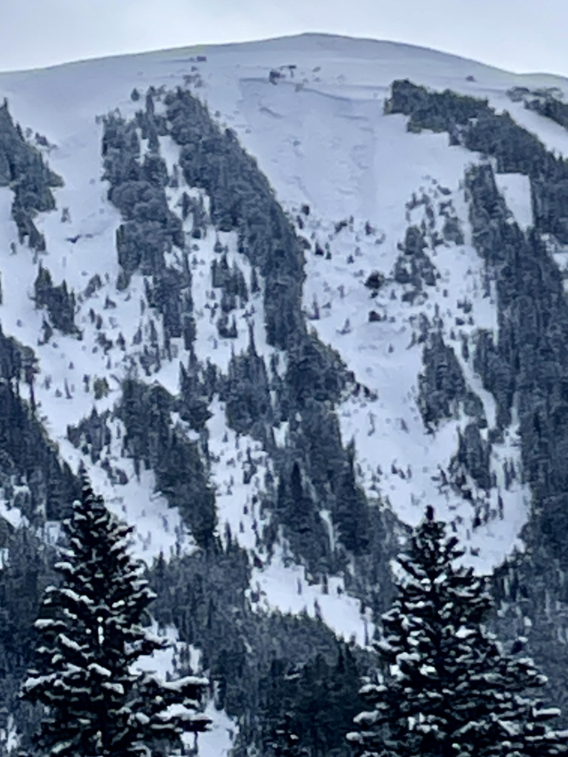
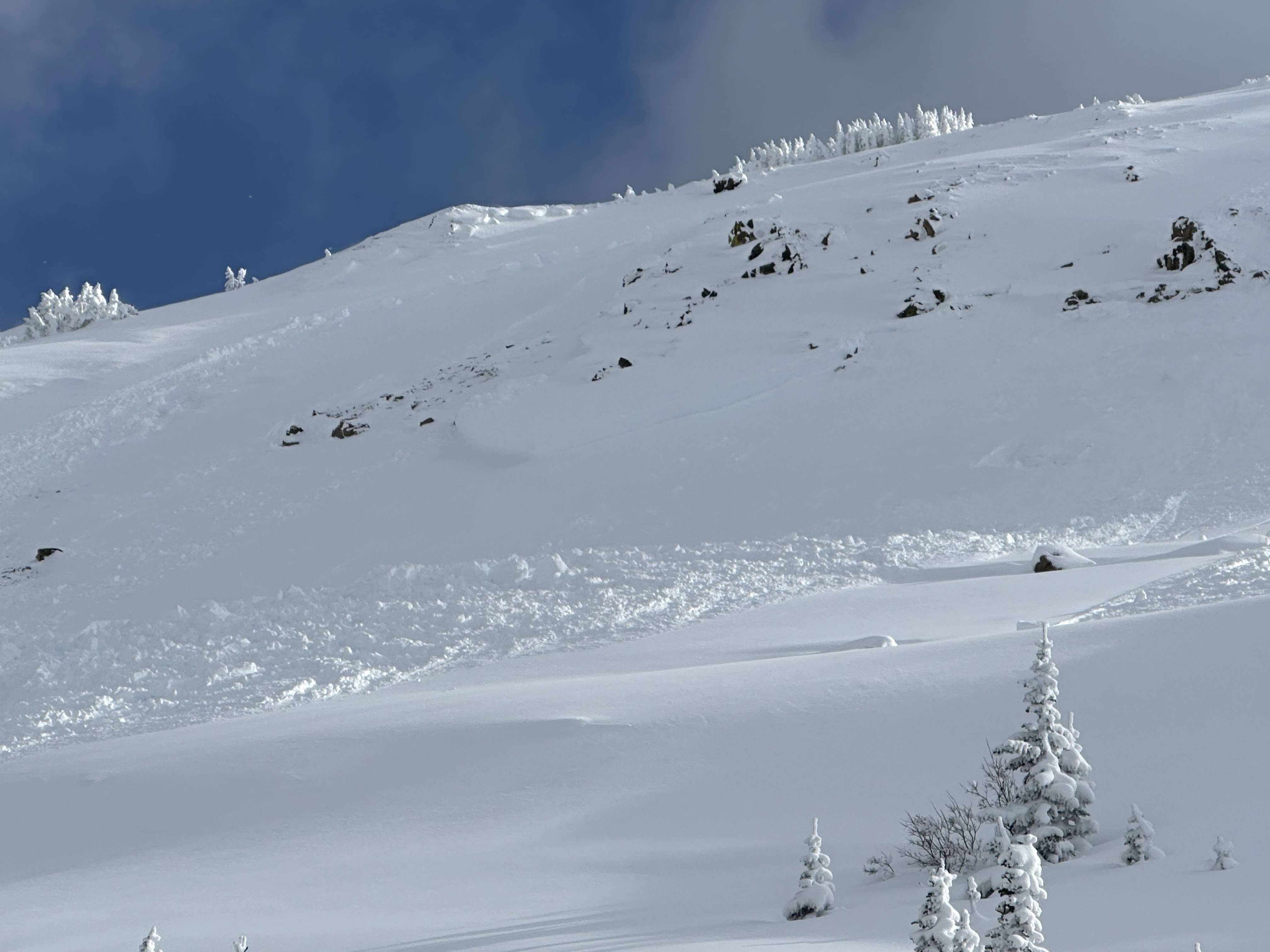
Today heading up Republic, we observed the crown of a recent avy on Woody Ridge north (pic 2). I wondered for a sec if I had remoted it yesterday but I was further south. The avy looked to originate around 9800’ on a west (slight north) aspect in rocky terrain. Appeared natural from what we could see from the drainage.
We skied a zone south of woody proper, and had less but still pretty regular collapsing and cracking, though steep tester slopes were nonreactive to ski cuts, surprisingly. Still very little wind. "
Full Snow Observation Report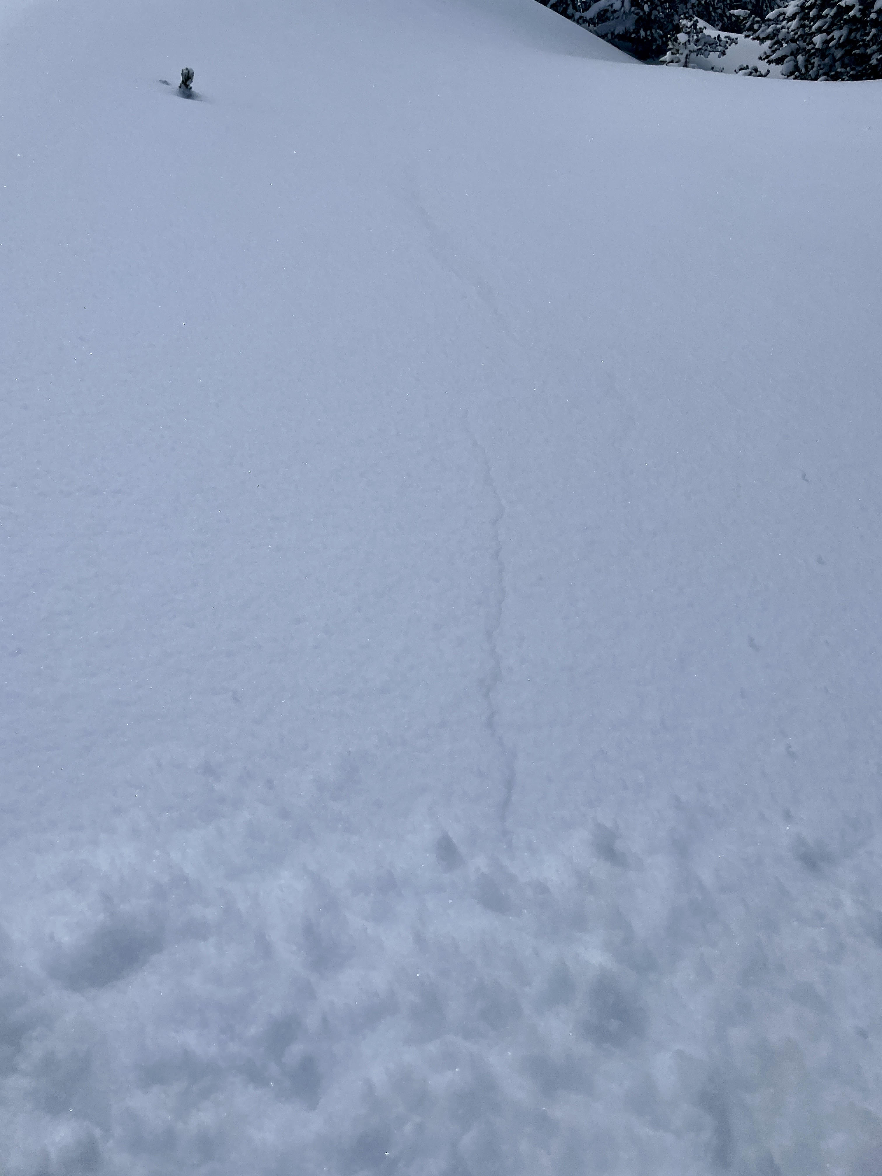
Whumphing, collapsing and shooting cracks on all aspects, at all elevations. The longest shooting crack went over 100' long, shot right out in front of me on a 24deg E aspect slope. Propagating collapses out to 40 feet or so, very thin overall snowpack. Moderately nice turns on low angle slopes above 7300 but had to be very careful not to bottom out.
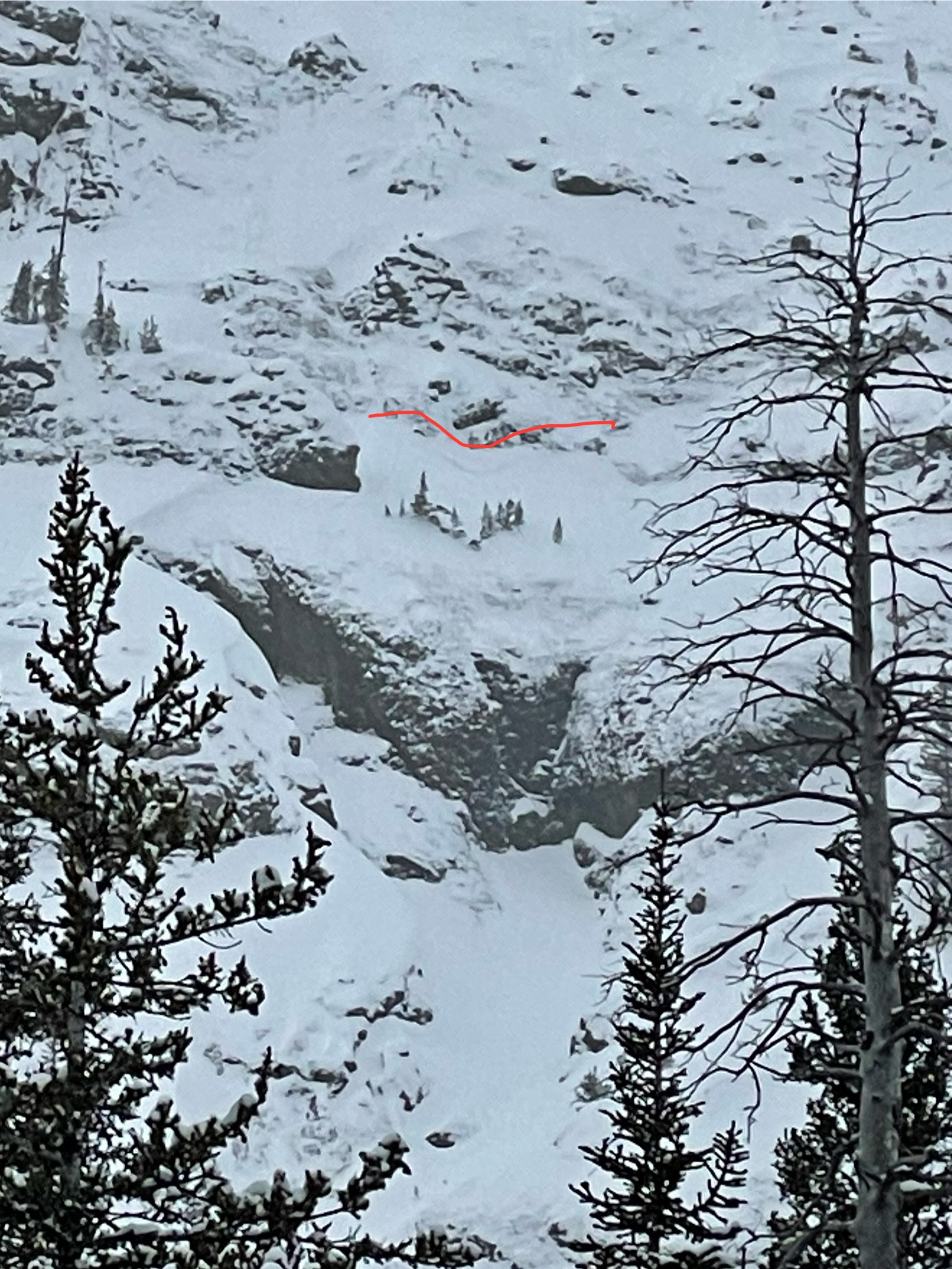
From my high point, it looked like the entirety of the large avalanche path on Ernie Miller Ridge E face slid recently, obvious crown on lookers L side and appeared to go wall to wall for the path (R4+). Unknown if natural.
Very obviously terrible snowpack, it's total garbage out there.
Full Snow Observation ReportAs we were coming out, I spotted this cracking above the creek. A sled has passed nearby on the right side ( you can see the track). The snow cracked and was starting to rub in the left (barely).
It was above the creek and could have created a trap for someone below.
This is just below the cabin Creek cabin where all the stands coverage.
https://maps.app.goo.gl/KyH21E7a9vts2UAF6
Full Snow Observation Report
Went for a little jaunt up History Rock this afternoon. Had two small localized whumfs near the top of the E facing meadow. Up to 20cm storm snow over a (mostly) supportive crust over facets. In the N facing meadow this crust was thin (<1cm) and breakable.
Full Snow Observation ReportWe spotted these fairly fresh looking avalanches all side by side with no apparent tracks leading into them. Likely either natural or remote triggered earlier in the day or overnight.
Full Snow Observation Report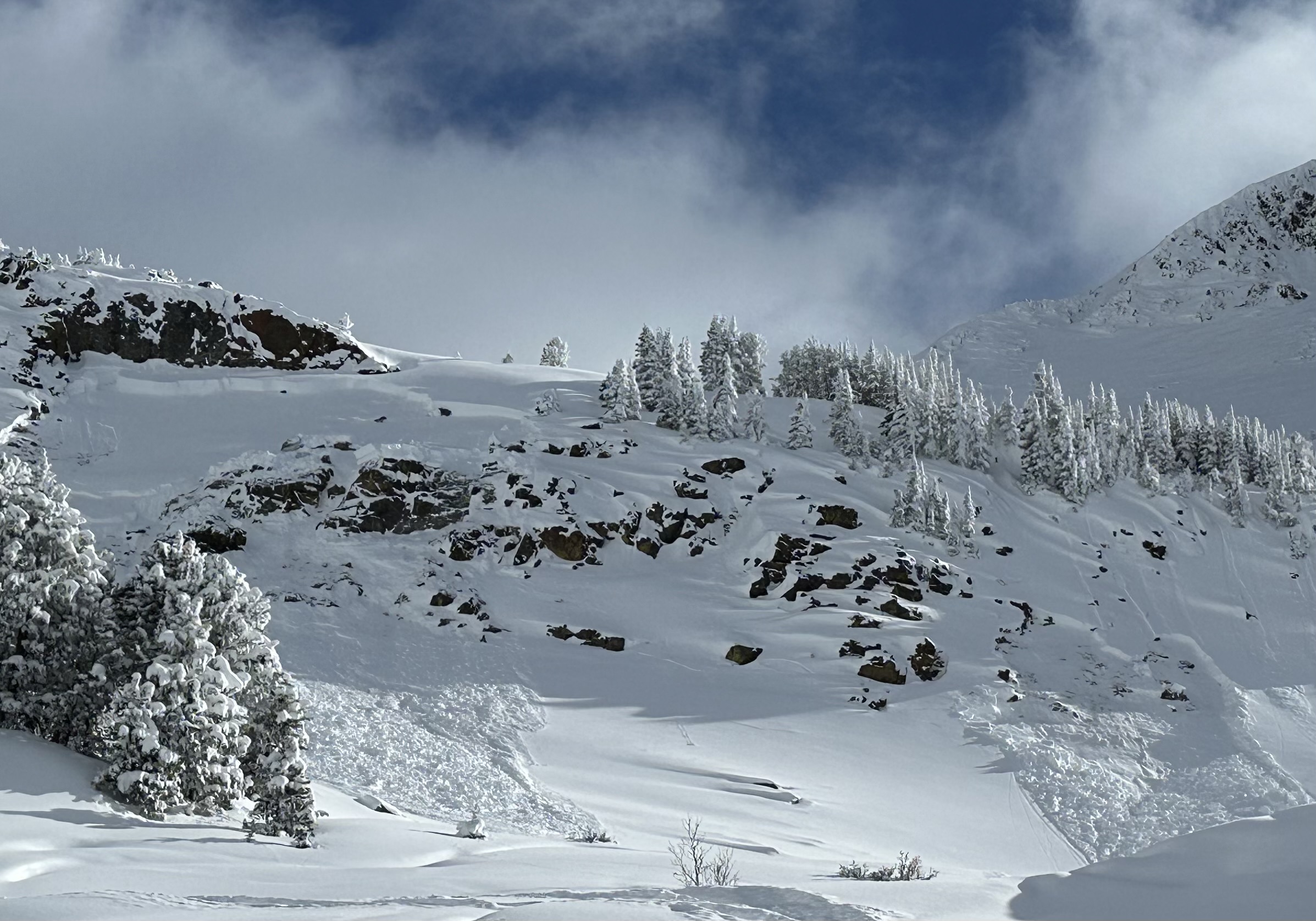
Witnessed a natural slide/sluff today day off the top of 1/4 Saddle around 3:30 pm from the Bitterend. Visibility was poor could not see the starting point. The slide produced a large dust cloud running down the right side of the Football field, which would could have taken a person for a ride. The slide ran over the cliffs skiers left of Lundy's Luge. The debris covered all the tracks the from the high traverse across the Cueball. Probably wound not have buried a person, but certainly would have rocked your world. Strong winds on the ridge were loading lee slopes, forming wind slabs right off the ridge line. Would expect more natural activity tonight, and human triggered tomorrow if someone wants to poke the bear.
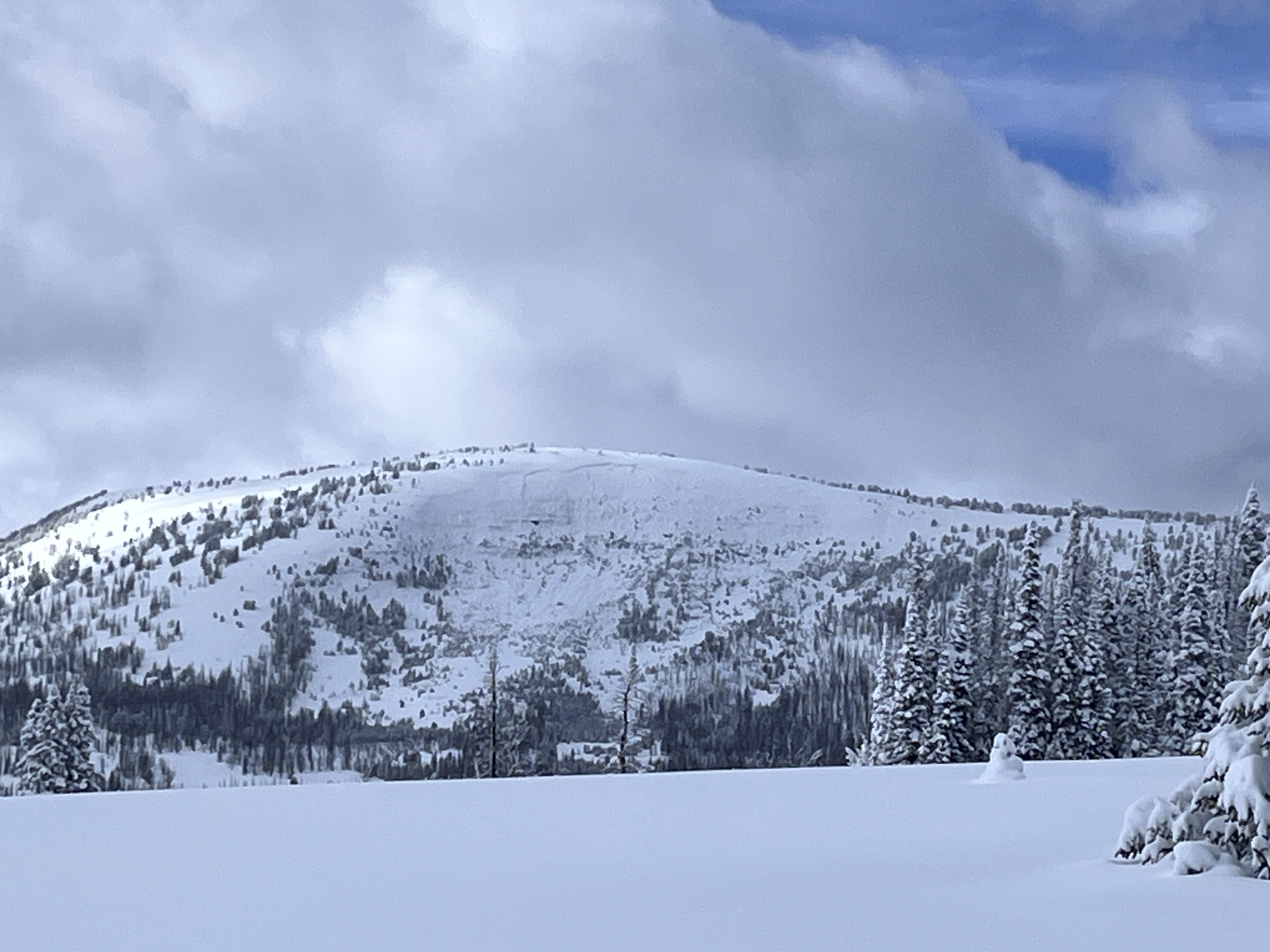
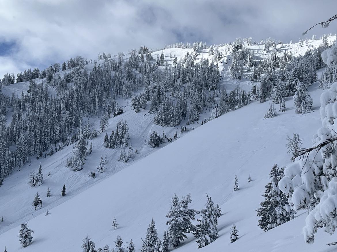
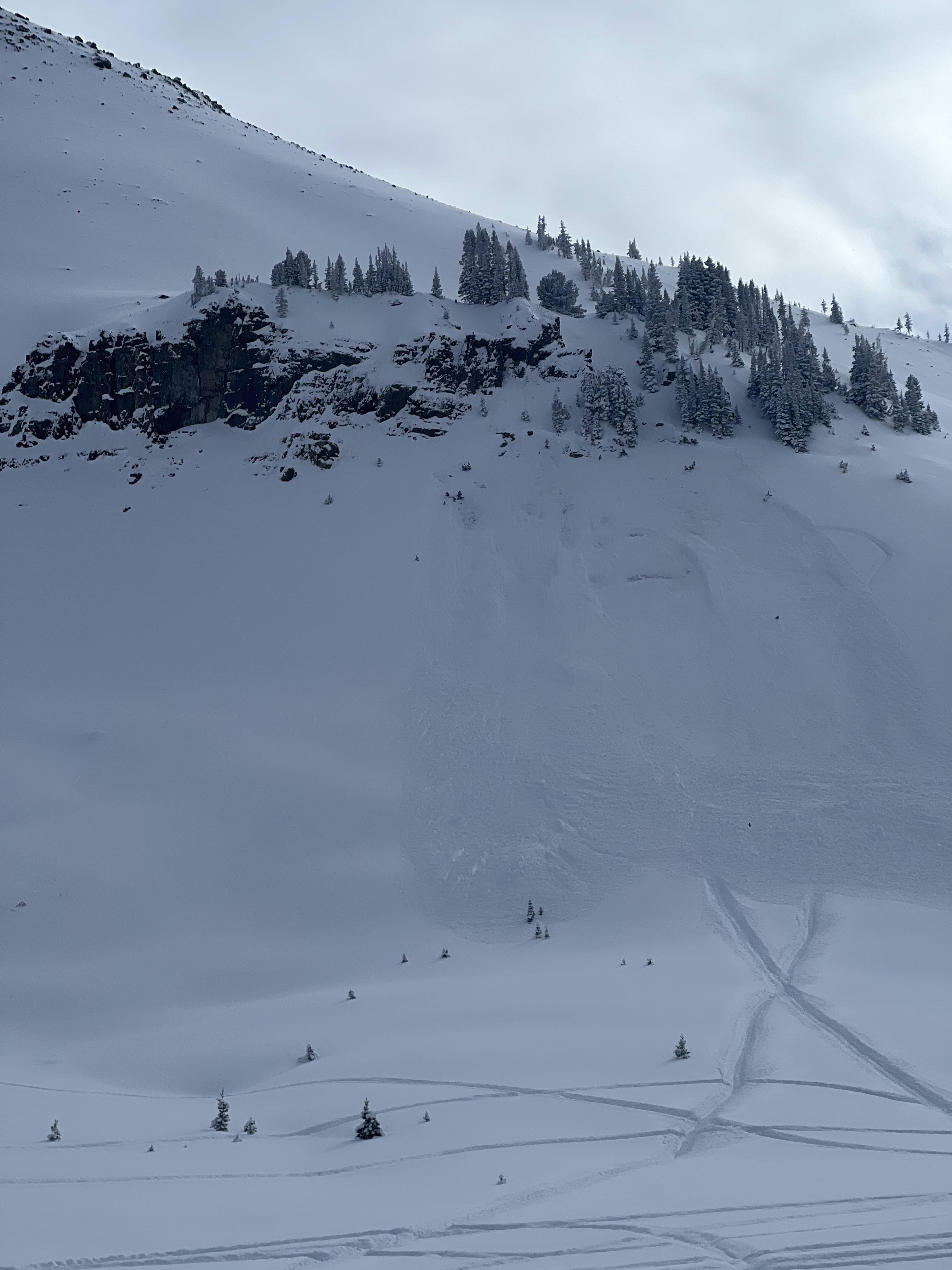
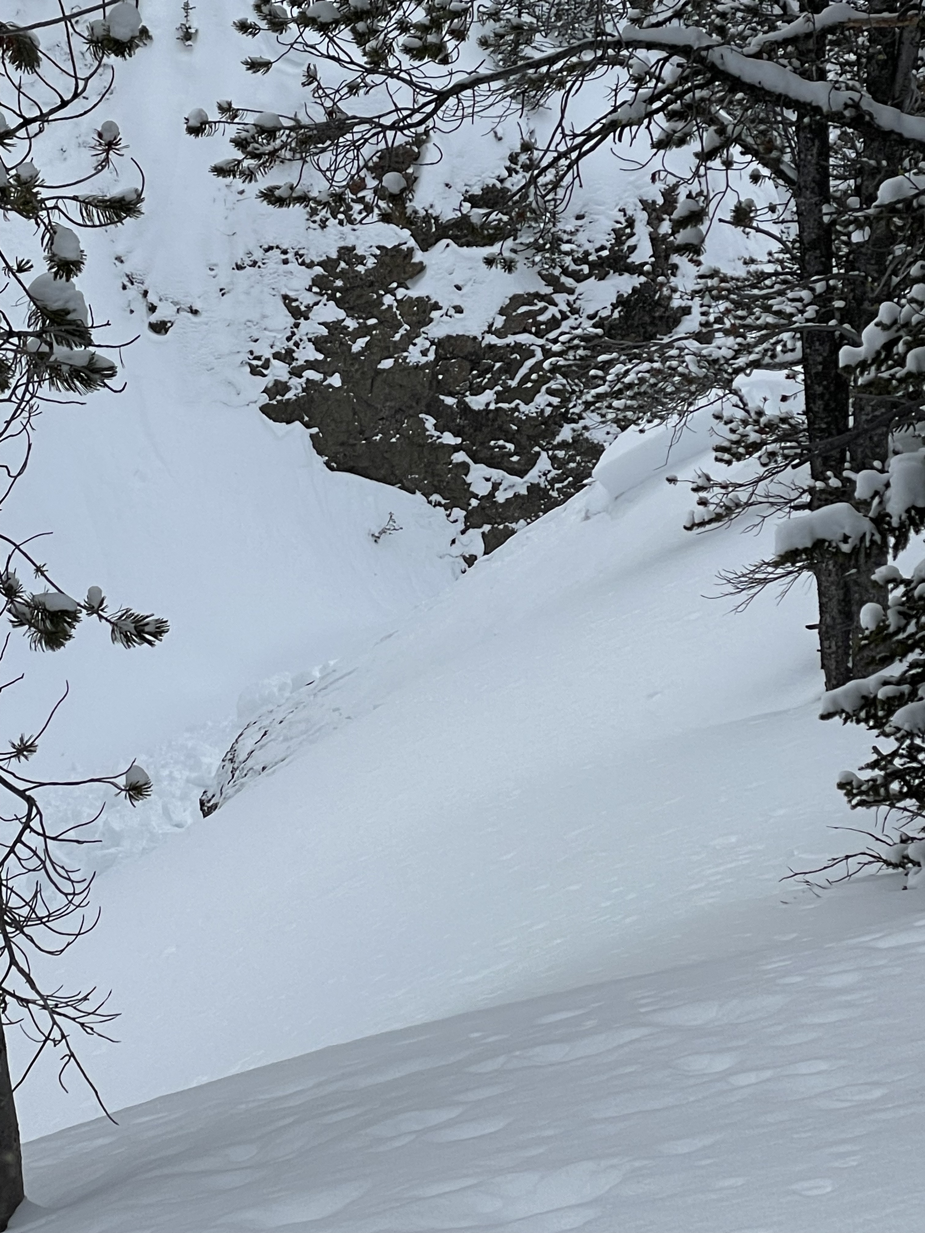
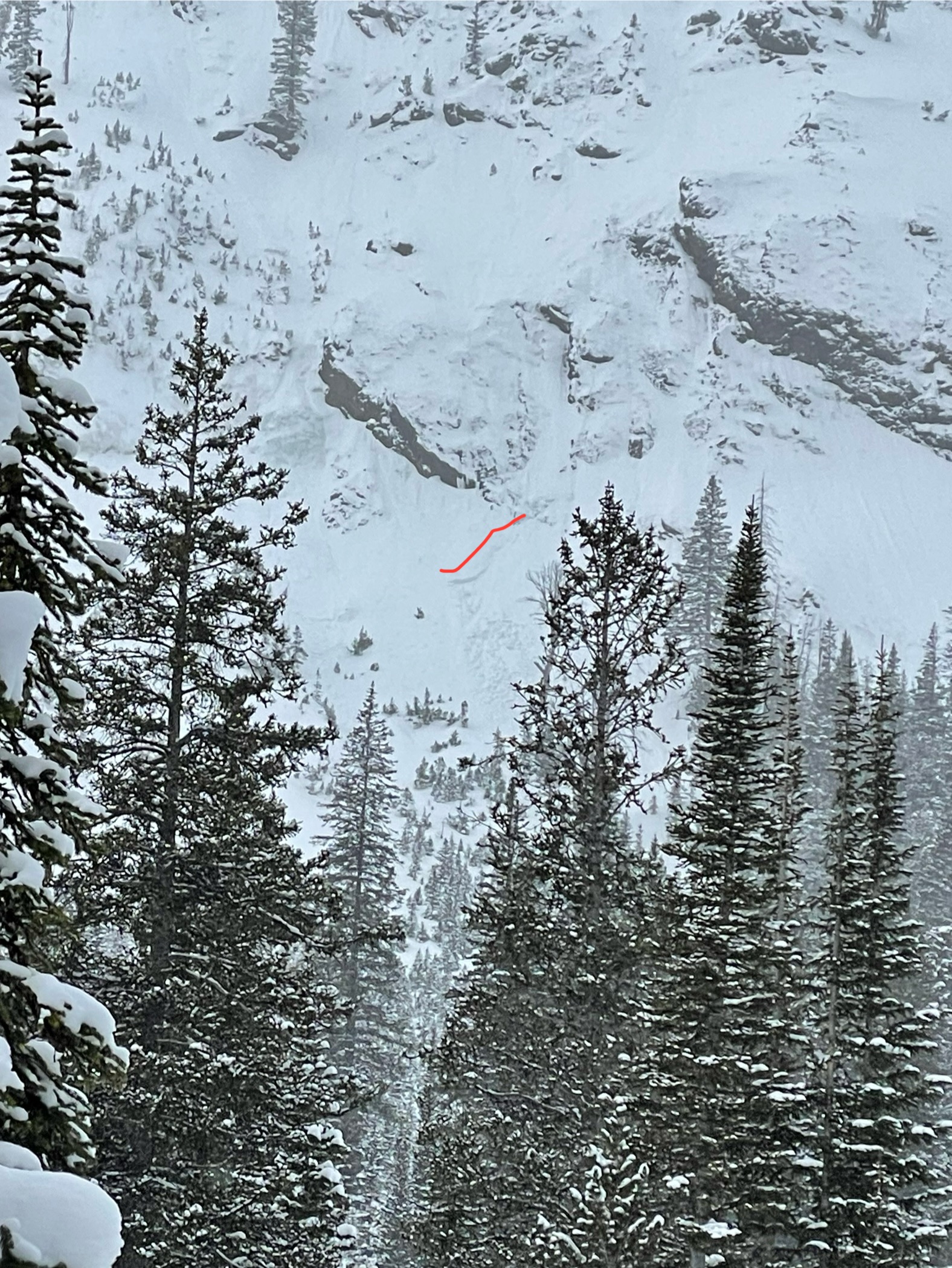
Full Snow Observation ReportPhotos of a natural avalanche in the NE/E facing bowl of Ernie Miller Ridge. Likely happened in the last few days.
We saw one other small avalanche in the trees below the ridge too far for a decent photo.

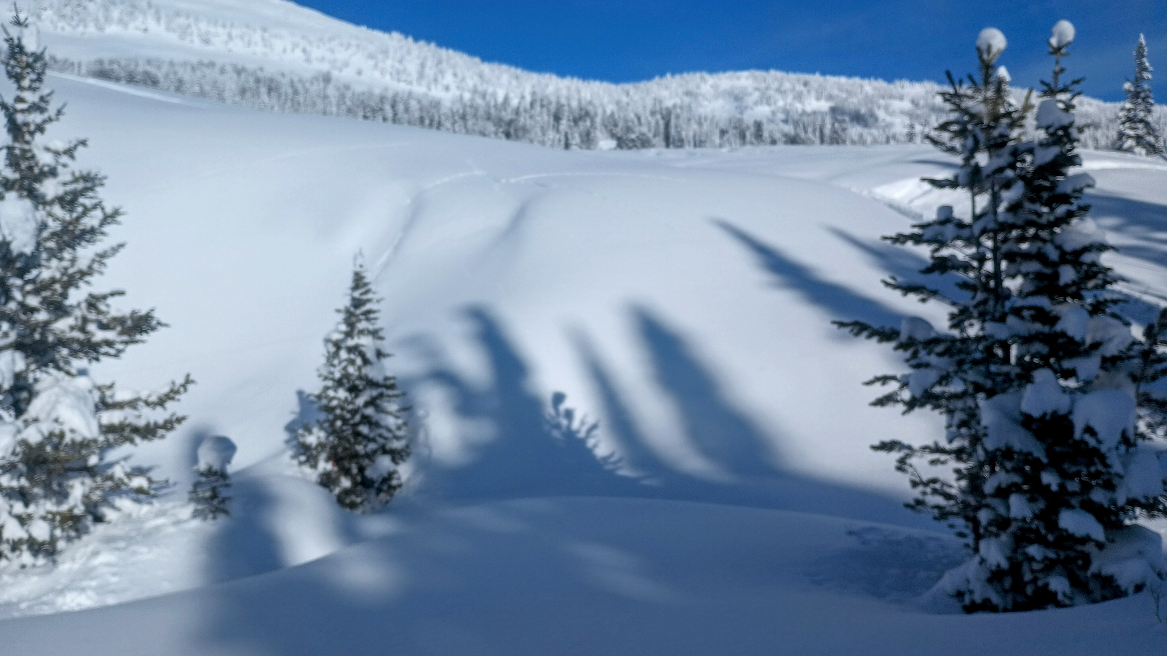
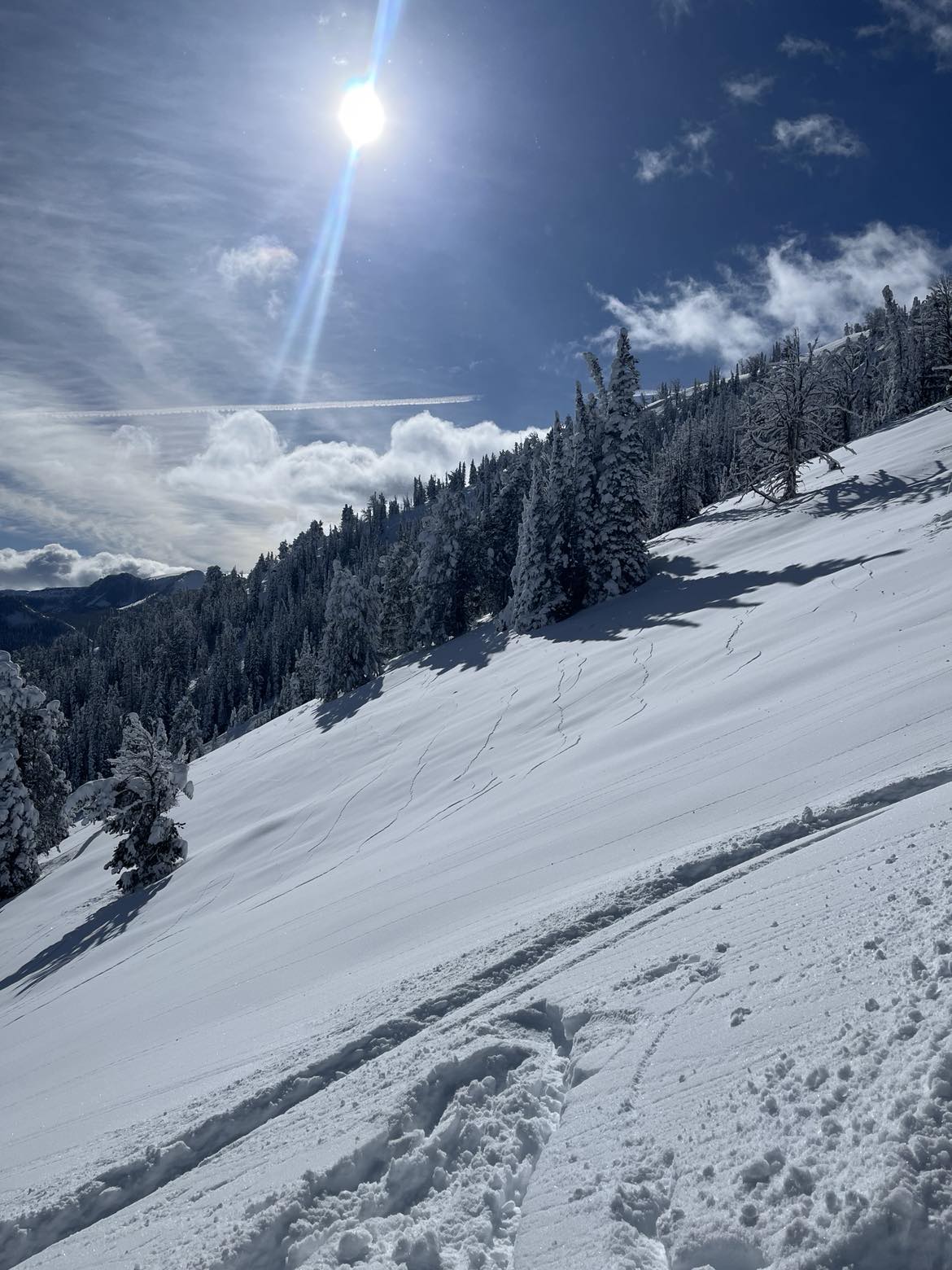
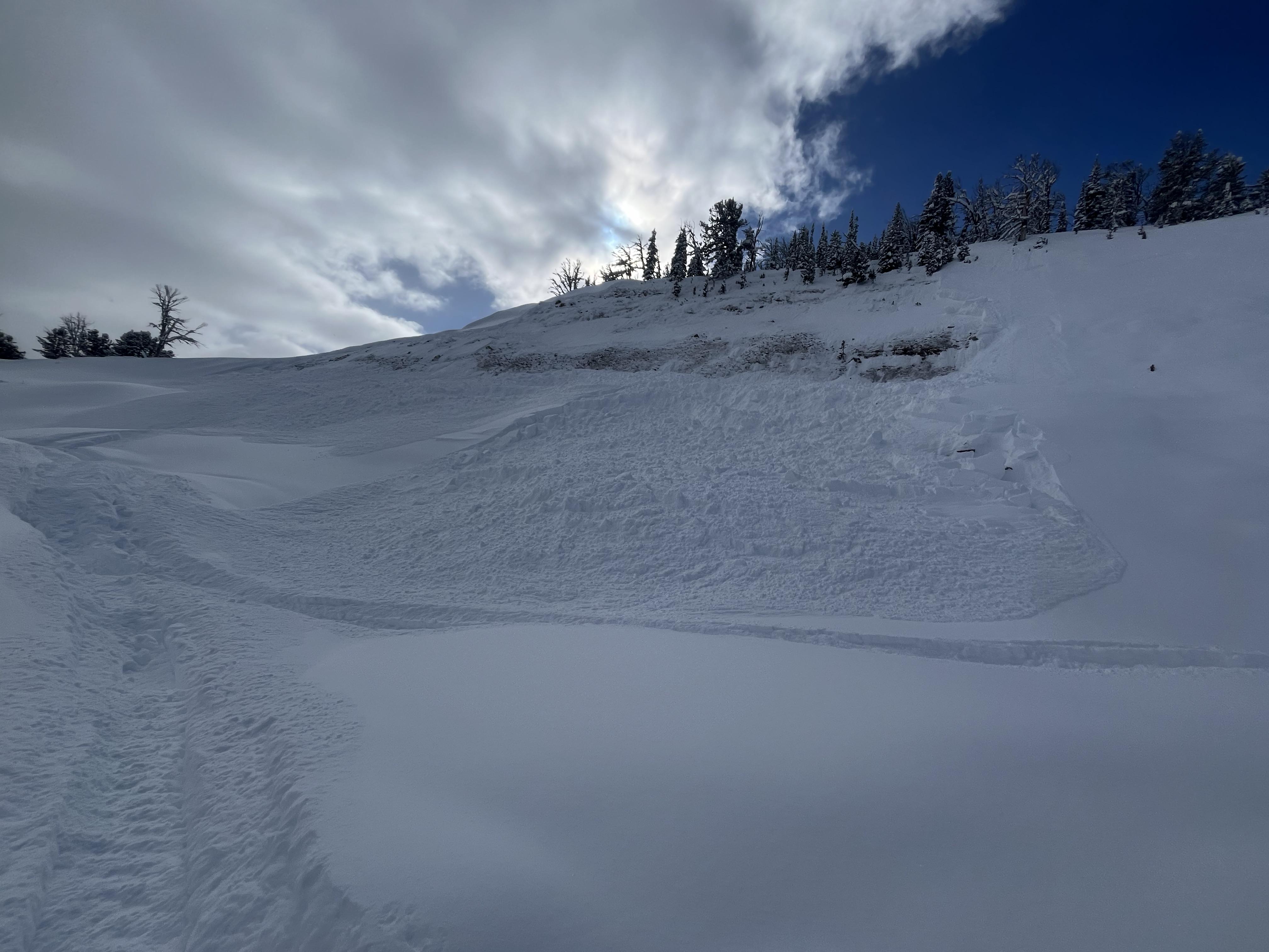
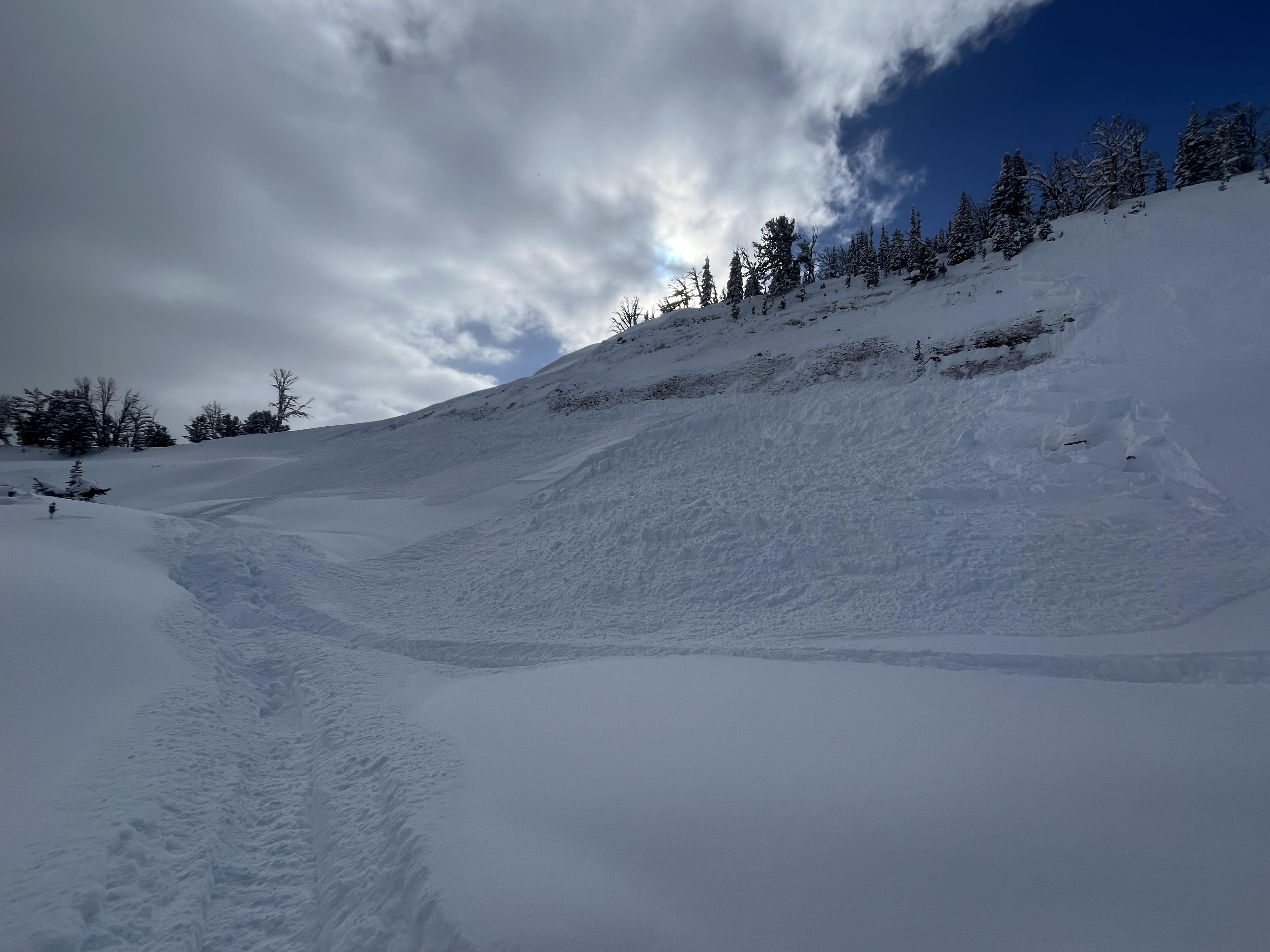
Toured up an east facing slope near the northwest arm of Hebgen Lake. We did not experience any collapsing or cracking on or off our ascent route but we did experience whumpfs on the ski down. At the top of the ridge at 9000 ft on either side of our skin track were three different avalanches. They all looked to be natural. One was pre recent storms, one was perhaps 24-48 hours old and maybe 500 feet wide, and one looked to be very recent, perhaps in the last 12 hours. We got a good look at the recent slide. It had no tracks in or out of it. It was at least 200 feet wide and broke 1-1.5 meters deep, gouging to the ground in spots and ran to the trees almost full path. Besides the avalanches, near the ridge line was a 30° planar slope that had a small concavity. There were shooting cracks everywhere, and it looked like the cracks propagated into a slab that would have broken up more if the slope had been steeper. It almost looked like a crevasse field with how many cracks there were. Photo is included but I don't think shows just how broken up that "relatively benign" terrain was. I have never seen anything like that before!
Full Snow Observation Report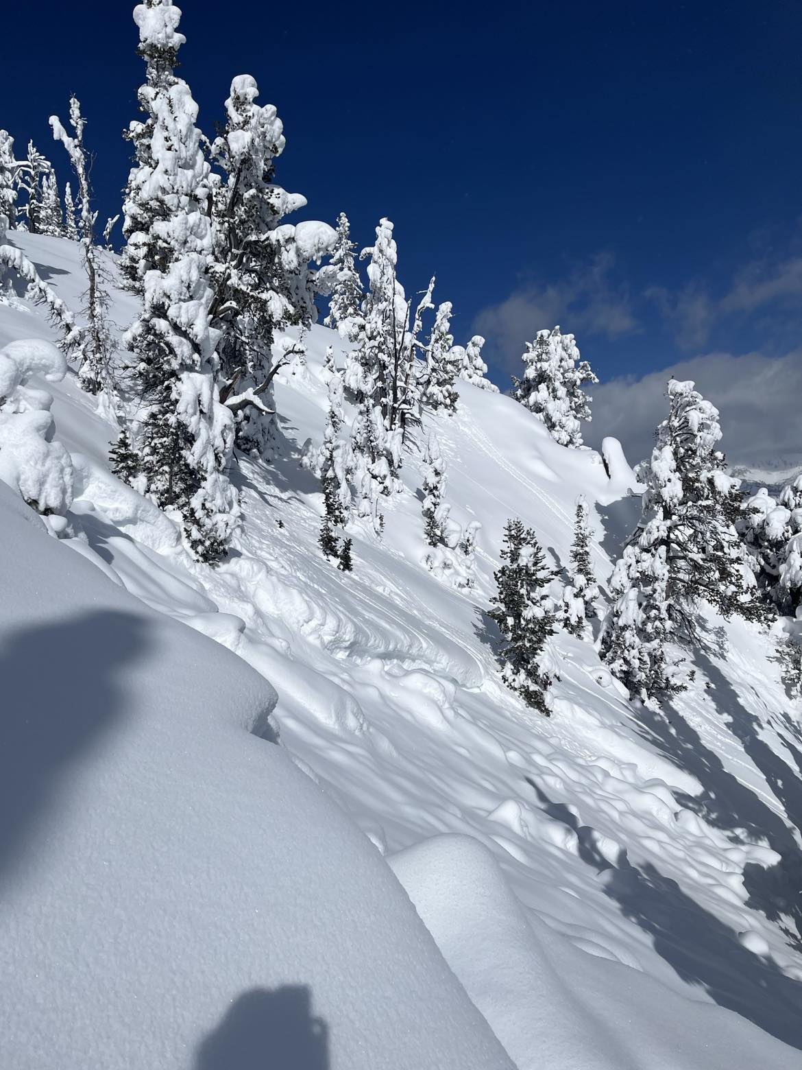
Toured out of mill creek today, at around 9200 feet we remote triggered a slide.
HS-ASr-R1-D2-O
We were ascending a low angle shoulder when a NE facing slope around 20ft away went. Crown was around 2ft deep on both sides and around 4ft at the deepest. It broke on the layer of December facts with a pencil hard slab around 1ft-2ft thick. Above the older slab was new snow about 1ft deep in non wind loaded areas, and around 2ft deep in wind loaded areas. It ran about 300ft and was 50ft wide.
Full Snow Observation Report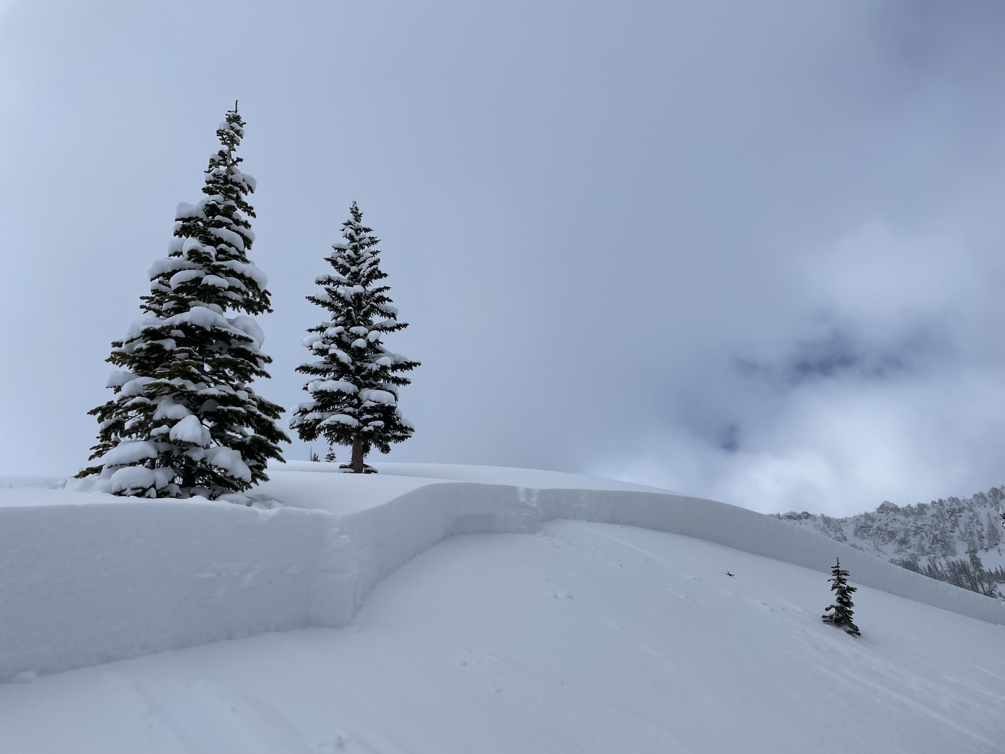
Member in our group was on the flank of the slope. Crack shot from beneath sled and triggered the slope from ~ 100’ away. Broke about 75 yards wide, ripped to dirt and travelled a short ways to toe of the slope. North facing, 9220’
Full Snow Observation Report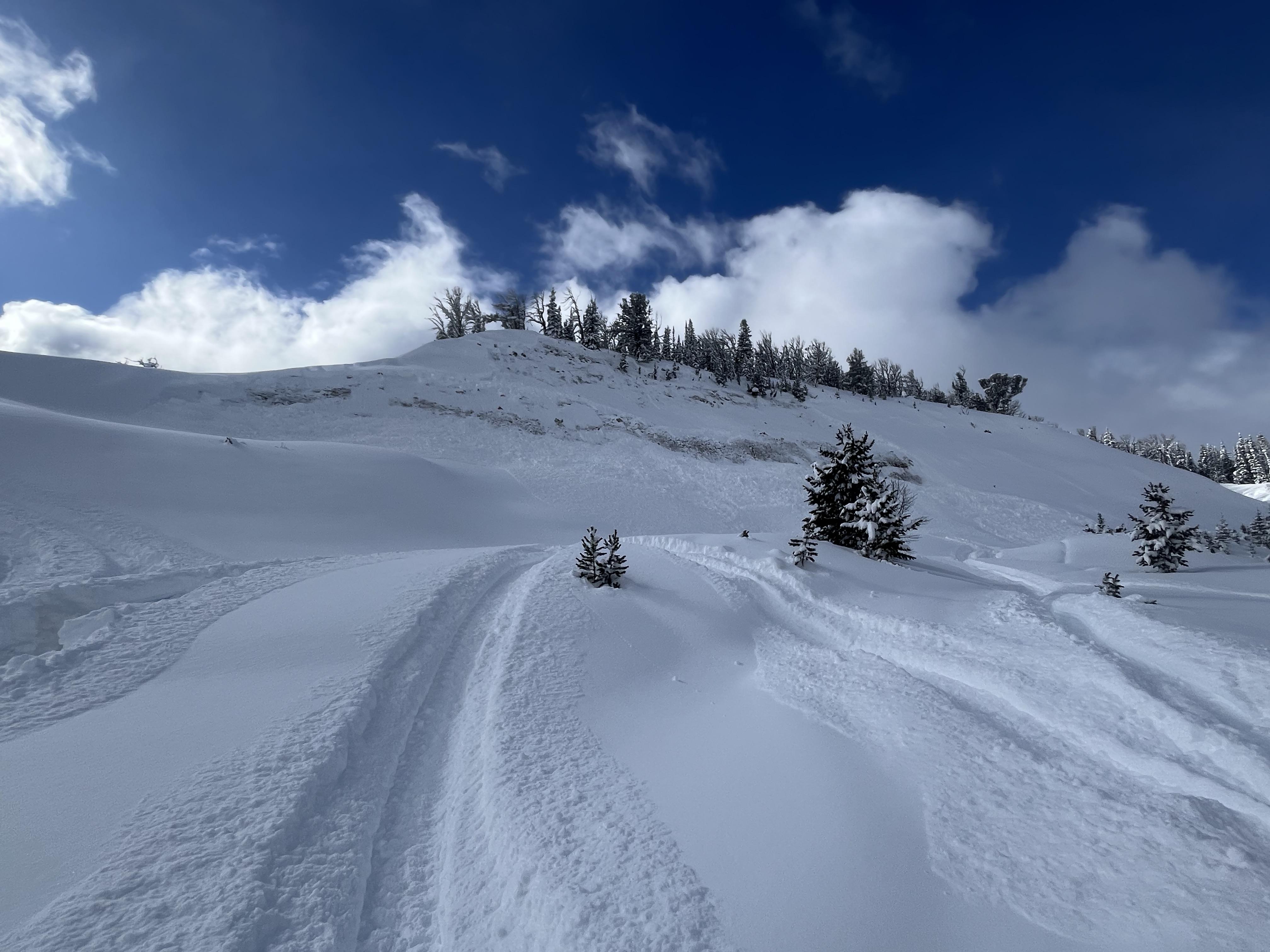
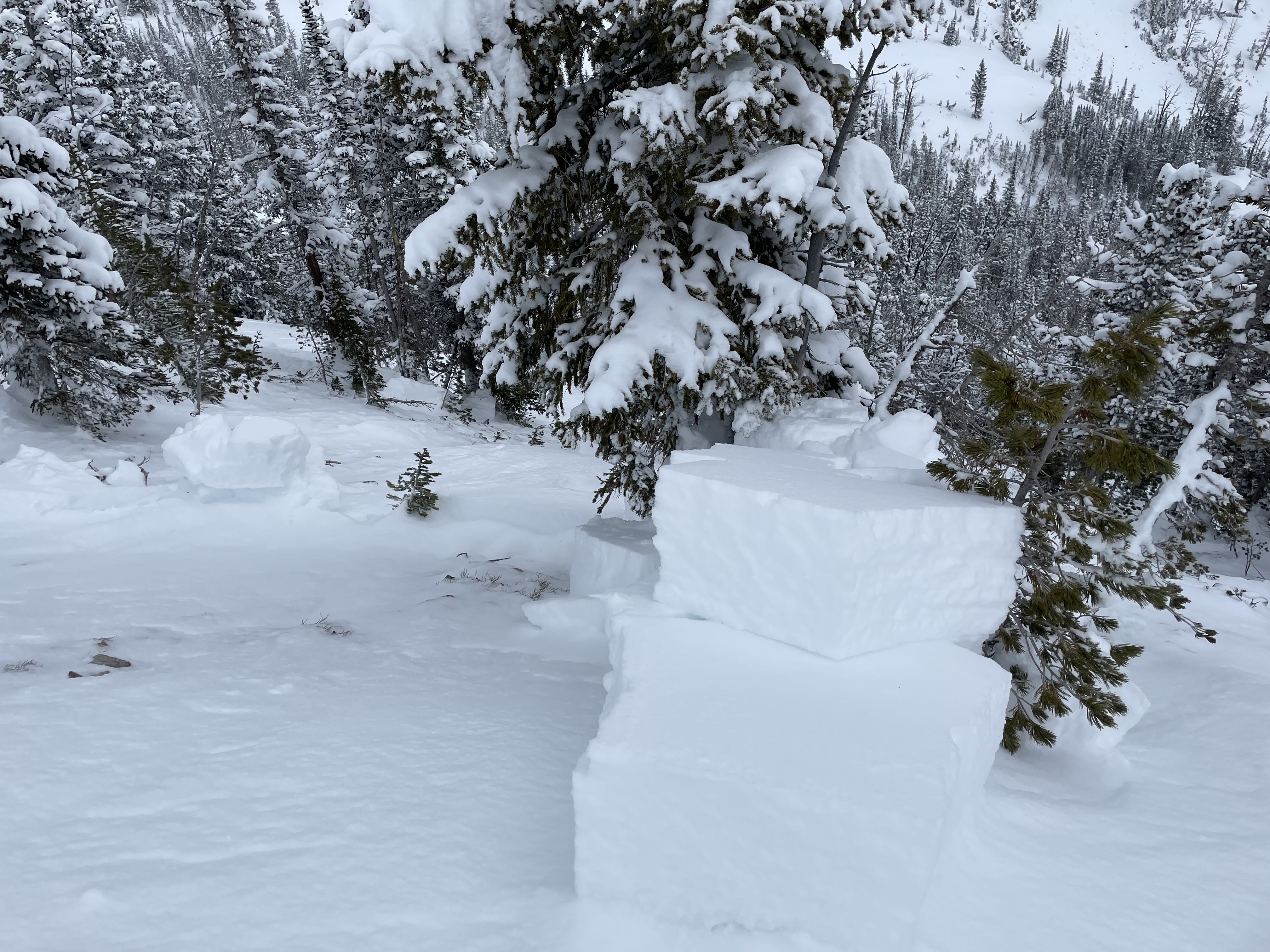
Was up at Beehive today from 8am-2pm. On our way up, snow was consistently whumping underfoot and in one of these instances, we triggered a small slide that went for 10-15 feet around the coordinates (45.34789, -111.39892) towards the top of the basin. Decided to dig a pit a bit further up the hill for some practice and discovered a weak icy layer a couple feet down, with a couple feet of minor to moderate facets 4-5 feet down.
Full Snow Observation Report
Toured up Brackett Creek to 8000’ on the E shoulder of Ross Peak. Depth of 90-120cm near 8000’. No propagation in ECT (ENE 7900’). Lots of trail breaking and no collapsing or whumps. No avalanches observed.
Full Snow Observation Report
Witnessed multiple natural avalanches on slopes that exceeded 30deg of incline. When riding on test slopes with similar conditions we saw shooting cracks all around the sled. We broke a couple slabs on hills around 25degs right at the crest of the hill but only the crest broke or showed signs of instability.
Full Snow Observation Report

Snowmobiler triggered an avalanche. She climbed up the backside of Crown Butte and as she descended the slope the avalanche broke and ran down the slope behind her. No one was caught or injured
Full Snow Observation Report

From facebook: "We saw 4 different avalanches today at the west end of lions head. One triggered close to us. We were at the bottom in a safe spot on a high spot. North 44.73482. West 111.36946. 100 feet wide 100 feet vertical. Broke to the ground. Afterwards we watched 4 more go from a 1/4 mile to 1/2 mile away from us as we were in a safe position on a high spot watching them go. I'm sure we triggered the first one from the bottom, but we were 100 feet from the slope toe."
Full Snow Observation ReportTest snow profile. The snow was surprisingly deep at HS 180, most likely from wind loading. Felt and heard various collapses of the snow during the day while riding snowmobiles. Approximately 30CM of fresh snow over a thin MFC followed by a dense thick snow slab. CT and ECT indicate this MFC is the weakest layer. CTM(16)SC down 30, ECTN(6) down 30
Full Snow Observation Report
The Bozeman Snow Ranger crew rode Buck Ridge today as far as Slatt's Hill/ 2nd Yellowmule. At the bottom of the trail there was about 3" of new, low density snow, while up on top there was at least 6-10" of new snow from the last 24 hours or so. There was no wind effect yet and there looked to be another wave of snow moving in from the SW as we were leaving. We peeked into Beaver Creek and the Slatts area and did not see any recent avalanches though I did notice the snow settling significantly as I rode around on the flats in the Slatt's hill area- the SE facing basin opposite 2nd Yellowmule. Plenty of fun to be had in the flats and gentle meadows right now.
Full Snow Observation ReportWhile splitboarding south of Cooke City today I remote triggered an avalanche. I stopped to transition, stepped into the snow, triggered a massive collapse and a slope about 100ft away slid. I stopped right there to dig a pit. HS 110, south facing, 9,000ft, non wind loaded slope. I got an ECTP 14 and an ECTP 13 both 60cm down, right at the top of the big ol facet layer making up the lower 50cm of the snowpack.
Other than the remote trigger, lots of small loose dry natural avalanches on all aspects, mid and upper elevations. I also saw a few small D1 natural slab avalanches in the area on east and north facing aspects, mid elevation. Hard to tell when these all happened, but I'd guess within the last 24hrs. Flat light, hard to see definition Large collapses often and throughout the whole area, on and off established skin tacks.
Full Snow Observation Report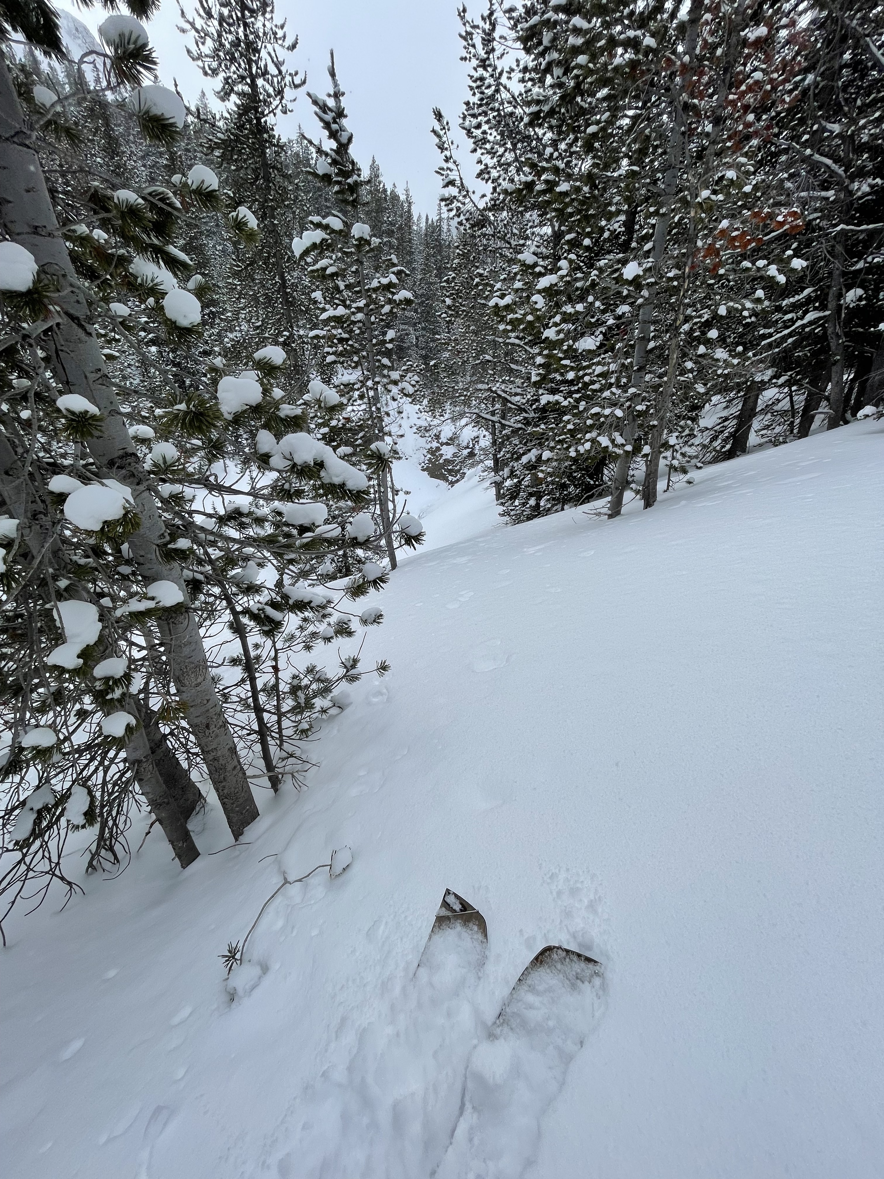
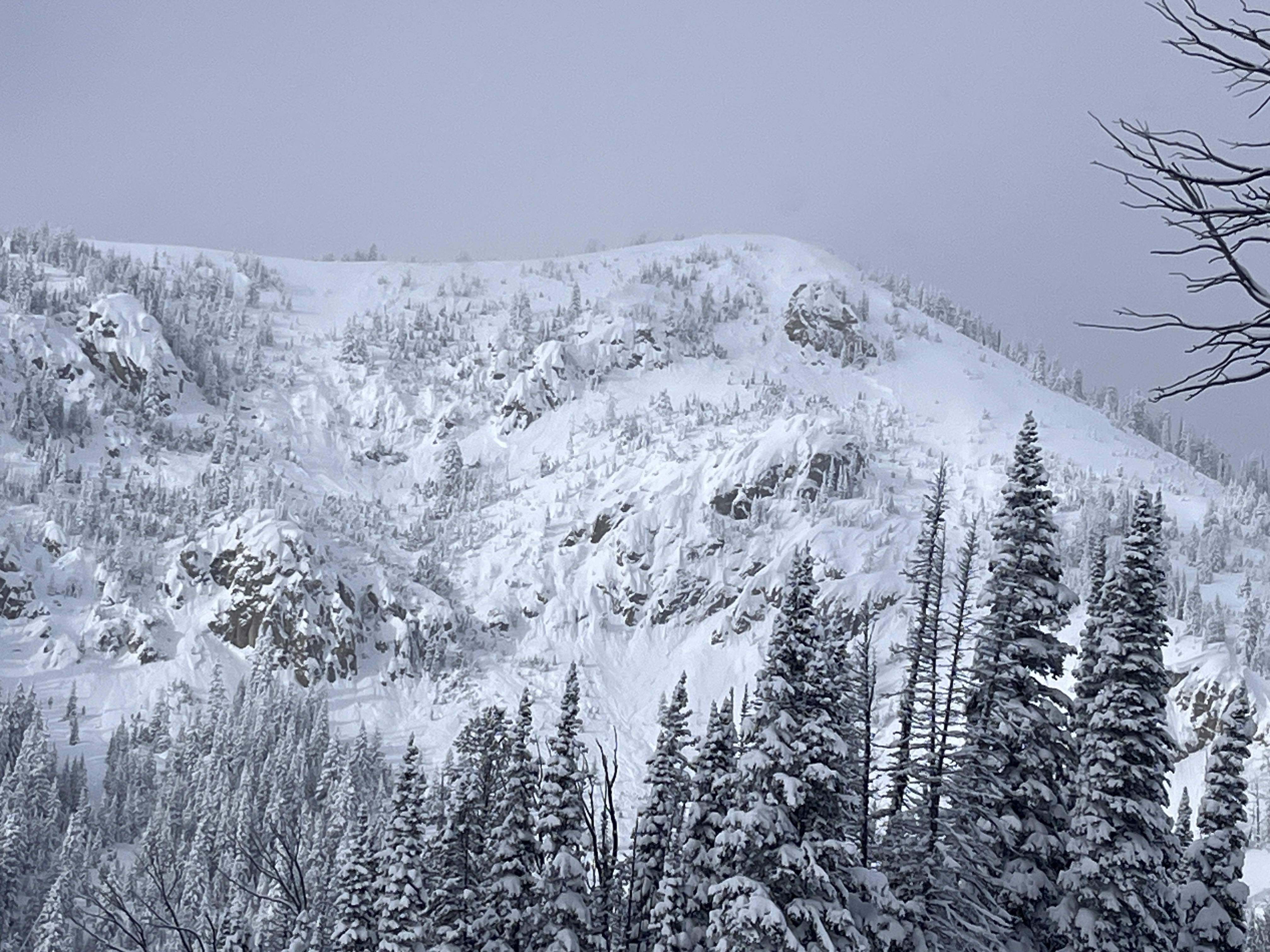
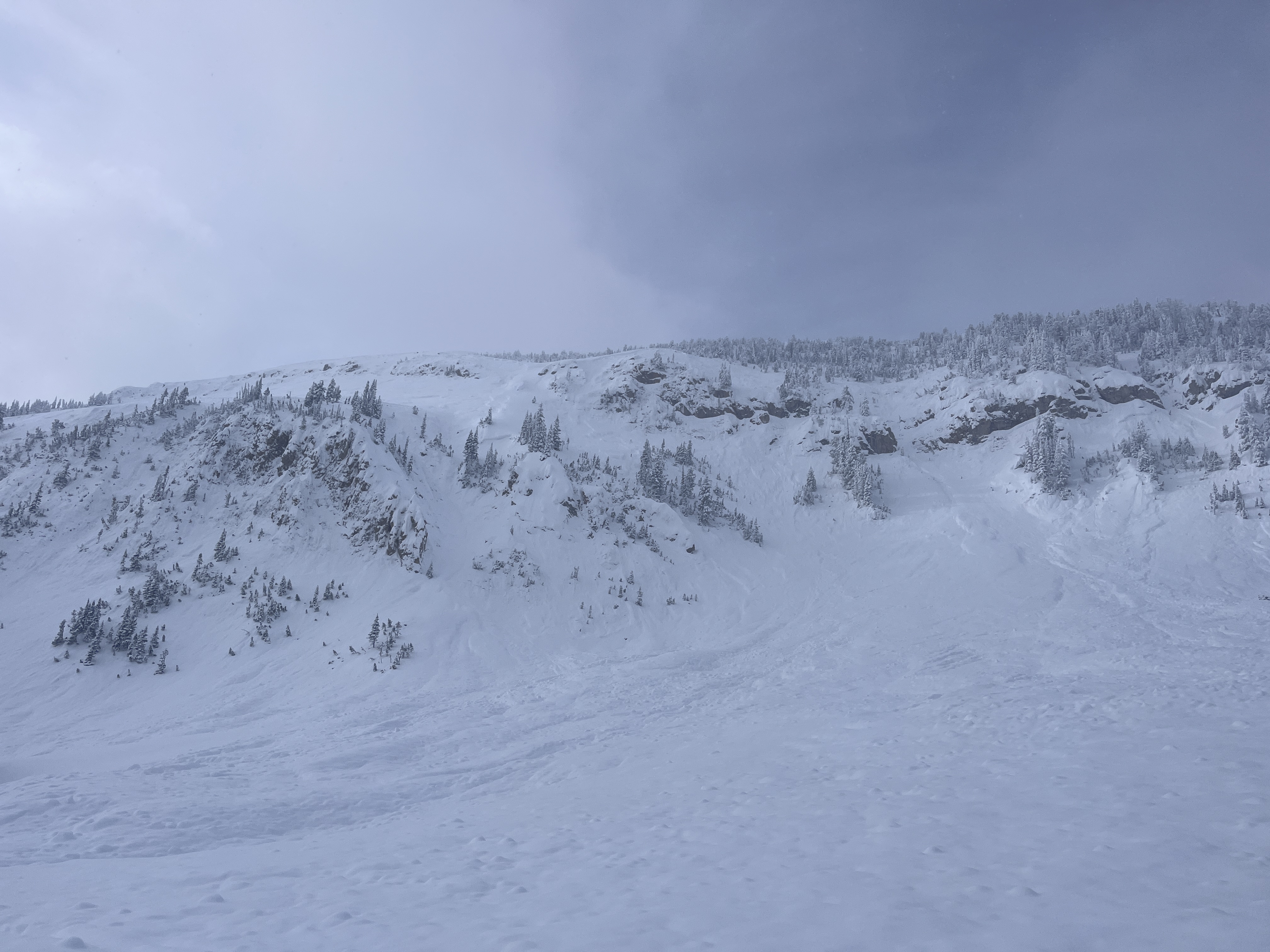
We rode into Tepee Basin and stopped at a recent rider-triggered avalanche that happened on 02/07/2024, ob and video. This avalanche was very large in size, we estimated it to be 3/4 of a mile long, 3-4' deep and ran full path the flats below. The clouds parted long enough for us to seen the entire crown from afar, it was quite continuous and connected multiple smaller avalanche paths.
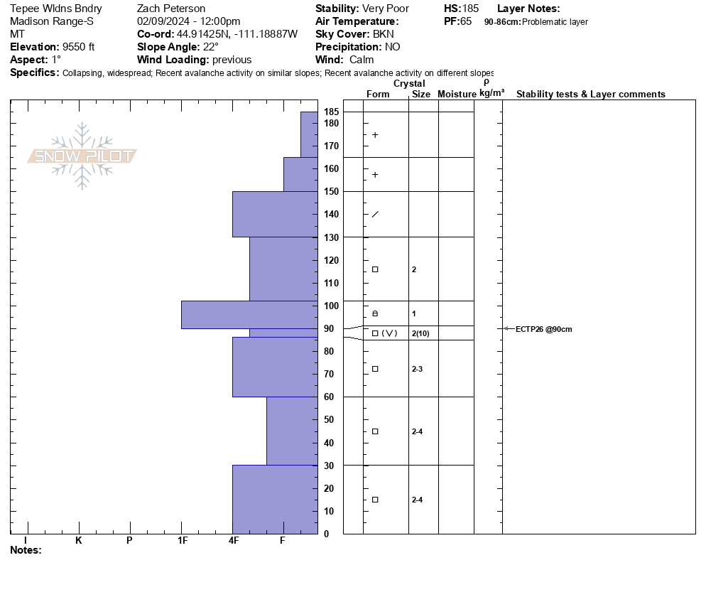
We continued riding to the wilderness boundary. While walking down to our pit side we felt as large collpase and saw snow fall from the trees around us. Our snowpit was on a N facing slope at 9500'. Here, weak snow low in the snowpack is now buried about a meter deep. We got unstable results of ECTP26. While riding away from our snowpit and stepping off snowmobiles we again triggered a large collapse. Collpasing continued as we worked through the trees.
From here we rode along the wilderness boundary towards another area to look for more recent avalanche activity. While crossing a flat meadow above a steep slope the rider breaking trail triggered an avalanche from 30' away. This avalanche broke several hundred feet wide, 2-3' deep and ran full path to the valley bottom. Additionally, around the corner we saw another recent avalanche that likely occured naturally within the last few days.
Overall conditions felt very unstable today. Recent avalanches and collapsing were clear signs on instability. Even if we didn't see these signs of instability, knowing the snowpack is weak and has recently received a lot of new snow was enough information for us to plan to stay off of and out from underneath avalanche terrain today.
Full Snow Observation ReportThe buttermilk lot is plowed. And the trail to the cabin/tepee split was groomed.
Definitely felt appropriate to have a warning out today.

Went for a quick tour into wolverine bowl today. Found new snow totals of around a foot in most places and a very thin melt freeze crust from high-pressure system on all shadier aspects while sunnier aspects had more of a noticeable crust beneath the new snow. Dug a 130 cm pit adjacent to the refrigerator chutes and got a CT15 Q1 @ 99cm and CT21 Q1 @ 30cm. Shallower result failed on facets beneath the recent melt freeze while the deeper result failed on the old melt freeze interface from earlier this season. Snow was coming down heavy by the time I left the bowl and wind was calm.
Full Snow Observation Report