Snow Observations List
Couple days old [1/23 or 24]. Better light on it today. S aspect. 9800'
19° at 11:00 a.m. under overcast skies but warmed up when the sun came out.
(Photos by T. Parrie)
Full Snow Observation Report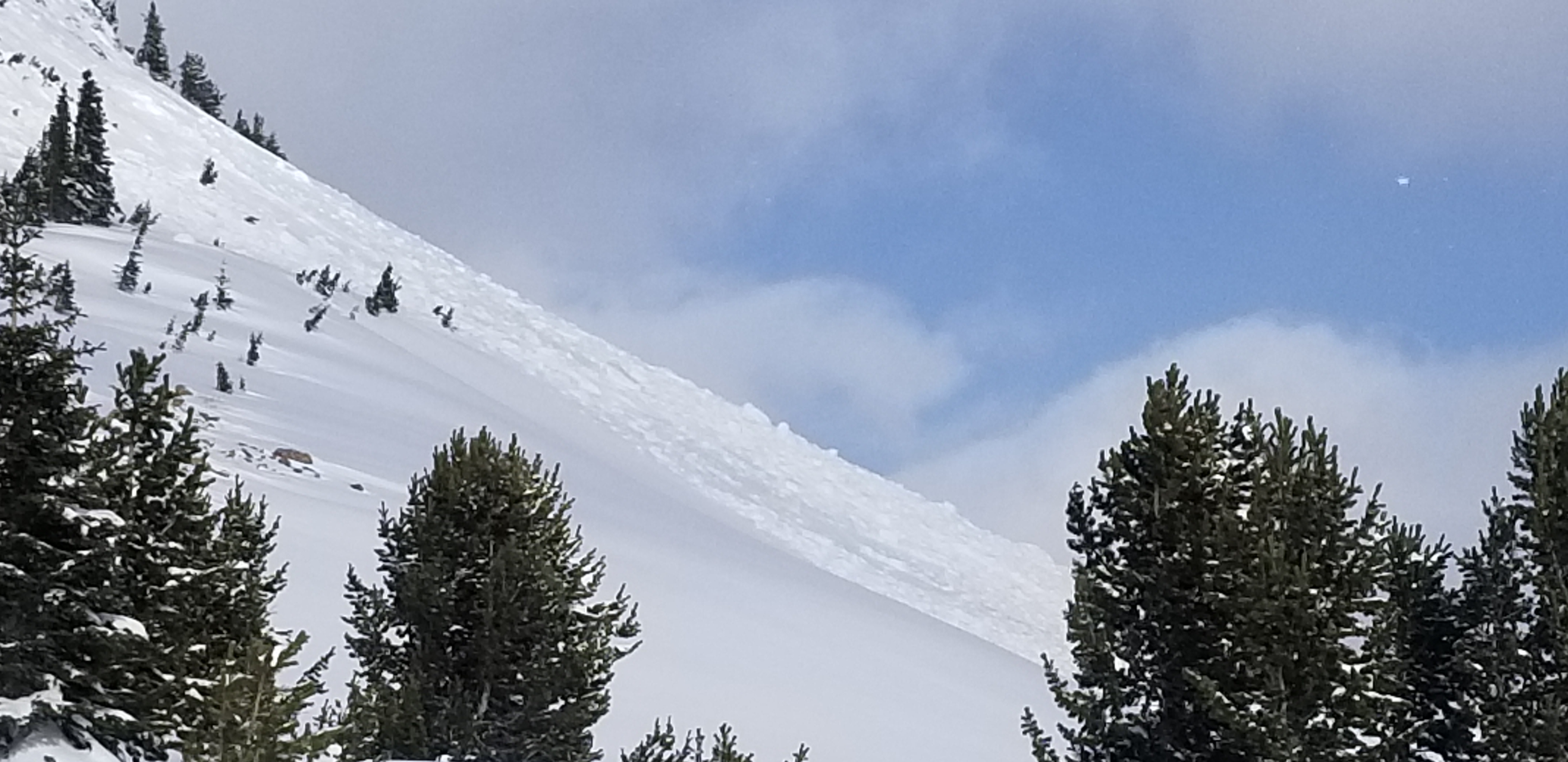
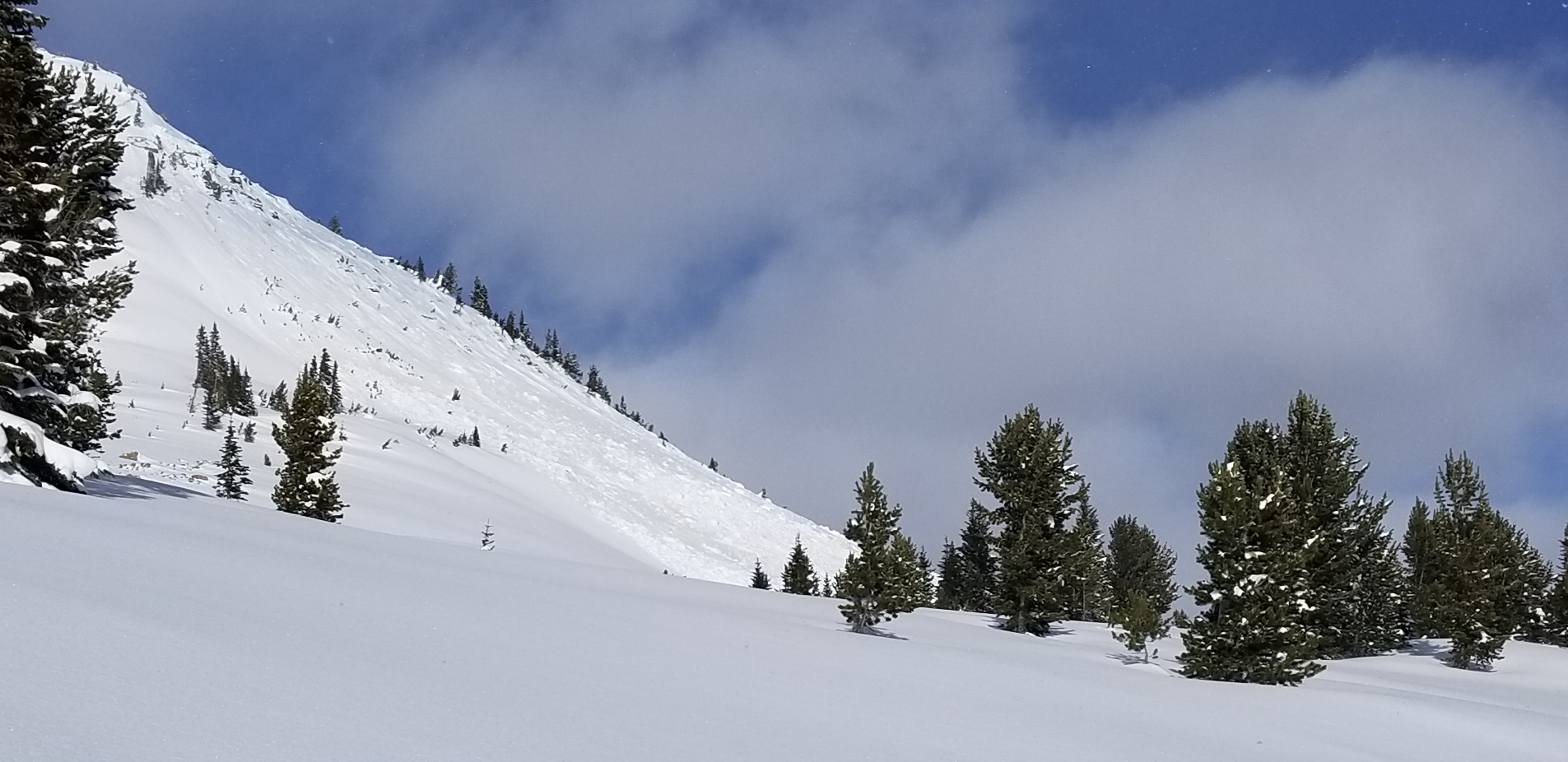
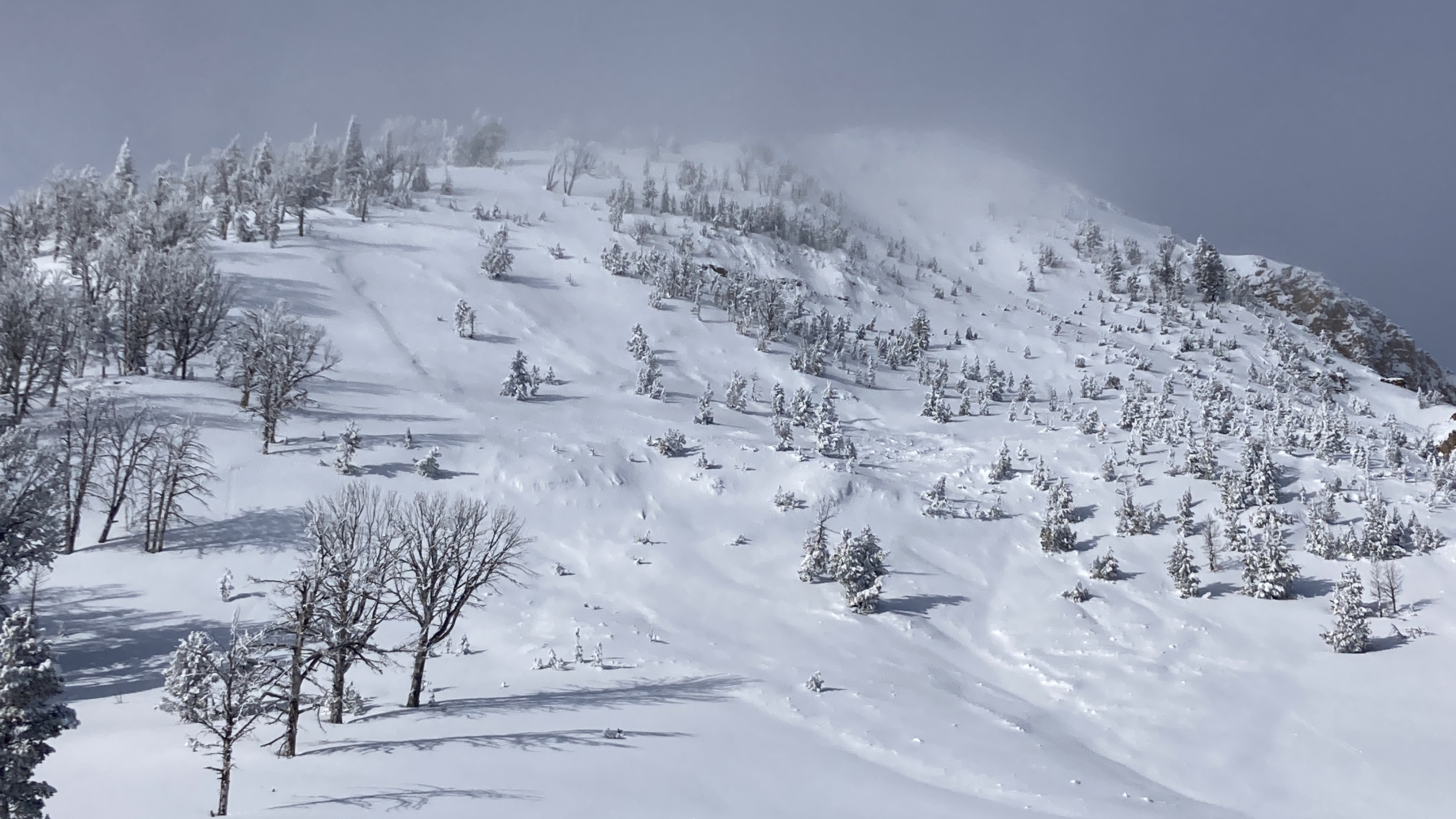
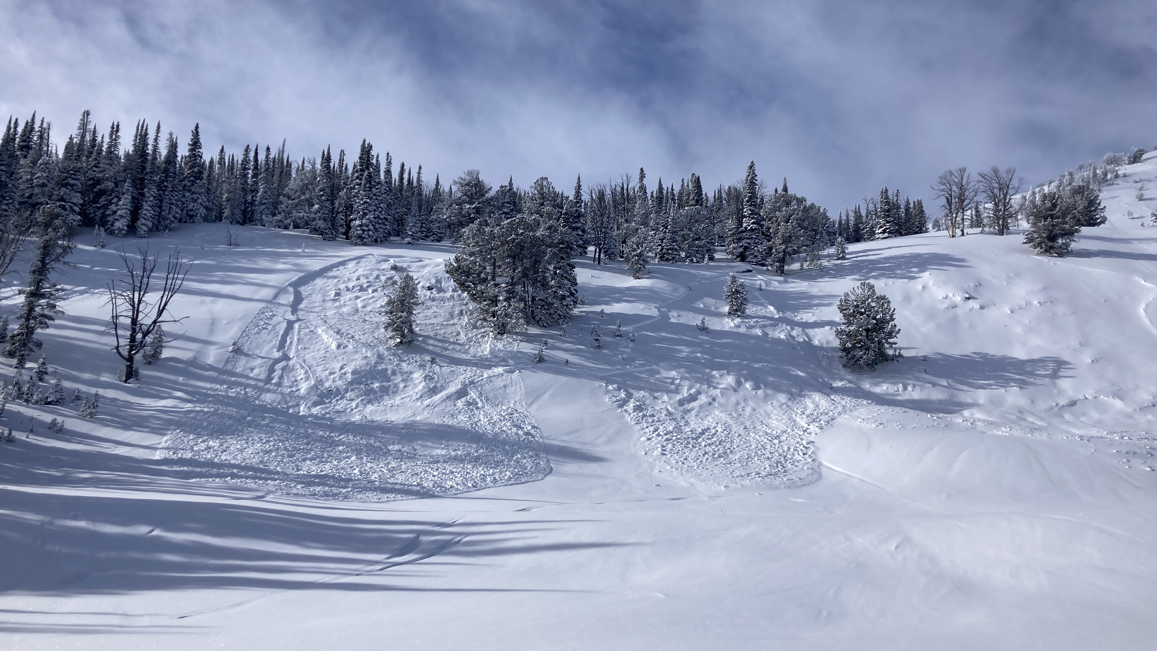
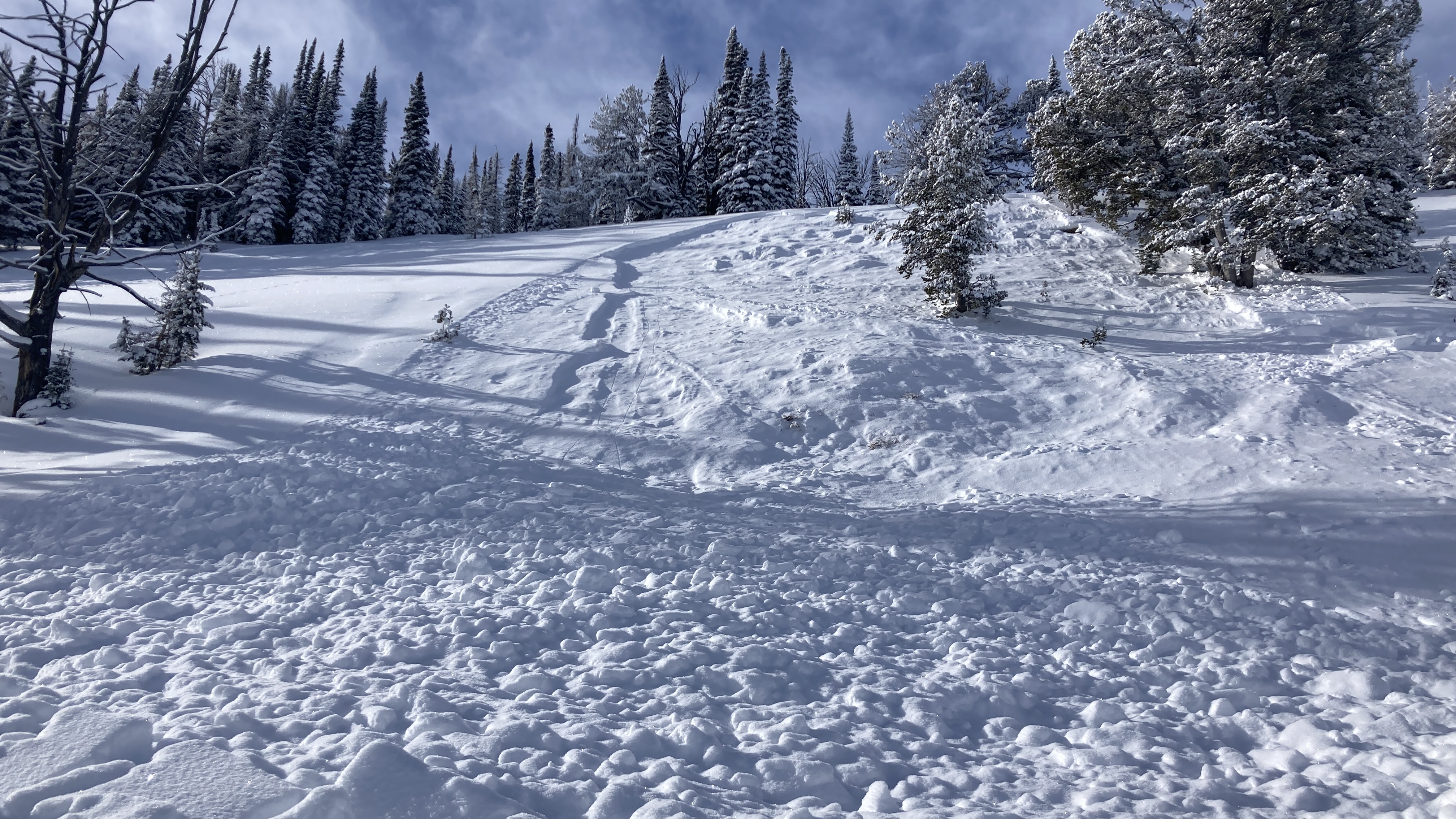
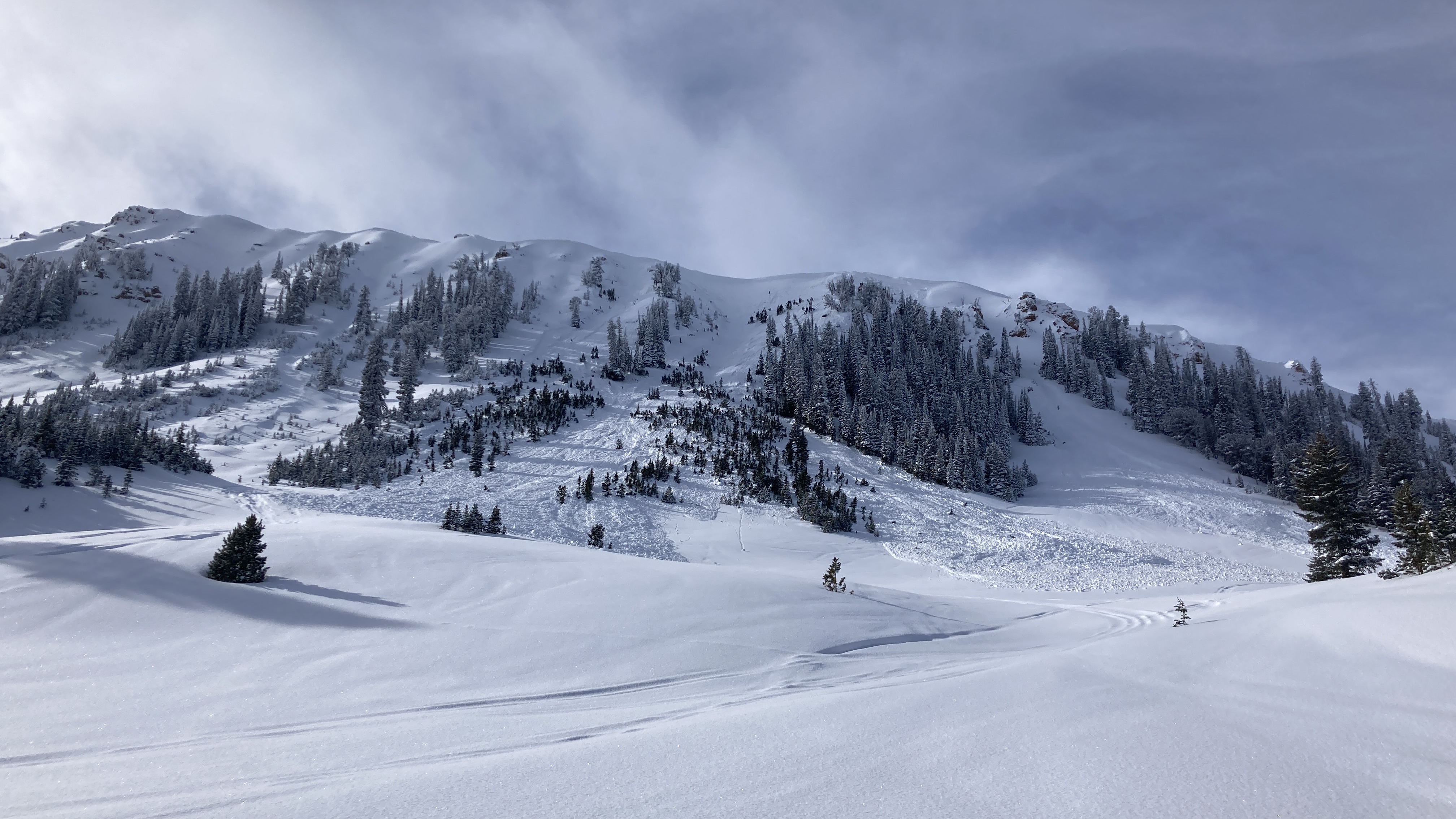
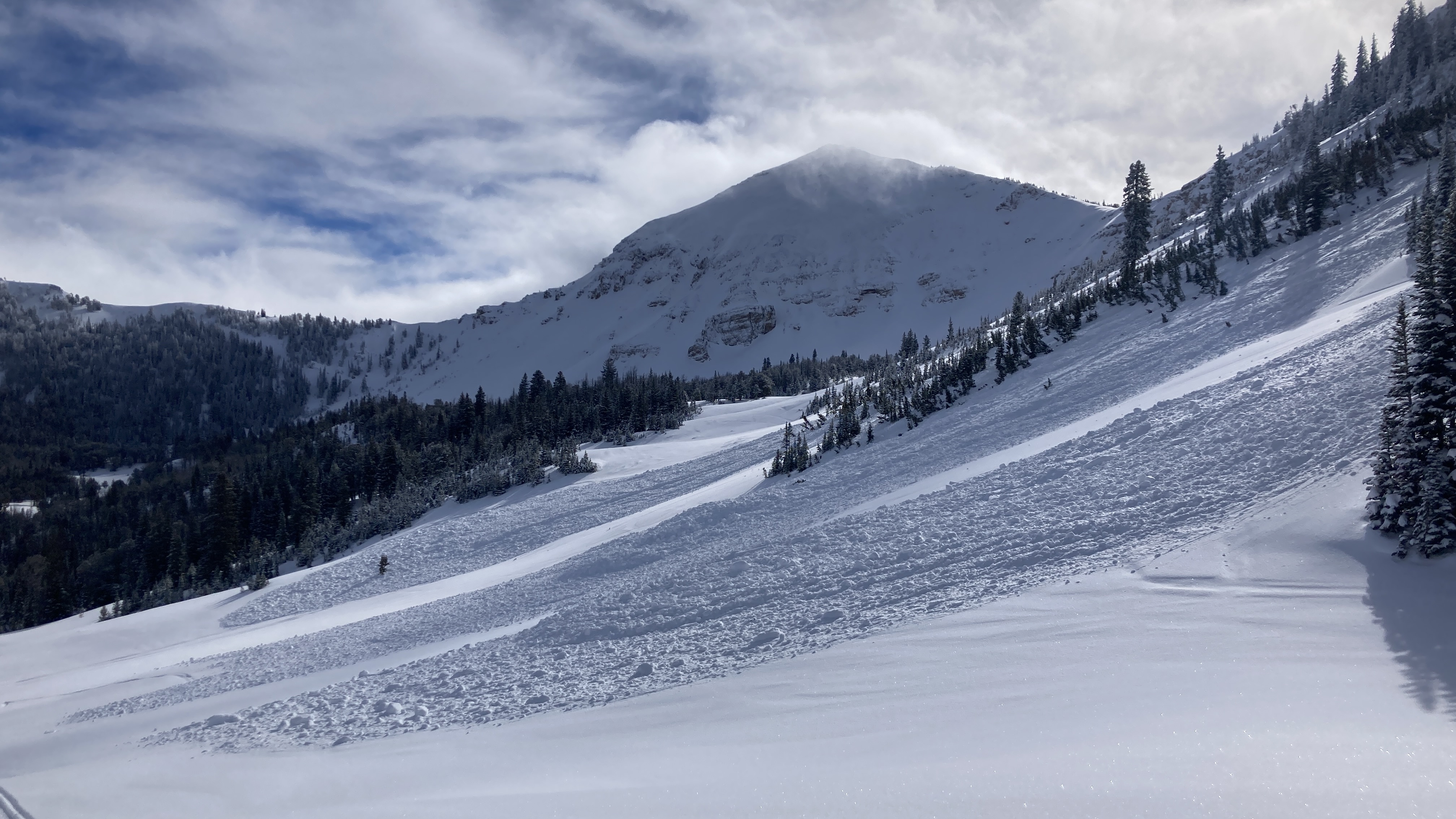
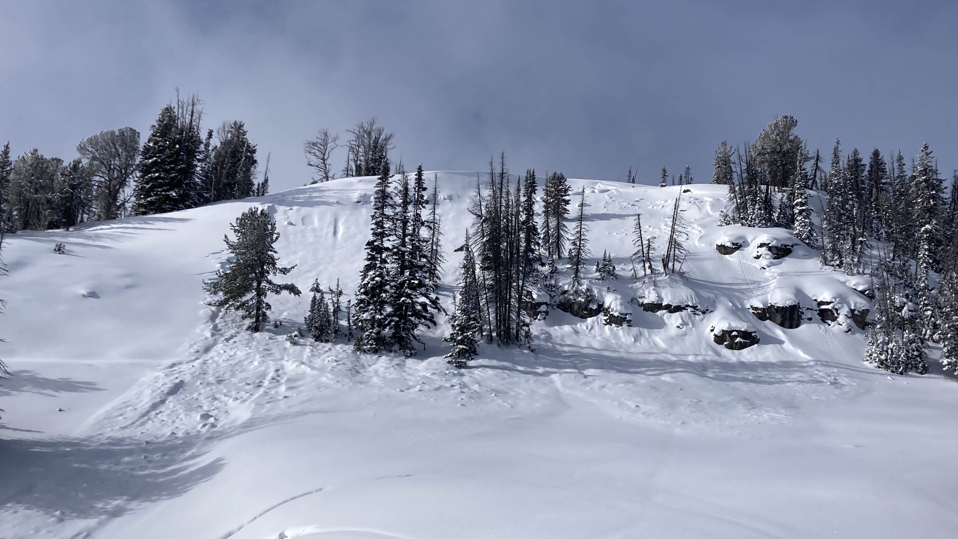
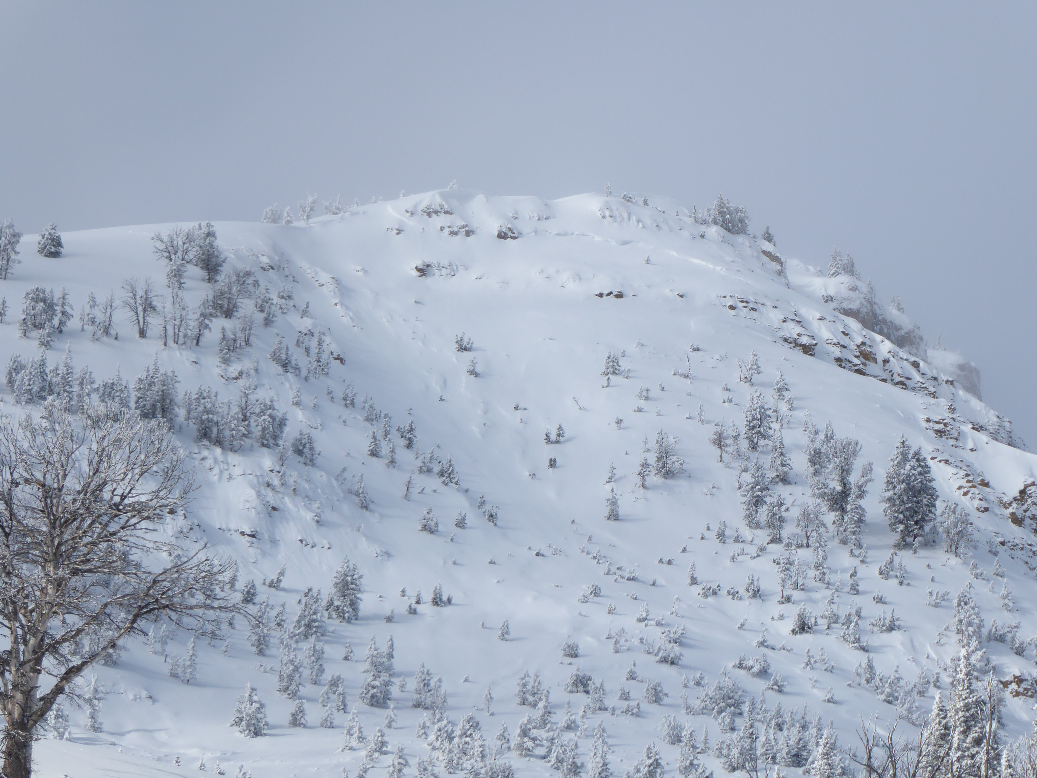
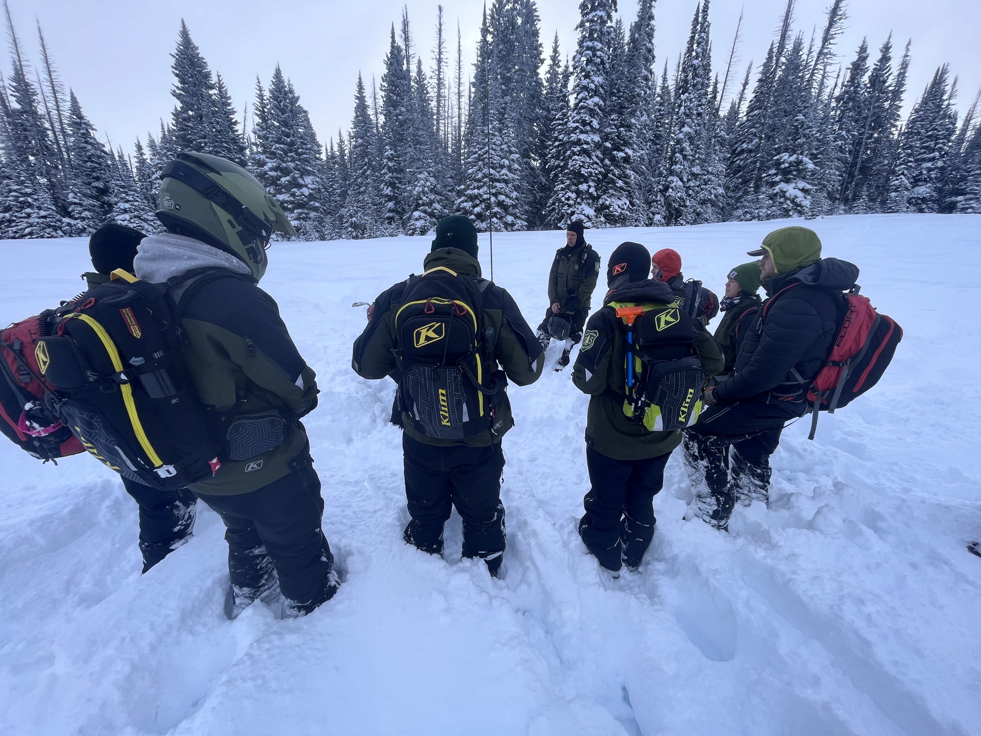
Rode along Lionhead Ridge from Denny Creek to Watkins Creek and around into the head of Targhee Creek. Saw dozens of avalanches that broke within the last week. Most of the slides looked to have broken early this week with a couple looking like they broke in the last 24 hours. Slides broke on all aspects, both above treeline and well below treeline, and on both wind-loaded and nonwind-loaded slopes. Some looked to be naturals and some looked to have been rider triggered. One of the slides in Watkins Creek broke across three avalanche paths/gully features and was one of the larger slides we've seen this season, looking to have piled up debris 10+ ft deep. All these slides looked to have broken on one of the December surface hoar layers at the top of the early season facets.
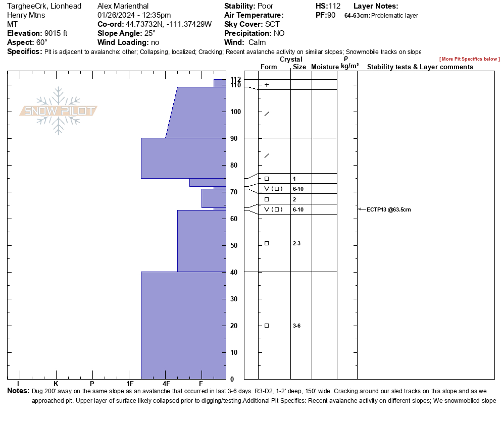
Dug a pit adjacent to one of the slides in Targhee Creek and got an ECTP13 on the lower of two well defined surface hoar layers.
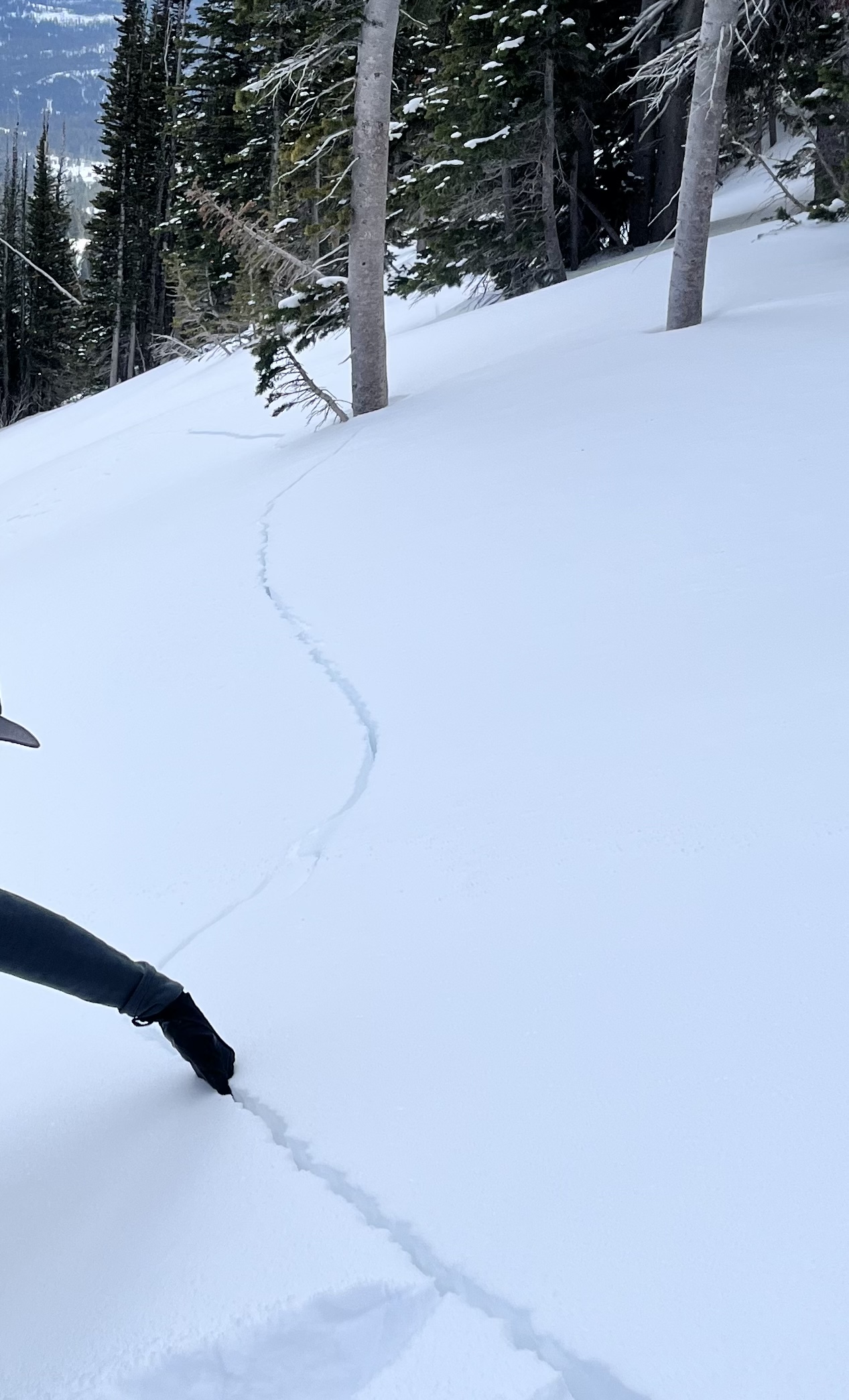
Riding today it was quite dramatic how much stiffer the slab is than it was the 10 days ago. Instead of just trenching through the whole snowpack you now mostly ride on top until you dramatically break though. We got a couple of shooting cracks while approaching our snowpit site, but they were not nearly as dramatic as the cracks last week.
Full Snow Observation ReportButtermilk was no problem for parking.
CONSIDERABLE seemed great for today. The amount of activity make it seem like the period of HIGH danger over the last week verified.


Skier triggered several small avalanches while skiing near the zimmer creek yurt and observed a large natural avalanche on Sheep Mountain.
From email: "
I did not get a good photo but yesterday (01/24) skiing out of the yurt with friends noticed a large natural on the NorthEast facing bowl on Sheep Mountain. Similar size to the Henderson slide if not a little larger.
~300 ft. crown and ran a similar distance (300-400ft?)
Also remote triggered a few D1 avalanches over the past 2 days. Continous cracking/collapsing even in a day old skin track. "
Full Snow Observation Report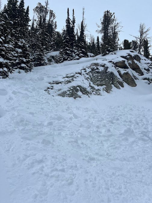
From email: "Photo of a recent slide observed today, north of Cooke. East aspect, 9k'.
We also remotely triggered a different, small avalanche today from safe terrain while eating our lunch!
And had an ECTP3 and ECTV on the Jan. 5th interface (30cms down), also on easterly aspects.
Widespread collapsing today too."
Full Snow Observation Report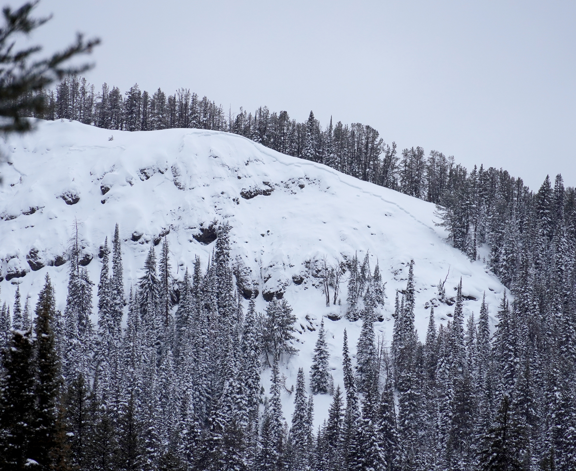
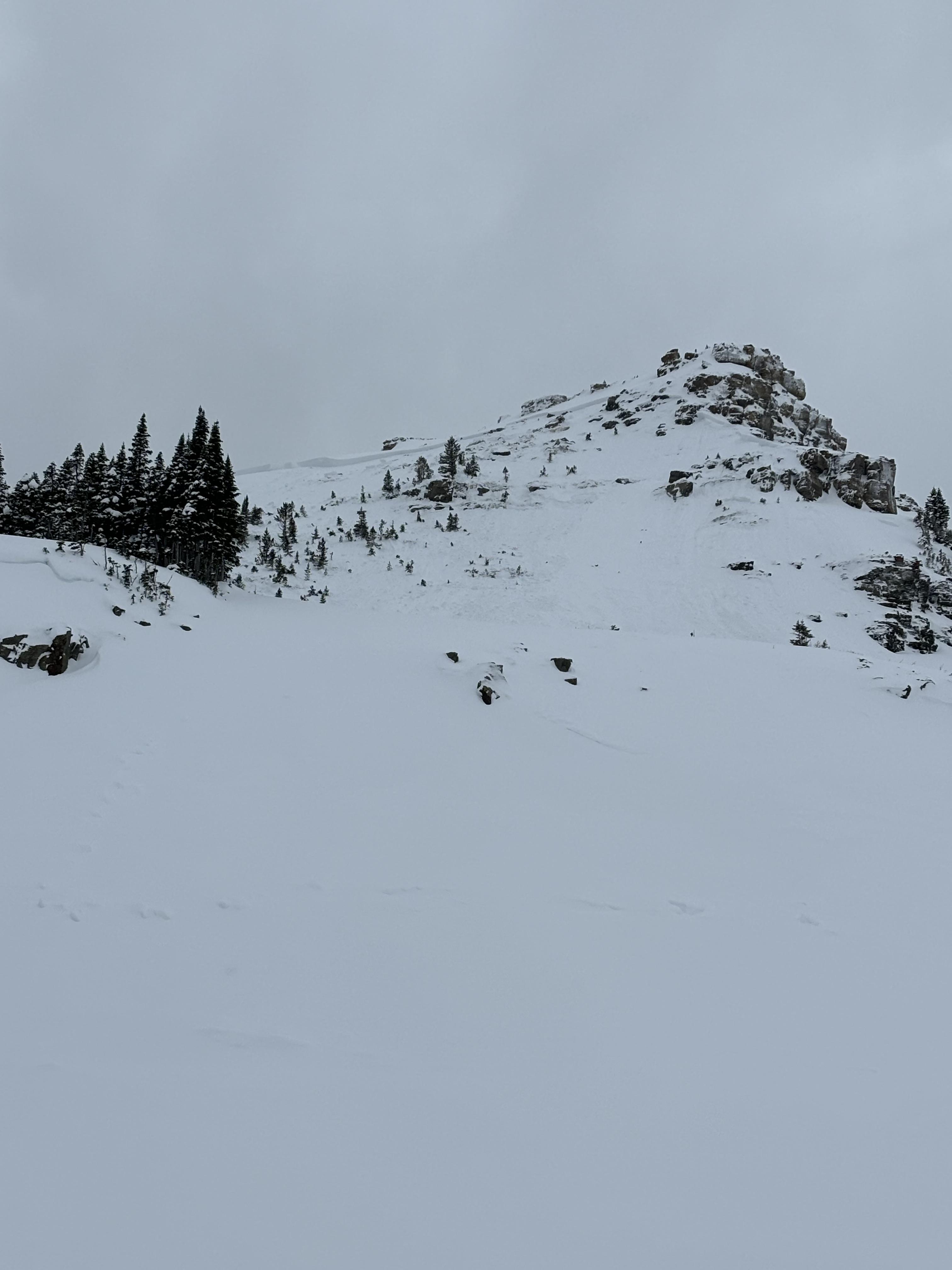
I did not stick around long enough to investigate the slide so I apologize for the lack of information, but figured I'd share the photos. The location is the knoll under the Saddle Peak cliff that can be accessed by traversing through the southern boundary gate from Bridger Bowl. The slide propagated on a NE aspect going into a gully. The crown looked to be 1-2 feet tall with an approximate width of 30 feet. There are numerous tracks that go in and out of the slide path, but could not tell if it was triggered by a skier. A friend who I was with said that the slide had not been there the day before.
Full Snow Observation Report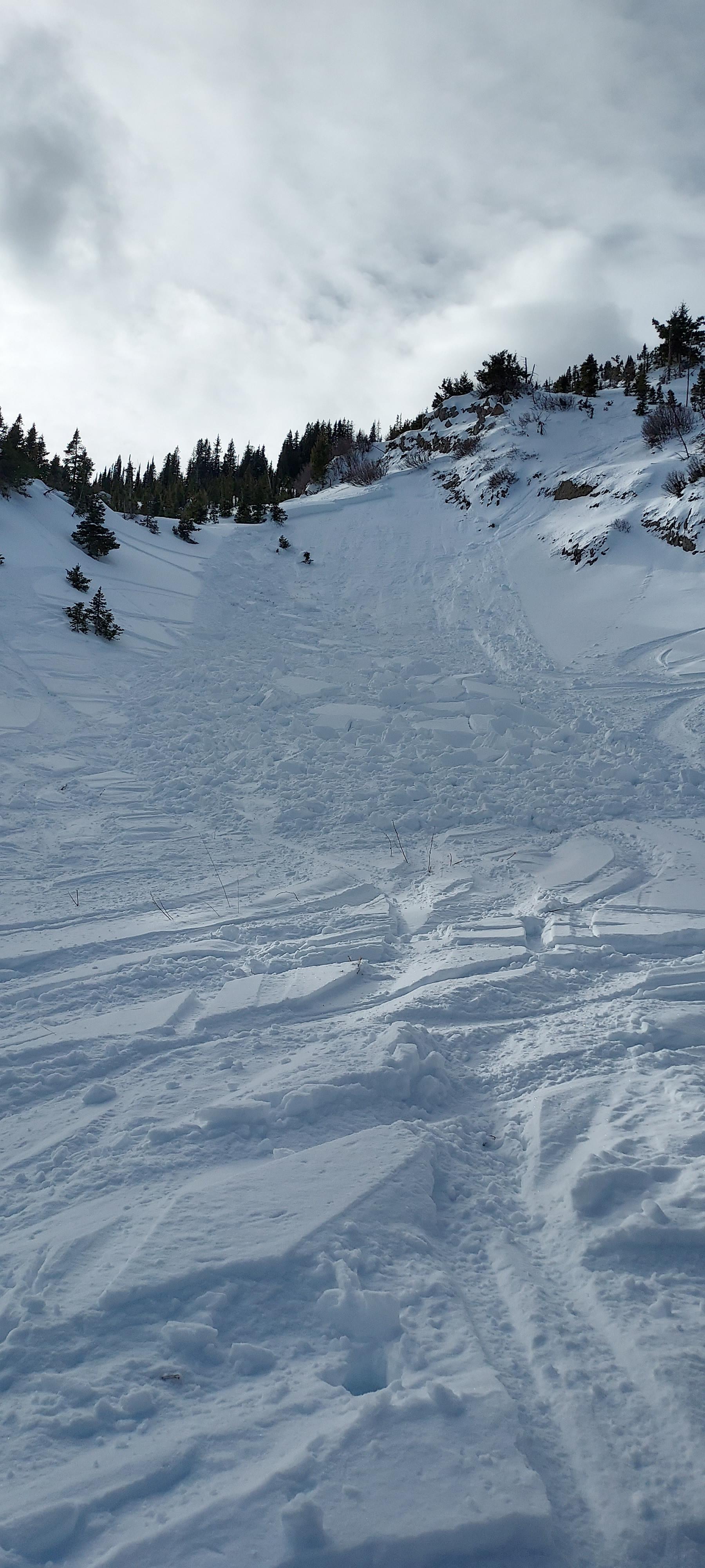


From email: "A friend and I were riding in lower Tepee today, staying on low angle terrain because of the current avalanche conditions. When side hilling on a 24 degree slope, I saw cracks shoot out approximately 100 feet around me. It was a smaller slope, but things are still pretty sensitive. This was a north facing slope in a valley that shouldn’t have been too wind loaded. "
Full Snow Observation Report
Dug on an E (105deg) slope at 9600 feet on Mt. Blackmore. This was a quick pit not a full profile.
SKY: SCT Wind: L variable
HS 95cm
ECTN15 down 40cm on 1-2mm facets.
Snow above facets was mostly 4F to 4F+. While there was no propagation observed in the pit, the structure was quite poor. Additional stiffening of the slab and/or loading in the future could likely easily increase the propagation propensity.
approx. 3-4+mm facets down 60cm were also worth noting.
Recent wind effect was evident on lee slopes.
We had predetermined that avalanche terrain was "closed" for the day as we were just out collecting info/obs and skied low angle slopes and the rather spicy re-frozen skin track out.
Full Snow Observation Report
Toured from the M to Bridger Bowl. Conditions varied from windswept ridge line to wind slab, to soft snow. Often times the W side of the ridge was completely windswept while the E side had a cornice. Cornices were all small in size. I found once pocket of snow on the W side that collapsed under me, and shot cracks above and in front of me, causing me to back out and move higher in the cliff band to continue my traverse. No other avalanche activity noted, and the slide on Saddle wasn't apparent from my vantage.
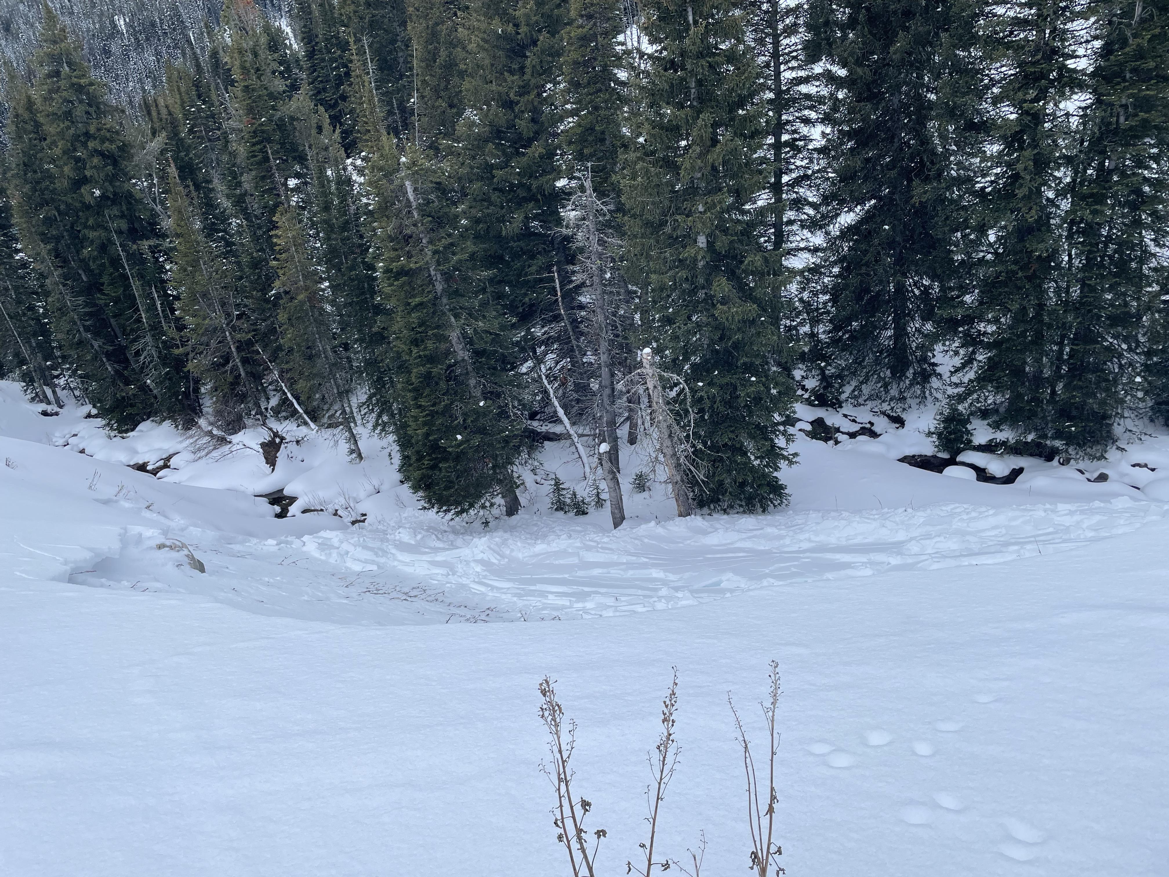
Full Snow Observation ReportWe rode into Tepee Basin today to practice rescue skills with snow rangers from different districts across the Custer-Gallatin Forest. On top of a great day riding and practicing rescue skills we saw a natural avalanche above the first meadow of Tepee. This avalanche is old and likely happened a few days ago near the end of the last storm on 01/20. NE facing slope at ~8500 feet.
There is plenty of snow on the ground to practice rescue. Now is as good of a time as any to get out and practice your skills!
Full Snow Observation Report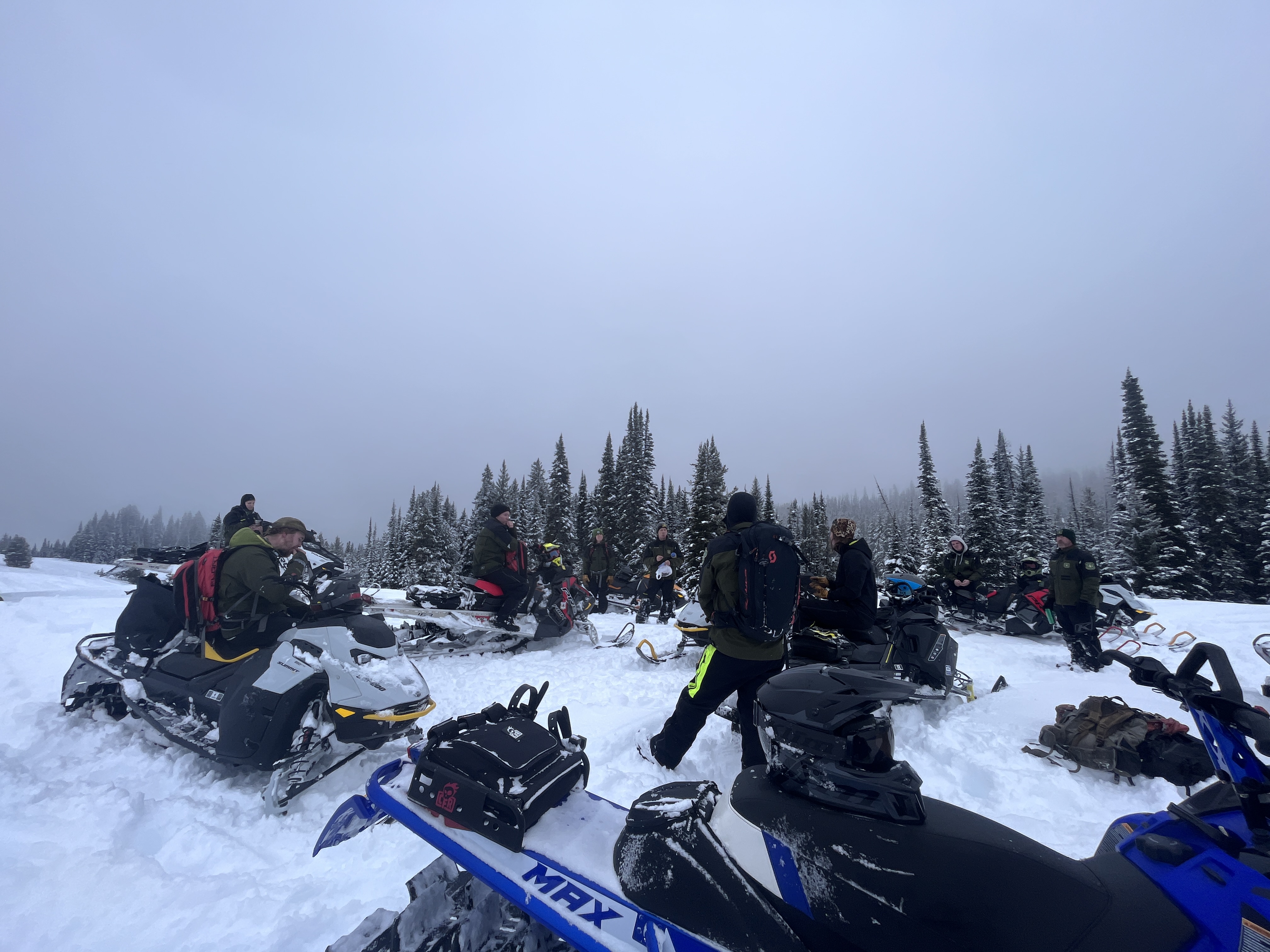

20ft diameter collapse on shallow slope, 25-30 inch snowpack, bottom 10inches to ground rotten and ball bearing like.
Shooting crack in a gulley, evidence of previous avalanche present in same gulley
Full Snow Observation Report20ft diameter collapse on shallow slope, 25-30 inch snowpack, bottom 10inches to ground rotten and ball bearing like.
Shooting crack in a gulley, evidence of previous avalanche present in same gulley
Full Snow Observation ReportI believe this occurred either Wednesday Jan 24th or Tuesday Jan 23rd
Full Snow Observation Report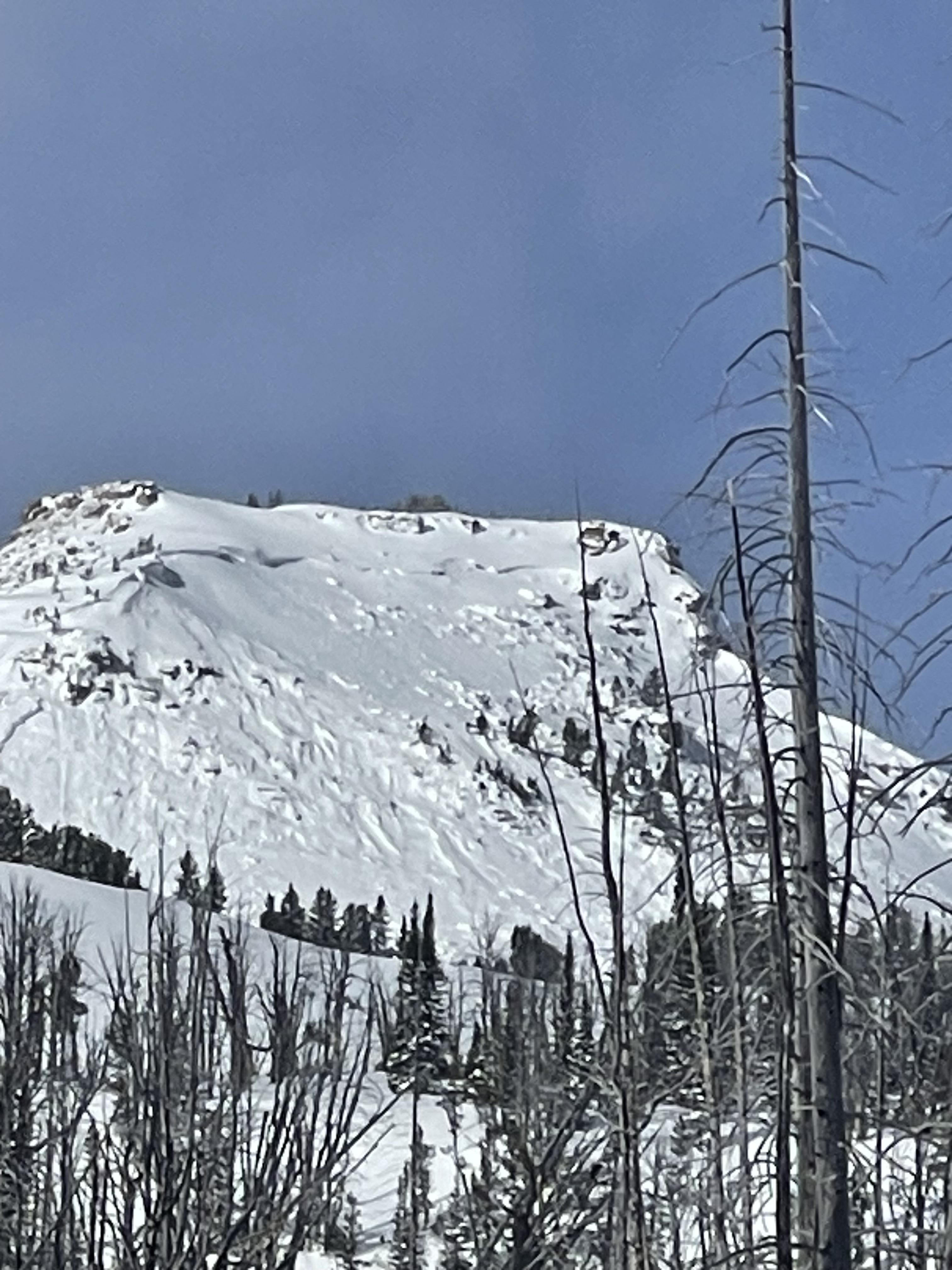

Was out today and noticed this large avalanche on the south side of Henderson. Looks like it happened today (1/24) or yesterday (1/23). Possible remote trigger, there were snowmobilers riding underneath that zone. The slide looks about 200 feet across and 4 feet deep in the thickest spot. D2.
Dug a pit over there. HS 145. ECTP19 50 cm down on surface hoar.
From B. Fredlund: "...large avalanche observed today on the SE aspect Mt. Henderson was not visable there at 4pm yesterday." (1/23).
Full Snow Observation Report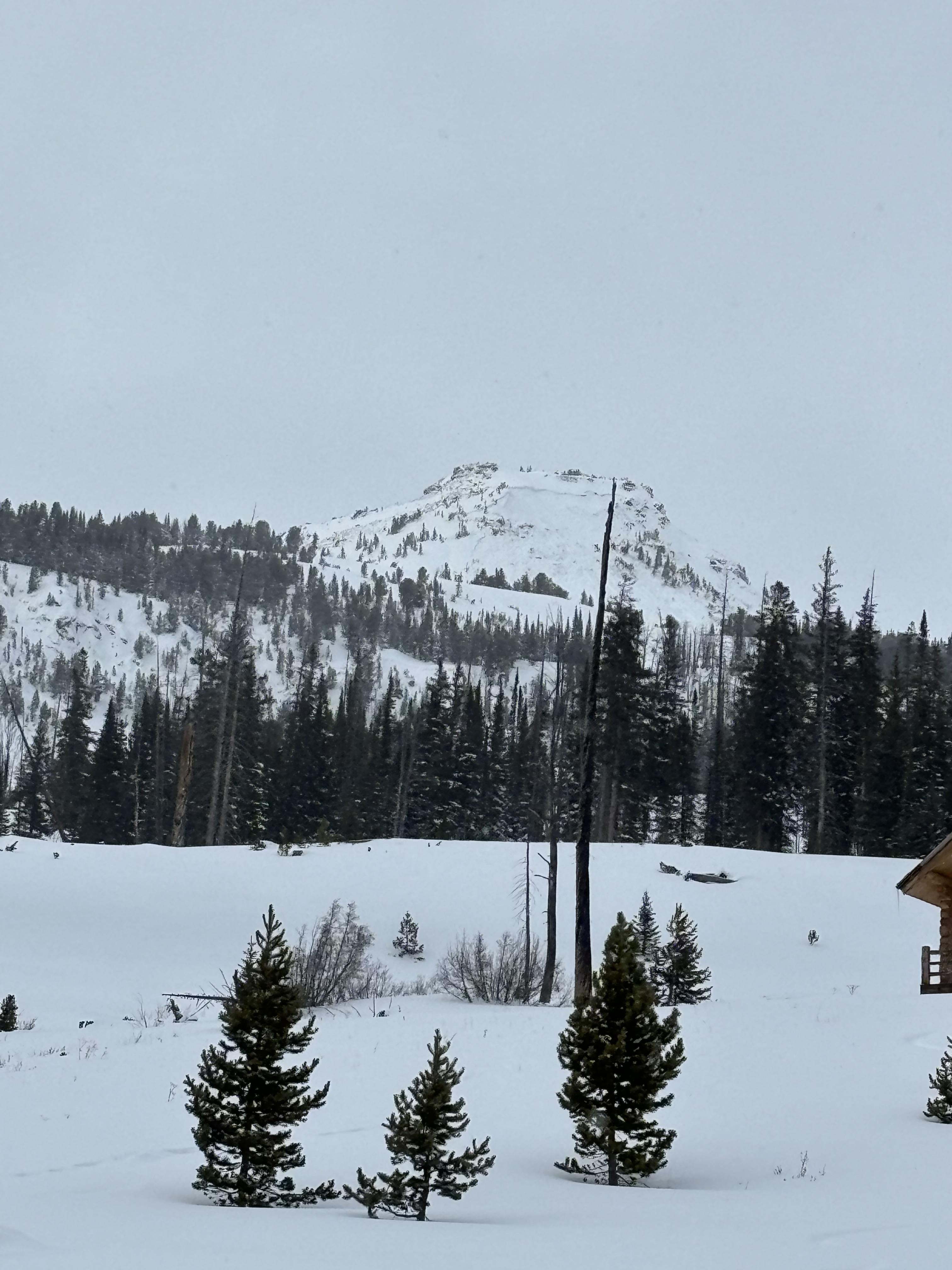
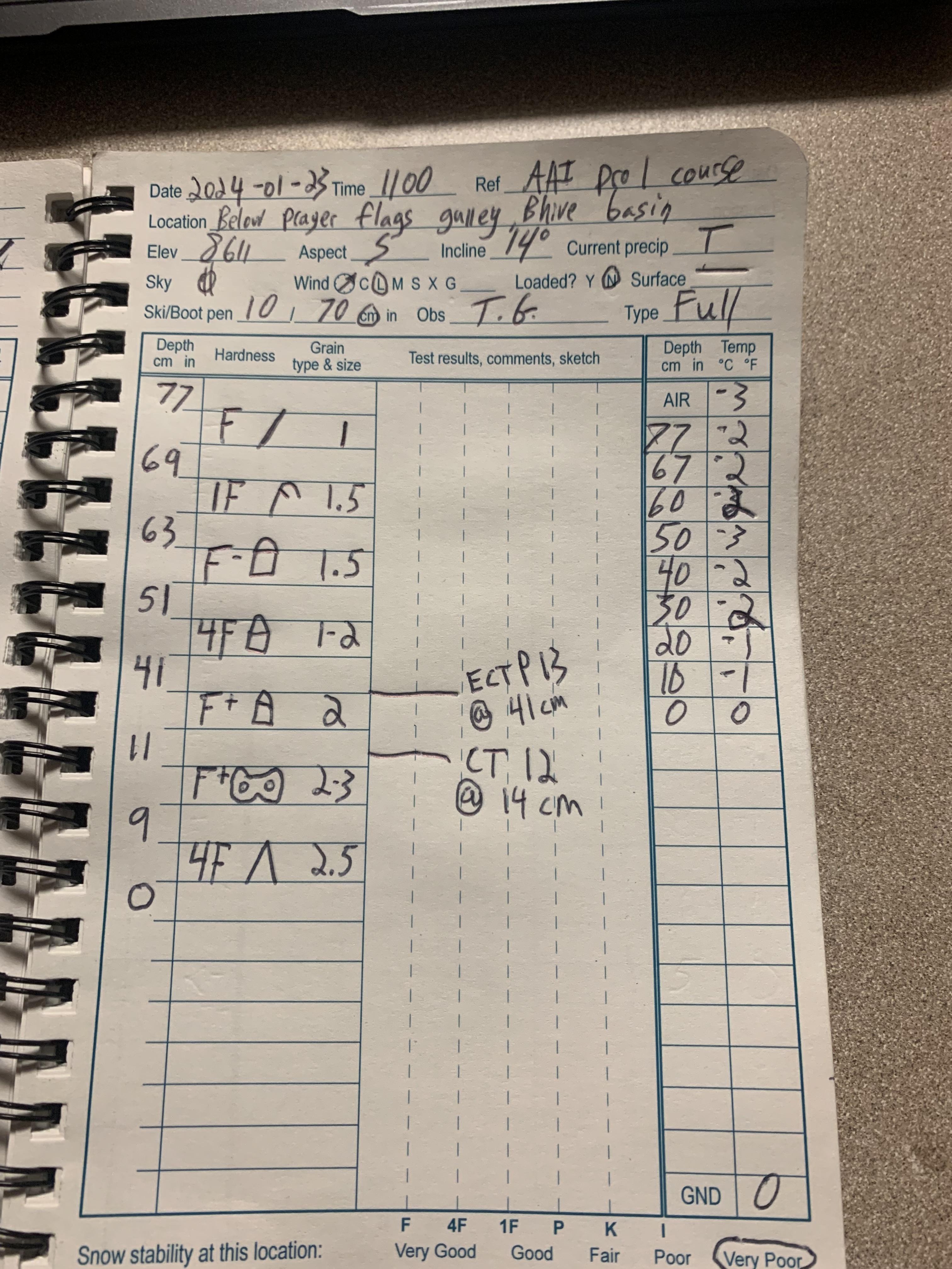
Triggered a good size slide intentionally on a test slope in bhive, about 5 ft below the summer trail. I’m currently doing a pro level 1 course with AAI, my instructor told me to go jump around above the rollover. The slab initiated almost with a slight delay after my 3rd and closest jump toward the rollover, I started to mumble “well not today” and boom it went.
total snow depth:69cm
SS-AR-D1.5-R3 intentionally triggered
aspect:sw
elevation:8250
I went back after class and did an ect and ct test directly above the crown, where the top of the crown was 24 degrees :
Ectp20 @44cm down
ectp11@44cm down
ct21 @60cm down
Full Snow Observation Report
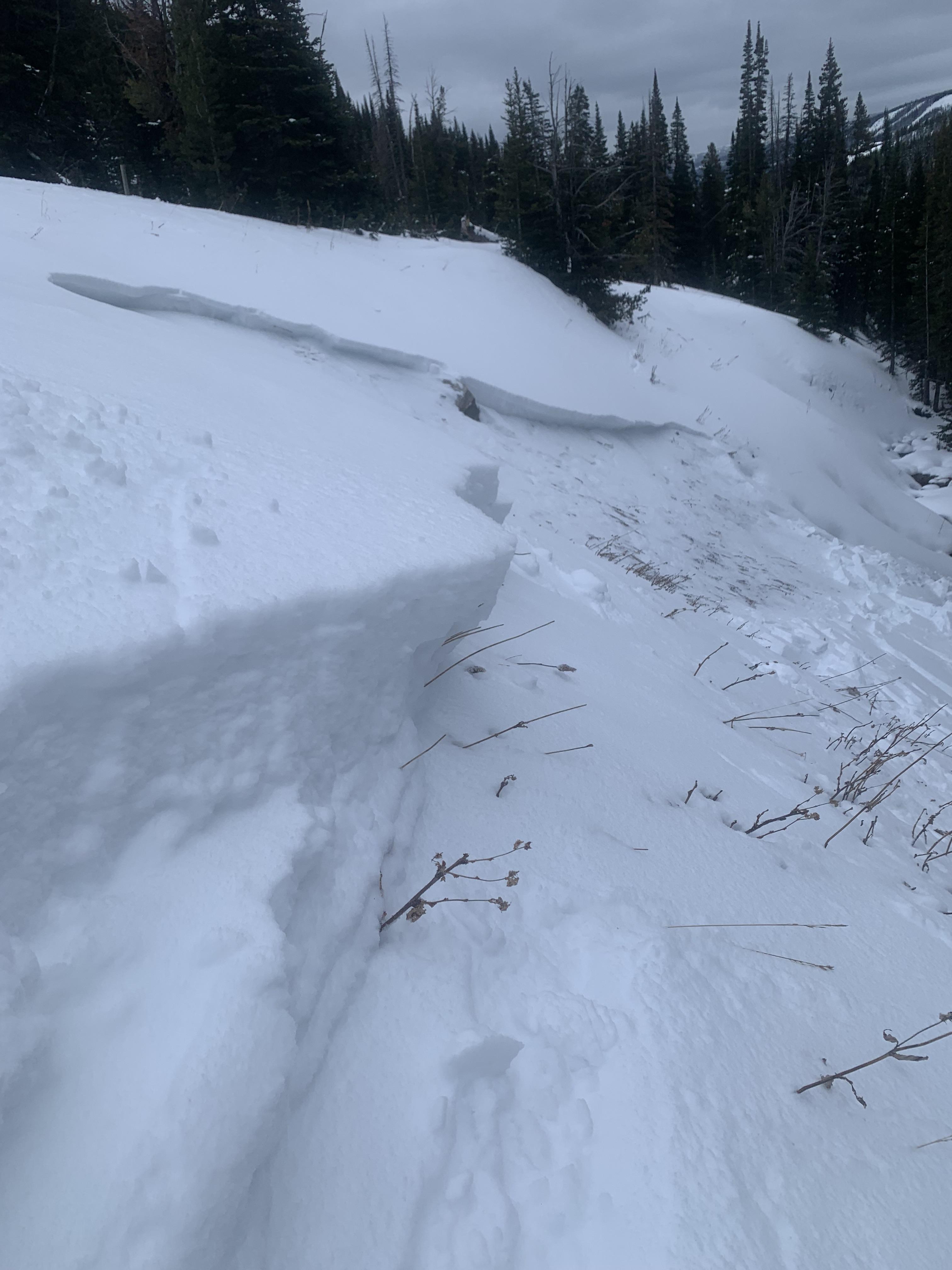
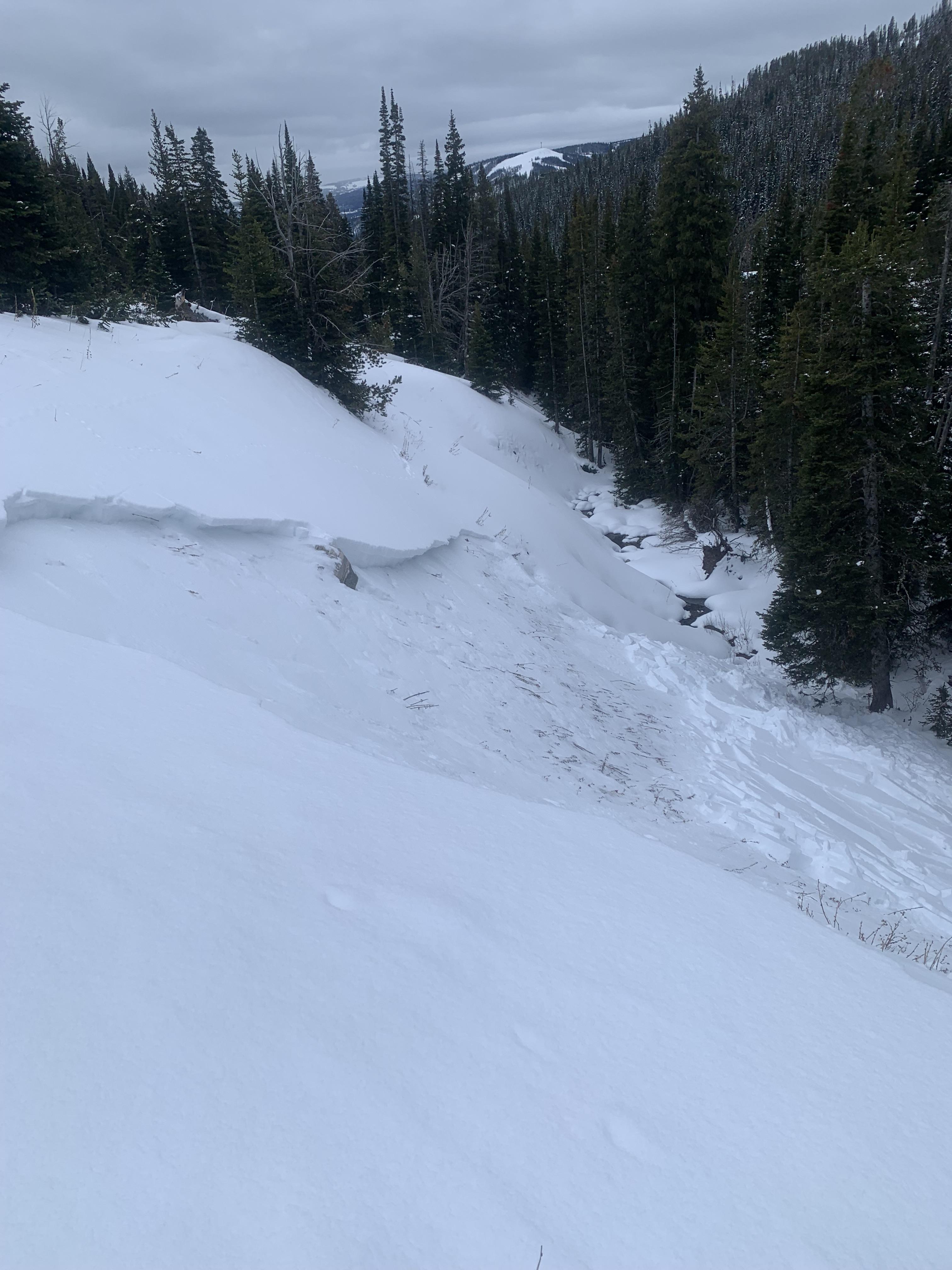

From email: "AAI Pro 1 course to Beehive Basin. One of the students stomped on a lower angle slope directly above a large test slope. On the second stomp the slope released. West aspect at about 8000'. SS-ASc-R3-D1.5-O
18 pits were dug by students and all had ECTP results scoring 15 or lower, and most scoring less than 10, failing on small facets down 20-40cm. PST 22/100 end and 40/100 end. Rutschblock RB3. HS 60-80cm, E and W aspects at about 8500'. Surprisingly, we didn't find SH in any of our pits. Some localized cr, co while breaking trail."
Full Snow Observation Report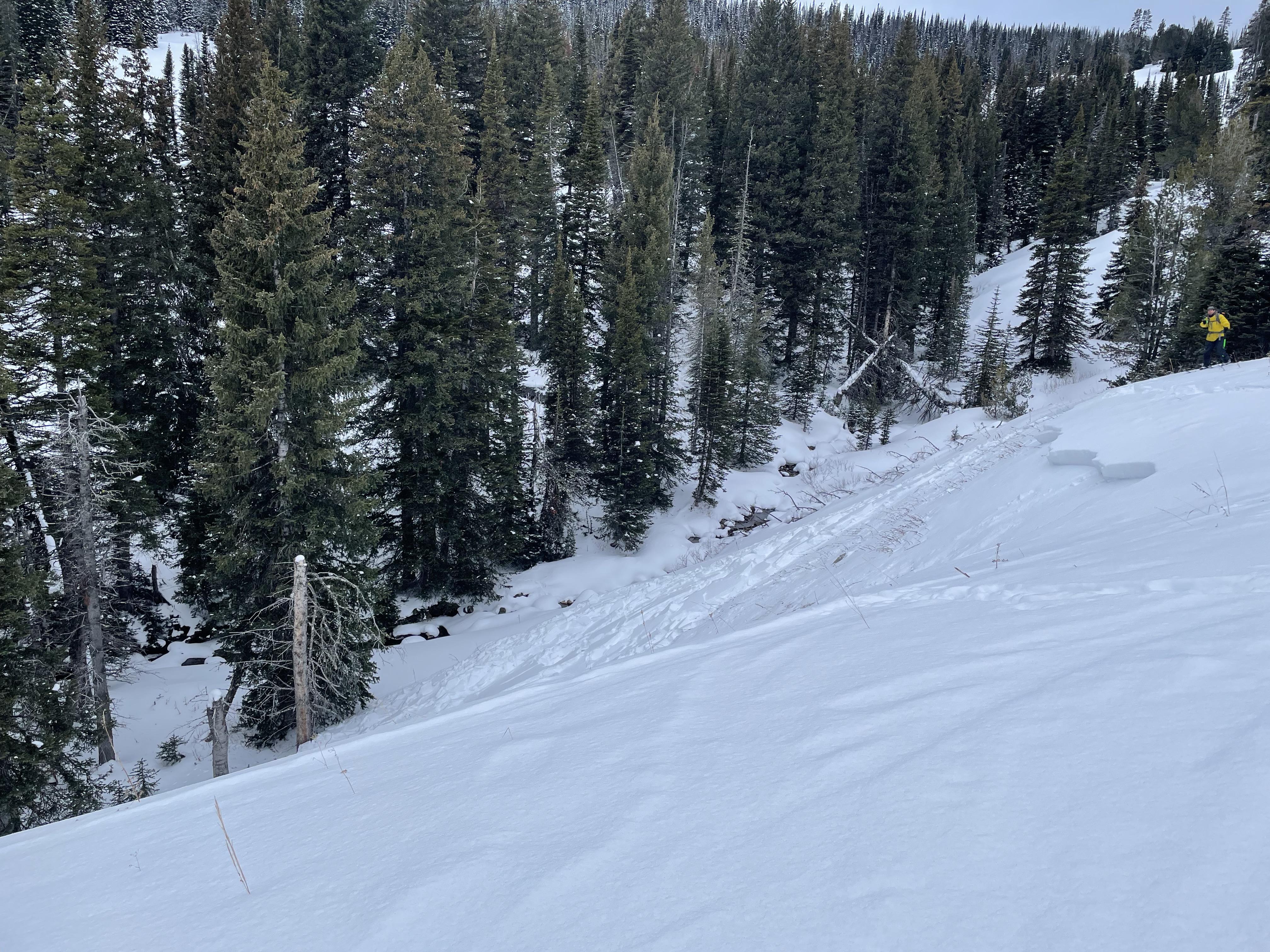
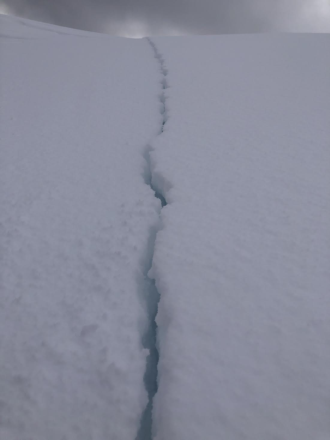
Collapsing snow could be felt underneath my sled all day up Black Canyon Loop trail, east of Island Park. There was a moment where shooting cracks spread from my ski tips to about 10 yards away on flat ground. The canyon just north my location was probably steep enough to slide.
Full Snow Observation ReportN45.923090° W110.958035°
8150ft NE aspect 20 degree slope
ECT18 at 20cm boundary between soft slab and depth hoar. All "sugar" below the boundary extending to the ground. No releases were observed. In the distance at far northern peaks there were cornices that had released naturally.
Full Snow Observation Report
We rode into the Throne in the northern Bridgers. On the east facing hill visible from the sleds, a slab avalanche about 1 foot deep and 100 feet wide was seen. The debris fanned out and did not seem deep enough to bury a person. A roller ball likely triggered it on Sunday (01/21/24) as there were no roller ball tracks on the bed surface, only leading to the crown. It was a bit disheartening to think that a roller ball was enough to trigger a slide.
We skinned to the runout zone of the Throne letting our runout angle approach 23 degrees. We has numerous collapses and we decided to not ascent because there is not a way to stay out of avalanche terrain, plus we were concerned about having a collapse propagate up the hill and avalanche on us.
Full Snow Observation Report
The sleds did not overheat on the way in. There were no tracks on the Throne.

Large natural avalanches and significant cornice formation were visible in October Bowl. We noted frequent collapsing and shooting cracks (5-100ft+) on E facing slopes at ~8000ft.
Full Snow Observation Report