Snow Observations List
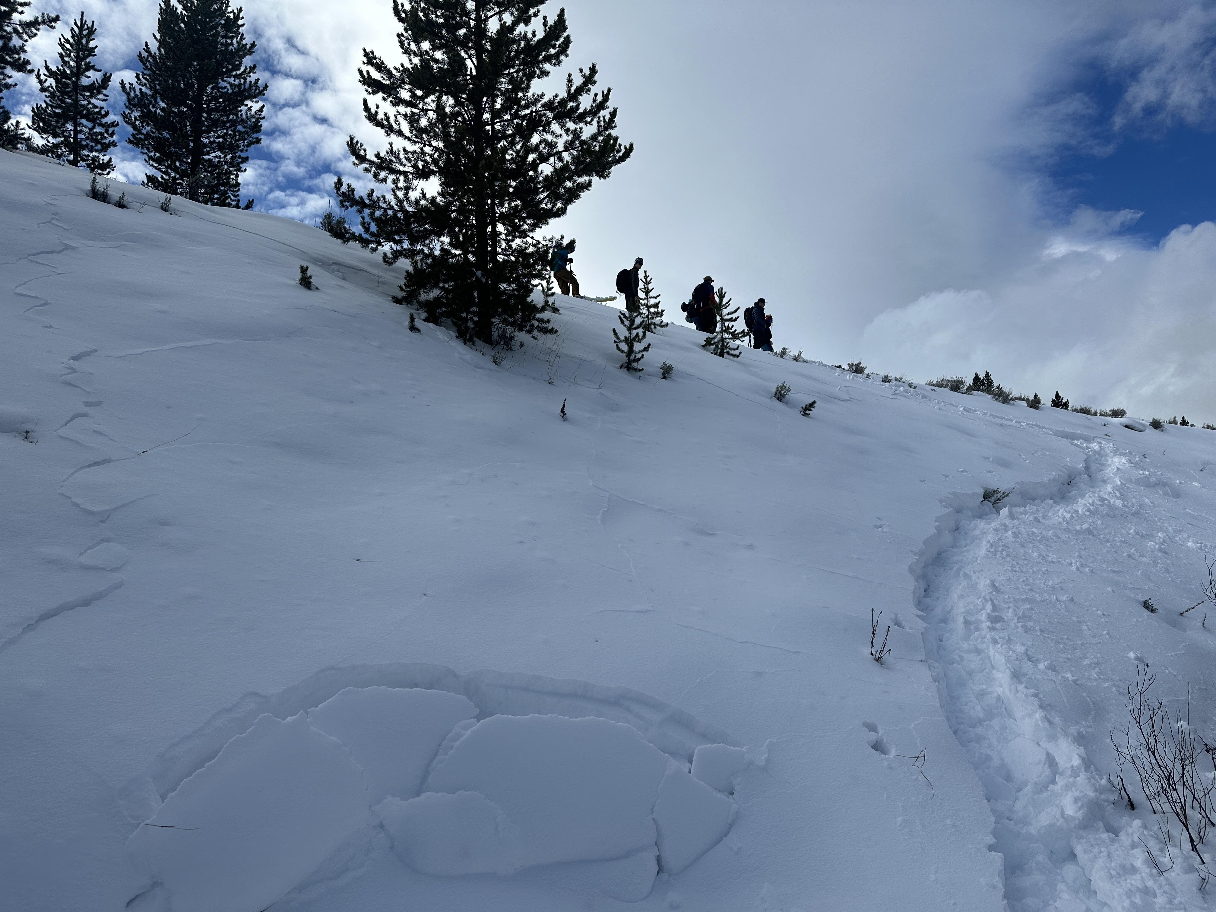
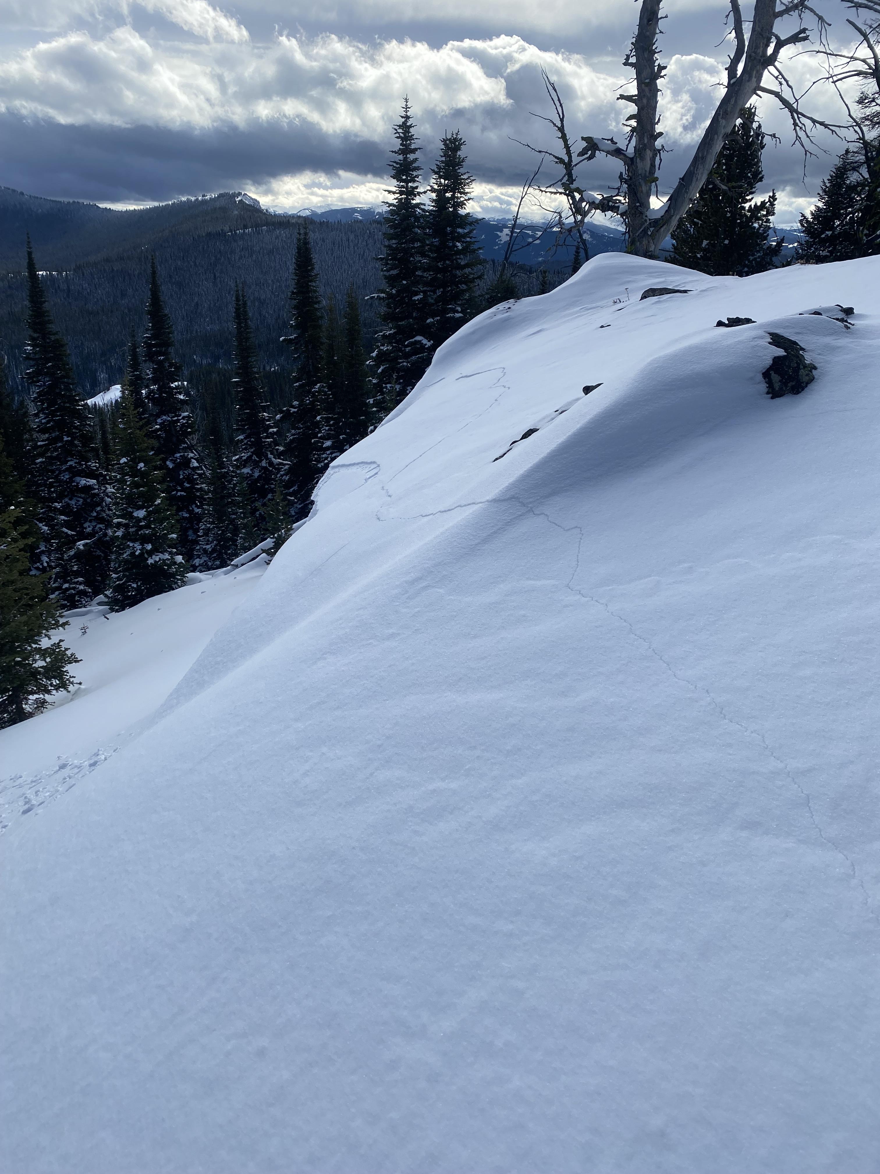
Ski toured to west Woody Ridge today, south of Cooke City.
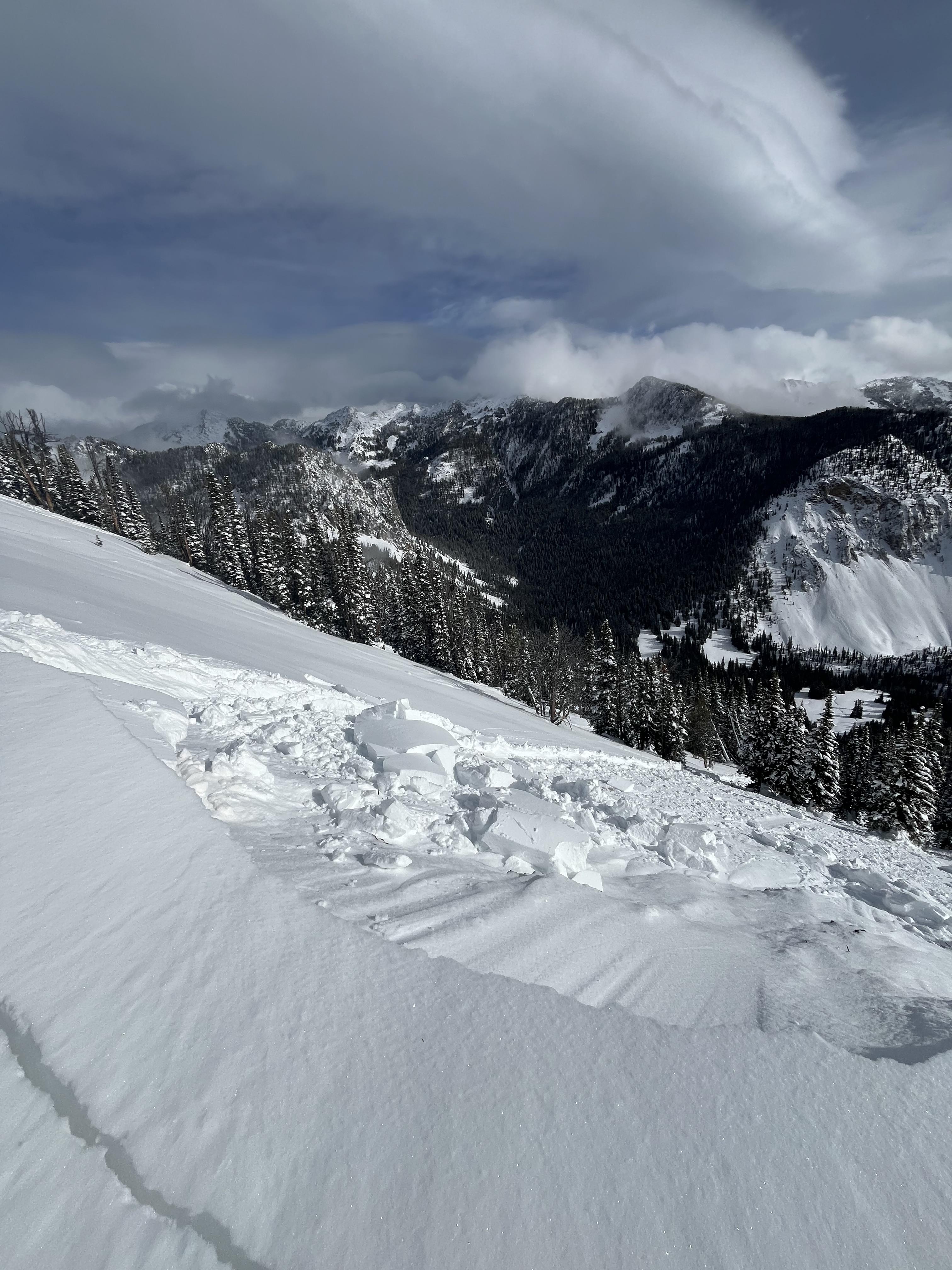
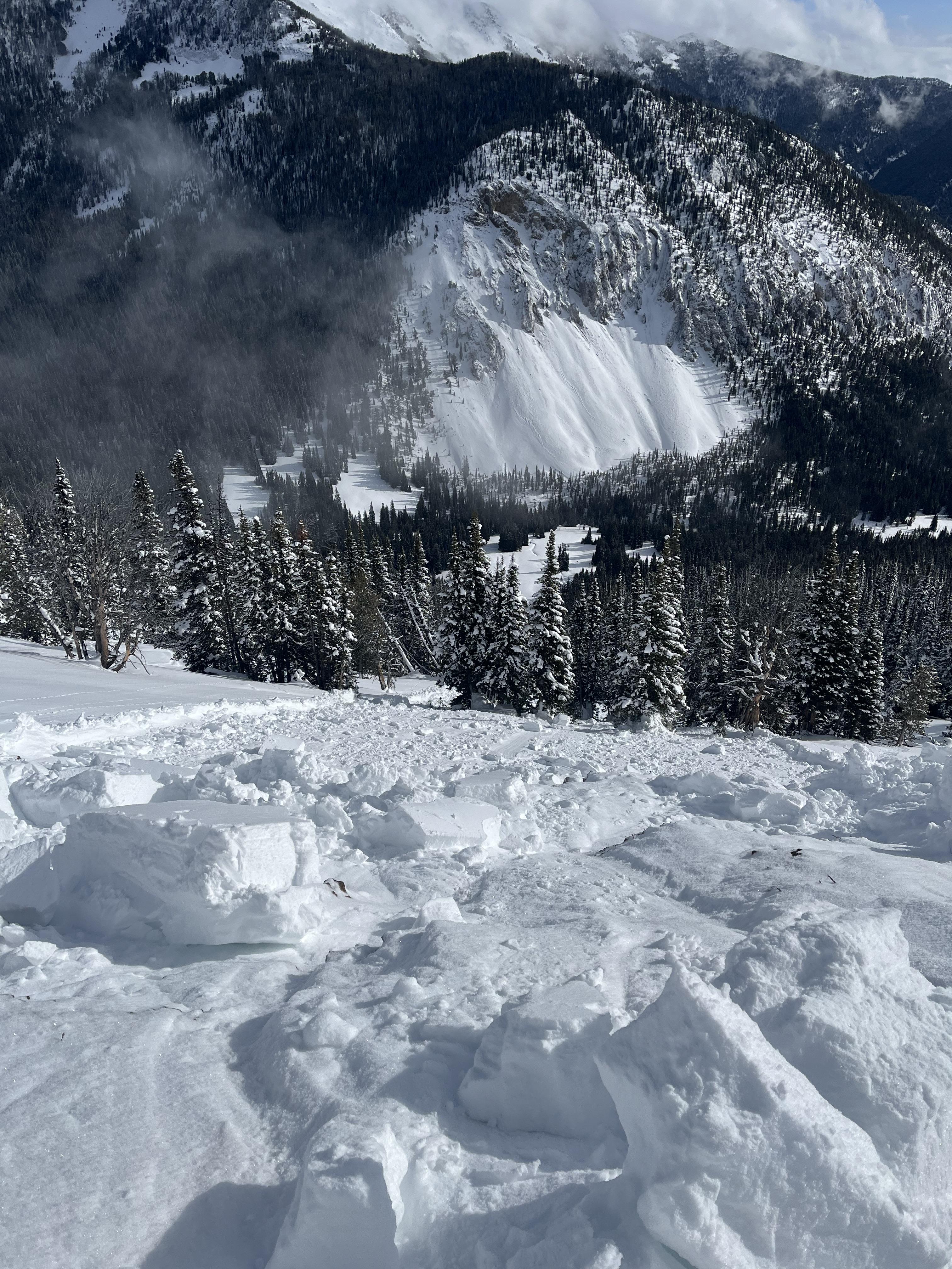
We set a new skin track and I would estimate that 80%+ of the snow we touched created a large collapse/ whompf. Many of the collapses were large and loud (over 100' wide). It seemed like remotely triggering an avalanche would have been easy/ likely had we been connected to steeper slopes.
We noted widespread avalanche activity in a nearby gully (NW aspects) adjacent ski tracks from yesterday.
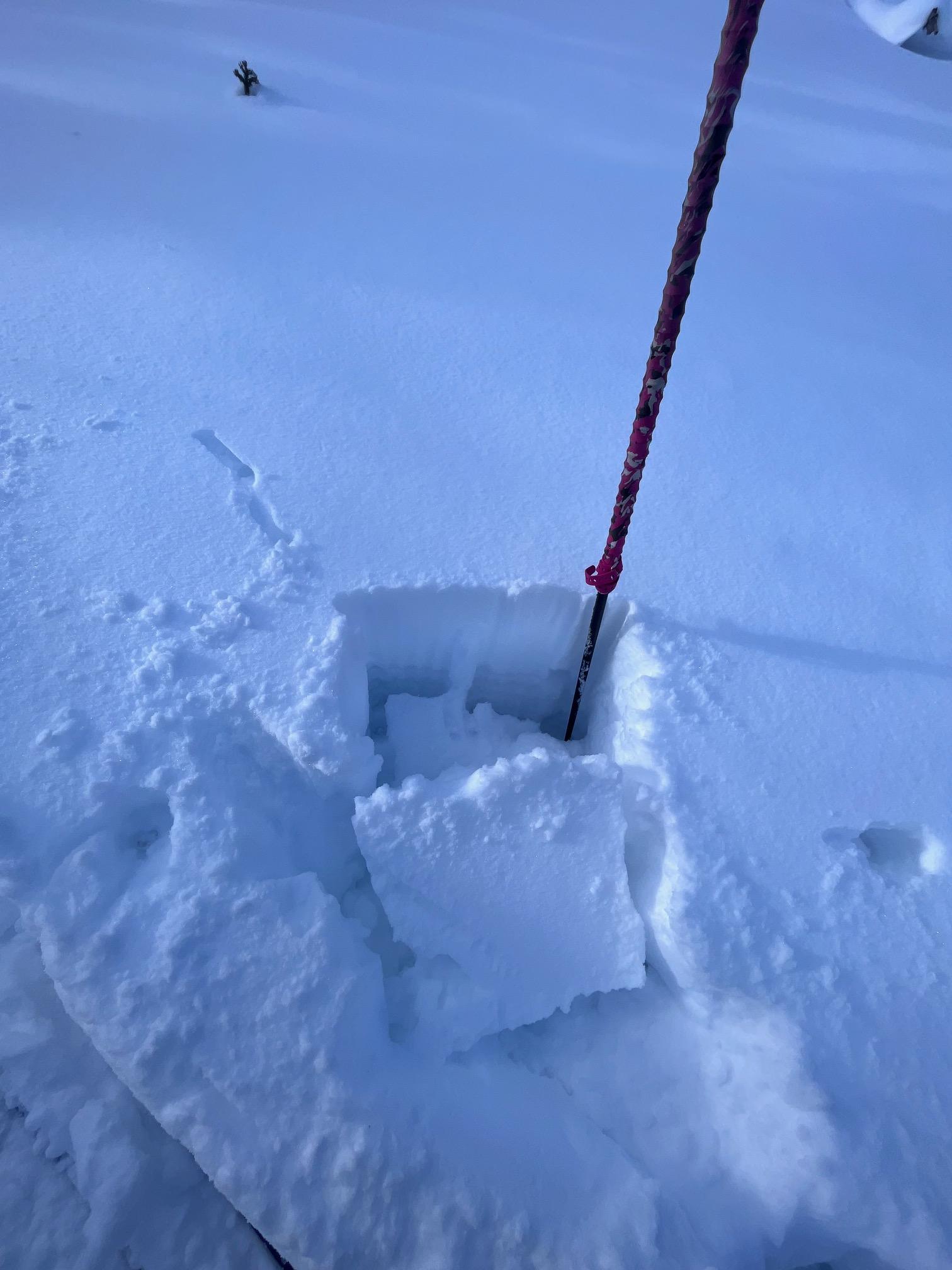
In our snowpit at 9700', on a westerly aspect, we had an ECTPV. On 2mm facets, 45cms down.
I've skied that area a lot over the last 15 years, commonly during big snowstorms and elevated avalanche hazard, but today seemed like one of the most hazardous, if not THe most hazardous days for avalanches I experienced there- given the widespread nature of the PWL and thickness and sensitivity of the slab.
The warm temperatures today likely had a significant influence on the instabilities. (35 deg F in town for much of the afternoon.) Lots of roof-a-lanches noted today as well.
Full Snow Observation ReportFrom BSSP 1/20/24: "There were large avalanches observed on Cedar Mountain, on northerly aspects. Slides appeared to
be running on basal instabilities deep in the pack."
From email on 01/22:
"On 1/20, we toured north of town into sheep creek to ski the north-facing burn glade. We saw no new avalanche activity, but continued to experience numerous collapses as soon as we stepped off the skin track. The sun came out periodically in the morning, and that's all it took for the new snow to become much more wet and heavy. The denser snow was able to support the weight of a skier a little better and we subsequently experienced fewer collapses. Winds picked up from the west into the afternoon and began to transport a lot of snow around."
Full Snow Observation ReportSnow was heavy and glopping on our way up to the basin. Our plan remained the same all day - ski the skiers left trees of the SE bowl in Flanders. Once in the Alpine, lack of snow in the area led to slow, rock hitting skiing, one of our partners took a turn a bit more right of original ski line. I was waiting up higher in a safe position, and watched as he turned into the bowl, a remote triggered avalanche ripped out above him. He was fast to reach a safe position in the trees by the time the avalanche finished its ride. The photo shows the 3 ski tracks, and the most left one is what remote triggered above.
Full Snow Observation Report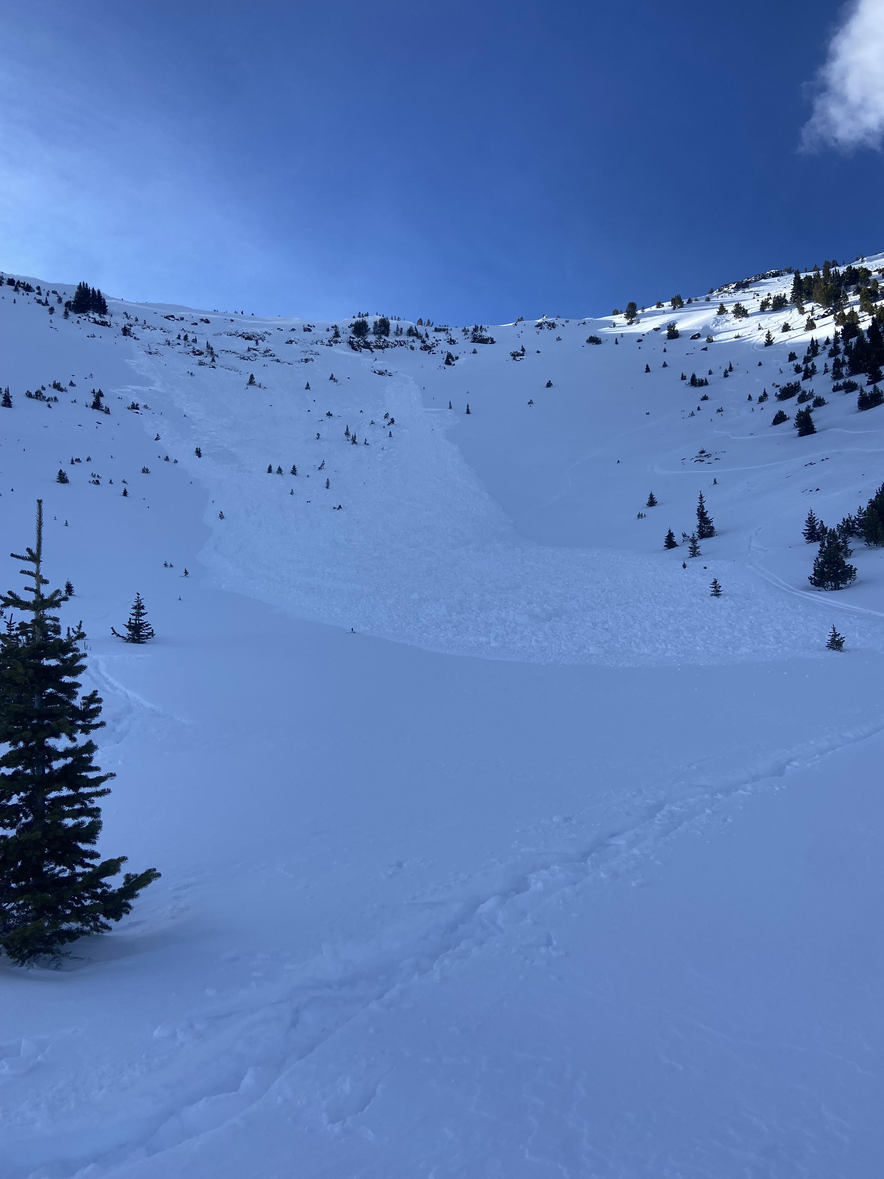
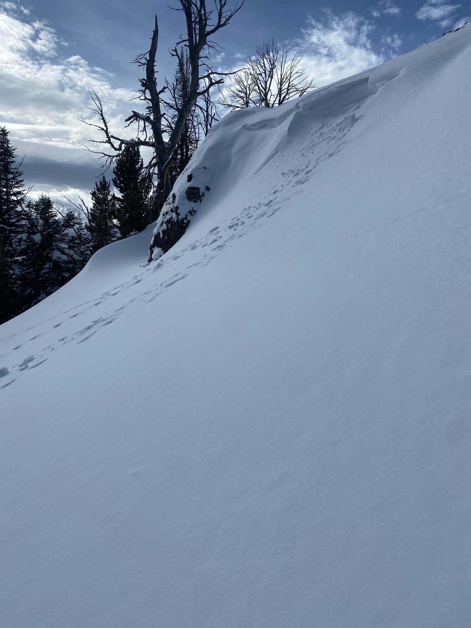
We reached the east ridge of beehive basin at 11:30 and it was warming up quickly. We considered skiing east into middle just before the prayer flags, but when approaching the slope to dig a pit we got a significant collapse and decided to ski a more conservative pitch further north. When continuing north on the ridge we saw a recent cornice collapse which triggered an avalanche, size unknown but pictured here. The conservative east slope was in the shade and skied well.
on the way out we got another sizable collapse when skiing west down from prayer flags, on the shallow, sunny western slope, when I edged out of the gully at the first dog leg to regroup with the party.
Full Snow Observation Report


Snow warmed up significantly and felt heavy compared to a few days ago. Dug a snow pit on on an easterly slope. ECTP 11. Didn’t notice as much cracking as a few days ago.
Full Snow Observation Report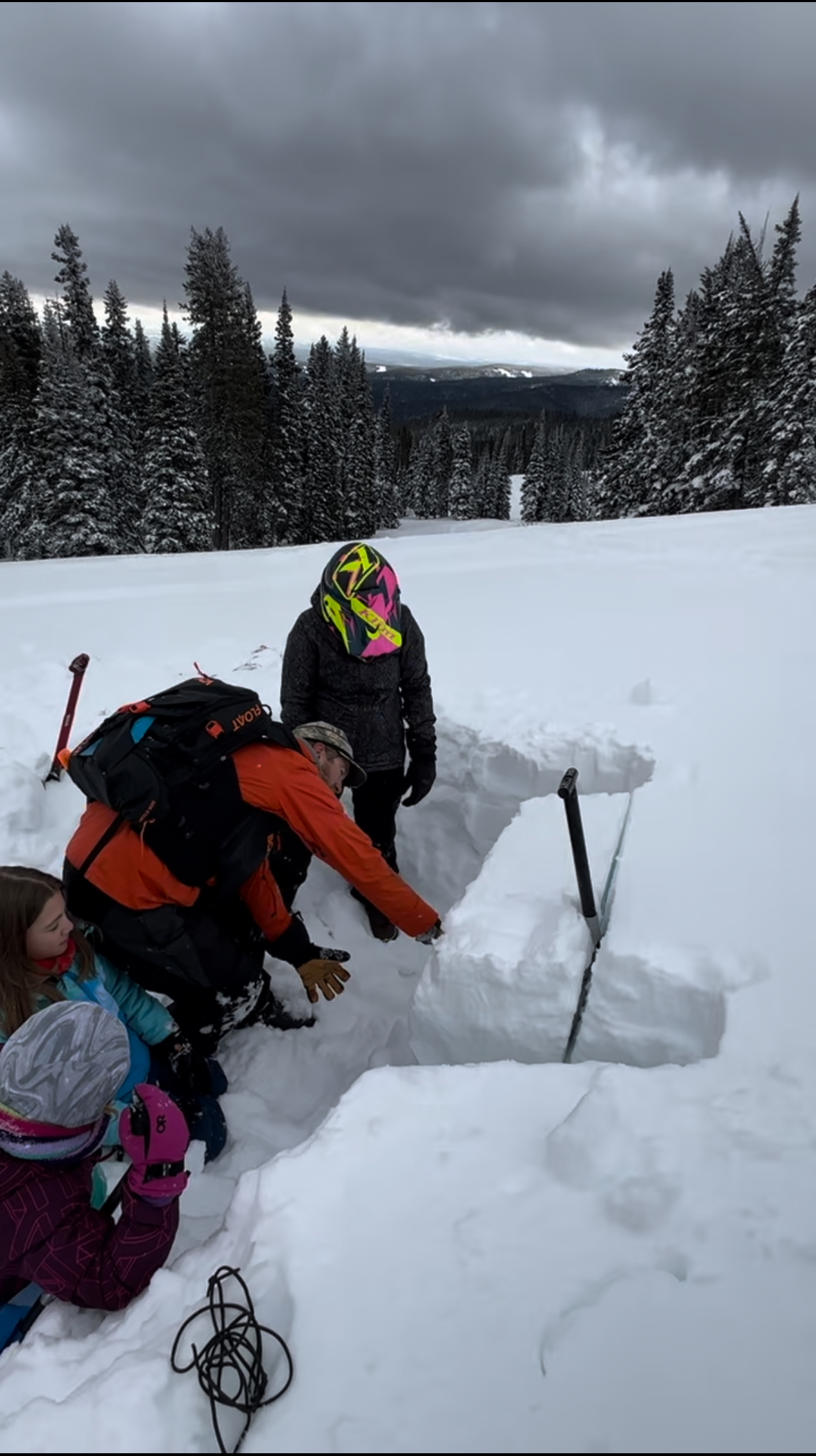
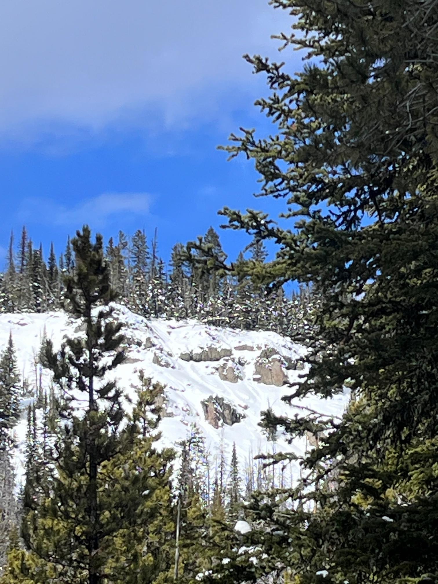
While skiing into Beehive Basin from the ridge between Beehive and Middle basin we noticed some sizable natural wet loose avalanches. West facing, around 9000 feet, 10-12 inches deep, ran ~150 feet, observed at 2:15 pm. The new snow from last weeks storm had warmed and slid on the weak snow below.
Full Snow Observation Report
Observed several natural avalanches on the ridge above the cabin in Cabin Creek. Also saw lots of shooting cracks and triggered a small slide on a short steep hill.
Full Snow Observation Report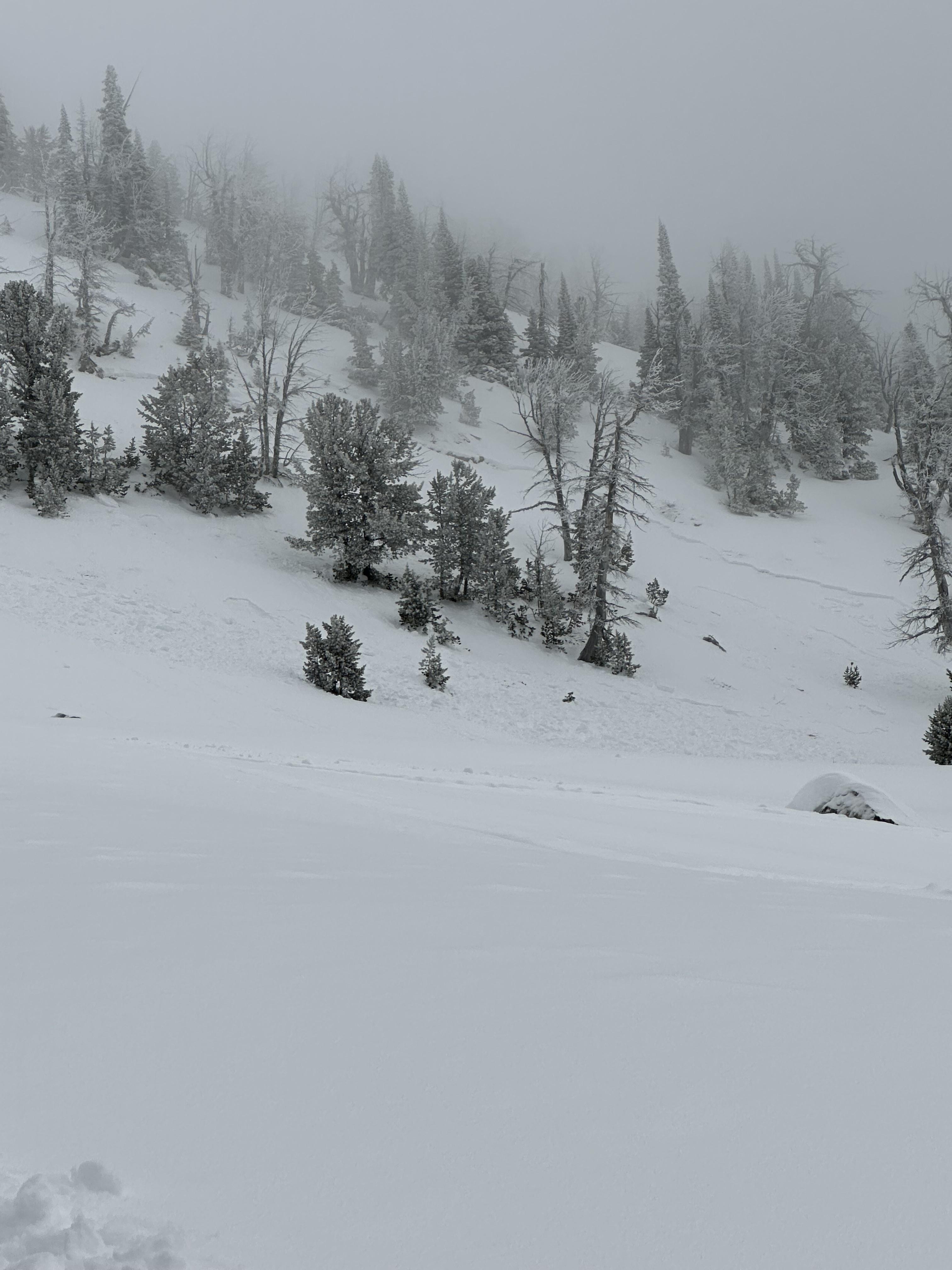
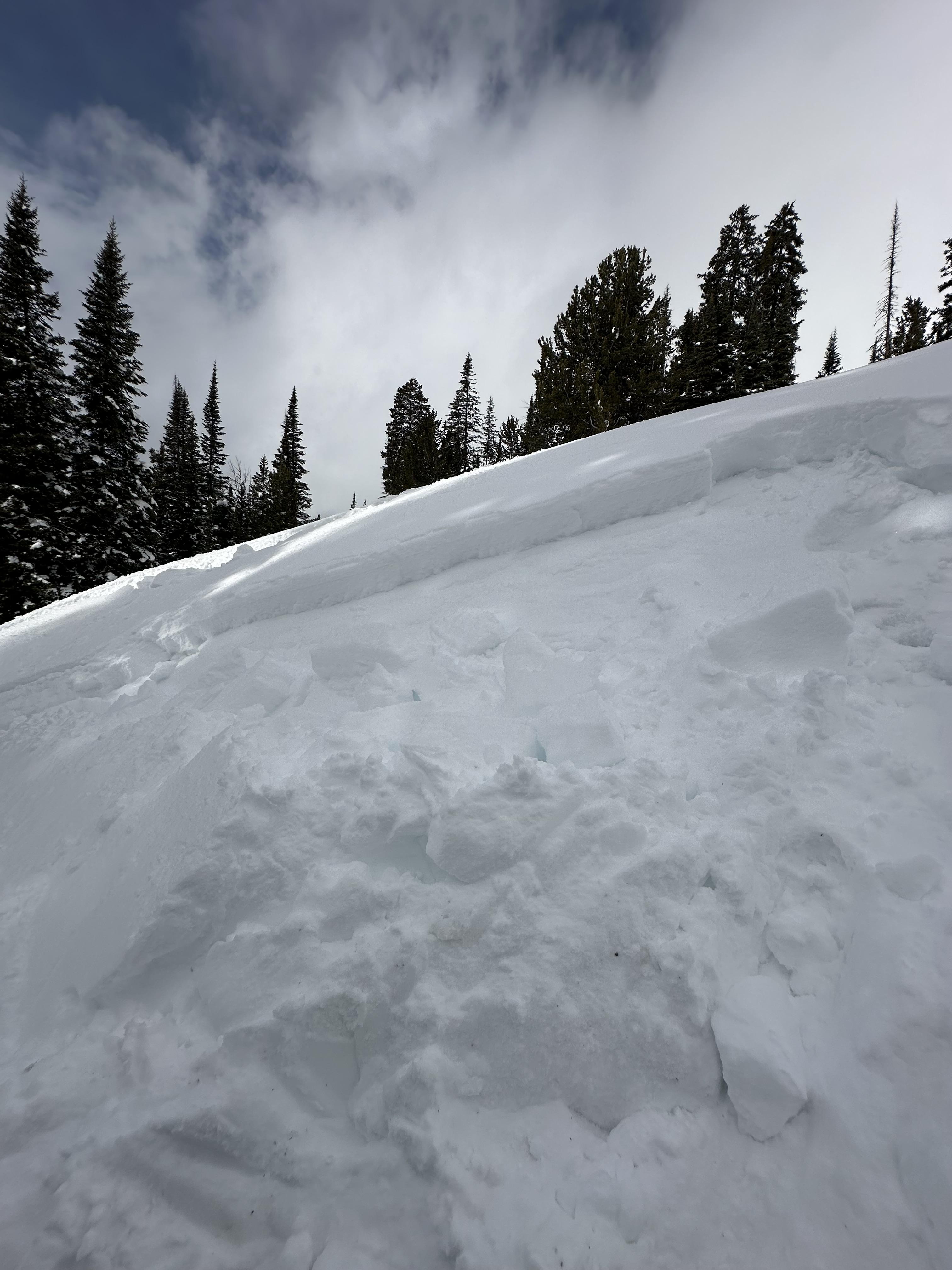
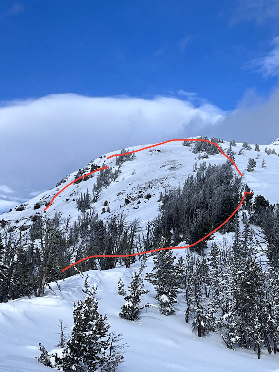
My partner and I were traveling along the ridgeline separating Beehive and Middle Basin. 60 meters before the prayer flags on the ridge, we were stomping on the cornices. We heard a very loud whumphf and the cornice directly below me fell. This and our stomping triggered shooting cracks along the ridge and remotely triggered a cornice 30 meters ahead of us. This cornice fall triggered a hard slab avalanche that was about 15 meters wide and ran at least 100 hundred meters, but we could not see the terminus in the trees. The crown was 1F wind slab failing on facets 35 cm deep. It immediately stepped down to basal facets in spots with total crown depth of 75 cm.
We dug a pit several hundred meters further down the ridgeline in a more representative area. See attached for snowpilot and picture of large chained depth hoar at the ground.
Full Snow Observation Report


Skied two low angle meadow laps. Continued up towards Hyalite. Consistent whumphing when breaking trail. We dug a pit a bit before the first steep rollover on the way to Hyalite Peak (~9200’). ECTP18, broke 50cm deep where the storm slap interfaced with facets. Total depth 130cm. Consistent beefy storm slab underneath 4-5” of fresh snow once out of the thick trees. Snow so unsupportive we couldn’t walk 15 feet to dig our pit.
we also observed signs of recent natural avalanche activity in Divide Basin

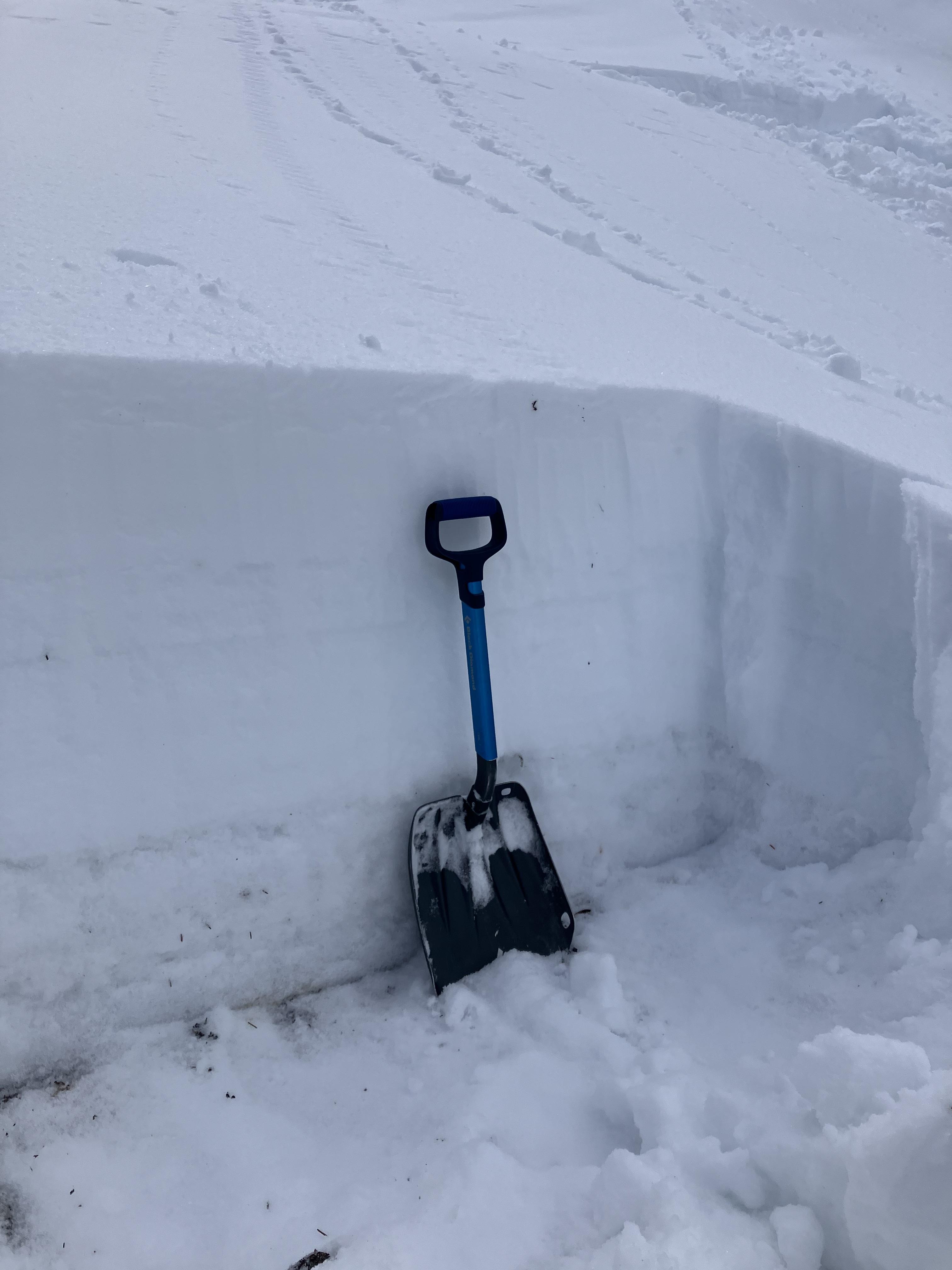
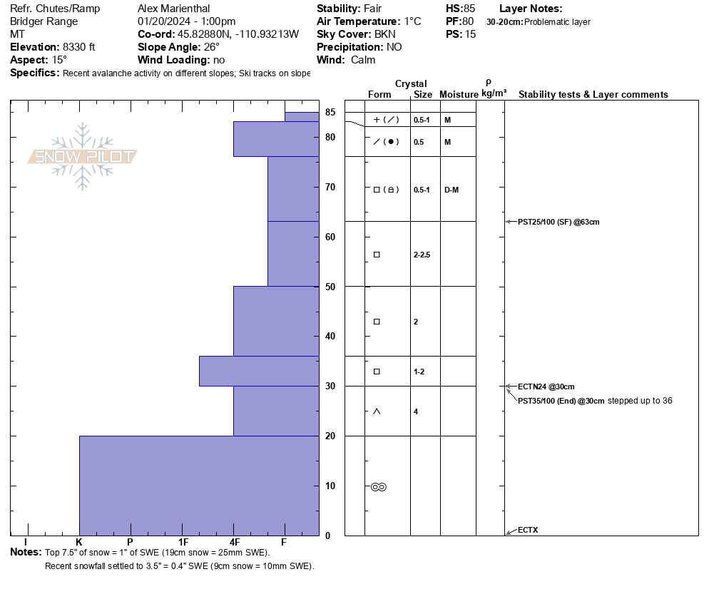
Toured up the Ramp in the Bridger Range. At the top of The Ramp/Wolverine I pushed on some small wind-loaded terrain features with skis. About three inches of soft snow moved/cracked no wider than my ski width, then one step lower a hard slab cracked out about 10' wide, 10-12" deep and did not move more than a few inches downhill due to flatter terrain supporting it below. The slab was pencil hardness which leads me to believe it was older than the last snowfall on Wed-Thurs, but possible it formed during that event if there was a period of moderate-strong wind at the ridge. I had two other terrain-feature sized "whumphs" on similar small wind-loaded slopes directly adjacent. These hard slabs were sitting on sugary facets, and show that avalanches can be triggered on previously wind-loaded slopes. While these were small, a similar size slab on a steeper slope could easily take you for a ride, and larger avalanches are possible on larger wind-loaded slopes.
Warm temps made the recent snow moist and denser, feeling more like a slab, but there was not quite enough recent snow on non-wind loaded slopes to get much cracking or propagation in tests. There were small cracks on the surface, but did not travel beyond shovel or ski width. A pit at 8,300' on a northeast aspect showed a very weak snowpack with generally stable test scores. and we had ECTX and ECTN results, a PST 35/100end at 30cm above the ground, and PST 25/100slab-fracture below the recent snow at 63cm above the ground. Snow depth was 75-85cm.
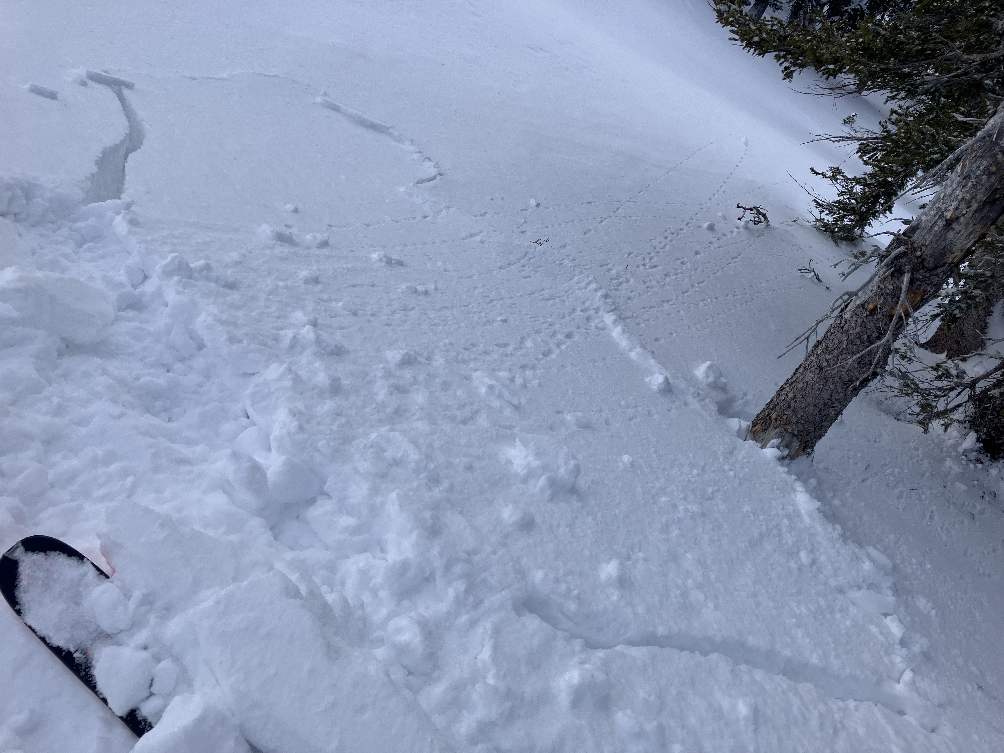
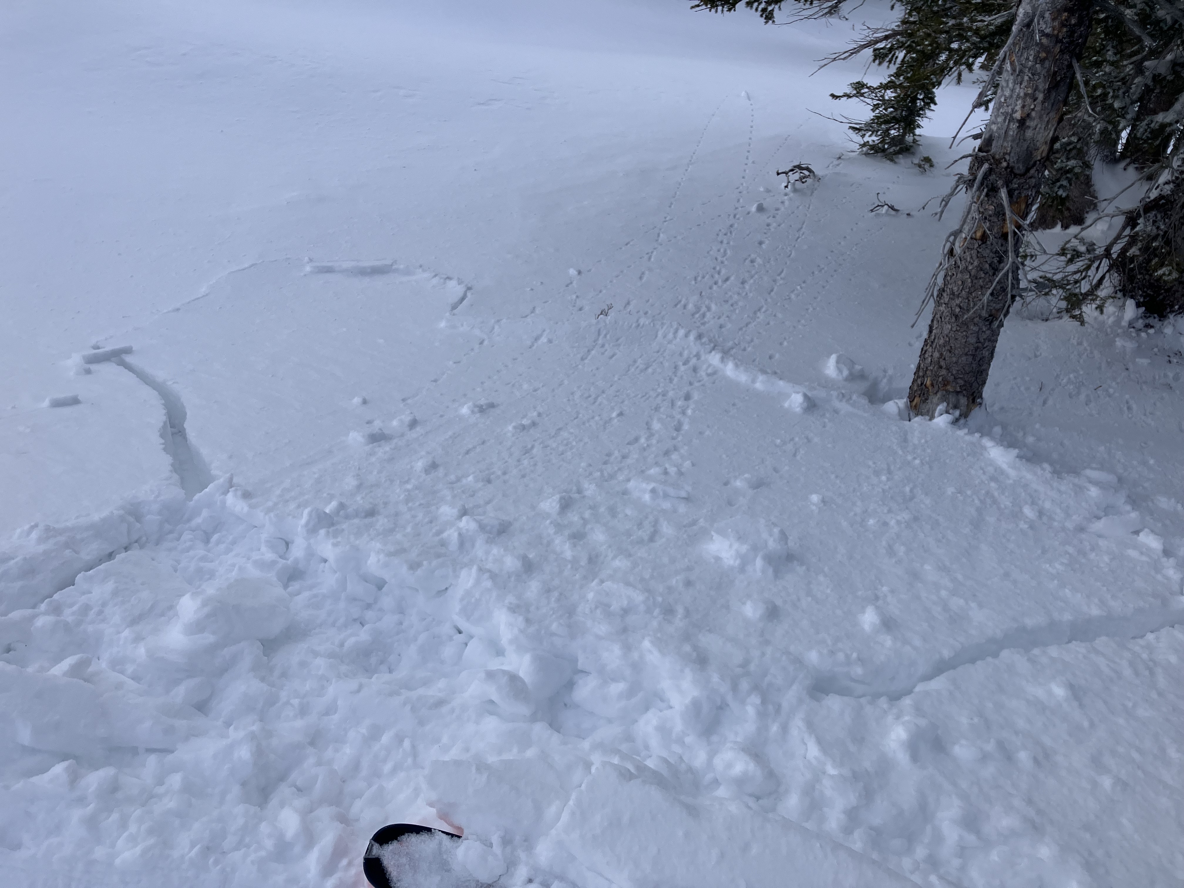
There were natural rollerballs on most aspects initiated from warm snow falling off trees. Possible recent small-medium slab avalanche (8-12" deep) on the west side, behind the Patrol lift, but didn't get a great look. There were rollerballs on that slope which may have triggered a slab?
Temperatures were above freezing and it was raining below 8,000' at 10am. Snowing above 8000' briefly, accumulated to 1cm. Calm wind. Partly sunny by mid-afternoon. Skins were glopping bad off the heavily used skin tracks, and moist snow surface will become a melt-freeze crust on most aspects, possibly with the exception of a few slopes at the highest elevations.
Full Snow Observation Report

We experienced widespread whumpfing on all aspects between 7200'-10200'. Solid slabs were also widespread, ranging between 4''-12'', all of which were sitting on facets. We dug many handpits and the results were extremely reactive, often propagating while cutting the pit. We did not observe any natural slides. We remotely triggered a cornice and large slab, but it did not run due to the slope angle. I'm certain if we ventured into or near steep terrain, something would've run. Between 7200'-9000' we saw many wet loose on slopes > 30, and set off large roller balls on most slopes. Down low it was very warm and felt like an early spring snowpack. From 9000'-10200' it was much colder and wind slab/board was widespread on E & SE aspects. Every aspect we touched up high had shooting cracks and loud whumpfing.
Full Snow Observation Report

Toured Ramshorn Peak from the rd. closure in Tom Miner basin. On approach we observed continuous wumpfing and shooting cracks from 7,500' to 9,900'.
A hand shear on a 20° slope with a SE aspect at 7,800' sheared cleanly upon isolation. This hand shear was completed in a rather shallow (~10") snowpack, with large facets below a slab of thicker, fist dense snow.
Large roller balls were observed in avalanche terrain on a SE aspect at 8,300'. Alongside this observation, rather wet, sticky snow was observed throughout the tour, causing multiple glopping incidents on our skins.
A second hand shear was preformed on a E. aspect, 20° slope around 8,400', which easily sheared clean with light hand pressure. This snowpack was notably thicker than the previous hand shear location, measured closer to 30" with facets below a 6" slab of fist-dense snow.
Near our second hand shear, a 2' cornice on at 27° slope created a large shooting crack that propagated across the whole slope (contained by trees). If said cornice and slab was on a steeper slope, we are pretty sure this slab would've slid.
A several day old avalanche was also spotted on the windward portion of Ramshorn's SW shoulder around 9,800'. Upon further inspection, this slide seemed to be natural and had a crown of ~1.5' with a width of approximately 300'.
Clear evidence of recent wind events (e,g. Thursday's 75mph gusts) were clear on the SE face of Ramshorn, creating several inch thick wind slabs on the face and removing the majority of the snow above from the SW ridge and peak above 10,000'.
Full Snow Observation Report
Had a nice tour in tele meadows in the AM given the avy danger. Snowpack was 5-8” of wetter snow on top of the old facet layer.
Every time we stepped away from the skin track or skied untracked snow heard a few whumpfs and saw shooting cracks (most in the few foot range but a few extended 40-50’ across the slope).
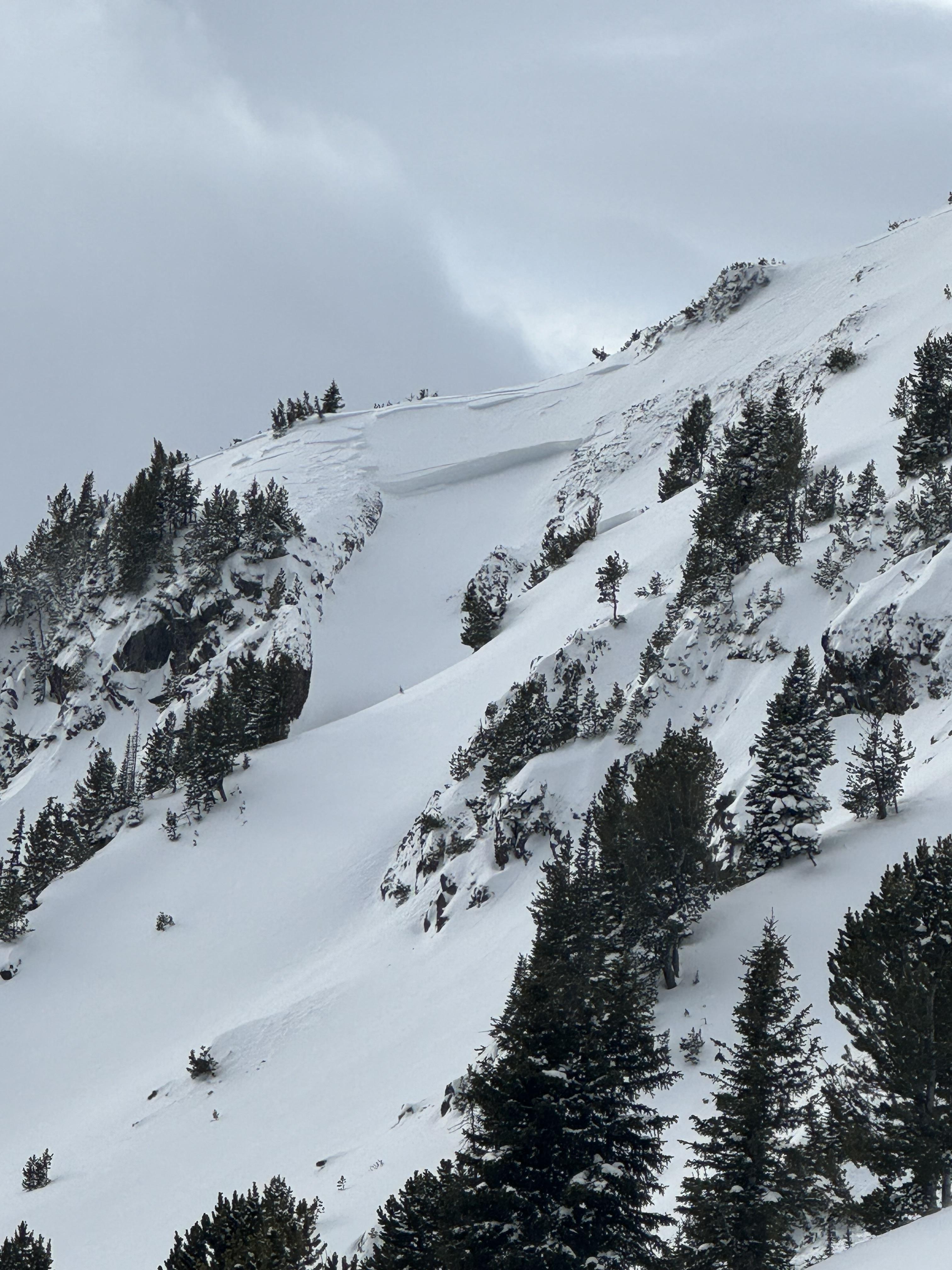
Warm temps made for wet snow and gloping on the tour up toward Blackmore. At about 8400' the conditions changed with winds keeping the snow surface dry and cold. Upon entering the basin we saw the skier triggered slide reported on 01/19 as well as another slide off the west side of the peak, both D2. The crown of the westward slide looked to be around 4'. Like the one reported the other day, it ran almost to the skin track. Winds were high in the basin and on the ridge tops, transporting snow into moderately stiff slabs. At around 12PM the snow surface up high was getting wet and by the time we reached the parking lot it felt like your typical sunny day in April.
Full Snow Observation Report


Saturday morning above freezing with wet, sticky snow and then it started to rain. Rained perhaps 1 hour from at least 7200 feet back to the parking area. Should have waxed for May!
Full Snow Observation ReportSnow has weak layers from recent storm and old facets. Dug a quick pit and found what’s been going on all season.
Two distinct slides-
1. Off the top on the face of Blackmore- Talked to the guy that set this slide off, it was triggered while he was skiing down yesterday morning from the summit. Ran all the way down to almost the skin track.
2. A much bigger one on lookers left of Blackmore peak, naturally occurring as there were no tracks near it. Looked like a bigger crown. Talking to the guy who triggered the slide yesterday he stated this one wasn’t there yesterday.
Lots of wind when I was up there this morning skiing the shoulder, could see loading happening throughout the range. Sun came out and warmed everything up. 46 degrees at Hyalite parking lot when I got back to my car just before 1:00pm. Saw roller balls driving back down on the road on the steep hillsides.
Thanks for all you do!
Full Snow Observation Report

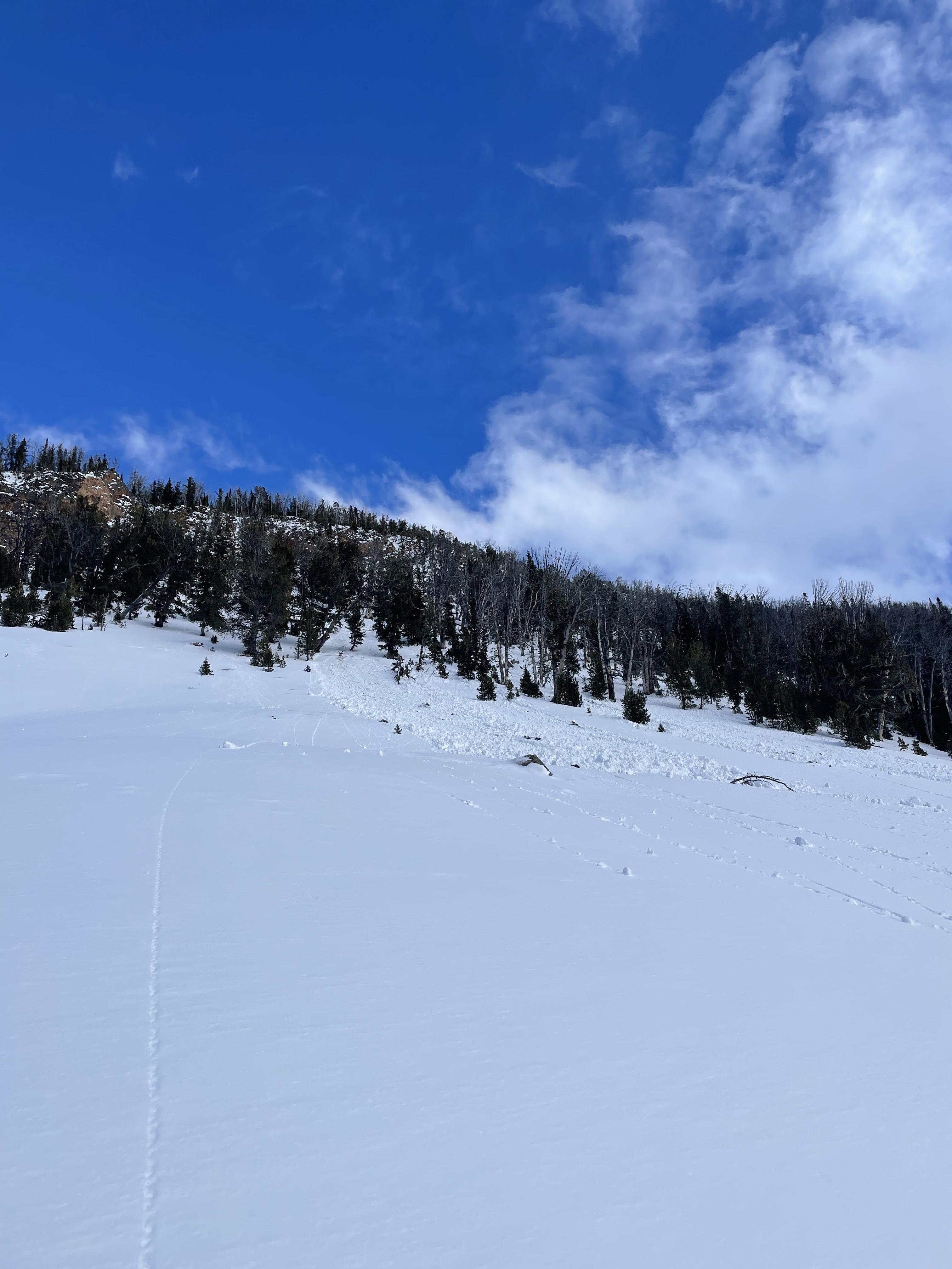
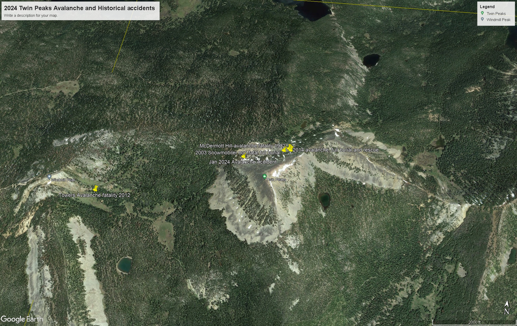
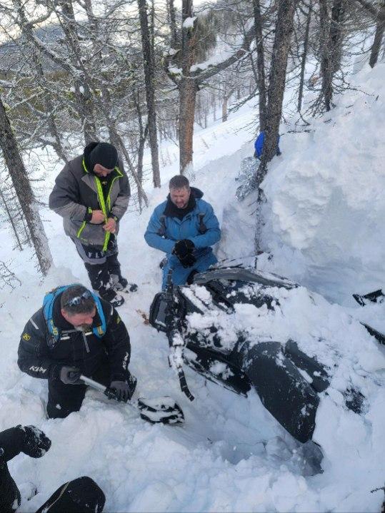
2 Snowmobilers riding into the Twin Peaks area, and one decided to sidehill a slope with patchy larch trees that is 42 degrees at the top, and consistently windloaded. The resulting avalanche took him and his sled approximately 300 feet downhill to a patch of small diameter larch trees where the trees formed a fence that strained the rider and his sled and also piled up the debris. It was likely one of these small trees that broke the victim's leg. They were very familiar with the area, and all the previous accidents (one fatality occurred north of this spot by 150 yds, and several full and partial burials have occurred along this ridge) that have happened in that area. They were carrying all rescue gear and airbags(victim did not deploy his airbag). One of the riders was at an avalanche class I put on at the toe of the slope 5 years ago. There was no real hazard evaluation, and the riders did not observe any signs of instability prior to triggering the avalanche. Once the rider sidehilled into the open everything fractured above him in the windslab. My partner and I had several large collapses assessing the area, and the victim's riding partner stated that they had several collapses moving the victim to the helicopter. The helicopter landed very close to the toe of the slope. The snow depth at the crown was 60 inches deep, with one wind slab sitting on another on facets, and at the toe of the slope the snow depth was less than 20 inches deep. The fracture traveled roughly 800 feet in and around the larch trees near the top of the slope and it deposited debris in 3 different run outs.
Victim was buried vertically with a boot sticking out, and his riding partner exposed his face in 2 minutes. He extricated his whole body in 8-10. He had a broken femur and a broken hand. As they were digging, rescuers stated that the second leg wasn't vertical, and they found it at an oblique angle to the rest of the body. They had an inreach and sent out a help signal that was picked up, and LifeFlight was nearby. Lifeflight was able to land at the base of the slope and take him to St. Pete's in Missoula at 1230 pm.
Full Snow Observation Report
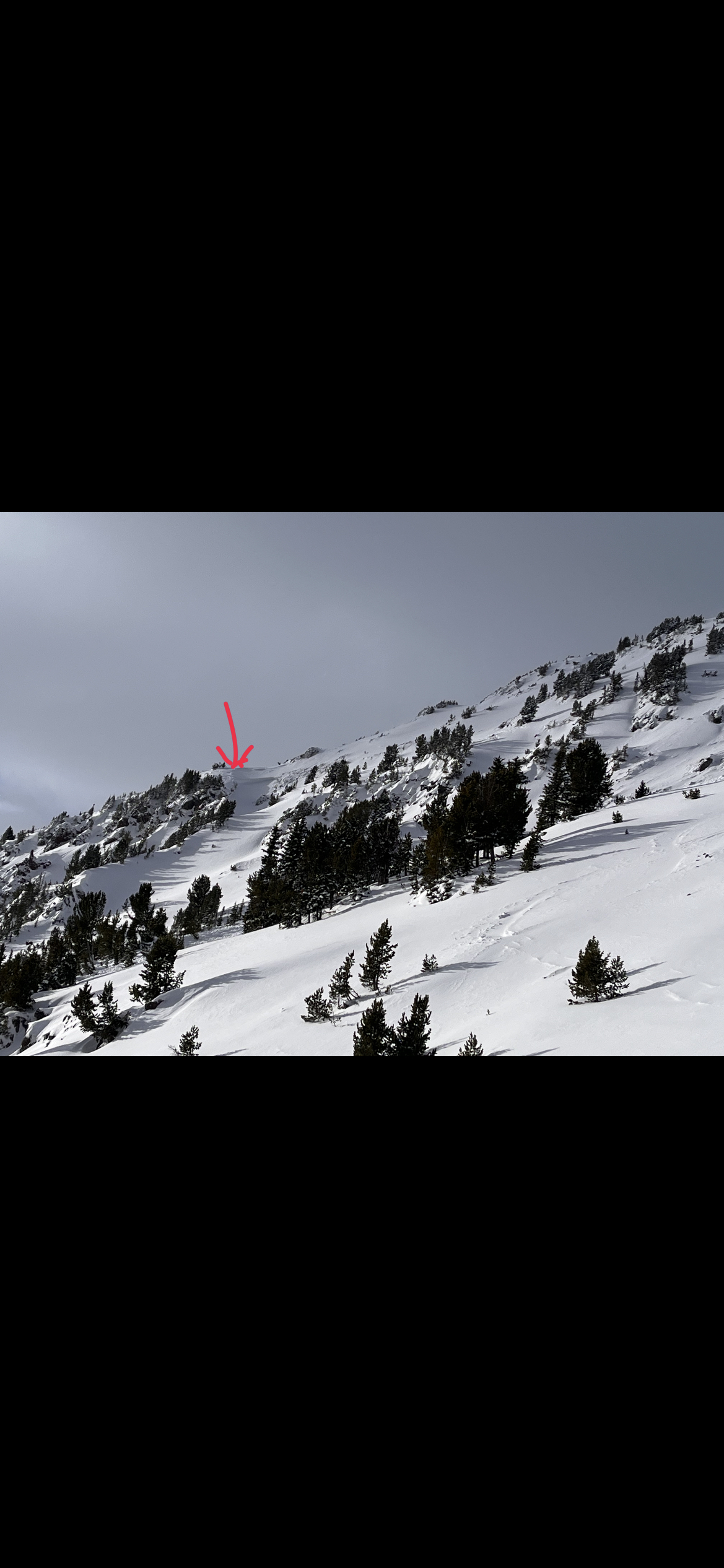
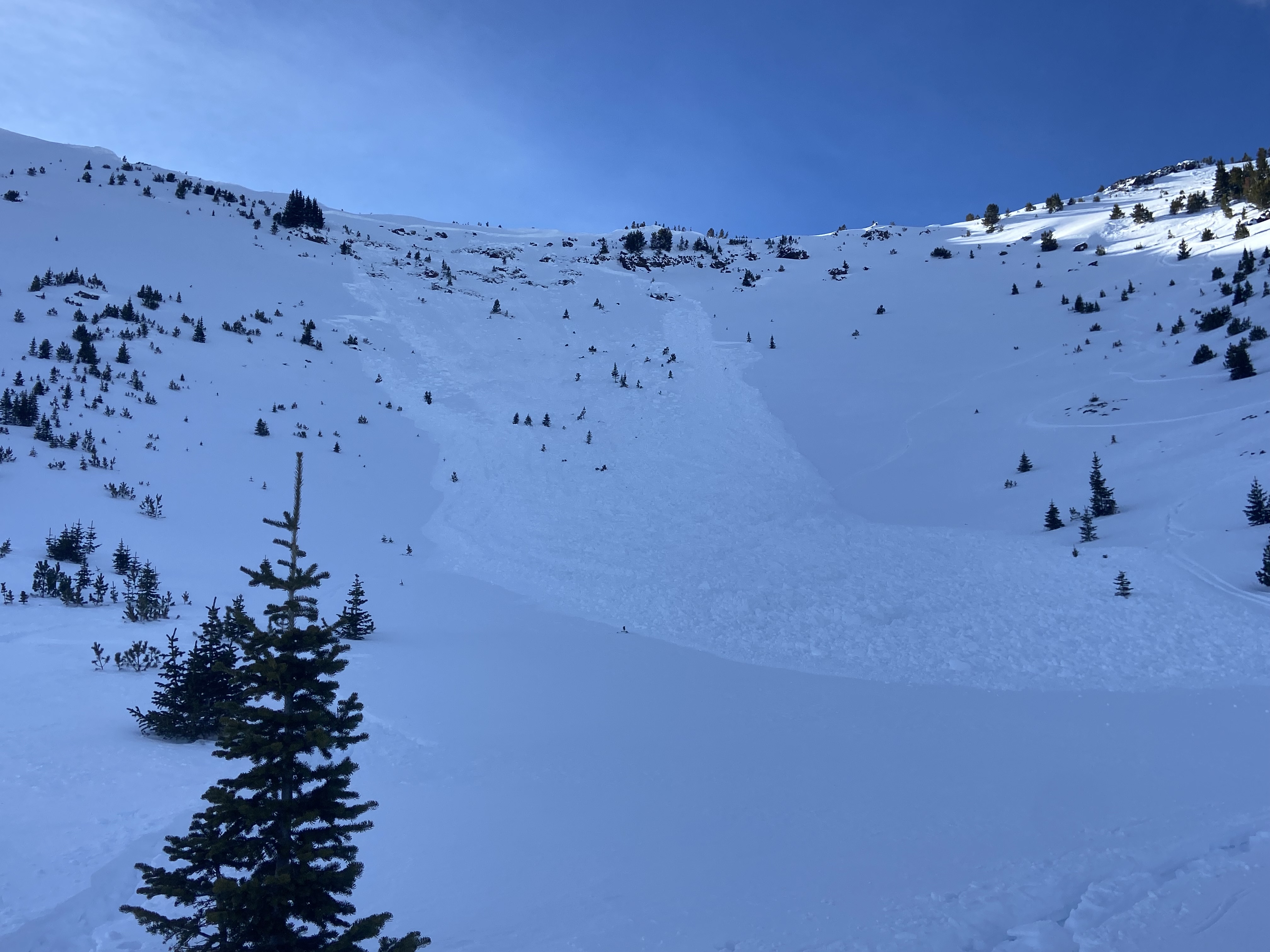
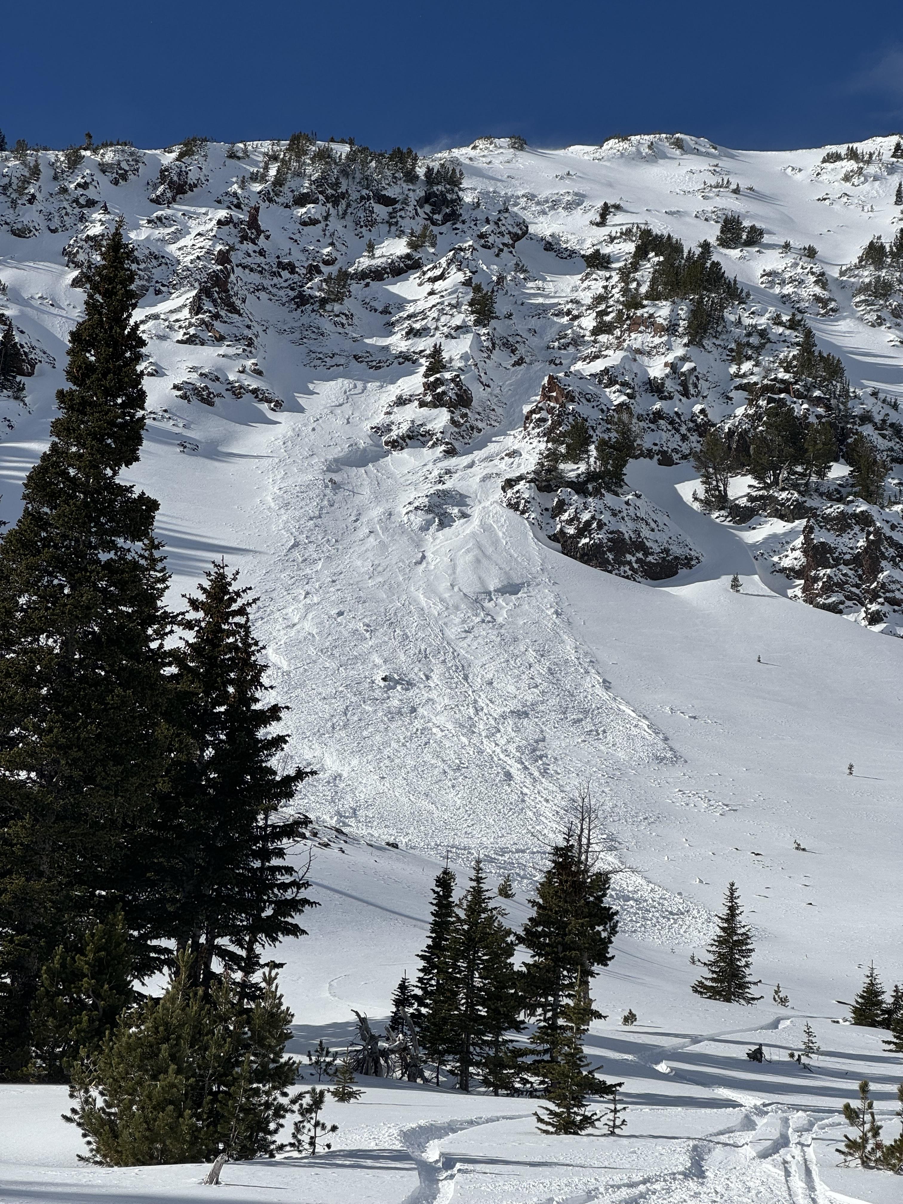
While up there investigating yesterday’s avalanche i noticed a new debris coming out of the lookers left chute on Southeast face a blackmore. got closer to the ridge and noticed this. happened last night or this morning. wind was definitely pumping a change. Directions loading this aspect. debris ran out of side of this picture. 5 feet deep 50 to 100 ft wide and ran roughly 800 feet.
Full Snow Observation Report