Snow Observations List
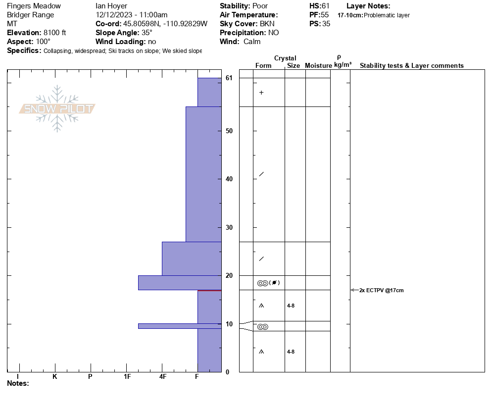
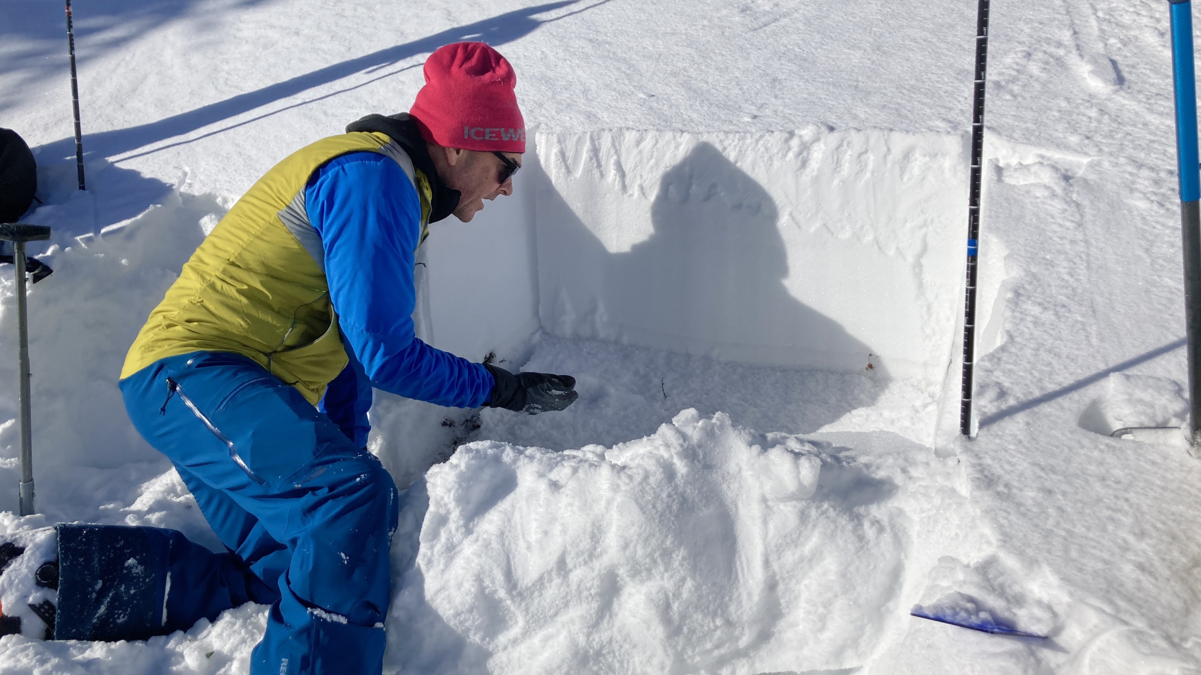
Skinned up the closed ski area to the Fingers Meadow above the Pierres Knob chairlift. Got a substantial collapse (whumpf) while skinning and stopped to dig a pit at that location. E aspect, 8100 ft. Snowpack consisted of 6-8" of old, weak, faceted snow at the ground capped by ~18" of snow that has fallen over the last week.
ECT broke on the old snow while isolating the column. Twice (ECTPV x 2). Clear signs of instability kept us out of avalanche terrain.
Full Snow Observation Report

Lots of collapsing today near Miller Ridge (S, SE facing slopes), just 50' from the road. This continued in more sheltered areas as well. Dug on a NE facing slope at 9300', HS: 80 ECTP12 @ 40 cm.
Full Snow Observation ReportNE aspect 7600 ft.
Hand pit - 40 cm deep
First 15cm of the snowpack from the ground up, was rotten, un-compacted snow, with a thin hard crust.
Top 25 cm was compacted snow, density 4F.
S Brackett Cr road has a few inches over most of it. Snowpack is still too shallow to allow for much skiing.
Full Snow Observation Report
I went with a party of 4 to check out the ice climb Tequila Tour - what we believe to be "Willis Route" in the guidebook. This is the next significant drainage south of Horsetail Falls on the west side of the east fork valley.
Around the base of the climb (45.43740, -110.91324), we found on an unshaded south facing aspect a snowpack of 30-40cm. Icy crust layer for the bottom 8-10cm with 4F harness and then very fluffy new snow on top.
Lower down near the creek, the snowpack is thinner - much of the recent snow and wind transported snow is up in the trees.
Today, there was a quick dump of new snow, lasting about 30 minutes. The sun came out briefly afterwards.
Our party got to the bottom of P1 and turned around. While we knew the gully between pitches is relatively low angle, we were a bit uncertain about the size and positioning of hanging snowfields above and knew that today's forecast was considerable. Something to revisit later.
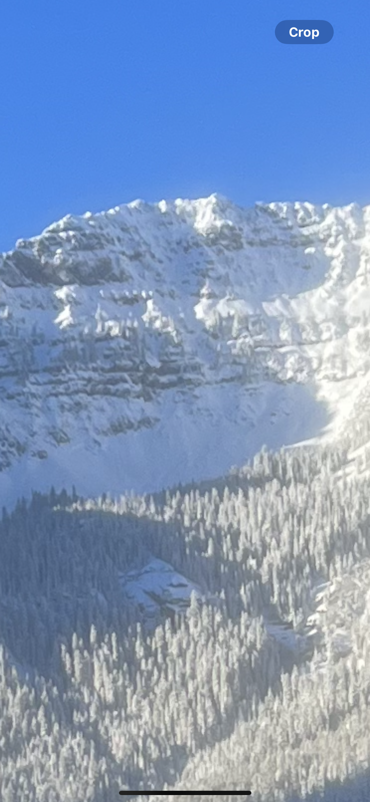
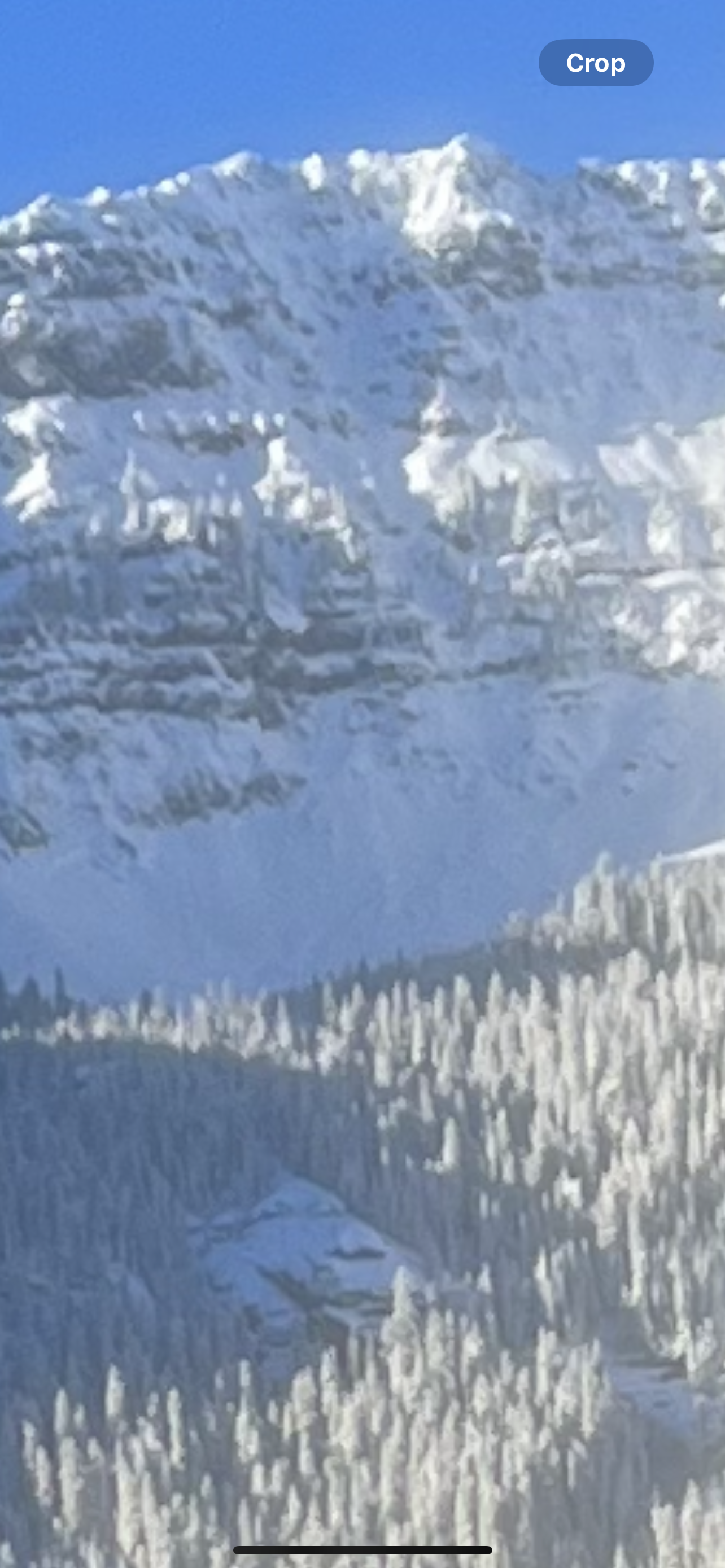
Full Snow Observation ReportToured up toward Mt. Blackmore today with the goal of skiing the mellow SE facing meadow and familiarizing myself with the current unstable snowpack. While stopping for lunch I dug a quick pit out of curiosity and performed a CT at 8757’ on a NW aspect with HS 85cm. Results were CT11 down 17 cm within the new snow on a hardness change and a CT13 down 35 cm on old facets. Moving farther up in the basin we noticed the pictured recent D2 avalanche on the E aspect of Blackmore. As we skinned up the SE meadow, we experienced three audible whumpfs. Otherwise great skiing was found today albeit a bit thin!
Full Snow Observation Report
Dave Zinn saw two avalanches, had a large collapse and an ECTP3 in his stability test.
Like the rest of the advisory area, the snowpack in the Taylor Fork is unstable and consists of a weak foundation capped by a slab of snow. Considerable danger, recent avalanches and collapsing were enough to keep us off steep slopes. Without new snow this week, you will observe fewer obvious signs of instability, but the weak structure will persist, and any steeper terrain should be approached cautiously.
Full Snow Observation Report
From email: "I dug a pit in the normal location to check the snow pack conditions and here’s what I found.
Aspect: East
Slope Angle: 19
Elevation: 8100ft
Total pit depth 70cm
Winds: light 5mph with gusts up to approximately 15mph. I wasn’t on the very top of the ridge so I was a little protected.
ECTP 22 The failure was right at the old snow and new snow line 27cm up from the ground.
The snow coverage of the parking lot, trail up and off trail areas wasn’t great, but I’ve seen worse."
Collapsable snow on SE and NW aspects of the parks above the meadow.
ECTPV, PST-end
NNW, 7489'
Full Snow Observation Report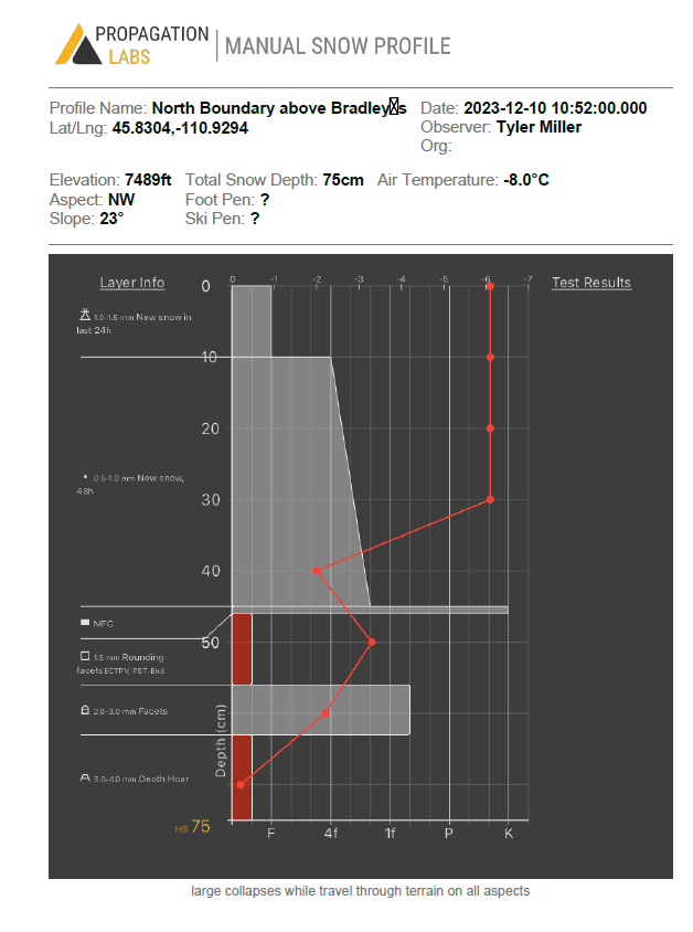
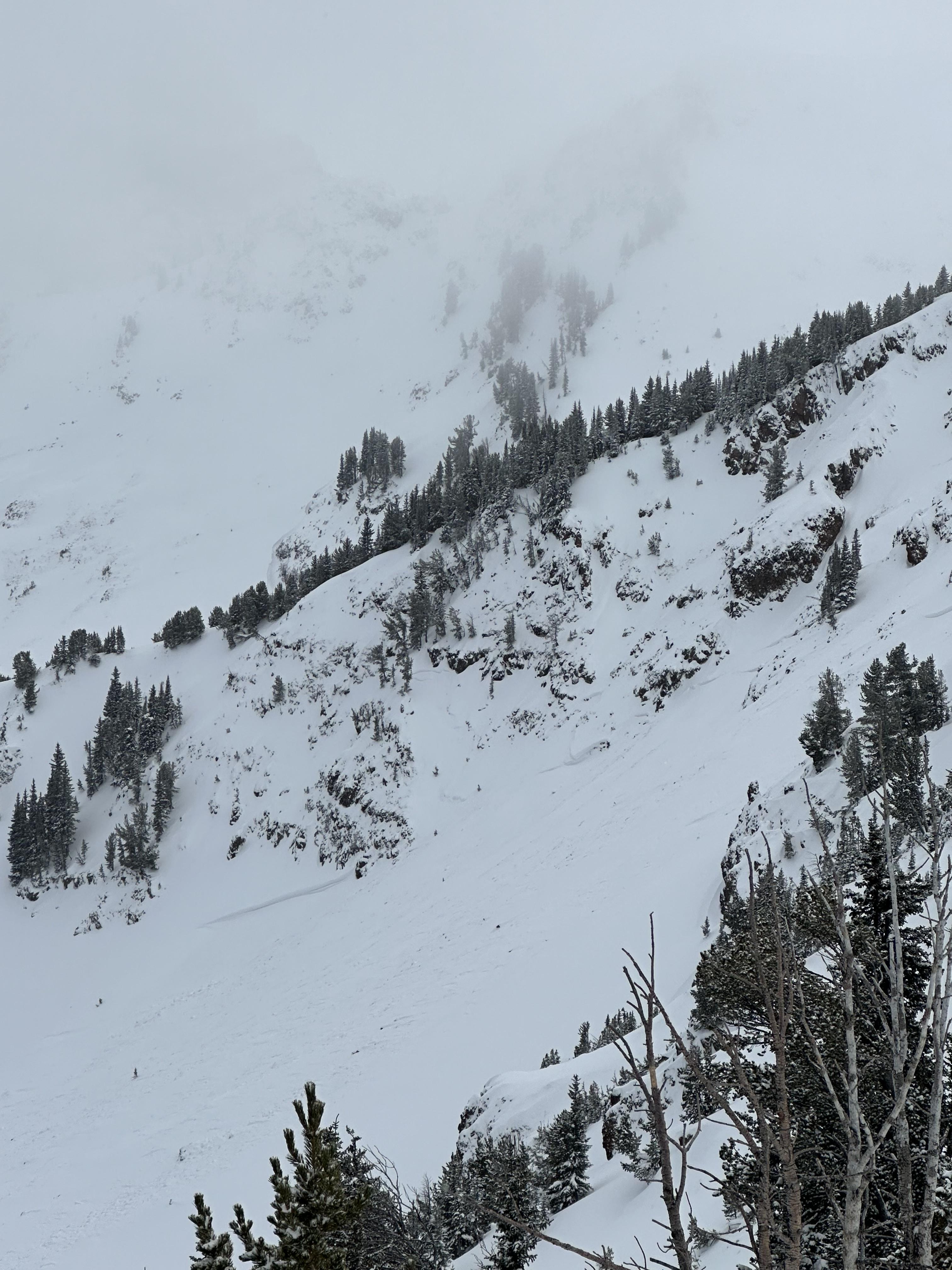
Yesterday 12/10/2023 at 0900, my climbing partner and I observed a clear crown line extend that extended throughout much of the east/ north east aspect of the bowl on Elephant Mountain.
My partner and I were both surprised by the depth of the crown. The eastern most point of the crown (photo left) was the deepest.
Full Snow Observation Report
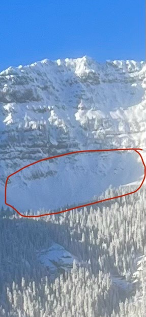
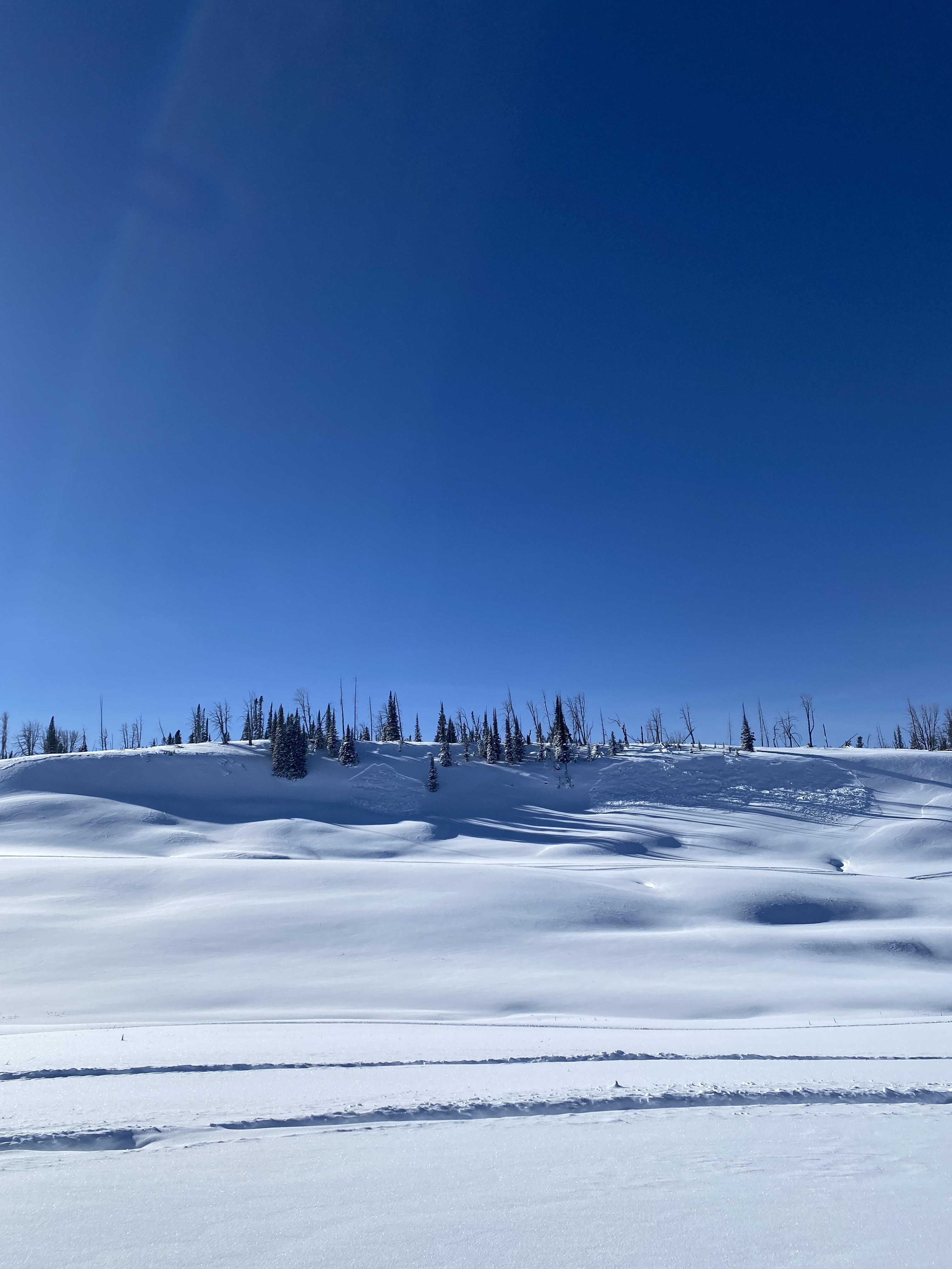
We skied into Beehive Basin today and found unstable snow. The bottom half of the 1.5' snowpack is weak, sugary facets that collapsed with audible "whumpfs" as we toured up. We dug at 8,700' on a SE aspect (a few hundred meters up valley of Tyler's slope) and the snowpit revealed a poor snow structure and instability. Even though some ranges have more snow, the set up is the same: weak, unstable snow underlying new snow. Avalanches, whumpfs and cracking are warning us to be careful throughout our entire forecast area.
Full Snow Observation Report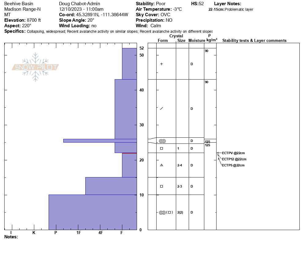

1 team yesterday (Saturday, not me) climbed Bobo Like and Big Sleep (first 2 pitches of each). They experienced 2x collapses but no other signed of instability.
Full Snow Observation Report
From email: "My partner and I skinned up, along the national forest boundary signs just northeast of the north fork trail junction. We had some thoughts about going into middle basin, but before even digging any pits we got a substantial whoomph. I dug a pit on the NE side of the ridge splitting beehive and middle basin around. 9200 ft, I didn’t get propagation or any fracture, the column just mushed down. My partner dug a pit about 20 ft higher and closer to the ridge top, he got an ectp13, it propagated on a crusty layer that was on top of faceted angular grained snow that was on the ground. I dug a pit on the opposite side of the ridge, SW aspect. Did 2 ect tests, I got a fracture only on the first, got ectp17 on the second."
Full Snow Observation ReportRiders in Taylor Fork saw natural avalanches on Saturday, 12/9
Full Snow Observation Report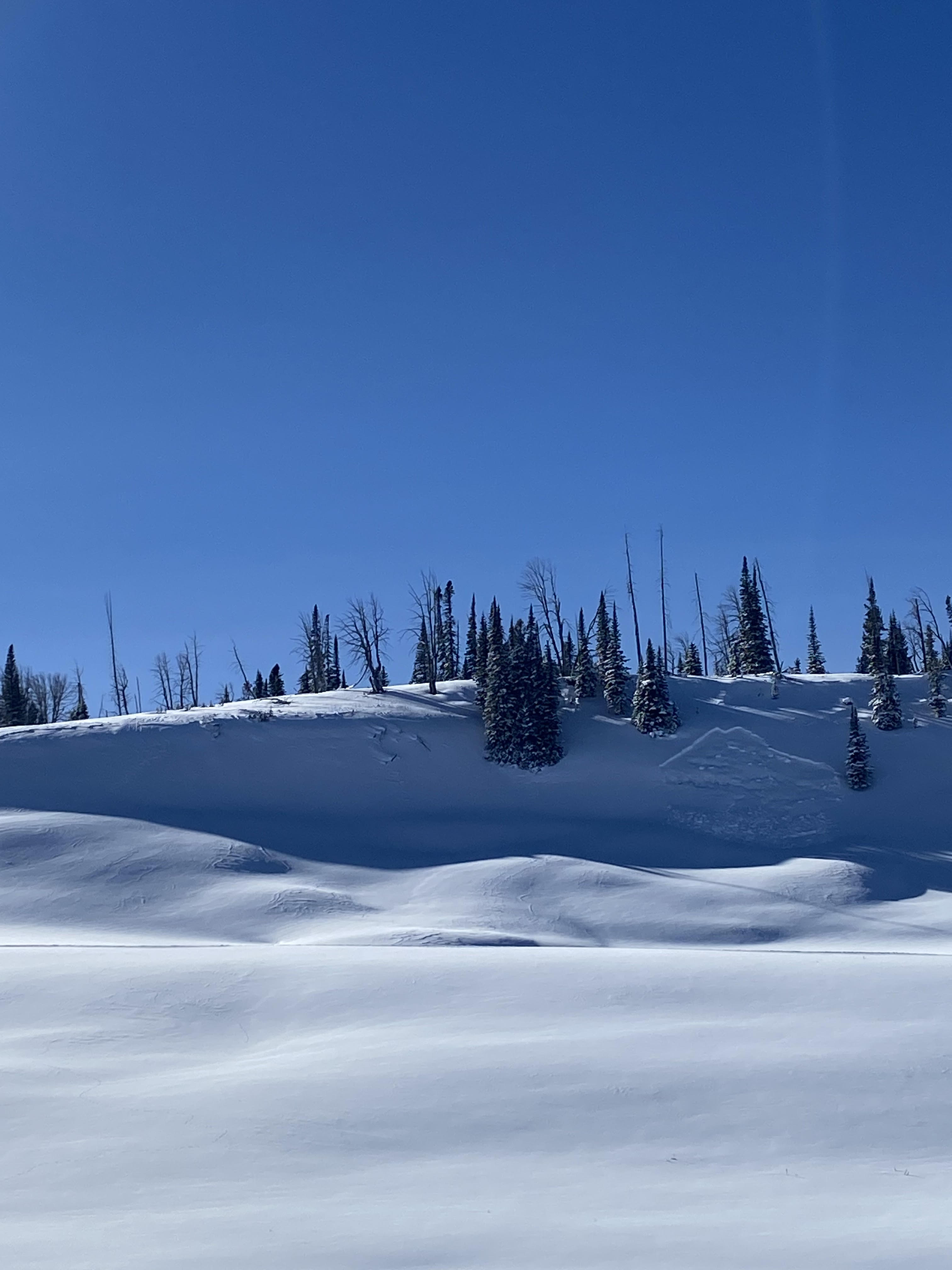
From email: "Solo skier that released a small pocket of snow at the bottom of Super Couloir - he was not caught and it was just the recent new snow and it didn't run far."
Full Snow Observation Report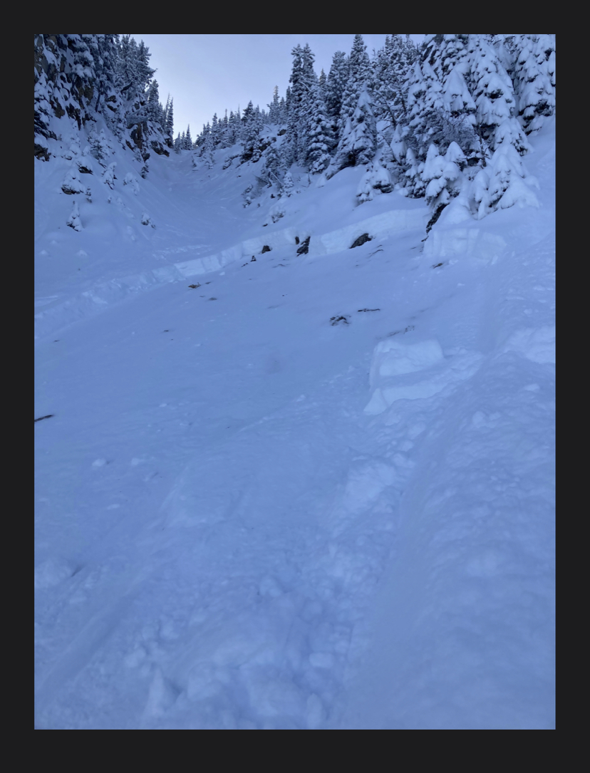
From IG: Natural activity in Beehive Basin
Full Snow Observation Report
Starting around 7500’ on E,S,W aspects we found extensive cracking and wumphing on faceting at the ground layer. Felt wumphs every few steps and had around 30 foot shooting cracks in meadows and on ridgelines. Total snow depth was never more than 45cm
Full Snow Observation Report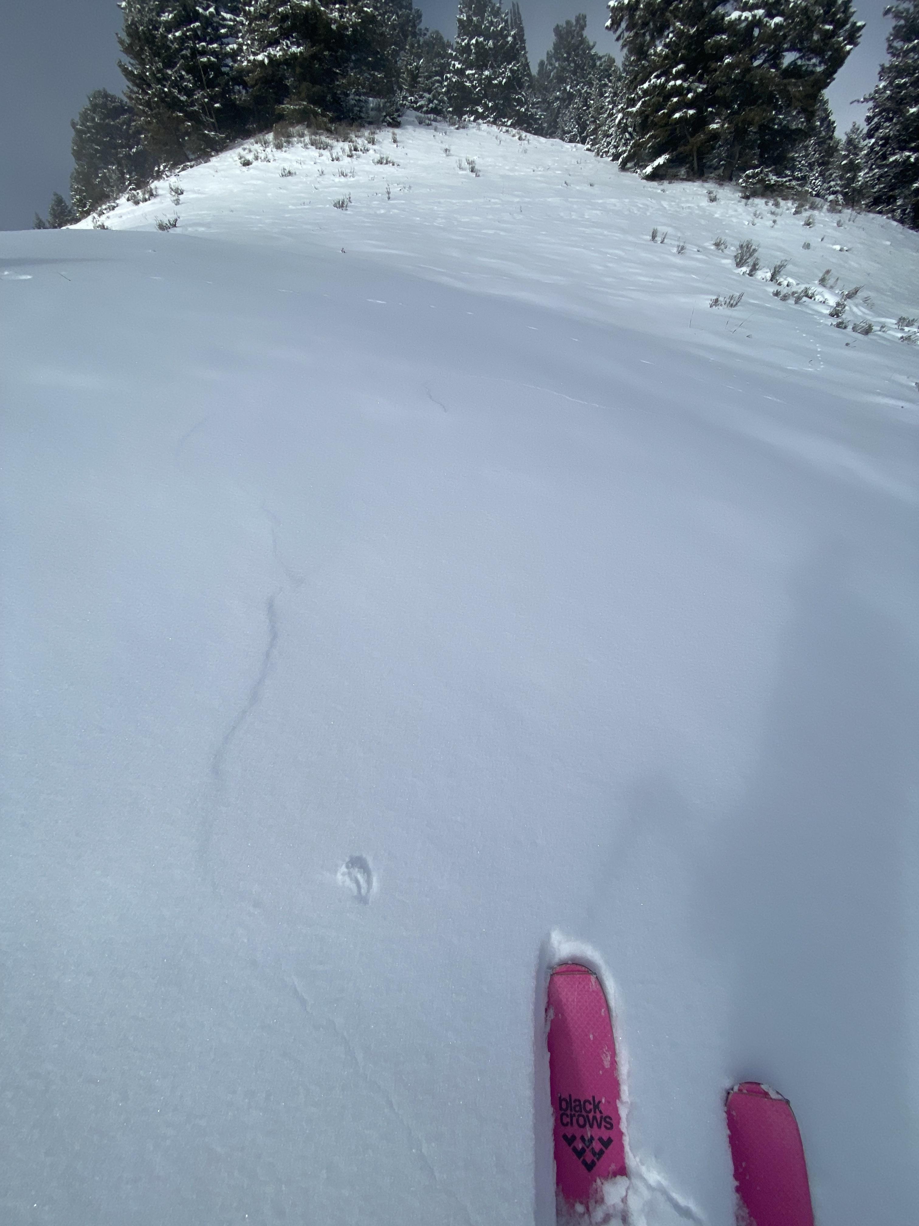
Got ECTP10/11 in a pit on an east facing slope at 9100'. The snowpack is about 60cm deep, with 30cm of facets and 30cm of fist to 4 finger hardness new snow . The test failed at the interface of the old facets and new snow.
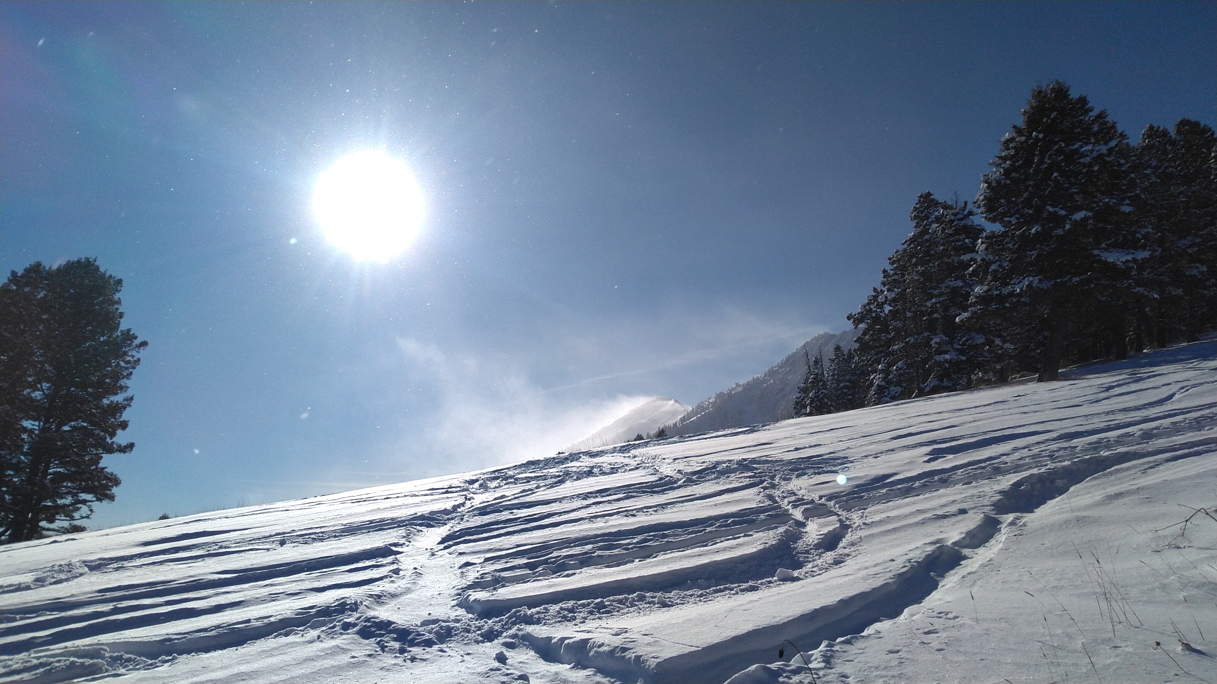
We decided to keep the skiing to below 30 degrees. After skiing one slope and skinning back up, we noticed widespread cracking around our ski tracks (image), but luckily the terrain was mellow enough that nothing moved.
Full Snow Observation Report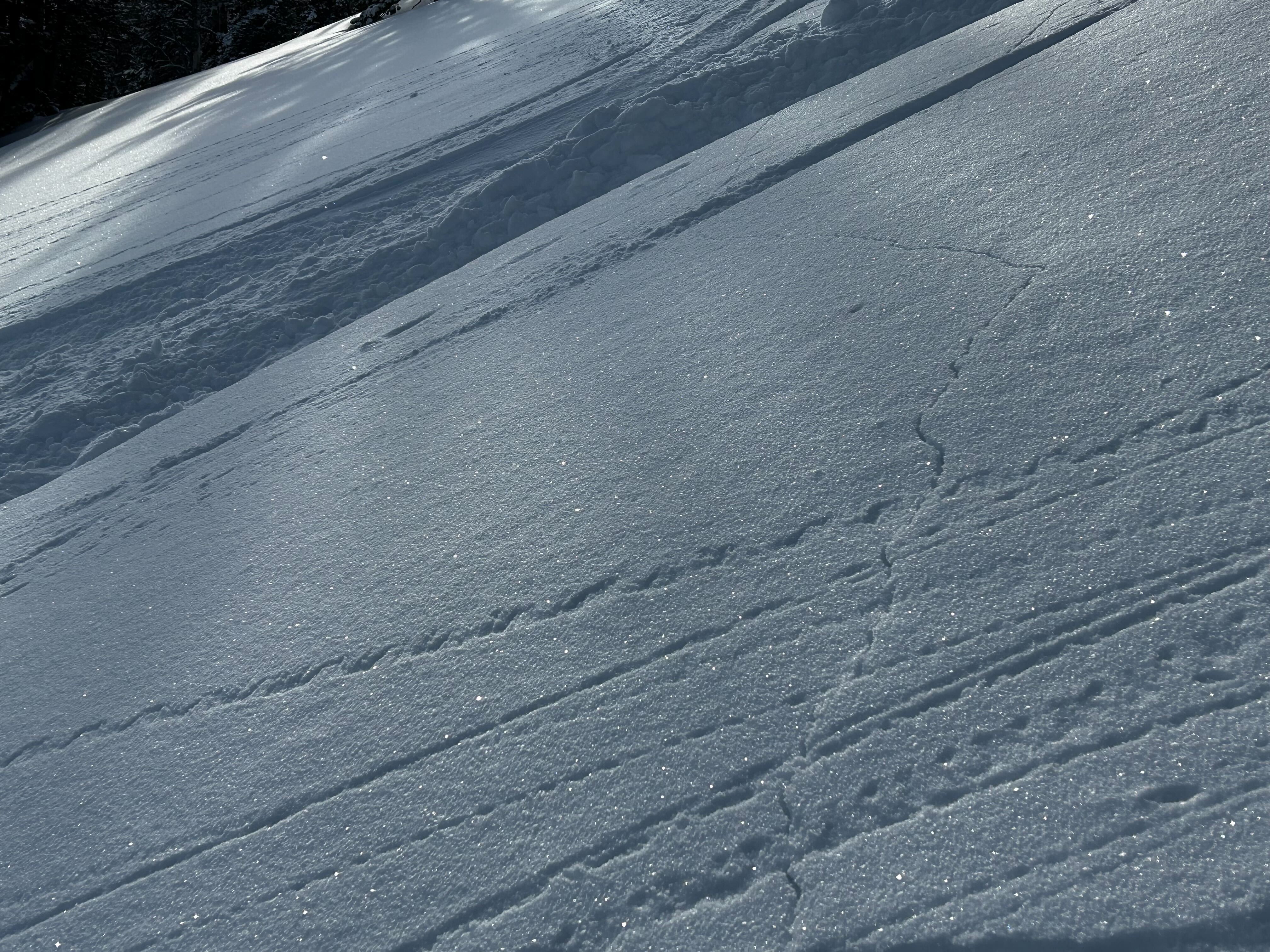
From IG on 12/10: "2 slides we triggered remotely in tepee yesterday"
Full Snow Observation Report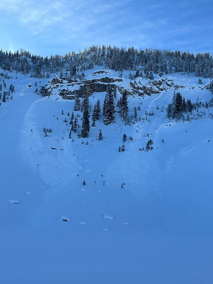
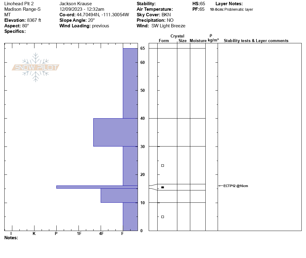
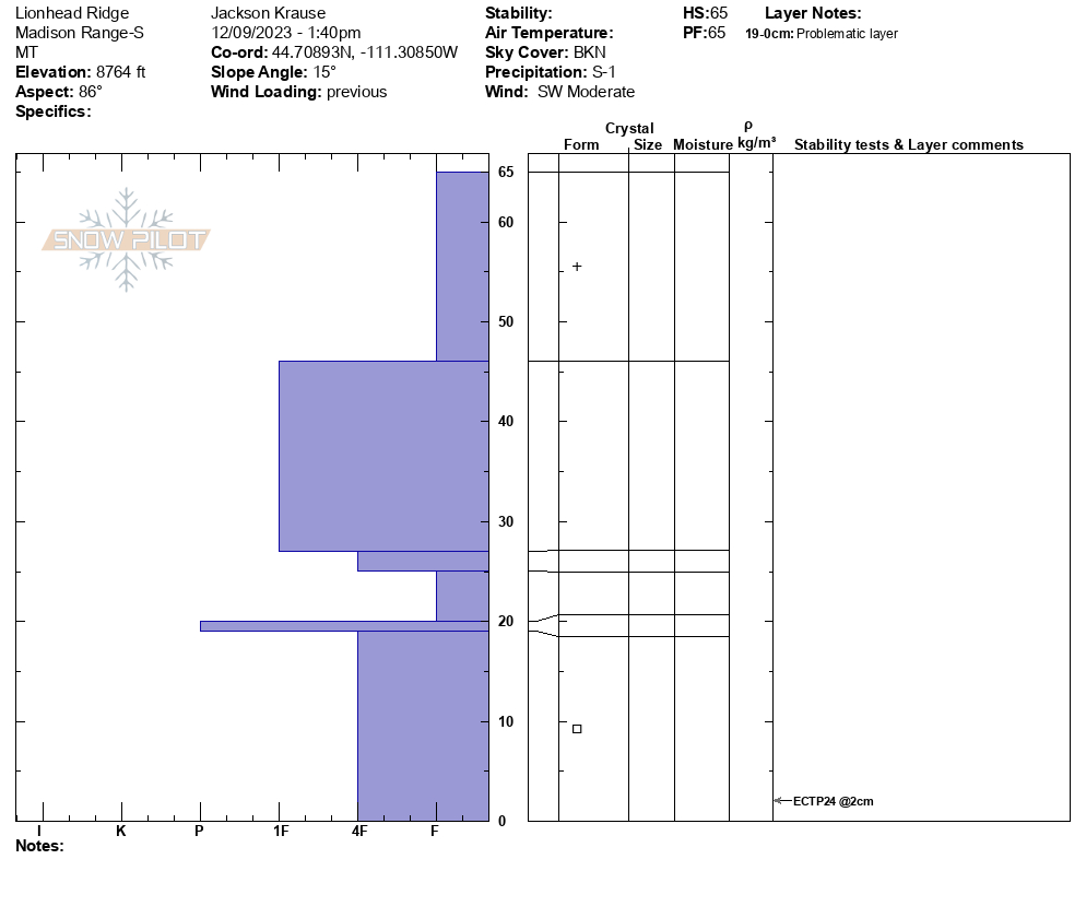
We (a group of 4) skinned up Lionhead Ridge from the ID/MT border and found troubling conditions. Several small whoomphs were observed in the shallower, bushy snow at lower elevations, and we had a massive (~100-foot propagation) whoomph on the ridge proper where the cornice met the ridge. Accompanying those whoomphs, we observed shooting cracks at multiple low-angle locations. We performed 3 separate pits, the shallowest of which was 48cm @8113' and had an ECTP10. The next two pits were 65cm deep and the SnowPilots are attached. Every single pit had sizeable (~3mm) basal faceting and a pencil-hard ice layer sandwiched with more facets above in the lower snowpack. While cutting a PST, the entire column propagated (Q1) above the ice layer at 25cm from the ground. Be careful out there, the snowpack is super touchy.
Full Snow Observation Report
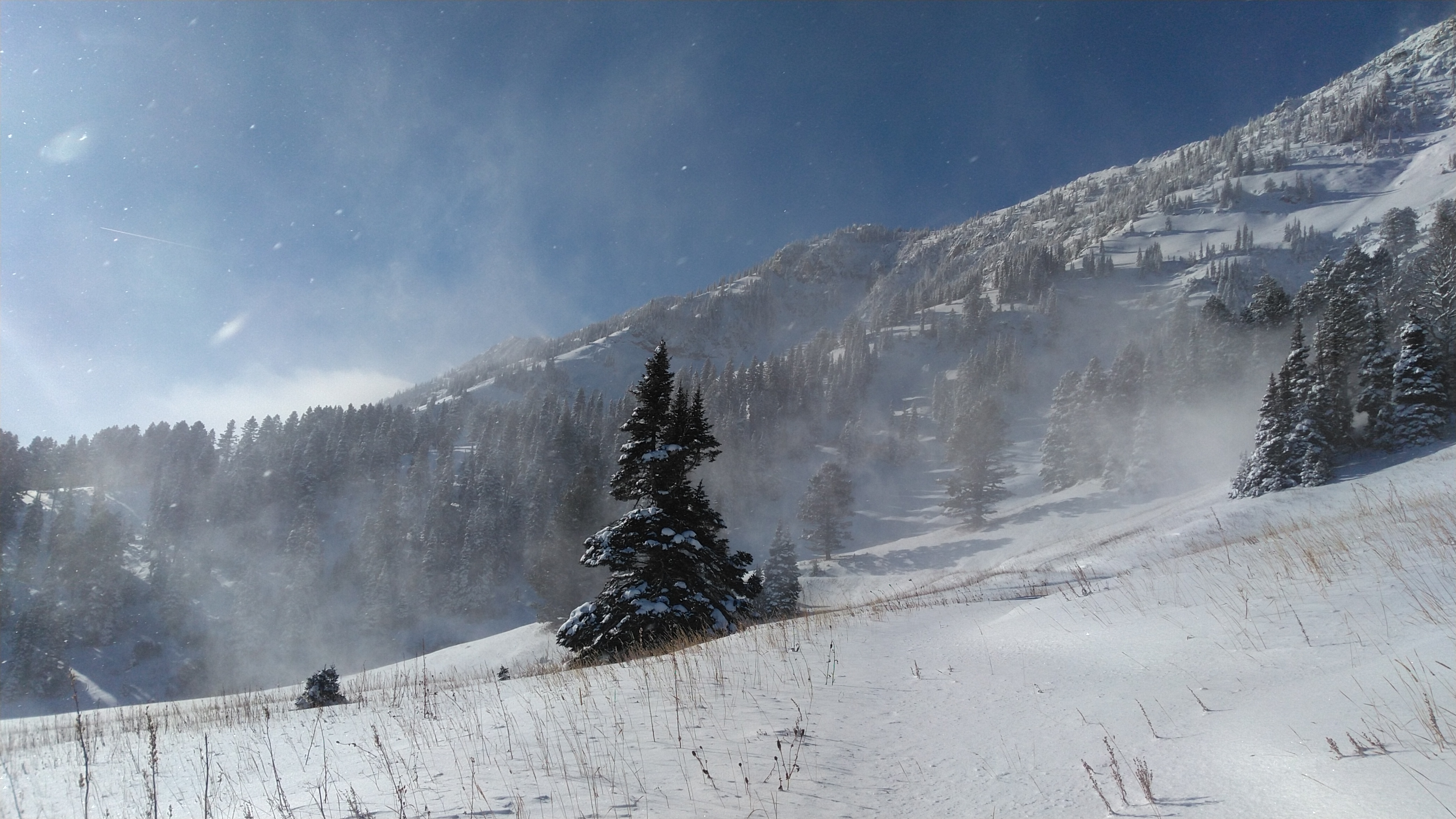
Windier then I expected today at me d elevations adjacent to Bridger while teaching Friends of GNFAC courses. Photos show lots of wind transport during the day.
Felt a few collapses while skinning.
Full Snow Observation Report