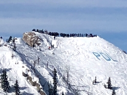
Good morning. This is Doug Chabot with the Gallatin National Forest Avalanche Forecast issued on Wednesday, March 6th at 6:45 a.m. Today's forecast is in memory of Pete Lazar, a local skier who was killed in an avalanche one week ago. Last night his family and friends gathered at Bridger Bowl to remember a wonderful man who will be missed by everyone who knew him (photo). This advisory does not apply to operating ski areas.
At 5 a.m. 1-2” has fallen in the Bridger Range and Hyalite, and 3-4” in Big Sky, West Yellowstone and Cooke City. Winds are averaging 10-20 mph with gusts of 30 mph from the southwest to southeast and northeast in the Bridger Range. Mountain temperatures are in the high teens. Scattered snowfall will continue and by morning there will be 2-4” around Bozeman and 4-6” everywhere else. Winds will blow southerly at 15-25 mph and temperatures will remain in the teens.

All Regions
Last week’s wallop of snow resulted in many avalanches, some being the largest in memory (avalanche activity page). Wilson Peak in the N. Madison Range (details) was one of these with a crown line about 1,000 feet wide. We read a report on Instagram (#gnfacobs) that the slope was shallow and broke on facets near the ground. On the heels of this avalanche cycle Ian dug to the ground in Lionhead on Monday (video) to assess the stability and yesterday Eric and I rode from Buck Ridge towards Cedar Mountain (video). In both cases we found improving conditions. The videos from these field days complement each other and outline the current situation:
- The snowpack is adjusting to last week’s snow load and getting stronger.
- A weak layer of facets near the ground are deeply buried in most areas, but in spots where they are shallow, like at the edges of a slope, they could still be triggered.
- Wind-loaded slopes, especially with today’s new snow, could be triggered near the ridgelines.
- Last night’s snowfall just buried a layer of surface hoar and/or small-grained facets that formed over the previous few days. This may be a new weak layer and could facilitate shooting cracks and thin avalanches in the new snow.
In general, be wary of triggering slides on wind-loaded slopes or breaking cornices, and be mindful of sliding over thin areas of the snowpack where you could trigger an avalanche on the buried facets. For today the avalanche danger is rated MODERATE on all slopes throughout the forecast area.
Hot Tip: Use the Regional Pages (top of the webpage) to find out what avalanche activity has been reported in the area you plan to visit.
If you get out and have any avalanche or snowpack observations to share, contact us via our website, email (mtavalanche@gmail.com), phone (406-587-6984), or Instagram (#gnfacobs).
Two avalanche fatalities in 2 days, one in CO and another in WY
On Sunday, a solo backcountry skier was caught, buried, and killed in an avalanche near Telluride, Colorado. You can read the preliminary report here. On Monday, a snowmobiler was buried and killed in a large slide at Togwotee Pass, Wyoming. More information is here.
Upcoming Avalanche Education and Events
Our education calendar is full of awareness lectures and field courses. Check it out: Events and Education Calendar.
BOZEMAN
TONIGHT, March 6, 1-hr Avalanche Awareness, 6-7 p.m. at REI Bozeman.
TONIGHT, March 6, Drinks for a Purpose, 5-8 p.m. at Bozeman Spirits Distillery, More info.
COOKE CITY
Every Friday and Saturday, Rescue Training and Snowpack Update. Friday 6:30-7:30 p.m. at the Soda Butte Lodge. Saturday anytime between 10-2 @ Round Lake.
The accident report for the avalanche fatality in the Bridger Range on February 26th is complete. You can view the report here.