Good morning. This is Eric Knoff with the Gallatin National Forest Avalanche Forecast issued on Thursday, March 8th at 7:00 a.m. Today's forecast is sponsored by Cooke City Super 8/Bearclaw and World Boards. This advisory does not apply to operating ski areas.
Over the past 24 hours the mountains around Bozeman and Big Sky picked up 1-2” of new snow while the mountains around West Yellowstone and Cooke City picked up 3-5”. This morning, snow has tapered off and temps are in the teens to low 20’s F under mostly cloudy skies. Winds are blowing 10-20 mph out of the west-southwest. Highs today will climb into the mid to upper 20’s F and winds will remain light to moderate out of the west-southwest. Snow returns this afternoon and the mountains should see 4-6” by tomorrow morning.

All Regions
A few inches of snow overnight won’t be enough to spike the avalanche danger. Today, wind loaded slopes will be most prone to producing human triggered slides. Winds have been fairly light, but upper elevation gusts out of the west-southwest have been strong enough to transport snow and form fresh slabs below ridgelines. These slabs will be 1-2 feet thick and could fail under the weight of a skier or rider.
On some slopes, fresh wind slabs rest over a thin layer of facets that formed last weekend. Conditions will be touchier on slopes where this layer exists. On Wednesday, a skier unintentionally triggered a slide on Mt Blackmore that likely failed on this layer of facets (details). Fortunately, nobody was caught. We know this layer exists in the mountains around Bozeman and Big Sky (video), but we’re unsure of its distribution in the mountains around West Yellowstone and Cooke City. Yesterday, I rode around Cabin Creek in the southern Madison Range and did not find this layer. My observations are consistent with what Karl found at Bacon Rind on Wednesday (video).
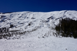
Fortunately, you only need to dig about a foot deep to look for and assess this layer. This process only takes a few minutes and is a good insurance policy before jumping into steep terrain. If you’re feeling motivated, you can dig and test weak snow near the ground. The deep slab problem has improved significantly over the past few weeks (video), but slides failing on weak snow buried deep in the pack can’t be entirely ruled out (photo). This problem is most likely to occur in steep rocky terrain where the snowpack is highly variable.
Today, human triggered avalanches are possible and the avalanche danger is rated MODERATE.
Avalanche Activity: Use the Regional Pages under the Forecast tap to find out what avalanche activity has been reported in the area you plan to visit.
If you get out and have any avalanche or snowpack observations to share, contact us via our website, email (mtavalanche@gmail.com), phone (406-587-6984), or Instagram (#gnfacobs).
Upcoming Avalanche Education and Events
Our education calendar is full of awareness lectures and field courses. Check it out: Events and Education Calendar.
COOKE CITY
This Friday and Saturday, Rescue Training and Snowpack Update. Friday 6:30-7:30 p.m. at the Soda Butte Lodge. Saturday anytime between 10-2 @ Round Lake.
The accident report for the avalanche fatality in the Bridger Range on February 26th is complete. You can view the report here.