Good morning. This is Eric Knoff with the Gallatin National Forest Avalanche Forecast issued on Saturday, March 9th at 7:00 a.m. Today's forecast is sponsored by Knoff Group Real Estate and PH D. Skis. This advisory does not apply to operating ski areas.
Since yesterday morning the mountains picked up 1-2” of new snow. At 5 a.m. temps range from the single digits to low teens F and winds are blowing 5-15 mph out of the west-northwest. Today, the mountains near Cooke City could see an additional 1-2” of new snow while the rest of the forecast area remains dry. Highs today will warm into the upper teens to low 20’s F under partly to mostly cloudy skies and winds remain light to moderate out of the west. No significant snow accumulation is expected tonight or tomorrow.

All Regions
This recent storm was a bit of a bust. Snow totals were on the low end of forecasted amounts. Without a significant loading event, avalanche conditions aren’t as dangerous as they could be. Today the primary concern is a thin layer of facets buried 6-12” deep, possibly deeper on wind loaded slopes. This layer of facets has produced natural and human triggered avalanches in the mountains around Bozeman, Big Sky, and Cooke City. It doesn’t appear to be a problem in the mountains near West Yellowstone (video).
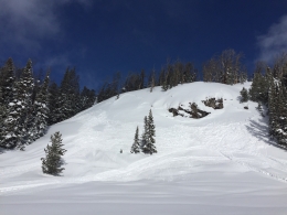
Yesterday, skiers near Hyalite Peak in the northern Gallatin Range observed recent avalanche activity on wind loaded slopes and experienced unstable test results on facets buried 8-12” deep. Doug is in Cooke City and saw multiple human triggered slides that occurred yesterday. These slides only involved the new snow and mainly took place on south facing slopes (photo). I highly recommend digging a quick snowpit and testing the new snow/old snow interface before committing to steep terrain (video).
Slopes with wind drifted snow will be the most unstable and should be approached with caution (video). Be especially observant of surface conditions in steep high consequence terrain. Even small slides can be deadly if they push you into trees or carry you over rocks (photo). Conditions will become less touchy as time goes on, but human triggered slides remain possible today.
For this reason the avalanche danger is rated MODERATE.
Avalanche Activity: Use the Regional Pages under the Forecast tap to find out what avalanche activity has been reported in the area you plan to visit.
If you get out and have any avalanche or snowpack observations to share, contact us via our website, email (mtavalanche@gmail.com), phone (406-587-6984), or Instagram (#gnfacobs).
Upcoming Avalanche Education and Events
Our education calendar is full of awareness lectures and field courses. Check it out: Events and Education Calendar.
COOKE CITY
This Friday and Saturday, Rescue Training and Snowpack Update. Friday 6:30-7:30 p.m. at the Soda Butte Lodge. Saturday anytime between 10-2 @ Round Lake.
The accident report for the avalanche fatality in the Bridger Range on February 26th is complete. You can view the report here.