Advisory Archive

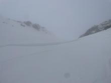
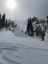
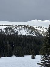
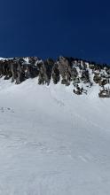
Snow showers yesterday left at most an inch of new snow. Winds are light this morning, out of the north and west. Mountain temperatures this morning are in the single digits and teens F under clear skies.
Today will be sunny and 5 to 10 degrees F warmer than yesterday. High temperatures will be in the 30s and low 40s F. Winds will shift more southwesterly today and remain light.
The next couple days will remain sunny and warm, before clouds and a chance for precipitation return early next week.

New snow totals since yesterday morning are:
5-7” around Bozeman and Big Sky.
0-1” everywhere else
Temperatures this morning are in the teens F. Winds are light out of the north and northwest. Except in the Bridger Range, where they’re a little stronger and out of the east.
Snow showers in the north will end this morning, with skies gradually clearing across the whole area by this evening. High temperatures will be in the 20s and 30s F. Wind speeds will pick up a bit this morning, generally blowing from the north.
Expect dry, sunny and warmer conditions through the weekend.
Yesterday most places received 1-3 inches of snow, and overnight a trace of snow fell near Big Sky and Bozeman. Exceptions include:
- The Taylor Fork area where the Carrot Bason SNOTEL received 7 inches.
- Just south West Yellowstone where the Madison Plateau SNOTEL received zero.
- Near Cooke City, the Fisher Creek SNOTEL received 5 inches.
This morning, temperatures are in the low to mid teens F in most areas and low 20s F in the Bridgers. Winds are barely moving.
Today will have classic spring weather with a spot or two of sunshine peeking through the clouds this morning warming temperatures into the 20s F, closer to 30 degrees in the Bridgers. Cold air and moisture will descend from the north again. This afternoon winds will become a little gusty as more clouds arrive and snow falls. Overall another 1-3 inches should accumulate, but mostly north of West Yellowstone. A few places could see 5-6 inches of snow and a couple cracks of thunder.
Two more things: (1) A Winter Storm Warning has been issued for the Absaroka/Beartooth mountains today where there could be very heavy snowfall (8-16 inches) mostly on the north slope, and it shouldn’t make it to Cooke City. (2) Looking ahead, the sun comes out Friday and really gets cranking with very warm temps and strong sunshine this weekend…get ready for wet snow.


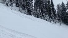
Snow continued falling yesterday in the mountains near Bozeman and Big Sky with 2-3 inches during the day followed by another 2-3 inches very early this morning.
Snowfall totals since Monday morning:
- Bridger Range - 18” snow (2.2” water)
- Big Sky - 8-9” snow (0.8” water)
- West Yellowstone and Island Park areas - 7-10” snow (0.7-0.9” water)
- Cooke City areas - 4-6” snow (0.4” water)
This morning, light snow continues to fall near Bozeman and Big Sky. Mountain temperatures are in the mid teens F but closer to 20 degrees F in the Bridgers. Light winds from the west are blowing 5-10 mph gusting in the teens.
Today moisture descending from the north will continue bringing snow to the northern areas this morning, then to southern parts of the forecast area this afternoon. 1-3 inches should fall in most areas by the end of the day. Cold air will keep high temperatures in the low to mid 20s; however, some sun could appear this afternoon near Bozeman and push high temperatures in the Bridgers closer to freezing. Winds will blow more from the northwest around 10 mph. They may increase a bit mid-morning with gusts in the 20s.

24-Hour Snow Totals (NO JOKE!)
- Bridger Range - 13” of snow (1.4” of snow water equivalent - SWE)
- West Yellowstone and Island Park - 7-10” of snow (0.7-0.9” SWE)
- Big Sky and Cooke City - 4-7” of snow (0.4-0.5” SWE)
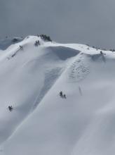
This morning, snow is falling heavily, especially in the Bridger Range, and it is expected to continue through tomorrow, with the heaviest accumulation favoring the mountains around Bozeman and Big Sky. Temperatures are in the teens and 20s F with 10-20 mph winds from the west and southwest.
Today, the intensity of the snowfall and wind will be the main drivers of the avalanche danger. The mountains around Bozeman and Big Sky will receive an additional 10-12 inches of snow by tomorrow morning, with 5-8 inches near West Yellowstone, Island Park and Cooke City. Winds will be 10-20 mph from the west shifting to the north, and high temperatures will be in the 20s to low 30s F.

Since yesterday morning 24 hour snow totals are:
- 2-4” near Bozeman, Big Sky, Cooke City and Island Park
- 0-1” near West Yellowstone.
Temperatures are teens to 20s F this morning. Wind was calm most of yesterday, and increased overnight to 10-25 mph with gusts of 25-45 mph out of the south and southwest.
Today, temperatures will reach mid-30s F with a chance of thunderstorms this afternoon, and wind will be light to moderate out of the southwest and west. Near Island Park, West Yellowstone and Cooke City could get 3-5” of new snow today with another 2-4” in most of the forecast area by tomorrow morning. Heavy snowfall is forecast tomorrow with 1-2 feet possible by Wednesday morning.
Snow totals since yesterday morning are:
- 11” (0.9” snow water equivalent (SWE)) in Hyalite.
- 3-7” (0.3-0.6” SWE) in Big Sky, Cooke City and the Bridger Range.
- 0-1” (0.1” SWE) near West Yellowstone and Island Park.
Temperatures are teens to 20s F. Wind out of the south and east increased overnight to 10-25 mph with gusts of 25-35 mph, and this morning wind has lessened to 5-15 mph out of the southeast and southwest.
Today temperatures will reach high 20s and low 30s F. Wind will be calm to light out of the east, southeast and southwest. Snow showers through tonight should drop 2-3” in most areas with 4-7” possible near Cooke City, Hyalite and Big Sky.

Temperatures are below freezing across the whole advisory area for the first time since Monday. There are 2” of new snow in the Bridger Range and a dusting to an inch elsewhere. Winds picked up yesterday afternoon near West Yellowstone and Island Park, gusting 40-55 mph. Winds died down in those areas overnight and are now blowing 5-15 mph out of the west and south across the region.
Winds today will be light. High temperatures will be substantially cooler than the last couple days, generally in the 30s F. Around Bozeman and Big Sky, skies will be mostly cloudy and snow showers will leave 1-3” by this evening. Near West Yellowstone, Island Park, and Cooke City, expect a mix of sun and clouds, with only a dusting of snowfall. By tomorrow morning, 2-4” will fall across much of the region, with potentially a few more inches in the Big Sky area.
Several more rounds of snowfall are expected in the coming days.
Temperatures this morning are up to 10 degrees cooler than yesterday morning, but still fairly warm, in the high 20s and 30s F. Winds are 15-25 mph out of the west, south, and southeast. Skies are mostly cloudy and there hasn’t been any precipitation yet.
The sun may come out for a bit this morning, but by this afternoon it’ll be cloudy across the whole area and a few snowflakes may fall (and maybe raindrops at lower elevations). High temperatures will be 5 to 10 degrees lower than yesterday, in the 30s and 40s F. Winds will remain moderate, mostly blowing out of the south and west.
A dusting up to an inch or two of new snow may accumulate overnight. Temperatures will be much cooler tomorrow, with more substantial snowfall starting tomorrow night.
Enjoy the warmth and sunshine for one more morning as the weather pattern will turn back to winter tonight. The jet stream will generally stay to the south of us with cold air and multiple disturbances passing through for the next week or two. By this time next week there could be a decent amount of fresh snow in the mountains.
This morning air temperatures are in the mid to upper 30s F, about 4-5 degrees warmer than yesterday morning. Clear skies have likely cooled the snowpack on open slopes enough to refreeze and form a thin ice crust except on slopes in thick trees. Winds this morning are averaging about 15 mph and gusting up to 34 mph from the SW (a bit lighter in the Bridgers).
Today will kick off warm and sunny with rapidly warming temperatures reaching the low 40s F. Cloudy skies this afternoon and winds blowing 15-20 mph should put the brakes on warming. By the end of the day a few raindrops or snowflakes could fall as well as a rumble or two of thunder.
