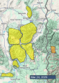
Advisory Archive

This morning, temperatures are in the upper 20s to low 30s F with 5-15 mph wind from the northwest to southwest. There is no new snow.
Today will be similar to yesterday, but warmer and sunnier, with high temperatures in the upper 40s to upper 50s F. Winds will be 5-15 mph from the south and southwest under sunny skies.

This morning, temperatures are in the high 20s to low 30s F with 10-20 mph winds from the west and northwest. In the last 24 hours, an inch of snow fell in the mountains around Cooke City, with some rain around West Yellowstone and Island Park.
Today, high temperatures will be in the 40s to 50s F with 5-15 mph winds from the west and southwest. Skies will be mostly sunny across much of the forecast area except Cooke City, where overcast skies may produce a few showers.


Since yesterday morning 24 hour snow totals are:
- 5”+ near Cooke City.
- 3” near West Yellowstone.
- 1-2” in Island Park, Big Sky and Bridgers.
- Zero in Hyalite.
Wind has been westerly at 15-35 mph with gusts of 40-60 mph overnight. Temperatures are high 20s and low 30s F.
Today, under mostly cloudy skies, temperatures will reach high 30s and low 40s F, and wind will be from the west at 15-30 mph with some stronger gusts. There is a chance for snow showers and possibly rain this afternoon and evening. The mountains could receive a trace to an inch of snow by morning.


Since yesterday morning 24 hour snow totals are:
- 4-6” around Big Sky.
- 3” in Island Park, West Yellowstone and Cooke City.
- 2” near Bozeman.
- 1” in Taylor Fork.
Yesterday the wind was 15-25 mph with gusts of 45-55 mph. This morning, temperatures are single digits to teens F, and wind is from the west and northwest at 10-15 mph with gusts of 20-35 mph.
Today, temperatures will reach high 20s to low 30s F, and wind will be from the west and northwest at 10-30 mph. Snow showers this afternoon and tonight could drop 5” or more near Cooke City with 1-3” elsewhere by morning.

24 Hour Snow Totals:
- 4-5” around Cooke City, Island Park, and West Yellowstone (including the S. Gallatin and S. Madison Ranges).
- Trace around Bozeman and Big Sky.
This morning, temperatures are in the teens and 20s F with 15-35 mph winds from the southwest and west. Snow is falling across much of the forecast area, with higher precipitation rates farther south around Island Park, West Yellowstone and Cooke City.
Today, high temperatures will be in the 20s to low 30s F, with strong winds this morning blowing 20-40 mph from the west and southwest. By tomorrow morning, the mountains around Cooke City, Island Park and West Yellowstone will receive 3-5 inches of new snow, with 1-3 inches near Bozeman and Big Sky.


This morning, new snow totals are:
5-8” near Big Sky
3-4” near West Yellowstone, Island Park and Cooke City
1-2” near Bozeman
Winds peaked yesterday evening, gusting 45-60 mph out of the west. They have backed off a little bit this morning, to 15-20 mph, gusting into the 30s and 40s mph. Temperatures are in the teens and 20s F.
Today, westerly winds will pick up again, blowing consistently in the 20s and 30s mph, with gusts into the 40s and 50s mph. High temperatures will be in the 20s and 30s F. We’ll see a mix of sun, clouds, and snow showers today before accumulating snow moves into the area tonight. By tomorrow morning, expect 4-8” around Island Park, 1-3” near West Yellowstone, Big Sky, and Cooke City, and only a dusting near Bozeman.
This morning may be the first day of spring but it feels like winter. Temperatures are hovering near 10 degrees F in most areas and in the mid to upper teens F in Hyalite Canyon and the Bridger Range. Winds were gusty yesterday and have increased this morning blowing 14-27 mph gusting in the 30s from the W and SW.
A small trough of low pressure moves overhead today bringing clouds and cold air that will limit daytime warming with temperatures struggling to get out of the upper teens F and a bit warmer in the Bridgers. Winds may ease a bit this morning and then increase midday gusting 30-40 mph from W and SW.
A good band of moisture is moving across Idaho and the Snake River Plain early this morning. The mountains near Island Park, West Yellowstone, and Cooke City could get 2-5 inches of snow by tomorrow morning. Other areas may only get 1-3 inches. There’s a break in the action Friday with more snow coming Friday night through Saturday followed by very warm and dry weather next week.


It’s a cold start this morning with temperatures in the single digits F in most places but a bit warmer in the Bridgers. Winds yesterday blew from the north and started coming from the west this morning blowing 5-10 mph gusting to 15 mph.
Today will have a ridge of high pressure overhead with sunny skies. Temperatures will warm into the mid 20s F but will feel a lot warmer under the strong spring sunshine. Winds will be light but a little gusty coming from the west slowly shifting to the southwest as the next storm system approaches.
More snow will fall tomorrow but maybe only a few inches. A better chance of snow comes with another storm system this weekend.

24-Hour Snowfall Totals at 6 am:
Lionhead and Island Park areas: 8-10” with 0.8-1” of snow water equivalent (SWE)
Cooke City: 5” (0.5” SWE).
Madison Range: 3-4” (0.4-0.6” SWE).
Bridger and Gallatin Ranges: 1-2” (0.1-0.2” SWE)
This morning, temperatures are in the teens and 20s F. Winds are 10-15 mph out of the north and west with gusts of 20-30 mph.
Snowfall will continue today in Cooke City and the northern Madison and northern Gallatin Ranges. Another 4-8” are expected in Cooke City by nightfall, with 3-5” near Big Sky and in Hyalite. At most an inch or two will fall elsewhere. Winds are forecast to increase this morning, especially in the southern ranges, where they will be 30-40 mph out of the northwest. High temperatures will be in the teens and 20s F.


24-Hour Snowfall Totals:
- Centennial Mountains in Island Park: 20” with 2” of snow water equivalent (SWE).
- Cooke City: 14” (1.4” SWE).
- Bridger Range and Lionhead area: 10-12” (1.0-1.2” SWE).
- Madison and Gallatin Ranges: 4-6” (0.4-0.6” SWE).
This morning, temperatures are in the teens and 20s F with 15-35 mph winds from the west and southwest. Late yesterday into last night, 65-100 mph wind gusts blasted the mountains, with the strongest on Lionhead Ridge.
Today, winds will decrease and blow 10-20 mph with gusts in the 30s. High temperatures will be in the upper 20s to low 30s F with continuing snowfall. By tomorrow morning, the mountains around Cooke City, Island Park and West Yellowstone will receive 8-12” of snow, with 3-6” in the Gallatin, Madison, and Bridger Ranges.